Acklands Coppice

Wood, Forest in Shropshire

England

Acklands Coppice

A4169 Farley Road towards Telford
A4169 Farley Road towards Telford Credit: Mat Fascione

Acklands Coppice is a picturesque woodland located in the rural county of Shropshire, England. It covers an area of approximately 50 acres and is known for its diverse range of flora and fauna, making it a popular destination for nature enthusiasts and hikers alike.

The woodland is characterized by its dense canopy of oak and beech trees, which provide a sheltered and serene environment for visitors. The forest floor is covered with a thick layer of leaf litter, creating a natural carpet that is home to a variety of wildflowers, ferns, and mosses.

Acklands Coppice is also home to a rich and diverse wildlife population. Birdwatchers often flock to the area to catch a glimpse of native species such as woodpeckers, owls, and various songbirds. The woodland is also inhabited by mammals including deer, foxes, and badgers, providing ample opportunities for wildlife spotting.

Visitors to Acklands Coppice can explore the woodland through a network of well-maintained footpaths and trails. These paths lead to beautiful viewpoints, tranquil ponds, and hidden clearings, offering a sense of tranquility and escape from the hustle and bustle of everyday life.

The woodland is managed by local conservation organizations, who work tirelessly to ensure the preservation of its natural beauty and biodiversity. They organize regular guided walks and educational programs for visitors to learn about the importance of woodland conservation and sustainable forestry practices.

Overall, Acklands Coppice is a hidden gem in Shropshire, offering a peaceful retreat for those seeking to reconnect with nature and explore the beauty of a traditional English woodland.

If you have any feedback on the listing, please let us know in the comments section below.

Acklands Coppice Images

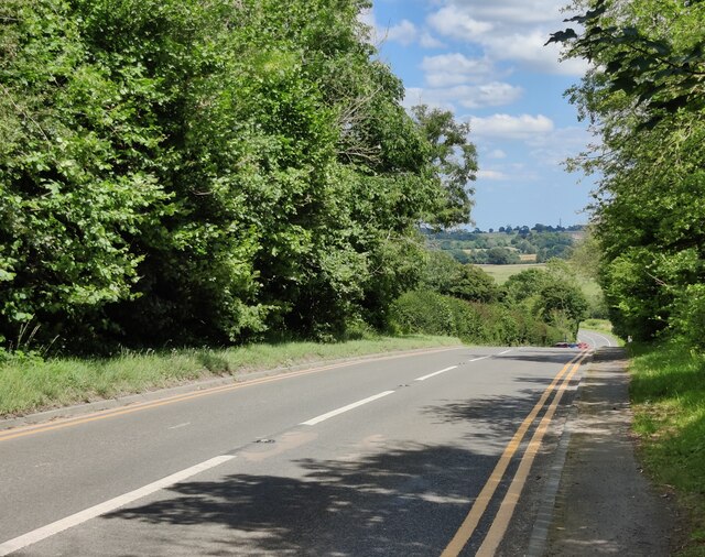
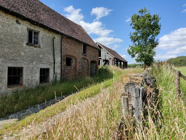
Images are sourced within 2km of 52.619735/-2.5362327 or Grid Reference SJ6302. Thanks to Geograph Open Source API. All images are credited.

A4169 Farley Road towards Telford
Lane towards Wyke
Lane towards Wyke
Lane at Bradley Farm Three long distance footpaths meet at this point, the Shropshire Way, the Cross Britain Way, and the Jack Mytton Way.
Lane at Bradley Farm
Three long distance footpaths meet at this point, the Shropshire Way, the Cross Britain Way, and the Jack Mytton Way.
Old barn at Bradley Farm
Old buildings at Bradley Farm The route of the Shropshire Way and the Cross Britain Way.
Old buildings at Bradley Farm
The route of the Shropshire Way and the Cross Britain Way.
Path and gate at Bradley Farm The Shropshire Way is a 139 mile long, varied route crossing lowland farmland and many of the notable hills of Shropshire. It passes through Shrewsbury, Clun and Ludlow (the most southerly point), and on the return takes in the Clee Hills, Wenlock Edge, Ironbridge and the Wrekin. The path is waymarked by a buzzard on a named disc.
Map: <span class="nowrap"><a title="http://www.ldwa.org.uk/ldp/members/show_path.php?path_id=410" rel="nofollow ugc noopener" href="http://www.ldwa.org.uk/ldp/members/show_path.php?path_id=410">Link</a><img style="margin-left:2px;" alt="External link" title="External link - shift click to open in new window" src="https://s1.geograph.org.uk/img/external.png" width="10" height="10"/></span>
Path and gate at Bradley Farm
The Shropshire Way is a 139 mile long, varied route crossing lowland farmland and many of the notable hills of Shropshire. It passes through Shrewsbury, Clun and Ludlow (the most southerly point), and on the return takes in the Clee Hills, Wenlock Edge, Ironbridge and the Wrekin. The path is waymarked by a buzzard on a named disc. Map: LinkExternal link
Old buildings at Bradley Farm The route of the Shropshire Way and the Cross Britain Way.
Old buildings at Bradley Farm
The route of the Shropshire Way and the Cross Britain Way.
Old buildings at Bradley Farm
Path towards Bradley Farm The Shropshire Way is a 139 mile long, varied route crossing lowland farmland and many of the notable hills of Shropshire. It passes through Shrewsbury, Clun and Ludlow (the most southerly point), and on the return takes in the Clee Hills, Wenlock Edge, Ironbridge and the Wrekin. The path is waymarked by a buzzard on a named disc.
Map: <span class="nowrap"><a title="http://www.ldwa.org.uk/ldp/members/show_path.php?path_id=410" rel="nofollow ugc noopener" href="http://www.ldwa.org.uk/ldp/members/show_path.php?path_id=410">Link</a><img style="margin-left:2px;" alt="External link" title="External link - shift click to open in new window" src="https://s1.geograph.org.uk/img/external.png" width="10" height="10"/></span>
Path towards Bradley Farm
The Shropshire Way is a 139 mile long, varied route crossing lowland farmland and many of the notable hills of Shropshire. It passes through Shrewsbury, Clun and Ludlow (the most southerly point), and on the return takes in the Clee Hills, Wenlock Edge, Ironbridge and the Wrekin. The path is waymarked by a buzzard on a named disc. Map: LinkExternal link
Grassland near Bradley Farm Along the Shropshire Way and the Cross Britain Way.
Grassland near Bradley Farm
Along the Shropshire Way and the Cross Britain Way.
Kissing gate along the Shropshire Way The Shropshire Way is a 139 mile long, varied route crossing lowland farmland and many of the notable hills of Shropshire. It passes through Shrewsbury, Clun and Ludlow (the most southerly point), and on the return takes in the Clee Hills, Wenlock Edge, Ironbridge and the Wrekin. The path is waymarked by a buzzard on a named disc.
Map: <span class="nowrap"><a title="http://www.ldwa.org.uk/ldp/members/show_path.php?path_id=410" rel="nofollow ugc noopener" href="http://www.ldwa.org.uk/ldp/members/show_path.php?path_id=410">Link</a><img style="margin-left:2px;" alt="External link" title="External link - shift click to open in new window" src="https://s1.geograph.org.uk/img/external.png" width="10" height="10"/></span>
Kissing gate along the Shropshire Way
The Shropshire Way is a 139 mile long, varied route crossing lowland farmland and many of the notable hills of Shropshire. It passes through Shrewsbury, Clun and Ludlow (the most southerly point), and on the return takes in the Clee Hills, Wenlock Edge, Ironbridge and the Wrekin. The path is waymarked by a buzzard on a named disc. Map: LinkExternal link
Grassland north of Bradley Farm
Gate along the Shropshire Way The Shropshire Way is a 139 mile long, varied route crossing lowland farmland and many of the notable hills of Shropshire. It passes through Shrewsbury, Clun and Ludlow (the most southerly point), and on the return takes in the Clee Hills, Wenlock Edge, Ironbridge and the Wrekin. The path is waymarked by a buzzard on a named disc.
Map: <span class="nowrap"><a title="http://www.ldwa.org.uk/ldp/members/show_path.php?path_id=410" rel="nofollow ugc noopener" href="http://www.ldwa.org.uk/ldp/members/show_path.php?path_id=410">Link</a><img style="margin-left:2px;" alt="External link" title="External link - shift click to open in new window" src="https://s1.geograph.org.uk/img/external.png" width="10" height="10"/></span>
Gate along the Shropshire Way
The Shropshire Way is a 139 mile long, varied route crossing lowland farmland and many of the notable hills of Shropshire. It passes through Shrewsbury, Clun and Ludlow (the most southerly point), and on the return takes in the Clee Hills, Wenlock Edge, Ironbridge and the Wrekin. The path is waymarked by a buzzard on a named disc. Map: LinkExternal link
Grassland near Newhouse Farm
Sheep under a tree near Woodhouse Farm
Woodhouse Farm near Farley
Track and gate at Audience Wood The Shropshire Way is a 139 mile long, varied route crossing lowland farmland and many of the notable hills of Shropshire. It passes through Shrewsbury, Clun and Ludlow (the most southerly point), and on the return takes in the Clee Hills, Wenlock Edge, Ironbridge and the Wrekin. The path is waymarked by a buzzard on a named disc.
Map: <span class="nowrap"><a title="http://www.ldwa.org.uk/ldp/members/show_path.php?path_id=410" rel="nofollow ugc noopener" href="http://www.ldwa.org.uk/ldp/members/show_path.php?path_id=410">Link</a><img style="margin-left:2px;" alt="External link" title="External link - shift click to open in new window" src="https://s1.geograph.org.uk/img/external.png" width="10" height="10"/></span>
Track and gate at Audience Wood
The Shropshire Way is a 139 mile long, varied route crossing lowland farmland and many of the notable hills of Shropshire. It passes through Shrewsbury, Clun and Ludlow (the most southerly point), and on the return takes in the Clee Hills, Wenlock Edge, Ironbridge and the Wrekin. The path is waymarked by a buzzard on a named disc. Map: LinkExternal link
Show me another place!

Acklands Coppice is located at Grid Ref: SJ6302 (Lat: 52.619735, Lng: -2.5362327)

Unitary Authority: Shropshire

Police Authority: West Mercia

What 3 Words

///drum.proves.items. Near Much Wenlock, Shropshire

Related Wikis

Farley Halt railway station

Farley Halt railway station was a station in Farley to the north of Much Wenlock, Shropshire, England. The station was opened in 1934 and closed in 1962...

Wyke, Shropshire

Wyke (or the Wyke) is a small hamlet in rural Shropshire, England, where it is part of the civil parish of Much Wenlock. Its name may originate from Old...

Buildwas Abbey

Buildwas Abbey was a Cistercian (originally Savigniac) monastery located on the banks of the River Severn, at Buildwas in Shropshire, England - today about...

Buildwas

Buildwas is a village and civil parish in Shropshire, England, on the north bank of the River Severn at grid reference SJ641045. It lies on the B4380 road...

Nearby Amenities

Located within 500m of 52.619735,-2.5362327
Barrier: kissing_gate
Source: survey
Lat/Long: 52.6169059/-2.5324454
Waterway: waterfall
Lat/Long: 52.62181/-2.5373564
Turning Loop
Lat/Long: 52.6176882/-2.5324079
The data included in this document is from www.openstreetmap.org. The data is made available under ODbL.

Have you been to Acklands Coppice?

Leave your review of Acklands Coppice below (or comments, questions and feedback).