Traps Coppice

Wood, Forest in Shropshire

England

Traps Coppice

River Severn, Buildwas
River Severn, Buildwas Credit: Richard Law

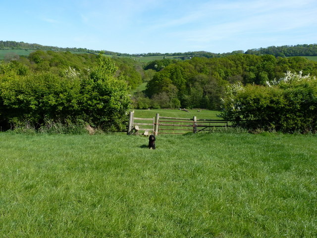
Traps Coppice is a picturesque woodland located in the county of Shropshire, England. Situated near the village of Cleobury North, this enchanting forest covers an area of approximately 50 acres, offering visitors a serene and tranquil escape from the hustle and bustle of everyday life.

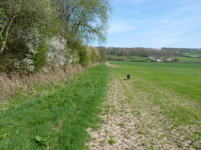
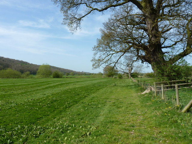
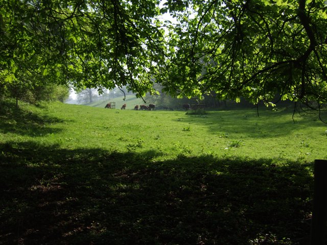
The coppice, which refers to a wooded area where trees are periodically cut down to encourage regrowth, is predominantly composed of broadleaf trees, such as oak, ash, and birch. The dense canopy created by these majestic trees provides a cool and shaded environment, making it an ideal spot for a leisurely stroll on a warm summer's day.

Traps Coppice is renowned for its diverse and thriving ecosystem. The forest floor is carpeted with a rich variety of wildflowers, including bluebells, primroses, and wood anemones, creating a vibrant display of colors during the spring months. This natural spectacle attracts an array of wildlife, including squirrels, badgers, and a wide range of bird species.

The woodland is crisscrossed by a network of well-maintained trails, allowing visitors to explore its beauty at their own pace. The paths wind their way through the forest, leading to hidden clearings and tranquil ponds, adding to the sense of enchantment and discovery.

Traps Coppice is a popular destination for nature enthusiasts, photographers, and those seeking a peaceful retreat in the heart of nature. With its diverse flora and fauna, stunning scenery, and a sense of tranquility, this hidden gem in Shropshire offers a unique opportunity to reconnect with the natural world.

If you have any feedback on the listing, please let us know in the comments section below.

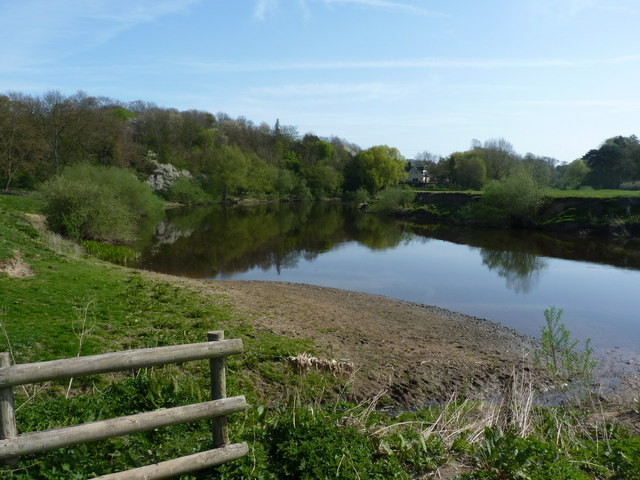
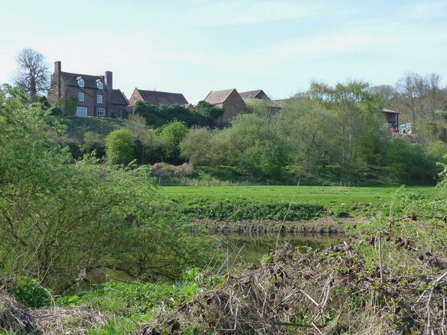
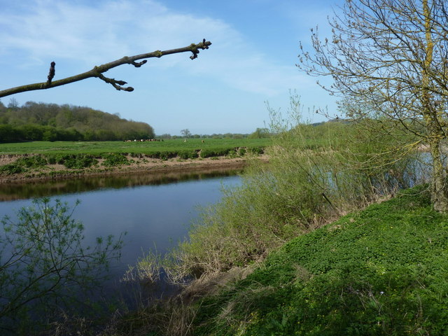
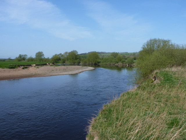
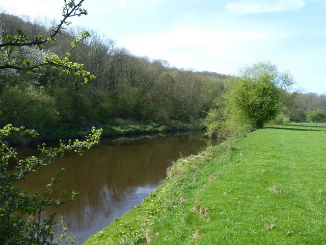
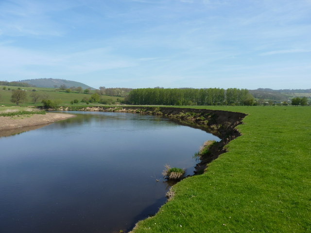
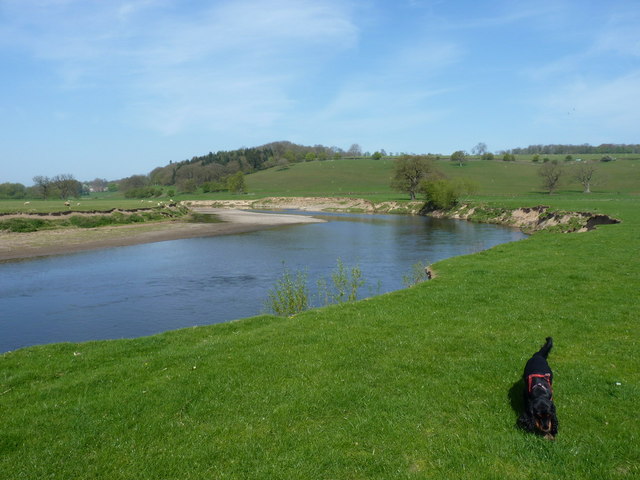
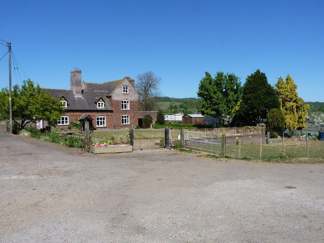
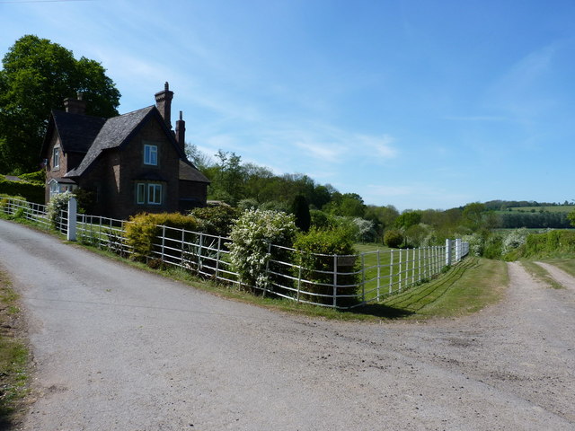
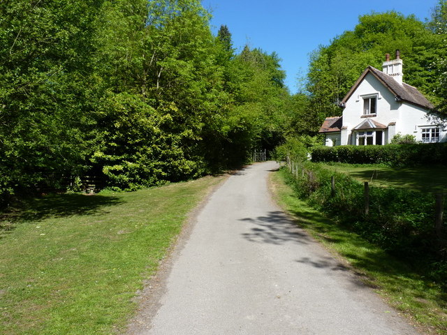
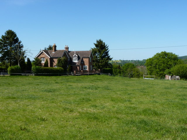
Traps Coppice Images

Images are sourced within 2km of 52.621229/-2.5476989 or Grid Reference SJ6302. Thanks to Geograph Open Source API. All images are credited.

River Severn, Buildwas
Park Farm, near Sheinton A view across the Severn to Park Farm on the southern bank.
Park Farm, near Sheinton
A view across the Severn to Park Farm on the southern bank.
Floodplain & meadows of the River Severn
Shingle bank on the Severn A wide shingle bank, typical of the ones that form on the inside of bends in this part of the river.
Shingle bank on the Severn
A wide shingle bank, typical of the ones that form on the inside of bends in this part of the river.
Wheat on the floodplain of the Severn Spring-sprouting wheat in a field just north of the river; there is a footpath marked across these fields - it doesn't exist, and neither do any of the stiles or bridges.
Wheat on the floodplain of the Severn
Spring-sprouting wheat in a field just north of the river; there is a footpath marked across these fields - it doesn't exist, and neither do any of the stiles or bridges.
Line of a footpath The line of the non-existent path across these fields. It seems to have fallen into disuse, and may have been extinguished.
Line of a footpath
The line of the non-existent path across these fields. It seems to have fallen into disuse, and may have been extinguished.
The Severn near Buildwas Park
Space to run, and run, and run.... ... just don't fall into the river, because I don't want to have to fish you out.
Space to run, and run, and run....
... just don't fall into the river, because I don't want to have to fish you out.
Cockshut Rough and the Severn Across the river to Cockshut Rough, where the line of the old Shrewsbury to Bridgnorth railway is still visible in the woods.
Cockshut Rough and the Severn
Across the river to Cockshut Rough, where the line of the old Shrewsbury to Bridgnorth railway is still visible in the woods.
One of the Severn meanders at Leighton A view along the riverbank of the much-photographed classic meander in the floodplain at Leighton.
One of the Severn meanders at Leighton
A view along the riverbank of the much-photographed classic meander in the floodplain at Leighton.
Floodplain and Severn at Leighton
Cattle grazing in farmland near Tickwood Hall
Park Farm, Buildwas Park The farmhouse at Park Farm
Park Farm, Buildwas Park
The farmhouse at Park Farm
Gatehouse at Buildwas Park One of the entrances into Buildwas Park, this one coming from the east. A footpath heads off down the track to the right, whilst the main uphill route leads into the private grounds of the estate.
Gatehouse at Buildwas Park
One of the entrances into Buildwas Park, this one coming from the east. A footpath heads off down the track to the right, whilst the main uphill route leads into the private grounds of the estate.
Gatehouse at the western side of Buildwas Park At the entrance into Buildwas Park from the Sheinton direction, with a footpath dropping down into Cockshut Rough via the stile just behind the tree on the left.
Gatehouse at the western side of Buildwas Park
At the entrance into Buildwas Park from the Sheinton direction, with a footpath dropping down into Cockshut Rough via the stile just behind the tree on the left.
House at Sheinton Common
Into the valley of the Sheinton Brook Looking down the footpath (past the daft dog) to the footbridge over the Sheinton Brook.
Into the valley of the Sheinton Brook
Looking down the footpath (past the daft dog) to the footbridge over the Sheinton Brook.
The Sheinton Brook The brook at Sheinwood
The Sheinton Brook
The brook at Sheinwood
Show me another place!

Traps Coppice is located at Grid Ref: SJ6302 (Lat: 52.621229, Lng: -2.5476989)

Unitary Authority: Shropshire

Police Authority: West Mercia

What 3 Words

///uncouth.calm.pictures. Near Much Wenlock, Shropshire

Related Wikis

Farley Halt railway station

Farley Halt railway station was a station in Farley to the north of Much Wenlock, Shropshire, England. The station was opened in 1934 and closed in 1962...

Homer, Shropshire

Homer is a small village in Shropshire, England, north of the town of Much Wenlock. The name first appears in the 14th century as "Honemor". Originally...

Wyke, Shropshire

Wyke (or the Wyke) is a small hamlet in rural Shropshire, England, where it is part of the civil parish of Much Wenlock. Its name may originate from Old...

Buildwas Abbey

Buildwas Abbey was a Cistercian (originally Savigniac) monastery located on the banks of the River Severn, at Buildwas in Shropshire, England - today about...

Nearby Amenities

Located within 500m of 52.621229,-2.5476989
Barrier: cattle_grid
Lat/Long: 52.6219396/-2.5499473
Power: pole
Lat/Long: 52.6233271/-2.5413957
Power: pole
Lat/Long: 52.6225618/-2.5426805
Power: pole
Lat/Long: 52.6218649/-2.5439063
Power: pole
Lat/Long: 52.6211387/-2.5450462
Power: pole
Lat/Long: 52.6205883/-2.545749
Power: pole
Lat/Long: 52.6198409/-2.5467333
Power: pole
Lat/Long: 52.6191912/-2.547546
Power: pole
Lat/Long: 52.6183053/-2.5486645
Power: pole
Lat/Long: 52.6174748/-2.5496757
Power: pole
Lat/Long: 52.6175057/-2.550188
Power: pole
Lat/Long: 52.6207825/-2.5541093
Power: pole
Lat/Long: 52.621639/-2.5531839
Power: pole
Lat/Long: 52.6224319/-2.552331
Power: pole
Lat/Long: 52.6232354/-2.5514687
Power: pole
Lat/Long: 52.6205246/-2.554382
Power: pole
Lat/Long: 52.6248321/-2.5514177
Power: pole
Lat/Long: 52.6234972/-2.5512073
Power: pole
Lat/Long: 52.624154/-2.5513084
The data included in this document is from www.openstreetmap.org. The data is made available under ODbL.

Have you been to Traps Coppice?

Leave your review of Traps Coppice below (or comments, questions and feedback).