Pogles Wood

Wood, Forest in Gloucestershire Forest of Dean

England

Pogles Wood

Harbour Road level crossing at Lydney station
Harbour Road level crossing at Lydney station Credit: Roy Hughes

Pogles Wood is a picturesque woodland located in Gloucestershire, England. Nestled in the heart of the county, this enchanting forest covers a vast area of approximately 200 acres. Its natural beauty and diverse ecosystem attract nature enthusiasts and visitors throughout the year.

The wood is home to a wide variety of plant and animal species, making it a haven for wildlife. Ancient oak, beech, and birch trees dominate the landscape, creating a dense canopy that provides shade and shelter. Bluebells, wildflowers, and ferns carpet the forest floor, adding a burst of color to the surroundings.

Tranquil streams and babbling brooks meander through the woodland, enhancing its serene ambiance. These water sources are teeming with fish, frogs, and other aquatic creatures, which further contribute to the rich biodiversity of the area.

Pogles Wood offers numerous walking trails and paths that allow visitors to explore its natural wonders. These pathways wind through the forest, offering glimpses of hidden glades, moss-covered rocks, and ancient ruins. The wood also boasts a series of small ponds and clearings, providing peaceful spots for picnics or simply taking in the beauty of nature.

Managed by local conservation groups, Pogles Wood is carefully preserved and protected. Its importance as a habitat for wildlife and a recreational space for the community is recognized, and efforts are made to maintain its ecological balance.

Visiting Pogles Wood provides a unique opportunity to escape the hustle and bustle of everyday life and immerse oneself in the tranquility of nature. Whether it's for a leisurely stroll, bird-watching, or simply enjoying the fresh air, this captivating woodland offers a truly magical experience for all who venture into its depths.

If you have any feedback on the listing, please let us know in the comments section below.
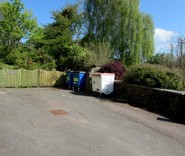
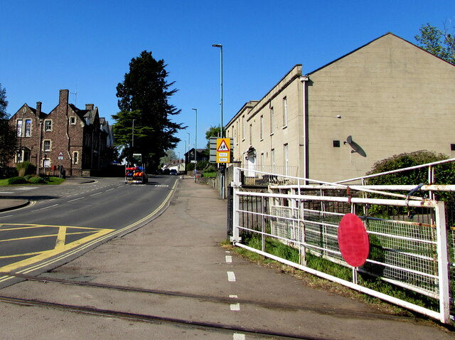
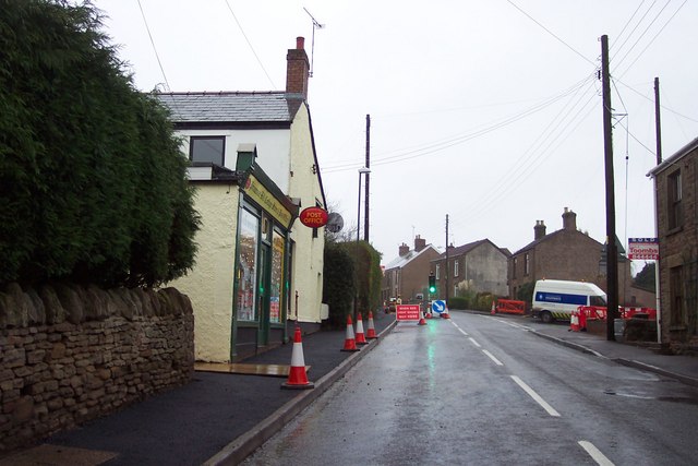
Pogles Wood Images

Images are sourced within 2km of 51.728699/-2.5369852 or Grid Reference SO6303. Thanks to Geograph Open Source API. All images are credited.

Harbour Road level crossing at Lydney station
Station Road, Lydney From the level crossing.
Station Road, Lydney
From the level crossing.
Directions sign, Hill Street, Lydney On a lamppost on the approach to the B4234 for Whitecroft and Parkend.
Directions sign, Hill Street, Lydney
On a lamppost on the approach to the B4234 for Whitecroft and Parkend.
Suez wheelie bins, Lydney Large wheelie bins near the corner of Hill Street and Hill View in May 2021.
Suez wheelie bins, Lydney
Large wheelie bins near the corner of Hill Street and Hill View in May 2021.
Up Hill View, Lydney Dead-end Hill View ascends from Hill Street.
Up Hill View, Lydney
Dead-end Hill View ascends from Hill Street.
Warning sign alongside Hill Street, Lydney Showing Patrol 85yds. The car is turning into Bathurst Park Road in May 2021.
Warning sign alongside Hill Street, Lydney
Showing Patrol 85yds. The car is turning into Bathurst Park Road in May 2021.
Single-track railway in Lydney This part of the heritage Dean Forest Railway is past the edge of Town Station Business Park.
Single-track railway in Lydney
This part of the heritage Dean Forest Railway is past the edge of Town Station Business Park.
Town Station Business Park access road, Lydney On the north side of Hill Street.
Town Station Business Park access road, Lydney
On the north side of Hill Street.
Thank You to our NHS workers and all key workers, Lydney Alongside Town Station Business Park access road in May 2021 during the Coronavirus (COVID-19) pandemic.
Thank You to our NHS workers and all key workers, Lydney
Alongside Town Station Business Park access road in May 2021 during the Coronavirus (COVID-19) pandemic.
Town Station Business Park name sign, Lydney In the background here <a title="https://www.geograph.org.uk/photo/6983679" href="https://www.geograph.org.uk/photo/6983679">Link</a> in May 2021. Also shown are a Lydney Space Station sign and a Velux sign. The rusty railings on the left are at the edge of the heritage Dean Forest Railway. <a title="https://www.geograph.org.uk/photo/6983653" href="https://www.geograph.org.uk/photo/6983653">Link</a>
Town Station Business Park name sign, Lydney
In the background here Link in May 2021. Also shown are a Lydney Space Station sign and a Velux sign. The rusty railings on the left are at the edge of the heritage Dean Forest Railway. Link
Dominant trees in Lydney Viewed across Hill Street.
Dominant trees in Lydney
Viewed across Hill Street.
SSE along Bathurst Park Road, Lydney From Hill Street, Bathurst Park Road leads to Bathurst Park. 
Formerly Lydney Police Station, the building on the corner is now (2021) in business use.
SSE along Bathurst Park Road, Lydney
From Hill Street, Bathurst Park Road leads to Bathurst Park. Formerly Lydney Police Station, the building on the corner is now (2021) in business use.
Stay Safe, Shop Local, Lydney On a Hill Street lamppost in May 2021 during the Coronavirus (COVID-19) pandemic.
Stay Safe, Shop Local, Lydney
On a Hill Street lamppost in May 2021 during the Coronavirus (COVID-19) pandemic.
Windows on the west side of Watney Hall, Lydney The name sign shows WATNEY HALL AT 3 HILL STREET.
Windows on the west side of Watney Hall, Lydney
The name sign shows WATNEY HALL AT 3 HILL STREET.
Sorry We Are Closed, Watney Hall, Lydney The notice is at the entrance to Watney Hall at 3 Hill Street in May 2021 during the Coronavirus (COVID-19) pandemic. It shows 

SORRY WE ARE CLOSED. 

We did try to open but we completely understand why some customers do not feel comfortable and it was difficult to socialise in the safe environment that we have created.

We will keep the matter under review in line with the regulations, but we do not expect to reopen until at least October.
Sorry We Are Closed, Watney Hall, Lydney
The notice is at the entrance to Watney Hall at 3 Hill Street in May 2021 during the Coronavirus (COVID-19) pandemic. It shows SORRY WE ARE CLOSED. We did try to open but we completely understand why some customers do not feel comfortable and it was difficult to socialise in the safe environment that we have created. We will keep the matter under review in line with the regulations, but we do not expect to reopen until at least October.
Plaque dated 1973, Hill Street, Lydney The plaque on the wall of 3 Hill Street <a title="https://www.geograph.org.uk/photo/3805239" href="https://www.geograph.org.uk/photo/3805239">Link</a> shows THIS CLOCK AND SEATING WAS ERECTED BY THE ROYAL BRITISH LEGION LYDNEY BRANCH AND CLUB IN MEMORY OF JOHN HYLTON WATTS PATRON FOR MANY YEARS. THIS PLAQUE WAS UNVEILED BY HIS GRACE THE DUKE OF BEAUFORT K.G. P.C. G.C.V.O. ON AUGUST 5TH 1973.
Plaque dated 1973, Hill Street, Lydney
The plaque on the wall of 3 Hill Street Link shows THIS CLOCK AND SEATING WAS ERECTED BY THE ROYAL BRITISH LEGION LYDNEY BRANCH AND CLUB IN MEMORY OF JOHN HYLTON WATTS PATRON FOR MANY YEARS. THIS PLAQUE WAS UNVEILED BY HIS GRACE THE DUKE OF BEAUFORT K.G. P.C. G.C.V.O. ON AUGUST 5TH 1973.
Level crossing gate, Hill Street, Lydney In the foreground the track of the Dean Forest Railway crosses Hill Street.
Level crossing gate, Hill Street, Lydney
In the foreground the track of the Dean Forest Railway crosses Hill Street.
Wildin & Co, Hill Street, Lydney Accountants offices in King's Buildings.
Wildin & Co, Hill Street, Lydney
Accountants offices in King's Buildings.
Show me another place!

Pogles Wood is located at Grid Ref: SO6303 (Lat: 51.728699, Lng: -2.5369852)

Administrative County: Gloucestershire

District: Forest of Dean

Police Authority: Gloucestershire

What 3 Words

///baffle.outbursts.masking. Near Lydney, Gloucestershire

Related Wikis

Tufts Junction

Tufts Junction was a junction on the Severn and Wye Railway between Lydney Town and Whitecroft, England. The junction is now on the Dean Forest Railway...

Lydney Town railway station

Lydney Town railway station is a railway station on the Dean Forest Railway in Lydney in Gloucestershire. == History == The station which is situated in...

Allaston

Allaston is a village in Gloucestershire, England, now forming part of the town of Lydney. Allaston was mentioned in the Domesday Book, when it was part...

Lydney

Lydney is a town and civil parish in Gloucestershire, England. It is on the west bank of the River Severn in the Forest of Dean District, and is 16 miles...
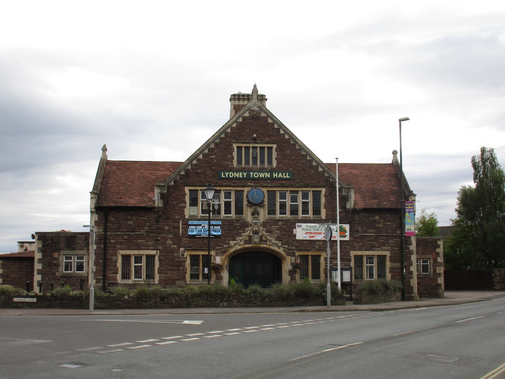
Lydney Town Hall

Lydney Town Hall is a municipal structure in the High Street, Lydney, Gloucestershire, England. The structure, which is used as an events venue, is listed...

White Cross Manor

White Cross Manor was the manor house in Lydney, Gloucestershire, England, of the Wynter family. It was burnt to the ground in April 1645 on the orders...

Lydney power station

The Lydney power station supplied electricity to 300 square miles (780 km2) of West Gloucestershire, England from 1923 until 1967. The supply area included...

Recreational Trust Ground

Recreational Trust Ground is a cricket ground in Lydney, Gloucestershire. The first inter-county match on the ground was in 1962, when the Gloucestershire...

Nearby Amenities

Located within 500m of 51.728699,-2.5369852
Lydney
Is In: Gloucestershire, UK
Place: town
Postal Code: GL15 5
Wikidata: Q540012
Wikipedia: en:Lydney
Lat/Long: 51.7259292/-2.5313485
Crossing Barrier: full
Railway: level_crossing
Lat/Long: 51.726171/-2.5323784
Lydney Town
Naptan AtcoCode: 940GZZDFLDT
Operator: Dean Forest Railway
Public Transport: station
Railway: station
Usage: tourism
Wheelchair: no
Wikidata: Q6707734
Lat/Long: 51.725442/-2.5319837
Bus Stop
Town Centre
Bench: no
Bin: no
Check Date Shelter: 2023-05-23
Lit: no
Naptan AtcoCode: 1600GL3127
Naptan Bearing: N
Naptan CommonName: Town Centre
Naptan NaptanCode: gloagwag
Naptan Street: Forest Rd
Naptan Verified: no
Shelter: no
Source: naptan_import
Tactile Paving: no
Lat/Long: 51.7269346/-2.531438
Bus Stop
Lydney Hospital
Naptan AtcoCode: 1600GL3129
Naptan Bearing: NW
Naptan CommonName: Lydney Hospital
Naptan NaptanCode: gloagtda
Naptan Street: Grove Rd
Naptan Verified: no
Shelter: no
Source: naptan_import
Tactile Paving: no
Lat/Long: 51.7282222/-2.5389388
Bus Stop
Lydney Hospital
Naptan AtcoCode: 1600GL3130
Naptan Bearing: SE
Naptan CommonName: Lydney Hospital
Naptan NaptanCode: glogjpwt
Naptan Street: Grove Rd
Naptan Verified: no
Shelter: no
Source: naptan_import
Tactile Paving: no
Lat/Long: 51.7282495/-2.5388523
Bus Stop
Tesco
Naptan AtcoCode: 1600GL3133
Naptan Bearing: SW
Naptan CommonName: Tesco
Naptan NaptanCode: gloagtmj
Naptan Street: High St
Naptan Verified: no
Shelter: yes
Source: naptan_import
Tactile Paving: no
Lat/Long: 51.7246569/-2.535327
Bus Stop
Tesco
Bench: no
Bin: no
Lit: no
Naptan AtcoCode: 1600GL3134
Naptan Bearing: NE
Naptan CommonName: Tesco
Naptan Indicator: Opp
Naptan NaptanCode: gloagtpd
Naptan Street: High St
Naptan Verified: no
Shelter: no
Source: naptan_import
Tactile Paving: no
Lat/Long: 51.7253825/-2.534634
Bus Stop
Springfield Rd
Naptan AtcoCode: 1600GL3137
Naptan Bearing: NE
Naptan CommonName: Springfield Rd
Naptan NaptanCode: gloagwad
Naptan Street: Spring Meadow Rd
Naptan Verified: no
Source: naptan_import
Lat/Long: 51.7300991/-2.5315331
Bus Stop
Forest Rd
Bench: no
Bin: no
Lit: no
Naptan AtcoCode: 1600GL4338
Naptan Bearing: SW
Naptan CommonName: Forest Rd
Naptan NaptanCode: gloagtwa
Naptan Street: Spring Meadow Rd
Naptan Verified: no
Shelter: no
Source: naptan_import
Tactile Paving: no
Lat/Long: 51.7291907/-2.5335785
Bus Stop
Lydney Hospital
Naptan AtcoCode: 1600GLF169
Naptan Bearing: N
Naptan CommonName: Lydney Hospital
Naptan NaptanCode: gloagtdw
Naptan Street: Bream Rd
Naptan Verified: no
Source: naptan_import
Lat/Long: 51.7291499/-2.5385879
Bus Stop
Lydney Hospital
Naptan AtcoCode: 1600GLF170
Naptan Bearing: SE
Naptan BusStopType: CUS
Naptan CommonName: Lydney Hospital
Naptan Indicator: Opp
Naptan NaptanCode: gloagtgp
Naptan Street: Bream Rd
Naptan Verified: no
Source: naptan_import
Lat/Long: 51.7286841/-2.5379945
Bus Stop
Temple Close
Naptan AtcoCode: 1600GLF337
Naptan Bearing: NE
Naptan CommonName: Temple Close
Naptan NaptanCode: gloagtap
Naptan Street: Templeway West
Naptan Verified: no
Shelter: no
Source: naptan_import
Tactile Paving: no
Lat/Long: 51.7253528/-2.5391798
Bus Stop
Temple Close
Naptan AtcoCode: 1600GLF338
Naptan Bearing: SW
Naptan CommonName: Temple Close
Naptan Indicator: Opp
Naptan NaptanCode: glogjwda
Naptan Street: Templeway West
Naptan Verified: no
Shelter: no
Source: naptan_import
Tactile Paving: no
Lat/Long: 51.7251907/-2.5392213
Bus Stop
Grove Rd
Naptan AtcoCode: 1600GLF339
Naptan Bearing: NE
Naptan CommonName: Grove Rd
Naptan NaptanCode: gloagtdg
Naptan Street: Templeway West
Naptan Verified: no
Shelter: no
Source: naptan_import
Tactile Paving: no
Lat/Long: 51.7276292/-2.5388304
Bus Stop
Grove Rd
Naptan AtcoCode: 1600GLF340
Naptan Bearing: SW
Naptan CommonName: Grove Rd
Naptan NaptanCode: glogjwdg
Naptan Street: Templeway West
Naptan Verified: no
Shelter: no
Source: naptan_import
Tactile Paving: no
Lat/Long: 51.7276029/-2.5386853
Bus Stop
Springfield Methodist Church
Naptan AtcoCode: 1600GLF703
Naptan Bearing: NW
Naptan CommonName: Springfield Methodist Church
Naptan NaptanCode: gloagwga
Naptan Street: Albert St
Naptan Verified: no
Source: naptan_import
Lat/Long: 51.7297263/-2.5304717
Bus Stop
Springfield Methodist Church
Naptan AtcoCode: 1600GLF704
Naptan Bearing: SE
Naptan CommonName: Springfield Methodist Church
Naptan Indicator: Opp
Naptan NaptanCode: gloagwgd
Naptan Street: Albert St
Naptan Verified: no
Source: naptan_import
Lat/Long: 51.7297453/-2.5302402
Place Of Worship
Springfield Methodist Church
Denomination: methodist
Religion: christian
Source: NPE + NaPTAN
Lat/Long: 51.729746/-2.5307928
Crossing
Crossing: marked
Kerb: lowered
Source: Bing
Tactile Paving: yes
Lat/Long: 51.7247643/-2.5345305
Fast Food
Lydney Charcoal Grill
Addr City: Lydney
Addr Housenumber: 6
Addr Postcode: GL15 5LA
Addr Street: Forest Parade
Fhrs Id: 11079
Lat/Long: 51.7266754/-2.5314599
Fast Food
D&M Pizza House
Addr City: Lydney
Addr Housename: Forest Parade
Addr Postcode: GL15 5LA
Addr Street: Hill Street
Addr Unit: 3
Fhrs Id: 530399
Website: https://dmpizza.co.uk/
Lat/Long: 51.7264353/-2.5315498
Bus Stop
Forest Rd
Bench: no
Bin: no
Lit: no
Naptan AtcoCode: 1600GL4337
Naptan Bearing: NE
Naptan CommonName: Forest Rd
Naptan NaptanCode: gloagtpw
Naptan Street: Spring Meadow Rd
Naptan Verified: no
Shelter: no
Source: naptan_import
Tactile Paving: no
Lat/Long: 51.7297184/-2.5325095
Highbury
Place: hamlet
Source: OS 1:25k
Lat/Long: 51.7300082/-2.5391338
Bus Stop
Naptan AtcoCode: 1600GLA90903
Naptan NaptanCode: glogptwt
Tactile Paving: no
Lat/Long: 51.7257437/-2.5346209
Post Box
Operator: Royal Mail
Post Box Type: wall
Lat/Long: 51.7258523/-2.5328976
Kindergarten
Lydney Early Learners
Addr City: Lydney
Addr Postcode: GL15 5JH
Addr Street: Bream Road
Fhrs Id: 688055
Lat/Long: 51.7268453/-2.5347362
Bus Stop
Naptan AtcoCode: 1600GLA90902
Naptan NaptanCode: glogptwp
Lat/Long: 51.7256623/-2.5347201
Post Box
Lat/Long: 51.7278587/-2.538443
Pub
The Swan Hotel
Addr City: Lydney
Addr Housename: Swan Hotel
Addr Postcode: GL15 5RF
Addr Street: Newerne Street
Fhrs Id: 959917
Source Addr: FHRS Open Data
Lat/Long: 51.7262638/-2.5311072
Restaurant
Ugly Duckling
Addr City: Lydney
Addr Housename: Swan Hotel
Addr Postcode: GL15 5RF
Addr Street: Newerne Street
Fhrs Id: 959917
Source Addr: FHRS Open Data
Lat/Long: 51.7261142/-2.5311393
Fast Food
Lydney Chipgy
Addr City: Lydney
Addr Housename: Forest Parade
Addr Postcode: GL15 5LA
Addr Street: Forest Road
Addr Unit: 7
Fhrs Id: 1592397
Source Addr: FHRS Open Data
Lat/Long: 51.7266077/-2.5314317
Parking
Lat/Long: 51.7279916/-2.5307987
Shop: car_repair
Lat/Long: 51.7249678/-2.536088
ETB Autos
Shop: car_repair
Lat/Long: 51.728706/-2.5324671
Recycling
Location: overground
Recycling Type: container
Lat/Long: 51.728079/-2.531261
Recycling
Location: overground
Recycling Type: container
Lat/Long: 51.7258326/-2.5344532
Reflections
Addr City: Lydney
Addr Street: High Street
Contact Facebook: https://www.facebook.com/ReflectionsHairSalonLydney/
Shop: hairdresser
Lat/Long: 51.7246688/-2.5356092
Revial Hair & Beauty
Addr City: Lydney
Addr Housename: Cavendish Buildings
Addr Postcode: GL15 5HD
Addr Street: Hill Street
Addr Unit: 1
Shop: hairdresser
Lat/Long: 51.7256777/-2.5341394
Poppies
Addr City: Lydney
Addr Housename: Forest Parade
Addr Postcode: GL15 5HJ
Addr Street: Hill Street
Addr Unit: 1
Fhrs Id: 740412
Shop: florist
Source Addr: FHRS Open Data
Lat/Long: 51.7264021/-2.5316792
Magic Scissors
Addr City: Lydney
Addr Housename: Forest Parade
Addr Street: Hill Street
Addr Unit: 5
Contact Facebook: https://www.facebook.com/HanBarbersLydney/
Shop: hairdresser
Lat/Long: 51.7264706/-2.5313908
Crossing
Button Operated: yes
Crossing: traffic_signals
Crossing Island: no
Tactile Paving: no
Traffic Signals Vibration: yes
Lat/Long: 51.7244928/-2.5357627
Fast Food
Golden Phoenix
Addr City: Lydney
Addr Housenumber: 35
Addr Postcode: GL15 5DD
Addr Street: High Street
Cuisine: chinese
Drive Through: no
Fhrs Id: 988390
Lat/Long: 51.7243805/-2.5362724
Booth: K6
Removed Amenity: telephone
Lat/Long: 51.7295868/-2.5325262
Light Fantastic
Shop: doityourself
Lat/Long: 51.7282641/-2.5329981
Shop: doityourself
Lat/Long: 51.7274467/-2.5327031
Post Box
Collection Times: Mo-Fr 09:00; Sa 07:00
Collection Times Checked: 2015-07-28
Operator: Royal Mail
Post Box Type: lamp
Ref: GL15 68D
Royal Cypher: EIIR
Royal Cypher Wikidata: Q33102113
Lat/Long: 51.7295932/-2.5325459
Crossing
Button Operated: yes
Crossing: traffic_signals
Crossing Island: no
Kerb: lowered
Tactile Paving: no
Traffic Signals Vibration: yes
Lat/Long: 51.7264398/-2.5307544
Bonmarche Fashions
Addr City: Lydney
Addr Housenumber: 33
Addr Postcode: GL15 5RB
Addr Street: Newerne Street
Opening Hours: Mo-Sa 09:00-18:00
Shop: clothes
Wheelchair: yes
Lat/Long: 51.7273117/-2.5300835
Burtons Tailors - Menswear
Addr City: Lydney
Addr Housenumber: 33
Addr Postcode: GL15 5RB
Addr Street: Newerne Street
Opening Hours: Mo-Sa 09:00-18:00, Su 10:00-15:00
Shop: clothes
Wheelchair: yes
Lat/Long: 51.7274441/-2.5303033
Bonmarche Fashions
Addr City: Lydney
Addr Housenumber: 33
Addr Postcode: GL15 5RB
Addr Street: Newerne Street
Opening Hours: Mo-Sa 09:00-18:00, Su 10:00-15:00
Shop: clothes
Wheelchair: yes
Lat/Long: 51.7274225/-2.5305231
Dorothy Perkins Ladieswear
Addr City: Lydney
Addr Housenumber: 33
Addr Postcode: GL15 5RB
Addr Street: Newerne Street
Opening Hours: Mo-Sa 09:00-18:00, Su 10:00-15:00
Shop: clothes
Wheelchair: yes
Lat/Long: 51.7273796/-2.5302793
Burton's the Tailors
Addr City: Lydney
Addr Housenumber: 33
Addr Postcode: GL15 5RB
Addr Street: Newerne Street
Opening Hours: Mo-Sa 09:00-18:00, Su 10:00-15:00
Operator: Burton Tailors plc
Shop: tailor
Wheelchair: yes
Lat/Long: 51.7274236/-2.5301422
Hospital
Lydney & District Hospital
Yes
Addr City: Lydney
Addr Postcode: GL15 5JE
Addr Street: Grove Road
Designation: Minor Injuries Unit
Emergency: yes
Phone: +44 300 421 8722
Lat/Long: 51.7284068/-2.5384763
Power: pole
Lat/Long: 51.733037/-2.5359321
David Kear
Addr City: Lydney
Addr Housenumber: 9
Addr Postcode: GL15 5HJ
Addr Street: Hill Street
Shop: optician
Website: https://davidkearopticians.co.uk/lydney/
Lat/Long: 51.7263103/-2.532243
Restaurant
NG Thai Food
Addr City: Lydney
Addr Postcode: GL15 5HH
Addr Street: Hill Street
Fhrs Id: 1210314
Source Addr: FHRS Open Data
Lat/Long: 51.7262336/-2.5315229
Railway: crossing
Lat/Long: 51.7306328/-2.5359393
Railway: switch
Lat/Long: 51.7304036/-2.5360008
Railway: crossing
Lat/Long: 51.7306185/-2.5359894
Middle Forge Junction
Railway: junction
Lat/Long: 51.7307893/-2.5359445
Power: pole
Lat/Long: 51.7307288/-2.537059
Power: pole
Lat/Long: 51.7315761/-2.5368605
Power: pole
Lat/Long: 51.7298977/-2.5372555
Power: pole
Lat/Long: 51.7322081/-2.5365653
Location Transition: yes
Power: pole
Transformer: distribution
Lat/Long: 51.7288457/-2.5374985
Barrier: bollard
Lat/Long: 51.7249875/-2.5338104
Barrier: bollard
Lat/Long: 51.7249825/-2.5338306
Barrier: bollard
Lat/Long: 51.7249763/-2.533848
Pitman Blackstock White
Addr City: Lydney
Addr Housenumber: 6
Addr Postcode: GL15 5HE
Addr Street: Hill Street
Office: lawyer
Website: http://www.pbwsolicitors.co.uk/
Lat/Long: 51.7254581/-2.5335489
Thrings
Addr City: Lydney
Addr Housename: Oakfield
Addr Postcode: GL15 5HE
Addr Street: Hill Street
Office: lawyer
Website: https://www.thrings.com/en-gb/contact/lydney-solicitors
Lat/Long: 51.7256583/-2.5333437
Signs 4 You
Addr City: Lydney
Addr Housename: The Station
Addr Postcode: GL15 5HE
Addr Street: Hill Street
Craft: printer
Website: http://www.signs4y.co.uk/
Lat/Long: 51.7257356/-2.5331426
Clock
Lat/Long: 51.7260568/-2.5329693
Inspirations Picture Framing
Addr City: Lydney
Contact Facebook: https://www.facebook.com/InspirationsLydney/
Shop: frame
Lat/Long: 51.7255242/-2.5344126
Makinson & Co
Addr City: Lydney
Addr Housenumber: 1
Addr Postcode: GL15 5HB
Addr Street: Hill Street
Office: accountant
Website: https://www.makinsonandco.co.uk/
Lat/Long: 51.7255183/-2.5343154
Cafe
Coco & Bliss
Addr City: Lydney
Addr Housenumber: 1
Addr Postcode: GL15 5HB
Addr Street: Hill Street
Fhrs Id: 1379986
Source Addr: FHRS Open Data
Lat/Long: 51.7256002/-2.5342537
A.K. McCallagh & Son
Addr City: Lydney
Addr Housename: Cavendish Buildings
Addr Postcode: GL15 5HD
Addr Street: Hill Street
Addr Unit: 2
Shop: jewelry
Website: https://www.akmccullaghandson.com/
Lat/Long: 51.7256992/-2.53408
Restaurant
Bengal Balti
Addr City: Lydney
Addr Housename: Cavendish Buildings
Addr Postcode: GL15 5HD
Addr Street: Hill Street
Addr Unit: 3
Fhrs Id: 10791
Source Addr: FHRS Open Data
Lat/Long: 51.7257202/-2.5340183
Cavendish Dry Cleaners & Laundry Services
Addr City: Lydney
Addr Housename: Cavendish Buildings
Addr Postcode: GL15 5HD
Addr Street: Hill Street
Addr Unit: 4
Shop: dry_cleaning
Lat/Long: 51.7257412/-2.5339566
All About Eve
Addr City: Lydney
Addr Housename: Cavendish Buildings
Addr Postcode: GL15 5HD
Addr Street: Hill Street
Addr Unit: 5
Clothes: underwear
Shop: clothes
Lat/Long: 51.7257622/-2.5338949
Restaurant
The Railway Restaurant
Addr City: Lydney
Addr Housenumber: 3
Addr Postcode: GL15 5HW
Addr Street: Hill Street
Fhrs Id: 763839
Source Addr Postcode: FHRS Open Data
Lat/Long: 51.7261759/-2.53281
Addr City: Lydney
Addr Street: Hill Street
Fixme: Check what is here
Shop: yes
Lat/Long: 51.7263287/-2.5321005
Cream Xtends
Addr City: Lydney
Addr Housename: Gosscox Court
Addr Postcode: GL15 5HJ
Addr Street: Hill Street
Addr Unit: 1
Shop: beauty
Website: https://www.creamxtendz.co.uk/
Lat/Long: 51.7263387/-2.5319678
Hairways
Addr City: Lydney
Addr Street: Hill Street
Shop: hairdresser
Lat/Long: 51.7263478/-2.5318464
The Worx
Addr City: Lydney
Addr Housename: Forest Parade
Addr Street: Hill Street
Addr Unit: 2
Shop: hairdresser
Lat/Long: 51.7264101/-2.5316218
Gibb Menswear
Addr City: Lydney
Addr Housename: Forest Parade
Addr Postcode: GL15 5HJ
Addr Street: Hill Street
Addr Unit: 4
Shop: clothes
Website: https://www.gibbmenswear.co.uk/
Lat/Long: 51.7264467/-2.531493
Age UK
Addr City: Lydney
Addr Street: Newerne Street
Brand: Age UK
Brand Wikidata: Q4691850
Shop: charity
Website: https://directory.ageuk.org.uk/charity-shops/age-uk-shop-lydney/
Lat/Long: 51.7264683/-2.5311027
Vape Escape
Addr City: Lydney
Addr Street: Newerne Street
Shop: e-cigarette
Lat/Long: 51.7264791/-2.5309981
Addr City: Lydney
Addr Street: Newerne Street
Disused Shop: yes
Lat/Long: 51.7264932/-2.5309284
Addr City: Lydney
Addr Street: Newerne Street
Disused Shop: yes
Old Name: Bidmean Cook
Lat/Long: 51.7265721/-2.5307997
Great Oaks Hospice
Addr City: Lydney
Addr Street: Newerne Street
Shop: charity
Lat/Long: 51.7266219/-2.5306052
OfficeBase
Office: yes
Lat/Long: 51.7263125/-2.5308848
Halo Hair
Addr City: Lydney
Addr Street: Newerne Street
Shop: hairdresser
Lat/Long: 51.7263021/-2.5309519
Zelish
Addr City: Lydney
Addr Street: Hill Street
Shop: hairdresser
Lat/Long: 51.7262556/-2.5313509
Lydney Nails
Addr City: Lydney
Addr Housenumber: 20a
Addr Postcode: GL15 5HQ
Addr Street: Hill Street
Beauty: nails
Shop: beauty
Website: https://lydneynails.co.uk/
Lat/Long: 51.7262506/-2.5314105
Wildin & Co
Addr City: Lydney
Addr Housename: Kings Buldings
Addr Postcode: GL15 5HE
Addr Street: Hill Street
Office: accountant
Website: https://www.wildinaccountants.co.uk/
Lat/Long: 51.7260621/-2.5320737
Crossing
Lat/Long: 51.7249218/-2.5349065
Crossing
Lat/Long: 51.7249745/-2.5348274
Crossing
Crossing Ref: zebra
Lat/Long: 51.7246486/-2.5346881
Crossing
Crossing Island: yes
Lat/Long: 51.7251732/-2.5347921
Addr City: Lydney
Addr Street: High Street
Disused Shop: yes
Lat/Long: 51.7250893/-2.5351287
Lydney Laundrette
Addr City: Lydney
Addr Street: High Street
Shop: laundry
Website: https://www.lydneylaundrette.com/
Lat/Long: 51.7251167/-2.5350805
Looby's Curtain Craft
Addr City: Lydney
Addr Street: High Street
Contact Facebook: https://www.facebook.com/loobyscurtaincraft/
Craft: curtains
Lat/Long: 51.7245859/-2.5357631
Clock
Lat/Long: 51.7246731/-2.5355586
Sun Kissed Tanning Studio
Addr City: Lydney
Addr Street: High Street
Beauty: tanning
Shop: beauty
Lat/Long: 51.7250178/-2.5352106
Ferrino
Addr City: Lydney
Addr Housenumber: 47
Addr Postcode: GL15 5DD
Addr Street: High Street
Office: estate_agent
Website: https://www.ferrino.co.uk/
Lat/Long: 51.7249838/-2.5352682
The data included in this document is from www.openstreetmap.org. The data is made available under ODbL.

Have you been to Pogles Wood?

Leave your review of Pogles Wood below (or comments, questions and feedback).