Copt Heath
Settlement in Warwickshire
England
Copt Heath

Copt Heath is a small village located in the West Midlands county of Warwickshire, England. Situated near the larger towns of Solihull and Knowle, Copt Heath enjoys a peaceful rural setting while still benefiting from its proximity to urban amenities.
The village is best known for its beautiful countryside, characterized by rolling hills, open fields, and picturesque woodlands. The area offers numerous opportunities for outdoor activities such as walking, cycling, and horse riding. Copt Heath also boasts several well-maintained parks and green spaces, providing residents with ample opportunities for relaxation and recreation.
The village itself is relatively small, with a population of around 1,000 residents. The community is close-knit and friendly, maintaining a strong sense of local pride. The village center features a range of essential amenities, including a post office, a convenience store, and a few local businesses. For more extensive shopping and entertainment options, nearby Solihull provides a wider variety of choices.
Copt Heath is well-connected to the surrounding areas, with good transportation links to Solihull, Birmingham, and other neighboring towns. The village benefits from its proximity to major road networks, including the M42 and M40 motorways, making it easily accessible by car. Public transportation options include regular bus services connecting Copt Heath to nearby towns and cities.
In summary, Copt Heath offers a peaceful and idyllic rural lifestyle within easy reach of larger urban centers. Its stunning natural surroundings, strong community spirit, and convenient location make it an attractive place to live for those seeking a balance between rural tranquility and urban convenience.
If you have any feedback on the listing, please let us know in the comments section below.
Copt Heath Images
Images are sourced within 2km of 52.401055/-1.74422 or Grid Reference SP1778. Thanks to Geograph Open Source API. All images are credited.


Copt Heath is located at Grid Ref: SP1778 (Lat: 52.401055, Lng: -1.74422)
Unitary Authority: Solihull
Police Authority: West Midlands
What 3 Words
///employ.clocks.period. Near Knowle, West Midlands
Nearby Locations
Related Wikis

Grimshaw Hall
Built in c.1560, Grimshaw Hall (grid reference SP184774) is a half-timbered Tudor manor house located in the village of Knowle, approximately 15 miles...
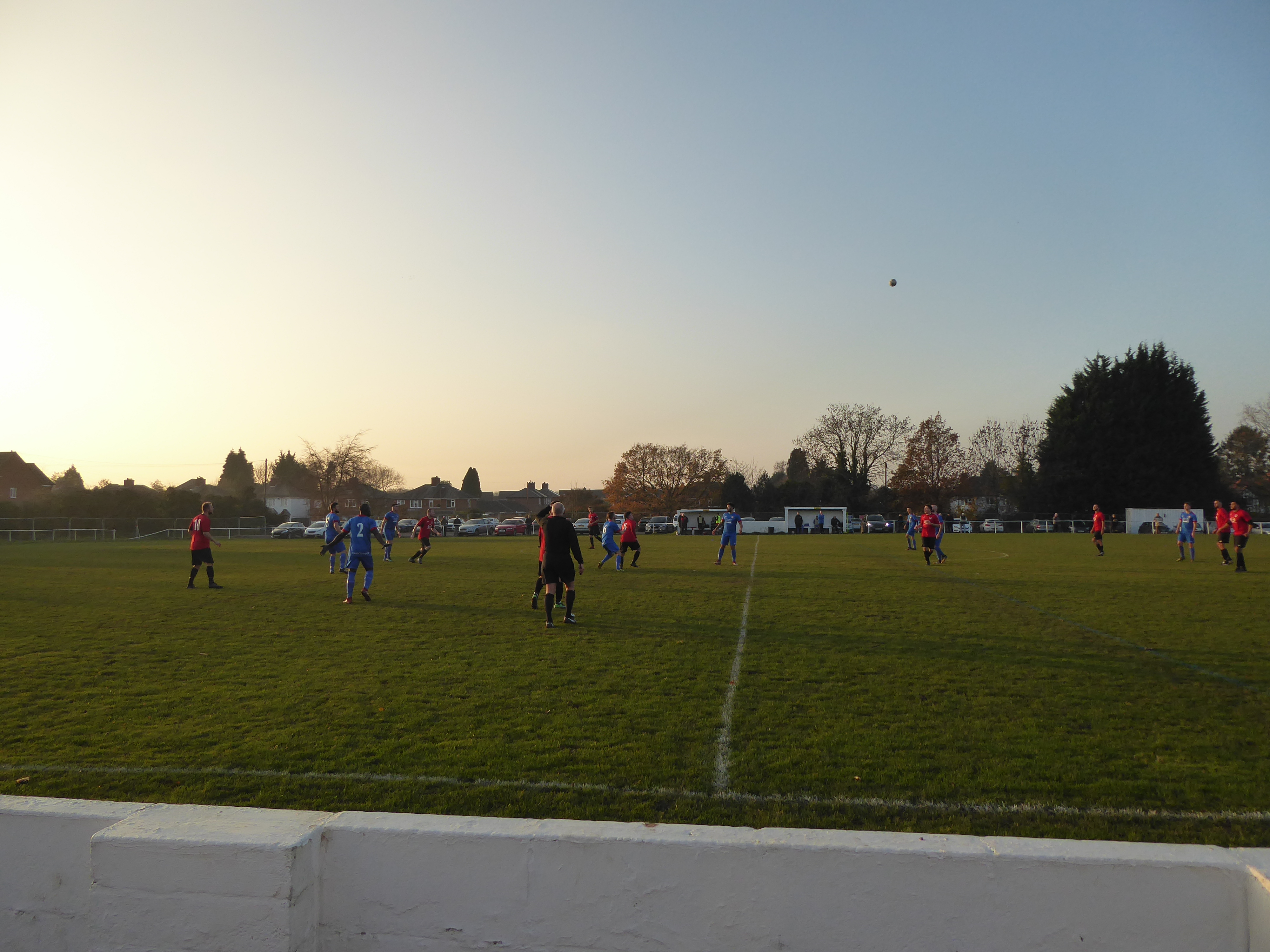
Knowle F.C.
Knowle Football Club is a football club based in Knowle Solihull, in the West Midlands, England. They are currently members of the Midland League Division...
Catherine-de-Barnes Isolation Hospital
Catherine-de-Barnes Isolation Hospital was a specialist isolation hospital for infection control in Catherine-de-Barnes, a village within the Metropolitan...
Berry Hall Farm
Berry Hall Farm is a moated, fifteenth century half-timbered property located on Ravenshaw Lane in central Solihull. Originally named 'Berry Hall' and...
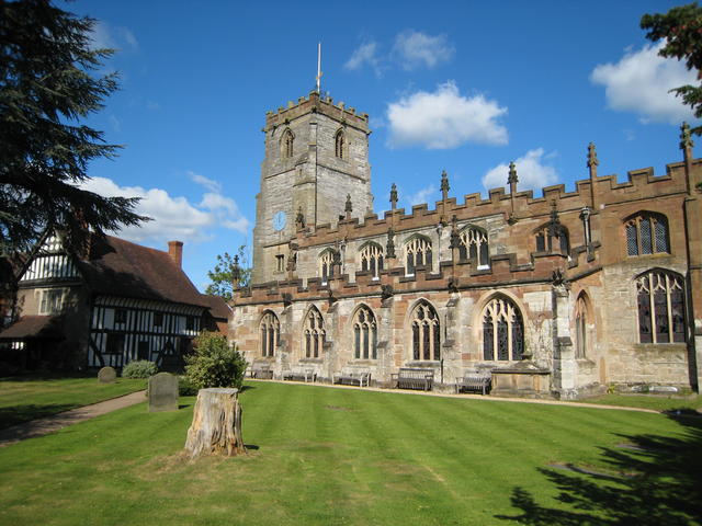
Knowle Parish Church
Knowle Parish Church is a Grade I listed parish church in the Church of England in Knowle, West Midlands. == History == The church dates from the 15th...
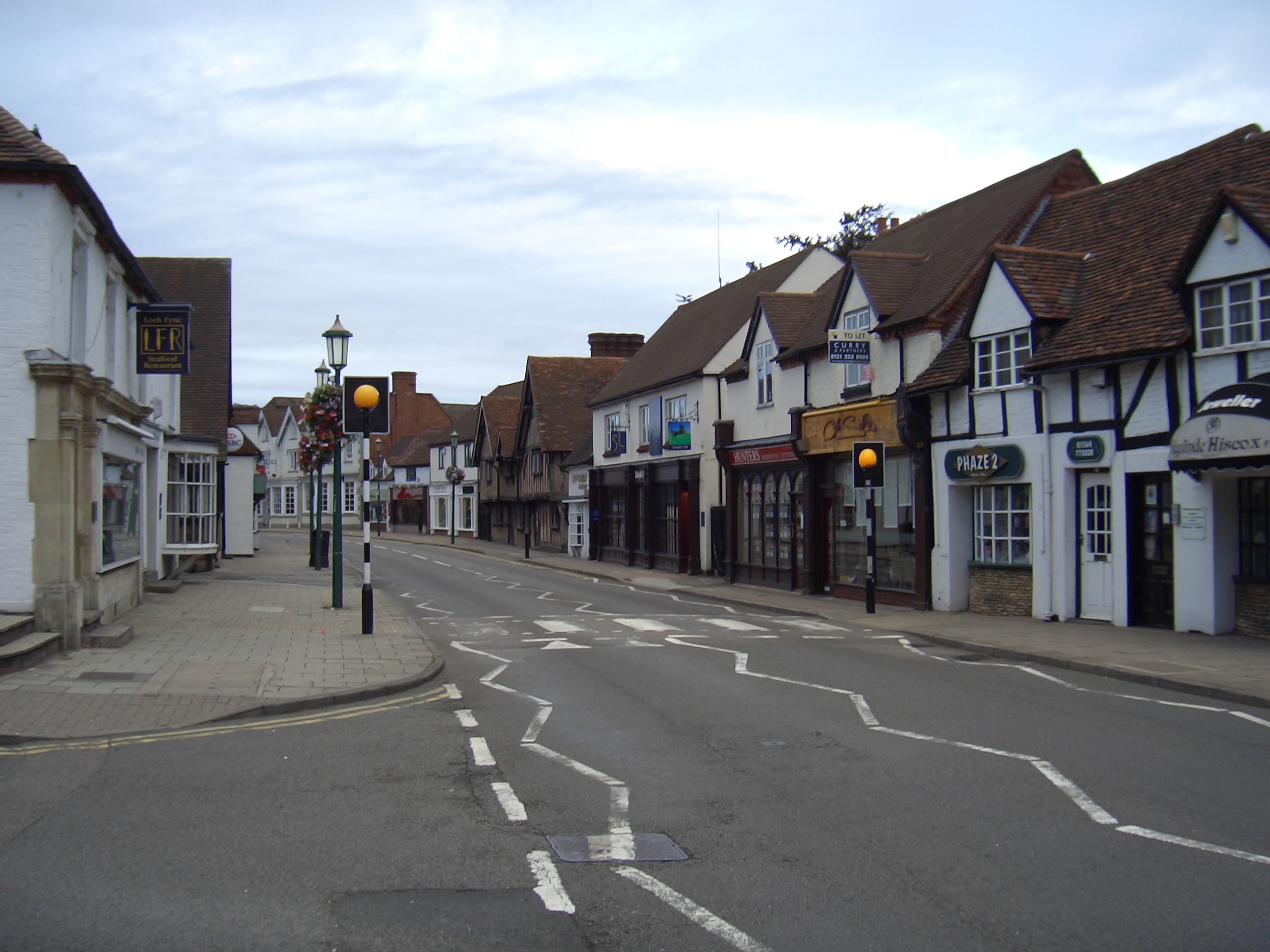
Knowle, West Midlands
Knowle is a large village situated 3 miles (5 km) east-southeast of the town of Solihull, West Midlands, England. Knowle lies within the Arden area of...

Malvern and Brueton Park
Malvern and Brueton Park is a town park and local nature reserve in Solihull in the West Midlands, England. The park is formed from a comparatively narrow...
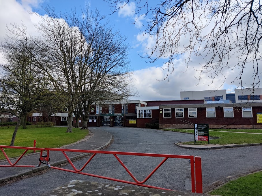
Arden Academy
Arden Academy (formerly Arden School) is a ten form entry (from 2015) mixed comprehensive secondary school with academy status It was re-designated as...
Nearby Amenities
Located within 500m of 52.401055,-1.74422Have you been to Copt Heath?
Leave your review of Copt Heath below (or comments, questions and feedback).