The Warren

Wood, Forest in Derbyshire Derbyshire Dales

England

The Warren

High Neb Trig point at High Neb
High Neb Credit: Shaun Ferguson

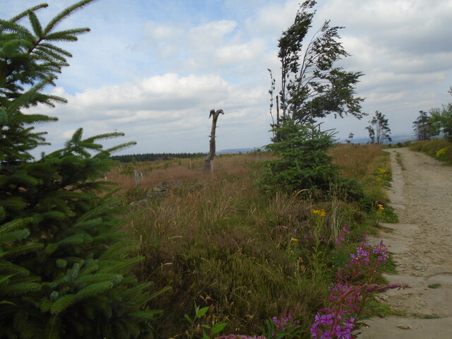
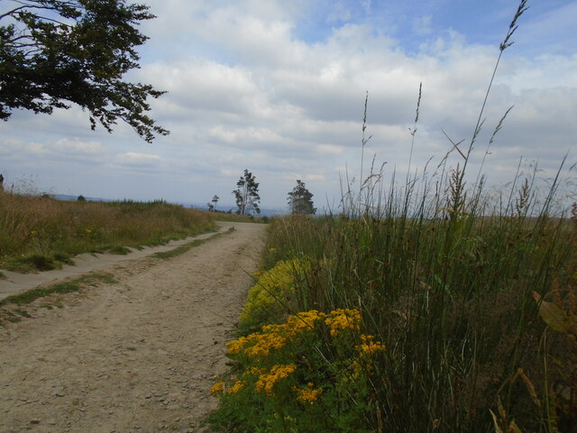
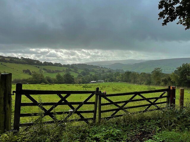
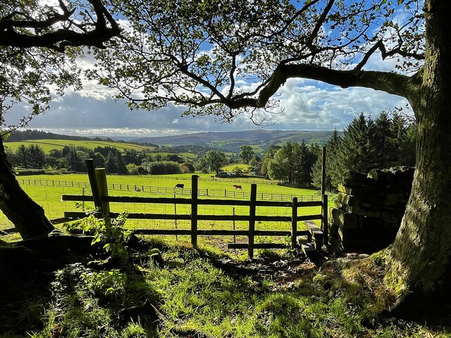
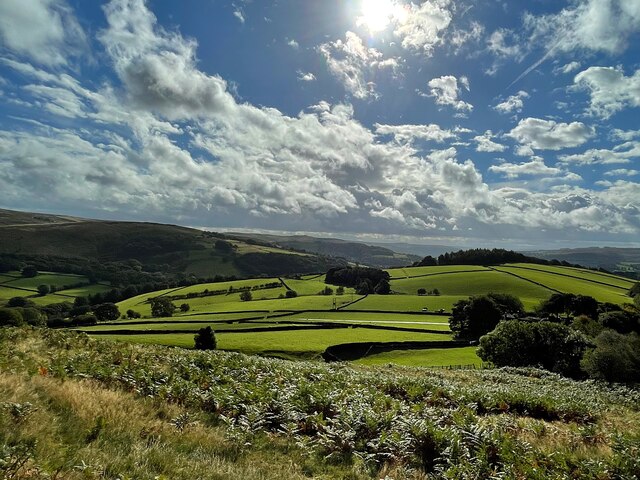
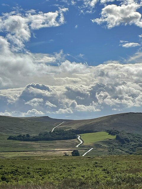
The Warren, located in Derbyshire, is a picturesque woodland area known for its natural beauty and tranquility. Spanning over a vast expanse, the forest is nestled within the rolling hills and valleys of the region, offering visitors a peaceful escape from the bustling city life.

The woodland is characterized by its dense canopy of trees, predominantly consisting of oak, beech, and birch. These trees provide a haven for a wide variety of wildlife, including squirrels, deer, and a diverse range of bird species. The forest floor is carpeted with a rich tapestry of wildflowers and ferns, creating a vibrant and enchanting atmosphere.

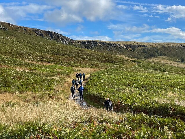
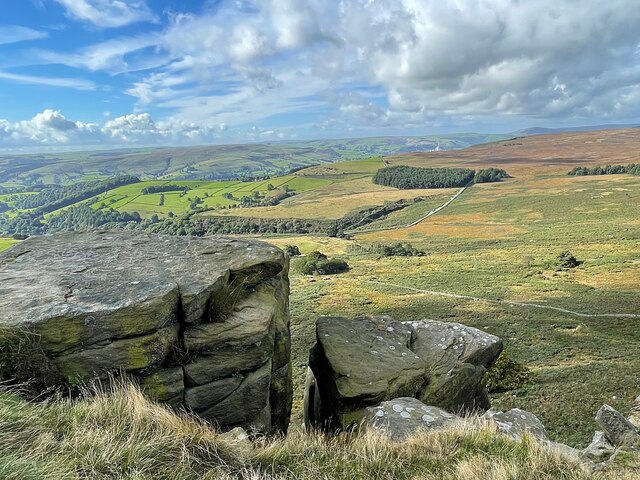
The Warren is a popular destination for nature lovers and outdoor enthusiasts, offering numerous walking and hiking trails that wind through the forest. These trails cater to all levels of fitness and provide opportunities for visitors to explore the area's natural wonders. Along the way, there are several designated picnic areas where visitors can rest and enjoy a meal amidst the serene surroundings.

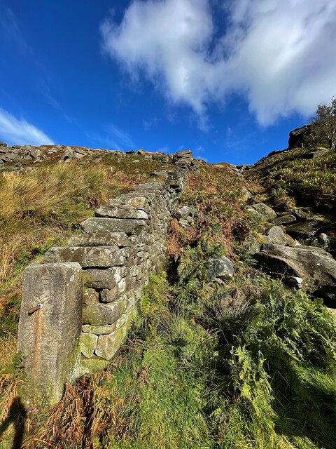
The forest also has a rich historical significance, with evidence of human activity dating back thousands of years. Archaeological remains, such as ancient burial mounds and stone circles, can be found within the woodland, offering a glimpse into the area's past.

Overall, The Warren in Derbyshire is a haven of natural beauty and tranquility. With its diverse flora and fauna, scenic trails, and rich history, it is a must-visit destination for anyone seeking a peaceful retreat in the heart of nature.

If you have any feedback on the listing, please let us know in the comments section below.
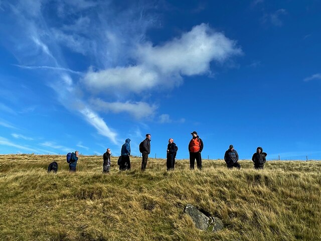
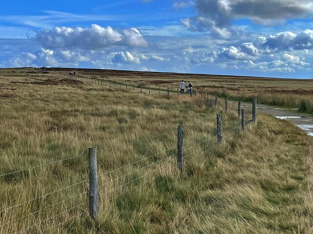
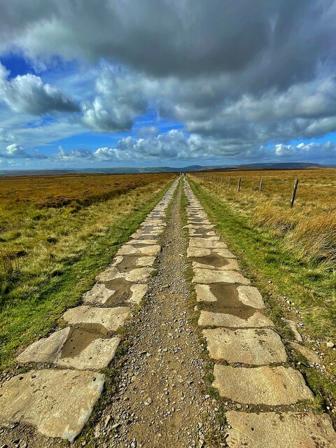
The Warren Images

Images are sourced within 2km of 53.350972/-1.6504168 or Grid Reference SK2383. Thanks to Geograph Open Source API. All images are credited.

High Neb Trig point at High Neb
High Neb
Trig point at High Neb
Stanage Edge Stanage Edge above the path coming up from Dennis Knoll
Stanage Edge
Stanage Edge above the path coming up from Dennis Knoll
Stanedge Pole Stanedge Pole on the moor above Stanage Edge
Stanedge Pole
Stanedge Pole on the moor above Stanage Edge
Stanage Edge Stanage Edge above the path to Hook's Car parking
Stanage Edge
Stanage Edge above the path to Hook's Car parking
Long Causeway track Descending from Stanedge Pole towards Redmires reservoir.   Interesting dead tree.  Ragwort and rosebay willowherb.
Long Causeway track
Descending from Stanedge Pole towards Redmires reservoir. Interesting dead tree. Ragwort and rosebay willowherb.
Longcauseway More ragwort on Long Causeway.   A paved section on the left side of the track. Sheffield just visible in the haze on the horizon.
Longcauseway
More ragwort on Long Causeway. A paved section on the left side of the track. Sheffield just visible in the haze on the horizon.
Footpath steps climbing out of Hurst Clough This is the start of an old field path into Bamford. When Bamford Filters waterworks was constructed, the path had to be diverted around the perimeter. The area is also much more wooded than it once was.
Footpath steps climbing out of Hurst Clough
This is the start of an old field path into Bamford. When Bamford Filters waterworks was constructed, the path had to be diverted around the perimeter. The area is also much more wooded than it once was.
Hirstclough Lane A steep byway open to all traffic to the east of Bamford
Hirstclough Lane
A steep byway open to all traffic to the east of Bamford
Cloudy sky over the Derwent Valley From Hurstclough Lane. Fortunately the grey clouds passed without depositing too much rain.
Cloudy sky over the Derwent Valley
From Hurstclough Lane. Fortunately the grey clouds passed without depositing too much rain.
Looking over the Derwent Valley From a public footpath in Bolehill Wood.
Looking over the Derwent Valley
From a public footpath in Bolehill Wood.
Cloudy blue sky over green fields and trees The glorious view to the east from Bole Hill
Cloudy blue sky over green fields and trees
The glorious view to the east from Bole Hill
Walking up to Stanage Edge This path provides a gentle climb to the edge.
Walking up to Stanage Edge
This path provides a gentle climb to the edge.
View from a path to Stanage Edge The minor road runs over Cattis-side Moor between Stanage Edge and Carrhead Rocks.
View from a path to Stanage Edge
The minor road runs over Cattis-side Moor between Stanage Edge and Carrhead Rocks.
Wall and stream below Stanage Edge
The view from Stanage Edge Looking over Bamford Moor to the Hope Valley.
The view from Stanage Edge
Looking over Bamford Moor to the Hope Valley.
On Stanage Edge A group of walkers are admiring the view.
On Stanage Edge
A group of walkers are admiring the view.
The path to Stanedge Pole
Byway between Stanedge Pole and Stanage Edge Strange that the pole <a href="https://www.geograph.org.uk/photo/6981418">SK2484 : Stanedge Pole</a> and the edge are spelled differently.
Byway between Stanedge Pole and Stanage Edge
Strange that the pole SK2484 : Stanedge Pole and the edge are spelled differently.
Show me another place!

The Warren is located at Grid Ref: SK2383 (Lat: 53.350972, Lng: -1.6504168)

Administrative County: Derbyshire

District: Derbyshire Dales

Police Authority: Derbyshire

What 3 Words

///email.fields.reform. Near Hathersage, Derbyshire

Related Wikis

Long Causeway

Long Causeway or Long Causey was a medieval packhorse route in England, which ran between Sheffield in South Yorkshire and Hathersage in Derbyshire. In...
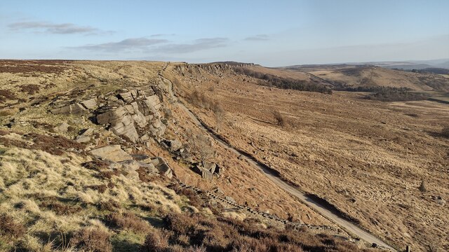
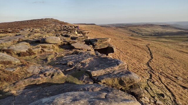
Stanage Edge

Stanage Edge, or simply Stanage (from "stone edge") is a gritstone escarpment in the Peak District, England, famous as a location for climbing. It lies...
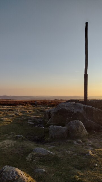
Stanedge Pole

Stanedge Pole also known as Stanage Pole (grid reference SK2468784429) is a landmark on Hallam Moors close to Stanage Edge in South Yorkshire, England...

Hood Brook

Hood Brook is a stream in the Derbyshire Peak District, originating near Stanage Edge, close to Robin Hoods Cave. == Background == Hood Brook flows south...

St Michael and All Angels' Church, Hathersage

St Michael and All Angels’ Church, Hathersage, is a Grade I listed parish church in the Church of England in Hathersage, Derbyshire. == History == The...

Hathersage

Hathersage ( HATHə-sidge) is a village and civil parish in the Peak District in Derbyshire, England. It lies slightly to the north of the River Derwent...

Bamford

Bamford is a village in the Peak District, Derbyshire, England, close to the River Derwent. To the north-east is Bamford Edge, and to the north-west the...

Our Lady of Sorrows Church, Bamford

Our Lady of Sorrows Church, Bamford is a Roman Catholic church in the village of Bamford, Derbyshire. The church dates back to the mid-19th century and...

Related Videos

STANAGE EDGE | PEAK DISTRICT - Full Hiking Tour

In this episode Hay and Kyle are your personal tour guides, taking you round the popular Peak District spot, Stanage Edge.

Peak District Country Walk- HATHERSAGE to STANAGE EDGE // Travel Vlog- Brits in Britain

In this video we walk from Hathersage to Stanage edge in the Peak District- showing you some amazing views and giving a good ...

Peak district walking...Stanage edge from Wyming brook..with a visit to the cave along the edge.

Working last night so i am totally knackered on this walk...i got up after about an hours sleep ..feet ache, legs ache, so tired, but ...

Nearby Amenities

Located within 500m of 53.350972,-1.6504168
Waterway: waterfall
Lat/Long: 53.3506338/-1.6514479
Barrier: stile
Source: survey;gps
Lat/Long: 53.3482066/-1.6544866
Fixme: gate
Lat/Long: 53.347219/-1.6474817
Hollin Bank
Tourism: picnic_site
Lat/Long: 53.3503409/-1.6446946
Bicycle Parking
Bicycle Parking: stands
Capacity: 12
Covered: no
Lat/Long: 53.3508708/-1.6445287
Passing Place
Lat/Long: 53.3525401/-1.6484196
Barrier: stile
Material: stone
Source: survey;gps
Step Count: 3
Stile: stepover
Lat/Long: 53.3520883/-1.6563872
Barrier: stile
Material: stone
Source: survey;gps
Stile: stepover
Lat/Long: 53.3532475/-1.6565138
Barrier: stile
Material: wood
Source: survey;gps
Stile: stepover
Lat/Long: 53.3500483/-1.6563561
Barrier: stile
Lat/Long: 53.350181/-1.6543639
Barrier: stile
Lat/Long: 53.3500179/-1.6538677
Ford: yes
Lat/Long: 53.3543139/-1.6519957
Ford: stepping_stones
Lat/Long: 53.34996/-1.6521233
Information: guidepost
Operator: Peak & Northern Footpaths Society
Ref: 262
Source: survey;gps
Tourism: information
Lat/Long: 53.3477001/-1.6535065
Bench
Lat/Long: 53.3476348/-1.6536047
Ford: yes
Lat/Long: 53.3542781/-1.651952
Natural: spring
Lat/Long: 53.3482001/-1.6513339
The data included in this document is from www.openstreetmap.org. The data is made available under ODbL.

Have you been to The Warren?

Leave your review of The Warren below (or comments, questions and feedback).