Goltho

Civil Parish in Lincolnshire West Lindsey

England

Goltho

The Ivy public house and Corndolly café
The Ivy public house and Corndolly café Credit: David Lally

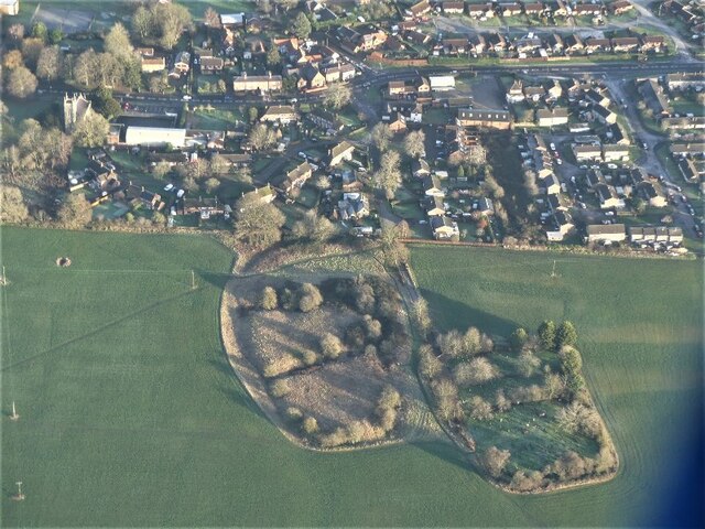
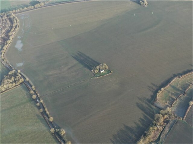
Goltho is a civil parish located in the county of Lincolnshire, England. It is situated approximately six miles northeast of the city of Lincoln and covers an area of around 8.5 square kilometers. The parish is predominantly rural, with a small population of around 150 residents.

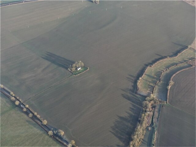
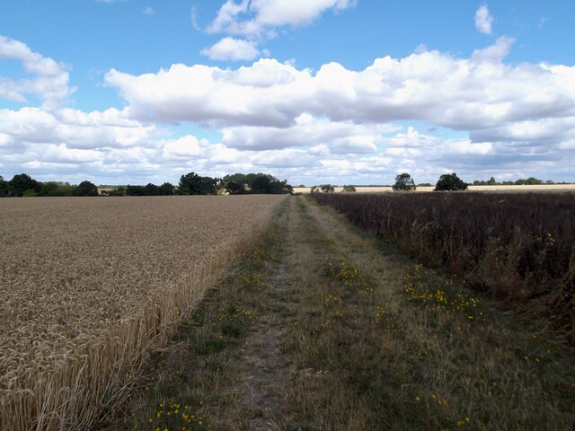
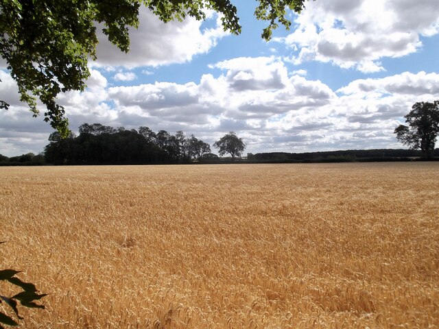
Goltho is known for its picturesque countryside and idyllic landscapes, attracting visitors who appreciate the tranquility and natural beauty of the area. The village itself is small, consisting of a few scattered houses and farms. The parish also encompasses Goltho Gardens, a popular attraction that features stunning gardens and a medieval moat.

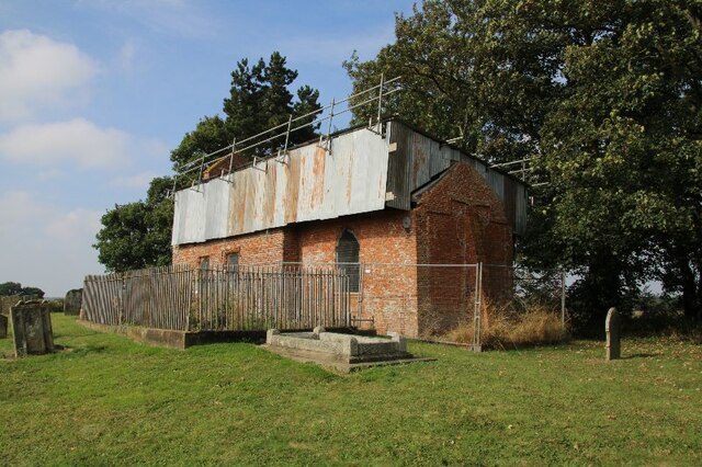
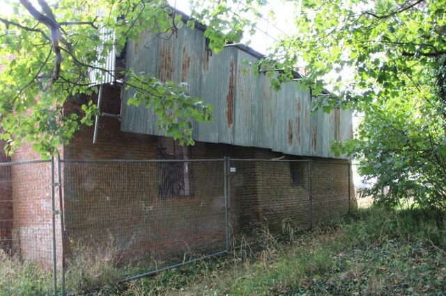
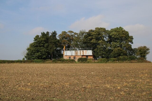
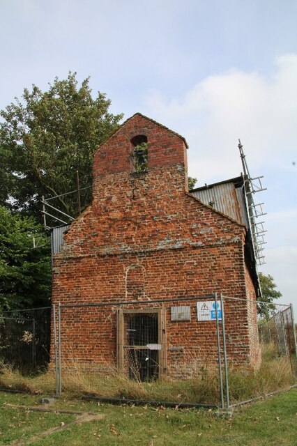
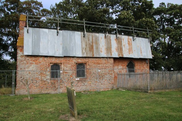
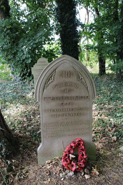
Historically, Goltho has an interesting past. The village was mentioned in the Domesday Book of 1086 as "Golthone" and has been inhabited for centuries. The local church, St. George's, dates back to the 12th century and is a Grade I listed building, boasting impressive architectural features.

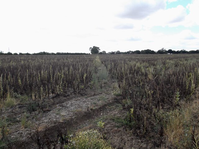
The economy of Goltho is primarily agricultural, with farming playing a significant role in the livelihood of the community. Some residents are also employed in nearby towns and cities, commuting for work.

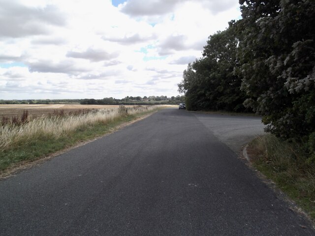
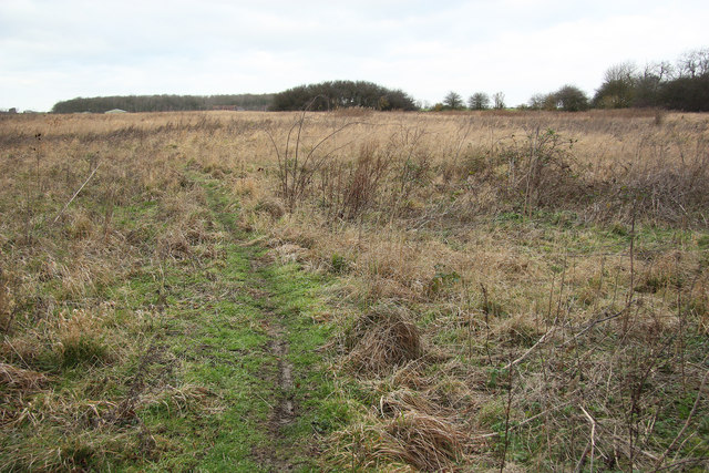
Goltho offers a peaceful and rural lifestyle, perfect for those seeking a quieter way of life. The area provides ample opportunities for outdoor activities such as walking, cycling, and horse-riding, making it a popular destination for nature enthusiasts. With its rich history and scenic landscapes, Goltho offers a glimpse into the traditional English countryside.

If you have any feedback on the listing, please let us know in the comments section below.

Goltho Images

Images are sourced within 2km of 53.279742/-0.325484 or Grid Reference TF1177. Thanks to Geograph Open Source API. All images are credited.

The Ivy public house and Corndolly café
The Turnor Arms
The Turnor Arms
The sign of The Turnor Arms See: <a href="https://www.geograph.org.uk/photo/6933995">TF1378 : The Turnor Arms</a>
The sign of The Turnor Arms
Goltho, St. George's Church, 2021 (1) 8 years after a disastrous fire in 2013 - See <a href="https://www.geograph.org.uk/photo/3716859">TF1177 : St.George's church</a>.
Goltho, St. George's Church, 2021 (1)
8 years after a disastrous fire in 2013 - See TF1177 : St.George's church.
Goltho, St. George's Church, 2021 (2) 8 years after a disastrous fire in 2013 - See <a href="https://www.geograph.org.uk/photo/3716859">TF1177 : St.George's church</a>.
Goltho, St. George's Church, 2021 (2)
8 years after a disastrous fire in 2013 - See TF1177 : St.George's church.
Goltho, St. George's Church, 2021 (3) 8 years after a disastrous fire in 2013 - See <a href="https://www.geograph.org.uk/photo/3716859">TF1177 : St.George's church</a>.
Goltho, St. George's Church, 2021 (3)
8 years after a disastrous fire in 2013 - See TF1177 : St.George's church.
Goltho, St. George's Church, 2021 (4) 8 years after a disastrous fire in 2013 - See <a href="https://www.geograph.org.uk/photo/3716859">TF1177 : St.George's church</a>.
Goltho, St. George's Church, 2021 (4)
8 years after a disastrous fire in 2013 - See TF1177 : St.George's church.
Goltho, St. George's Church, 2021 (5) 8 years after a disastrous fire in 2013 - See <a href="https://www.geograph.org.uk/photo/3716859">TF1177 : St.George's church</a>.
Goltho, St. George's Church, 2021 (5)
8 years after a disastrous fire in 2013 - See TF1177 : St.George's church.
War grave at Goltho, St. George's Church, 2021 8 years after a disastrous fire in 2013 - See <a href="https://www.geograph.org.uk/photo/3716859">TF1177 : St.George's church</a>.
War grave at Goltho, St. George's Church, 2021
8 years after a disastrous fire in 2013 - See TF1177 : St.George's church.
"Wragby Moats", a Manorian Manor complex: aerial 2022 The remains of a medieval manorial complex. 

See <span class="nowrap"><a title="https://www.heritagegateway.org.uk/Gateway/Results_Single.aspx?uid=09cad9c1-6cbb-4d7a-b6ac-b5ff9c4d1eec&resourceID=19191" rel="nofollow ugc noopener" href="https://www.heritagegateway.org.uk/Gateway/Results_Single.aspx?uid=09cad9c1-6cbb-4d7a-b6ac-b5ff9c4d1eec&resourceID=19191">Link</a><img style="margin-left:2px;" alt="External link" title="External link - shift click to open in new window" src="https://s1.geograph.org.uk/img/external.png" width="10" height="10"/></span> and <span class="nowrap"><a title="https://www.heritagegateway.org.uk/Gateway/Results_Single.aspx?uid=MLI43631&resourceID=1006" rel="nofollow ugc noopener" href="https://www.heritagegateway.org.uk/Gateway/Results_Single.aspx?uid=MLI43631&resourceID=1006">Link</a><img style="margin-left:2px;" alt="External link" title="External link - shift click to open in new window" src="https://s1.geograph.org.uk/img/external.png" width="10" height="10"/></span>

See also <a href="https://www.geograph.org.uk/photo/5021809">TF1377 : Wragby moats: aerial 2016</a> and <a href="https://www.geograph.org.uk/photo/5021793">TF1377 : Wragby and its moats: aerial 2016</a>.
"Wragby Moats", a Manorian Manor complex: aerial 2022
The remains of a medieval manorial complex. See LinkExternal link and LinkExternal link See also TF1377 : Wragby moats: aerial 2016 and TF1377 : Wragby and its moats: aerial 2016.
Goltho: aerial 2022 (1) St. George's Church: <span class="nowrap"><a title="https://www.heritagegateway.org.uk/Gateway/Results_Single.aspx?uid=76b2167a-05d4-432c-a931-3a659f9cdacf&resourceID=19191" rel="nofollow ugc noopener" href="https://www.heritagegateway.org.uk/Gateway/Results_Single.aspx?uid=76b2167a-05d4-432c-a931-3a659f9cdacf&resourceID=19191">Link</a><img style="margin-left:2px;" alt="External link" title="External link - shift click to open in new window" src="https://s1.geograph.org.uk/img/external.png" width="10" height="10"/></span>

Goltho Medieval Settlement Earthwork And Cropmark Site: <span class="nowrap"><a title="https://www.heritagegateway.org.uk/Gateway/Results_Single.aspx?uid=ec19aad5-49d4-4854-bafb-f065821c9129&resourceID=19191" rel="nofollow ugc noopener" href="https://www.heritagegateway.org.uk/Gateway/Results_Single.aspx?uid=ec19aad5-49d4-4854-bafb-f065821c9129&resourceID=19191">Link</a><img style="margin-left:2px;" alt="External link" title="External link - shift click to open in new window" src="https://s1.geograph.org.uk/img/external.png" width="10" height="10"/></span>

Traces of Romano-British settlement: <span class="nowrap"><a title="https://www.heritagegateway.org.uk/Gateway/Results_Single.aspx?uid=59411ede-0a52-4991-907a-6925db9d8905&resourceID=19191" rel="nofollow ugc noopener" href="https://www.heritagegateway.org.uk/Gateway/Results_Single.aspx?uid=59411ede-0a52-4991-907a-6925db9d8905&resourceID=19191">Link</a><img style="margin-left:2px;" alt="External link" title="External link - shift click to open in new window" src="https://s1.geograph.org.uk/img/external.png" width="10" height="10"/></span>

Site of defended manorial enclosure: <span class="nowrap"><a title="https://www.heritagegateway.org.uk/Gateway/Results_Single.aspx?uid=MLI50494&resourceID=1006" rel="nofollow ugc noopener" href="https://www.heritagegateway.org.uk/Gateway/Results_Single.aspx?uid=MLI50494&resourceID=1006">Link</a><img style="margin-left:2px;" alt="External link" title="External link - shift click to open in new window" src="https://s1.geograph.org.uk/img/external.png" width="10" height="10"/></span>

Site of motte and bailey castle: <span class="nowrap"><a title="https://www.heritagegateway.org.uk/Gateway/Results_Single.aspx?uid=MLI50493&resourceID=1006" rel="nofollow ugc noopener" href="https://www.heritagegateway.org.uk/Gateway/Results_Single.aspx?uid=MLI50493&resourceID=1006">Link</a><img style="margin-left:2px;" alt="External link" title="External link - shift click to open in new window" src="https://s1.geograph.org.uk/img/external.png" width="10" height="10"/></span>

Part of Middle-Saxon settlement: <span class="nowrap"><a title="https://www.heritagegateway.org.uk/Gateway/Results_Single.aspx?uid=MLI51233&resourceID=1006" rel="nofollow ugc noopener" href="https://www.heritagegateway.org.uk/Gateway/Results_Single.aspx?uid=MLI51233&resourceID=1006">Link</a><img style="margin-left:2px;" alt="External link" title="External link - shift click to open in new window" src="https://s1.geograph.org.uk/img/external.png" width="10" height="10"/></span>

Deserted settlement of Goltho or Bullington: <span class="nowrap"><a title="https://www.heritagegateway.org.uk/Gateway/Results_Single.aspx?uid=MLI51217&resourceID=1006" rel="nofollow ugc noopener" href="https://www.heritagegateway.org.uk/Gateway/Results_Single.aspx?uid=MLI51217&resourceID=1006">Link</a><img style="margin-left:2px;" alt="External link" title="External link - shift click to open in new window" src="https://s1.geograph.org.uk/img/external.png" width="10" height="10"/></span>

Romano-British farmstead and building remains: <span class="nowrap"><a title="https://www.heritagegateway.org.uk/Gateway/Results_Single.aspx?uid=MLI50713&resourceID=1006" rel="nofollow ugc noopener" href="https://www.heritagegateway.org.uk/Gateway/Results_Single.aspx?uid=MLI50713&resourceID=1006">Link</a><img style="margin-left:2px;" alt="External link" title="External link - shift click to open in new window" src="https://s1.geograph.org.uk/img/external.png" width="10" height="10"/></span>


The soilmarks are picked out by the early morning January frost, and the remains of the earthworks by the (long) early morning morning winter shadows - note the shadows of the trees around the church.
Goltho: aerial 2022 (1)
St. George's Church: LinkExternal link Goltho Medieval Settlement Earthwork And Cropmark Site: LinkExternal link Traces of Romano-British settlement: LinkExternal link Site of defended manorial enclosure: LinkExternal link Site of motte and bailey castle: LinkExternal link Part of Middle-Saxon settlement: LinkExternal link Deserted settlement of Goltho or Bullington: LinkExternal link Romano-British farmstead and building remains: LinkExternal link The soilmarks are picked out by the early morning January frost, and the remains of the earthworks by the (long) early morning morning winter shadows - note the shadows of the trees around the church.
Goltho: aerial 2022 (2) St. George's Church: <span class="nowrap"><a title="https://www.heritagegateway.org.uk/Gateway/Results_Single.aspx?uid=76b2167a-05d4-432c-a931-3a659f9cdacf&resourceID=19191" rel="nofollow ugc noopener" href="https://www.heritagegateway.org.uk/Gateway/Results_Single.aspx?uid=76b2167a-05d4-432c-a931-3a659f9cdacf&resourceID=19191">Link</a><img style="margin-left:2px;" alt="External link" title="External link - shift click to open in new window" src="https://s1.geograph.org.uk/img/external.png" width="10" height="10"/></span>

Goltho Medieval Settlement Earthwork And Cropmark Site: <span class="nowrap"><a title="https://www.heritagegateway.org.uk/Gateway/Results_Single.aspx?uid=ec19aad5-49d4-4854-bafb-f065821c9129&resourceID=19191" rel="nofollow ugc noopener" href="https://www.heritagegateway.org.uk/Gateway/Results_Single.aspx?uid=ec19aad5-49d4-4854-bafb-f065821c9129&resourceID=19191">Link</a><img style="margin-left:2px;" alt="External link" title="External link - shift click to open in new window" src="https://s1.geograph.org.uk/img/external.png" width="10" height="10"/></span>

Traces of Romano-British settlement: <span class="nowrap"><a title="https://www.heritagegateway.org.uk/Gateway/Results_Single.aspx?uid=59411ede-0a52-4991-907a-6925db9d8905&resourceID=19191" rel="nofollow ugc noopener" href="https://www.heritagegateway.org.uk/Gateway/Results_Single.aspx?uid=59411ede-0a52-4991-907a-6925db9d8905&resourceID=19191">Link</a><img style="margin-left:2px;" alt="External link" title="External link - shift click to open in new window" src="https://s1.geograph.org.uk/img/external.png" width="10" height="10"/></span>

Site of defended manorial enclosure: <span class="nowrap"><a title="https://www.heritagegateway.org.uk/Gateway/Results_Single.aspx?uid=MLI50494&resourceID=1006" rel="nofollow ugc noopener" href="https://www.heritagegateway.org.uk/Gateway/Results_Single.aspx?uid=MLI50494&resourceID=1006">Link</a><img style="margin-left:2px;" alt="External link" title="External link - shift click to open in new window" src="https://s1.geograph.org.uk/img/external.png" width="10" height="10"/></span>

Site of motte and bailey castle: <span class="nowrap"><a title="https://www.heritagegateway.org.uk/Gateway/Results_Single.aspx?uid=MLI50493&resourceID=1006" rel="nofollow ugc noopener" href="https://www.heritagegateway.org.uk/Gateway/Results_Single.aspx?uid=MLI50493&resourceID=1006">Link</a><img style="margin-left:2px;" alt="External link" title="External link - shift click to open in new window" src="https://s1.geograph.org.uk/img/external.png" width="10" height="10"/></span>

Part of Middle-Saxon settlement: <span class="nowrap"><a title="https://www.heritagegateway.org.uk/Gateway/Results_Single.aspx?uid=MLI51233&resourceID=1006" rel="nofollow ugc noopener" href="https://www.heritagegateway.org.uk/Gateway/Results_Single.aspx?uid=MLI51233&resourceID=1006">Link</a><img style="margin-left:2px;" alt="External link" title="External link - shift click to open in new window" src="https://s1.geograph.org.uk/img/external.png" width="10" height="10"/></span>

Deserted settlement of Goltho or Bullington: <span class="nowrap"><a title="https://www.heritagegateway.org.uk/Gateway/Results_Single.aspx?uid=MLI51217&resourceID=1006" rel="nofollow ugc noopener" href="https://www.heritagegateway.org.uk/Gateway/Results_Single.aspx?uid=MLI51217&resourceID=1006">Link</a><img style="margin-left:2px;" alt="External link" title="External link - shift click to open in new window" src="https://s1.geograph.org.uk/img/external.png" width="10" height="10"/></span>

Romano-British farmstead and building remains: <span class="nowrap"><a title="https://www.heritagegateway.org.uk/Gateway/Results_Single.aspx?uid=MLI50713&resourceID=1006" rel="nofollow ugc noopener" href="https://www.heritagegateway.org.uk/Gateway/Results_Single.aspx?uid=MLI50713&resourceID=1006">Link</a><img style="margin-left:2px;" alt="External link" title="External link - shift click to open in new window" src="https://s1.geograph.org.uk/img/external.png" width="10" height="10"/></span>

The soilmarks are picked out by the early morning January frost, and the remains of the earthworks by the (long) early morning morning winter shadows - note the shadows of the trees around the church.
Goltho: aerial 2022 (2)
St. George's Church: LinkExternal link Goltho Medieval Settlement Earthwork And Cropmark Site: LinkExternal link Traces of Romano-British settlement: LinkExternal link Site of defended manorial enclosure: LinkExternal link Site of motte and bailey castle: LinkExternal link Part of Middle-Saxon settlement: LinkExternal link Deserted settlement of Goltho or Bullington: LinkExternal link Romano-British farmstead and building remains: LinkExternal link The soilmarks are picked out by the early morning January frost, and the remains of the earthworks by the (long) early morning morning winter shadows - note the shadows of the trees around the church.
The Turnor Arms, Wragby
Old Lincoln Road, Goltho
Path across a field of beans
Field track to the medieval village of Goltho
Golden fields near Shepherd's Farm
Show me another place!

Goltho is located at Grid Ref: TF1177 (Lat: 53.279742, Lng: -0.325484)

Administrative County: Lincolnshire

District: West Lindsey

Police Authority: Lincolnshire

What 3 Words

///lemmings.bombard.homelands. Near Wragby, Lincolnshire

Related Wikis

Goltho

Goltho is a hamlet in the West Lindsey district of Lincolnshire, England. The population (including Bullington) was 157 at the 2011 census. It is situated...

St George's Church, Goltho

St George's Church is a redundant Anglican church in the deserted village of Goltho, Lincolnshire, England. It is recorded in the National Heritage List...
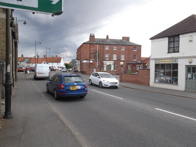
Wragby

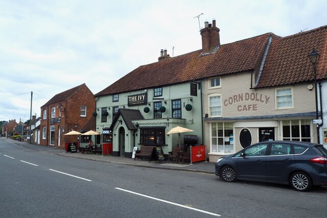
Wragby ( RAG-bee) is a town and civil parish in the East Lindsey district of Lincolnshire, England. It is situated at the junction of the A157 and A158...

Bullington Priory

Bullington Priory was a priory in Bullington, Lincolnshire, England. The priory was a house of the Gilbertine Order and dedicated to Saint Mary. It was...

Rand, Lincolnshire

Rand is a small village and civil parish in the West Lindsey district of Lincolnshire, England. It is situated approximately 9 miles (14 km) north-east...

Apley

Apley is a hamlet and civil parish in the West Lindsey district of Lincolnshire, England. It is situated 1 mile (1.6 km) west from the hamlet of Kingthorpe...

Wragby railway station

Wragby railway station was a railway station that served the town of Wragby, Lincolnshire, England between 1874 and 1960, on the Louth to Bardney line...

Kingthorpe

Kingthorpe is a hamlet in the West Lindsey district of Lincolnshire, England. The hamlet is in the civil parish of Apley, and is 10 miles (16 km) east...

Nearby Amenities

Located within 500m of 53.279742,-0.325484
Goltho
Is In: Lincolnshire, England, UK
Place: hamlet
Source: NPE
Lat/Long: 53.2776806/-0.3264667
Power: pole
Lat/Long: 53.2755664/-0.3255424
Power: pole
Lat/Long: 53.2756883/-0.3239264
Power: pole
Lat/Long: 53.2758009/-0.3223136
Goltho village (historic)
Addr Street: Goltho Lane
Archaeological Site: fortification
Historic: archaeological_site
Source: Bing
Lat/Long: 53.2820941/-0.32737
Goltho
End Date: C15
Historic: deserted_medieval_village
Lat/Long: 53.2830334/-0.3297507
Goltho Fishing Lakes
Addr Street: Goltho Lane
Tourism: attraction
Lat/Long: 53.278784/-0.3271127
The data included in this document is from www.openstreetmap.org. The data is made available under ODbL.

Have you been to Goltho?

Leave your review of Goltho below (or comments, questions and feedback).