Goltho Woods

Wood, Forest in Lincolnshire West Lindsey

England

Goltho Woods

Goltho, St. George's Church, 2021 (1) 8 years after a disastrous fire in 2013 - See <a href="https://www.geograph.org.uk/photo/3716859">TF1177 : St.George's church</a>.
Goltho, St. George's Church, 2021 (1) Credit: Chris

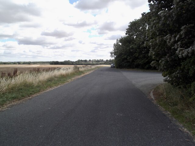
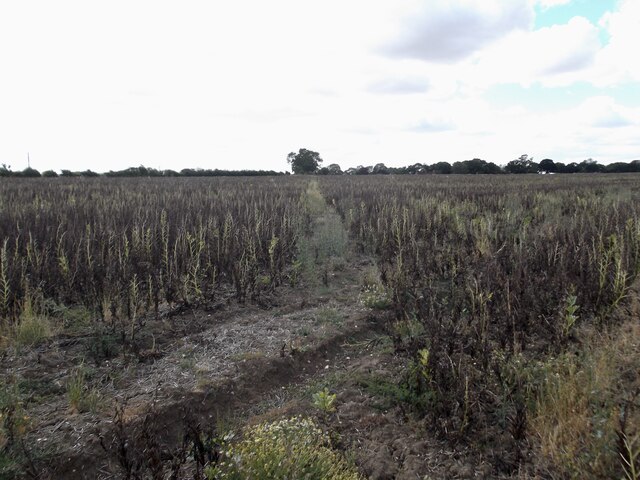
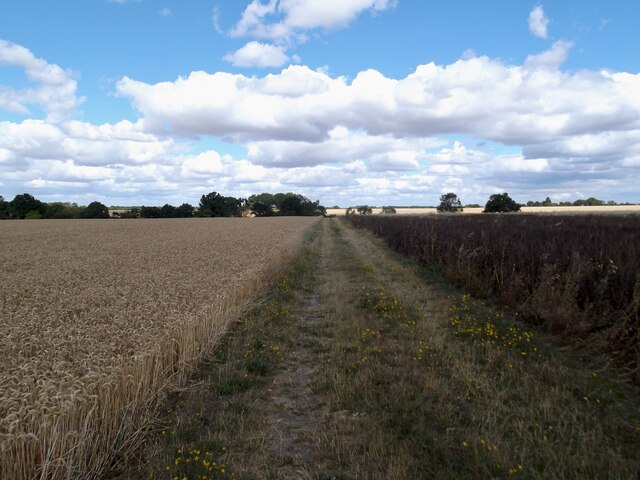
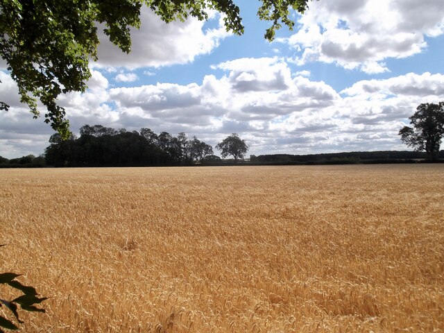
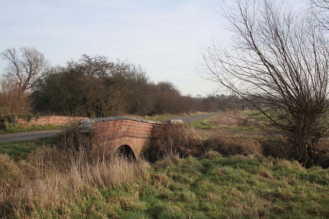
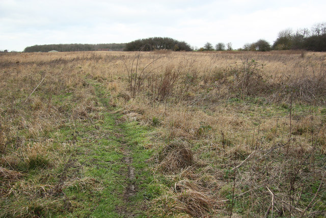
Goltho Woods is a stunning woodland located in the county of Lincolnshire, England. Covering an area of approximately 80 acres, it is known for its natural beauty and rich biodiversity. The woods are situated near the village of Wragby, just a few miles northeast of the historic city of Lincoln.

The woodland is predominantly composed of native deciduous trees, including oak, ash, and birch, which create a dense and enchanting canopy. The forest floor is adorned with a variety of wildflowers, such as bluebells and primroses, adding bursts of color to the surroundings.

Goltho Woods has a long history, dating back to medieval times when it was part of the Goltho Estate. Today, it is managed by the Forestry Commission and has been designated as a Site of Special Scientific Interest (SSSI) due to its ecological importance. The woods provide a habitat for a diverse range of wildlife, including deer, badgers, and various species of birds.

Visitors to Goltho Woods can enjoy a network of well-maintained footpaths and trails that wind through the woodland, allowing for leisurely walks and wildlife spotting. The peaceful atmosphere and tranquil surroundings make it a popular destination for nature lovers, photographers, and families seeking an escape from the hustle and bustle of everyday life.

Overall, Goltho Woods is a charming and picturesque woodland that offers a serene and immersive experience in nature.

If you have any feedback on the listing, please let us know in the comments section below.

Goltho Woods Images

Images are sourced within 2km of 53.284553/-0.33601922 or Grid Reference TF1177. Thanks to Geograph Open Source API. All images are credited.

Goltho, St. George's Church, 2021 (1) 8 years after a disastrous fire in 2013 - See <a href="https://www.geograph.org.uk/photo/3716859">TF1177 : St.George's church</a>.
Goltho, St. George's Church, 2021 (1)
8 years after a disastrous fire in 2013 - See TF1177 : St.George's church.
Goltho, St. George's Church, 2021 (2) 8 years after a disastrous fire in 2013 - See <a href="https://www.geograph.org.uk/photo/3716859">TF1177 : St.George's church</a>.
Goltho, St. George's Church, 2021 (2)
8 years after a disastrous fire in 2013 - See TF1177 : St.George's church.
Goltho, St. George's Church, 2021 (3) 8 years after a disastrous fire in 2013 - See <a href="https://www.geograph.org.uk/photo/3716859">TF1177 : St.George's church</a>.
Goltho, St. George's Church, 2021 (3)
8 years after a disastrous fire in 2013 - See TF1177 : St.George's church.
Goltho, St. George's Church, 2021 (4) 8 years after a disastrous fire in 2013 - See <a href="https://www.geograph.org.uk/photo/3716859">TF1177 : St.George's church</a>.
Goltho, St. George's Church, 2021 (4)
8 years after a disastrous fire in 2013 - See TF1177 : St.George's church.
Goltho, St. George's Church, 2021 (5) 8 years after a disastrous fire in 2013 - See <a href="https://www.geograph.org.uk/photo/3716859">TF1177 : St.George's church</a>.
Goltho, St. George's Church, 2021 (5)
8 years after a disastrous fire in 2013 - See TF1177 : St.George's church.
War grave at Goltho, St. George's Church, 2021 8 years after a disastrous fire in 2013 - See <a href="https://www.geograph.org.uk/photo/3716859">TF1177 : St.George's church</a>.
War grave at Goltho, St. George's Church, 2021
8 years after a disastrous fire in 2013 - See TF1177 : St.George's church.
Rand Medieval Settlement: aerial 2021 (1) Rand was documented in the late 11th century as a manor of Wragby, but during the late 12th century a separate manor was established here by the Burdet family, who retained it until the mid 14th century.

See <span class="nowrap"><a title="https://www.heritagegateway.org.uk/Gateway/Results_Single.aspx?uid=MLI54189&resourceID=1006" rel="nofollow ugc noopener" href="https://www.heritagegateway.org.uk/Gateway/Results_Single.aspx?uid=MLI54189&resourceID=1006">Link</a><img style="margin-left:2px;" alt="External link" title="External link - shift click to open in new window" src="https://s1.geograph.org.uk/img/external.png" width="10" height="10"/></span>
Rand Medieval Settlement: aerial 2021 (1)
Rand was documented in the late 11th century as a manor of Wragby, but during the late 12th century a separate manor was established here by the Burdet family, who retained it until the mid 14th century. See LinkExternal link
Rand Medieval Settlement: aerial 2021 (2) Rand was documented in the late 11th century as a manor of Wragby, but during the late 12th century a separate manor was established here by the Burdet family, who retained it until the mid 14th century.

See <span class="nowrap"><a title="https://www.heritagegateway.org.uk/Gateway/Results_Single.aspx?uid=MLI54189&resourceID=1006" rel="nofollow ugc noopener" href="https://www.heritagegateway.org.uk/Gateway/Results_Single.aspx?uid=MLI54189&resourceID=1006">Link</a><img style="margin-left:2px;" alt="External link" title="External link - shift click to open in new window" src="https://s1.geograph.org.uk/img/external.png" width="10" height="10"/></span>
Rand Medieval Settlement: aerial 2021 (2)
Rand was documented in the late 11th century as a manor of Wragby, but during the late 12th century a separate manor was established here by the Burdet family, who retained it until the mid 14th century. See LinkExternal link
Rand Medieval Settlement: aerial 2021 (3) Rand was documented in the late 11th century as a manor of Wragby, but during the late 12th century a separate manor was established here by the Burdet family, who retained it until the mid 14th century.

See <span class="nowrap"><a title="https://www.heritagegateway.org.uk/Gateway/Results_Single.aspx?uid=MLI54189&resourceID=1006" rel="nofollow ugc noopener" href="https://www.heritagegateway.org.uk/Gateway/Results_Single.aspx?uid=MLI54189&resourceID=1006">Link</a><img style="margin-left:2px;" alt="External link" title="External link - shift click to open in new window" src="https://s1.geograph.org.uk/img/external.png" width="10" height="10"/></span> 

The moated site is first recorded in 1153: see <span class="nowrap"><a title="https://www.heritagegateway.org.uk/Gateway/Results_Single.aspx?uid=MLI54190&resourceID=1006" rel="nofollow ugc noopener" href="https://www.heritagegateway.org.uk/Gateway/Results_Single.aspx?uid=MLI54190&resourceID=1006">Link</a><img style="margin-left:2px;" alt="External link" title="External link - shift click to open in new window" src="https://s1.geograph.org.uk/img/external.png" width="10" height="10"/></span>

Former fishponds to the south of the moat: see <span class="nowrap"><a title="https://www.heritagegateway.org.uk/Gateway/Results_Single.aspx?uid=MLI51215&resourceID=1006" rel="nofollow ugc noopener" href="https://www.heritagegateway.org.uk/Gateway/Results_Single.aspx?uid=MLI51215&resourceID=1006">Link</a><img style="margin-left:2px;" alt="External link" title="External link - shift click to open in new window" src="https://s1.geograph.org.uk/img/external.png" width="10" height="10"/></span>
Rand Medieval Settlement: aerial 2021 (3)
Rand was documented in the late 11th century as a manor of Wragby, but during the late 12th century a separate manor was established here by the Burdet family, who retained it until the mid 14th century. See LinkExternal link The moated site is first recorded in 1153: see LinkExternal link Former fishponds to the south of the moat: see LinkExternal link
Goltho: aerial 2022 (1) St. George's Church: <span class="nowrap"><a title="https://www.heritagegateway.org.uk/Gateway/Results_Single.aspx?uid=76b2167a-05d4-432c-a931-3a659f9cdacf&resourceID=19191" rel="nofollow ugc noopener" href="https://www.heritagegateway.org.uk/Gateway/Results_Single.aspx?uid=76b2167a-05d4-432c-a931-3a659f9cdacf&resourceID=19191">Link</a><img style="margin-left:2px;" alt="External link" title="External link - shift click to open in new window" src="https://s1.geograph.org.uk/img/external.png" width="10" height="10"/></span>

Goltho Medieval Settlement Earthwork And Cropmark Site: <span class="nowrap"><a title="https://www.heritagegateway.org.uk/Gateway/Results_Single.aspx?uid=ec19aad5-49d4-4854-bafb-f065821c9129&resourceID=19191" rel="nofollow ugc noopener" href="https://www.heritagegateway.org.uk/Gateway/Results_Single.aspx?uid=ec19aad5-49d4-4854-bafb-f065821c9129&resourceID=19191">Link</a><img style="margin-left:2px;" alt="External link" title="External link - shift click to open in new window" src="https://s1.geograph.org.uk/img/external.png" width="10" height="10"/></span>

Traces of Romano-British settlement: <span class="nowrap"><a title="https://www.heritagegateway.org.uk/Gateway/Results_Single.aspx?uid=59411ede-0a52-4991-907a-6925db9d8905&resourceID=19191" rel="nofollow ugc noopener" href="https://www.heritagegateway.org.uk/Gateway/Results_Single.aspx?uid=59411ede-0a52-4991-907a-6925db9d8905&resourceID=19191">Link</a><img style="margin-left:2px;" alt="External link" title="External link - shift click to open in new window" src="https://s1.geograph.org.uk/img/external.png" width="10" height="10"/></span>

Site of defended manorial enclosure: <span class="nowrap"><a title="https://www.heritagegateway.org.uk/Gateway/Results_Single.aspx?uid=MLI50494&resourceID=1006" rel="nofollow ugc noopener" href="https://www.heritagegateway.org.uk/Gateway/Results_Single.aspx?uid=MLI50494&resourceID=1006">Link</a><img style="margin-left:2px;" alt="External link" title="External link - shift click to open in new window" src="https://s1.geograph.org.uk/img/external.png" width="10" height="10"/></span>

Site of motte and bailey castle: <span class="nowrap"><a title="https://www.heritagegateway.org.uk/Gateway/Results_Single.aspx?uid=MLI50493&resourceID=1006" rel="nofollow ugc noopener" href="https://www.heritagegateway.org.uk/Gateway/Results_Single.aspx?uid=MLI50493&resourceID=1006">Link</a><img style="margin-left:2px;" alt="External link" title="External link - shift click to open in new window" src="https://s1.geograph.org.uk/img/external.png" width="10" height="10"/></span>

Part of Middle-Saxon settlement: <span class="nowrap"><a title="https://www.heritagegateway.org.uk/Gateway/Results_Single.aspx?uid=MLI51233&resourceID=1006" rel="nofollow ugc noopener" href="https://www.heritagegateway.org.uk/Gateway/Results_Single.aspx?uid=MLI51233&resourceID=1006">Link</a><img style="margin-left:2px;" alt="External link" title="External link - shift click to open in new window" src="https://s1.geograph.org.uk/img/external.png" width="10" height="10"/></span>

Deserted settlement of Goltho or Bullington: <span class="nowrap"><a title="https://www.heritagegateway.org.uk/Gateway/Results_Single.aspx?uid=MLI51217&resourceID=1006" rel="nofollow ugc noopener" href="https://www.heritagegateway.org.uk/Gateway/Results_Single.aspx?uid=MLI51217&resourceID=1006">Link</a><img style="margin-left:2px;" alt="External link" title="External link - shift click to open in new window" src="https://s1.geograph.org.uk/img/external.png" width="10" height="10"/></span>

Romano-British farmstead and building remains: <span class="nowrap"><a title="https://www.heritagegateway.org.uk/Gateway/Results_Single.aspx?uid=MLI50713&resourceID=1006" rel="nofollow ugc noopener" href="https://www.heritagegateway.org.uk/Gateway/Results_Single.aspx?uid=MLI50713&resourceID=1006">Link</a><img style="margin-left:2px;" alt="External link" title="External link - shift click to open in new window" src="https://s1.geograph.org.uk/img/external.png" width="10" height="10"/></span>


The soilmarks are picked out by the early morning January frost, and the remains of the earthworks by the (long) early morning morning winter shadows - note the shadows of the trees around the church.
Goltho: aerial 2022 (1)
St. George's Church: LinkExternal link Goltho Medieval Settlement Earthwork And Cropmark Site: LinkExternal link Traces of Romano-British settlement: LinkExternal link Site of defended manorial enclosure: LinkExternal link Site of motte and bailey castle: LinkExternal link Part of Middle-Saxon settlement: LinkExternal link Deserted settlement of Goltho or Bullington: LinkExternal link Romano-British farmstead and building remains: LinkExternal link The soilmarks are picked out by the early morning January frost, and the remains of the earthworks by the (long) early morning morning winter shadows - note the shadows of the trees around the church.
Goltho: aerial 2022 (2) St. George's Church: <span class="nowrap"><a title="https://www.heritagegateway.org.uk/Gateway/Results_Single.aspx?uid=76b2167a-05d4-432c-a931-3a659f9cdacf&resourceID=19191" rel="nofollow ugc noopener" href="https://www.heritagegateway.org.uk/Gateway/Results_Single.aspx?uid=76b2167a-05d4-432c-a931-3a659f9cdacf&resourceID=19191">Link</a><img style="margin-left:2px;" alt="External link" title="External link - shift click to open in new window" src="https://s1.geograph.org.uk/img/external.png" width="10" height="10"/></span>

Goltho Medieval Settlement Earthwork And Cropmark Site: <span class="nowrap"><a title="https://www.heritagegateway.org.uk/Gateway/Results_Single.aspx?uid=ec19aad5-49d4-4854-bafb-f065821c9129&resourceID=19191" rel="nofollow ugc noopener" href="https://www.heritagegateway.org.uk/Gateway/Results_Single.aspx?uid=ec19aad5-49d4-4854-bafb-f065821c9129&resourceID=19191">Link</a><img style="margin-left:2px;" alt="External link" title="External link - shift click to open in new window" src="https://s1.geograph.org.uk/img/external.png" width="10" height="10"/></span>

Traces of Romano-British settlement: <span class="nowrap"><a title="https://www.heritagegateway.org.uk/Gateway/Results_Single.aspx?uid=59411ede-0a52-4991-907a-6925db9d8905&resourceID=19191" rel="nofollow ugc noopener" href="https://www.heritagegateway.org.uk/Gateway/Results_Single.aspx?uid=59411ede-0a52-4991-907a-6925db9d8905&resourceID=19191">Link</a><img style="margin-left:2px;" alt="External link" title="External link - shift click to open in new window" src="https://s1.geograph.org.uk/img/external.png" width="10" height="10"/></span>

Site of defended manorial enclosure: <span class="nowrap"><a title="https://www.heritagegateway.org.uk/Gateway/Results_Single.aspx?uid=MLI50494&resourceID=1006" rel="nofollow ugc noopener" href="https://www.heritagegateway.org.uk/Gateway/Results_Single.aspx?uid=MLI50494&resourceID=1006">Link</a><img style="margin-left:2px;" alt="External link" title="External link - shift click to open in new window" src="https://s1.geograph.org.uk/img/external.png" width="10" height="10"/></span>

Site of motte and bailey castle: <span class="nowrap"><a title="https://www.heritagegateway.org.uk/Gateway/Results_Single.aspx?uid=MLI50493&resourceID=1006" rel="nofollow ugc noopener" href="https://www.heritagegateway.org.uk/Gateway/Results_Single.aspx?uid=MLI50493&resourceID=1006">Link</a><img style="margin-left:2px;" alt="External link" title="External link - shift click to open in new window" src="https://s1.geograph.org.uk/img/external.png" width="10" height="10"/></span>

Part of Middle-Saxon settlement: <span class="nowrap"><a title="https://www.heritagegateway.org.uk/Gateway/Results_Single.aspx?uid=MLI51233&resourceID=1006" rel="nofollow ugc noopener" href="https://www.heritagegateway.org.uk/Gateway/Results_Single.aspx?uid=MLI51233&resourceID=1006">Link</a><img style="margin-left:2px;" alt="External link" title="External link - shift click to open in new window" src="https://s1.geograph.org.uk/img/external.png" width="10" height="10"/></span>

Deserted settlement of Goltho or Bullington: <span class="nowrap"><a title="https://www.heritagegateway.org.uk/Gateway/Results_Single.aspx?uid=MLI51217&resourceID=1006" rel="nofollow ugc noopener" href="https://www.heritagegateway.org.uk/Gateway/Results_Single.aspx?uid=MLI51217&resourceID=1006">Link</a><img style="margin-left:2px;" alt="External link" title="External link - shift click to open in new window" src="https://s1.geograph.org.uk/img/external.png" width="10" height="10"/></span>

Romano-British farmstead and building remains: <span class="nowrap"><a title="https://www.heritagegateway.org.uk/Gateway/Results_Single.aspx?uid=MLI50713&resourceID=1006" rel="nofollow ugc noopener" href="https://www.heritagegateway.org.uk/Gateway/Results_Single.aspx?uid=MLI50713&resourceID=1006">Link</a><img style="margin-left:2px;" alt="External link" title="External link - shift click to open in new window" src="https://s1.geograph.org.uk/img/external.png" width="10" height="10"/></span>

The soilmarks are picked out by the early morning January frost, and the remains of the earthworks by the (long) early morning morning winter shadows - note the shadows of the trees around the church.
Goltho: aerial 2022 (2)
St. George's Church: LinkExternal link Goltho Medieval Settlement Earthwork And Cropmark Site: LinkExternal link Traces of Romano-British settlement: LinkExternal link Site of defended manorial enclosure: LinkExternal link Site of motte and bailey castle: LinkExternal link Part of Middle-Saxon settlement: LinkExternal link Deserted settlement of Goltho or Bullington: LinkExternal link Romano-British farmstead and building remains: LinkExternal link The soilmarks are picked out by the early morning January frost, and the remains of the earthworks by the (long) early morning morning winter shadows - note the shadows of the trees around the church.
Old Lincoln Road, Goltho
Path across a field of beans
Field track to the medieval village of Goltho
Golden fields near Shepherd's Farm
Path to the Black Plantation
Monument to Anne Metham, St Oswald's church, Rand She was daughter of Robert Dymoke of Scrivelsby. She married Charles Metham and they had 8 children, one died young.
Monument to Anne Metham, St Oswald's church, Rand
She was daughter of Robert Dymoke of Scrivelsby. She married Charles Metham and they had 8 children, one died young.
Ten years later It is nearly ten years since St George's church at Goltho was struck by lightning and severely damaged by fire. As yet repairs have not been made.
Ten years later
It is nearly ten years since St George's church at Goltho was struck by lightning and severely damaged by fire. As yet repairs have not been made.
Show me another place!

Goltho Woods is located at Grid Ref: TF1177 (Lat: 53.284553, Lng: -0.33601922)

Administrative County: Lincolnshire

District: West Lindsey

Police Authority: Lincolnshire

What 3 Words

///disposing.examples.grandson. Near Wragby, Lincolnshire

Related Wikis

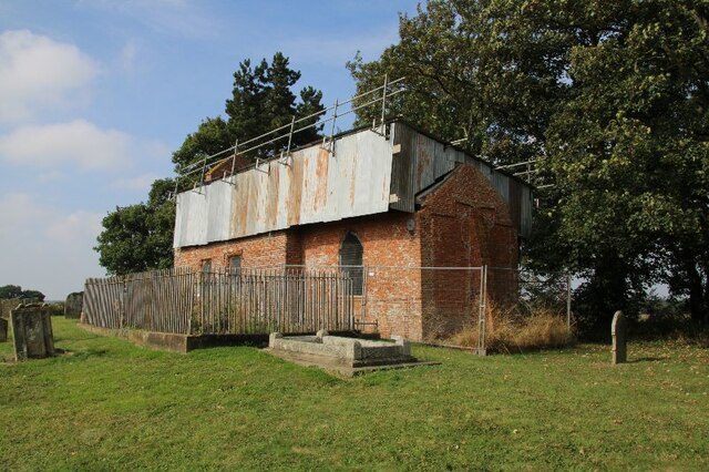
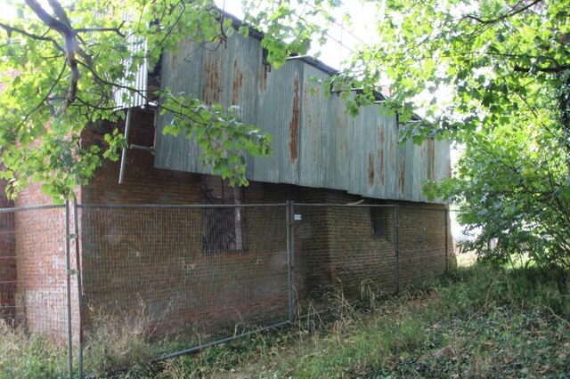
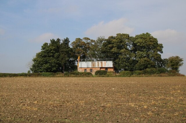
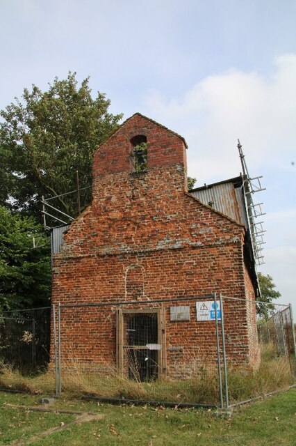
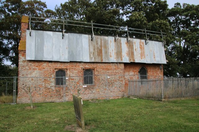
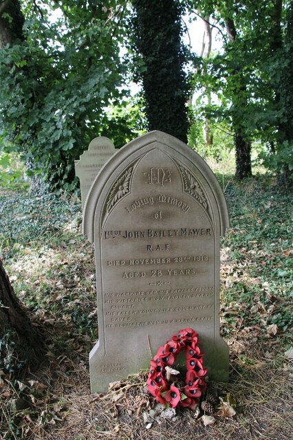
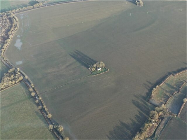
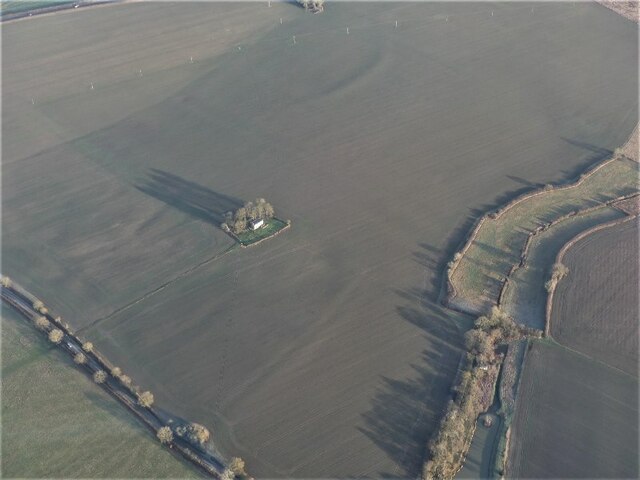
St George's Church, Goltho

St George's Church is a redundant Anglican church in the deserted village of Goltho, Lincolnshire, England. It is recorded in the National Heritage List...

Goltho

Goltho is a hamlet in the West Lindsey district of Lincolnshire, England. The population (including Bullington) was 157 at the 2011 census. It is situated...

Rand, Lincolnshire

Rand is a small village and civil parish in the West Lindsey district of Lincolnshire, England. It is situated approximately 9 miles (14 km) north-east...

Bullington Priory

Bullington Priory was a priory in Bullington, Lincolnshire, England. The priory was a house of the Gilbertine Order and dedicated to Saint Mary. It was...

Fulnetby

Fulnetby is a hamlet and civil parish in the West Lindsey district of Lincolnshire, England. It is situated approximately 8 miles (13 km) north-east from...

Wragby

Wragby ( RAG-bee) is a town and civil parish in the East Lindsey district of Lincolnshire, England. It is situated at the junction of the A157 and A158...

Bullington, Lincolnshire

Bullington is a village and civil parish in the West Lindsey district of Lincolnshire, England. It is situated approximately 8 miles (13 km) north-east...

Apley

Apley is a hamlet and civil parish in the West Lindsey district of Lincolnshire, England. It is situated 1 mile (1.6 km) west from the hamlet of Kingthorpe...

Nearby Amenities

Located within 500m of 53.284553,-0.33601922
Bus Stop
Rand Lane End
Naptan AtcoCode: 270000008298
Naptan Bearing: E
Naptan CommonName: Rand Lane End
Naptan Indicator: adj
Naptan Landmark: Rand Lane End
Naptan NaptanCode: lingpmap
Naptan Street: A158
Naptan Verified: no
Source: naptan_import
Lat/Long: 53.2872304/-0.3399084
Bus Stop
Lincoln Road
Naptan AtcoCode: 2700LKLE5326
Naptan Bearing: SE
Naptan CommonName: Lincoln Road
Naptan Landmark: Lincoln Road
Naptan NaptanCode: lindtgmw
Naptan Street: Goltho Lane
Naptan Verified: no
Source: naptan_import
Lat/Long: 53.2879142/-0.3337657
Bus Stop
Rand Lane End
Naptan AtcoCode: 2700LRLE6218
Naptan Bearing: W
Naptan CommonName: Rand Lane End
Naptan Indicator: opp
Naptan Landmark: Rand Lane End
Naptan NaptanCode: lingatdg
Naptan Street: A158
Naptan Verified: no
Source: naptan_import
Lat/Long: 53.2868672/-0.3412026
Passing Place
Source: Bing
Lat/Long: 53.2874369/-0.3409981
Power: pole
Lat/Long: 53.2846881/-0.3405237
Power: pole
Lat/Long: 53.2847921/-0.3419129
Power: pole
Lat/Long: 53.2848825/-0.343358
Power: pole
Lat/Long: 53.2848864/-0.3392888
Power: pole
Lat/Long: 53.285122/-0.3378799
Power: pole
Lat/Long: 53.2853537/-0.3365661
Power: pole
Lat/Long: 53.2854813/-0.3354232
Power: pole
Lat/Long: 53.2856639/-0.3340898
Power: pole
Lat/Long: 53.2858622/-0.332809
Power: pole
Lat/Long: 53.2860549/-0.331547
Power: pole
Lat/Long: 53.2862533/-0.3303056
Barrier: kissing_gate
Lat/Long: 53.2880789/-0.3342187
Goltho Woods Woodhenge
Artist Name: Mick Burns
Artwork Type: sculpture
Tourism: artwork
Lat/Long: 53.2806913/-0.3337436
Fixme: What is this?
Lat/Long: 53.284093/-0.3382793
Fixme: What is this?
Lat/Long: 53.2844795/-0.3386793
Fixme: What is this?
Lat/Long: 53.2845713/-0.3377431
Goltho
End Date: C15
Historic: deserted_medieval_village
Lat/Long: 53.2830334/-0.3297507
The data included in this document is from www.openstreetmap.org. The data is made available under ODbL.

Have you been to Goltho Woods?

Leave your review of Goltho Woods below (or comments, questions and feedback).