Wylam

Settlement in Northumberland

England

Wylam

Gateway, Hagg Farm
Gateway, Hagg Farm Credit: Andrew Curtis

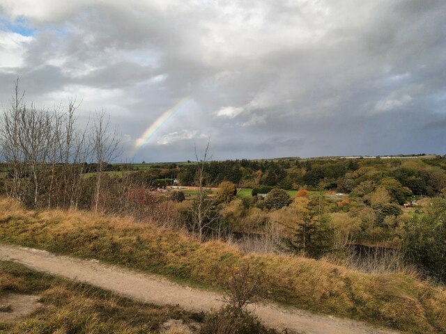
Wylam is a small village located in the county of Northumberland, England. Situated about 10 miles west of Newcastle upon Tyne, it lies on the southern bank of the River Tyne. The village is known for its picturesque setting, nestled amidst rolling hills and lush countryside.

Originally an industrial village, Wylam played a significant role in the development of the railway industry during the 19th century. It was the birthplace of George Stephenson, the renowned engineer who pioneered the world's first successful steam locomotive, the "Blucher." The village proudly showcases its railway heritage, with the George Stephenson Trail allowing visitors to explore various historical sites and landmarks associated with the industry.

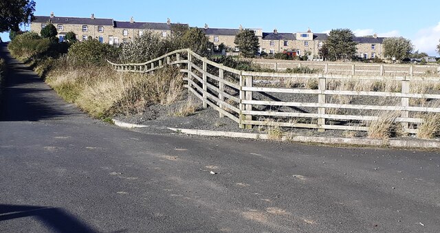
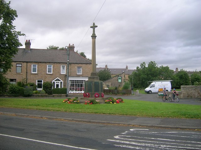
Wylam features a charming village center, with well-preserved buildings dating back to the 18th and 19th centuries. The village is home to a range of amenities, including traditional pubs, quaint shops, and a village hall serving as a hub for community events.

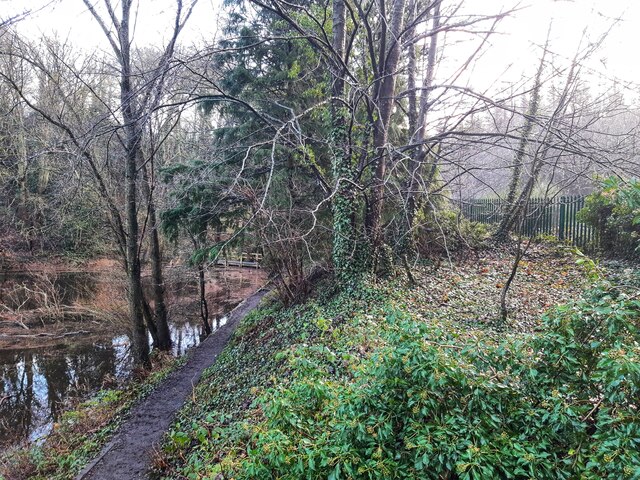
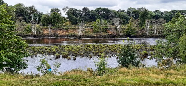
For nature enthusiasts, Wylam offers ample opportunities to enjoy the great outdoors. The village is surrounded by scenic countryside, offering beautiful walking trails and cycling routes. The nearby Wylam Riverside Park provides a serene setting for picnics and leisurely strolls along the riverbank.

With its rich history, natural beauty, and friendly community, Wylam attracts both visitors and residents seeking a peaceful retreat away from the hustle and bustle of city life.

If you have any feedback on the listing, please let us know in the comments section below.
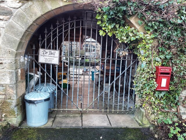
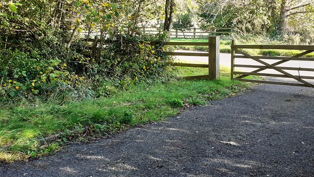
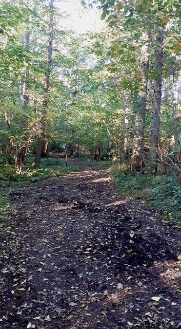
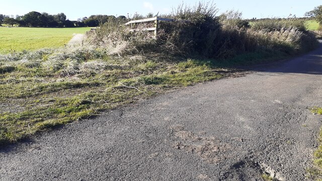
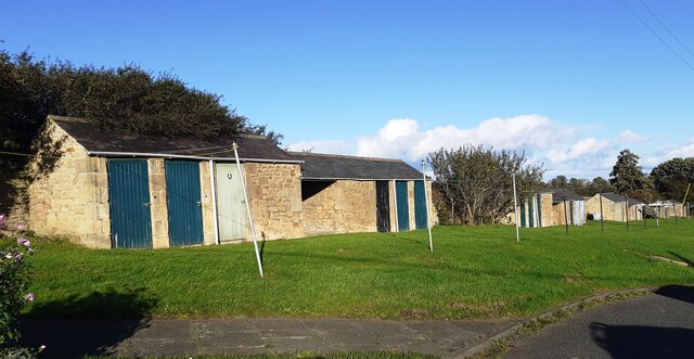
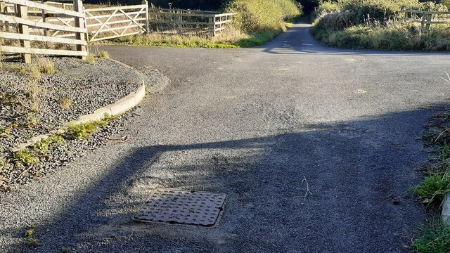
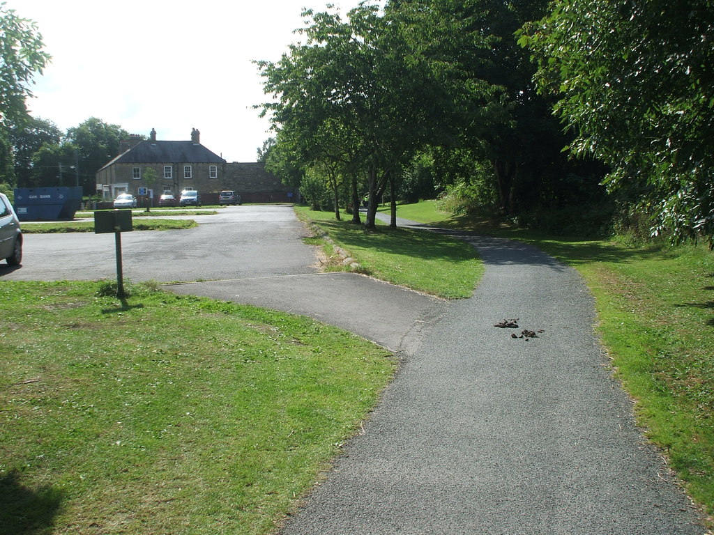
Wylam Images

Images are sourced within 2km of 54.976165/-1.8193212 or Grid Reference NZ1164. Thanks to Geograph Open Source API. All images are credited.

Gateway, Hagg Farm
Gateway, Hagg Farm
East Lodge, Hagg Farm
Close to railway, Tyne Riverside Park The second edition Ordnance Survey map (published 1897) shows the route of an old waggonway <a href="https://www.geograph.org.uk/photo/7648850">NZ1064 : Old wagonway, Ovingham Riverside</a> which joined the Newcastle & Carlisle Railway just west of a junction at Hagg Bank. The modern line is protected by the green-painted metal fence on the right of the photograph. The old waggonway served a colliery near the River Tyne close to Hagg Farm but neither the colliery or waggonway are shown on the first edition 6" map (published 1864) and both appear to have gone out of use by 1897. A branch railway along the same route was installed later to serve an aerial ropeway across the river used to transport materials for the construction activities of the Newcastle & Gateshead Water Company.
Close to railway, Tyne Riverside Park
The second edition Ordnance Survey map (published 1897) shows the route of an old waggonway NZ1064 : Old wagonway, Ovingham Riverside which joined the Newcastle & Carlisle Railway just west of a junction at Hagg Bank. The modern line is protected by the green-painted metal fence on the right of the photograph. The old waggonway served a colliery near the River Tyne close to Hagg Farm but neither the colliery or waggonway are shown on the first edition 6" map (published 1864) and both appear to have gone out of use by 1897. A branch railway along the same route was installed later to serve an aerial ropeway across the river used to transport materials for the construction activities of the Newcastle & Gateshead Water Company.
Hagg Farm
Hagg Farm
View over River Tyne from the Spetchells A rainbow in the dark, sunlit sky shows of rain on its way.
View over River Tyne from the Spetchells
A rainbow in the dark, sunlit sky shows of rain on its way.
Yellow-wort (Blackstonia perfoliata), The Spetchells Yellow-wort is a yellow-flowered member of the Gentian family. It grows from ten to fifty centimetres tall with stiff, branching stems. The leaves are glaucous, opposite and entire, the upper ones perfoliate, being united at the base. It bears terminal cymes of bright yellow, stalked flowers, 1–1.5 cm across. The calyx is deeply divided into 6–10 linear lobes or sepals, spirally arranged, free or nearly free from each other at the base and shorter than the corolla. The petals number six to ten and form a short tube. There are six to ten adherent stamens and a two-lobed stigma. It flowers from June to October in Britain where it is widespread but not common.
<span class="nowrap"><a title="https://en.wikipedia.org/wiki/Blackstonia_perfoliata" rel="nofollow ugc noopener" href="https://en.wikipedia.org/wiki/Blackstonia_perfoliata">Link</a><img style="margin-left:2px;" alt="External link" title="External link - shift click to open in new window" src="https://s1.geograph.org.uk/img/external.png" width="10" height="10"/></span>

Its main habitats are lowland calcareous grasslands and fixed sand dunes, but it can be an abundant colonist of disturbed ground, including quarries and railway cuttings, and on road verges and pathsides.

There has been little change in the overall distribution of this species since the 1962 Atlas, although it has spread into Northumberland since then.
<span class="nowrap"><a title="https://www.brc.ac.uk/plantatlas/plant/blackstonia-perfoliata" rel="nofollow ugc noopener" href="https://www.brc.ac.uk/plantatlas/plant/blackstonia-perfoliata">Link</a><img style="margin-left:2px;" alt="External link" title="External link - shift click to open in new window" src="https://s1.geograph.org.uk/img/external.png" width="10" height="10"/></span>
Yellow-wort (Blackstonia perfoliata), The Spetchells
Yellow-wort is a yellow-flowered member of the Gentian family. It grows from ten to fifty centimetres tall with stiff, branching stems. The leaves are glaucous, opposite and entire, the upper ones perfoliate, being united at the base. It bears terminal cymes of bright yellow, stalked flowers, 1–1.5 cm across. The calyx is deeply divided into 6–10 linear lobes or sepals, spirally arranged, free or nearly free from each other at the base and shorter than the corolla. The petals number six to ten and form a short tube. There are six to ten adherent stamens and a two-lobed stigma. It flowers from June to October in Britain where it is widespread but not common. LinkExternal link Its main habitats are lowland calcareous grasslands and fixed sand dunes, but it can be an abundant colonist of disturbed ground, including quarries and railway cuttings, and on road verges and pathsides. There has been little change in the overall distribution of this species since the 1962 Atlas, although it has spread into Northumberland since then. LinkExternal link
Terrace path below The Spetchells More naturalised Columbines growing on the chalk showing large variation in flower shape and colour.
Terrace path below The Spetchells
More naturalised Columbines growing on the chalk showing large variation in flower shape and colour.
Mining bee burrows on the Spetchells Apparently  several varieties of mining bees make their homes on the only chalk hills in Northumberland.

For an explanation of the Spetchells, see Andrew Curtis' entry

<a href="https://www.geograph.org.uk/photo/2039327">NZ1064 : The Spetchells, east end</a>
Mining bee burrows on the Spetchells
Apparently several varieties of mining bees make their homes on the only chalk hills in Northumberland. For an explanation of the Spetchells, see Andrew Curtis' entry NZ1064 : The Spetchells, east end
Road/bridleway between South Lodge and North Lodge
Horsley Wood Cottages viewed from Mill Way
Gateway from sewage pumping station onto Ovingham to Wylam road Ordnance Survey documents indicate that a rivet benchmark levelled at 13.426m above Newlyn Datum was verified in 1961 on a culvert at the junction of the stream on the left hand side of the track and the fence
Gateway from sewage pumping station onto Ovingham to Wylam road
Ordnance Survey documents indicate that a rivet benchmark levelled at 13.426m above Newlyn Datum was verified in 1961 on a culvert at the junction of the stream on the left hand side of the track and the fence
Footpath through woodland towards Horsley
Enclosure of sewage pumping station on west side of Mill Way Ordnance Survey documents indicate that a rivet benchmark levelled at 49.509m above Newlyn Datum was verified in 1961 on a manhole on the left hand side of the road at this location
Enclosure of sewage pumping station on west side of Mill Way
Ordnance Survey documents indicate that a rivet benchmark levelled at 49.509m above Newlyn Datum was verified in 1961 on a manhole on the left hand side of the road at this location
Outhouses at Horsley Wood Cottages
Mill Way passing entrance to sewage pumping station There is a manhole cover in the middle of the road in the foreground
Mill Way passing entrance to sewage pumping station
There is a manhole cover in the middle of the road in the foreground
Horsley Wood Cottages Ordnance Survey documents indicate that a benchmark levelled at 71.512m above Newlyn Datum was verified in 1961 on the right hand corner of the nearest house
Horsley Wood Cottages
Ordnance Survey documents indicate that a benchmark levelled at 71.512m above Newlyn Datum was verified in 1961 on the right hand corner of the nearest house
Erosion of south bank of River Tyne By 3rd February 2021, 5 months after this photo was taken, there was a further landslip in this location leading to closure of the footpath and cycle route <a href="https://www.geograph.org.uk/photo/6995543">NZ1264 : Landslip on south bank of River Tyne</a>

"A section of the Keelman's Way, the popular walking and cycling route linking Wylam with Gateshead Quays, has had to be closed due to the imminent risk of the river bank collapsing.

The Keelman's Way, which follows the south bank of the River Tyne all the way from Wylam to Gateshead Quays, has had to be closed after large cracks and collapses of the river bank have affected the stability of the path.

The decision to close the footpath was taken in the interests of public safety and will mean that there will be no direct pedestrian or cycle access between Wylam railway station and Ryton for the foreseeable future.

Closure signs are now being erected and a diversion route is being devised, though this is likely to be lengthy.

Network Rail, whose main Newcastle-Carlisle rail line runs close to the footpath, has also been alerted.

Gateshead Council has been monitoring the erosion of the river bank east of Wylam railway station for some years since changes were observed in the flow of the River Tyne which were leading to increased erosion of the south bank of the river. The land on which the erosion is taking place - and on which the Keelman's Way runs -  is privately-owned.

Options for the long term future of the riverside path will now need to be examined."

<span class="nowrap"><a title="https://www.gateshead.gov.uk/article/17433/Keelman-Way-closed-at-Wylam-due-to-landslip" rel="nofollow ugc noopener" href="https://www.gateshead.gov.uk/article/17433/Keelman-Way-closed-at-Wylam-due-to-landslip">Link</a><img style="margin-left:2px;" alt="External link" title="External link - shift click to open in new window" src="https://s1.geograph.org.uk/img/external.png" width="10" height="10"/></span>
Erosion of south bank of River Tyne
By 3rd February 2021, 5 months after this photo was taken, there was a further landslip in this location leading to closure of the footpath and cycle route NZ1264 : Landslip on south bank of River Tyne "A section of the Keelman's Way, the popular walking and cycling route linking Wylam with Gateshead Quays, has had to be closed due to the imminent risk of the river bank collapsing. The Keelman's Way, which follows the south bank of the River Tyne all the way from Wylam to Gateshead Quays, has had to be closed after large cracks and collapses of the river bank have affected the stability of the path. The decision to close the footpath was taken in the interests of public safety and will mean that there will be no direct pedestrian or cycle access between Wylam railway station and Ryton for the foreseeable future. Closure signs are now being erected and a diversion route is being devised, though this is likely to be lengthy. Network Rail, whose main Newcastle-Carlisle rail line runs close to the footpath, has also been alerted. Gateshead Council has been monitoring the erosion of the river bank east of Wylam railway station for some years since changes were observed in the flow of the River Tyne which were leading to increased erosion of the south bank of the river. The land on which the erosion is taking place - and on which the Keelman's Way runs -  is privately-owned. Options for the long term future of the riverside path will now need to be examined." LinkExternal link
Winter walk at Broomy Hill Monochrome in a monochrome world.
Winter walk at Broomy Hill
Monochrome in a monochrome world.
Show me another place!

Wylam is located at Grid Ref: NZ1164 (Lat: 54.976165, Lng: -1.8193212)

Unitary Authority: Northumberland

Police Authority: Northumbria

What 3 Words

///insert.fondest.quoted. Near Wylam, Northumberland

Related Wikis

North Wylam railway station

North Wylam railway station served the village of Wylam, Northumberland, England from 1876 to 1968 on the Tyne Valley Line. == History == The station opened...

Wylam

Wylam is a village and civil parish in the county of Northumberland. It is located about 10 miles (16 km) west of Newcastle upon Tyne. It is famous for...

Wylam Bridge

Wylam Bridge is a road bridge in Northumberland, England linking the residential area of North Wylam and neighbouring villages of Heddon-on-the-Wall, and...

Wylam railway station

Wylam is a railway station on the Tyne Valley Line, which runs between Newcastle and Carlisle via Hexham. The station, situated 9 miles 71 chains (9.89...

Nearby Amenities

Located within 500m of 54.976165,-1.8193212
Source: PGS
Lat/Long: 54.9727945/-1.824458
Source: PGS
Lat/Long: 54.9730341/-1.822935
Source: PGS
Lat/Long: 54.9732989/-1.8222638
Source: PGS
Lat/Long: 54.9738694/-1.8211062
Source: PGS
Lat/Long: 54.9740958/-1.8204705
Source: PGS
Lat/Long: 54.9742448/-1.8199785
Source: PGS
Lat/Long: 54.9746608/-1.8187904
Source: PGS
Lat/Long: 54.9748712/-1.8180214
Source: PGS
Lat/Long: 54.9749987/-1.8176504
Source: PGS
Lat/Long: 54.9751669/-1.8172446
Source: PGS
Lat/Long: 54.975344/-1.8166809
Source: PGS
Lat/Long: 54.9758119/-1.8154254
Source: PGS
Lat/Long: 54.9760365/-1.8148494
Source: PGS
Lat/Long: 54.9760463/-1.8145736
Source: PGS
Lat/Long: 54.9762581/-1.813988
Source: PGS
Lat/Long: 54.9758496/-1.8133973
Source: PGS
Lat/Long: 54.9755385/-1.8145857
Source: PGS
Lat/Long: 54.9752315/-1.8144743
Source: PGS
Lat/Long: 54.9749456/-1.8157472
Source: PGS
Lat/Long: 54.974828/-1.8161081
Source: PGS
Lat/Long: 54.9745975/-1.8167358
Source: PGS
Lat/Long: 54.9744029/-1.817358
Source: PGS
Lat/Long: 54.9742665/-1.8178125
Source: PGS
Lat/Long: 54.9740067/-1.8185591
Source: PGS
Lat/Long: 54.9737465/-1.8195701
Source: PGS
Lat/Long: 54.9735517/-1.8200389
Source: PGS
Lat/Long: 54.9731794/-1.820711
Source: PGS
Lat/Long: 54.9729093/-1.821386
Source: PGS
Lat/Long: 54.9762862/-1.8118555
Source: PGS
Lat/Long: 54.9760744/-1.8126475
Source: PGS
Lat/Long: 54.976474/-1.8130513
Wylam
Public Transport: stop_position
Railway: stop
Train: yes
Lat/Long: 54.9746146/-1.8154084
Wylam
Is In Country: United Kingdom
Is In Country Code: GB
Is In County: Northumberland
Place: village
Source: npe
Lat/Long: 54.9769729/-1.8222825
Crossing Barrier: double_half
Railway: level_crossing
Lat/Long: 54.9748794/-1.8144323
Pub
The Ship Inn
Addr City: Wylam
Addr County: Northumberland
Addr Postcode: NE41 8AQ
Addr Street: Main Road
Fhrs Id: 287466
Wikidata: Q79683751
Lat/Long: 54.9761074/-1.8236299
Barrier: cycle_barrier
Lat/Long: 54.9753261/-1.812929
Bicycle Parking
Bicycle Parking: lockers
Capacity: 2
Source: survey
Lat/Long: 54.9751125/-1.8141375
Great War Memorial
Historic: memorial
Memorial: war_memorial
Lat/Long: 54.9761221/-1.8164443
Post Box
Fixme: has this been moved now the post office has gone?
Ref: NE41 536
Source: local_knowledge
Lat/Long: 54.9762636/-1.8228702
Public Bookcase
Booth: KX100
Covered: booth
Disused Amenity: telephone
Man Made: telephone_box
Public Bookcase Type: phone_box
Lat/Long: 54.9763075/-1.8227716
J.A. Stobo & Son Flowers
Addr City: Wylam
Addr Street: Main Road
Shop: florist
Lat/Long: 54.9763418/-1.8225253
Pharmacy
Wylam Pharmacy
Addr City: Wylam
Addr County: Northumberland
Addr Postcode: NE41 8AB
Addr Street: Main Road
Fhrs Id: 286953
Healthcare: pharmacy
Lat/Long: 54.9763737/-1.8223948
J.A. Stobo & Son
Addr City: Wylam
Addr County: Northumberland
Addr Housenumber: 1-2
Addr Postcode: NE41 8AB
Addr Street: Cherry Tree Lane
Fhrs Id: 287390
Shop: greengrocer
Source: local_knowledge
Source Addr: FHRS Open Data
Lat/Long: 54.9764207/-1.8229258
Spar
Addr City: Wylam
Addr Country: GB
Addr County: Northumberland
Addr Housenumber: 2
Addr Postcode: NE41 8AG
Addr Street: South View
Brand: Spar
Brand Wikidata: Q610492
Brand Wikipedia: en:SPAR (retailer)
Check Date: 2019-09-05
Check Date Opening Hours: 2019-09-05
Fhrs Id: 286959
Opening Hours: Mo-Su 06:00-21:00
Shop: convenience
Lat/Long: 54.9763708/-1.8230572
Wylam Cricket Club
Club: sport
Leisure: pitch
Sport: cricket
Lat/Long: 54.9748994/-1.820202
Post Box
Collection Times: Mo-Fr 09:00; Sa 07:00
Operator: Royal Mail
Operator Wikidata: Q638098
Post Box Type: lamp
Ref: NE41 95
Royal Cypher: EIIR
Royal Cypher Wikidata: Q33102113
Lat/Long: 54.9745622/-1.8141657
Source: OS_OpenData_StreetView
Lat/Long: 54.9794506/-1.8183288
Barrier: bollard
Lat/Long: 54.9798137/-1.8189211
Recycling
Recycling Glass: yes
Recycling Glass Bottles: yes
Recycling Type: container
Lat/Long: 54.9764846/-1.8156825
Post Office
Wylam Post Office
Addr City: Wylam
Addr Country: GB
Addr County: Northumberland
Addr Postcode: NE41 8AG
Addr Street: South View
Brand: Post Office
Brand Wikidata: Q1783168
Check Date: 2020-02-20
Check Date Opening Hours: 2020-02-20
Opening Hours: Mo-Su 06:00-21:00
Operator: Spar
Operator Wikidata: Q610492
Ref Pol Id: 135804
Website: https://www.postoffice.co.uk/branch-finder/5433290/wylam
Lat/Long: 54.9763947/-1.8230618
Railway Museum
Addr City: Wylam
Addr Housename: The Falcon Centre
Addr Postcode: NE41 8EE
Addr Street: Falcon Terrace
Museum: railway
Tourism: museum
Website: https://wylamparishcouncil.org.uk/local-information/wylam-railway-museum
Lat/Long: 54.976899/-1.8177948
Library
Wylam Library
Addr City: Wylam
Addr Street: Falcon Terrace
Wikidata: Q54810919
Lat/Long: 54.9768572/-1.8180136
Fast Food
Wylam's Garden
Addr City: Wylam
Addr County: Northumberland
Addr Housenumber: 41
Addr Postcode: NE41 8EL
Addr Street: Jackson Road
Cuisine: chinese
Delivery: yes
Drive Through: no
Fhrs Id: 286909
Note: Formerly "Wylam Diner"
Phone: +44 1661 852672
Source: local_knowledge
Takeaway: only
Lat/Long: 54.9780374/-1.8201036
Doctors
White Medical Group
Addr City: Wylam
Addr Street: Dene Road
Healthcare: doctor
Source: local_knowledge
Website: http://www.whitemedicalgroup.gpsurgery.net/
Lat/Long: 54.9780821/-1.8201428
Barrier: bollard
Lat/Long: 54.9790437/-1.8203076
Bus Stop
Bench: no
Covered: no
Naptan AtcoCode: 3100Z114646
Naptan NaptanCode: nldadjga
Shelter: no
Source: survey;Bing
Lat/Long: 54.9765585/-1.822268
Bus Stop
Naptan AtcoCode: 3100Z117646
Naptan NaptanCode: nldgjgja
Source: survey;Bing
Lat/Long: 54.9759536/-1.8169934
Bus Stop
Bench: no
Bin: yes
Bus: yes
Public Transport: platform
Source: survey;Bing
Lat/Long: 54.9775953/-1.824745
Bus Stop
Wylam, Charlie's Corner
Bench: no
Bus: yes
Covered: no
Departures Board: timetable
Public Transport: platform
Shelter: no
Source: survey;Bing
Lat/Long: 54.975618/-1.8245693
Bus Stop
Holeyn Hall Road
Source: survey;Bing
Lat/Long: 54.9787517/-1.8247611
Bus Stop
Wylam, Charlie's Corner
Bench: yes
Bin: yes
Bus: yes
Covered: yes
Departures Board: timetable
Public Transport: platform
Shelter: yes
Source: survey;Bing
Lat/Long: 54.9758873/-1.8244573
Bus Stop
Bus: yes
Public Transport: platform
Source: survey;Bing
Lat/Long: 54.9740231/-1.8139772
Bus Stop
Source: survey;Bing
Lat/Long: 54.9760328/-1.8170108
Bus Stop
Bus: yes
Public Transport: platform
Source: survey;Bing
Lat/Long: 54.974164/-1.8141529
Bus Stop
Bench: no
Covered: no
Shelter: no
Source: survey;Bing
Lat/Long: 54.9764408/-1.8224061
Entrance: main
Source: survey
Lat/Long: 54.9763272/-1.8242926
Board Type: nature
Description: Wylam Haughs information board
Information: board
Source: survey
Tourism: information
Lat/Long: 54.9739667/-1.8239077
Cafe
The Coffee Tree
Addr City: Wylam
Addr County: Northumberland
Addr Postcode: NE41 8AQ
Addr Street: Main Road
Cuisine: coffee_shop
Fhrs Id: 466159
Note: "The Coffee Tree" replaced "Elliot's Kitchen" in June 2017, which previously replaced "Frenchs' Food and Gifts" in December 2016
Opening Hours: 09:30-15:30
Outdoor Seating: yes
Source: local_knowledge
Website: https://www.facebook.com/thecoffeetreewylam/
Lat/Long: 54.9760773/-1.8237826
Jools
Addr City: Wylam
Addr Street: Main Road
Phone: +44 1661 852950
Shop: hairdresser
Lat/Long: 54.9758001/-1.8175952
Crossing Barrier: double_half
Railway: level_crossing
Lat/Long: 54.974848/-1.8144033
Wylam
Public Transport: stop_position
Railway: stop
Source: OS 1:25k
Train: yes
Lat/Long: 54.9750035/-1.813822
Wylam
Naptan AtcoCode: 9100WYLAM
Network: National Rail
Network Website: https://www.nationalrail.co.uk/stations/wym/
Network Wikidata: Q26334
Operator: Northern Rail
Operator Website: https://www.northernrailway.co.uk/stations/wylam
Operator Wikidata: Q85789775
Public Transport: station
Railway: station
Ref Crs: WYM
Source: survey
Train: yes
Wikidata: Q2536803
Wikipedia: en:Wylam railway station
Lat/Long: 54.9748735/-1.8143684
Stephensons Arms
Tourism: camp_site
Lat/Long: 54.9772486/-1.8137978
Post Box
Ref: NE41 156
Lat/Long: 54.9768444/-1.8151053
Doctors
Riversdale Surgery
Addr City: Wylam
Addr Housenumber: 51
Addr Postcode: NE41 8DH
Addr Street: Woodcroft Road
Healthcare: doctor
Phone: +44 1661 852208
Website: http://riversdalesurgery.co.uk
Lat/Long: 54.9749091/-1.8238225
Post Box
Ref: NE41 116
Lat/Long: 54.9775403/-1.8170185
Post Box
Ref: NE41 703
Lat/Long: 54.9789073/-1.8208012
North Wylam
Historic Railway: station
Railway: site
Wikidata: Q30595479
Wikipedia: en:North Wylam railway station
Lat/Long: 54.9765049/-1.8171776
Note: Small convenience store. Currently vacant awaiting rental or sale. Previously "Steve's Emporium" and was the Wylam Post Ofice before that.
Shop: vacant
Lat/Long: 54.9762334/-1.8228675
Barrier: cycle_barrier
Bicycle: yes
Lat/Long: 54.9769369/-1.814046
Barrier: cycle_barrier
Lat/Long: 54.9769288/-1.8140941
Entrance: yes
Lat/Long: 54.975728/-1.8182763
Atm
Source: survey
Lat/Long: 54.9757039/-1.8183379
Information: guidepost
Source: survey
Tourism: information
Lat/Long: 54.9757445/-1.8217447
Addr City: Wylam
Addr Housenumber: 31
Addr Street: Woodcroft Road
Lat/Long: 54.9754013/-1.8220156
Addr City: Wylam
Addr Housenumber: 23
Addr Street: Woodcroft Road
Lat/Long: 54.9757476/-1.8212189
Addr City: Wylam
Addr Housenumber: 21
Addr Street: Woodcroft Road
Lat/Long: 54.9757954/-1.8210261
Addr City: Wylam
Addr Housenumber: 33
Addr Street: Woodcroft Road
Lat/Long: 54.9753644/-1.8221577
Addr City: Wylam
Addr Housenumber: 27
Addr Street: Woodcroft Road
Lat/Long: 54.9756522/-1.8215354
Addr City: Wylam
Addr Housenumber: 47
Addr Postcode: NE41 8DH
Addr Street: Woodcroft Road
Lat/Long: 54.975001/-1.8233406
Addr City: Wylam
Addr Housenumber: 49
Addr Postcode: NE41 8DH
Addr Street: Woodcroft Road
Lat/Long: 54.9749672/-1.8234532
Addr City: Wylam
Addr Housenumber: 45
Addr Postcode: NE41 8DH
Addr Street: Woodcroft Road
Lat/Long: 54.975078/-1.8230589
Addr City: Wylam
Addr Housenumber: 15
Addr Street: Woodcroft Road
Lat/Long: 54.9760417/-1.8205457
Addr City: Wylam
Addr Housenumber: 5
Addr Street: Woodcroft Road
Lat/Long: 54.976034/-1.8199639
Addr City: Wylam
Addr Housenumber: 17
Addr Street: Woodcroft Road
Lat/Long: 54.9759724/-1.8206664
Addr City: Wylam
Addr Housenumber: 19
Addr Street: Woodcroft Road
Lat/Long: 54.9759416/-1.8207737
Addr City: Wylam
Addr Housenumber: 9
Addr Street: Woodcroft Road
Lat/Long: 54.9759062/-1.8202104
Addr City: Wylam
Addr Housenumber: 7
Addr Street: Woodcroft Road
Lat/Long: 54.9759786/-1.8199798
Addr City: Wylam
Addr Housenumber: 11
Addr Street: Woodcroft Road
Lat/Long: 54.9759201/-1.8203043
Bench
Lat/Long: 54.9734924/-1.8222918
Addr City: Wylam
Addr Housenumber: 11a
Addr Street: Woodcroft Road
Lat/Long: 54.9760894/-1.8203848
Addr City: Wylam
Addr Housenumber: 25
Addr Street: Woodcroft Road
Lat/Long: 54.9756954/-1.8213799
Addr City: Wylam
Addr Housenumber: 43
Addr Postcode: NE41 8DH
Addr Street: Woodcroft Road
Lat/Long: 54.9751211/-1.8229409
Addr City: Wylam
Addr Housenumber: 46
Addr Street: Woodcroft Road
Lat/Long: 54.9751657/-1.8242553
Addr City: Wylam
Addr Housenumber: 44
Addr Street: Woodcroft Road
Lat/Long: 54.9751919/-1.8241695
Addr City: Wylam
Addr Housenumber: 37
Addr Street: Woodcroft Road
Lat/Long: 54.9752658/-1.8224581
Addr City: Wylam
Addr Housenumber: 35
Addr Street: Woodcroft Road
Lat/Long: 54.9752997/-1.8223347
Addr City: Wylam
Addr Housenumber: 39
Addr Street: Woodcroft Road
Lat/Long: 54.9752104/-1.8226325
Addr City: Wylam
Addr Housenumber: 41
Addr Street: Woodcroft Road
Lat/Long: 54.975175/-1.8227612
Waste Basket
Lat/Long: 54.9749487/-1.8241507
Addr City: Wylam
Addr Housenumber: 30
Addr Postcode: NE41 8DH
Addr Street: Woodcroft Road
Lat/Long: 54.9754872/-1.8232578
Addr City: Wylam
Addr Housenumber: 22
Addr Postcode: NE41 8DH
Addr Street: Woodcroft Road
Lat/Long: 54.9756595/-1.822716
Addr City: Wylam
Addr Housenumber: 28
Addr Postcode: NE41 8DH
Addr Street: Woodcroft Road
Lat/Long: 54.9755226/-1.8231505
Addr City: Wylam
Addr Postcode: NE41 8DH
Lat/Long: 54.9751515/-1.8239525
Addr City: Wylam
Addr Housenumber: 40
Addr Postcode: NE41 8DH
Addr Street: Woodcroft Road
Lat/Long: 54.9752778/-1.8238801
Addr City: Wylam
Addr Housenumber: 36
Addr Postcode: NE41 8DH
Addr Street: Woodcroft Road
Lat/Long: 54.975361/-1.8236253
Addr City: Wylam
Addr Housenumber: 34
Addr Postcode: NE41 8DH
Addr Street: Woodcroft Road
Lat/Long: 54.9754086/-1.8234805
Addr City: Wylam
Addr Housenumber: 38
Addr Postcode: NE41 8DH
Addr Street: Woodcroft Road
Lat/Long: 54.9753256/-1.8237353
Addr City: Wylam
Addr Housenumber: 32
Addr Postcode: NE41 8DH
Addr Street: Woodcroft Road
Lat/Long: 54.9754333/-1.8234
Addr City: Wylam
Addr Housenumber: 42
Addr Postcode: NE41 8DH
Addr Street: Woodcroft Road
Lat/Long: 54.9752316/-1.8240142
Addr City: Wylam
Addr Housenumber: 59
Addr Postcode: NE41 8DH
Addr Street: Woodcroft Road
Lat/Long: 54.9753317/-1.8247652
Fire Hydrant
Emergency: fire_hydrant
Fire Hydrant Diameter: 150
Fire Hydrant Position: lane
Fire Hydrant Type: underground
Lat/Long: 54.9762506/-1.8243361
Street Lamp
Lat/Long: 54.9772934/-1.8258144
Fire Hydrant
Emergency: fire_hydrant
Fire Hydrant Diameter: 75
Fire Hydrant Position: lane
Fire Hydrant Type: underground
Lat/Long: 54.9774042/-1.824707
Bench
Lat/Long: 54.9774936/-1.8248841
Waste Basket
Lat/Long: 54.9775121/-1.8248197
Addr City: Wylam
Addr Housenumber: 3
Addr Postcode: NE41 8BS
Addr Street: The Orchard
Lat/Long: 54.9764752/-1.8262025
Addr City: Wylam
Addr Housenumber: 2
Addr Postcode: NE41 8BS
Addr Street: The Orchard
Lat/Long: 54.9766909/-1.8260147
Addr City: Wylam
Addr Housenumber: 2
Addr Postcode: NE41 8AR
Addr Street: Blackett Cottages
Lat/Long: 54.9763492/-1.8247572
Addr City: Wylam
Addr Housenumber: 16
Addr Postcode: NE41 8AR
Addr Street: Blackett Cottages
Lat/Long: 54.9764846/-1.8251649
Addr City: Wylam
Addr Housenumber: 4
Addr Postcode: NE41 8BS
Addr Street: The Orchard
Lat/Long: 54.9762999/-1.8264439
Addr City: Wylam
Addr Housenumber: 5
Addr Postcode: NE41 8BS
Addr Street: The Orchard
Lat/Long: 54.9763861/-1.8268516
Addr City: Wylam
Addr Housenumber: 7
Addr Postcode: NE41 8BS
Addr Street: The Orchard
Lat/Long: 54.9766877/-1.8270447
Fire Hydrant
Emergency: fire_hydrant
Fire Hydrant Position: sidewalk
Fire Hydrant Type: underground
Lat/Long: 54.9769665/-1.8262482
Street Lamp
Lat/Long: 54.9766169/-1.8265995
Addr City: Wylam
Addr Housenumber: 1
Addr Postcode: NE41 8BS
Addr Street: The Orchard
Lat/Long: 54.9769617/-1.8260845
Addr City: Wylam
Addr Housenumber: 8
Addr Postcode: NE41 8AR
Addr Street: Blackett Cottages
Lat/Long: 54.9767494/-1.8249879
Addr City: Wylam
Addr Housenumber: 17
Addr Postcode: NE41 8AR
Addr Street: Blackett Cottages
Lat/Long: 54.976423/-1.8251354
Addr City: Wylam
Addr Housenumber: 6
Addr Postcode: NE41 8AR
Addr Street: Blackett Cottages
Lat/Long: 54.97662/-1.8249154
Addr City: Wylam
Addr Housenumber: 8
Addr Postcode: NE41 8BS
Addr Street: The Orchard
Lat/Long: 54.9767894/-1.826696
Addr City: Wylam
Addr Housenumber: 11
Addr Postcode: NE41 8AR
Addr Street: Blackett Cottages
Lat/Long: 54.976854/-1.8254972
Addr City: Wylam
Addr Housenumber: 1
Addr Postcode: NE41 8AR
Addr Street: Blackett Cottages
Lat/Long: 54.9762845/-1.8247196
Addr City: Wylam
Addr Housenumber: 15
Addr Postcode: NE41 8AR
Addr Street: Blackett Cottages
Lat/Long: 54.9765477/-1.8252024
Addr City: Wylam
Addr Housenumber: 7
Addr Postcode: NE41 8AR
Addr Street: Blackett Cottages
Lat/Long: 54.9766862/-1.8249557
Addr City: Wylam
Addr Housenumber: 4
Addr Postcode: NE41 8AR
Addr Street: Blackett Cottages
Lat/Long: 54.9764846/-1.8248457
Addr City: Wylam
Addr Housenumber: 5
Addr Postcode: NE41 8AR
Addr Street: Blackett Cottages
Lat/Long: 54.9765492/-1.8248806
Addr City: Wylam
Addr Housenumber: 14
Addr Postcode: NE41 8AR
Addr Street: Blackett Cottages
Lat/Long: 54.9766371/-1.8252397
Addr City: Wylam
Addr Housenumber: 3
Addr Postcode: NE41 8AR
Addr Street: Blackett Cottages
Lat/Long: 54.9764168/-1.8248028
Addr City: Wylam
Addr Housenumber: 9
Addr Postcode: NE41 8AR
Addr Street: Blackett Cottages
Lat/Long: 54.9768201/-1.8250281
Addr City: Wylam
Addr Housenumber: 10
Addr Postcode: NE41 8AR
Addr Street: Blackett Cottages
Lat/Long: 54.9769033/-1.8256718
Addr City: Wylam
Addr Housenumber: 13
Addr Postcode: NE41 8AR
Addr Street: Blackett Cottages
Lat/Long: 54.9767355/-1.8252959
Addr City: Wylam
Addr Housenumber: 12
Addr Postcode: NE41 8AR
Addr Street: Blackett Cottages
Lat/Long: 54.9767955/-1.825347
Addr City: Wylam
Addr Housenumber: 5
Addr Postcode: NE41 8BN
Lat/Long: 54.9775492/-1.8252525
Addr City: Wylam
Addr Housenumber: 6
Addr Postcode: NE41 8BN
Lat/Long: 54.9777616/-1.8255582
Addr City: Wylam
Addr Housenumber: 3
Addr Postcode: NE41 8BN
Lat/Long: 54.9776462/-1.8249306
Addr City: Wylam
Addr Housenumber: 7
Addr Postcode: NE41 8BN
Lat/Long: 54.9778063/-1.8253973
Addr City: Wylam
Addr Housenumber: 4
Addr Postcode: NE41 8BN
Lat/Long: 54.9776/-1.8250781
Addr City: Wylam
Addr Housenumber: 2
Addr Postcode: NE41 8BN
Lat/Long: 54.9783265/-1.8254
Addr City: Wylam
Addr Housenumber: 9
Addr Postcode: NE41 8BN
Lat/Long: 54.9780925/-1.8256199
Addr City: Wylam
Addr Housenumber: 1
Addr Postcode: NE41 8BN
Lat/Long: 54.9783464/-1.8252364
Addr City: Wylam
Addr Housenumber: 10
Addr Postcode: NE41 8BN
Lat/Long: 54.978211/-1.8256575
Addr City: Wylam
Addr Housenumber: 17
Addr Postcode: NE41 8BN
Lat/Long: 54.9785974/-1.82551
Addr City: Wylam
Addr Housenumber: 8
Addr Postcode: NE41 8BN
Lat/Long: 54.9779895/-1.8255663
Addr City: Wylam
Addr Housenumber: 12
Addr Postcode: NE41 8BN
Lat/Long: 54.978505/-1.8258452
Addr City: Wylam
Addr Housenumber: 11
Addr Postcode: NE41 8BF
Addr Street: Forster Gardens
Lat/Long: 54.9790823/-1.8249977
Addr City: Wylam
Addr Housenumber: 9
Addr Postcode: NE41 8BF
Addr Street: Forster Gardens
Lat/Long: 54.9791376/-1.8250862
Addr City: Wylam
Addr Housenumber: 8
Addr Postcode: NE41 8BF
Addr Street: Forster Gardens
Lat/Long: 54.9791638/-1.8251318
Addr City: Wylam
Addr Housenumber: 10
Addr Postcode: NE41 8BF
Addr Street: Forster Gardens
Lat/Long: 54.9791115/-1.8250486
Addr City: Wylam
Addr Housenumber: 17
Addr Postcode: NE41 8ES
Addr Street: Woodvale Gardens
Lat/Long: 54.9773075/-1.8222108
Addr City: Wylam
Addr Housenumber: 18
Addr Postcode: NE41 8ES
Addr Street: Woodvale Gardens
Lat/Long: 54.9773891/-1.8221062
Addr City: Wylam
Addr Housenumber: 16
Addr Postcode: NE41 8ES
Addr Street: Woodvale Gardens
Lat/Long: 54.9772521/-1.8223128
Addr City: Wylam
Addr Housenumber: 19
Addr Postcode: NE41 8ES
Addr Street: Woodvale Gardens
Lat/Long: 54.9774614/-1.8220016
Addr City: Wylam
Addr Housenumber: 20
Addr Postcode: NE41 8ES
Addr Street: Woodvale Gardens
Lat/Long: 54.9775368/-1.8219078
Addr City: Wylam
Addr Housenumber: 12
Addr Postcode: NE41 8ES
Addr Street: Woodvale Gardens
Lat/Long: 54.976932/-1.8220901
Addr City: Wylam
Addr Housenumber: 11
Addr Postcode: NE41 8ES
Addr Street: Woodvale Gardens
Lat/Long: 54.9768703/-1.8219855
Addr City: Wylam
Addr Housenumber: 15
Addr Postcode: NE41 8ES
Addr Street: Woodvale Gardens
Lat/Long: 54.9770813/-1.8223289
Addr City: Wylam
Addr Housenumber: 13
Addr Postcode: NE41 8ES
Addr Street: Woodvale Gardens
Lat/Long: 54.9769751/-1.8221518
Addr City: Wylam
Addr Housenumber: 14
Addr Postcode: NE41 8ES
Addr Street: Woodvale Gardens
Lat/Long: 54.9770443/-1.8222725
Addr City: Wylam
Addr Housenumber: 22
Addr Postcode: NE41 8ES
Addr Street: Woodvale Gardens
Lat/Long: 54.9775876/-1.822581
Addr City: Wylam
Addr Housenumber: 27
Addr Postcode: NE41 8ES
Addr Street: Woodvale Gardens
Lat/Long: 54.9780341/-1.8226722
Addr City: Wylam
Addr Housenumber: 24
Addr Postcode: NE41 8ES
Addr Street: Woodvale Gardens
Lat/Long: 54.9777616/-1.8226185
Addr City: Wylam
Addr Housenumber: 28
Addr Postcode: NE41 8ES
Addr Street: Woodvale Gardens
Lat/Long: 54.9781203/-1.8226883
Addr City: Wylam
Addr Housenumber: 23
Addr Postcode: NE41 8ES
Addr Street: Woodvale Gardens
Lat/Long: 54.9776754/-1.8226024
Addr City: Wylam
Addr Housenumber: 26
Addr Postcode: NE41 8ES
Addr Street: Woodvale Gardens
Lat/Long: 54.9779402/-1.8226588
Addr City: Wylam
Addr Housenumber: 21
Addr Postcode: NE41 8ES
Addr Street: Woodvale Gardens
Lat/Long: 54.9775062/-1.822557
Addr City: Wylam
Addr Housenumber: 25
Addr Postcode: NE41 8ES
Addr Street: Woodvale Gardens
Lat/Long: 54.9778494/-1.8226346
Waste Basket
Lat/Long: 54.9766472/-1.8220848
Fire Hydrant
Emergency: fire_hydrant
Fire Hydrant Diameter: 75
Fire Hydrant Position: lane
Fire Hydrant Type: underground
Lat/Long: 54.9768595/-1.821669
Bench
Lat/Long: 54.978272/-1.8217079
Grit Bin
Lat/Long: 54.9777902/-1.8219519
Street Lamp
Lat/Long: 54.9779996/-1.8217642
Street Lamp
Lat/Long: 54.978332/-1.8211312
Addr City: Wylam
Addr Housenumber: 2
Addr Postcode: NE41 8EY
Addr Street: Dene Road
Source: survey
Lat/Long: 54.9782166/-1.8206537
Waste Basket
Lat/Long: 54.9778364/-1.8219519
Addr City: Wylam
Addr Housenumber: 12
Addr Postcode: NE41 8EY
Addr Street: Dene Road
Source: survey
Lat/Long: 54.9791559/-1.8212353
Addr City: Wylam
Addr Housenumber: 10
Addr Postcode: NE41 8EY
Addr Street: Dene Road
Source: survey
Lat/Long: 54.9789527/-1.8214203
Addr City: Wylam
Addr Housenumber: 7
Addr Postcode: NE41 8EY
Addr Street: Dene Road
Source: survey
Lat/Long: 54.9787172/-1.8210851
Addr City: Wylam
Addr Housenumber: 14
Addr Postcode: NE41 8EY
Addr Street: Dene Road
Source: survey
Lat/Long: 54.979296/-1.8209456
Addr City: Wylam
Addr Housenumber: 4
Addr Postcode: NE41 8EY
Addr Street: Dene Road
Source: survey
Lat/Long: 54.9784109/-1.8207927
Addr City: Wylam
Addr Housenumber: 9
Addr Postcode: NE41 8EY
Addr Street: Dene Road
Source: survey
Lat/Long: 54.9788773/-1.8212782
Addr City: Wylam
Addr Housenumber: 13
Addr Postcode: NE41 8EY
Addr Street: Dene Road
Source: survey
Lat/Long: 54.9792421/-1.8211199
Addr City: Wylam
Addr Housenumber: 11
Addr Postcode: NE41 8EY
Addr Street: Dene Road
Source: survey
Lat/Long: 54.9790867/-1.8215169
Addr City: Wylam
Addr Housenumber: 8
Addr Postcode: NE41 8EY
Addr Street: Dene Road
Source: survey
Lat/Long: 54.9787957/-1.8212084
Addr City: Wylam
Addr Housenumber: 6
Addr Postcode: NE41 8EY
Addr Street: Dene Road
Source: survey
Lat/Long: 54.9786248/-1.8209831
Addr City: Wylam
Addr Housenumber: 5
Addr Postcode: NE41 8EY
Addr Street: Dene Road
Source: survey
Lat/Long: 54.9785418/-1.8208758
Addr City: Wylam
Addr Housenumber: 3
Addr Postcode: NE41 8EY
Addr Street: Dene Road
Source: survey
Lat/Long: 54.9783017/-1.8206854
Street Lamp
Lat/Long: 54.9786019/-1.8205111
Addr City: Wylam
Addr Housenumber: 15
Addr Postcode: NE41 8EY
Addr Street: Dene Road
Source: survey
Lat/Long: 54.9795853/-1.8204172
Addr City: Wylam
Addr Housenumber: 17
Addr Postcode: NE41 8EY
Addr Street: Dene Road
Source: survey
Lat/Long: 54.9796654/-1.8202482
Addr City: Wylam
Addr Housenumber: 16
Addr Postcode: NE41 8EY
Addr Street: Dene Road
Source: survey
Lat/Long: 54.9796193/-1.8203284
Addr City: Wylam
Addr Housenumber: 18
Addr Postcode: NE41 8EY
Addr Street: Dene Road
Source: survey
Lat/Long: 54.97971/-1.8202133
Addr City: Wylam
Addr Housenumber: 112
Addr Postcode: NE41 8EY
Addr Street: Dene Road
Source: survey
Lat/Long: 54.9802195/-1.818832
Addr City: Wylam
Addr Housenumber: 31
Addr Postcode: NE41 8EY
Addr Street: Dene Road
Source: survey
Lat/Long: 54.9803381/-1.8191405
Waste Basket
Lat/Long: 54.9803903/-1.8185799
Addr City: Wylam
Addr Housenumber: 29
Addr Postcode: NE41 8EY
Addr Street: Dene Road
Source: survey
Lat/Long: 54.9801887/-1.8194731
Addr City: Wylam
Addr Housenumber: 30
Addr Postcode: NE41 8EY
Addr Street: Dene Road
Source: survey
Lat/Long: 54.9802733/-1.8193443
Addr City: Wylam
Addr Housenumber: 32
Addr Postcode: NE41 8EY
Addr Street: Dene Road
Source: survey
Lat/Long: 54.9803826/-1.81906
Addr City: Wylam
Addr Housenumber: 25
Addr Postcode: NE41 8EY
Addr Street: Dene Road
Source: survey
Lat/Long: 54.980021/-1.8197171
Addr City: Wylam
Addr Housenumber: 23
Addr Postcode: NE41 8EY
Addr Street: Dene Road
Source: survey
Lat/Long: 54.9799409/-1.8198698
Addr City: Wylam
Addr Housenumber: 22
Addr Postcode: NE41 8EY
Addr Street: Dene Road
Source: survey
Lat/Long: 54.9798732/-1.8199344
Addr City: Wylam
Addr Housenumber: 19
Addr Postcode: NE41 8EY
Addr Street: Dene Road
Source: survey
Lat/Long: 54.9797546/-1.820157
Addr City: Wylam
Addr Housenumber: 21
Addr Postcode: NE41 8EY
Addr Street: Dene Road
Source: survey
Lat/Long: 54.9798239/-1.8200068
Addr City: Wylam
Addr Housenumber: 28
Addr Postcode: NE41 8EY
Addr Street: Dene Road
Source: survey
Lat/Long: 54.9801256/-1.8195777
Addr City: Wylam
Addr Housenumber: 26
Addr Postcode: NE41 8EY
Addr Street: Dene Road
Source: survey
Lat/Long: 54.9800655/-1.8196796
Addr City: Wylam
Addr Housenumber: 24
Addr Postcode: NE41 8EY
Addr Street: Dene Road
Source: survey
Lat/Long: 54.9799578/-1.8198003
Addr City: Wylam
Addr Housenumber: 27
Addr Postcode: NE41 8EY
Addr Street: Dene Road
Source: survey
Lat/Long: 54.9800963/-1.8196152
Addr City: Wylam
Addr Housenumber: 20
Addr Postcode: NE41 8EY
Addr Street: Dene Road
Source: survey
Lat/Long: 54.9797978/-1.8200926
Addr City: Wylam
Addr Housenumber: 12
Addr Postcode: NE41 8DJ
Addr Street: Woodcroft Road
Lat/Long: 54.9761082/-1.821254
Addr City: Wylam
Addr Housenumber: 10
Addr Postcode: NE41 8DJ
Addr Street: Woodcroft Road
Lat/Long: 54.9761327/-1.8211682
Addr City: Wylam
Addr Housenumber: 2
Addr Postcode: NE41 8DJ
Addr Street: Woodcroft Road
Lat/Long: 54.9763098/-1.8205459
Addr City: Wylam
Addr Housenumber: 4
Addr Postcode: NE41 8DJ
Addr Street: Woodcroft Road
Lat/Long: 54.9762636/-1.820723
Addr City: Wylam
Addr Housenumber: 8
Addr Postcode: NE41 8DJ
Addr Street: Woodcroft Road
Lat/Long: 54.9761913/-1.82101
Addr City: Wylam
Addr Housenumber: 6
Addr Postcode: NE41 8DJ
Addr Street: Woodcroft Road
Lat/Long: 54.9762159/-1.8209241
Addr City: Wylam
Addr Housenumber: 14
Addr Postcode: NE41 8DJ
Addr Street: Woodcroft Road
Lat/Long: 54.976022/-1.8214659
Addr City: Wylam
Addr Housenumber: 16
Addr Postcode: NE41 8DJ
Addr Street: Woodcroft Road
Lat/Long: 54.9759804/-1.8215893
Defibrillator
Defibrillator Location: outside Ship Inn, Wylam
Emergency: defibrillator
Indoor: no
Not Ref GB The Circuit: BD831A51-9216-4160-A9CF-B0B600B4EA19
Lat/Long: 54.9760927/-1.8235551
Addr City: Wylam
Addr Housenumber: 115
Addr Postcode: NE41 8EY
Addr Street: Dene Road
Source: survey
Lat/Long: 54.9800471/-1.8190278
Addr City: Wylam
Addr Housenumber: 119
Addr Postcode: NE41 8EY
Addr Street: Dene Road
Source: survey
Lat/Long: 54.979847/-1.8193336
Addr City: Wylam
Addr Housenumber: 118
Addr Postcode: NE41 8EY
Addr Street: Dene Road
Source: survey
Lat/Long: 54.9798947/-1.8192263
Addr City: Wylam
Addr Housenumber: 121
Addr Postcode: NE41 8EY
Addr Street: Dene Road
Source: survey
Lat/Long: 54.9797424/-1.8194596
Addr City: Wylam
Addr Housenumber: 117
Addr Postcode: NE41 8EY
Addr Street: Dene Road
Source: survey
Lat/Long: 54.9799394/-1.8191592
Addr City: Wylam
Addr Housenumber: 122
Addr Postcode: NE41 8EY
Addr Street: Dene Road
Source: survey
Lat/Long: 54.9797038/-1.819524
Addr City: Wylam
Addr Housenumber: 120
Addr Postcode: NE41 8EY
Addr Street: Dene Road
Source: survey
Lat/Long: 54.9798085/-1.8193953
Addr City: Wylam
Addr Housenumber: 113
Addr Postcode: NE41 8EY
Addr Street: Dene Road
Source: survey
Lat/Long: 54.9801456/-1.8188749
Addr City: Wylam
Addr Housenumber: 114
Addr Postcode: NE41 8EY
Addr Street: Dene Road
Source: survey
Lat/Long: 54.9801056/-1.8189366
Addr City: Wylam
Addr Housenumber: 116
Addr Postcode: NE41 8EY
Addr Street: Dene Road
Source: survey
Lat/Long: 54.980001/-1.8190868
Waste Basket
Lat/Long: 54.9763591/-1.8229355
Barrier: bollard
Lat/Long: 54.9764628/-1.8227869
Addr City: Wylam
Addr Housenumber: 129
Addr Postcode: NE41 8EY
Addr Street: Dene Road
Source: survey
Lat/Long: 54.9792913/-1.8203072
Addr City: Wylam
Addr Housenumber: 134
Addr Postcode: NE41 8EY
Addr Street: Dene Road
Source: survey
Lat/Long: 54.9790512/-1.8207632
Addr City: Wylam
Addr Housenumber: 133
Addr Postcode: NE41 8EY
Addr Street: Dene Road
Source: survey
Lat/Long: 54.9790958/-1.8206666
Addr City: Wylam
Addr Housenumber: 132
Addr Postcode: NE41 8EY
Addr Street: Dene Road
Source: survey
Lat/Long: 54.9791297/-1.8205915
Addr City: Wylam
Addr Housenumber: 130
Addr Postcode: NE41 8EY
Addr Street: Dene Road
Source: survey
Lat/Long: 54.9792513/-1.8202482
Addr City: Wylam
Addr Housenumber: 131
Addr Postcode: NE41 8EY
Addr Street: Dene Road
Source: survey
Lat/Long: 54.9792113/-1.8201865
Addr City: Wylam
Addr Housenumber: 135
Addr Postcode: NE41 8EY
Addr Street: Dene Road
Source: survey
Lat/Long: 54.9790142/-1.8208356
Addr City: Wylam
Addr Housenumber: 127
Addr Postcode: NE41 8EY
Addr Street: Dene Road
Source: survey
Lat/Long: 54.9794791/-1.8199317
Addr City: Wylam
Addr Housenumber: 126
Addr Postcode: NE41 8EY
Addr Street: Dene Road
Source: survey
Lat/Long: 54.979536/-1.8198459
Addr City: Wylam
Addr Housenumber: 125
Addr Postcode: NE41 8EY
Addr Street: Dene Road
Source: survey
Lat/Long: 54.9795868/-1.8197574
Addr City: Wylam
Addr Housenumber: 128
Addr Postcode: NE41 8EY
Addr Street: Dene Road
Source: survey
Lat/Long: 54.9794191/-1.8200336
Addr City: Wylam
Addr Housenumber: 124
Addr Postcode: NE41 8EY
Addr Street: Dene Road
Source: survey
Lat/Long: 54.979633/-1.8196823
Addr City: Wylam
Addr Housenumber: 123
Addr Postcode: NE41 8EY
Addr Street: Dene Road
Source: survey
Lat/Long: 54.9796592/-1.8196018
Addr City: Wylam
Addr Housenumber: 136
Addr Postcode: NE41 8EY
Addr Street: Dene Road
Source: survey
Lat/Long: 54.9788665/-1.820326
Addr City: Wylam
Addr Housenumber: 139
Addr Postcode: NE41 8EY
Addr Street: Dene Road
Source: survey
Lat/Long: 54.9787757/-1.8205325
Addr City: Wylam
Addr Housenumber: 140
Addr Postcode: NE41 8EY
Addr Street: Dene Road
Source: survey
Lat/Long: 54.9787403/-1.8205889
Addr City: Wylam
Addr Housenumber: 137
Addr Postcode: NE41 8EY
Addr Street: Dene Road
Source: survey
Lat/Long: 54.9788388/-1.8203957
Addr City: Wylam
Addr Housenumber: 138
Addr Postcode: NE41 8EY
Addr Street: Dene Road
Source: survey
Lat/Long: 54.978808/-1.8204682
Addr City: Wylam
Addr Housenumber: 1
Addr Postcode: NE41 8AB
Addr Street: Main Road
Lat/Long: 54.9763421/-1.8232279
Waste Basket
Lat/Long: 54.9762914/-1.8232011
Addr City: Wylam
Addr Housenumber: 5
Addr Postcode: NE41 8AL
Addr Street: Burgoyne Terrace
Lat/Long: 54.9757861/-1.8239801
Addr City: Wylam
Addr Housenumber: 3
Addr Postcode: NE41 8AL
Addr Street: Burgoyne Terrace
Lat/Long: 54.9758349/-1.8238276
Addr City: Wylam
Addr Housenumber: 6
Addr Postcode: NE41 8AL
Addr Street: Burgoyne Terrace
Lat/Long: 54.9757684/-1.8240354
Addr City: Wylam
Addr Housenumber: 4
Addr Postcode: NE41 8AL
Addr Street: Burgoyne Terrace
Lat/Long: 54.9758174/-1.8238822
Addr City: Wylam
Addr Housenumber: 2
Addr Postcode: NE41 8AL
Addr Street: Burgoyne Terrace
Lat/Long: 54.9758707/-1.8237154
Addr City: Wylam
Addr Housenumber: 1
Addr Postcode: NE41 8AL
Addr Street: Burgoyne Terrace
Lat/Long: 54.9758911/-1.8236517
Grit Bin
Lat/Long: 54.9766145/-1.821758
Addr City: Wylam
Addr Housename: Rushmere
Addr Street: Elm Bank Road
Source: survey
Lat/Long: 54.9743193/-1.8148995
Addr City: Wylam
Addr Housename: High Croft
Addr Street: Elm Bank Road
Source: survey
Lat/Long: 54.9742434/-1.8150744
Addr City: Wylam
Addr Housename: Elm Bank Cottage
Addr Street: Elm Bank Road
Source: survey
Lat/Long: 54.9739777/-1.8157825
Addr City: Wylam
Addr Housename: Scarbriw
Addr Street: Elm Bank Road
Source: survey
Lat/Long: 54.9738394/-1.8162134
Addr City: Wylam
Addr Housename: Eagelesfield
Addr Street: Elm Bank Road
Source: survey
Lat/Long: 54.9737182/-1.8164736
Addr City: Wylam
Addr Housename: Lyton
Addr Street: Elm Bank Road
Source: survey
Lat/Long: 54.9736558/-1.8166677
Addr City: Wylam
Addr Housename: Breaside
Addr Street: Elm Bank Road
Source: survey
Lat/Long: 54.9734819/-1.8162475
Addr City: Wylam
Addr Housename: Fairholme
Addr Street: The Crescent
Source: survey
Lat/Long: 54.9731465/-1.8159276
Addr City: Wylam
Addr Housename: Easthill
Addr Street: The Crescent
Source: survey
Lat/Long: 54.972805/-1.8159766
Addr City: Wylam
Addr Housename: Woodside
Addr Street: The Crescent
Source: survey
Lat/Long: 54.9721607/-1.8159887
Addr City: Wylam
Addr Housename: Briardine
Addr Street: The Crescent
Source: survey
Lat/Long: 54.9720044/-1.8167925
Addr City: Wylam
Addr Housename: Glennview
Addr Street: The Crescent
Source: survey
Lat/Long: 54.9721097/-1.8168053
Addr City: Wylam
Addr Housename: Sourthcroft
Addr Street: The Crescent
Source: survey
Lat/Long: 54.9723802/-1.8167584
Addr City: Wylam
Addr Housename: Moncrief
Addr Street: The Crescent
Lat/Long: 54.9724671/-1.816769
Addr City: Wylam
Addr Housename: Loughrigg
Addr Street: The Crescent
Source: survey
Lat/Long: 54.9726654/-1.816705
Addr City: Wylam
Addr Housename: Woddburry
Addr Street: The Crescent
Source: survey
Lat/Long: 54.9727536/-1.8166986
Addr City: Wylam
Addr Housename: Hillcrest
Addr Street: The Crescent
Source: survey
Lat/Long: 54.9729727/-1.8166133
Addr City: Wylam
Addr Housename: Wickersley
Addr Street: The Crescent
Source: survey
Lat/Long: 54.9730523/-1.8166389
Addr City: Wylam
Addr Housename: Tiggy
Addr Street: Elm Bank Road
Source: survey
Lat/Long: 54.9732114/-1.8169205
Addr City: Wylam
Addr Housename: Holmfield
Addr Street: Elm Bank Road
Source: survey
Lat/Long: 54.9735077/-1.8170015
Addr City: Wylam
Addr Housename: Dalry
Addr Street: Elm Bank Road
Source: survey
Lat/Long: 54.9733412/-1.8175027
Addr City: Wylam
Addr Housename: Fernbank
Addr Street: Wylam Wood Road
Source: survey
Lat/Long: 54.9721618/-1.8175622
Addr City: Wylam
Addr Housename: Lynfors
Addr Street: Wylam Wood Road
Source: survey
Lat/Long: 54.9721661/-1.8177299
Addr City: Wylam
Addr Housename: Wingrove
Addr Street: Wylam Wood Road
Source: survey
Lat/Long: 54.9721737/-1.8178806
Addr City: Wylam
Addr Housename: Cosquet House
Addr Street: Wylam Wood Road
Source: survey
Lat/Long: 54.972218/-1.818116
Addr City: Wylam
Addr Housename: Hillside
Addr Street: Wylam Wood Road
Source: survey
Lat/Long: 54.9722256/-1.8182761
Addr City: Wylam
Addr Housename: Craigöands
Addr Street: Wylam Wood Road
Source: survey
Lat/Long: 54.9722353/-1.8183421
Addr City: Wylam
Addr Housename: Cranford
Addr Street: Wylam Wood Road
Lat/Long: 54.9722343/-1.8184381
Addr City: Wylam
Addr Housename: Tallandhouse
Addr Street: Wylam Wood Road
Source: survey
Lat/Long: 54.9722083/-1.8185888
Addr City: Wylam
Addr Housename: Highfield
Addr Street: Wylam Wood Road
Source: survey
Lat/Long: 54.9722818/-1.8186755
Addr City: Wylam
Addr Housename: Meadowfield
Addr Street: Wylam Wood Road
Source: survey
Lat/Long: 54.9722094/-1.8187715
Addr City: Wylam
Addr Housename: Thornton House
Addr Street: Wylam Wood Road
Source: survey
Lat/Long: 54.9722613/-1.8189505
Addr City: Wylam
Addr Housename: Rosemount
Addr Street: Elm Bank Road
Source: survey
Lat/Long: 54.9728235/-1.8174228
Addr City: Wylam
Addr Housename: Haverbrack
Addr Street: Elm Bank Road
Source: survey
Lat/Long: 54.9728094/-1.8176206
Addr City: Wylam
Addr Housename: Thornwood
Addr Street: Elm Bank Road
Source: survey
Lat/Long: 54.9727748/-1.8178937
Addr City: Wylam
Addr Housename: Elton
Addr Street: Elm Bank Road
Source: survey
Lat/Long: 54.9727629/-1.818067
Addr City: Wylam
Addr Housename: Wanford
Addr Street: Elm Bank Road
Source: survey
Lat/Long: 54.9727197/-1.8183289
Addr City: Wylam
Addr Housename: Nithsdale
Addr Street: Elm Bank Road
Source: survey
Lat/Long: 54.9726386/-1.8187828
Addr City: Wylam
Addr Housename: Oakhurst
Addr Street: Elm Bank Road
Source: survey
Lat/Long: 54.9725964/-1.8189561
Addr City: Wylam
Addr Housename: Eversley
Addr Street: Elm Bank Road
Source: survey
Lat/Long: 54.9725359/-1.8192745
Addr City: Wylam
Addr Housename: Soutrhbank
Addr Street: Elm Bank Road
Source: survey
Lat/Long: 54.9725056/-1.8194647
Addr City: Wylam
Addr Housename: The Shieling
Addr Street: Elm Bank Road
Source: survey
Lat/Long: 54.9729035/-1.8192669
Addr City: Wylam
Addr Housename: lynthorpe
Addr Street: Elm Bank Road
Source: survey
Lat/Long: 54.972937/-1.8190371
Addr City: Wylam
Addr Housename: Eskdale
Addr Street: Elm Bank Road
Source: survey
Lat/Long: 54.9729792/-1.8188356
Addr City: Wylam
Addr Housename: Garda
Addr Street: Elm Bank Road
Source: survey
Lat/Long: 54.9731013/-1.8183647
Addr City: Wylam
Addr Housename: Haven
Addr Street: Elm Bank Road
Source: survey
Lat/Long: 54.9732062/-1.8180482
Addr City: Wylam
Addr Housename: The Hollies
Addr Street: Elm Bank Road
Source: survey
Lat/Long: 54.9732754/-1.8178467
Vending Machine
Vending: public_transport_tickets
Lat/Long: 54.9747718/-1.8150552
Generator Method: photovoltaic
Generator Output Electricity: yes
Generator Source: solar
Generator Type: solar_photovoltaic_panel
Location: roof
Power: generator
Lat/Long: 54.9797862/-1.8193779
Generator Method: photovoltaic
Generator Output Electricity: yes
Generator Source: solar
Generator Type: solar_photovoltaic_panel
Location: roof
Power: generator
Lat/Long: 54.9798878/-1.8199063
Generator Method: photovoltaic
Generator Output Electricity: yes
Generator Source: solar
Generator Type: solar_photovoltaic_panel
Location: roof
Power: generator
Lat/Long: 54.980054/-1.8196944
Generator Method: photovoltaic
Generator Output Electricity: yes
Generator Source: solar
Generator Type: solar_photovoltaic_panel
Location: roof
Power: generator
Lat/Long: 54.9792367/-1.8210945
Generator Method: photovoltaic
Generator Output Electricity: yes
Generator Source: solar
Generator Type: solar_photovoltaic_panel
Location: roof
Power: generator
Lat/Long: 54.9802942/-1.8181253
Generator Method: photovoltaic
Generator Output Electricity: yes
Generator Source: solar
Generator Type: solar_photovoltaic_panel
Location: roof
Power: generator
Lat/Long: 54.9790612/-1.818128
Generator Method: photovoltaic
Generator Output Electricity: yes
Generator Source: solar
Generator Type: solar_photovoltaic_panel
Location: roof
Power: generator
Lat/Long: 54.9790027/-1.8182621
Generator Method: photovoltaic
Generator Output Electricity: yes
Generator Source: solar
Generator Type: solar_photovoltaic_panel
Location: roof
Power: generator
Lat/Long: 54.9786718/-1.8174333
Generator Method: photovoltaic
Generator Output Electricity: yes
Generator Source: solar
Generator Type: solar_photovoltaic_panel
Location: roof
Power: generator
Lat/Long: 54.9770294/-1.821301
Generator Method: photovoltaic
Generator Output Electricity: yes
Generator Source: solar
Generator Type: solar_photovoltaic_panel
Location: roof
Power: generator
Lat/Long: 54.9771448/-1.8214834
Generator Method: photovoltaic
Generator Output Electricity: yes
Generator Source: solar
Generator Type: solar_photovoltaic_panel
Location: roof
Power: generator
Lat/Long: 54.9772649/-1.8216122
Generator Method: photovoltaic
Generator Output Electricity: yes
Generator Source: solar
Generator Type: solar_photovoltaic_panel
Location: roof
Power: generator
Lat/Long: 54.9773726/-1.8221084
Generator Method: photovoltaic
Generator Output Electricity: yes
Generator Source: solar
Generator Type: solar_photovoltaic_panel
Location: roof
Power: generator
Lat/Long: 54.9768092/-1.8225912
Generator Method: photovoltaic
Generator Output Electricity: yes
Generator Source: solar
Generator Type: solar_photovoltaic_panel
Location: roof
Power: generator
Lat/Long: 54.9788704/-1.8228272
Generator Method: photovoltaic
Generator Output Electricity: yes
Generator Source: solar
Generator Type: solar_photovoltaic_panel
Location: roof
Power: generator
Lat/Long: 54.9750821/-1.8229318
Generator Method: photovoltaic
Generator Output Electricity: yes
Generator Source: solar
Generator Type: solar_photovoltaic_panel
Location: roof
Power: generator
Lat/Long: 54.9751806/-1.8226448
Generator Method: photovoltaic
Generator Output Electricity: yes
Generator Source: solar
Generator Type: solar_photovoltaic_panel
Location: roof
Power: generator
Lat/Long: 54.975373/-1.8181709
Generator Method: photovoltaic
Generator Output Electricity: yes
Generator Source: solar
Generator Type: solar_photovoltaic_panel
Location: roof
Power: generator
Lat/Long: 54.9753915/-1.8182299
Generator Method: photovoltaic
Generator Output Electricity: yes
Generator Source: solar
Generator Type: solar_photovoltaic_panel
Location: roof
Power: generator
Lat/Long: 54.9748111/-1.824871
Generator Method: photovoltaic
Generator Output Electricity: yes
Generator Source: solar
Generator Type: solar_photovoltaic_panel
Location: roof
Power: generator
Lat/Long: 54.9748111/-1.8249676
Generator Method: photovoltaic
Generator Output Electricity: yes
Generator Source: solar
Generator Type: solar_photovoltaic_panel
Location: roof
Power: generator
Lat/Long: 54.9752345/-1.8253404
Generator Method: photovoltaic
Generator Output Electricity: yes
Generator Source: solar
Generator Type: solar_photovoltaic_panel
Location: roof
Power: generator
Lat/Long: 54.9751575/-1.8252734
Leisure: park
Lat/Long: 54.9778216/-1.8247635
Leisure: park
Lat/Long: 54.9784388/-1.8219405
Natural: wetland
Lat/Long: 54.9778785/-1.8247086
Leisure: nature_reserve
Lat/Long: 54.9730094/-1.8246415
Leisure: nature_reserve
Lat/Long: 54.9738484/-1.8241292
Leisure: nature_reserve
Lat/Long: 54.9732372/-1.8230456
Leisure: park
Lat/Long: 54.9778739/-1.8162301
Direction: SSE
Generator Method: photovoltaic
Generator Output Electricity: yes
Generator Source: solar
Generator Type: solar_photovoltaic_panel
Location: roof
Power: generator
Lat/Long: 54.9752742/-1.8223339
Generator Method: photovoltaic
Generator Output Electricity: yes
Generator Source: solar
Generator Type: solar_photovoltaic_panel
Location: roof
Power: generator
Lat/Long: 54.9764234/-1.8241175
Generator Method: photovoltaic
Generator Output Electricity: yes
Generator Source: solar
Generator Type: solar_photovoltaic_panel
Location: roof
Power: generator
Lat/Long: 54.9789974/-1.8158952
Generator Method: photovoltaic
Generator Output Electricity: yes
Generator Source: solar
Generator Type: solar_photovoltaic_panel
Location: roof
Power: generator
Lat/Long: 54.9790528/-1.8157128
Generator Method: photovoltaic
Generator Output Electricity: yes
Generator Source: solar
Generator Type: solar_photovoltaic_panel
Location: roof
Power: generator
Lat/Long: 54.9791621/-1.8156806
Direction: WSW
Generator Method: photovoltaic
Generator Output Electricity: yes
Generator Source: solar
Generator Type: solar_photovoltaic_panel
Power: generator
Source: survey
Lat/Long: 54.9749436/-1.8246722
Direction: E
Generator Method: photovoltaic
Generator Output Electricity: yes
Generator Source: solar
Generator Type: solar_photovoltaic_panel
Power: generator
Source: survey
Lat/Long: 54.9750444/-1.8250316
Direction: W
Generator Method: photovoltaic
Generator Output Electricity: yes
Generator Source: solar
Generator Type: solar_photovoltaic_panel
Power: generator
Source: survey
Lat/Long: 54.9750452/-1.8250799
Direction: WSW
Generator Method: photovoltaic
Generator Output Electricity: yes
Generator Source: solar
Generator Type: solar_photovoltaic_panel
Power: generator
Source: survey
Lat/Long: 54.9788213/-1.8178803
Direction: SSE
Generator Method: photovoltaic
Generator Output Electricity: yes
Generator Source: solar
Generator Type: solar_photovoltaic_panel
Power: generator
Source: survey
Lat/Long: 54.9788098/-1.8172393
Direction: SSE
Generator Method: photovoltaic
Generator Output Electricity: yes
Generator Solar Modules: 12
Generator Source: solar
Generator Type: solar_photovoltaic_panel
Power: generator
Source: survey
Lat/Long: 54.9729371/-1.8190645
Direction: SSE
Generator Method: photovoltaic
Generator Output Electricity: yes
Generator Solar Modules: 12
Generator Source: solar
Generator Type: solar_photovoltaic_panel
Power: generator
Source: survey
Lat/Long: 54.9729748/-1.8188124
Direction: SSE
Generator Method: photovoltaic
Generator Output Electricity: yes
Generator Source: solar
Generator Type: solar_photovoltaic_panel
Power: generator
Source: survey
Lat/Long: 54.9733989/-1.8149339
Wylam Parish Council
Board Type: notice
Information: board
Tourism: information
Lat/Long: 54.9759067/-1.8188975
Waste Basket
Lat/Long: 54.9758929/-1.8189488
Board Type: notice
Information: board
Tourism: information
Lat/Long: 54.9764222/-1.8165126
Waste Basket
Lat/Long: 54.9762998/-1.8163705
Wylam Parish Council
Board Type: notice
Information: board
Tourism: information
Lat/Long: 54.9763183/-1.8163182
Charging Station
Charge: 0.35 GBP/kWh
Fee: yes
Network: Charge Your Car
Parking Fee: no
Socket Chademo: 1
Socket Chademo Output: 50
Socket Type1 Combo: 1
Socket Type1 Combo Output: 50
Socket Type2: 1
Socket Type2 Output: 43
Lat/Long: 54.9764884/-1.8164764
Telephone
Operator: BT
Phone: +441661654405
Lat/Long: 54.9749005/-1.8140168
Barrier: stile
Lat/Long: 54.9754609/-1.8117142
Vending Machine
Indoor: no
Operator: Northern
Vending: public_transport_tickets
Lat/Long: 54.9750483/-1.8140877
Defibrillator
Defibrillator Location: On external wall of sports pavilion
Emergency: defibrillator
Indoor: no
Ref GB The Circuit: CCBD2DDE-377B-40C5-97B7-AECB0119EAA5
Lat/Long: 54.9754601/-1.8200062
Colour: black
Disused Amenity: post_box
Note: In wall of former Post Office
Lat/Long: 54.9762591/-1.8228747
The data included in this document is from www.openstreetmap.org. The data is made available under ODbL.

Have you been to Wylam?

Leave your review of Wylam below (or comments, questions and feedback).