Sprat Sand

Beach in Devon Teignbridge

England

Sprat Sand

Teignmouth Lido temporarily closed Closed during the pandemic, the Lido will remain closed until 2022. Teignbridge Council explains that it has been "successful in a grant funding bid to the Public Sector Decarbonisation Scheme which will enable us to reduce energy costs and carbon emissions by installing new, green technology at Newton Abbot Leisure Centre, Teignmouth Lido and Broadmeadow Sports Centre [Dawlish]". The deadline for completing the work is September 2021: watch this space. <a href="https://www.geograph.org.uk/photo/3463487">SX9473 : Early morning lane swimming, Teignmouth Lido</a>.
Teignmouth Lido temporarily closed Credit: Robin Stott

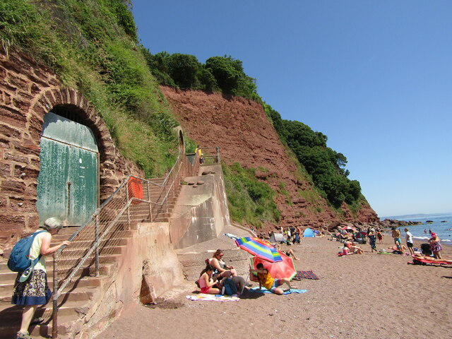
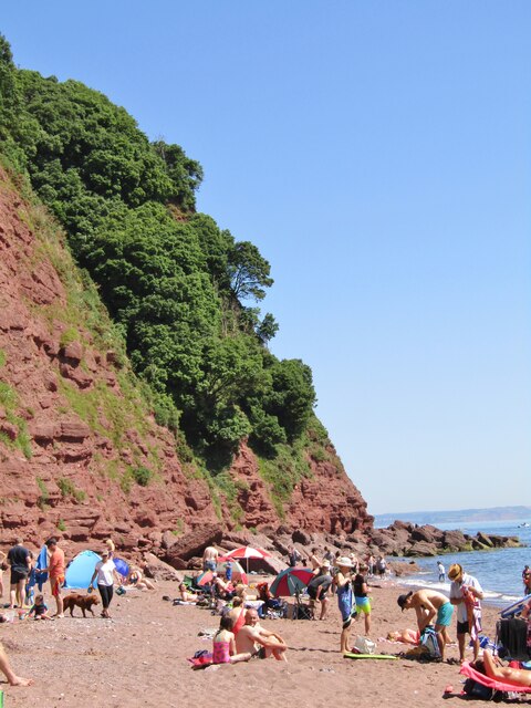
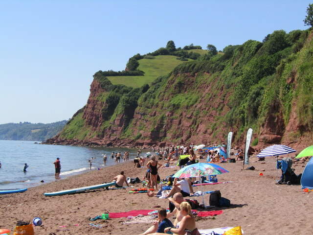
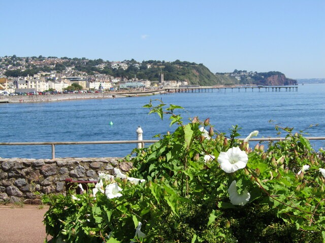
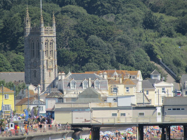
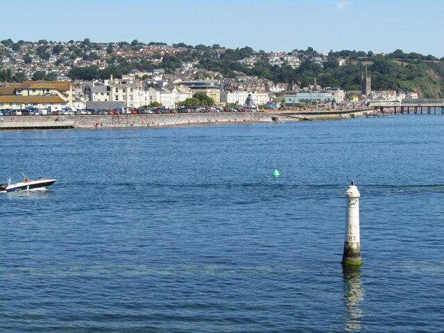
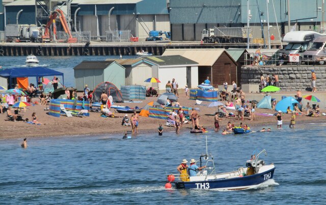
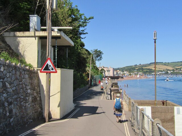
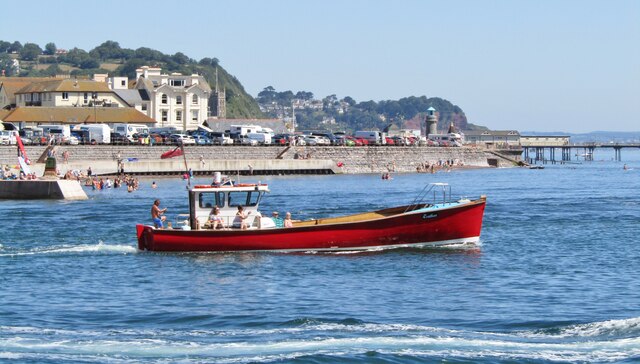
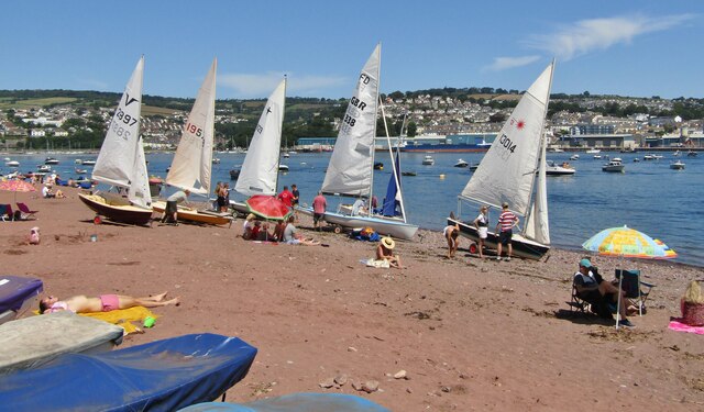
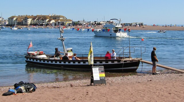
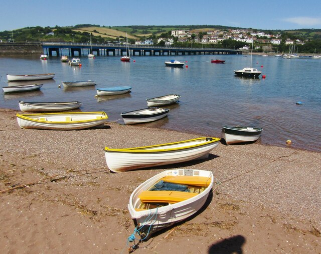
Sprat Sand is a picturesque beach located in the county of Devon, England. Situated on the south coast of the county, this beach is renowned for its natural beauty and tranquil atmosphere. With its golden sands and crystal-clear waters, Sprat Sand offers an idyllic setting for visitors looking to relax and unwind.

The beach is relatively small, stretching for approximately 300 meters along the coastline. It is flanked by rugged cliffs on either side, providing a sense of seclusion and privacy. The sand is fine and soft, perfect for building sandcastles or simply lounging in the sun.

One of Sprat Sand's unique features is the presence of rockpools at low tide. These shallow pools form among the rocks and offer a glimpse into the fascinating marine life that inhabits the area. Visitors can explore these rockpools, discovering small fish, crabs, and other marine creatures.

Sprat Sand is also a popular spot for water sports enthusiasts. The calm waters and gentle waves make it ideal for activities such as swimming, kayaking, and paddleboarding. The beach is monitored by lifeguards during peak season, ensuring the safety of visitors.

Facilities at Sprat Sand include public toilets, a small car park, and a beach café offering refreshments and snacks. The beach is easily accessible by foot, with a short walk from the nearest parking area.

Overall, Sprat Sand is a hidden gem on Devon's coastline, offering a peaceful and scenic escape for beach lovers of all ages.

If you have any feedback on the listing, please let us know in the comments section below.

Sprat Sand Images

Images are sourced within 2km of 50.541783/-3.4967929 or Grid Reference SX9472. Thanks to Geograph Open Source API. All images are credited.

Teignmouth Lido temporarily closed Closed during the pandemic, the Lido will remain closed until 2022. Teignbridge Council explains that it has been "successful in a grant funding bid to the Public Sector Decarbonisation Scheme which will enable us to reduce energy costs and carbon emissions by installing new, green technology at Newton Abbot Leisure Centre, Teignmouth Lido and Broadmeadow Sports Centre [Dawlish]". The deadline for completing the work is September 2021: watch this space. <a href="https://www.geograph.org.uk/photo/3463487">SX9473 : Early morning lane swimming, Teignmouth Lido</a>.
Teignmouth Lido temporarily closed
Closed during the pandemic, the Lido will remain closed until 2022. Teignbridge Council explains that it has been "successful in a grant funding bid to the Public Sector Decarbonisation Scheme which will enable us to reduce energy costs and carbon emissions by installing new, green technology at Newton Abbot Leisure Centre, Teignmouth Lido and Broadmeadow Sports Centre [Dawlish]". The deadline for completing the work is September 2021: watch this space. SX9473 : Early morning lane swimming, Teignmouth Lido.
Shaldon - Ness Cove Ness Cove is a long sandy beach, accessible through a tunnel from Shaldon car park. It is backed by high old red sandstone cliffs.
Shaldon - Ness Cove
Ness Cove is a long sandy beach, accessible through a tunnel from Shaldon car park. It is backed by high old red sandstone cliffs.
Shaldon - The Ness Steep old red sandstone cliff at the northern end of Ness Cove.
Shaldon - The Ness
Steep old red sandstone cliff at the northern end of Ness Cove.
Shaldon - Ness Cove Ness Cove is a long sandy beach, accessible through a tunnel from Shaldon car park. It is backed by high old red sandstone cliffs.
Shaldon - Ness Cove
Ness Cove is a long sandy beach, accessible through a tunnel from Shaldon car park. It is backed by high old red sandstone cliffs.
Shaldon - The Ness Pub double sign on Marine Parade - "The Ness" takes its name from the nearby promontory and the pub has sweeping views across the water to Teignmouth.
Shaldon - The Ness
Pub double sign on Marine Parade - "The Ness" takes its name from the nearby promontory and the pub has sweeping views across the water to Teignmouth.
Shaldon - Teign River Mouth View from The Ness at Shaldon, across the Teign estuary, towards Teignmouth Pier.
Shaldon - Teign River Mouth
View from The Ness at Shaldon, across the Teign estuary, towards Teignmouth Pier.
Teignmouth - St Michael's Church Historic church tower seen here from The Ness at Shaldon.
Teignmouth - St Michael's Church
Historic church tower seen here from The Ness at Shaldon.
Shaldon - Navigation Beacon Maritime aid at the southern side of the Teign river mouth. Teignmouth is in the background.
Shaldon - Navigation Beacon
Maritime aid at the southern side of the Teign river mouth. Teignmouth is in the background.
Teignmouth - The Point Promontory and honeypot for tourists at the northern bank where the River Teign enters the sea. Seen here from The Ness at Shaldon.
Teignmouth - The Point
Promontory and honeypot for tourists at the northern bank where the River Teign enters the sea. Seen here from The Ness at Shaldon.
Shaldon - Searchlight Emplacement WW2 relic on Marine Parade, overlooking the mouth of the River Teign.
Shaldon - Searchlight Emplacement
WW2 relic on Marine Parade, overlooking the mouth of the River Teign.
Shaldon - Pleasure Boat "Restless" heads out to sea from Teignmouth harbour.
Shaldon - Pleasure Boat
"Restless" heads out to sea from Teignmouth harbour.
Teignmouth - Old Quay General cargo ship, "Conformity", moored in Teignmouth Harbour.
Teignmouth - Old Quay
General cargo ship, "Conformity", moored in Teignmouth Harbour.
Shaldon - Dinghies White sails in the sunshine at Shaldon. Teignmouth is in the background.
Shaldon - Dinghies
White sails in the sunshine at Shaldon. Teignmouth is in the background.
Teignmouth-Shaldon Ferry Ferry No. 4 at Shaldon preparing to cross the mouth of the Teign, carrying foot passengers to Teignmouth.
Teignmouth-Shaldon Ferry
Ferry No. 4 at Shaldon preparing to cross the mouth of the Teign, carrying foot passengers to Teignmouth.
Shaldon - War Memorial WW1 memorial in the centre of Shaldon village.
Shaldon - War Memorial
WW1 memorial in the centre of Shaldon village.
Shaldon - Teign Estuary Rowing boats pulled up on the beach during high tide on the Teign at Shaldon. The bridge to Teignmouth is in the background.
Shaldon - Teign Estuary
Rowing boats pulled up on the beach during high tide on the Teign at Shaldon. The bridge to Teignmouth is in the background.
Shaldon - Church Ornate figure holding a clam shell inside the Victorian village church.
Shaldon - Church
Ornate figure holding a clam shell inside the Victorian village church.
Shaldon - Milestone Historic stone by the southern end of the Shaldon-Teignmouth Bridge showing distances in miles, furlongs and poles.
To Torquay 7.2.12
Brixham 15.2.21
Dartmouth 17.5.26
Totnes 15.0.21
Shaldon - Milestone
Historic stone by the southern end of the Shaldon-Teignmouth Bridge showing distances in miles, furlongs and poles. To Torquay 7.2.12 Brixham 15.2.21 Dartmouth 17.5.26 Totnes 15.0.21
Show me another place!

Sprat Sand is located at Grid Ref: SX9472 (Lat: 50.541783, Lng: -3.4967929)

Administrative County: Devon

District: Teignbridge

Police Authority: Devon and Cornwall

What 3 Words

///beep.moisture.caves. Near Teignmouth, Devon

Related Wikis

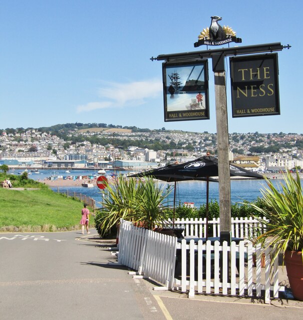
Teignmouth Lighthouse

Teignmouth lighthouse is a lighthouse situated on the south end of the Den promenade at Teignmouth, Devon, England. It is paired with a red polycarbonate...

Teignmouth Lifeboat Station

Teignmouth Lifeboat Station is the base for Royal National Lifeboat Institution (RNLI) search and rescue operations at Teignmouth, Devon in England. The...

River Teign

The River Teign is a river in the county of Devon, England. It is 31 mi (50 km) long and rises on Dartmoor, becomes an estuary just below Newton Abbot...

Grand Pier, Teignmouth

Designed by and constructed between 1865 and 1867, The Grand Pier, also known as Teignmouth Pier, is a pier in the town of Teignmouth, Devon, England that...

Nearby Amenities

Located within 500m of 50.541783,-3.4967929
Source: PGS
Lat/Long: 50.5442263/-3.5015237
Created By: almien_coastlines
Source: PGS
Lat/Long: 50.543747/-3.50132
Source: PGS
Lat/Long: 50.5430741/-3.5013413
Source: PGS
Lat/Long: 50.5427059/-3.5016525
Source: PGS
Lat/Long: 50.5422627/-3.5019743
Source: PGS
Lat/Long: 50.5413354/-3.5025537
Source: PGS
Lat/Long: 50.5450413/-3.4998509
Source: PGS
Lat/Long: 50.5453243/-3.4994137
Source: PGS
Lat/Long: 50.5443244/-3.4989872
Source: PGS
Lat/Long: 50.5431135/-3.4985385
Source: PGS
Lat/Long: 50.5425951/-3.4988151
Source: PGS
Lat/Long: 50.5422537/-3.4988724
Source: PGS
Lat/Long: 50.5419384/-3.4991848
Source: PGS
Lat/Long: 50.540941/-3.5002606
Source: PGS
Lat/Long: 50.5407877/-3.4999718
Source: PGS
Lat/Long: 50.5408489/-3.4997278
Source: PGS
Lat/Long: 50.5412266/-3.4995029
Source: PGS
Lat/Long: 50.5414143/-3.4989829
Source: PGS
Lat/Long: 50.5425459/-3.4961047
Source: PGS
Lat/Long: 50.5433775/-3.494748
Source: PGS
Lat/Long: 50.5434968/-3.4946543
Source: PGS
Lat/Long: 50.5437947/-3.4943984
Source: PGS
Lat/Long: 50.5441492/-3.4940984
Source: PGS
Lat/Long: 50.5447406/-3.4936007
Source: PGS
Lat/Long: 50.5381034/-3.4963549
Source: PGS
Lat/Long: 50.5381171/-3.4977818
Source: PGS
Lat/Long: 50.538158/-3.4985758
Source: PGS
Lat/Long: 50.5383179/-3.4988043
Source: PGS
Lat/Long: 50.5384908/-3.4993324
Source: PGS
Lat/Long: 50.5392767/-3.5013013
Source: PGS
Lat/Long: 50.5394563/-3.5017539
Source: PGS
Lat/Long: 50.5398025/-3.5022928
Source: PGS
Lat/Long: 50.5400114/-3.5028178
Source: PGS
Lat/Long: 50.5402339/-3.5032663
Crossing
Crossing: uncontrolled
Crossing Island: no
Kerb: flush
Kerb Left: flush
Kerb Right: flush
Supervised: no
Tactile Paving: yes
Lat/Long: 50.5453523/-3.4954247
Man Made: lighthouse
Note: operational
Lat/Long: 50.5424837/-3.4968407
Ferry Terminal
Shaldon Ferry Landing
Ferry: yes
Public Transport: station
Lat/Long: 50.5402523/-3.5033067
Gales Hill
Leisure: slipway
Lat/Long: 50.5452855/-3.4993544
Toilets
Fee: no
Wheelchair: yes
Lat/Long: 50.545499/-3.4971501
Post Box
Brand: Royal Mail
Brand Wikidata: Q638098
Brand Wikipedia: en:Royal Mail
Collection Times: Mo-Fr 09:00; Sa 07:00; Su off
Operator: Royal Mail
Operator Wikidata: Q638098
Post Box Design: type_b
Post Box Type: pillar
Ref: TQ14 7D
Royal Cypher: GVIR
Royal Cypher Wikidata: Q33102169
Source: survey;streetlevel imagery;aerial imagery;local knowledge
Lat/Long: 50.5437988/-3.4971956
The Ness
Is In: Devon, England, UK
Natural: headland
Place: locality
Source: NPE
Lat/Long: 50.5376168/-3.4969898
Pub
The Ness
Addr Country: GB
Brand: Hall & Woodhouse
Brand Wikidata: Q5642555
Brand Wikipedia: en:Hall & Woodhouse
Check Date: 2023-04-15
Lat/Long: 50.5379137/-3.4991291
Place Of Worship
Teignmouth Methodist Church
Religion: christian
Wikidata: Q26682876
Lat/Long: 50.5460398/-3.497604
Coast Guard
Lat/Long: 50.5435147/-3.4978491
Post Office
Teignmouth Post Office
Addr City: Teignmouth
Addr Postcode: TQ14 8AA
Addr Street: Den Road
Brand: Post Office
Brand Wikidata: Q1783168
Collection Times: Mo-Fr 18:30; Sa 13:30
Opening Hours: Mo,We-Fr 09:00-17:30; Tu 09:30-17:30; Sa 09:00-12:30
Operator: Post Office Ltd
Operator Wikidata: Q1783168
Ref Pol Id: 17587
Source: OS OpenData StreetView;pol_branch_list_2020‑11‑13
Website: https://www.postoffice.co.uk/branch-finder/0075523/teignmouth
Wheelchair: yes
Lat/Long: 50.5457201/-3.4957726
Seamark Beacon Special Purpose Colour: white
Seamark Light Character: Oc
Seamark Light Colour: red
Seamark Light Height: 4
Seamark Light Period: 6
Seamark Light Range: 3
Seamark Light Reference: A 0263
Seamark Type: beacon_special_purpose
Source: US NGA Pub. 114. 2011-05-26.
Lat/Long: 50.5388353/-3.4987376
Seamark Light Character: F
Seamark Light Colour: red
Seamark Light Height: 11
Seamark Light Range: 3
Seamark Light Reference: A 0262.1
Seamark Type: light_minor
Source: US NGA Pub. 114. 2011-05-26.
Lat/Long: 50.5428863/-3.4969626
Seamark Light Character: F
Seamark Light Colour: red
Seamark Light Height: 10
Seamark Light Range: 6
Seamark Light Reference: A 0262
Seamark Type: light_minor
Lat/Long: 50.5423565/-3.496542
Seamark Beacon Lateral Category: starboard
Seamark Beacon Lateral Colour: green
Seamark Beacon Lateral System: iala-a
Seamark Light Character: Oc
Seamark Light Colour: green
Seamark Light Period: 6
Seamark Light Range: 3
Seamark Light Reference: A 0263.5
Seamark Type: beacon_lateral
Lat/Long: 50.5413297/-3.499402
Crossing
Crossing: marked
Crossing Island: no
Crossing Markings: yes
Tactile Paving: yes
Lat/Long: 50.5447866/-3.4959877
Ferry Terminal
Teignmouth Ferry Landing
Ferry: yes
Public Transport: stop_position
Lat/Long: 50.5422813/-3.4989347
Source: PGS
Lat/Long: 50.5434112/-3.4952922
Source: PGS
Lat/Long: 50.5377679/-3.4959873
Source: PGS
Lat/Long: 50.5379789/-3.4957282
Historic: building
Note: formerly Assembly Rooms where Liszt played
Lat/Long: 50.5453448/-3.4957017
New Quay for shipping granite
Information: plaque
Tourism: information
Lat/Long: 50.5448505/-3.4980375
Keats resided here in 1818
Information: plaque
Tourism: information
Lat/Long: 50.544603/-3.4977605
Direction: NE
Tourism: viewpoint
Lat/Long: 50.5377216/-3.4966789
Man Made: tower
Tower Type: navigation
Lat/Long: 50.5405254/-3.4998469
Brunswick House
Tourism: guest_house
Lat/Long: 50.5443469/-3.4969615
Restaurant
Naz
Addr City: Teignmouth
Addr Housenumber: 9
Addr Postcode: TQ14 8EN
Addr Street: Somerset Place
Check Date Opening Hours: 2023-02-22
Cuisine: indian
Fhrs Id: 442643
Fhrs Local Authority Id: 12/01861/MIXED
Opening Hours: Mo-Th 17:30-23:00; Fr,Sa 17:30-24:00; Su 17:00-22:00
Source: survey
Source Addr: FHRS Open Data
Lat/Long: 50.5461401/-3.4974944
Cafe
Oystercatcher
Addr City: Teignmouth
Addr Housenumber: 12
Addr Postcode: TQ14 8DD
Addr Street: Northumberland Place
Fhrs Id: 1093763
Fhrs Local Authority Id: 18/03515/MIXED
Opening Hours Signed: no
Source: survey
Source Addr: FHRS Open Data
Lat/Long: 50.5450575/-3.497905
Pub
Ship Inn
Addr City: Teignmouth
Addr Postcode: TQ14 8BY
Addr Street: Queen Street
Check Date: 2023-04-13
Fhrs Id: 49247
Fhrs Local Authority Id: 11/01418/MIXED
Source Addr: FHRS Open Data
Wikidata: Q26682902
Lat/Long: 50.5444763/-3.4982968
Pub
The New Quay Inn
Addr City: Teignmouth
Addr Postcode: TQ14 8DA
Addr Street: New Quay Street
Check Date: 2023-04-13
Fhrs Id: 558439
Fhrs Local Authority Id: 13/02004/MIXED
Source Addr: FHRS Open Data
Wikidata: Q26647452
Lat/Long: 50.5447979/-3.4984668
Pub
Devon Arms Hotel
Addr City: Teignmouth
Addr Postcode: TQ14 8DE
Addr Street: Northumberland Place
Check Date: 2023-04-13
Fhrs Id: 10664
Fhrs Local Authority Id: 04/00265/MIXED
Fhrs Name: Devon Arms Hotel - Bar Sales
Source: survey
Wikidata: Q26682893
Lat/Long: 50.545392/-3.4980617
Pub
Ye Olde Jolly Sailor
Addr City: Teignmouth
Addr Housenumber: 46
Addr Postcode: TQ14 8DE
Addr Street: Northumberland Place
Check Date: 2023-04-13
Fhrs Id: 446829
Fhrs Local Authority Id: 12/01857/MIXED
Source Addr: FHRS Open Data
Wikidata: Q79684414
Lat/Long: 50.5451961/-3.4984644
Ocean
Addr City: Teignmouth
Addr Street: Northumberland Place
Shop: hairdresser
Lat/Long: 50.5447102/-3.4980307
The Courtenay
Addr City: Teignmouth
Addr Housename: The Courtenay
Addr Postcode: TQ14 8AY
Addr Street: Courtenay Place
Disused Amenity: pub
Fhrs Id: 558443
Fhrs Local Authority Id: 13/02081/MIXED
Source: survey
Source Addr: FHRS Open Data
Wikidata: Q79684389
Lat/Long: 50.5458313/-3.4945065
Pub
Lobster Lounge
Addr City: Teignmouth
Addr Housenumber: 31
Addr Postcode: TQ14 8BU
Addr Street: Northumberland Place
Wikidata: Q80476349
Lat/Long: 50.5443169/-3.4977935
The Launderette
Opening Hours: Mo-Su 07:00-20:00
Self Service: yes
Shop: laundry
Lat/Long: 50.5457507/-3.4965986
New Quay
Tourism: viewpoint
Wikidata: Q26647451
Lat/Long: 50.5444493/-3.4989912
Pub
King William IV
Addr City: Teignmouth
Addr Housenumber: 19
Addr Postcode: TQ14 8BZ
Addr Street: Northumberland Place
Check Date: 2023-04-13
Not Fhrs Id: 914039
Note: FHRS ID 914039 is for F&R's, the former name of the premises
Old Name: F&R's Bar
Wikidata: Q79684393
Lat/Long: 50.5446688/-3.497782
Fast Food
Harbour Fish Bar
Cuisine: fish_and_chips
Opening Hours: We-Sa 12:00-14:00,16:00-20:00; Su-Tu off
Lat/Long: 50.5452156/-3.4981183
Crossing
Crossing: unmarked
Crossing Island: no
Crossing Markings: no
Kerb: flush
Kerb Left: flush
Kerb Right: flush
Supervised: no
Tactile Paving: yes
Lat/Long: 50.5455841/-3.494914
Crossing
Crossing: uncontrolled
Kerb: flush
Kerb Left: flush
Kerb Right: flush
Supervised: no
Tactile Paving: yes
Lat/Long: 50.5453677/-3.494142
Cafe
Relish
Addr City: Teignmouth
Addr Housenumber: 6
Addr Postcode: TQ14 8DD
Addr Street: Northumberland Place
Check Date Opening Hours: 2023-04-18
Fhrs Id: 31384
Fhrs Local Authority Id: 09/00853/MIXED
Opening Hours: Tu-Sa 09:30-13:30
Source Addr: FHRS Open Data
Lat/Long: 50.5455684/-3.497459
Fish Quay
Tourism: viewpoint
Lat/Long: 50.5447854/-3.4993892
Cafe
Luders Patisserie
Addr City: Teignmouth
Addr Postcode: TQ14 8AS
Addr Street: Waterloo Street
Check Date: 2024-03-01
Fhrs Id: 11381
Fhrs Local Authority Id: 04/00607/MIXED
Opening Hours: Tu-Sa 09:00-15:00
Operator: Luders Patisserie Ltd
Source Addr: FHRS Open Data
Lat/Long: 50.5460379/-3.4949363
Bar
Teignmouth Social Club
Opening Hours: We 11:00-20:00; Th-Sa 11:00-22:00; Su 12:00-19:00
Lat/Long: 50.545722/-3.4948558
Bench
Backrest: yes
Lat/Long: 50.5442573/-3.4963311
Bench
Backrest: yes
Lat/Long: 50.541314/-3.4993411
Bench
Backrest: yes
Lat/Long: 50.5431556/-3.4960738
Bench
Backrest: yes
Lat/Long: 50.5428772/-3.4964062
Bench
Backrest: yes
Lat/Long: 50.5428422/-3.4964573
Bench
Backrest: yes
Lat/Long: 50.5432171/-3.4959997
Bench
Backrest: yes
Lat/Long: 50.5427213/-3.4966533
Bench
Backrest: yes
Lat/Long: 50.5429623/-3.4963078
Bench
Backrest: yes
Lat/Long: 50.5428292/-3.4965845
Bench
Backrest: yes
Lat/Long: 50.5426682/-3.4967454
Bench
Backrest: yes
Lat/Long: 50.5426227/-3.4968378
Bench
Backrest: no
Lat/Long: 50.5377086/-3.4966002
Defibrillator
Emergency: defibrillator
Indoor: no
Lat/Long: 50.5422194/-3.4985959
Defibrillator
Emergency: defibrillator
Indoor: no
Lat/Long: 50.5453823/-3.4952892
Defibrillator
Emergency: defibrillator
Indoor: no
Lat/Long: 50.544612/-3.4983551
Addr Housenumber: 13
Addr Postcode: TQ14 8BX
Addr Street: Teign View Place
Lat/Long: 50.5438303/-3.4982497
Addr Housenumber: 12
Addr Postcode: TQ14 8BX
Addr Street: Teign View Place
Lat/Long: 50.5438627/-3.498253
Co-op Food
Addr City: Teignmouth
Addr Housenumber: 8
Addr Postcode: TQ14 8AL
Addr Street: Bank Street
Atm: yes
Brand: Co-op Food
Brand Wikidata: Q3277439
Brand Wikipedia: en:Co-op Food
Check Date Opening Hours: 2022-10-05
Fhrs Id: 11654
Fhrs Local Authority Id: 04/00780/MIXED
Opening Hours: Mo-Su 07:00-22:00
Operator: The Co-operative Group
Operator Wikidata: Q117202
Shop: supermarket
Website: https://www.coop.co.uk/store-finder/TQ14-8AL/8-bank-street
Lat/Long: 50.546145/-3.4964217
Salty Cottage
Addr Housenumber: 7
Addr Street: Ivy Lane
Tourism: apartment
Lat/Long: 50.5437426/-3.4983224
Atm
Cash In: no
Check Date: 2023-08-15
Indoor: no
Operator: Cooperative Bank
Lat/Long: 50.5461855/-3.4963538
Cafe
Pearl's Parlour
Addr City: Teignmouth
Addr Housenumber: 2
Addr Postcode: TQ14 8AL
Addr Street: Bank Street
Diet Gluten Free: yes
Diet Vegan: yes
Diet Vegetarian: yes
Fhrs Id: 1285649
Fhrs Local Authority Id: 20/03931/MIXEDD
Level: 0
Opening Hours: Mo-Sa 08:00-16:30; Su 08:30-15:00
Source Addr: FHRS Open Data
Lat/Long: 50.54622/-3.4971486
Addr City: Teignmouth
Addr Postcode: TQ14 8EP
Addr Street: Somerset Place
Note: e.g. 2 Somerset Place
Lat/Long: 50.5461814/-3.4972341
Teignmouth Den Weather Station
Ele: 3
Man Made: observatory
Observatory Type: meteorological
Lat/Long: 50.5450271/-3.4949159
Generator Method: photovoltaic
Generator Output Electricity: yes
Generator Source: solar
Generator Type: solar_photovoltaic_panel
Location: roof
Power: generator
Lat/Long: 50.5378824/-3.4991457
Generator Method: photovoltaic
Generator Output Electricity: yes
Generator Source: solar
Generator Type: solar_photovoltaic_panel
Location: roof
Power: generator
Lat/Long: 50.5378295/-3.4991726
Direction: 215
Generator Method: photovoltaic
Generator Output Electricity: yes
Generator Solar Modules: 30
Generator Source: solar
Generator Type: solar_photovoltaic_panel
Location: roof
Power: generator
Lat/Long: 50.5454844/-3.494596
Direction: 215
Generator Method: photovoltaic
Generator Output Electricity: yes
Generator Solar Modules: 18
Generator Source: solar
Generator Type: solar_photovoltaic_panel
Location: roof
Power: generator
Lat/Long: 50.5454401/-3.4944593
The Cones
Check Date Opening Hours: 2023-11-21
Opening Hours Signed: no
Shop: kiosk
Lat/Long: 50.5432944/-3.4957217
Bench
Backrest: yes
Lat/Long: 50.5436467/-3.4955536
Bench
Backrest: yes
Lat/Long: 50.5435852/-3.4956138
Bench
Backrest: yes
Lat/Long: 50.5435427/-3.4956556
Bench
Backrest: yes
Lat/Long: 50.5435145/-3.4956825
Bench
Backrest: yes
Lat/Long: 50.54348/-3.4957179
Bench
Backrest: yes
Lat/Long: 50.5434343/-3.4957613
Bench
Backrest: yes
Lat/Long: 50.5433881/-3.495809
Bench
Backrest: yes
Lat/Long: 50.5433191/-3.4958831
Bench
Backrest: yes
Lat/Long: 50.5432811/-3.4959253
Bench
Backrest: yes
Lat/Long: 50.5432584/-3.4959526
Seamark Buoy Lateral Colour: red
Seamark Type: buoy_lateral
Lat/Long: 50.5389835/-3.496416
Seamark Buoy Lateral Colour: green
Seamark Type: buoy_lateral
Lat/Long: 50.5396409/-3.4949354
Seamark Mooring Category: buoy
Seamark Type: mooring
Lat/Long: 50.5411294/-3.5037951
Seamark Mooring Category: buoy
Seamark Type: mooring
Lat/Long: 50.5410455/-3.5036003
Seamark Mooring Category: buoy
Seamark Type: mooring
Lat/Long: 50.5412312/-3.5036241
Seamark Mooring Category: buoy
Seamark Type: mooring
Lat/Long: 50.5413268/-3.5036143
Seamark Mooring Category: buoy
Seamark Type: mooring
Lat/Long: 50.5411377/-3.5034292
Seamark Mooring Category: buoy
Seamark Type: mooring
Lat/Long: 50.5407896/-3.5027572
Seamark Mooring Category: buoy
Seamark Type: mooring
Lat/Long: 50.5407813/-3.5034024
Seamark Mooring Category: buoy
Seamark Type: mooring
Lat/Long: 50.5408879/-3.5036156
Seamark Mooring Category: buoy
Seamark Type: mooring
Lat/Long: 50.540543/-3.5032021
Seamark Mooring Category: buoy
Seamark Type: mooring
Lat/Long: 50.5405994/-3.5033699
Seamark Mooring Category: buoy
Seamark Type: mooring
Lat/Long: 50.5416438/-3.5037429
Seamark Mooring Category: buoy
Seamark Type: mooring
Lat/Long: 50.5413184/-3.5033452
Seamark Mooring Category: buoy
Seamark Type: mooring
Lat/Long: 50.5414792/-3.5036596
Seamark Mooring Category: buoy
Seamark Type: mooring
Lat/Long: 50.5414362/-3.5032996
Seamark Mooring Category: buoy
Seamark Type: mooring
Lat/Long: 50.5414163/-3.5031676
Seamark Mooring Category: buoy
Seamark Type: mooring
Lat/Long: 50.5414263/-3.502718
Seamark Mooring Category: bollard
Seamark Type: mooring
Lat/Long: 50.5455153/-3.5006603
Seamark Mooring Category: bollard
Seamark Type: mooring
Lat/Long: 50.5454399/-3.5005318
Seamark Mooring Category: bollard
Seamark Type: mooring
Lat/Long: 50.5453505/-3.500376
Seamark Mooring Category: bollard
Seamark Type: mooring
Lat/Long: 50.5452718/-3.5002422
Seamark Mooring Category: bollard
Seamark Type: mooring
Lat/Long: 50.5452022/-3.5001198
Seamark Mooring Category: bollard
Seamark Type: mooring
Lat/Long: 50.545124/-3.4999838
Seamark Mooring Category: bollard
Seamark Type: mooring
Lat/Long: 50.5450525/-3.4998488
Seamark Mooring Category: buoy
Seamark Type: mooring
Lat/Long: 50.5417792/-3.5001069
Seamark Mooring Category: buoy
Seamark Type: mooring
Lat/Long: 50.5418993/-3.4999794
Seamark Mooring Category: buoy
Seamark Type: mooring
Lat/Long: 50.5419961/-3.4998684
Seamark Mooring Category: buoy
Seamark Type: mooring
Lat/Long: 50.5416622/-3.500264
Dive Centre
Teign Diving Centre
Lat/Long: 50.5455463/-3.4987198
Post Box
Brand: Royal Mail
Brand Wikidata: Q638098
Brand Wikipedia: en:Royal Mail
Collection Times: Mo-Fr 18:00; Sa 13:00; Su off
Drive Through: no
Operator: Royal Mail
Operator Wikidata: Q638098
Post Box Apertures: 2
Post Box Mounting: building
Post Box Type: posting_suite
Ref: TQ14 222
Royal Cypher: no
Source: survey;streetlevel imagery;aerial imagery;local knowledge
Survey Date: 2023-11-29
Lat/Long: 50.545771/-3.4956986
Bench
Backrest: yes
Lat/Long: 50.5438671/-3.4953441
Bench
Backrest: yes
Lat/Long: 50.5440226/-3.495206
Bench
Backrest: yes
Lat/Long: 50.5442262/-3.4950368
Bench
Backrest: yes
Lat/Long: 50.5442716/-3.4949973
Bench
Backrest: yes
Lat/Long: 50.5443116/-3.4949565
Bench
Backrest: yes
Lat/Long: 50.5444687/-3.4948097
Bench
Backrest: yes
Lat/Long: 50.5444921/-3.4947878
Bench
Backrest: yes
Lat/Long: 50.5445204/-3.4947613
Bench
Backrest: yes
Lat/Long: 50.5445449/-3.4947384
Bench
Backrest: yes
Lat/Long: 50.5450883/-3.4942544
Bench
Backrest: yes
Lat/Long: 50.5451472/-3.4942088
Bench
Backrest: yes
Lat/Long: 50.5455709/-3.4938242
Bench
Backrest: yes
Lat/Long: 50.5456106/-3.4937931
Bench
Backrest: yes
Lat/Long: 50.5456522/-3.4937558
Bench
Backrest: yes
Lat/Long: 50.5457677/-3.4936524
Pharmacy
Lloyds Pharmacy
Addr Postcode: TQ14 8AJ
Brand: Lloyds Pharmacy
Brand Wikidata: Q6662870
Brand Wikipedia: en:LloydsPharmacy
Dispensing: yes
Healthcare: pharmacy
Opening Hours: Mo-Fr 09:00-17:30; Sa 09:30-17:30
Lat/Long: 50.545949/-3.4958118
Restaurant
Brunch
Lat/Long: 50.545974/-3.4948892
Covered: no
Leisure: picnic_table
Lat/Long: 50.5431856/-3.4968679
Leisure: picnic_table
Lat/Long: 50.5431563/-3.4969127
Leisure: picnic_table
Lat/Long: 50.5433698/-3.4967463
Lloyd Maunder
Addr Street: Bank Street
Shop: butcher
Lat/Long: 50.5462703/-3.4964529
Teignmouth Farm Shop
Addr City: Teignmouth
Addr Street: Bank Street
Check Date Opening Hours: 2023-05-08
Opening Hours: Mo-Sa 07:00-16:00
Shop: greengrocer
Lat/Long: 50.546271/-3.4966042
British Heart Foundation
Addr City: Teignmouth
Addr Street: Bank Street
Brand: British Heart Foundation
Brand Wikidata: Q4970039
Brand Wikipedia: en:British Heart Foundation
Opening Hours: Mo-Sa 09:30-17:00; Su 10:30-16:30
Shop: charity
Website: https://www.bhf.org.uk/what-we-do/find-bhf-near-you/teignmouth-bhf-shop
Lat/Long: 50.5462709/-3.496522
Card Factory
Brand: Card Factory
Brand Wikidata: Q5038192
Brand Wikipedia: en:Card Factory
Shop: gift
Lat/Long: 50.546197/-3.4959528
Rowcroft Hospice Shop
Shop: charity
Lat/Long: 50.5461961/-3.4960806
Saltrock
Addr City: Teignmouth
Addr Street: Bank Street
Brand: Saltrock
Brand Wikidata: Q7406195
Brand Wikipedia: en:Saltrock
Shop: clothes
Lat/Long: 50.5461892/-3.4961584
Cafe
Costa
Addr Housenumber: 9
Addr Postcode: TQ14 8AL
Addr Street: Bank Street
Brand: Costa
Brand Wikidata: Q608845
Brand Wikipedia: en:Costa Coffee
Cuisine: coffee_shop
Fhrs Id: 583775
Opening Hours: Mo-Sa 07:00-18:00; Su 08:00-17:00
Takeaway: yes
Lat/Long: 50.5461824/-3.4962393
Bench
Backrest: yes
Lat/Long: 50.5383493/-3.4993054
Bench
Backrest: yes
Lat/Long: 50.538342/-3.4992718
Bench
Backrest: yes
Lat/Long: 50.538328/-3.499239
Bench
Backrest: yes
Lat/Long: 50.5383111/-3.4991966
Bench
Backrest: yes
Lat/Long: 50.5382931/-3.4991479
Bench
Backrest: yes
Lat/Long: 50.5382717/-3.4991001
Bench
Backrest: yes
Lat/Long: 50.5382509/-3.4990559
Bench
Backrest: yes
Lat/Long: 50.5382307/-3.4990046
Face Electrical
Check Date Opening Hours: 2023-04-18
Opening Hours Signed: no
Shop: electrical
Lat/Long: 50.5462569/-3.4974398
Bench
Backrest: yes
Lat/Long: 50.5413049/-3.4993564
Bench
Backrest: yes
Lat/Long: 50.5412987/-3.4993759
Bench
Backrest: yes
Lat/Long: 50.5412987/-3.499398
Bench
Backrest: yes
Lat/Long: 50.5413066/-3.4994263
Bench
Backrest: yes
Lat/Long: 50.5413268/-3.4994387
Bench
Backrest: yes
Lat/Long: 50.5429282/-3.4963561
Bench
Backrest: yes
Lat/Long: 50.5430188/-3.4962437
Bench
Backrest: yes
Lat/Long: 50.5430441/-3.4962074
Bench
Backrest: yes
Lat/Long: 50.5441405/-3.4951156
Telephone
Booth: KX100
Survey Date: 2022-11-12
Lat/Long: 50.5453081/-3.4953323
Life Ring
Emergency: life_ring
Survey Date: 2022-11-12
Lat/Long: 50.5383828/-3.499192
Waste Basket
Survey Date: 2022-11-12
Lat/Long: 50.5383478/-3.4993976
Bench
Backrest: yes
Survey Date: 2022-11-12
Lat/Long: 50.5381518/-3.4988347
Defibrillator
Emergency: defibrillator
Indoor: no
Lat/Long: 50.5431526/-3.4959468
Waste Basket
Survey Date: 2022-11-19
Lat/Long: 50.5457516/-3.4968108
Fire Hydrant
Emergency: fire_hydrant
Fire Hydrant Type: underground
Survey Date: 2022-11-19
Lat/Long: 50.5430205/-3.4976765
Life Ring
Emergency: life_ring
Survey Date: 2022-11-19
Lat/Long: 50.5414136/-3.4990387
Life Ring
Emergency: life_ring
Survey Date: 2022-11-19
Lat/Long: 50.5424652/-3.496764
Waste Basket
Survey Date: 2022-11-19
Lat/Long: 50.5425773/-3.4968623
Waste Basket
Survey Date: 2022-11-19
Waste: dog_excrement
Lat/Long: 50.5431382/-3.4957352
Waste Basket
Survey Date: 2022-11-19
Waste: dog_excrement
Lat/Long: 50.5445338/-3.4945094
Waste Basket
Survey Date: 2022-11-19
Lat/Long: 50.5446112/-3.4947152
Life Ring
Emergency: life_ring
Survey Date: 2022-11-19
Lat/Long: 50.5454959/-3.4935943
Fire Hydrant
Emergency: fire_hydrant
Fire Hydrant Type: underground
Survey Date: 2022-11-19
Lat/Long: 50.5442675/-3.4968113
Waste Basket
Survey Date: 2022-11-19
Lat/Long: 50.5420864/-3.4981634
Recycling
Recycling Beverage Cartons: no
Recycling Cans: yes
Recycling Plastic: no
Recycling Plastic Bottles: yes
Recycling Plastic Packaging: no
Recycling Type: container
Survey Date: 2022-11-19
Lat/Long: 50.542084/-3.4981956
Bench
Backrest: yes
Survey Date: 2022-11-19
Lat/Long: 50.5422622/-3.4986452
Life Ring
Emergency: life_ring
Survey Date: 2022-11-19
Lat/Long: 50.5416702/-3.498322
Waste Basket
Survey Date: 2022-11-19
Lat/Long: 50.5433754/-3.4958549
Waste Basket
Survey Date: 2022-11-19
Lat/Long: 50.5442175/-3.4950748
Life Ring
Emergency: life_ring
Survey Date: 2022-11-19
Lat/Long: 50.5444849/-3.4945888
Defibrillator
Emergency: defibrillator
Indoor: no
Survey Date: 2022-11-19
Lat/Long: 50.5449081/-3.4943996
Waste Basket
Survey Date: 2022-11-19
Waste: dog_excrement
Lat/Long: 50.5448957/-3.4941526
Waste Basket
Survey Date: 2022-11-19
Waste: dog_excrement
Lat/Long: 50.5455294/-3.4935782
Bench
Backrest: yes
Survey Date: 2022-11-19
Lat/Long: 50.5422665/-3.4986886
Waste Basket
Survey Date: 2022-11-19
Waste: dog_excrement
Lat/Long: 50.5424685/-3.4966976
Life Ring
Emergency: life_ring
Survey Date: 2022-11-19
Lat/Long: 50.5431095/-3.495786
Waste Basket
Survey Date: 2022-11-19
Waste: dog_excrement
Lat/Long: 50.5436593/-3.4952647
Bench
Backrest: yes
Survey Date: 2022-11-19
Lat/Long: 50.5443282/-3.4934558
Bench
Backrest: yes
Survey Date: 2022-11-19
Lat/Long: 50.5444176/-3.4935021
Waste Basket
Survey Date: 2022-11-19
Lat/Long: 50.5449843/-3.4943119
Waste Basket
Survey Date: 2022-11-19
Lat/Long: 50.5455455/-3.4938401
Bicycle Parking
Bicycle Parking: stands
Capacity: 10
Covered: no
Survey Date: 2022-11-27
Lat/Long: 50.5457636/-3.4975539
Bench
Backrest: yes
Survey Date: 2022-11-27
Lat/Long: 50.5457395/-3.4975193
Bench
Backrest: yes
Survey Date: 2022-11-27
Lat/Long: 50.5457908/-3.4947796
Bicycle Parking
Bicycle Parking: stands
Capacity: 8
Covered: no
Survey Date: 2022-11-27
Lat/Long: 50.5425109/-3.4966989
Waste Basket
Survey Date: 2022-11-27
Lat/Long: 50.5457104/-3.4975378
Bench
Backrest: yes
Survey Date: 2022-11-27
Lat/Long: 50.5462098/-3.4974061
Man Made: water_tap
Lat/Long: 50.5448818/-3.494478
Historic: memorial
Memorial: obelisk
Lat/Long: 50.5441134/-3.4951408
Restaurant
Crab Shack
Cuisine: seafood
Lat/Long: 50.5443336/-3.4982577
Bar
Halulu Bar
Addr City: Teignmouth
Addr Postcode: TQ14 8BD
Lat/Long: 50.5451295/-3.4945156
Quayside Bookshop
Shop: books
Lat/Long: 50.5451532/-3.4980965
Description: Point marker post
Man Made: tower
Tower Type: navigation
Lat/Long: 50.5402855/-3.5007948
River Teign Rowing Club
Shop: boat
Lat/Long: 50.5451766/-3.498807
Toilets
Point toilets
Lat/Long: 50.5420053/-3.4981957
Place Of Worship
The Salvation Army - Teignmouth
Addr City: Teignmouth
Addr Country: GB
Addr Housenumber: 17
Addr Postcode: TQ14 8AE
Addr Street: Bruswick Street
Denomination: salvation_army
Email: Teignmouth@salvationarmy.org.uk
Phone: 01626 369053
Religion: christian
Website: https://www.salvationarmy.org.uk/teignmouth
Lat/Long: 50.5447524/-3.4971178
Restaurant
The View
Lat/Long: 50.5453926/-3.494292
Noexit: yes
Lat/Long: 50.5385119/-3.4994095
The data included in this document is from www.openstreetmap.org. The data is made available under ODbL.

Have you been to Sprat Sand?

Leave your review of Sprat Sand below (or comments, questions and feedback).