West Bottom

Valley in Dorset

England

West Bottom

Coastline in Ringstead Bay
Coastline in Ringstead Bay Credit: Doug Lee

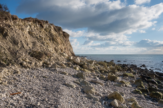
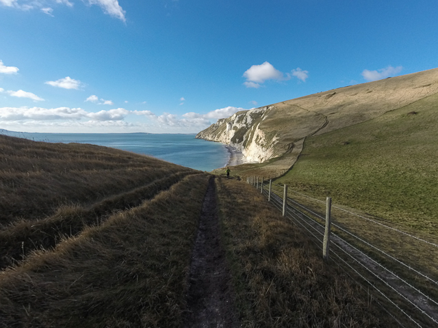
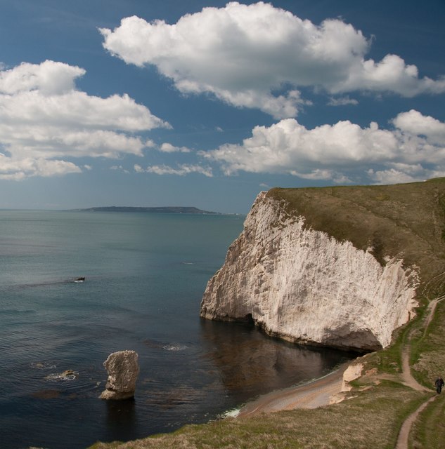
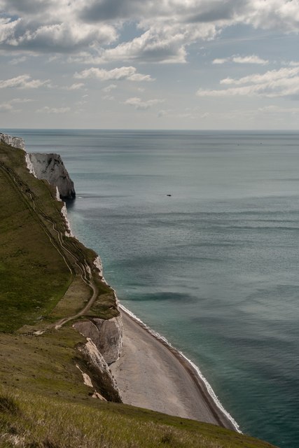
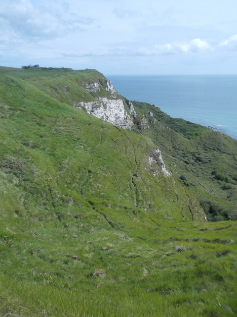
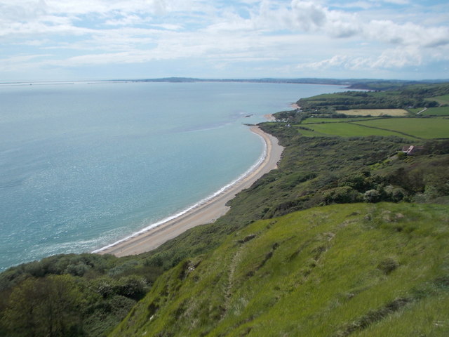
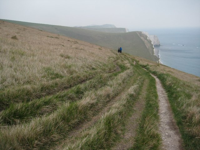
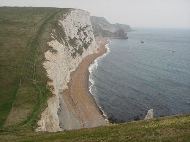
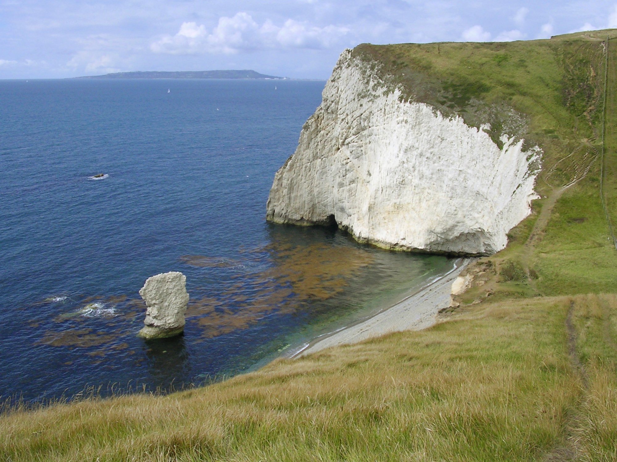
West Bottom is a valley located in the picturesque county of Dorset, England. Situated on the western side of the county, it is known for its stunning natural beauty and tranquil surroundings. The valley is nestled between rolling hills and is surrounded by lush green countryside, making it a popular destination for nature lovers and hikers.

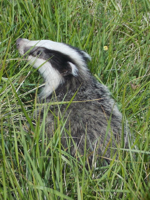
The landscape of West Bottom is characterized by its meandering river, which flows through the heart of the valley, creating a serene and peaceful atmosphere. The river is lined with trees and wildflowers, further enhancing the scenic beauty of the area. The valley is also home to a variety of wildlife, including birds, small mammals, and insects, making it a haven for nature enthusiasts and wildlife photographers.

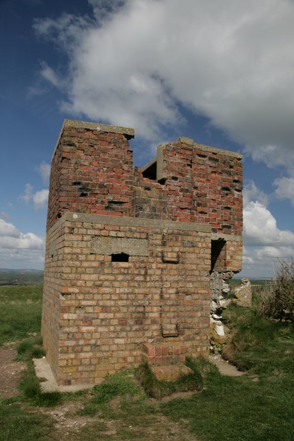
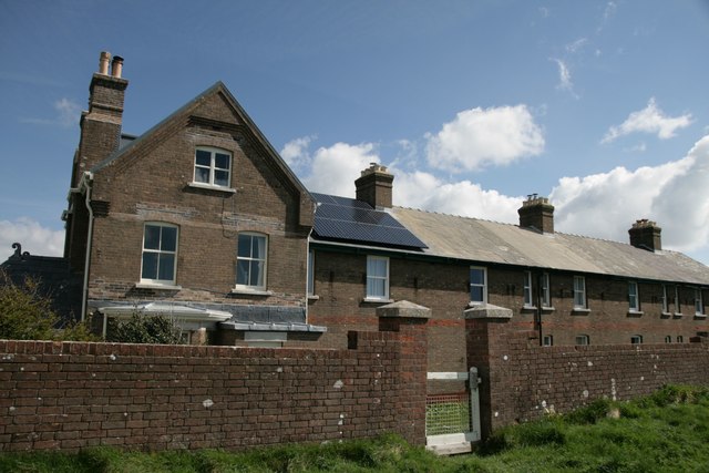
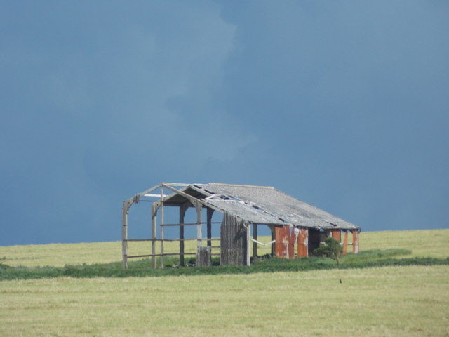
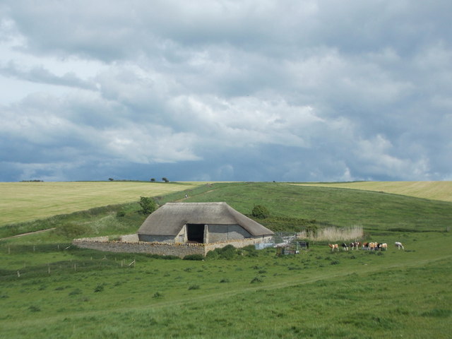
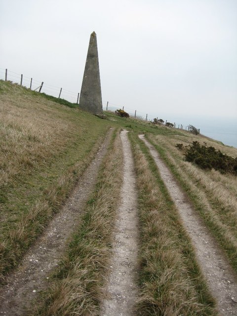
In addition to its natural beauty, West Bottom has a rich history dating back centuries. The valley was once home to a thriving farming community, with evidence of ancient settlements and agricultural practices still visible today. Visitors to the area can explore historic buildings, such as old farmhouses and barns, which provide a glimpse into the region's past.

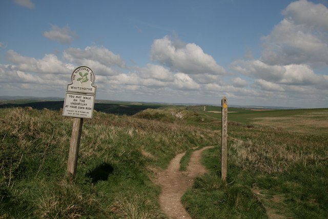
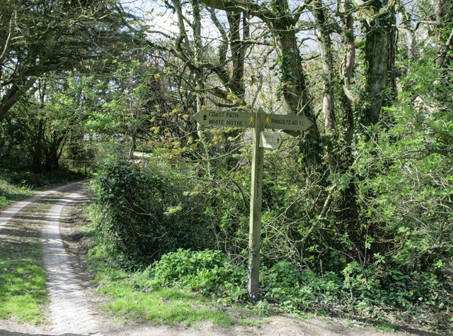
For those seeking outdoor activities, West Bottom offers numerous walking trails and bridle paths, allowing visitors to fully immerse themselves in the stunning surroundings. The valley is also an ideal spot for picnicking, with several designated picnic areas offering breathtaking views of the countryside.

Overall, West Bottom in Dorset is a hidden gem, offering a peaceful retreat from the hustle and bustle of modern life. With its natural beauty, rich history, and abundance of outdoor activities, it is a must-visit destination for anyone seeking a true taste of rural England.

If you have any feedback on the listing, please let us know in the comments section below.

West Bottom Images

Images are sourced within 2km of 50.626691/-2.3113289 or Grid Reference SY7880. Thanks to Geograph Open Source API. All images are credited.

Coastline in Ringstead Bay
Descending to Middle Bottom
National Trust sign at Whitenothe
Signpost on South-west Coast Path
View west from Swyre Head Portland in the distance. Bat's Head in the foreground.
View west from Swyre Head
Portland in the distance. Bat's Head in the foreground.
Whitenothe Pillbox
Whitenothe Pillbox
Between West and Middle Bottom on the SW Coast path Bat's Head in the distance.
Between West and Middle Bottom on the SW Coast path
Bat's Head in the distance.
Whitenothe Cottages Once the coastguard cottages.
Whitenothe Cottages
Once the coastguard cottages.
Holworth: a derelict barn Looking along the northern edge of this square towards a decrepit looking barn on Brimstone Bottom. The darkish clouds look threatening but in fact the sunny appearance of the ground was far more representative of today's lovely weather - I don't think it rained all day nearby.
Holworth: a derelict barn
Looking along the northern edge of this square towards a decrepit looking barn on Brimstone Bottom. The darkish clouds look threatening but in fact the sunny appearance of the ground was far more representative of today's lovely weather - I don't think it rained all day nearby.
Holworth: a thatched barn A well built barn, a contrast to the sorry state of the one beyond but just out of sight to our left, <a href="https://www.geograph.org.uk/photo/4963779">SY7681 : Holworth: a derelict barn</a>.
Holworth: a thatched barn
A well built barn, a contrast to the sorry state of the one beyond but just out of sight to our left, SY7681 : Holworth: a derelict barn.
Holworth: the grassy cliffs of White Nothe The undulating landscape blurs the boundary between the cliff top and the cliff face, no doubt as a result of gradual slips. The white chalk cliff face, that gives the headland half of its name, is apparent beyond but in fact better appreciated from more distant viewpoints.
Holworth: the grassy cliffs of White Nothe
The undulating landscape blurs the boundary between the cliff top and the cliff face, no doubt as a result of gradual slips. The white chalk cliff face, that gives the headland half of its name, is apparent beyond but in fact better appreciated from more distant viewpoints.
Holworth: a badger on White Nothe cliffs This little chap was rummaging around the grassy slopes of White Nothe, not too bothered by my approach, although he did wander off once I was within a few feet.
Holworth: a badger on White Nothe cliffs
This little chap was rummaging around the grassy slopes of White Nothe, not too bothered by my approach, although he did wander off once I was within a few feet.
Holworth: the slopes of White Nothe drop down to Ringstead Bay Looking west from the cliff top at White Nothe - in this direction the cliffs are more like a grassy slope, although there are sheer, white chalk cliff faces behind us.

The land drops down to the shingle beach of Ringstead Bay, while the coastline continues in the background to Weymouth (the town centre is just right of centre) and Portland Harbour (the harbour walls can be seen far-left).
Holworth: the slopes of White Nothe drop down to Ringstead Bay
Looking west from the cliff top at White Nothe - in this direction the cliffs are more like a grassy slope, although there are sheer, white chalk cliff faces behind us. The land drops down to the shingle beach of Ringstead Bay, while the coastline continues in the background to Weymouth (the town centre is just right of centre) and Portland Harbour (the harbour walls can be seen far-left).
West Chaldon: postbox bristles Detail of the posting slot on <a href="https://www.geograph.org.uk/photo/1415411">SY7782 : West Chaldon: postbox № DT2 11</a>.

Bristles have been attached to prevent snails from getting inside. Apparently they do not like the bristles tickling their undersides. The practice originated in November 2000 in the West Country, where the problem was particularly prevalent - especially with boxes set into walls with ivy or similar vegetation growing up around them.

As you can see, a couple of snails are in the immediate vicinity of the slot.
West Chaldon: postbox bristles
Detail of the posting slot on SY7782 : West Chaldon: postbox № DT2 11. Bristles have been attached to prevent snails from getting inside. Apparently they do not like the bristles tickling their undersides. The practice originated in November 2000 in the West Country, where the problem was particularly prevalent - especially with boxes set into walls with ivy or similar vegetation growing up around them. As you can see, a couple of snails are in the immediate vicinity of the slot.
Coast path above West Bottom The South West Coast Path above West Bottom.  A stone on the left indicates the distance to various places including Lulworth Cove and Durdle Door.
Coast path above West Bottom
The South West Coast Path above West Bottom. A stone on the left indicates the distance to various places including Lulworth Cove and Durdle Door.
Beacon above West Bottom Beacon beside the South West Coast Path above West Bottom.  Presumably the beacon is a navigation guide for shipping in the past.
Beacon above West Bottom
Beacon beside the South West Coast Path above West Bottom. Presumably the beacon is a navigation guide for shipping in the past.
Coast path above West Bottom The South West Coast Path on its descent to Middle Bottom pictured here above West Bottom.
Coast path above West Bottom
The South West Coast Path on its descent to Middle Bottom pictured here above West Bottom.
View to Swyre Head View to Swyre Head from Bat's Head, Durdle Door can be seen in the distance.
View to Swyre Head
View to Swyre Head from Bat's Head, Durdle Door can be seen in the distance.
Show me another place!

West Bottom is located at Grid Ref: SY7880 (Lat: 50.626691, Lng: -2.3113289)

Unitary Authority: Dorset

Police Authority: Dorset

What 3 Words

///bunny.parks.pickup. Near Overcombe, Dorset

Nearby Locations

West Bottom Middle Bottom

Related Wikis

Chaldon Hill

Chaldon Hill, also called Chaldon Down, is one of the highest hills, 178 metres (584 ft), on South Dorset's Jurassic Coast in England. The summit is about...

White Nothe

White Nothe (meaning "White Nose") is a chalk headland on the English Channel coast at the eastern end of Ringstead Bay, east of Weymouth in Dorset, England...

Bat's Head

Bat's Head is a chalk headland on the Dorset coast in southern England, located between Swyre Head and Durdle Door to the east, and Chaldon Hill and White...

Swyre Head, Lulworth

Swyre Head, Lulworth is a hill and sea cliff which lies on the Jurassic Coast between Bat's Head to the west and Durdle Door to the east, close to Lulworth...

Nearby Amenities

Located within 500m of 50.626691,-2.3113289
Source: PGS
Lat/Long: 50.625364/-2.3177952
Source: PGS
Lat/Long: 50.6252068/-2.3176021
Source: PGS
Lat/Long: 50.6254011/-2.316783
Source: PGS
Lat/Long: 50.6255107/-2.3159864
Source: PGS
Lat/Long: 50.6253581/-2.3146347
Source: PGS
Lat/Long: 50.6255895/-2.3137013
Source: PGS
Lat/Long: 50.6255963/-2.3131434
Source: PGS
Lat/Long: 50.6256508/-2.312371
Source: PGS
Lat/Long: 50.625746/-2.3115985
Source: PGS
Lat/Long: 50.6257052/-2.310944
Source: PGS
Lat/Long: 50.6256576/-2.3104076
Source: PGS
Lat/Long: 50.6255759/-2.3096887
Source: PGS
Lat/Long: 50.6255419/-2.3087232
Source: PGS
Lat/Long: 50.6254057/-2.3077254
Source: PGS
Lat/Long: 50.6253785/-2.3068027
Source: PGS
Lat/Long: 50.6252492/-2.3049466
Barrier: kissing_gate
Foot: yes
Lat/Long: 50.6268929/-2.3148015
Ele: 178
Man Made: survey_point
Natural: peak
Lat/Long: 50.6305458/-2.3084253
Man Made: beacon
Lat/Long: 50.6274731/-2.3096313
Tourism: artwork
Lat/Long: 50.6290138/-2.3058621
Tourism: artwork
Lat/Long: 50.62899/-2.3063931
Tourism: artwork
Lat/Long: 50.6289866/-2.3068652
Barrier: kissing_gate
Lat/Long: 50.627816/-2.3111094
Barrier: kissing_gate
Source: survey;gps
Lat/Long: 50.628629/-2.3123237
The data included in this document is from www.openstreetmap.org. The data is made available under ODbL.

Have you been to West Bottom?

Leave your review of West Bottom below (or comments, questions and feedback).