Cow Cleugh

Valley in Northumberland

England

Cow Cleugh

Sheepfold beside Fool Sike In Canker Cleugh.
Sheepfold beside Fool Sike Credit: Russel Wills

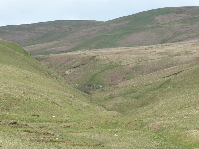
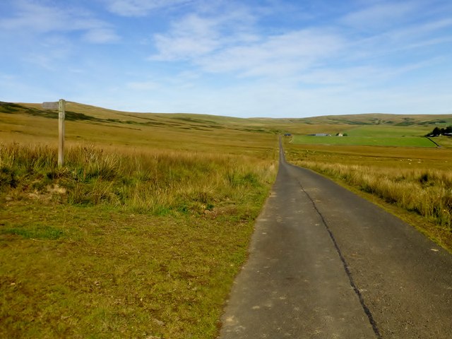
Cow Cleugh is a picturesque valley located in Northumberland, England. Nestled amidst the scenic Northumberland National Park, it offers a serene and idyllic retreat for nature lovers and hikers. The valley is named after the small river that runs through it, known as Cow Cleugh Burn.

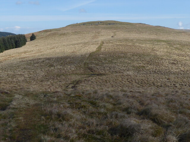
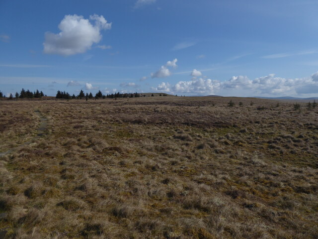
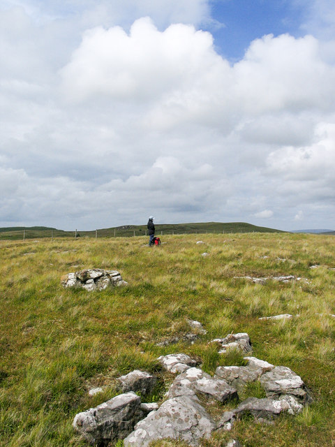
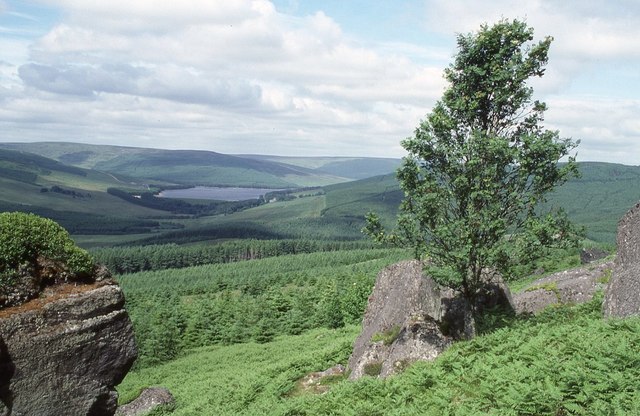
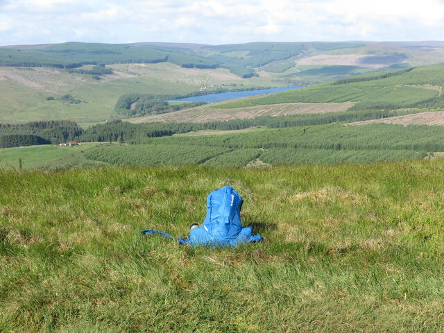
Surrounded by rolling hills and lush greenery, Cow Cleugh boasts stunning panoramic views of the surrounding countryside. The valley is home to an abundance of wildlife, including various species of birds, mammals, and plant life, making it a popular spot for birdwatching and nature enthusiasts.

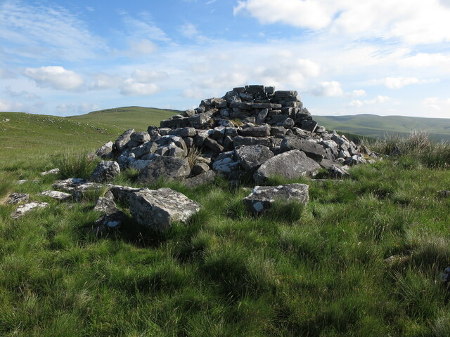
The area is known for its rich history, with evidence of human activity dating back to the Bronze Age. There are several ancient stone circles and burial sites scattered throughout the valley, adding to its cultural significance.

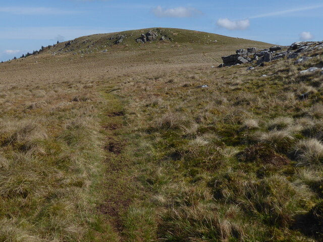
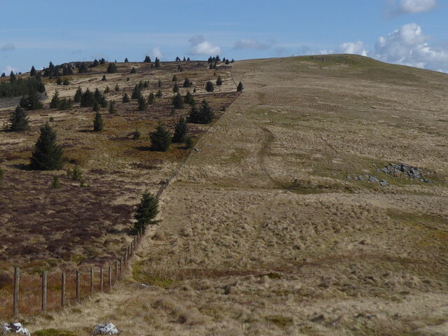
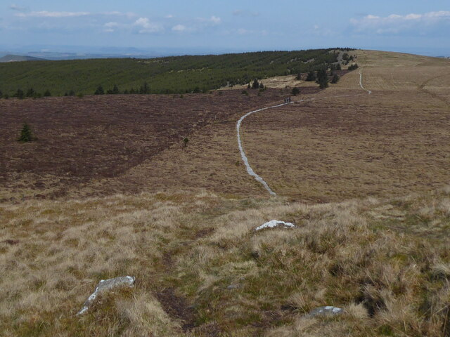
Visitors to Cow Cleugh can explore the numerous walking trails that crisscross the valley, offering varying levels of difficulty and length. These trails provide opportunities to discover hidden waterfalls, ancient woodlands, and breathtaking vistas. One of the most popular routes is the Cow Cleugh Circular Walk, which takes hikers on a journey through the heart of the valley and offers a chance to spot local wildlife.

The valley is also a haven for photographers, with its ever-changing scenery and dramatic landscapes providing endless opportunities for capturing stunning images. Whether it's the vibrant colors of autumn or the tranquil beauty of a winter's morning, Cow Cleugh offers a truly enchanting experience for all who visit.

If you have any feedback on the listing, please let us know in the comments section below.
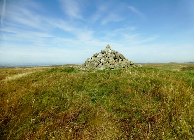
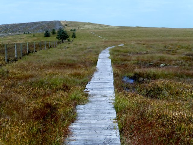
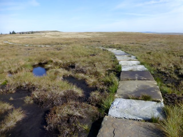
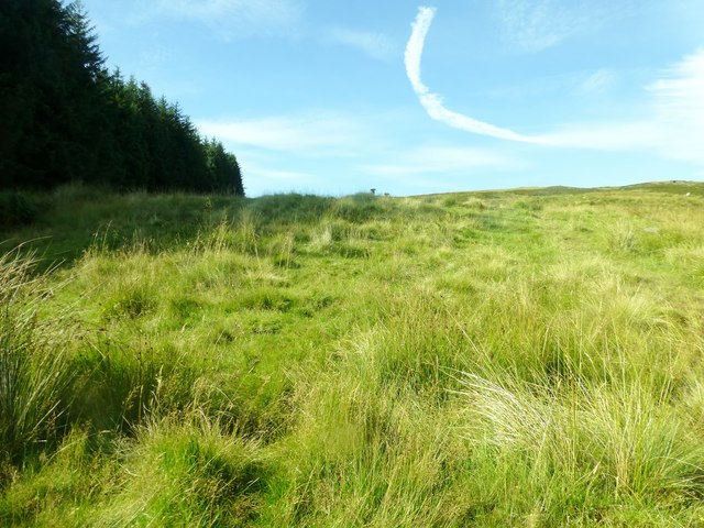
Cow Cleugh Images

Images are sourced within 2km of 55.337776/-2.347069 or Grid Reference NT7804. Thanks to Geograph Open Source API. All images are credited.

Sheepfold beside Fool Sike In Canker Cleugh.
Sheepfold beside Fool Sike
In Canker Cleugh.
Spithope Bothy This small basic hiking shelter is cared for by the Mountain Bothies Association with permission of the landowner. The sign on the door is regarding "Bothy Watch", a police initiative to help prevent misuse of these volunteer maintained facilities.
Spithope Bothy
This small basic hiking shelter is cared for by the Mountain Bothies Association with permission of the landowner. The sign on the door is regarding "Bothy Watch", a police initiative to help prevent misuse of these volunteer maintained facilities.
View from the Pennine Way on Byrness Hill
The Pennine Way near Saughy Crag
The Pennine Way near Green Crag
The Pennine Way near Windy Crag
The Pennine Way near Ravens Pike
Ravens Knowe Bagged with Adrian Dust after parking at Carter Bar. Wooplaw Edge, Leap Hill, Hungry Law, Greyhound Law and then Ravens Knowe before heading to the Cottonshope road to walk back to collect Dusty's car from the campsite opposite this road beside the A68.
Name: Ravens Knowe
Hill number: 3553
Height: 527m / 1729ft
Parent (Ma/M): 2302  The Cheviot
Section: 33: The Scottish Border to the River Tyne
Area: The Cheviots
County/UA: Northumberland (CoU)
Class: Dewey
Grid ref: NT 78017 06211
Summit feature: large cairn
Drop: 34m
Col: 493m  NT778072
Ravens Knowe
Bagged with Adrian Dust after parking at Carter Bar. Wooplaw Edge, Leap Hill, Hungry Law, Greyhound Law and then Ravens Knowe before heading to the Cottonshope road to walk back to collect Dusty's car from the campsite opposite this road beside the A68. Name: Ravens Knowe Hill number: 3553 Height: 527m / 1729ft Parent (Ma/M): 2302 The Cheviot Section: 33: The Scottish Border to the River Tyne Area: The Cheviots County/UA: Northumberland (CoU) Class: Dewey Grid ref: NT 78017 06211 Summit feature: large cairn Drop: 34m Col: 493m NT778072
Boardwalk Looking Northward Towards Ogre Hill This boardwalk takes the Pennine Way across some very boggy ground between Ravens Knowe and Ogre Hill.
Boardwalk Looking Northward Towards Ogre Hill
This boardwalk takes the Pennine Way across some very boggy ground between Ravens Knowe and Ogre Hill.
Flagstone Path A flagstone path prevents soil erosion and makes for a very narrow path across boggy moorland here with a distant view towards Ravens Knowe.
Flagstone Path
A flagstone path prevents soil erosion and makes for a very narrow path across boggy moorland here with a distant view towards Ravens Knowe.
Grassy Footpath A view up this grassy footpath over the moorland between the Cottonshope Road in the higher Pennine Way up this hill.
Grassy Footpath
A view up this grassy footpath over the moorland between the Cottonshope Road in the higher Pennine Way up this hill.
Cottonshope Road A view up the Cottonshope Road at the point where the footpath towards the Pennine Way goes off to the left. This minor road can be used as a short cut into the Coquet Valley when there is no firing on the Otterburn Ranges.
Cottonshope Road
A view up the Cottonshope Road at the point where the footpath towards the Pennine Way goes off to the left. This minor road can be used as a short cut into the Coquet Valley when there is no firing on the Otterburn Ranges.
Ordnance Survey Cut Mark This OS cut mark can be found on the west parapet of the Hollin Burn Bridge. It marks a point 272.150m above mean sea level.
Ordnance Survey Cut Mark
This OS cut mark can be found on the west parapet of the Hollin Burn Bridge. It marks a point 272.150m above mean sea level.
Minor rocks outcropping close to 491 metre top The walker is at, or very close to the summit at 491 metres top of Windy Crag. Ravens Knowe lies in the distance.
Minor rocks outcropping close to 491 metre top
The walker is at, or very close to the summit at 491 metres top of Windy Crag. Ravens Knowe lies in the distance.
View to Catcleugh Reservoir View to the west from the Pennine Way on Byrness Hill to Catceugh Reservoir which can be seen in the distant valley.
View to Catcleugh Reservoir
View to the west from the Pennine Way on Byrness Hill to Catceugh Reservoir which can be seen in the distant valley.
Cairn, Byrness Hill This cairn marks the top of Byrness Hill the first hill on what is normally the final leg of the Pennine Way heading north. The views over Redesdale and Catcleugh Reservoir are impressive. For a selection of detailed free to download walking routes in the area visit <span class="nowrap"><a title="www.cheviotwalks.co.uk" rel="nofollow ugc noopener" href="http://www.cheviotwalks.co.uk">Link</a><img style="margin-left:2px;" alt="External link" title="External link - shift click to open in new window" src="https://s1.geograph.org.uk/img/external.png" width="10" height="10"/></span>
Cairn, Byrness Hill
This cairn marks the top of Byrness Hill the first hill on what is normally the final leg of the Pennine Way heading north. The views over Redesdale and Catcleugh Reservoir are impressive. For a selection of detailed free to download walking routes in the area visit LinkExternal link
Houx Hill near Byrness The sac lies close to the top of Houx Hill which enjoys superb views over Redesdale and the Catcleugh Reservoir. For a selection of detailed free to download walking routes in the area visit <span class="nowrap"><a title="www.cheviotwalks.co.uk" rel="nofollow ugc noopener" href="http://www.cheviotwalks.co.uk">Link</a><img style="margin-left:2px;" alt="External link" title="External link - shift click to open in new window" src="https://s1.geograph.org.uk/img/external.png" width="10" height="10"/></span>
Houx Hill near Byrness
The sac lies close to the top of Houx Hill which enjoys superb views over Redesdale and the Catcleugh Reservoir. For a selection of detailed free to download walking routes in the area visit LinkExternal link
Show me another place!

Cow Cleugh is located at Grid Ref: NT7804 (Lat: 55.337776, Lng: -2.347069)

Unitary Authority: Northumberland

Police Authority: Northumbria

What 3 Words

///collide.technical.copper. Near Rochester, Northumberland

Nearby Locations

Cow Cleugh

Related Wikis

Byrness

Byrness is a village within Rochester civil parish in Northumberland, England. It is approximately 37 miles (60 km) north-west of Newcastle upon Tyne on...

Cottonshopeburnfoot

Cottonshopeburnfoot is a hamlet in Redesdale in Northumberland, England. It lies on the A68 road, 2 miles south east of the village of Byrness. The hamlet...

Featherwood Roman Camps

Featherwood Roman Camps are neighbouring archaeological sites in Northumberland, England, 1 mile (1.6 km) north of Featherwood and about 3 miles (5 km...

Chew Green

Chew Green is the site of the ancient Roman encampment, commonly but erroneously called Ad Fines (Latin: The Limits) on the 1885-1900 edition of the Ordnance...

Related Videos

EP 22 Blakehopeburnhaugh to Rochester - The Grand Tour of Northumberland

1st August 2020 Join us on our walk of historic Northumberland as we continue our hike. Packed full of history and beautiful ...

Redesdale Faiths

Today were up near Carter Bar on the Scottish Border at Redesdale in Northern Northumbia. We will be looking at a two religious ...

Have you been to Cow Cleugh?

Leave your review of Cow Cleugh below (or comments, questions and feedback).