The Grove

Wood, Forest in Kent

England

The Grove

London Loop footpath climbing A2 embankment The footpath uses the A2 bridge to cross the railway line.
London Loop footpath climbing A2 embankment Credit: David Martin

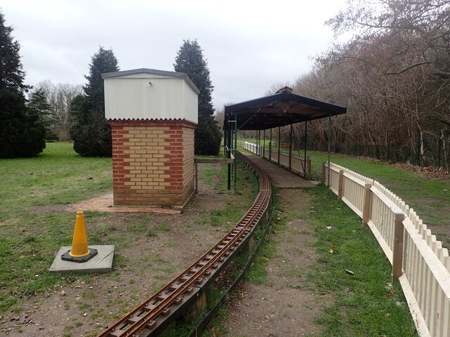
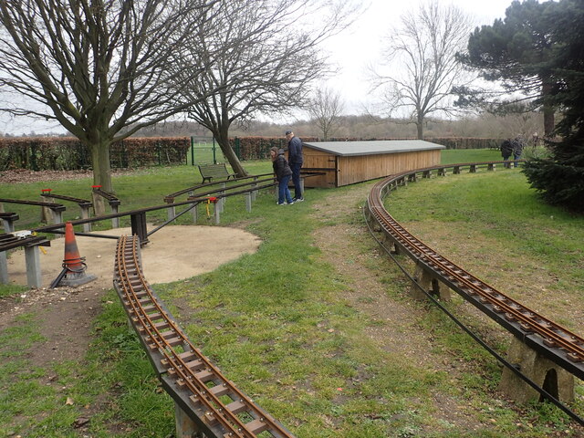
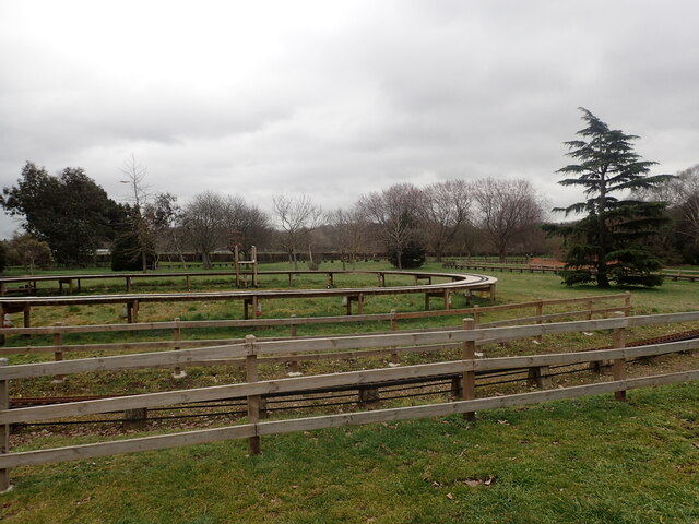
The Grove, located in Kent, is a picturesque woodland area known for its natural beauty and rich diversity of flora and fauna. This enchanting forest covers an area of approximately 200 acres and is a popular destination for nature lovers and outdoor enthusiasts alike.

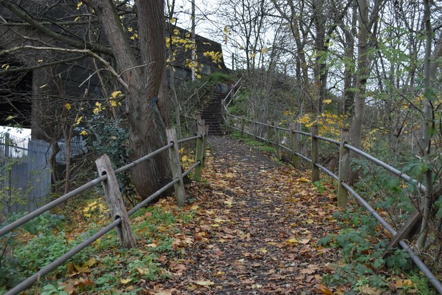
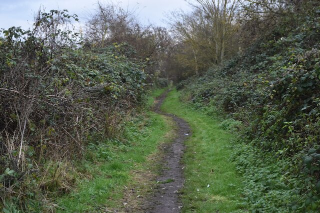
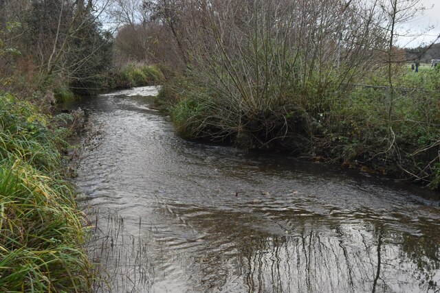
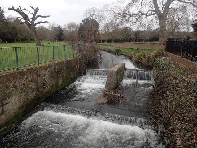
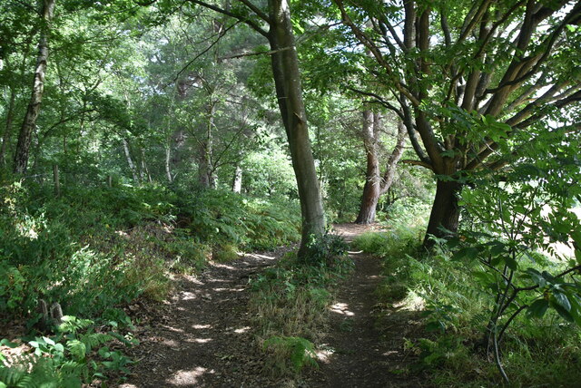
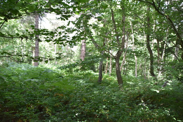
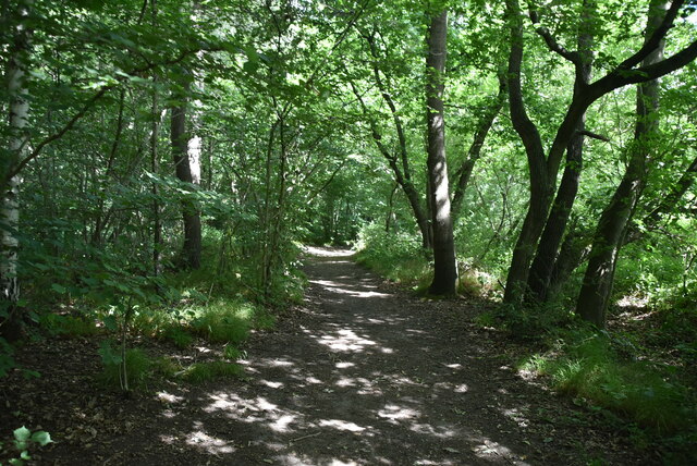
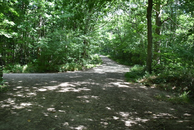
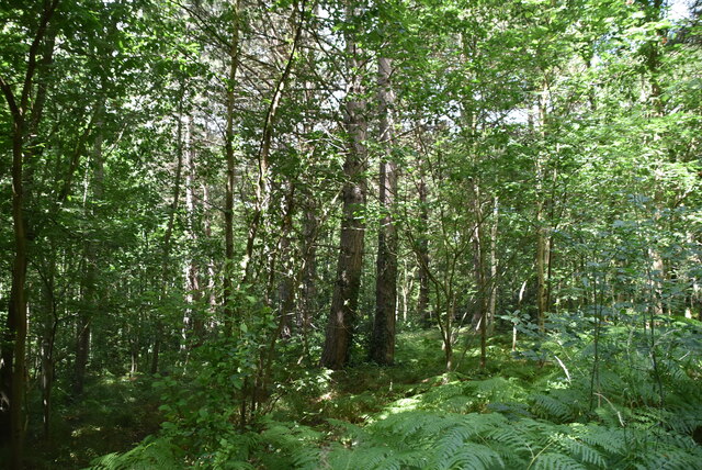
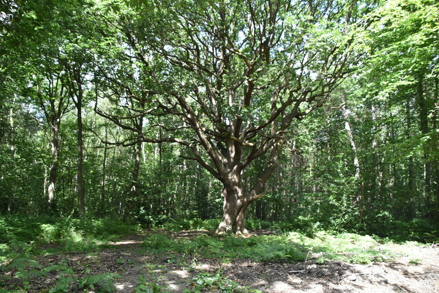
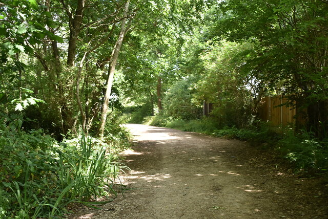
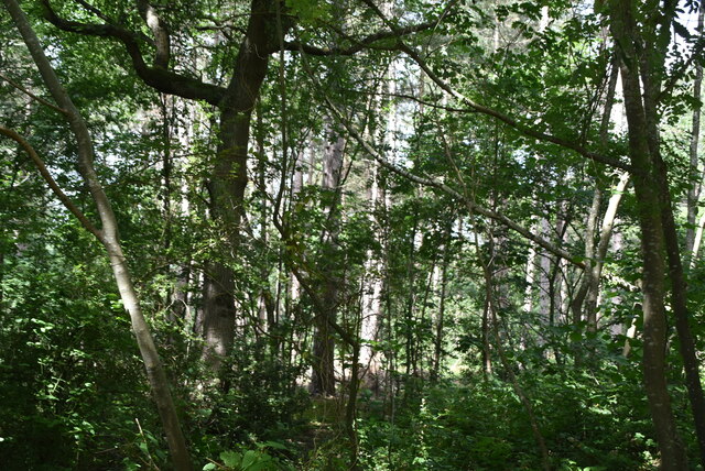
The Grove is characterized by its dense canopy of towering trees, including oak, beech, and chestnut, which provide ample shade and a serene atmosphere. The forest floor is adorned with a vibrant carpet of wildflowers, ferns, and mosses, adding to its magical appeal. The natural beauty of The Grove is further enhanced by the presence of a meandering river that gently flows through the heart of the woodland, offering a tranquil spot for visitors to relax and enjoy the peaceful surroundings.

The wildlife in The Grove is abundant, with a wide range of species calling this forest home. Visitors may spot deer, foxes, rabbits, and various bird species, including owls, woodpeckers, and songbirds. The Grove's diverse ecosystem also supports a plethora of insects, butterflies, and other small creatures, making it a haven for wildlife enthusiasts and photographers.

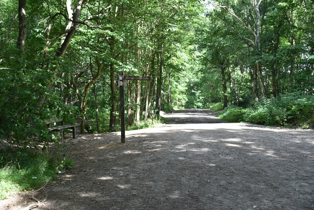
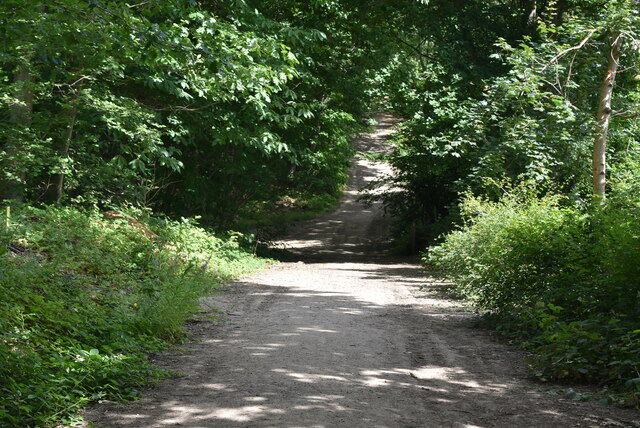
The Grove is a haven for outdoor activities, with numerous walking trails and cycling paths crisscrossing through the forest. These well-maintained trails offer visitors the opportunity to explore the woodland at their own pace and discover its hidden gems. Additionally, The Grove provides designated picnic areas and open spaces, inviting visitors to enjoy a leisurely lunch or indulge in a game of frisbee or football with friends and family.

Overall, The Grove in Kent is a captivating woodland retreat, offering a peaceful escape from the hustle and bustle of daily life. Its stunning natural scenery, diverse wildlife, and recreational opportunities make it a must-visit destination for nature enthusiasts and those seeking tranquility in the heart of nature.

If you have any feedback on the listing, please let us know in the comments section below.

The Grove Images

Images are sourced within 2km of 51.434343/0.14853331 or Grid Reference TQ4972. Thanks to Geograph Open Source API. All images are credited.

London Loop footpath climbing A2 embankment The footpath uses the A2 bridge to cross the railway line.
London Loop footpath climbing A2 embankment
The footpath uses the A2 bridge to cross the railway line.
Path beside the railway at Braeburn Park Nature reserve south of the Dartford Loop Line.
Path beside the railway at Braeburn Park
Nature reserve south of the Dartford Loop Line.
River Cray at Hall Place
Miniature railway at Hall Place The Welling & District Model Engineering Society moved their layout from their previous location at Falconwood to Hall Place & Gardens in 2022. This is the station.
Miniature railway at Hall Place
The Welling & District Model Engineering Society moved their layout from their previous location at Falconwood to Hall Place & Gardens in 2022. This is the station.
Miniature railway at Hall Place The Welling & District Model Engineering Society moved their layout from their previous location at Falconwood to Hall Place & Gardens in 2022.
Miniature railway at Hall Place
The Welling & District Model Engineering Society moved their layout from their previous location at Falconwood to Hall Place & Gardens in 2022.
Miniature railway at Hall Place The Welling & District Model Engineering Society moved their layout from their previous location at Falconwood to Hall Place & Gardens in 2022. This photograph gives some idea of the size of the layout.
Miniature railway at Hall Place
The Welling & District Model Engineering Society moved their layout from their previous location at Falconwood to Hall Place & Gardens in 2022. This photograph gives some idea of the size of the layout.
River Cray at Hall Place The River Cray is a very clean chalk stream with natural banks for much of its length. It is followed throughout its course in Bexley by the Cray Riverway. This view looks upriver at Hall Place.
River Cray at Hall Place
The River Cray is a very clean chalk stream with natural banks for much of its length. It is followed throughout its course in Bexley by the Cray Riverway. This view looks upriver at Hall Place.
Joydens Wood A Woodland Trust site in Dartford borough, opened to the public in 1988.  Close to the A2 and A20 trunk roads,this remains a natural ancient woodland and contains visible remains of the ancient "Faesten Dic" (strong dyke), an Anglo-Saxon (or possibly older) defensive ditch.  It is approximately 130 hectares in area and contains many tracks and paths; the main tracks are open to horses and cyclists.
Joydens Wood
A Woodland Trust site in Dartford borough, opened to the public in 1988. Close to the A2 and A20 trunk roads,this remains a natural ancient woodland and contains visible remains of the ancient "Faesten Dic" (strong dyke), an Anglo-Saxon (or possibly older) defensive ditch. It is approximately 130 hectares in area and contains many tracks and paths; the main tracks are open to horses and cyclists.
joydens Wood A Woodland Trust site in Dartford borough, opened to the public in 1988.  Close to the A2 and A20 trunk roads,this remains a natural ancient woodland and contains visible remains of the ancient "Faesten Dic" (strong dyke), an Anglo-Saxon (or possibly older) defensive ditch.  It is approximately 130 hectares in area and contains many tracks and paths; the main tracks are open to horses and cyclists.
joydens Wood
A Woodland Trust site in Dartford borough, opened to the public in 1988. Close to the A2 and A20 trunk roads,this remains a natural ancient woodland and contains visible remains of the ancient "Faesten Dic" (strong dyke), an Anglo-Saxon (or possibly older) defensive ditch. It is approximately 130 hectares in area and contains many tracks and paths; the main tracks are open to horses and cyclists.
Joydens Wood A Woodland Trust site in Dartford borough, opened to the public in 1988.  Close to the A2 and A20 trunk roads,this remains a natural ancient woodland and contains visible remains of the ancient "Faesten Dic" (strong dyke), an Anglo-Saxon (or possibly older) defensive ditch.  It is approximately 130 hectares in area and contains many tracks and paths; the main tracks are open to horses and cyclists.
Joydens Wood
A Woodland Trust site in Dartford borough, opened to the public in 1988. Close to the A2 and A20 trunk roads,this remains a natural ancient woodland and contains visible remains of the ancient "Faesten Dic" (strong dyke), an Anglo-Saxon (or possibly older) defensive ditch. It is approximately 130 hectares in area and contains many tracks and paths; the main tracks are open to horses and cyclists.
Show me another place!

The Grove is located at Grid Ref: TQ4972 (Lat: 51.434343, Lng: 0.14853331)

Unitary Authority: Bexley

Police Authority: Metropolitan

What 3 Words

///league.trap.admits. Near Bexley, London

Related Wikis

Bexley railway station

Bexley railway station is in the London Borough of Bexley in south-east London, in Travelcard Zone 6. It is 13 miles 69 chains (22.3 km) down the line...

Bexley

Bexley is an area of south-eastern Greater London, England and part of the London Borough of Bexley. It is sometimes known as Bexley Village or Old Bexley...

Loring Hall

Loring Hall is a private mental health care facility in North Cray, London Borough of Bexley. Formerly known as Wollet Hall or Woollet Hall, it is a Grade...

King's Head, Bexley

The King's Head is a pub at 65 Bexley High Street, Bexley, London. It is a Grade II listed building, dating back to the 16th or early 17th century. �...

Joyden's Wood

Joyden's Wood is an area of ancient woodland that straddles the border between the London Borough of Bexley in South East London and the Borough of Dartford...

Bexley F.C.

Bexley Football Club is a football club based in Bexley, London, England. They are currently members of the Kent County League Division One West. ��2...

Coldblow

Coldblow is a village in South East London within the London Borough of Bexley. It is located south east of Bexleyheath and south west of Dartford, adjacent...

Black Prince, Bexley

The Black Prince is a hotel in the London Borough of Bexley, contained in a landscaped part of the intersection of the A2 dual carriageway. The intersection...

Nearby Amenities

Located within 500m of 51.434343,0.14853331
Height: 0.8
Waterway: weir
Lat/Long: 51.4361614/0.1471115
Barrier: kissing_gate
Lat/Long: 51.4331347/0.1511352
Barrier: stile
Foot: yes
Lat/Long: 51.4331528/0.1511057
Bus Stop
Mount Mascal Farm
Bus: yes
Naptan AtcoCode: 490010083N
Naptan Bearing: N
Naptan CommonName: Mount Mascal Farm
Naptan Street: NORTH CRAY ROAD
Naptan Verified: no
Network: London Buses
Operator: Transport for London
Public Transport: platform
Ref: 51359
Lat/Long: 51.4345794/0.1461243
Bus Stop
Mount Mascal Farm
Bus: yes
Naptan AtcoCode: 490010083S
Naptan Bearing: N
Naptan CommonName: Mount Mascal Farm
Naptan Street: NORTH CRAY ROAD
Naptan Verified: no
Network: London Buses
Public Transport: platform
Ref: 76781
Lat/Long: 51.4344412/0.1463049
Bus Stop
North Cray Road / Vicarage Road
Bus: yes
Local Ref: L
Naptan AtcoCode: 490014042L
Naptan Bearing: N
Naptan CommonName: North Cray Road Vicarage Road
Naptan Indicator: L
Naptan Verified: no
Network: London Buses
Network Wikidata: Q1192411
Public Transport: platform
Ref: 76500
Lat/Long: 51.4378839/0.1513011
Barrier: stile
Material: wood
Lat/Long: 51.4307059/0.1474587
Design: barrel
Power: tower
Lat/Long: 51.4334757/0.1546286
Design: barrel
Power: tower
Lat/Long: 51.4338143/0.1553426
Design: barrel
Power: tower
Lat/Long: 51.4345047/0.1542812
Design: barrel
Power: tower
Lat/Long: 51.4352562/0.1496211
Design: barrel
Power: tower
Lat/Long: 51.4363426/0.1426174
Design: barrel
Power: tower
Lat/Long: 51.4370078/0.1469225
Power: transformer
Lat/Long: 51.4332183/0.154915
Power: transformer
Lat/Long: 51.4330152/0.1539011
Power: transformer
Lat/Long: 51.4337125/0.1538985
Give Way
Lat/Long: 51.4358574/0.1481968
Give Way
Lat/Long: 51.4356056/0.1478634
North Cray Road / Vicarage Road
Bus: yes
Network: London Buses
Public Transport: stop_position
Lat/Long: 51.4378574/0.1513554
Mount Mascal Farm
Bus: yes
Network: London Buses
Public Transport: stop_position
Lat/Long: 51.4344719/0.1462601
Mount Mascal Farm
Bus: yes
Network: London Buses
Operator: Transport for London
Public Transport: stop_position
Lat/Long: 51.4345527/0.1461656
Barrier: swing_gate
Height: 1.5
Material: metal
Lat/Long: 51.4361967/0.1472459
Crossing
Lat/Long: 51.4357637/0.1490546
Barrier: kissing_gate
Material: wood
Width: 0.5
Lat/Long: 51.4303423/0.1508986
Crossing
Crossing: uncontrolled
Lat/Long: 51.4341015/0.1549075
The data included in this document is from www.openstreetmap.org. The data is made available under ODbL.

Have you been to The Grove?

Leave your review of The Grove below (or comments, questions and feedback).