Cray, North

Settlement in Kent

England

Cray, North

Entering Joyden Wood A Woodland Trust site in Dartford borough, opened to the public in 1988.  Close to the A2 and A20 trunk roads,this remains a natural ancient woodland and contains visible remains of the ancient "Faesten Dic" (strong dyke), an Anglo-Saxon (or possibly older) defensive ditch.  It is approximately 130 hectares in area and contains many tracks and paths; the main tracks are open to horses and cyclists.
Entering Joyden Wood Credit: N Chadwick

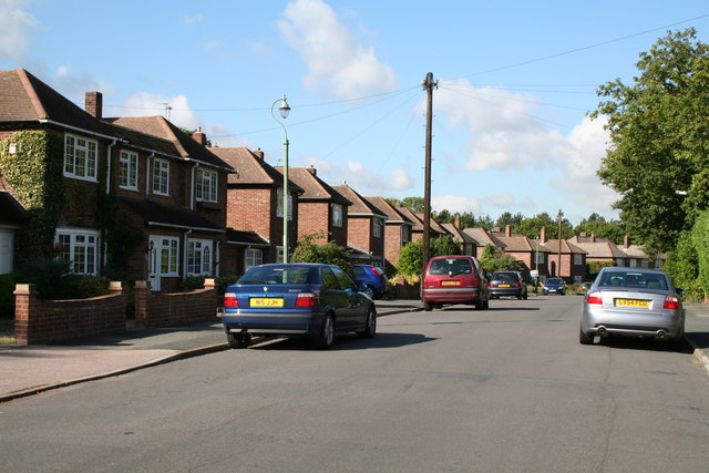
Cray is a small village located in the county of Kent, in the southeastern region of England. Situated in the district of Sevenoaks, Cray is part of a cluster of villages known as the Cray Valley. It is specifically positioned in the northern part of the valley, hence the name Cray North.

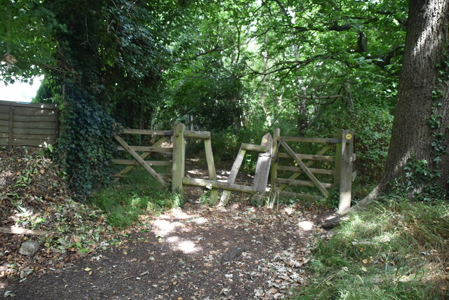
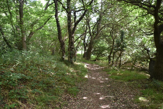
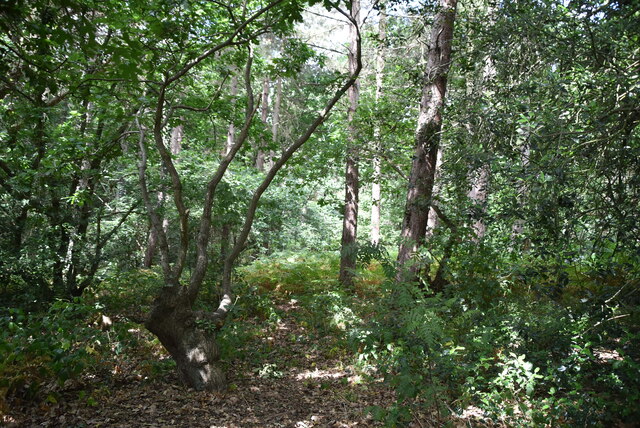
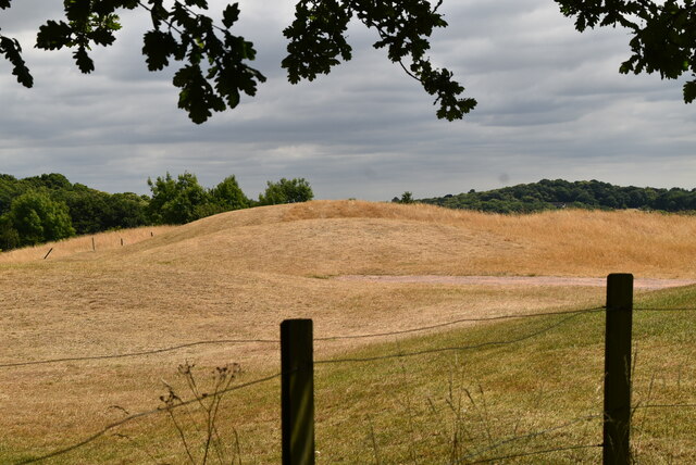
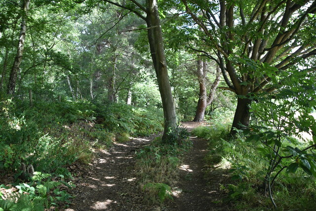
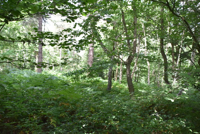
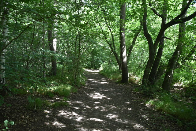
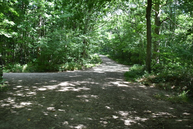
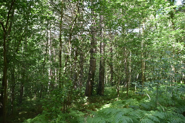
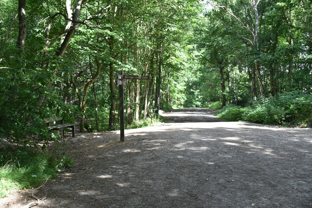
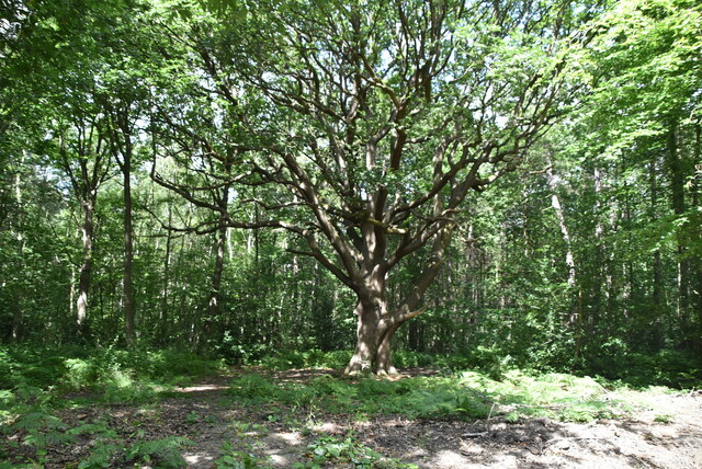
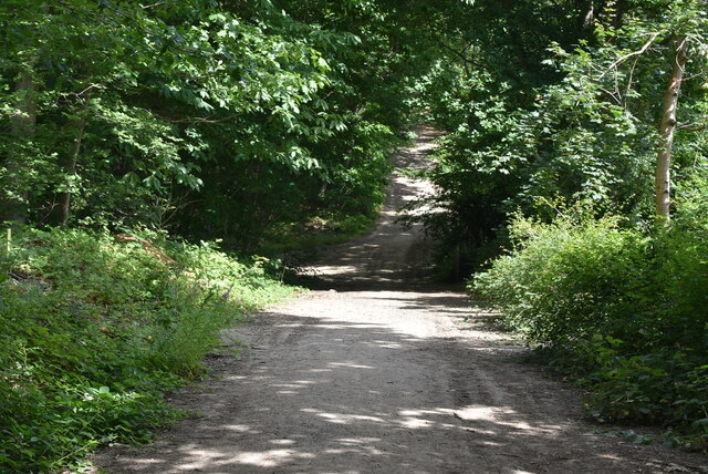
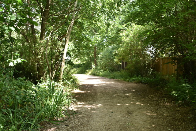
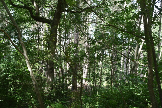
The village is surrounded by picturesque countryside, offering residents and visitors a tranquil and idyllic setting. The area is characterized by rolling hills, lush green fields, and charming woodlands, making it a popular destination for nature enthusiasts and hikers. Additionally, the nearby River Cray adds to the natural beauty of the surroundings, providing opportunities for fishing and leisurely walks along its banks.

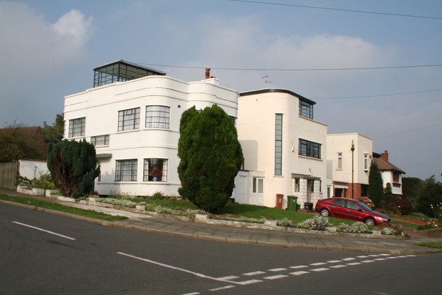
Cray North is a small community, with a relatively low population. The village predominantly consists of residential properties, ranging from quaint cottages to modern houses. There are also a few local businesses, including a village shop and a traditional pub, which serve as social hubs for the community.

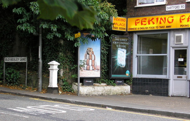
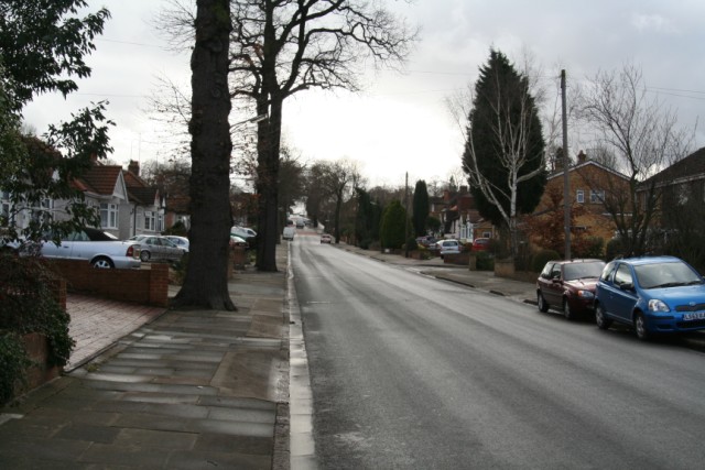
For amenities and services beyond the village, residents can easily access nearby towns such as Orpington and Sidcup, where there are a wider range of shops, supermarkets, and leisure facilities. Transport links are also favorable, with good road connections to the nearby A20 and A224, providing easy access to London and other major towns in Kent.

Overall, Cray North offers a peaceful, rural lifestyle within close proximity to urban conveniences, making it an attractive place to live for those seeking a balance between country living and city accessibility.

If you have any feedback on the listing, please let us know in the comments section below.

Cray, North Images

Images are sourced within 2km of 51.430064/0.141986 or Grid Reference TQ4972. Thanks to Geograph Open Source API. All images are credited.

Entering Joyden Wood A Woodland Trust site in Dartford borough, opened to the public in 1988.  Close to the A2 and A20 trunk roads,this remains a natural ancient woodland and contains visible remains of the ancient "Faesten Dic" (strong dyke), an Anglo-Saxon (or possibly older) defensive ditch.  It is approximately 130 hectares in area and contains many tracks and paths; the main tracks are open to horses and cyclists.
Entering Joyden Wood
A Woodland Trust site in Dartford borough, opened to the public in 1988. Close to the A2 and A20 trunk roads,this remains a natural ancient woodland and contains visible remains of the ancient "Faesten Dic" (strong dyke), an Anglo-Saxon (or possibly older) defensive ditch. It is approximately 130 hectares in area and contains many tracks and paths; the main tracks are open to horses and cyclists.
Joyden Wood A Woodland Trust site in Dartford borough, opened to the public in 1988.  Close to the A2 and A20 trunk roads,this remains a natural ancient woodland and contains visible remains of the ancient "Faesten Dic" (strong dyke), an Anglo-Saxon (or possibly older) defensive ditch.  It is approximately 130 hectares in area and contains many tracks and paths; the main tracks are open to horses and cyclists.
Joyden Wood
A Woodland Trust site in Dartford borough, opened to the public in 1988. Close to the A2 and A20 trunk roads,this remains a natural ancient woodland and contains visible remains of the ancient "Faesten Dic" (strong dyke), an Anglo-Saxon (or possibly older) defensive ditch. It is approximately 130 hectares in area and contains many tracks and paths; the main tracks are open to horses and cyclists.
Joyden Wood
Joyden Wood
Birchwood Park Golf Course Website: <span class="nowrap"><a title="www.birchwoodparkgc.co.uk/" rel="nofollow ugc noopener" href="http://www.birchwoodparkgc.co.uk/">Link</a><img style="margin-left:2px;" alt="External link" title="External link - shift click to open in new window" src="https://s1.geograph.org.uk/img/external.png" width="10" height="10"/></span>
Birchwood Park Golf Course
Website: LinkExternal link
Joydens Wood A Woodland Trust site in Dartford borough, opened to the public in 1988.  Close to the A2 and A20 trunk roads,this remains a natural ancient woodland and contains visible remains of the ancient "Faesten Dic" (strong dyke), an Anglo-Saxon (or possibly older) defensive ditch.  It is approximately 130 hectares in area and contains many tracks and paths; the main tracks are open to horses and cyclists.
Joydens Wood
A Woodland Trust site in Dartford borough, opened to the public in 1988. Close to the A2 and A20 trunk roads,this remains a natural ancient woodland and contains visible remains of the ancient "Faesten Dic" (strong dyke), an Anglo-Saxon (or possibly older) defensive ditch. It is approximately 130 hectares in area and contains many tracks and paths; the main tracks are open to horses and cyclists.
joydens Wood A Woodland Trust site in Dartford borough, opened to the public in 1988.  Close to the A2 and A20 trunk roads,this remains a natural ancient woodland and contains visible remains of the ancient "Faesten Dic" (strong dyke), an Anglo-Saxon (or possibly older) defensive ditch.  It is approximately 130 hectares in area and contains many tracks and paths; the main tracks are open to horses and cyclists.
joydens Wood
A Woodland Trust site in Dartford borough, opened to the public in 1988. Close to the A2 and A20 trunk roads,this remains a natural ancient woodland and contains visible remains of the ancient "Faesten Dic" (strong dyke), an Anglo-Saxon (or possibly older) defensive ditch. It is approximately 130 hectares in area and contains many tracks and paths; the main tracks are open to horses and cyclists.
Joydens Wood A Woodland Trust site in Dartford borough, opened to the public in 1988.  Close to the A2 and A20 trunk roads,this remains a natural ancient woodland and contains visible remains of the ancient "Faesten Dic" (strong dyke), an Anglo-Saxon (or possibly older) defensive ditch.  It is approximately 130 hectares in area and contains many tracks and paths; the main tracks are open to horses and cyclists.
Joydens Wood
A Woodland Trust site in Dartford borough, opened to the public in 1988. Close to the A2 and A20 trunk roads,this remains a natural ancient woodland and contains visible remains of the ancient "Faesten Dic" (strong dyke), an Anglo-Saxon (or possibly older) defensive ditch. It is approximately 130 hectares in area and contains many tracks and paths; the main tracks are open to horses and cyclists.
Coal Tax Post (Nail Number 209 - <span class="nowrap"><a title="http://www.rhaworth.pwp.blueyonder.co.uk/coalwine/postlist.htm#kent" rel="nofollow ugc noopener" href="http://www.rhaworth.pwp.blueyonder.co.uk/coalwine/postlist.htm#kent">Link</a><img style="margin-left:2px;" alt="External link" title="External link - shift click to open in new window" src="https://s1.geograph.org.uk/img/external.png" width="10" height="10"/></span> ) at the point where Old Bexley Lane, Dartford becomes Dartford Road, Old Bexley and still standing on the Greater London / Kent boundary as it did in 1861.
Coal Tax Post
(Nail Number 209 - LinkExternal link ) at the point where Old Bexley Lane, Dartford becomes Dartford Road, Old Bexley and still standing on the Greater London / Kent boundary as it did in 1861.
1930s Apartment Block, Hill Crescent, Bexley Deserving of listed status is this almost perfectly preserved example of 1930s architecture, with its flat roof and curved corner windows.  Even the original metal window frames are still in position.  It is an architectural gem.
1930s Apartment Block, Hill Crescent, Bexley
Deserving of listed status is this almost perfectly preserved example of 1930s architecture, with its flat roof and curved corner windows. Even the original metal window frames are still in position. It is an architectural gem.
Woodlands Park, Joydens Wood Estate, Kent Joydens Wood Estate has a great deal to recommend it: remote from main roads, this is a peaceful modern development with a variety of housing types.  Well kept houses and gardens, no graffiti, no gangs of y*bs hanging about!
Woodlands Park, Joydens Wood Estate, Kent
Joydens Wood Estate has a great deal to recommend it: remote from main roads, this is a peaceful modern development with a variety of housing types. Well kept houses and gardens, no graffiti, no gangs of y*bs hanging about!
Summerhouse Drive, Joydens Wood Estate, Bexley
Show me another place!

Cray, North is located at Grid Ref: TQ4972 (Lat: 51.430064, Lng: 0.141986)

Unitary Authority: Bexley

Police Authority: Metropolitan

What 3 Words

///locals.lasts.cloud. Near Bexley, London

Related Wikis

Loring Hall

Loring Hall is a private mental health care facility in North Cray, London Borough of Bexley. Formerly known as Wollet Hall or Woollet Hall, it is a Grade...

North Cray

North Cray is an area in South East London, England, within the London Borough of Bexley. It is located east of Sidcup and south of Bexleyheath and is...

Foots Cray Meadows

Foots Cray Meadows is an area of parkland and woodland 97 hectares (240 acres) in size, within the London Borough of Bexley, England. It borders the suburbs...

Joyden's Wood

Joyden's Wood is an area of ancient woodland that straddles the border between the London Borough of Bexley in South East London and the Borough of Dartford...

Bexley railway station

Bexley railway station is in the London Borough of Bexley in south-east London, in Travelcard Zone 6. It is 13 miles 69 chains (22.3 km) down the line...

Albany Park railway station

Albany Park railway station is in the London Borough of Bexley in south-east London (Travelcard Zone 5). It is 12 miles 68 chains (20.7 km) down the line...

Bexley

Bexley is an area of south-eastern Greater London, England and part of the London Borough of Bexley. It is sometimes known as Bexley Village or Old Bexley...

King's Head, Bexley

The King's Head is a pub at 65 Bexley High Street, Bexley, London. It is a Grade II listed building, dating back to the 16th or early 17th century. �...

Nearby Amenities

Located within 500m of 51.430064,0.141986
Bus Stop
Bunkers Hill / The White Cross
Bus: yes
Naptan AtcoCode: 490004578N
Naptan Bearing: N
Naptan CommonName: Bunkers HillThe White Cross N
Naptan Verified: no
Network: London Buses
Network Wikidata: Q1192411
Operator: Transport for London
Public Transport: platform
Ref: 56040
Lat/Long: 51.4309789/0.1403066
Bus Stop
Bunkers Hill / The White Cross
Bus: yes
Naptan AtcoCode: 490004579S
Naptan Bearing: N
Naptan CommonName: Bunkers HillThe White Cross S
Naptan Verified: no
Network: London Buses
Network Wikidata: Q1192411
Operator: Transport for London
Public Transport: platform
Ref: 47273
Lat/Long: 51.4299967/0.1395218
Description: Cray Riverway - Old Bexley route
Lat/Long: 51.4329613/0.1377653
Barrier: cycle_barrier
Material: met
Lat/Long: 51.4330308/0.1376603
Description: Cray Riverway splits - 2 routes
Lat/Long: 51.4329274/0.1378261
Description: Viscount Castlereagh 1769-1822 lived here
Historic: memorial
Memorial: plaque
Openplaques Id: 292
Lat/Long: 51.4309386/0.139808
Barrier: kissing_gate
Material: metal
Lat/Long: 51.4298877/0.1453775
Crossing
Crossing: unmarked
Lat/Long: 51.4316669/0.1415646
Barrier: kissing_gate
Bicycle: no
Foot: yes
Material: metal
Width: 1.1
Lat/Long: 51.4329088/0.1377866
Barrier: stile
Material: wood
Lat/Long: 51.4307059/0.1474587
Barrier: kissing_gate
Material: wood
Width: 1.0
Lat/Long: 51.4304573/0.143909
Barrier: kissing_gate
Height: 1.1
Material: metal
Width: 0.8
Lat/Long: 51.4315869/0.1416969
Barrier: kissing_gate
Bicycle: no
Foot: yes
Material: metal
Width: 1.1
Lat/Long: 51.4329531/0.1377799
Post Box
Collection Times: Mo-Fr 18:30; Sa 11:30
Operator: Royal Mail
Operator Wikidata: Q638098
Post Box Type: wall
Ref: DA14 83
Royal Cypher: GR
Royal Cypher Wikidata: Q33102273
Survey Date: 2018-08-01
Lat/Long: 51.4306295/0.1398836
Restaurant
Penelope's Restaurant
Addr City: Sidcup
Addr Postcode: DA14 5ET
Addr Street: Water Lane
Old Name: Kelsey's Kitchen
Source Addr: FHRS Open Data
Lat/Long: 51.4327585/0.1397149
Penelope's Farm Shop
Addr City: Sidcup
Addr Postcode: DA14 5ET
Addr Street: Water Lane
Fhrs Id: 687254
Old Name: Kelsey's Farm Shop
Phone: +44 20 8300 2103
Shop: deli
Source Addr: FHRS Open Data
Website: www.kelseysfarmshop.co.uk
Lat/Long: 51.4326414/0.1398638
Crayzee Barn
Access: customers
Addr City: Sidcup
Addr Postcode: DA14 5ET
Addr Street: Water Lane
Fhrs Id: 329266
Leisure: playground
Source Addr: FHRS Open Data
Lat/Long: 51.4328948/0.1398008
Bunkers Hill / The White Cross
Bus: yes
Public Transport: stop_position
Lat/Long: 51.4300283/0.1394442
Bunkers Hill / The White Cross
Bus: yes
Network: London Buses
Operator: Transport for London
Public Transport: stop_position
Lat/Long: 51.4309271/0.140389
Castlereagh
Description: English Heritage
Historic: memorial
Inscription: Robert Stewart, Viscount Castlereagh (1769–1822) Statesman Lived and died here
Memorial: plaque
Openplaques Id: 292
Lat/Long: 51.4309717/0.1399643
Entrance: yes
Lat/Long: 51.4327242/0.1399395
Crossing
Crossing: unmarked
Lat/Long: 51.4317258/0.141451
The data included in this document is from www.openstreetmap.org. The data is made available under ODbL.

Have you been to Cray, North?

Leave your review of Cray, North below (or comments, questions and feedback).