Alston Wood

Wood, Forest in Lancashire Ribble Valley

England

Alston Wood

Our Lady and St. Michael Roman Catholic Church Grade II Listed building dating from 1856, replacing an earlier church founded in 1765.
Located on Alston Lane near Grimsargh.
Our Lady and St. Michael Roman Catholic Church Credit: Chris Heaton

Alston Wood is a small village located in the county of Lancashire, England. Situated in the Forest of Bowland, it is surrounded by lush greenery and offers a tranquil retreat for nature lovers. The village is located near the towns of Clitheroe and Longridge, providing easy access to amenities and services.

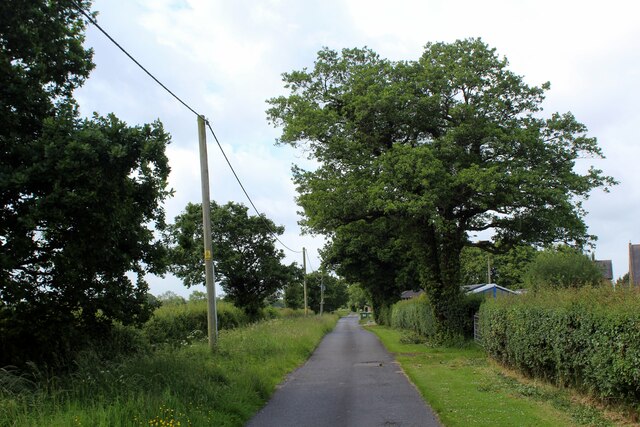
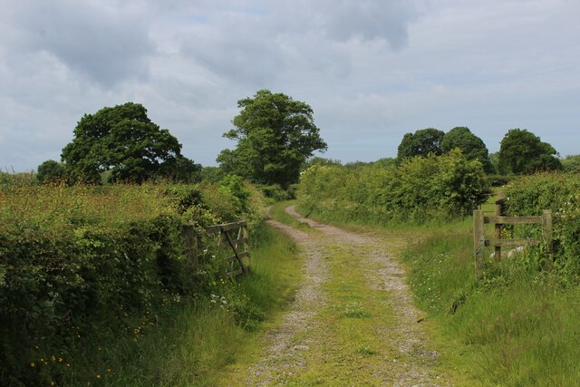
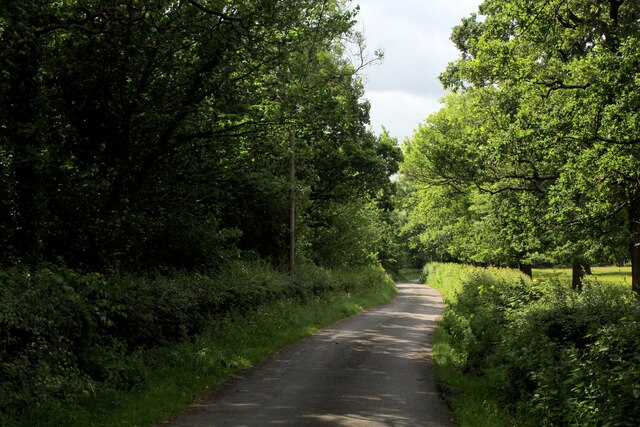
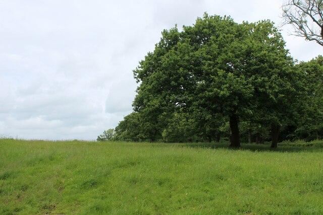
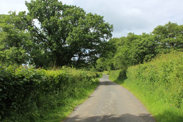
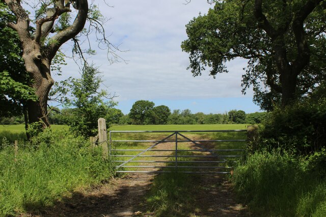
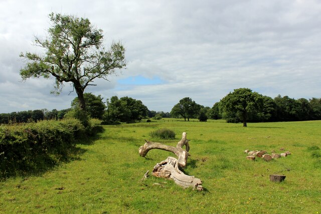
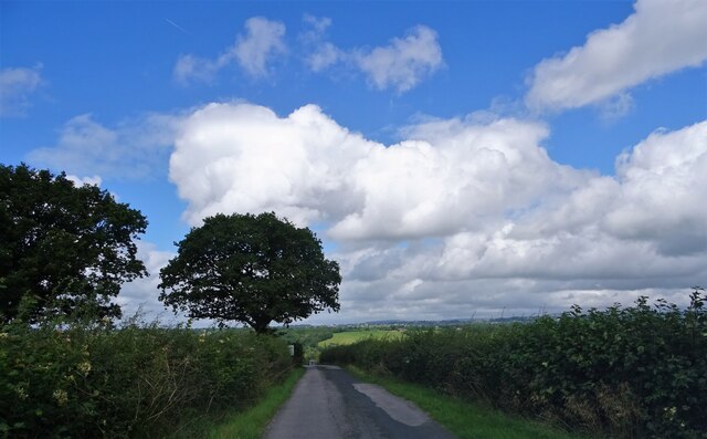
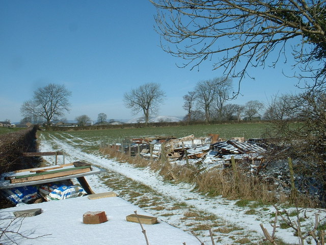
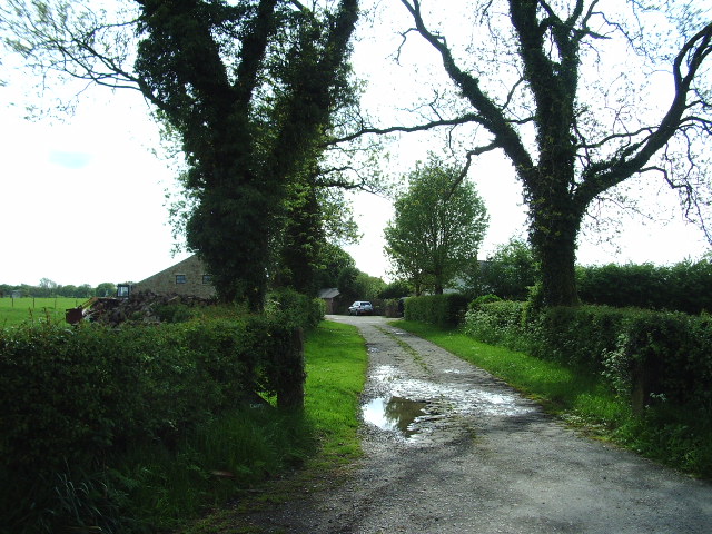
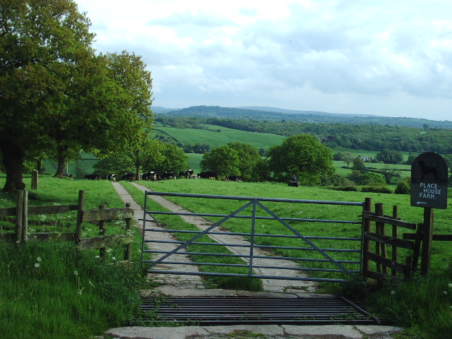
The main attraction of Alston Wood is its picturesque woodland, which covers a significant portion of the area. The forest boasts a diverse range of trees, including oak, beech, and ash, creating a haven for wildlife and a serene environment for hikers and nature enthusiasts. The woodland is crisscrossed with well-maintained walking trails, allowing visitors to explore its beauty at their own pace.

In addition to its natural beauty, Alston Wood is also known for its historical significance. The village is home to several ancient sites, including burial mounds and stone circles, which provide a glimpse into its rich past. These archaeological treasures attract researchers and history buffs from across the region.

Despite its small size, Alston Wood has a tight-knit community that takes pride in its village. The locals are known for their warm hospitality and are often seen participating in community events and activities. The village also has a quaint village pub, where residents and visitors can gather to socialize and enjoy a pint of locally brewed ale.

Overall, Alston Wood offers a peaceful retreat for those seeking to escape the hustle and bustle of city life. Its natural beauty, historical sites, and welcoming community make it an ideal destination for nature lovers and history enthusiasts alike.

If you have any feedback on the listing, please let us know in the comments section below.

Alston Wood Images

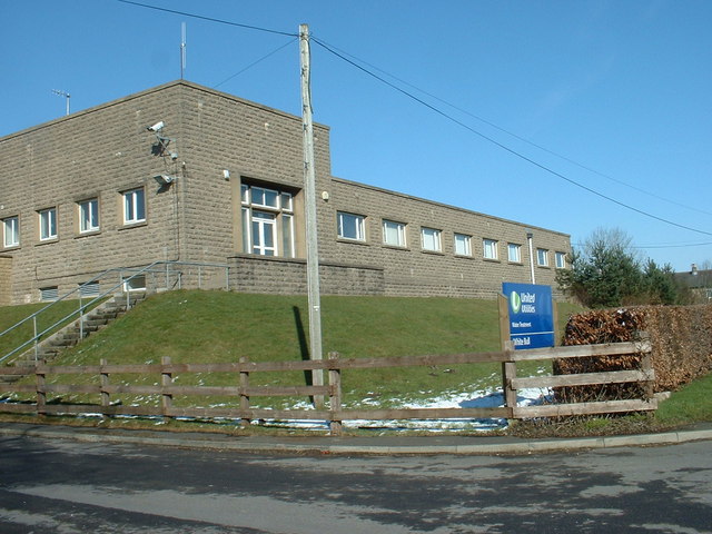
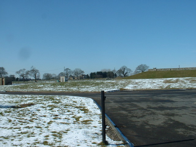
Images are sourced within 2km of 53.797735/-2.5960296 or Grid Reference SD6033. Thanks to Geograph Open Source API. All images are credited.

Our Lady and St. Michael Roman Catholic Church Grade II Listed building dating from 1856, replacing an earlier church founded in 1765.
Located on Alston Lane near Grimsargh.
Our Lady and St. Michael Roman Catholic Church
Grade II Listed building dating from 1856, replacing an earlier church founded in 1765. Located on Alston Lane near Grimsargh.
Access Lane to Wood Farm
Farm Track leading towards Elston Lane
Elston Lane in Big Wood Adopted by the Ribble Way long distance footpath - but maybe for not much longer.
About half a mile further on, the trail takes to fields before descending sharply through woods to cross Tun Brook - but the footbridge has gone, and it will be a very long time if ever that a replacement is constructed.
A red notice near Place House Farm advises walkers to find an alternative route, and another partially obscured effort in Big Wood tells Ribble Way walkers to turn round, and then turn left off Elston Lane before Chapel House Farm.
This will take walkers across Tun Brook, and will probably see the Ribble Way permanently re-routed on this footpath.
<a href="https://www.geograph.org.uk/photo/3443988">SD5932 : Footbridge over Tun Brook</a>
Elston Lane in Big Wood
Adopted by the Ribble Way long distance footpath - but maybe for not much longer. About half a mile further on, the trail takes to fields before descending sharply through woods to cross Tun Brook - but the footbridge has gone, and it will be a very long time if ever that a replacement is constructed. A red notice near Place House Farm advises walkers to find an alternative route, and another partially obscured effort in Big Wood tells Ribble Way walkers to turn round, and then turn left off Elston Lane before Chapel House Farm. This will take walkers across Tun Brook, and will probably see the Ribble Way permanently re-routed on this footpath. SD5932 : Footbridge over Tun Brook
Pasture beside Elston Lane
On Elston Lane Adopted by the Ribble Way long distance footpath - but maybe for not much longer.
About half a mile further on, the trail takes to fields before descending sharply through woods to cross Tun Brook - but the footbridge has gone, and it will be a very long time if ever that a replacement is constructed.
A red notice near Place House Farm advises walkers to find an alternative route, and another partially obscured effort in Big Wood tells Ribble Way walkers to turn round, and then turn left off Elston Lane before Chapel House Farm.
This will take walkers across Tun Brook, and will probably see the Ribble Way permanently re-routed on this footpath.
<a href="https://www.geograph.org.uk/photo/3443988">SD5932 : Footbridge over Tun Brook</a>
On Elston Lane
Adopted by the Ribble Way long distance footpath - but maybe for not much longer. About half a mile further on, the trail takes to fields before descending sharply through woods to cross Tun Brook - but the footbridge has gone, and it will be a very long time if ever that a replacement is constructed. A red notice near Place House Farm advises walkers to find an alternative route, and another partially obscured effort in Big Wood tells Ribble Way walkers to turn round, and then turn left off Elston Lane before Chapel House Farm. This will take walkers across Tun Brook, and will probably see the Ribble Way permanently re-routed on this footpath. SD5932 : Footbridge over Tun Brook
Gate and Field off Elston Lane
Ribble Way heading towards Tun Brook Wood The Ribble Way long distance footpath crosses this pasture to the woods beyond - but maybe for not much longer.
A red notice beside the entrance to this field warns of a closure - informing walkers that the footbridge across Tun Brook has been destroyed, and it will be a very long time if ever that a replacement is constructed.
A red notice near Place House Farm advises walkers to find an alternative route, and another partially obscured effort in Big Wood tells Ribble Way walkers to turn round, and then turn left off Elston Lane before Chapel House Farm.
This will take walkers across Tun Brook, and will probably see the Ribble Way permanently re-routed on this footpath.
<a href="https://www.geograph.org.uk/photo/3443988">SD5932 : Footbridge over Tun Brook</a>
Ribble Way heading towards Tun Brook Wood
The Ribble Way long distance footpath crosses this pasture to the woods beyond - but maybe for not much longer. A red notice beside the entrance to this field warns of a closure - informing walkers that the footbridge across Tun Brook has been destroyed, and it will be a very long time if ever that a replacement is constructed. A red notice near Place House Farm advises walkers to find an alternative route, and another partially obscured effort in Big Wood tells Ribble Way walkers to turn round, and then turn left off Elston Lane before Chapel House Farm. This will take walkers across Tun Brook, and will probably see the Ribble Way permanently re-routed on this footpath. SD5932 : Footbridge over Tun Brook
Nightfield Lane Near Sunderland Hall Farm.
Nightfield Lane
Near Sunderland Hall Farm.
Farm Junk near Grimsargh Reservoirs The reservoirs are just to the left, but I could not access them to get a view
Farm Junk near Grimsargh Reservoirs
The reservoirs are just to the left, but I could not access them to get a view
White Bull Water Treatment Works Named after the nearby pub.
White Bull Water Treatment Works
Named after the nearby pub.
White Bull Reservoir Bank A view into the grounds of the water treatment works.
White Bull Reservoir Bank
A view into the grounds of the water treatment works.
The Road to Chapel House
Place House Farm
Place House Farm
Church and Graveyard on Preston Road
Preston Road, Grimsargh
Our Lady & St Michael RC Church, Grimsargh
Elston New Hall Farm
Show me another place!

Alston Wood is located at Grid Ref: SD6033 (Lat: 53.797735, Lng: -2.5960296)

Administrative County: Lancashire

District: Ribble Valley

Police Authority: Lancashire

What 3 Words

///unheated.melt.advising. Near Longridge, Lancashire

Nearby Locations

Gib Holme Wood Alston Wood

Related Wikis

Alston Hall

Alston Hall is a 19th-century Victorian gothic style country mansion located in Longridge (near Preston) in Lancashire, England. It is not to be confused...

Lancashire dialect

The Lancashire dialect (or colloquially, Lanky) refers to the Northern English vernacular speech of the English county of Lancashire. The region is notable...

Rock FM (Lancashire)

Rock FM is an Independent Local Radio station based in Liverpool, England, owned and operated by Bauer as part of the Hits Radio network. It broadcasts...

Lancashire

Lancashire ( LAN-kə-shər, -⁠sheer; abbreviated Lancs) is a ceremonial county in North West England. It is bordered by Cumbria to the north, North Yorkshire...

Nearby Amenities

Located within 500m of 53.797735,-2.5960296
Alston Hall
Place: neighbourhood
Lat/Long: 53.8003063/-2.5958412
Alston Wood
Natural: wood
Lat/Long: 53.797292/-2.595016
The data included in this document is from www.openstreetmap.org. The data is made available under ODbL.

Have you been to Alston Wood?

Leave your review of Alston Wood below (or comments, questions and feedback).