Oxleasowe Coppice
Wood, Forest in Shropshire
England
Oxleasowe Coppice

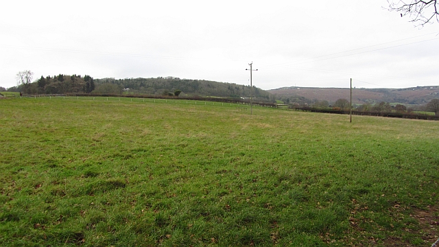
Oxleasowe Coppice is a woodland area located in the county of Shropshire, England. Stretching across approximately 50 acres, it is situated on rolling hills, providing visitors with stunning panoramic views of the surrounding countryside.
The coppice is comprised mainly of deciduous trees, including oak, ash, and beech. These trees are well-established, with some reaching impressive heights and creating a dense canopy that provides shade and shelter for various wildlife species.
The forest floor is covered in a thick carpet of leaf litter, creating a rich habitat for a diverse range of flora and fauna. Bluebells, primroses, and wood anemones are just a few examples of the wildflowers that bloom in spring, painting the woodland with vibrant colors. The woodland is also home to a variety of bird species, including woodpeckers, nuthatches, and tawny owls.
Visitors to Oxleasowe Coppice can enjoy a network of well-maintained footpaths that wind through the woods, allowing for peaceful walks and nature exploration. The paths are suitable for all abilities and are often used by walkers, joggers, and dog owners.
The woodland is managed by a local conservation group, who work to maintain the natural balance of the ecosystem and protect the diverse range of wildlife that calls Oxleasowe Coppice home. This includes selective tree thinning to encourage new growth and enhance the biodiversity of the area.
Overall, Oxleasowe Coppice offers a tranquil escape from the hustle and bustle of everyday life, providing visitors with the opportunity to immerse themselves in nature and enjoy the beauty of a Shropshire woodland.
If you have any feedback on the listing, please let us know in the comments section below.
Oxleasowe Coppice Images
Images are sourced within 2km of 52.33704/-2.5806514 or Grid Reference SO6071. Thanks to Geograph Open Source API. All images are credited.


Oxleasowe Coppice is located at Grid Ref: SO6071 (Lat: 52.33704, Lng: -2.5806514)
Unitary Authority: Shropshire
Police Authority: West Mercia
What 3 Words
///tablet.straw.mills. Near Tenbury Wells, Worcestershire
Nearby Locations
Related Wikis
Nash, south Shropshire
Nash is a small village and civil parish located in Shropshire, England, situated south east of Ludlow and north of Tenbury Wells. The parish had a population...

Boraston
Boraston is a small village and civil parish in Shropshire, England. It is situated in the West Midlands, approximately 0.8 mi (1.3 km) north of Worcestershire...
Burford, Shropshire
Burford is a village and civil parish in Shropshire, England. According to the 2001 census the parish had a population of 1,108, rising to 1,392 at the...

Tenbury Community Hospital
Tenbury Community Hospital is a health facility in Worcester Road, Burford, Tenbury Wells, Worcestershire, England. It is managed by Worcestershire Health...

Tenbury Wells railway station
Tenbury Wells railway station was a station in Burford, Shropshire, England. Serving the town of Tenbury Wells across the River Teme in Worcestershire...

Burford Rural District
Burford was a Rural district in Shropshire in England from 1894 to 1934. It was formed under the Local Government Act 1894 that part of the Tenbury rural...

Knighton on Teme
Knighton on Teme is a village and civil parish once in the hundred of Doddingtree and now in the Malvern Hills District of the county of Worcestershire...
Coreley
Coreley is a small, dispersed village and civil parish in south Shropshire, England, near to Clee Hill Village. It is situated approximately 30 miles...
Related Videos

View Of The River Teme, Tenbury Wells, Worcestershire, England Sunday 12th February 2023 #shorts #4k
A view of river Teme viewed from the Teme bridge, Tenbury Wells, Worcestershire & Shropshire Border, England. #shorts Sunday ...

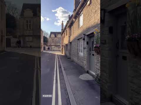
Exploring Burford In The Famous English Cotswolds | Relaxing Nature Walks & Sounds | 4KHD
Love travel videos? Like & subscribe to our channel we will be uploading content regularly of the wonderful places we visit in ...
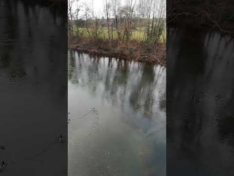
Ducks On The River Teme, Tenbury Wells, Worcestershire, England 12th February 2023 #shorts
Ducks on the river Teme viewed from the Teme bridge, Tenbury Wells, Worcestershire & Shropshire Border, England. Sunday ...
Have you been to Oxleasowe Coppice?
Leave your review of Oxleasowe Coppice below (or comments, questions and feedback).