Arbuthnott

Settlement in Kincardineshire

Scotland

Arbuthnott

Parkneuk Fields Fields by Parkneuk and the B976.
Parkneuk Fields Credit: Andrew Wood

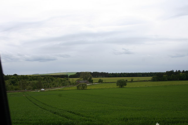
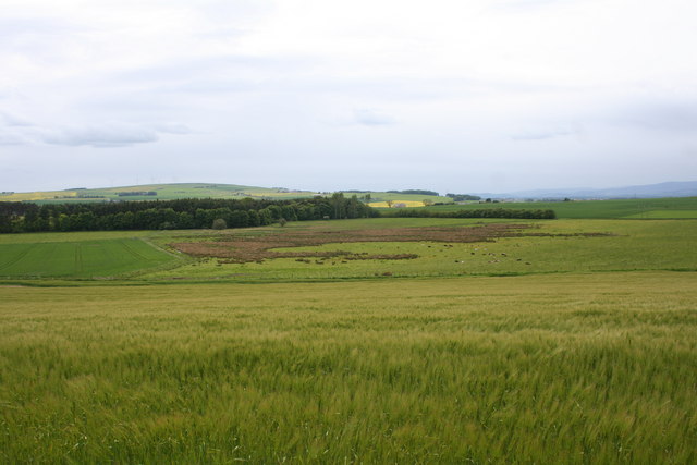
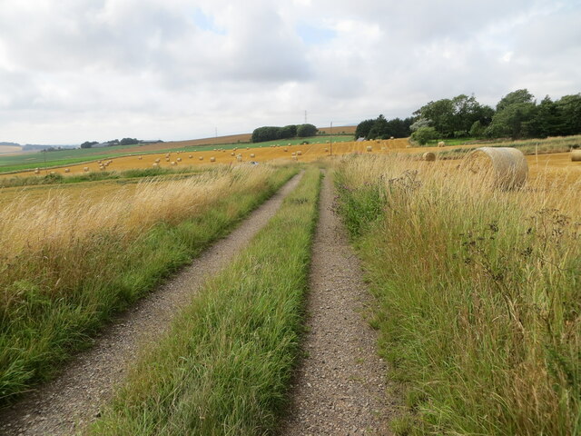
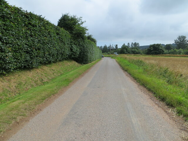
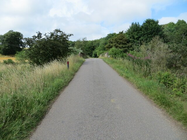
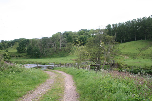
Arbuthnott is a small village located in Kincardineshire, Scotland. Situated approximately 30 miles south of Aberdeen, it lies in the northeastern part of the country. The village is nestled amidst rolling hills and lush countryside, offering picturesque views and a tranquil atmosphere.

Arbuthnott is known for its historic significance, with its roots dating back to the 12th century. The village is home to the magnificent Arbuthnott House, a stunning stately home built in the 17th century. This grand mansion boasts impressive architecture and is surrounded by beautifully landscaped gardens, making it a popular tourist attraction.

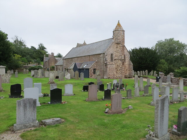
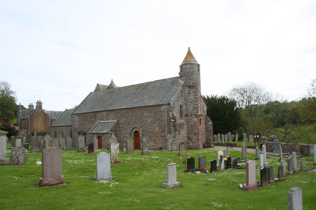
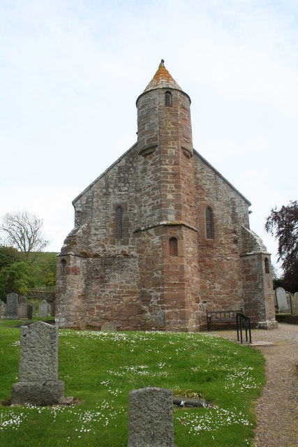
The village itself is small but charming, with a population of around 150 residents. It features a quaint church, Arbuthnott Parish Church, which dates back to the 13th century and is renowned for its beautiful stained glass windows. The village also has a primary school, providing education for local children.

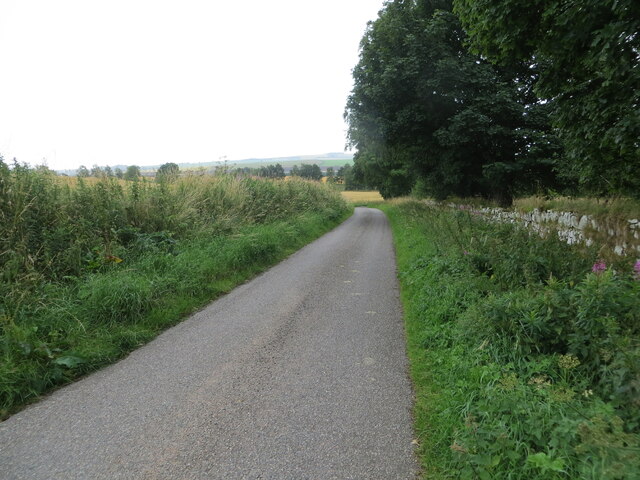
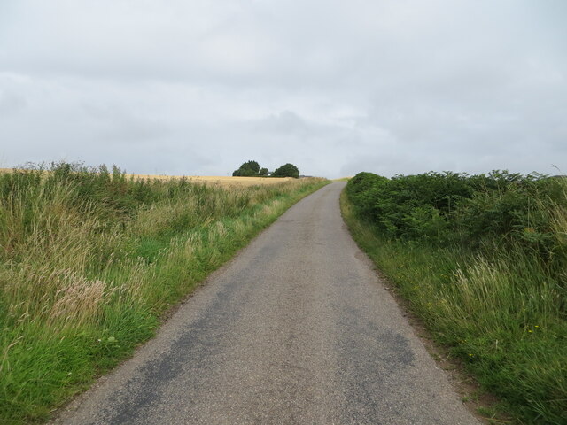
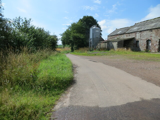
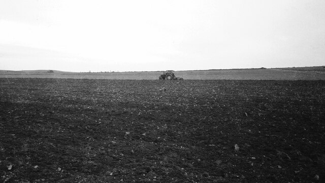
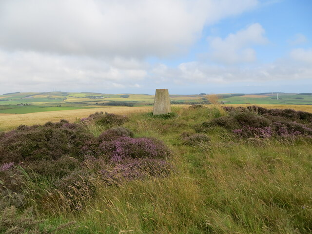
The surrounding area offers ample opportunities for outdoor activities, with numerous walking and hiking trails. The gentle hills and verdant countryside make it an ideal destination for nature enthusiasts and those seeking a peaceful retreat.

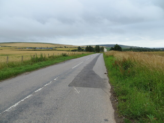
Although Arbuthnott is a quiet village, it is well-connected to nearby towns and cities. The village is easily accessible by road, with the A92 passing close by, providing convenient transportation links to Aberdeen and other parts of Scotland.

In summary, Arbuthnott is a small, historic village in Kincardineshire, Scotland. With its stunning landscapes, rich history, and peaceful ambiance, it attracts visitors seeking a glimpse into Scotland's past and a chance to immerse themselves in its natural beauty.

If you have any feedback on the listing, please let us know in the comments section below.

Arbuthnott Images

Images are sourced within 2km of 56.869499/-2.332473 or Grid Reference NO7975. Thanks to Geograph Open Source API. All images are credited.

Parkneuk Fields Fields by Parkneuk and the B976.
Parkneuk Fields
Fields by Parkneuk and the B976.
Barley Fields Barley growing in a fieldwith a moss and woodland beyond.
Barley Fields
Barley growing in a fieldwith a moss and woodland beyond.
Road (B967) near to Millplough Looking south-eastward. Millplough Farm can be seen on the left of the picture.
Road (B967) near to Millplough
Looking south-eastward. Millplough Farm can be seen on the left of the picture.
The Church of St Ternan and part of its burial ground at Arbuthnott Viewed from the northwest.
The Church of St Ternan and part of its burial ground at Arbuthnott
Viewed from the northwest.
Minor road signed 'To Arbuthnott Church' Looking south-eastward.
Minor road signed 'To Arbuthnott Church'
Looking south-eastward.
Minor road heading towards Laes Looking northward.
Minor road heading towards Laes
Looking northward.
Minor road at Gobbs Farm Looking southward.
Minor road at Gobbs Farm
Looking southward.
Ploughing at Nether Craighill
Long Cairn and Hillhead Triangulation Pillar Looking south-eastward.
Long Cairn and Hillhead Triangulation Pillar
Looking south-eastward.
Track between fields descending to a minor road near Alpity Looking westward.
Track between fields descending to a minor road near Alpity
Looking westward.
Minor road approaching the B967 near Arbuthnott Looking south-eastward from Parkneuk.
Minor road approaching the B967 near Arbuthnott
Looking south-eastward from Parkneuk.
Minor road and bridge crossing Bervie Water Looking north-westward.
Minor road and bridge crossing Bervie Water
Looking north-westward.
Ordnance Survey Cut Mark This mark can be found on the parapet wall of a bridge over Bervie Water near to Whitefield.
The recorded details give a height of 46.13 metres above sea level.
For more detail see : <span class="nowrap"><a title="https://www.bench-marks.org.uk/bm162418" rel="nofollow ugc noopener" href="https://www.bench-marks.org.uk/bm162418">Link</a><img style="margin-left:2px;" alt="External link" title="External link - shift click to open in new window" src="https://s1.geograph.org.uk/img/external.png" width="10" height="10"/></span>
Ordnance Survey Cut Mark
This mark can be found on the parapet wall of a bridge over Bervie Water near to Whitefield. The recorded details give a height of 46.13 metres above sea level. For more detail see : LinkExternal link
Kirkton Farm A farm by the B976 near Inverbervie.
Kirkton Farm
A farm by the B976 near Inverbervie.
Kirk of St Ternan The parish church of St Ternan, one of the few pre-reformation churches in continuous use. St Ternan was a Pictish saint placing the historic site even farther back.
Kirk of St Ternan
The parish church of St Ternan, one of the few pre-reformation churches in continuous use. St Ternan was a Pictish saint placing the historic site even farther back.
St Ternans Tower A Bell tower at St Ternans the parish church of Arbuthnott.
St Ternans Tower
A Bell tower at St Ternans the parish church of Arbuthnott.
Footbridge over the Bervie A footbridge over the Bervie water by Arbuthnott Kirk. The Bervie is fordable here the bridge presumably being a method to keep feet dry.
Footbridge over the Bervie
A footbridge over the Bervie water by Arbuthnott Kirk. The Bervie is fordable here the bridge presumably being a method to keep feet dry.
Bervie Water A view from the footbridge of the Bervie water flowing downstream at Arbuthnott.
Bervie Water
A view from the footbridge of the Bervie water flowing downstream at Arbuthnott.
Show me another place!

Arbuthnott is located at Grid Ref: NO7975 (Lat: 56.869499, Lng: -2.332473)

Unitary Authority: Aberdeenshire

Police Authority: North East

What 3 Words

///implore.ferrying.finalists. Near Inverbervie, Aberdeenshire

Related Wikis

Arbuthnott

Arbuthnott (Scottish Gaelic: Obar Bhuadhnait, "mouth of the Buadhnat") is a hamlet and parish in the Howe of the Mearns, a low-lying agricultural district...

Arbuthnott Parish Kirk

Arbuthnott Parish Kirk is a church in Arbuthnott, Aberdeenshire, Scotland. Now a Category A listed building, it was built in at least the 13th century...

Allardice Castle

Allardice Castle (also spelled Allardyce) is a sixteenth-century manor house in Kincardineshire, Scotland. It is approximately 1.5 kilometres north-west...

Inverbervie Town House

Inverbervie Town House is a municipal structure in Church Street in Inverbervie, Aberdeenshire, Scotland. The structure, which is primarily used as a public...

Inverbervie

Inverbervie (from Scottish Gaelic: Inbhir Biorbhaidh or Biorbhaigh, "mouth of the River Bervie") is a small town on the north-east coast of Scotland, south...

Abbeyton Bridge

Abbeyton Bridge was a road bridge that carried the B966 road over the Dundee–Aberdeen line. == History == In June 2018, Aberdeenshire Council introduced...

Inverbervie railway station

Bervie railway station served the town of Inverbervie, Aberdeenshire, Scotland from 1865 to 1966 on the Montrose and Bervie Railway. == History == The...
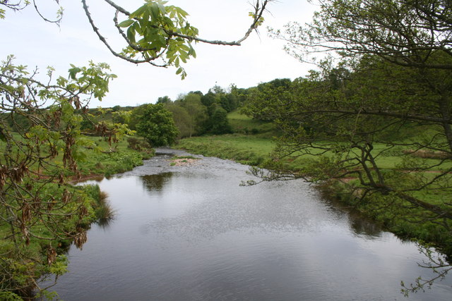
Bervie Water

Bervie Water (Scottish Gaelic: Uisge Bhiorbhaigh) is a river in Aberdeenshire, Scotland which rises in the Drumtochty Forest and flows across The Mearns...

Nearby Amenities

Located within 500m of 56.869499,-2.332473
Arbuthnott
Name Gd: Obar Bhuadhnait
Place: village
Wikidata: Q4784966
Wikipedia: en:Arbuthnott
Lat/Long: 56.8692091/-2.3305743
Noexit: yes
Lat/Long: 56.8687988/-2.3294744
Power: pole
Lat/Long: 56.8705327/-2.3252816
Power: pole
Lat/Long: 56.8705694/-2.3264893
Power: pole
Lat/Long: 56.8705826/-2.3274368
Power: pole
Lat/Long: 56.870612/-2.3284083
Power: pole
Lat/Long: 56.8706369/-2.3293182
Power: pole
Lat/Long: 56.871187/-2.3299167
Power: pole
Lat/Long: 56.8717165/-2.3305152
Power: pole
Lat/Long: 56.8723149/-2.3311405
Power: pole
Lat/Long: 56.8722944/-2.3324395
Power: pole
Lat/Long: 56.8722973/-2.3337573
Power: pole
Lat/Long: 56.8722826/-2.3350563
Power: pole
Lat/Long: 56.8725012/-2.3359044
Power: pole
Lat/Long: 56.8726728/-2.3366076
Power: pole
Lat/Long: 56.8702115/-2.3298147
Power: pole
Lat/Long: 56.8698228/-2.3302709
Power: pole
Lat/Long: 56.869437/-2.3307406
Power: pole
Lat/Long: 56.8716769/-2.334388
Power: pole
Lat/Long: 56.8710491/-2.3350268
Power: pole
Lat/Long: 56.8704961/-2.3355985
Power: pole
Lat/Long: 56.869946/-2.3359823
Power: pole
Lat/Long: 56.8694135/-2.3363339
Power: pole
Lat/Long: 56.86884/-2.3367284
Power: pole
Lat/Long: 56.8712603/-2.3363875
Power: pole
Lat/Long: 56.8716505/-2.3366962
Power: pole
Lat/Long: 56.8720274/-2.3369914
Power: pole
Lat/Long: 56.8724308/-2.3372839
Power: pole
Lat/Long: 56.873063/-2.3355341
Power: pole
Lat/Long: 56.8732346/-2.3350697
Power: pole
Lat/Long: 56.8667056/-2.3376959
Power: pole
Lat/Long: 56.8669755/-2.3373604
Power: pole
Lat/Long: 56.8672909/-2.3369874
Power: pole
Lat/Long: 56.8676312/-2.3369766
Power: pole
Lat/Long: 56.8685503/-2.3371082
Power: pole
Lat/Long: 56.8682378/-2.3375161
Power: pole
Lat/Long: 56.8669946/-2.3363795
Power: pole
Lat/Long: 56.8663975/-2.3358548
Power: pole
Lat/Long: 56.8696585/-2.3405368
Power: pole
Lat/Long: 56.8694546/-2.3398323
Power: pole
Lat/Long: 56.8692522/-2.3391613
Power: pole
Lat/Long: 56.8691876/-2.3383508
Power: pole
Lat/Long: 56.8691209/-2.3374074
Power: pole
Lat/Long: 56.8687674/-2.3364613
Power: pole
Lat/Long: 56.8689302/-2.3356884
Power: pole
Lat/Long: 56.8691026/-2.334949
Power: pole
Lat/Long: 56.8696262/-2.3341519
Power: pole
Lat/Long: 56.8698815/-2.3337546
Power: pole
Lat/Long: 56.8697194/-2.333238
Power: pole
Lat/Long: 56.8689273/-2.3283721
Power: pole
Lat/Long: 56.8694407/-2.3277897
Power: pole
Lat/Long: 56.8699908/-2.3271456
Power: pole
Lat/Long: 56.8685796/-2.3254735
Power: pole
Lat/Long: 56.8688664/-2.3261525
Power: pole
Lat/Long: 56.8689691/-2.3267349
Power: pole
Lat/Long: 56.8690879/-2.3274529
The data included in this document is from www.openstreetmap.org. The data is made available under ODbL.

Have you been to Arbuthnott?

Leave your review of Arbuthnott below (or comments, questions and feedback).