Ham Woods

Wood, Forest in Somerset Mendip

England

Ham Woods

Old Down Tunnel under Windsor Hill The Windsor Hills tunnels were on the Somerset and Dorset line, or the "Slow and Dirty". There are in fact two, an Up and a Down side by side, but built at different times
They were closed to all traffic in March 1966.
Old Down Tunnel under Windsor Hill Credit: Rick Crowley

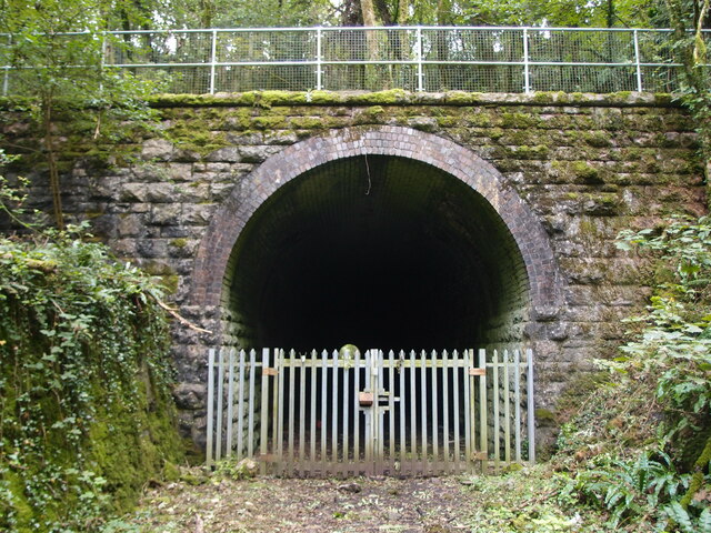
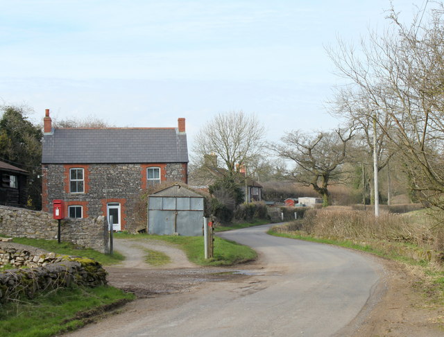
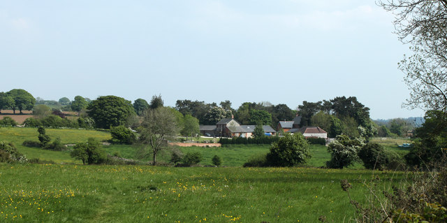
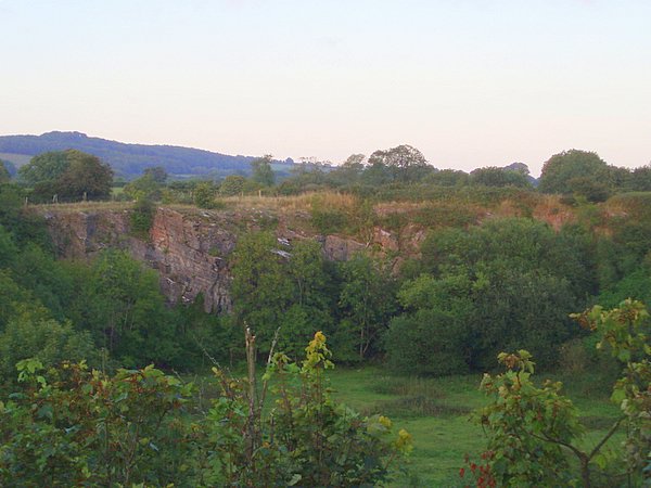
Ham Woods is a picturesque woodland located in Somerset, England. Spanning approximately 200 acres, it is a popular destination for nature lovers and outdoor enthusiasts. The woodland is situated near the village of Norton Fitzwarren, just a few miles from the bustling town of Taunton.

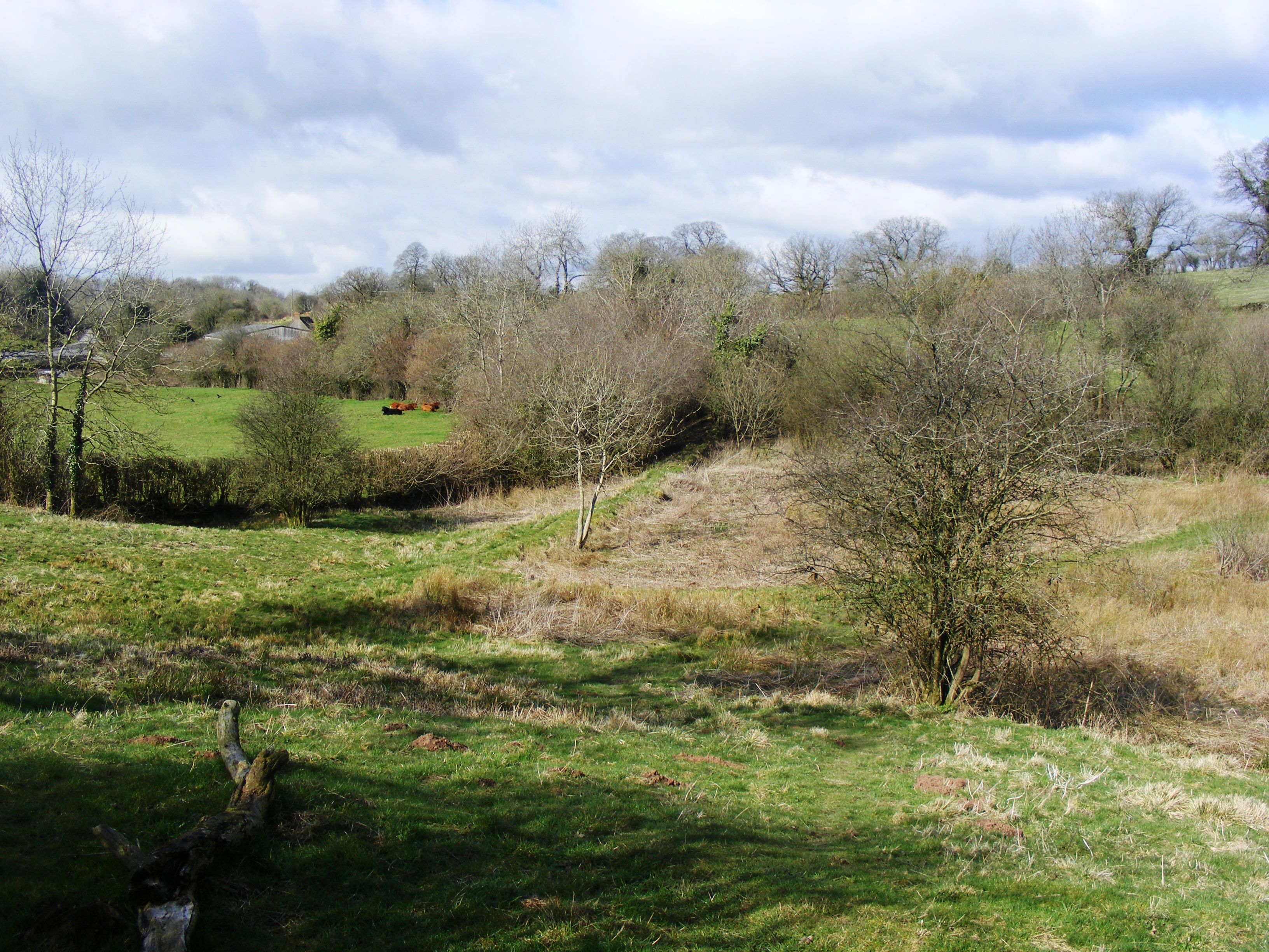
Ham Woods is characterized by its diverse range of flora and fauna, making it an important ecological site. The woodland is predominantly composed of broadleaf trees, including oak, beech, and birch, which provide a vibrant canopy and create a tranquil atmosphere. The forest floor is covered with a rich carpet of bluebells, wild garlic, and other native plants, adding to the natural beauty of the area.

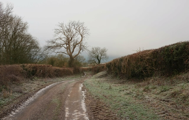
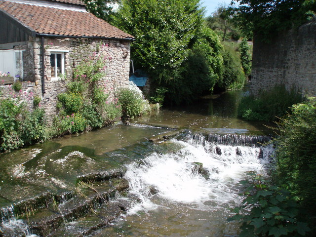
Several well-maintained footpaths and trails crisscross the woods, allowing visitors to explore the area at their leisure. These paths provide access to various points of interest, including a small stream that meanders through the woods and provides a peaceful backdrop for picnics or quiet contemplation.

Ham Woods has a long history, with evidence of human activity dating back centuries. The woodland has been managed by the Forestry Commission since the mid-20th century, ensuring its preservation and accessibility for future generations.

Throughout the year, Ham Woods hosts a range of events and activities, such as guided nature walks, educational programs, and wildlife spotting opportunities. These initiatives aim to engage visitors and foster an appreciation for the natural wonders that can be found within the woodland.

Overall, Ham Woods offers a tranquil escape from the hustle and bustle of everyday life, providing a haven for both wildlife and visitors seeking solace in nature.

If you have any feedback on the listing, please let us know in the comments section below.

Ham Woods Images

Images are sourced within 2km of 51.204793/-2.5676832 or Grid Reference ST6045. Thanks to Geograph Open Source API. All images are credited.

Old Down Tunnel under Windsor Hill The Windsor Hills tunnels were on the Somerset and Dorset line, or the "Slow and Dirty". There are in fact two, an Up and a Down side by side, but built at different times
They were closed to all traffic in March 1966.
Old Down Tunnel under Windsor Hill
The Windsor Hills tunnels were on the Somerset and Dorset line, or the "Slow and Dirty". There are in fact two, an Up and a Down side by side, but built at different times They were closed to all traffic in March 1966.
Commercial Road, Shepton Mallet Seen at sunrise across the crossroads with Old market Road and Rectory Road. On the left is the grade II* listed Anglo Trading Estate building <span class="nowrap"><a title="https://historicengland.org.uk/listing/the-list/list-entry/1296561?section=official-list-entry" rel="nofollow ugc noopener" href="https://historicengland.org.uk/listing/the-list/list-entry/1296561?section=official-list-entry">Link</a><img style="margin-left:2px;" alt="External link" title="External link - shift click to open in new window" src="https://s1.geograph.org.uk/img/external.png" width="10" height="10"/></span> (1864), also shown at most of the images at <a title="https://www.geograph.org.uk/search.php?i=173552446" href="https://www.geograph.org.uk/search.php?i=173552446">Link</a> .

On the right is No 24 Commercial Road (1840), described at <span class="nowrap"><a title="https://historicengland.org.uk/listing/the-list/list-entry/1058460?section=official-list-entry" rel="nofollow ugc noopener" href="https://historicengland.org.uk/listing/the-list/list-entry/1058460?section=official-list-entry">Link</a><img style="margin-left:2px;" alt="External link" title="External link - shift click to open in new window" src="https://s1.geograph.org.uk/img/external.png" width="10" height="10"/></span> .

Commercial Road is the A371.
Commercial Road, Shepton Mallet
Seen at sunrise across the crossroads with Old market Road and Rectory Road. On the left is the grade II* listed Anglo Trading Estate building LinkExternal link (1864), also shown at most of the images at Link . On the right is No 24 Commercial Road (1840), described at LinkExternal link . Commercial Road is the A371.
Studfold Cottage, Bowlish A listed cottage of about 1650 on Ham Lane, described at <span class="nowrap"><a title="https://historicengland.org.uk/listing/the-list/list-entry/1058437?section=official-list-entry" rel="nofollow ugc noopener" href="https://historicengland.org.uk/listing/the-list/list-entry/1058437?section=official-list-entry">Link</a><img style="margin-left:2px;" alt="External link" title="External link - shift click to open in new window" src="https://s1.geograph.org.uk/img/external.png" width="10" height="10"/></span> .
Studfold Cottage, Bowlish
A listed cottage of about 1650 on Ham Lane, described at LinkExternal link .
Bowlish Grange "Mill, now house. Circa 1700" <span class="nowrap"><a title="https://historicengland.org.uk/listing/the-list/list-entry/1345229?section=official-list-entry" rel="nofollow ugc noopener" href="https://historicengland.org.uk/listing/the-list/list-entry/1345229?section=official-list-entry">Link</a><img style="margin-left:2px;" alt="External link" title="External link - shift click to open in new window" src="https://s1.geograph.org.uk/img/external.png" width="10" height="10"/></span> .
Bowlish Grange
"Mill, now house. Circa 1700" LinkExternal link .
Bowlish Villa " Circa 1700" <span class="nowrap"><a title="https://historicengland.org.uk/listing/the-list/list-entry/1172895?section=official-list-entry" rel="nofollow ugc noopener" href="https://historicengland.org.uk/listing/the-list/list-entry/1172895?section=official-list-entry">Link</a><img style="margin-left:2px;" alt="External link" title="External link - shift click to open in new window" src="https://s1.geograph.org.uk/img/external.png" width="10" height="10"/></span> . The description also includes the "flanking walls either side of the front, that to the left containing pointed arch garden door".
Bowlish Villa
" Circa 1700" LinkExternal link . The description also includes the "flanking walls either side of the front, that to the left containing pointed arch garden door".
Junction, Ham Lane Snow has fallen, and there's a lot more to come. Left of centre is one of three doorways in a listed wall <span class="nowrap"><a title="https://historicengland.org.uk/listing/the-list/list-entry/1058396?section=official-list-entry" rel="nofollow ugc noopener" href="https://historicengland.org.uk/listing/the-list/list-entry/1058396?section=official-list-entry">Link</a><img style="margin-left:2px;" alt="External link" title="External link - shift click to open in new window" src="https://s1.geograph.org.uk/img/external.png" width="10" height="10"/></span> , surrounding the Old Manor <span class="nowrap"><a title="https://historicengland.org.uk/listing/the-list/list-entry/1058395?section=official-list-entry" rel="nofollow ugc noopener" href="https://historicengland.org.uk/listing/the-list/list-entry/1058395?section=official-list-entry">Link</a><img style="margin-left:2px;" alt="External link" title="External link - shift click to open in new window" src="https://s1.geograph.org.uk/img/external.png" width="10" height="10"/></span> , only a little of which can be seen. On the right is Cleevers <span class="nowrap"><a title="https://historicengland.org.uk/listing/the-list/list-entry/1058397?section=official-list-entry" rel="nofollow ugc noopener" href="https://historicengland.org.uk/listing/the-list/list-entry/1058397?section=official-list-entry">Link</a><img style="margin-left:2px;" alt="External link" title="External link - shift click to open in new window" src="https://s1.geograph.org.uk/img/external.png" width="10" height="10"/></span> .
Junction, Ham Lane
Snow has fallen, and there's a lot more to come. Left of centre is one of three doorways in a listed wall LinkExternal link , surrounding the Old Manor LinkExternal link , only a little of which can be seen. On the right is Cleevers LinkExternal link .
Ham Lane Starting a descent into the Sheppey valley as the snow holds off for a short while. On the left is Darshill Wood.
Ham Lane
Starting a descent into the Sheppey valley as the snow holds off for a short while. On the left is Darshill Wood.
Old Milepost by A37, Bath Road, opposite former Downside Inn, North of Shepton Mallet The Milepost is located on the bank alongside the road on the East side.  Parish of Shepton Mallet (Mendip District). Cast iron post, plated iron casting design, erected by the Shepton Mallet turnpike trust in the 19th Century, hole in top below "Bath", missing rivet. An earlier photograph can be found here: <a title="https://www.geograph.org.uk/photo/6044224" href="https://www.geograph.org.uk/photo/6044224">Link</a> 

Inscription reads:-  
SHEPTON / MALLET / 1  : : BRISTOL / 19 : : BATH / 16 

Grade II listed. List Entry Number: 1167921 <span class="nowrap"><a title="https://historicengland.org.uk/listing/the-list/list-entry/1167921" rel="nofollow ugc noopener" href="https://historicengland.org.uk/listing/the-list/list-entry/1167921">Link</a><img style="margin-left:2px;" alt="External link" title="External link - shift click to open in new window" src="https://s1.geograph.org.uk/img/external.png" width="10" height="10"/></span> 

Milestone Society National ID: SO_SMBR01
Old Milepost by A37, Bath Road, opposite former Downside Inn, North of Shepton Mallet
The Milepost is located on the bank alongside the road on the East side.  Parish of Shepton Mallet (Mendip District). Cast iron post, plated iron casting design, erected by the Shepton Mallet turnpike trust in the 19th Century, hole in top below "Bath", missing rivet. An earlier photograph can be found here: Link  Inscription reads:- SHEPTON / MALLET / 1 : : BRISTOL / 19 : : BATH / 16 Grade II listed. List Entry Number: 1167921 LinkExternal link Milestone Society National ID: SO_SMBR01
2011 : Thrupe Lane heading south Past Rising Sun Cottage.
An overbridge on the old Radstock to Shepton Mallet railway crossed the road at the other end of the straight. The embankment is still there.
2011 : Thrupe Lane heading south
Past Rising Sun Cottage. An overbridge on the old Radstock to Shepton Mallet railway crossed the road at the other end of the straight. The embankment is still there.
2011 : Thrupe, Somerset In Anglo-Saxon times a thrupe was a dairy farm. (from Wikipedia), not much has changed. <span class="nowrap"><a title="http://www.theoldmilkingparlour.co.uk/contact.html" rel="nofollow ugc noopener" href="http://www.theoldmilkingparlour.co.uk/contact.html">Link</a><img style="margin-left:2px;" alt="External link" title="External link - shift click to open in new window" src="https://s1.geograph.org.uk/img/external.png" width="10" height="10"/></span>
The limestone in this area is riddled with caves and swallets. More in <span class="nowrap"><a title="http://en.wikipedia.org/wiki/Thrupe_Lane_Swallet" rel="nofollow ugc noopener" href="http://en.wikipedia.org/wiki/Thrupe_Lane_Swallet">Link</a><img style="margin-left:2px;" alt="External link" title="External link - shift click to open in new window" src="https://s1.geograph.org.uk/img/external.png" width="10" height="10"/></span> and <span class="nowrap"><a title="http://www.absoluteastronomy.com/topics/Thrupe_Lane_Swallet" rel="nofollow ugc noopener" href="http://www.absoluteastronomy.com/topics/Thrupe_Lane_Swallet">Link</a><img style="margin-left:2px;" alt="External link" title="External link - shift click to open in new window" src="https://s1.geograph.org.uk/img/external.png" width="10" height="10"/></span> among others.
2011 : Thrupe, Somerset
In Anglo-Saxon times a thrupe was a dairy farm. (from Wikipedia), not much has changed. LinkExternal link The limestone in this area is riddled with caves and swallets. More in LinkExternal link and LinkExternal link among others.
2011 : The former Masbury Station On the equally former Somerset & Dorset line between Shepton Mallet and Paulton.
Seen in its glory days, 52 years previously, in <a href="https://www.geograph.org.uk/photo/2180927">ST6047 : Masbury Station, with Up express</a> from almost the same viewpoint.
2011 : The former Masbury Station
On the equally former Somerset & Dorset line between Shepton Mallet and Paulton. Seen in its glory days, 52 years previously, in ST6047 : Masbury Station, with Up express from almost the same viewpoint.
2011 : Thrupe Lane looking north The bank on the right is part of an embankment which carried the Somerset & Dorset Railway, or the Slow and Dirty as it was known locally.
2011 : Thrupe Lane looking north
The bank on the right is part of an embankment which carried the Somerset & Dorset Railway, or the Slow and Dirty as it was known locally.
2011 : Thrupe Main Street Thrupe is so small it only has outskirts, and just one of them.

Easy to sneer but we should remember, Thrupe has its own swallet.
<span class="nowrap"><a title="http://en.wikipedia.org/wiki/Thrupe_Lane_Swallet" rel="nofollow ugc noopener" href="http://en.wikipedia.org/wiki/Thrupe_Lane_Swallet">Link</a><img style="margin-left:2px;" alt="External link" title="External link - shift click to open in new window" src="https://s1.geograph.org.uk/img/external.png" width="10" height="10"/></span>
2011 : Thrupe Main Street
Thrupe is so small it only has outskirts, and just one of them. Easy to sneer but we should remember, Thrupe has its own swallet. LinkExternal link
2011 : Thrupe Lane at Thrupe Heading north near Lower Thrupe Farm.
2011 : Thrupe Lane at Thrupe
Heading north near Lower Thrupe Farm.
2011 : South on Thrupe Lane Passing through Thrupe.
A search of the internet reveals very little about Thrupe.
2011 : South on Thrupe Lane
Passing through Thrupe. A search of the internet reveals very little about Thrupe.
2011 : A carefully chosen collection of curious cows Seen from Ham Lane, north west of Shepton Mallet which is hiding in the next valley.
2011 : A carefully chosen collection of curious cows
Seen from Ham Lane, north west of Shepton Mallet which is hiding in the next valley.
2011 : On Windsor Hill, toward Lower Downside
2011 : Footpath to Shepton Mallet Shepton Mallet hides in the valley.
2011 : Footpath to Shepton Mallet
Shepton Mallet hides in the valley.
Show me another place!

Ham Woods is located at Grid Ref: ST6045 (Lat: 51.204793, Lng: -2.5676832)

Administrative County: Somerset

District: Mendip

Police Authority: Avon and Somerset

What 3 Words

///thudded.apes.peroxide. Near Shepton Mallet, Somerset

Nearby Locations

Ham Woods Thrupe Croscombe

Related Wikis

Thrupe Lane Swallet

Thrupe Lane Swallet (grid reference ST603458) is a 0.5 hectares (1.2 acres) geological Site of Special Scientific Interest in Somerset, notified in 1992...

Windsor Hill Quarry

Windsor Hill Quarry (grid reference ST615451) is a 0.8 hectare geological Site of Special Scientific Interest near Shepton Mallet on the Mendip Hills in...

Croscombe

Croscombe is a village and civil parish 2 miles (3 km) west of Shepton Mallet and 4 miles (6 km) from Wells, in the Mendip district of Somerset, England...

The Old Manor, Croscombe

The Old Manor in Croscombe, Somerset, England, was built around 1460–89 as a rectorial manor house for Hugh Sugar, the Treasurer of Wells Cathedral. It...

Windsor Hill Marsh

Windsor Hill Marsh (grid reference ST619454) is a 0.84 hectare biological Site of Special Scientific Interest, north of the town of Shepton Mallet in Somerset...

The Old Rectory, Croscombe

The Old Rectory in the village of Croscombe within the English county of Somerset was built in the 17th century and rebuilt in the 18th. It is a Grade...

Hobbs Quarry SSSI, Shepton Mallet

Hobbs Quarry (grid reference ST622446) is a 0.5 hectare geological Site of Special Scientific Interest near Shepton Mallet on the Mendip Hills in Somerset...

Brothers Cider

Brothers Cider is a brand of fruit cider originating in Somerset in South West England. Originally available at music festivals, it is now sold in pubs...

Nearby Amenities

Located within 500m of 51.204793,-2.5676832
Power: pole
Lat/Long: 51.2077145/-2.5723522
Power: pole
Lat/Long: 51.2079315/-2.5711063
Power: pole
Lat/Long: 51.2081371/-2.5699122
Power: pole
Lat/Long: 51.2083444/-2.5687025
Power: pole
Lat/Long: 51.2086375/-2.5670638
Power: pole
Lat/Long: 51.2088512/-2.5657998
Power: pole
Lat/Long: 51.2081663/-2.5649727
Power: pole
Lat/Long: 51.2074586/-2.5640887
Power: pole
Lat/Long: 51.206751/-2.5632642
Power: pole
Lat/Long: 51.2060255/-2.5623802
Power: pole
Lat/Long: 51.2050117/-2.5611137
The data included in this document is from www.openstreetmap.org. The data is made available under ODbL.

Have you been to Ham Woods?

Leave your review of Ham Woods below (or comments, questions and feedback).