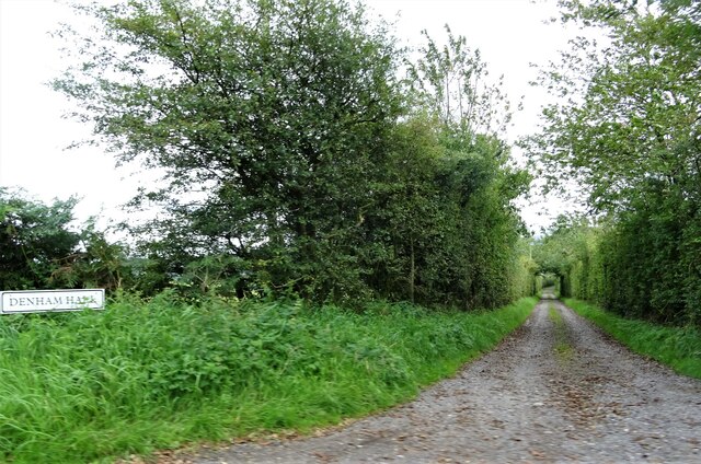
Denham Wood

Wood, Forest in Lancashire Chorley

England

Denham Wood

Old Boundary Marker by the B6228, Blackburn Road, Chorley Parish Parish Boundary Marker by the B6228 (was A674), in parish of Chorley (Chorley District), North of Great Knowley, hidden in grass just South of metal railings by bridge, West side of road.

Surveyed

Milestone Society National ID: LA_CYBB01pb
Old Boundary Marker by the B6228, Blackburn Road, Chorley Parish Credit: Milestone Society

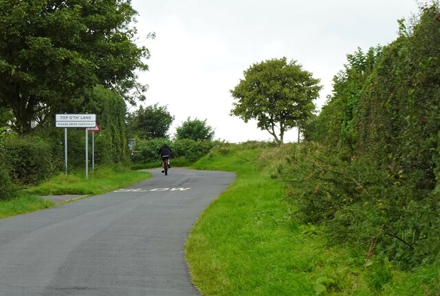
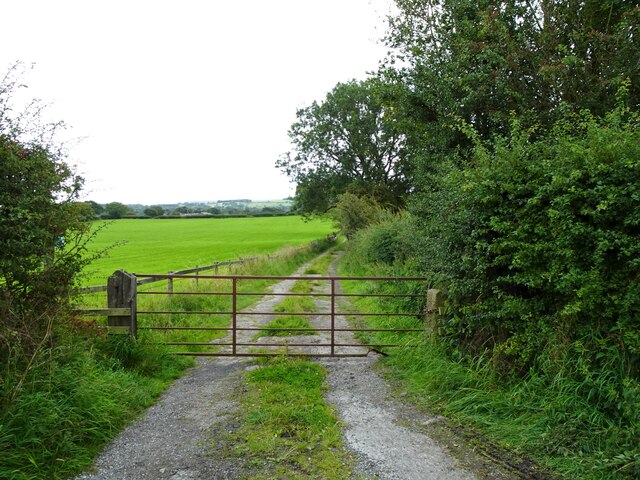
Denham Wood is a beautiful forest located in Lancashire, England. It is a popular destination for nature lovers and outdoor enthusiasts, offering a serene and tranquil environment. The wood covers a vast area and is known for its diverse range of flora and fauna.

The forest is primarily composed of deciduous trees, such as oak, birch, and beech, which create a stunning canopy of foliage during the summer months. The woodland floor is covered in a thick carpet of moss, ferns, and wildflowers, adding to the enchanting atmosphere.

Denham Wood is home to a variety of wildlife, including deer, foxes, badgers, and a wide array of bird species. Birdwatchers will be delighted to spot woodpeckers, owls, and various migratory birds that visit the wood throughout the year.

For those seeking outdoor activities, Denham Wood offers several well-maintained walking and hiking trails. These trails cater to different levels of difficulty, ensuring there is something for everyone. The forest is also popular for picnics, with designated areas and benches available for visitors to relax and enjoy the peaceful surroundings.

Nature conservation is a priority in Denham Wood, with efforts made to maintain the integrity of the forest and preserve its biodiversity. The wood is managed by local authorities and volunteers, who work tirelessly to protect and enhance its natural beauty.

Overall, Denham Wood is a picturesque and ecologically rich forest that offers a delightful escape from the hustle and bustle of everyday life. Whether it's a leisurely walk, birdwatching, or simply enjoying the tranquility of nature, Denham Wood provides a perfect setting for all nature enthusiasts.

If you have any feedback on the listing, please let us know in the comments section below.

Denham Wood Images

Images are sourced within 2km of 53.689992/-2.6087407 or Grid Reference SD5921. Thanks to Geograph Open Source API. All images are credited.

Old Boundary Marker by the B6228, Blackburn Road, Chorley Parish Parish Boundary Marker by the B6228 (was A674), in parish of Chorley (Chorley District), North of Great Knowley, hidden in grass just South of metal railings by bridge, West side of road.

Surveyed

Milestone Society National ID: LA_CYBB01pb
Old Boundary Marker by the B6228, Blackburn Road, Chorley Parish
Parish Boundary Marker by the B6228 (was A674), in parish of Chorley (Chorley District), North of Great Knowley, hidden in grass just South of metal railings by bridge, West side of road. Surveyed Milestone Society National ID: LA_CYBB01pb
Leeds and Liverpool Canal at Johnson's Hillock Top The canal towpath passing the private moorings of Wheelton Boat Club
Leeds and Liverpool Canal at Johnson's Hillock Top
The canal towpath passing the private moorings of Wheelton Boat Club
Approaching the Locks at Johnson's Hillock Top The Leeds and Liverpool Canal near Wheelton - between Chorley and Blackburn
Approaching the Locks at Johnson's Hillock Top
The Leeds and Liverpool Canal near Wheelton - between Chorley and Blackburn
Higher Garstang House Farm On Chapel Lane, Heapey.
Higher Garstang House Farm
On Chapel Lane, Heapey.
Leeds and Liverpool Canal At Top Lock near Wheelton.
Leeds and Liverpool Canal
At Top Lock near Wheelton.
The Top Lock A pub by the Leeds and Liverpool Canal near Wheelton.
The Top Lock
A pub by the Leeds and Liverpool Canal near Wheelton.
Mown field A hay crop will have been recently harvested here by the Leeds and Liverpool Canal.
Mown field
A hay crop will have been recently harvested here by the Leeds and Liverpool Canal.
Canal towpath At Top Lock Bridge near Wheelton.
Canal towpath
At Top Lock Bridge near Wheelton.
Unmown field Probably shortly to be mown for hay.
Unmown field
Probably shortly to be mown for hay.
Wheelton Boatyard On the Leeds and Liverpool Canal.
Wheelton Boatyard
On the Leeds and Liverpool Canal.
Cattle by the canal Young bovines by the edge of the Leeds and Liverpool Canal.
Cattle by the canal
Young bovines by the edge of the Leeds and Liverpool Canal.
Approaching Top o'th' Lane A small hamlet near Brindle in Lancashire.
Approaching Top o'th' Lane
A small hamlet near Brindle in Lancashire.
Track off Denham Lane Also a public footpath leading to Breworth Fold Farm and beyond.
Track off Denham Lane
Also a public footpath leading to Breworth Fold Farm and beyond.
Track leading to Denham Hall Leading off Denham Lane.
Track leading to Denham Hall
Leading off Denham Lane.
Field by the Leeds Liverpool canal On the horizon is the Preston Temple of The Church of Jesus Christ of Latter-day Saints (Mormon), currently the largest outside of Salt Lake City. <a href="https://www.geograph.org.uk/photo/118142">SD5819 : Mormon Temple, Chorley</a>
Field by the Leeds Liverpool canal
On the horizon is the Preston Temple of The Church of Jesus Christ of Latter-day Saints (Mormon), currently the largest outside of Salt Lake City. SD5819 : Mormon Temple, Chorley
Blackburn Road [B6228]
Footpath between Wheelton and Brinscall heading South West Footpath gradually ascending towards Brier Brow
Footpath between Wheelton and Brinscall heading South West
Footpath gradually ascending towards Brier Brow
Approaching Monk's Hill House On the footpath between Wheelton and Brinscall
Approaching Monk's Hill House
On the footpath between Wheelton and Brinscall
Show me another place!

Denham Wood is located at Grid Ref: SD5921 (Lat: 53.689992, Lng: -2.6087407)

Administrative County: Lancashire

District: Chorley

Police Authority: Lancashire

What 3 Words

///fonts.movement.decanter. Near Brinscall, Lancashire

Related Wikis

Wheelton

Wheelton is a village and civil parish of the Borough of Chorley, in Lancashire, England. According to the United Kingdom Census 2001 it has a population...

Heapey

Heapey is a village and civil parish of the Borough of Chorley, in Lancashire, England. The village is two miles from Chorley and on the western fringe...

Withnell Fold

Withnell Fold is a hamlet, situated between Blackburn and Chorley, in Lancashire, England. == History == Withnell Fold, a model village and paper mill...

Lucas Green, Lancashire

Lucas Green is a village in Lancashire, England. == References == The geographic coordinates are from the Ordnance Survey.

Whittle-le-Woods

Whittle-le-Woods (commonly shortened to Whittle) is a village and civil parish of the Borough of Chorley in Lancashire, England. The population of the...

Heapey railway station

Heapey railway station served the village of Heapey, in Lancashire, England. == History == The station was opened by the Lancashire and Yorkshire Railway...

Shaw Hill

Shaw Hill is an 18th-century country house in Whittle-le-Woods, Lancashire, England, standing in 192 acres of parkland some 3 miles (5 km) north of Chorley...

Preston England Temple

The Preston England Temple is the 52nd operating temple of the Church of Jesus Christ of Latter-day Saints (LDS Church). The temple is located in the town...

Nearby Amenities

Located within 500m of 53.689992,-2.6087407
Barrier: cycle_barrier
Bicycle: yes
Cycle Barrier: double
Foot: yes
Motor Vehicle: no
Lat/Long: 53.6877571/-2.6059693
Barrier: cycle_barrier
Bicycle: yes
Cycle Barrier: double
Foot: yes
Maxwidth: 1
Lat/Long: 53.6883549/-2.6051981
Waste Disposal
Lat/Long: 53.6873067/-2.6127527
Noexit: yes
Lat/Long: 53.68675/-2.6135016
Post Box
Check Date Collection Times: 2022-09-23
Collection Times: Mo-Fr 16:45; Sa 11:15
Operator: Royal Mail
Post Box Type: pillar
Ref: PR6 68
Royal Cypher: GVIR
Royal Cypher Wikidata: Q33102169
Source: survey
Lat/Long: 53.6857191/-2.6066083
D.Mayor & Son Coal Merchants
Fuel Coal: yes
Fuel Gas: yes
Mapillary: jIp8CmnV2WmitII8clucqg
Opening Hours: Mo-Sa 09:00-12:30
Phone: +44 1257 262452
Shop: fuel
Website: https://www.dmayorandson.co.uk/
Lat/Long: 53.6883868/-2.6145637
Cafe
Whins
Addr City: Chorley
Addr Postcode: PR6 8HN
Addr Street: Whins Lane
Addr Subdistrict: Wheelton
Diet Vegan: yes
Outdoor Seating: yes
Wheelchair: yes
Lat/Long: 53.691873/-2.6032957
Barrier: stile
Foot: yes
Material: metal
Stile: stepover
Lat/Long: 53.6912424/-2.6035206
The data included in this document is from www.openstreetmap.org. The data is made available under ODbL.

Have you been to Denham Wood?

Leave your review of Denham Wood below (or comments, questions and feedback).