Asps Wood

Wood, Forest in Lancashire

England

Asps Wood

Parkside Road crossing M6
Parkside Road crossing M6 Credit: Alpin Stewart

Asps Wood is a picturesque forest located in the county of Lancashire, England. Spanning over a vast area, the wood is known for its serene and tranquil atmosphere, making it a popular destination for nature enthusiasts and hikers alike.

The wood is primarily composed of aspen trees, which give it its unique name. These slender and graceful trees create a stunning canopy that filters sunlight, casting a beautiful dappled effect on the forest floor. The aspen trees also provide a habitat for a variety of wildlife, including birds, squirrels, and deer. Birdwatchers can spot a range of species, including woodpeckers, owls, and finches.

Asps Wood offers a network of well-maintained walking trails, allowing visitors to explore the natural beauty at their own pace. These trails wind through the forest, leading to hidden clearings and small streams, adding to the charm and allure of the wood. The peaceful ambiance of the wood makes it an ideal spot for a leisurely stroll or a family picnic.

In addition to its natural beauty, Asps Wood has historical significance. It is believed that the wood was once part of an ancient hunting ground used by the local nobility. Remnants of old stone walls and ruins can still be found in some areas, providing a glimpse into the wood's rich past.

Overall, Asps Wood in Lancashire is a stunning forest that offers a tranquil escape from the hustle and bustle of daily life. With its diverse flora and fauna, well-maintained trails, and historical significance, it is a must-visit destination for nature lovers and history enthusiasts alike.

If you have any feedback on the listing, please let us know in the comments section below.

Asps Wood Images

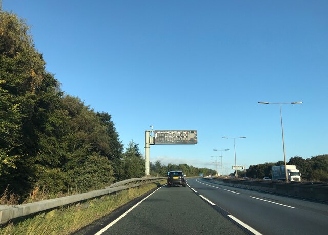
Images are sourced within 2km of 53.433576/-2.6057763 or Grid Reference SJ5993. Thanks to Geograph Open Source API. All images are credited.

Parkside Road crossing M6
A573 bridge  - M6 northbound
A573 bridge - M6 northbound
A49 bridge  - M6 northbound
A49 bridge - M6 northbound
Matrix board  - M6 northbound
Matrix board - M6 northbound
St Oswalds Church, Winwick
OS 1GL Bolt - Winwick, Church <span class="nowrap"><a title="https://www.bench-marks.org.uk/bm26641" rel="nofollow ugc noopener" href="https://www.bench-marks.org.uk/bm26641">Link</a><img style="margin-left:2px;" alt="External link" title="External link - shift click to open in new window" src="https://s1.geograph.org.uk/img/external.png" width="10" height="10"/></span>
OS 1GL Bolt - Winwick, Church
Close up of 1GL Bolt <span class="nowrap"><a title="https://www.bench-marks.org.uk/bm26641" rel="nofollow ugc noopener" href="https://www.bench-marks.org.uk/bm26641">Link</a><img style="margin-left:2px;" alt="External link" title="External link - shift click to open in new window" src="https://s1.geograph.org.uk/img/external.png" width="10" height="10"/></span>
Close up of 1GL Bolt
Door St Oswalds Church, Winwick
Golborne Rd, Winwick
A573 near its crossing over the M6
Hermitage Green Lane
Modern Milestone, Sankey Canal On the Sankey Trail, the path of the canal.

Inscription: 6 / Mile to / Ferry Lock

Milestone Society National ID: SAN-06R
Modern Milestone, Sankey Canal
On the Sankey Trail, the path of the canal. Inscription: 6 / Mile to / Ferry Lock Milestone Society National ID: SAN-06R
Emmanuel Parish Church, Wargrave, Newton-le-Willows
Entrance Emmanuel Parish Church, Wargrave, Newton-le-Willows
OS 1GL Bolt - Wargrave, Emmanuel Church <span class="nowrap"><a title="https://www.bench-marks.org.uk/bm32981" rel="nofollow ugc noopener" href="https://www.bench-marks.org.uk/bm32981">Link</a><img style="margin-left:2px;" alt="External link" title="External link - shift click to open in new window" src="https://s1.geograph.org.uk/img/external.png" width="10" height="10"/></span>
OS 1GL Bolt - Wargrave, Emmanuel Church
Location of OS 1GL Bolt - Wargrave, Emmanuel Church
OS Pivot - Wargrave, Emmanuel Parish Church <span class="nowrap"><a title="https://www.bench-marks.org.uk/bm149237" rel="nofollow ugc noopener" href="https://www.bench-marks.org.uk/bm149237">Link</a><img style="margin-left:2px;" alt="External link" title="External link - shift click to open in new window" src="https://s1.geograph.org.uk/img/external.png" width="10" height="10"/></span>
OS Pivot - Wargrave, Emmanuel Parish Church
Location of OS Pivot - Wargrave, Emmanuel Parish Church
Show me another place!

Asps Wood is located at Grid Ref: SJ5993 (Lat: 53.433576, Lng: -2.6057763)

Unitary Authority: Warrington

Police Authority: Cheshire

What 3 Words

///short.intention.elbow. Near Winwick, Cheshire

Nearby Locations

Cop Holt Wood Asps Wood

Related Wikis

Winwick Hospital

Winwick Hospital was a mental health facility at Winwick, Cheshire, England. == History == The hospital site was previously part of the Winwick Hall estate...

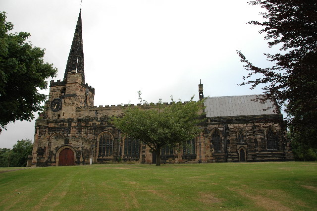
St Oswald's Church, Winwick

St Oswald's Church, is in the village of Winwick, Cheshire, England. The church is recorded in the National Heritage List for England as a designated Grade...

Winwick, Cheshire

Winwick is a village and civil parish in the Borough of Warrington, Cheshire, England. Located within the historic boundaries of Lancashire, it is situated...

Battle of Winwick

The Battle of Winwick (also known as the Battle of Red Bank) was fought on 19 August 1648 near the Lancashire village of Winwick between part of a Royalist...

Nearby Amenities

Located within 500m of 53.433576,-2.6057763
Crossing
Crossing: unmarked
Crossing Island: no
Tactile Paving: yes
Lat/Long: 53.4299968/-2.6100747
Power: tower
Lat/Long: 53.435254/-2.5997545
Crossing
Crossing: unmarked
Crossing Island: no
Tactile Paving: yes
Lat/Long: 53.4304222/-2.6043487
Power: tower
Lat/Long: 53.4317033/-2.6093143
Power: tower
Lat/Long: 53.4341635/-2.6053324
Power: tower
Lat/Long: 53.4352524/-2.6047992
Power: tower
Lat/Long: 53.4352428/-2.6092628
Crossing
Crossing: marked
Crossing Island: no
Lat/Long: 53.4294779/-2.6088638
Power: tower
Lat/Long: 53.435494/-2.6019493
Turning Circle
Lat/Long: 53.4323446/-2.5997
Bus Stop
Winwick Church
Alt Name: St Oswald Church
Bin: yes
Bus: yes
Departures Board: no
Naptan AtcoCode: 069000010420
Naptan NaptanCode: wrgmapd
Public Transport: platform
Shelter: yes
Lat/Long: 53.4315021/-2.5994953
Bus Stop
Old School House Lane
Bus: yes
Departures Board: no
Public Transport: platform
Shelter: no
Lat/Long: 53.4337763/-2.6018898
Bus Stop
Old School House Lane
Bus: yes
Public Transport: platform
Shelter: no
Lat/Long: 53.4340427/-2.6023797
Bus Stop
Winwick Church
Alt Name: St Oswald Church
Bus: yes
Departures Board: no
Public Transport: platform
Shelter: no
Lat/Long: 53.4308819/-2.5998266
Bus Stop
Winwick Park
Bus: yes
Departures Board: timetable
Public Transport: platform
Shelter: no
Lat/Long: 53.4304301/-2.6040452
Bus Stop
Winwick Park
Bus: yes
Departures Board: no
Public Transport: platform
Shelter: no
Lat/Long: 53.4304482/-2.6044323
Bus Stop
Hollins Park Hospital
Bus: yes
Departures Board: no
Public Transport: platform
Shelter: no
Lat/Long: 53.4299114/-2.6095643
Bus Stop
Hollins Park Hospital
Bus: yes
Departures Board: timetable
Public Transport: platform
Shelter: yes
Lat/Long: 53.4300255/-2.6099753
Crossing
Crossing: unmarked
Crossing Island: no
Tactile Paving: no
Lat/Long: 53.4339224/-2.6020626
Crossing
Crossing: unmarked
Crossing Island: no
Tactile Paving: no
Lat/Long: 53.4334633/-2.6015591
Crossing
Crossing: unmarked
Lat/Long: 53.4324591/-2.6003897
Crossing
Crossing: unmarked
Lat/Long: 53.4321759/-2.6000666
Crossing
Crossing: unmarked
Crossing Island: no
Tactile Paving: no
Lat/Long: 53.429851/-2.608957
Crossing
Crossing: unmarked
Crossing Island: no
Tactile Paving: yes
Lat/Long: 53.4301156/-2.601903
Crossing
Crossing: unmarked
Crossing Island: no
Crossing Markings: no
Tactile Paving: no
Lat/Long: 53.4304406/-2.6021276
Crossing
Crossing: unmarked
Crossing Island: no
Tactile Paving: yes
Lat/Long: 53.4305975/-2.6020697
Crossing
Crossing: unmarked
Crossing Island: no
Tactile Paving: no
Lat/Long: 53.4297013/-2.6021798
Milestone
HE Ref: 1230792
Listed Status: Grade II
Source: survey
Wikidata: Q26524442
Lat/Long: 53.4332204/-2.601448
Addr Housenumber: 1
Lat/Long: 53.4337641/-2.6021337
Crossing
Lat/Long: 53.4319498/-2.5998089
The data included in this document is from www.openstreetmap.org. The data is made available under ODbL.

Have you been to Asps Wood?

Leave your review of Asps Wood below (or comments, questions and feedback).