Beeston Wood

Wood, Forest in Lancashire South Ribble

England

Beeston Wood

Passing a Building Site in Coup Green The footpath keeps to the right of the hedge, only to come to an abrupt halt as it crosses a small footbridge a few yards further on. The building company has sealed off access without prior warning.
Option one is to turn around and walk back to Hoghton.
Option two is to be creative and find a channel to wriggle around all obstacles to bypass the site.
Option three, recommended for athletes and Marines only, vault over the 8ft high barrier and walk through construction workings without breaking stride.
Passing a Building Site in Coup Green Credit: Chris Heaton

Beeston Wood is a picturesque woodland located in the county of Lancashire, England. Covering an area of approximately 100 acres, it is a significant natural attraction in the region. The wood is situated in close proximity to the village of Beeston, near the town of Preston.

This woodland is predominantly composed of broadleaf trees, creating a rich and diverse ecosystem. The towering oak, beech, and birch trees provide a lush canopy that offers shade and shelter to a wide variety of flora and fauna. The forest floor is carpeted with ferns, bluebells, and wildflowers, adding to the enchanting ambiance of the wood.

Beeston Wood is a popular destination for nature enthusiasts and walkers alike. Numerous footpaths meander through the woodland, allowing visitors to explore its beauty at their own pace. The serenity of the surroundings makes it an ideal spot for peaceful walks, birdwatching, and photography.

Wildlife thrives within the wood, with a multitude of species calling it home. Birdwatchers can spot various species, including woodpeckers, owls, and thrushes. The wood is also inhabited by mammals such as deer, foxes, and rabbits.

Managed by local conservation organizations, Beeston Wood is protected to ensure the preservation of its natural beauty and biodiversity. Educational programs and guided tours are occasionally organized, offering visitors the opportunity to learn more about the woodland's ecology and history.

Overall, Beeston Wood is a cherished natural gem in Lancashire, offering a tranquil escape from the hustle and bustle of everyday life whilst providing a haven for wildlife and a delightful experience for visitors.

If you have any feedback on the listing, please let us know in the comments section below.
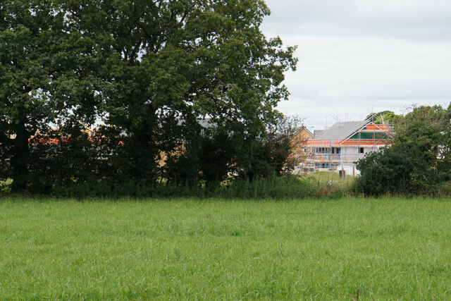
Beeston Wood Images

Images are sourced within 2km of 53.745746/-2.614035 or Grid Reference SD5927. Thanks to Geograph Open Source API. All images are credited.

Passing a Building Site in Coup Green The footpath keeps to the right of the hedge, only to come to an abrupt halt as it crosses a small footbridge a few yards further on. The building company has sealed off access without prior warning.
Option one is to turn around and walk back to Hoghton.
Option two is to be creative and find a channel to wriggle around all obstacles to bypass the site.
Option three, recommended for athletes and Marines only, vault over the 8ft high barrier and walk through construction workings without breaking stride.
Passing a Building Site in Coup Green
The footpath keeps to the right of the hedge, only to come to an abrupt halt as it crosses a small footbridge a few yards further on. The building company has sealed off access without prior warning. Option one is to turn around and walk back to Hoghton. Option two is to be creative and find a channel to wriggle around all obstacles to bypass the site. Option three, recommended for athletes and Marines only, vault over the 8ft high barrier and walk through construction workings without breaking stride.
Footbridge over Beeston Brook Not the most attractive brook, being sluggish with a fair amount of litter thrown in.
It carries the footpath between Coup Green and Fleetwood Hall over the brook in Beeston Wood.
Footbridge over Beeston Brook
Not the most attractive brook, being sluggish with a fair amount of litter thrown in. It carries the footpath between Coup Green and Fleetwood Hall over the brook in Beeston Wood.
Former Paper Mill at Roach Bridge Backs onto the River Darwen
<a href="https://www.geograph.org.uk/photo/6960755">SD5928 : River Darwen at Roach Bridge</a>
Former Paper Mill at Roach Bridge
Backs onto the River Darwen SD5928 : River Darwen at Roach Bridge
River Darwen at Roach Bridge Flows past the former paper mill - the weir was constructed to supply water to the enterprise.
<a href="https://www.geograph.org.uk/photo/6960752">SD5928 : Former Paper Mill at Roach Bridge</a>
River Darwen at Roach Bridge
Flows past the former paper mill - the weir was constructed to supply water to the enterprise. SD5928 : Former Paper Mill at Roach Bridge
Farm Outbuildings at Fleetwood Hall
Fleetwood Hall
Fleetwood Hall
Cuerdale Lane heading South West B6230 heading towards Walton-le-Dale and Preston
Cuerdale Lane heading South West
B6230 heading towards Walton-le-Dale and Preston
Pasture off Cuerdale Lane
Cuerdale Lane heading North East B6230 heading towards the Preston New Road
Cuerdale Lane heading North East
B6230 heading towards the Preston New Road
New Hall Tavern Located at a cross roads on Cuerdale Lane near Roach Bridge
New Hall Tavern
Located at a cross roads on Cuerdale Lane near Roach Bridge
Major Upgrade to Samlesbury Brewery Large investment to install a new canning line, brewing modifications and increasing capacity undertaken by the Budweiser Group.
Major Upgrade to Samlesbury Brewery
Large investment to install a new canning line, brewing modifications and increasing capacity undertaken by the Budweiser Group.
Footpath heading towards Cuerdale Lane
Cuerdale Lane bridge - northbound M6
Hoghton Lane, Coupe Green The A675 at the eastern end of the village, at its junction with Bells Lane.
Hoghton Lane, Coupe Green
The A675 at the eastern end of the village, at its junction with Bells Lane.
New housing on the edge of Coupe Green The former field at the end of Manor Close is now being built on, as viewed from the next field.
New housing on the edge of Coupe Green
The former field at the end of Manor Close is now being built on, as viewed from the next field.
Path through the hedge Part of a footpath on the eastern side of Coupe Green.
Path through the hedge
Part of a footpath on the eastern side of Coupe Green.
Green Lane A farm track heading in the direction of Roach Bridge, but it degenerates to a footpath before it gets there.
Green Lane
A farm track heading in the direction of Roach Bridge, but it degenerates to a footpath before it gets there.
Pond near Roach Bridge One of several still surviving on farmland near the River Darwen.
Pond near Roach Bridge
One of several still surviving on farmland near the River Darwen.
Show me another place!

Beeston Wood is located at Grid Ref: SD5927 (Lat: 53.745746, Lng: -2.614035)

Administrative County: Lancashire

District: South Ribble

Police Authority: Lancashire

What 3 Words

///respected.acre.soda. Near Preston, Lancashire

Related Wikis

Coupe Green

Coupe Green or Coup Green is a village in Lancashire, England. It is located on the A675 between Higher Walton and Hoghton. The village is in the borough...

Gregson Lane

Gregson Lane is a village in Lancashire, England. It is situated between Bamber Bridge, Higher Walton, Coupe Green and Brindle, and is within four miles...

Hoghton railway station

Hoghton railway station was a railway station in Lancashire that served the village of Hoghton. It was situated on the East Lancashire Line between Preston...

All Saints Church, Higher Walton

All Saints Church is in Blackburn Road in the village of Higher Walton, Lancashire, England. It is an active Anglican parish church in the deanery of Leyland...

Nearby Amenities

Located within 500m of 53.745746,-2.614035
Turning Circle
Lat/Long: 53.7417066/-2.6154863
Power: pole
Lat/Long: 53.7450662/-2.6209002
Power: pole
Lat/Long: 53.7457351/-2.6200266
Power: pole
Lat/Long: 53.746303/-2.6193934
Power: pole
Lat/Long: 53.7468303/-2.6190587
Power: pole
Lat/Long: 53.7475167/-2.618702
Power: pole
Lat/Long: 53.7481802/-2.6183398
Power: pole
Lat/Long: 53.7488974/-2.6180737
Power: pole
Lat/Long: 53.7495626/-2.6173768
Waste Basket
Lat/Long: 53.7432559/-2.6183155
The data included in this document is from www.openstreetmap.org. The data is made available under ODbL.

Have you been to Beeston Wood?

Leave your review of Beeston Wood below (or comments, questions and feedback).