Gregson Lane

Settlement in Lancashire Chorley

England

Gregson Lane

Passing a Building Site in Coup Green The footpath keeps to the right of the hedge, only to come to an abrupt halt as it crosses a small footbridge a few yards further on. The building company has sealed off access without prior warning.
Option one is to turn around and walk back to Hoghton.
Option two is to be creative and find a channel to wriggle around all obstacles to bypass the site.
Option three, recommended for athletes and Marines only, vault over the 8ft high barrier and walk through construction workings without breaking stride.
Passing a Building Site in Coup Green Credit: Chris Heaton

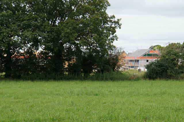
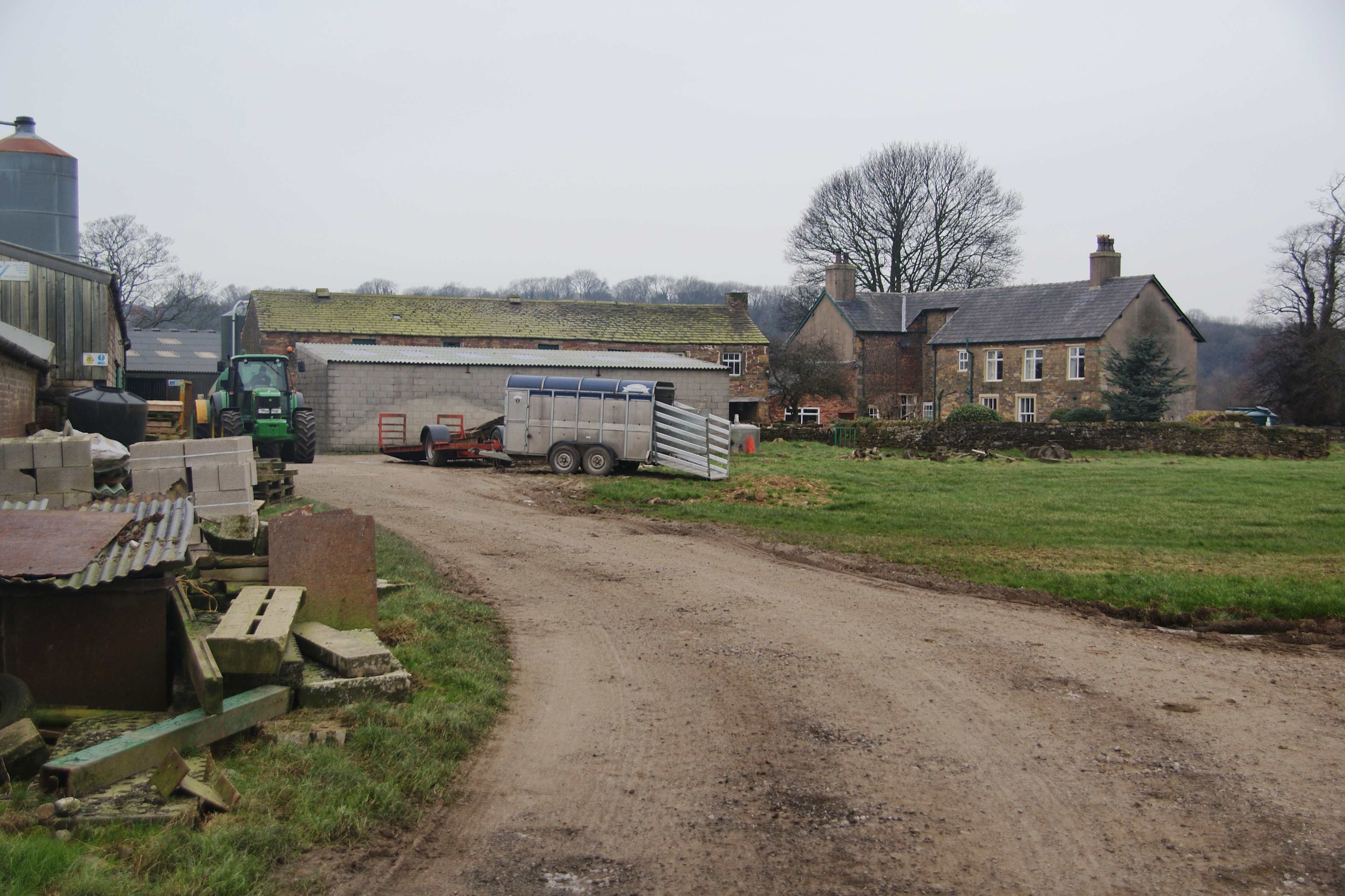
Gregson Lane is a small village located in the county of Lancashire, England. Situated in the South Ribble district, it lies approximately 7 miles northwest of the city of Preston. The village is nestled in a scenic rural area surrounded by beautiful landscapes and countryside.

With a population of around 1,500 people, Gregson Lane boasts a close-knit community atmosphere. The village is primarily residential, consisting mainly of traditional stone-built houses and cottages. The architecture reflects the area's rich history, with some buildings dating back several centuries.

Although relatively small, Gregson Lane offers a range of amenities to its residents. These include a local convenience store, a post office, and a primary school, providing essential services and facilities within walking distance. Additionally, the village is well-connected to neighboring towns and cities through a reliable public transportation network.

Nature enthusiasts will find plenty to explore in the surrounding area. Gregson Lane is situated near picturesque countryside, with numerous walking trails and nature reserves to enjoy. The nearby River Darwen adds to the village's charm, providing scenic views and recreational opportunities for locals and visitors alike.

Overall, Gregson Lane offers a peaceful and idyllic setting for those seeking a quieter way of life while still being within easy reach of larger urban areas. With its strong community spirit and beautiful surroundings, it is a desirable place to reside for both families and individuals.

If you have any feedback on the listing, please let us know in the comments section below.

Gregson Lane Images

Images are sourced within 2km of 53.743642/-2.615568 or Grid Reference SD5927. Thanks to Geograph Open Source API. All images are credited.

Passing a Building Site in Coup Green The footpath keeps to the right of the hedge, only to come to an abrupt halt as it crosses a small footbridge a few yards further on. The building company has sealed off access without prior warning.
Option one is to turn around and walk back to Hoghton.
Option two is to be creative and find a channel to wriggle around all obstacles to bypass the site.
Option three, recommended for athletes and Marines only, vault over the 8ft high barrier and walk through construction workings without breaking stride.
Passing a Building Site in Coup Green
The footpath keeps to the right of the hedge, only to come to an abrupt halt as it crosses a small footbridge a few yards further on. The building company has sealed off access without prior warning. Option one is to turn around and walk back to Hoghton. Option two is to be creative and find a channel to wriggle around all obstacles to bypass the site. Option three, recommended for athletes and Marines only, vault over the 8ft high barrier and walk through construction workings without breaking stride.
Footbridge over Beeston Brook Not the most attractive brook, being sluggish with a fair amount of litter thrown in.
It carries the footpath between Coup Green and Fleetwood Hall over the brook in Beeston Wood.
Footbridge over Beeston Brook
Not the most attractive brook, being sluggish with a fair amount of litter thrown in. It carries the footpath between Coup Green and Fleetwood Hall over the brook in Beeston Wood.
Former Paper Mill at Roach Bridge Backs onto the River Darwen
<a href="https://www.geograph.org.uk/photo/6960755">SD5928 : River Darwen at Roach Bridge</a>
Former Paper Mill at Roach Bridge
Backs onto the River Darwen SD5928 : River Darwen at Roach Bridge
River Darwen at Roach Bridge Flows past the former paper mill - the weir was constructed to supply water to the enterprise.
<a href="https://www.geograph.org.uk/photo/6960752">SD5928 : Former Paper Mill at Roach Bridge</a>
River Darwen at Roach Bridge
Flows past the former paper mill - the weir was constructed to supply water to the enterprise. SD5928 : Former Paper Mill at Roach Bridge
Farm Outbuildings at Fleetwood Hall
Fleetwood Hall
Fleetwood Hall
Cuerdale Lane heading South West B6230 heading towards Walton-le-Dale and Preston
Cuerdale Lane heading South West
B6230 heading towards Walton-le-Dale and Preston
Pasture off Cuerdale Lane
Cuerdale Lane heading North East B6230 heading towards the Preston New Road
Cuerdale Lane heading North East
B6230 heading towards the Preston New Road
New Hall Tavern Located at a cross roads on Cuerdale Lane near Roach Bridge
New Hall Tavern
Located at a cross roads on Cuerdale Lane near Roach Bridge
Major Upgrade to Samlesbury Brewery Large investment to install a new canning line, brewing modifications and increasing capacity undertaken by the Budweiser Group.
Major Upgrade to Samlesbury Brewery
Large investment to install a new canning line, brewing modifications and increasing capacity undertaken by the Budweiser Group.
Footpath heading towards Cuerdale Lane
Hoghton Lane, Coupe Green The A675 at the eastern end of the village, at its junction with Bells Lane.
Hoghton Lane, Coupe Green
The A675 at the eastern end of the village, at its junction with Bells Lane.
New housing on the edge of Coupe Green The former field at the end of Manor Close is now being built on, as viewed from the next field.
New housing on the edge of Coupe Green
The former field at the end of Manor Close is now being built on, as viewed from the next field.
Path through the hedge Part of a footpath on the eastern side of Coupe Green.
Path through the hedge
Part of a footpath on the eastern side of Coupe Green.
Green Lane A farm track heading in the direction of Roach Bridge, but it degenerates to a footpath before it gets there.
Green Lane
A farm track heading in the direction of Roach Bridge, but it degenerates to a footpath before it gets there.
Pond near Roach Bridge One of several still surviving on farmland near the River Darwen.
Pond near Roach Bridge
One of several still surviving on farmland near the River Darwen.
Residential development at Roach Bridge Mill Planning permission was granted in 2011 for this construction on former paper mill land.
Residential development at Roach Bridge Mill
Planning permission was granted in 2011 for this construction on former paper mill land.
Show me another place!

Gregson Lane is located at Grid Ref: SD5927 (Lat: 53.743642, Lng: -2.615568)

Administrative County: Lancashire

District: Chorley

Police Authority: Lancashire

What 3 Words

///along.anguished.counts. Near Clayton-le-Woods, Lancashire

Related Wikis

Coupe Green

Coupe Green or Coup Green is a village in Lancashire, England. It is located on the A675 between Higher Walton and Hoghton. The village is in the borough...

Gregson Lane

Gregson Lane is a village in Lancashire, England. It is situated between Bamber Bridge, Higher Walton, Coupe Green and Brindle, and is within four miles...

Hoghton railway station

Hoghton railway station was a railway station in Lancashire that served the village of Hoghton. It was situated on the East Lancashire Line between Preston...

All Saints Church, Higher Walton

All Saints Church is in Blackburn Road in the village of Higher Walton, Lancashire, England. It is an active Anglican parish church in the deanery of Leyland...

Higher Walton, Lancashire

Higher Walton is a village in South Ribble, Lancashire, England. It is on the old road between Blackburn and Preston where it crosses the River Darwen...

Cuerdale

Cuerdale is a civil parish in the South Ribble district of Lancashire, England. It includes Cuerdale Hall and has no substantive settlements. It originated...

Hoghton

Hoghton is a small village and civil parish in the Borough of Chorley, Lancashire, England. At the 2011 Census, it had a population of 802. Brindle and...

Holy Trinity Church, Hoghton

Holy Trinity Church is in the village of Hoghton, Lancashire, England. It is an active Anglican parish church in the deanery of Leyland, the archdeaconry...

Nearby Amenities

Located within 500m of 53.743642,-2.615568
Post Box
Collection Times: Mo-Fr 09:00; Sa 07:00
Operator: Royal Mail
Post Box Type: pillar
Postal Code: PR5
Ref: PR5 37D
Royal Cypher: EIIR
Royal Cypher Wikidata: Q33102113
Lat/Long: 53.7414086/-2.6215741
Description: red telephone box
Operator: BT
Removed Amenity: telephone
Lat/Long: 53.7412414/-2.6205138
Coupe Green
Alt Name: Coup Green
Place: village
Source Name: OS Streetview;local knowledge
Lat/Long: 53.7416636/-2.619361
Turning Circle
Lat/Long: 53.7417066/-2.6154863
Bus Stop
Hoghton, Old Oak
Naptan AtcoCode: 2500570
Naptan NaptanCode: lanawpdm
Public Transport: platform
Ref: unknown
Shelter: yes
Source: Bing;survey
Lat/Long: 53.7410126/-2.6190808
Turning Circle
Lat/Long: 53.74161/-2.6176382
Bus Stop
Hoghton, opposite Old Oak
Naptan AtcoCode: 250020158
Naptan NaptanCode: lanatwgj
Public Transport: platform
Ref: lanatwgj;250020158
Shelter: yes
Source: survey
Lat/Long: 53.7410262/-2.619944
Bus Stop
Hoghton, Bells Lane
Public Transport: platform
Ref: landtgpa;2500IMG1497
Route Ref: 150;151;152;352
Shelter: yes
Source: survey
Lat/Long: 53.7400716/-2.6151933
Bus Stop
Hoghton, Bells Lane
Public Transport: platform
Shelter: yes
Source: survey
Lat/Long: 53.7400735/-2.6148353
Barrier: entrance
Lat/Long: 53.7446537/-2.6221467
Location Transition: yes
Power: pole
Transformer: yes
Lat/Long: 53.7447327/-2.6221231
Power: pole
Lat/Long: 53.7450662/-2.6209002
Power: pole
Lat/Long: 53.7457351/-2.6200266
Power: pole
Lat/Long: 53.746303/-2.6193934
Power: pole
Lat/Long: 53.7468303/-2.6190587
Power: pole
Lat/Long: 53.7475167/-2.618702
Barrier: stile
Foot: yes
Lat/Long: 53.7405973/-2.610764
Waste Basket
Lat/Long: 53.7410215/-2.6191122
Waste Basket
Lat/Long: 53.7410278/-2.6199684
Waste Basket
Lat/Long: 53.741513/-2.619425
Waste Basket
Lat/Long: 53.7432559/-2.6183155
Waste Basket
Lat/Long: 53.7442901/-2.6214666
Barrier: entrance
Lat/Long: 53.7443983/-2.6217641
Barrier: entrance
Lat/Long: 53.7445397/-2.6219078
Give Way
Direction: backward
Lat/Long: 53.7412197/-2.6216919
Stop
Direction: forward
Lat/Long: 53.7399976/-2.6149548
The data included in this document is from www.openstreetmap.org. The data is made available under ODbL.

Have you been to Gregson Lane?

Leave your review of Gregson Lane below (or comments, questions and feedback).