Chalmington Firs

Wood, Forest in Dorset

England

Chalmington Firs

Ford and cottages in Lower Wraxhall
Ford and cottages in Lower Wraxhall Credit: Trevor Harris

Chalmington Firs, located in the picturesque county of Dorset in southern England, is a charming wood and forest that spans over a vast area. With its breathtaking natural beauty and diverse ecosystem, it has become a popular destination for nature lovers and outdoor enthusiasts.

The wood is primarily composed of a mix of deciduous and coniferous trees, including oak, beech, pine, and spruce, creating a rich and vibrant canopy. The forest floor is adorned with an array of wildflowers and ferns, adding to the enchanting ambiance of the area. Numerous walking trails wind their way through the wood, allowing visitors to explore and discover its hidden treasures.

Chalmington Firs is also home to a variety of wildlife, making it a haven for nature enthusiasts. Birdwatchers can spot species such as woodpeckers, owls, and various songbirds, while small mammals like rabbits, badgers, and foxes roam the forest floor. The tranquil atmosphere of the wood provides the perfect opportunity for wildlife photography and observation.

In addition to its natural beauty, Chalmington Firs offers recreational activities for visitors. Picnic areas and designated camping spots provide opportunities for relaxation and enjoyment amidst the stunning surroundings. The wood is also a popular spot for nature education, with guided tours and workshops available to learn about the local flora and fauna.

Chalmington Firs is a hidden gem in the Dorset countryside, offering a peaceful retreat and an escape from the hustle and bustle of everyday life. Whether you seek solitude, adventure, or a deeper connection with nature, this wood and forest is sure to captivate and inspire all who visit.

If you have any feedback on the listing, please let us know in the comments section below.

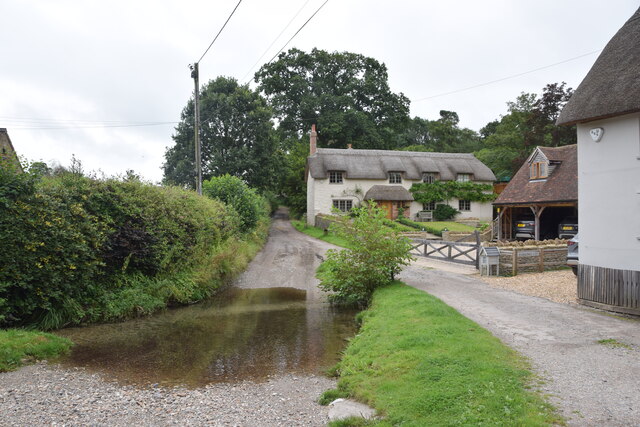
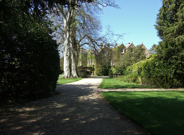
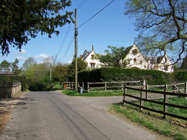
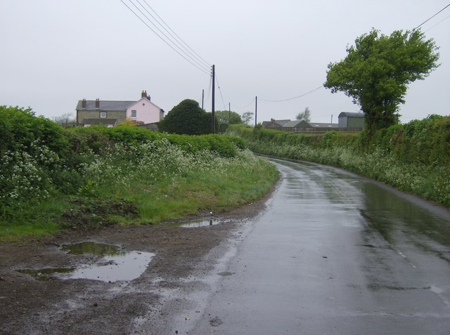
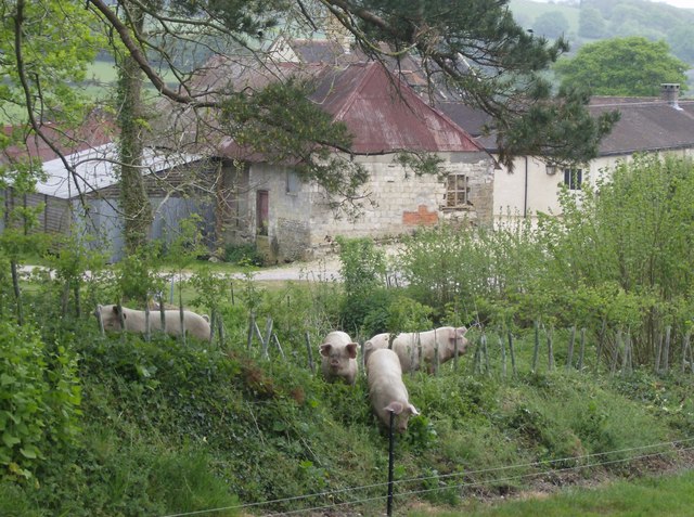
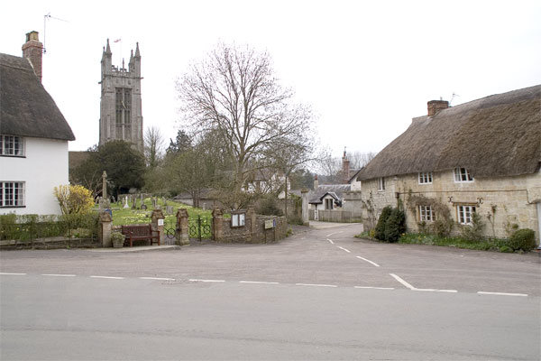
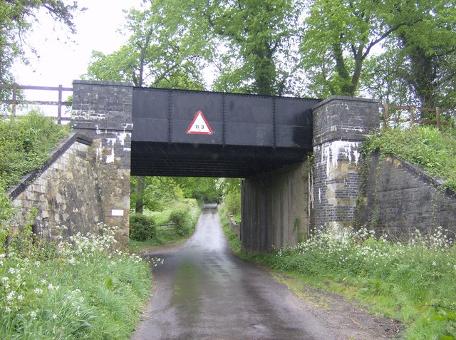
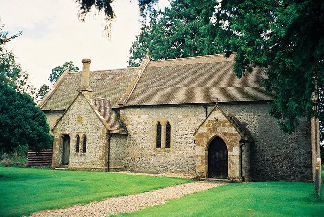
Chalmington Firs Images

Images are sourced within 2km of 50.802231/-2.5774905 or Grid Reference ST5900. Thanks to Geograph Open Source API. All images are credited.

Ford and cottages in Lower Wraxhall
Lower Wraxall Church Wraxall is divided into two tiny hamlets. Lower Wraxall has this small church of St. Mary, just a nave and chancel. The chancel arch and doorway are all that remains from the 12th century original with remainder much restored, including a 19th century east window and bell cote.
Lower Wraxall Church
Wraxall is divided into two tiny hamlets. Lower Wraxall has this small church of St. Mary, just a nave and chancel. The chancel arch and doorway are all that remains from the 12th century original with remainder much restored, including a 19th century east window and bell cote.
Chantmarle Manor The picture was taken on the road towards Frome St Quintin. This road passes and ends at Chantmarle Manor which until recently was a police training centre, and is now a conference centre.
Chantmarle Manor
The picture was taken on the road towards Frome St Quintin. This road passes and ends at Chantmarle Manor which until recently was a police training centre, and is now a conference centre.
Path above Chantmarle Manor Taken from the footpath just above Chantmarle Manor. Woodlands to the rear.
Path above Chantmarle Manor
Taken from the footpath just above Chantmarle Manor. Woodlands to the rear.
Woodland Path above Chantmarle Manor This path is situated in privately owned woodland associated with the conference centre at Chantmarle Manor.
Woodland Path above Chantmarle Manor
This path is situated in privately owned woodland associated with the conference centre at Chantmarle Manor.
Pond at Chantmarle Manor This pond is situated within the grounds of the conference centre at Chantmarle.
Pond at Chantmarle Manor
This pond is situated within the grounds of the conference centre at Chantmarle.
Chalmington Manor Early 19th century Tudor style manor house, with a possible late C16 core. Grade II listed.
Chalmington Manor
Early 19th century Tudor style manor house, with a possible late C16 core. Grade II listed.
Chalmington The former manor house stable block across the road from the manor, has since been converted into a substantial residence called "Woodlands".
Chalmington
The former manor house stable block across the road from the manor, has since been converted into a substantial residence called "Woodlands".
Sad Signpost at Sandhills This is one of several such signposts in the area that need some TLC from Dorset County Council. Viewpoint is from the south looking towards Evershot.
Sad Signpost at Sandhills
This is one of several such signposts in the area that need some TLC from Dorset County Council. Viewpoint is from the south looking towards Evershot.
A Glimpse of Metford Mill Metford Mill is no longer a mill, but is today a Grade II Listed late C17 farmhouse.
A Glimpse of Metford Mill
Metford Mill is no longer a mill, but is today a Grade II Listed late C17 farmhouse.
Access Road to Holway Farm View is from the Public Footpath. Modern farm buildings that are all too visible further along, unfortunately screen views of Holway Farm's 17th century farmhouse.
Access Road to Holway Farm
View is from the Public Footpath. Modern farm buildings that are all too visible further along, unfortunately screen views of Holway Farm's 17th century farmhouse.
Lane north of Cattistock On my way in to Cattistock the previous evening, I forgot to get a picture of this square as we passed through.  Too keen to get to my bed and breakfast.  So I had to nip back the following morning.  It was a Bank Holiday so it was raining, after weeks of fine weather.
Lane north of Cattistock
On my way in to Cattistock the previous evening, I forgot to get a picture of this square as we passed through. Too keen to get to my bed and breakfast. So I had to nip back the following morning. It was a Bank Holiday so it was raining, after weeks of fine weather.
Evidence of its former use Chantmarle was previously used as a Police training college.  Here is some evidence of its former use; a road layout very specifically marked out and empty shells of buildings presumably used to teach "search and entry".
Evidence of its former use
Chantmarle was previously used as a Police training college. Here is some evidence of its former use; a road layout very specifically marked out and empty shells of buildings presumably used to teach "search and entry".
Pigs at North Holway Farm These pigs appeared to have made a break for freedom but they were still within the electric fence.
Pigs at North Holway Farm
These pigs appeared to have made a break for freedom but they were still within the electric fence.
North Holway Farm Looks like a well-kept self-contained farm.  This sits just above the flood plain of the River Frome.  The Macmillan Way runs behind the farm on higher ground.
North Holway Farm
Looks like a well-kept self-contained farm. This sits just above the flood plain of the River Frome. The Macmillan Way runs behind the farm on higher ground.
Holway Farm Like many farms in this area, this is primarily cattle.  It is probably beef rather than dairy farming.  Amongst the cows spot the bull, lying down observing us carefully.
Holway Farm
Like many farms in this area, this is primarily cattle. It is probably beef rather than dairy farming. Amongst the cows spot the bull, lying down observing us carefully.
House on Holway Lane A typical stone built house of the area with a copper beech for company.
House on Holway Lane
A typical stone built house of the area with a copper beech for company.
Yeovil to Dorchester railway line Formerly a double-track railway, the single line is now skewed more towards the middle of the track bed, a common practice.
Yeovil to Dorchester railway line
Formerly a double-track railway, the single line is now skewed more towards the middle of the track bed, a common practice.
Show me another place!

Chalmington Firs is located at Grid Ref: ST5900 (Lat: 50.802231, Lng: -2.5774905)

Unitary Authority: Dorset

Police Authority: Dorset

What 3 Words

///composes.boost.chatting. Near Maiden Newton, Dorset

Related Wikis

Chalmington

Chalmington is a small hamlet close to the village of Cattistock, in west Dorset, England. == References == == External links == Media related to Chalmington...

Cattistock

Cattistock is a village and civil parish in west Dorset, England, sited in the upper reaches of the Frome Valley, 8 miles (13 km) northwest of the county...

Cattistock railway station

Cattistock Halt railway station was a railway station in the county of Dorset in England. It was served by trains on what is now known as the Heart of...

Chilfrome

Chilfrome () is a small village and civil parish in the county of Dorset in southwest England. It lies in the Dorset unitary authority administrative area...

Wraxall, Dorset

Wraxall is a civil parish in the English county of Dorset, consisting of the two hamlets Higher Wraxall and Lower Wraxall. It is situated in a valley in...

West Dorset (UK Parliament constituency)

West Dorset is a constituency represented in the House of Commons of the UK Parliament since 2019 by Chris Loder, a Conservative. == History == The seat...

West Dorset

West Dorset was a local government district in Dorset, England. The district was formed on 1 April 1974 under the Local Government Act 1972, and was a...

Frome St Quintin

Frome St Quintin is a village in the county of Dorset in southern England, situated approximately 11 miles (18 km) northwest of the county town Dorchester...

Related Videos

West Dorset 3 Peaks Challenge / Thorncombe Beacon, Golden Cap & Colmer’s Hill / Insta360 One X2

Thanks to West Dorset Leisure Holidays for creating this great walk that takes in 3 peaks around their campsites of Highlands End ...
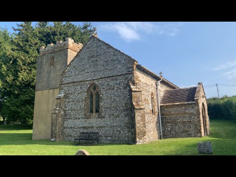
Nearby Amenities

Located within 500m of 50.802231,-2.5774905
Material: wood
Power: pole
Source: bing
Lat/Long: 50.8008664/-2.5832039
Material: wood
Power: pole
Source: bing
Lat/Long: 50.8008688/-2.5808853
Material: wood
Power: pole
Source: bing
Lat/Long: 50.8009002/-2.5791803
Material: wood
Power: pole
Source: bing
Lat/Long: 50.8009131/-2.5772207
Material: wood
Power: pole
Source: bing
Lat/Long: 50.8011135/-2.5754699
Material: wood
Power: pole
Source: bing
Lat/Long: 50.801301/-2.5736822
Material: wood
Power: pole
Source: bing
Lat/Long: 50.8015472/-2.5713533
Chalmington
Place: hamlet
Wikidata: Q5069025
Lat/Long: 50.8056347/-2.5770133
Barrier: stile
Foot: yes
Horse: no
Lat/Long: 50.7987861/-2.5807281
Barrier: stile
Foot: yes
Horse: no
Lat/Long: 50.8004348/-2.5806298
Castle Hill
Archaeological Site: tumulus
Historic: archaeological_site
Source: survey
Website: https://historicengland.org.uk/listing/the-list/list-entry/1004545
Wikidata: Q31115834
Lat/Long: 50.7990457/-2.5772059
Barrier: stile
Lat/Long: 50.8018685/-2.5779483
Direction: S
Generator Method: photovoltaic
Generator Output Electricity: yes
Generator Solar Modules: 17
Generator Source: solar
Generator Type: solar_photovoltaic_panel
Location: roof
Power: generator
Lat/Long: 50.8061159/-2.5748995
The data included in this document is from www.openstreetmap.org. The data is made available under ODbL.

Have you been to Chalmington Firs?

Leave your review of Chalmington Firs below (or comments, questions and feedback).