Big Wood

Wood, Forest in Lancashire

England

Big Wood

Eddie Stobart, Warrington Eddie Stobart Logistics is the largest freight and transport haulage company in the UK. It is an offshoot of the Eddie Stobart Group Ltd founded by "steady" Eddie Stobart in the 1950s.
Eddie Stobart, Warrington Credit: N Chadwick

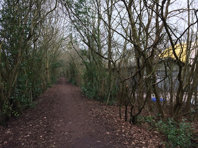
Big Wood is a dense forest located in the county of Lancashire, England. Covering an area of approximately 500 acres, it is considered one of the largest woodlands in the region. The forest is situated on the outskirts of the town of Wood, which takes its name from this expansive woodland.

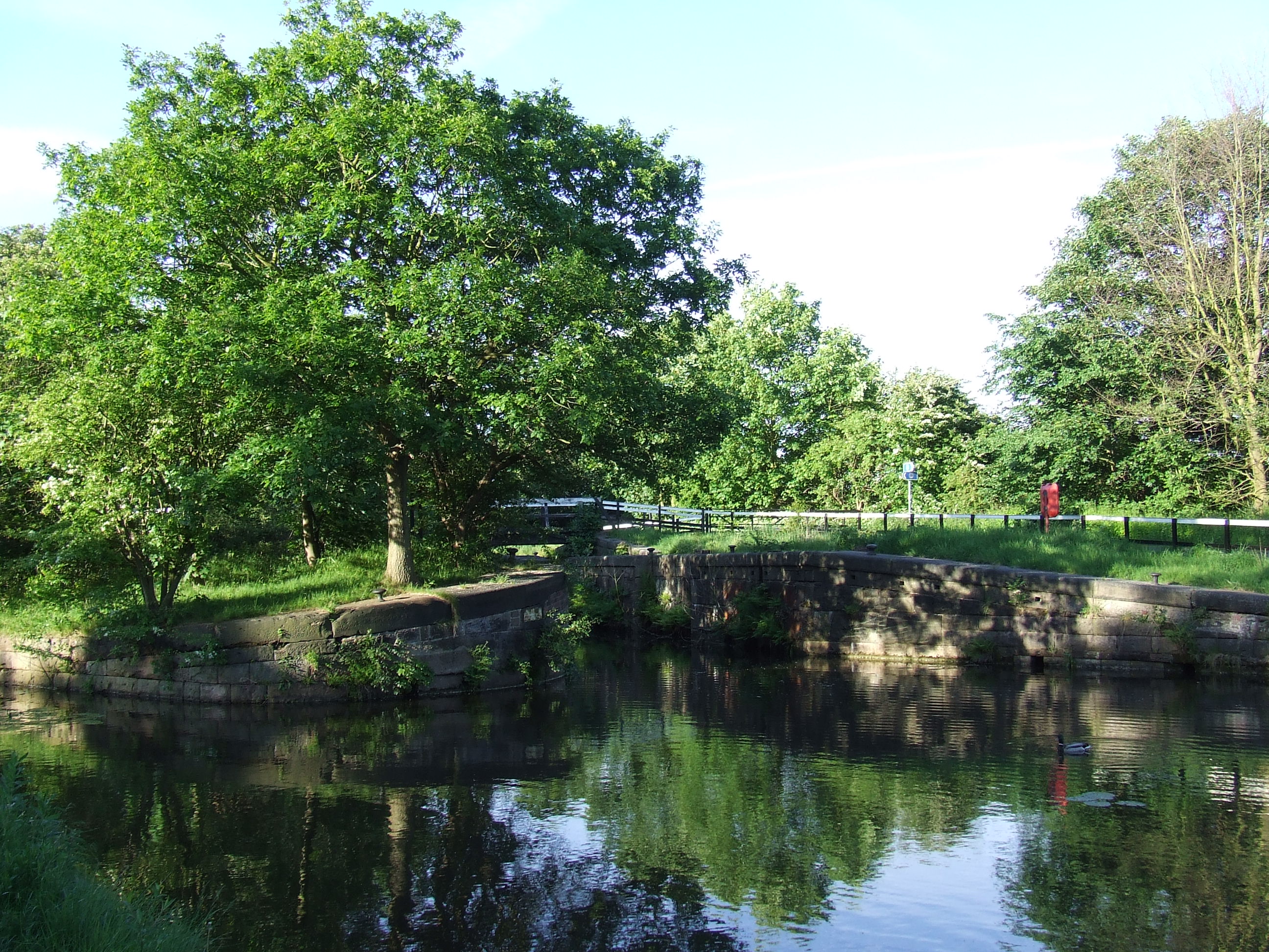
Big Wood boasts a diverse range of tree species, including oak, beech, ash, and birch, creating a rich and vibrant ecosystem. The dense canopy provides a habitat for numerous wildlife species, such as deer, foxes, rabbits, and a variety of bird species.

The woodland is crisscrossed by meandering footpaths and trails, making it a popular destination for walkers, hikers, and nature enthusiasts. The trails offer breathtaking views of the surrounding countryside and the opportunity to observe the flora and fauna up close.

Throughout the year, Big Wood offers an ever-changing landscape, with vibrant displays of bluebells and wildflowers in the spring, lush green foliage during the summer, and a stunning array of colors in the autumn. The forest is particularly enchanting during the winter months, when the trees are adorned with a frosty glaze, creating a magical atmosphere.

To preserve the natural beauty of Big Wood, certain areas are designated as protected nature reserves, ensuring the conservation of rare and endangered species. The woodland is also managed sustainably, with periodic tree planting initiatives and the removal of invasive species.

Overall, Big Wood is a cherished natural asset in Lancashire, providing a haven for wildlife and a tranquil retreat for visitors seeking solace in the beauty of nature.

If you have any feedback on the listing, please let us know in the comments section below.

Big Wood Images

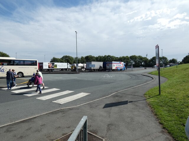
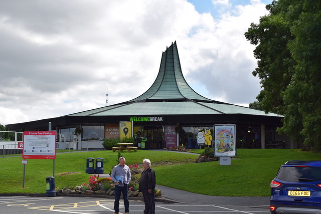
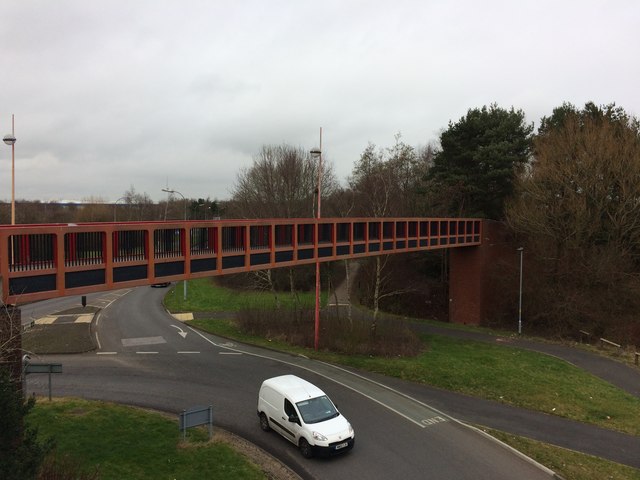
Images are sourced within 2km of 53.408008/-2.6204707 or Grid Reference SJ5890. Thanks to Geograph Open Source API. All images are credited.

Eddie Stobart, Warrington Eddie Stobart Logistics is the largest freight and transport haulage company in the UK. It is an offshoot of the Eddie Stobart Group Ltd founded by "steady" Eddie Stobart in the 1950s.
Eddie Stobart, Warrington
Eddie Stobart Logistics is the largest freight and transport haulage company in the UK. It is an offshoot of the Eddie Stobart Group Ltd founded by "steady" Eddie Stobart in the 1950s.
Dallam Recreaation Ground
Restaurant building, Burtonwood service station
M62 The M62 is the west to east trans-Pennine motorway. It is 107 miles long running from Liverpool to Hull. It was built between 1971 and 1976. At Windy Hill it is 372m above sea level, making it the highest point on any British motorway.
Wikipedia: <span class="nowrap"><a title="http://en.wikipedia.org/wiki/M62_motorway" rel="nofollow ugc noopener" href="http://en.wikipedia.org/wiki/M62_motorway">Link</a><img style="margin-left:2px;" alt="External link" title="External link - shift click to open in new window" src="https://s1.geograph.org.uk/img/external.png" width="10" height="10"/></span>
M62
The M62 is the west to east trans-Pennine motorway. It is 107 miles long running from Liverpool to Hull. It was built between 1971 and 1976. At Windy Hill it is 372m above sea level, making it the highest point on any British motorway. Wikipedia: LinkExternal link
Alfa interchange at Burtonwood Alfa coaches depart from a dedicated parking lot at Burtonwood Services on the M62. Passengers on their outward journey  are picked up from points around the North West of England and North Wales on feeder coaches. There is then up to an hour's wait as luggage is transferred. The procedure is reversed for the return journey. It is efficient but can create frustrating long waits.
Alfa interchange at Burtonwood
Alfa coaches depart from a dedicated parking lot at Burtonwood Services on the M62. Passengers on their outward journey are picked up from points around the North West of England and North Wales on feeder coaches. There is then up to an hour's wait as luggage is transferred. The procedure is reversed for the return journey. It is efficient but can create frustrating long waits.
H.Z. Transport At Burtonwood services.
H.Z. Transport
At Burtonwood services.
Burtonwood Services Alfa coaches depart from a dedicated parking lot next to the lorry park at Burtonwood Services.
Burtonwood Services
Alfa coaches depart from a dedicated parking lot next to the lorry park at Burtonwood Services.
Chapelford Farm, farmhouse inn, Warrington It is on the area of the former USAF airfield. See <a href="https://www.geograph.org.uk/photo/3524456">SJ5789 : Chapelford Farm pub restaurant, Great Sankey</a> for another view, 9 years before.
Chapelford Farm, farmhouse inn, Warrington
It is on the area of the former USAF airfield. See SJ5789 : Chapelford Farm pub restaurant, Great Sankey for another view, 9 years before.
Dakota in the clouds Imaginative children's climbing frame in Dakota Park, Chapelford (on site of RAF Burtonwood)
Dakota in the clouds
Imaginative children's climbing frame in Dakota Park, Chapelford (on site of RAF Burtonwood)
Bus on Longshaw Street, Dallam One of Network Warrington's large fleet of DAF/VDL SB120/Wright Cadets lays over at the terminus just south of Harrison Square in Dallam, before working a 16A back to the town centre. Network Warrington currently faces competition from two other operators on this route, Fairbrother's and GHA Coaches.
Bus on Longshaw Street, Dallam
One of Network Warrington's large fleet of DAF/VDL SB120/Wright Cadets lays over at the terminus just south of Harrison Square in Dallam, before working a 16A back to the town centre. Network Warrington currently faces competition from two other operators on this route, Fairbrother's and GHA Coaches.
Harrison Square roundabout, Dallam Seen from Longshaw Street, which continues north beyond the roundabout. Buses serving Dallam turn at the roundabout, either to return to Warrington town centre or to continue via Hawleys Lane to Longford and Orford.
Harrison Square roundabout, Dallam
Seen from Longshaw Street, which continues north beyond the roundabout. Buses serving Dallam turn at the roundabout, either to return to Warrington town centre or to continue via Hawleys Lane to Longford and Orford.
Alban Retail Park, Warrington
West Coast Main Line from A574 Bridge, Warrington
Burtonwood Services Welcome Break services on the M62.
Burtonwood Services
Welcome Break services on the M62.
Hulme Lock The site of a lock on an abandoned section of the Sankey Canal, alongside the Sankey Valley Trail.
Hulme Lock
The site of a lock on an abandoned section of the Sankey Canal, alongside the Sankey Valley Trail.
Remains of Lock Gates on the Sankey Canal Although the canal has been abandoned since 1963, and this section became completely silted up, these timbers from one of the lock gates still survive.
Remains of Lock Gates on the Sankey Canal
Although the canal has been abandoned since 1963, and this section became completely silted up, these timbers from one of the lock gates still survive.
Westbrook Way/Cromwell Avenue Roundabout Footbridge One of 4 near identical footbridges at this roundabout.
Westbrook Way/Cromwell Avenue Roundabout Footbridge
One of 4 near identical footbridges at this roundabout.
Footpath Behind Gulliver's World
Show me another place!

Big Wood is located at Grid Ref: SJ5890 (Lat: 53.408008, Lng: -2.6204707)

Unitary Authority: Warrington

Police Authority: Cheshire

What 3 Words

///dishes.line.rather. Near Great Sankey, Cheshire

Related Wikis

Gulliver's World

Gulliver's World is a theme park located in Warrington, England, loosely based on the world of Lilliput from Gulliver's Travels. It consists of the themed...

Five Ponds Copse

Five Ponds Copse is a woodland in Cheshire, England, near Warrington. It covers a total area of 1.15 hectares (2.84 acres). It is owned and managed by...

Westbrook, Cheshire

Westbrook is a ward and suburb in north west Warrington, in the Warrington district, in the ceremonial county of Cheshire, England. Within the boundaries...

Sankey Valley Park

Sankey Valley Park is a public park in Warrington, Cheshire. It occupies part of the Sankey Valley and the main park itself covers over 1½ miles between...

Nearby Amenities

Located within 500m of 53.408008,-2.6204707
Traffic Calming: cushion
Lat/Long: 53.4116536/-2.6164983
Crossing
Crossing: unmarked
Lat/Long: 53.4111391/-2.6168317
Direction: backward
Traffic Calming: choker
Lat/Long: 53.4109164/-2.6217821
Traffic Calming: cushion
Lat/Long: 53.4115411/-2.6223892
Crossing
Crossing: unmarked
Crossing Island: no
Tactile Paving: yes
Lat/Long: 53.4121415/-2.6231926
Crossing
Crossing: unmarked
Crossing Island: no
Tactile Paving: yes
Lat/Long: 53.4073618/-2.6266005
Turning Circle
Lat/Long: 53.4079751/-2.6271568
Turning Circle
Lat/Long: 53.4082407/-2.6243302
Turning Circle
Lat/Long: 53.4080151/-2.6241979
Turning Circle
Lat/Long: 53.4089408/-2.6245972
Turning Circle
Lat/Long: 53.4081781/-2.6255975
Turning Circle
Lat/Long: 53.4085594/-2.6258942
Turning Circle
Lat/Long: 53.4065532/-2.6270334
Turning Circle
Lat/Long: 53.4066025/-2.6271952
Crossing
Crossing: unmarked
Crossing Island: no
Tactile Paving: yes
Lat/Long: 53.410105/-2.6146533
Turning Circle
Lat/Long: 53.4080293/-2.61396
Turning Circle
Lat/Long: 53.4081144/-2.6138207
Barrier: cycle_barrier
Cycle Barrier: double
Cyclestreets Id: 87400
Url: https://www.cyclestreets.net/location/87400/
Lat/Long: 53.4084246/-2.6171941
Turning Circle
Lat/Long: 53.4090808/-2.6169666
Turning Circle
Lat/Long: 53.4109096/-2.6221596
Turning Circle
Lat/Long: 53.4098919/-2.6244915
Barrier: cycle_barrier
Bicycle: yes
Cycle Barrier: double
Cyclestreets Id: 87410
Foot: yes
Motor Vehicle: no
Url: https://www.cyclestreets.net/location/87410/
Lat/Long: 53.4099012/-2.6247465
Turning Circle
Lat/Long: 53.4096955/-2.622791
Turning Circle
Lat/Long: 53.4097571/-2.6218076
Turning Circle
Lat/Long: 53.4103724/-2.6214143
Turning Circle
Lat/Long: 53.4116653/-2.6229856
Turning Circle
Lat/Long: 53.4112726/-2.6234815
Turning Circle
Lat/Long: 53.411364/-2.6233823
Barrier: cycle_barrier
Bicycle: yes
Cycle Barrier: double
Cyclestreets Id: 87411
Foot: yes
Motor Vehicle: no
Url: https://www.cyclestreets.net/location/87411/
Lat/Long: 53.4105451/-2.625066
Callands
Is In City: Warrington
Is In Suburb: Westbrook
Place: suburb
Wikidata: Q123111329
Lat/Long: 53.411683/-2.6186065
Barrier: cycle_barrier
Bicycle: yes
Cycle Barrier: double
Cyclestreets Id: 87407
Foot: yes
Motor Vehicle: no
Url: https://www.cyclestreets.net/location/87407/
Lat/Long: 53.4078873/-2.6223197
Barrier: cycle_barrier
Bicycle: yes
Cycle Barrier: double
Cyclestreets Id: 87413
Foot: yes
Motor Vehicle: no
Url: https://www.cyclestreets.net/location/87413/
Lat/Long: 53.4109577/-2.6234252
Barrier: cycle_barrier
Bicycle: yes
Cycle Barrier: double
Cyclestreets Id: 87408
Foot: yes
Url: https://www.cyclestreets.net/location/87408/
Lat/Long: 53.4093249/-2.6250172
Barrier: cycle_barrier
Bicycle: yes
Cycle Barrier: double
Cyclestreets Id: 87403
Foot: yes
Url: https://www.cyclestreets.net/location/87403/
Lat/Long: 53.4087377/-2.6204891
Barrier: cycle_barrier
Bicycle: yes
Cycle Barrier: double
Cyclestreets Id: 87405
Foot: yes
Motor Vehicle: no
Url: https://www.cyclestreets.net/location/87405/
Lat/Long: 53.4090071/-2.6189007
Barrier: cycle_barrier
Bicycle: yes
Cycle Barrier: double
Cyclestreets Id: 87406
Foot: yes
Motor Vehicle: no
Url: https://www.cyclestreets.net/location/87406/
Lat/Long: 53.4088311/-2.6183059
Crossing
Crossing: unmarked
Crossing Island: no
Tactile Paving: yes
Lat/Long: 53.4116915/-2.6225217
Bus Stop
Barmouth Close
Bus: yes
Departures Board: no
Public Transport: platform
Shelter: no
Lat/Long: 53.4115433/-2.6166886
Bus Stop
Barmouth Close
Bench: yes
Bin: yes
Bus: yes
Departures Board: timetable
Naptan AtcoCode: 069000023910
Naptan NaptanCode: wrgapjt
Public Transport: platform
Shelter: yes
Lat/Long: 53.4110688/-2.616778
Bus Stop
Lydbury Close
Bus: yes
Departures Board: no
Naptan AtcoCode: 069000014613
Naptan NaptanCode: wrgaptg
Public Transport: platform
Shelter: no
Lat/Long: 53.4103881/-2.6188936
Bus Stop
Lydbury Close
Bench: yes
Bin: yes
Bus: yes
Departures Board: timetable
Naptan AtcoCode: 069000023920
Naptan NaptanCode: wrgaptd
Public Transport: platform
Shelter: yes
Lat/Long: 53.4102528/-2.619153
Bus Stop
Pensarn Gardens
Bench: yes
Bus: yes
Departures Board: timetable
Naptan AtcoCode: 069000023921
Naptan NaptanCode: wrgmjat
Public Transport: platform
Shelter: yes
Lat/Long: 53.4113853/-2.6223323
Bus Stop
Pensarn Gardens
Bus: yes
Departures Board: no
Naptan AtcoCode: 069000014611
Naptan NaptanCode: wrgmjaw
Public Transport: platform
Shelter: no
Lat/Long: 53.4113219/-2.6221004
Crossing
Crossing: unmarked
Crossing Island: no
Tactile Paving: yes
Lat/Long: 53.4113016/-2.6165824
Barrier: cycle_barrier
Bicycle: yes
Cycle Barrier: double
Cyclestreets Id: 87397
Foot: yes
Url: https://www.cyclestreets.net/location/87397/
Lat/Long: 53.4074172/-2.6162178
Barrier: cycle_barrier
Bicycle: yes
Cycle Barrier: double
Cyclestreets Id: 87398
Foot: yes
Url: https://www.cyclestreets.net/location/87398/
Lat/Long: 53.407449/-2.616605
Barrier: cycle_barrier
Bicycle: yes
Cycle Barrier: double
Cyclestreets Id: 87402
Foot: yes
Url: https://www.cyclestreets.net/location/87402/
Lat/Long: 53.4086029/-2.619997
Barrier: cycle_barrier
Bicycle: yes
Cycle Barrier: double
Cyclestreets Id: 87412
Foot: yes
Motor Vehicle: no
Url: https://www.cyclestreets.net/location/87412/
Lat/Long: 53.4110881/-2.6235152
Traffic Calming: cushion
Lat/Long: 53.4120966/-2.6230817
Direction: backward
Traffic Calming: choker
Lat/Long: 53.4105157/-2.6177927
Turning Circle
Lat/Long: 53.410074/-2.6151149
Turning Circle
Lat/Long: 53.4071987/-2.613687
Crossing
Crossing: unmarked
Crossing Island: no
Crossing Markings: no
Tactile Paving: yes
Lat/Long: 53.4118922/-2.6166684
Crossing
Crossing: unmarked
Crossing Island: no
Crossing Markings: no
Tactile Paving: yes
Lat/Long: 53.4114734/-2.6166551
Crossing
Crossing: unmarked
Crossing Island: no
Tactile Paving: yes
Lat/Long: 53.4077976/-2.6223474
Generator Method: photovoltaic
Generator Output Electricity: yes
Generator Source: solar
Generator Type: solar_photovoltaic_panel
Location: roof
Power: generator
Lat/Long: 53.4079145/-2.6138413
Generator Method: photovoltaic
Generator Output Electricity: yes
Generator Source: solar
Generator Type: solar_photovoltaic_panel
Location: roof
Power: generator
Lat/Long: 53.408359/-2.615633
Generator Method: photovoltaic
Generator Output Electricity: yes
Generator Source: solar
Generator Type: solar_photovoltaic_panel
Location: roof
Power: generator
Lat/Long: 53.4097484/-2.6144904
Generator Method: photovoltaic
Generator Output Electricity: yes
Generator Source: solar
Generator Type: solar_photovoltaic_panel
Location: roof
Power: generator
Lat/Long: 53.4097084/-2.6156223
Generator Method: photovoltaic
Generator Output Electricity: yes
Generator Source: solar
Generator Type: solar_photovoltaic_panel
Location: roof
Power: generator
Lat/Long: 53.4102344/-2.6161721
Generator Method: photovoltaic
Generator Output Electricity: yes
Generator Source: solar
Generator Type: solar_photovoltaic_panel
Location: roof
Power: generator
Lat/Long: 53.4101097/-2.6163304
Generator Method: photovoltaic
Generator Output Electricity: yes
Generator Source: solar
Generator Type: solar_photovoltaic_panel
Location: roof
Power: generator
Lat/Long: 53.4094462/-2.6133451
Generator Method: photovoltaic
Generator Output Electricity: yes
Generator Source: solar
Generator Type: solar_photovoltaic_panel
Location: roof
Power: generator
Lat/Long: 53.4090993/-2.6138708
Generator Method: photovoltaic
Generator Output Electricity: yes
Generator Source: solar
Generator Type: solar_photovoltaic_panel
Location: roof
Power: generator
Lat/Long: 53.4119546/-2.6234489
Generator Method: photovoltaic
Generator Output Electricity: yes
Generator Source: solar
Generator Type: solar_photovoltaic_panel
Location: roof
Power: generator
Lat/Long: 53.4114989/-2.6248302
Generator Method: photovoltaic
Generator Output Electricity: yes
Generator Source: solar
Generator Type: solar_photovoltaic_panel
Location: roof
Power: generator
Lat/Long: 53.4115005/-2.6235428
Generator Method: photovoltaic
Generator Output Electricity: yes
Generator Source: solar
Generator Type: solar_photovoltaic_panel
Location: roof
Power: generator
Lat/Long: 53.4117819/-2.6233148
Generator Method: photovoltaic
Generator Output Electricity: yes
Generator Source: solar
Generator Type: solar_photovoltaic_panel
Location: roof
Power: generator
Lat/Long: 53.4098346/-2.6237439
Generator Method: photovoltaic
Generator Output Electricity: yes
Generator Source: solar
Generator Type: solar_photovoltaic_panel
Location: roof
Power: generator
Lat/Long: 53.4096379/-2.6216035
Generator Method: photovoltaic
Generator Output Electricity: yes
Generator Source: solar
Generator Type: solar_photovoltaic_panel
Location: roof
Power: generator
Lat/Long: 53.4109305/-2.6201326
Barrier: kissing_gate
Bicycle: yes
Foot: yes
Horse: no
Motor Vehicle: no
Lat/Long: 53.4046052/-2.6177352
Turning Circle
Lat/Long: 53.4101613/-2.618349
Ladywood
Place: neighbourhood
Lat/Long: 53.4072918/-2.6243944
Turning Circle
Lat/Long: 53.4088667/-2.6247441
Turning Circle
Lat/Long: 53.409066/-2.6255844
Turning Circle
Lat/Long: 53.4089537/-2.6255777
Turning Circle
Lat/Long: 53.4087443/-2.6272538
Turning Circle
Lat/Long: 53.4086225/-2.6272631
Addr City: Warrington
Addr Housenumber: 1
Addr Postcode: WA5 9QP
Addr Street: Willoughby Close
Lat/Long: 53.4079617/-2.6267062
Addr City: Warrington
Addr Housenumber: 3
Addr Postcode: WA5 9QP
Addr Street: Willoughby Close
Lat/Long: 53.4079971/-2.6267347
Addr City: Warrington
Addr Housenumber: 25
Addr Postcode: WA5 9QP
Addr Street: Willoughby Close
Lat/Long: 53.4082371/-2.62699
Addr City: Warrington
Addr Housenumber: 27
Addr Postcode: WA5 9QP
Addr Street: Willoughby Close
Lat/Long: 53.4083063/-2.6269048
Addr City: Warrington
Addr Housenumber: 29
Addr Postcode: WA5 9QP
Addr Street: Willoughby Close
Lat/Long: 53.4084267/-2.6269456
Addr City: Warrington
Addr Housenumber: 31
Addr Postcode: WA5 9QP
Addr Street: Willoughby Close
Lat/Long: 53.4084699/-2.6269509
Addr City: Warrington
Addr Housenumber: 55
Addr Postcode: WA5 9QP
Addr Street: Willoughby Close
Lat/Long: 53.4091357/-2.6262039
Addr City: Warrington
Addr Housenumber: 57
Addr Postcode: WA5 9QP
Addr Street: Willoughby Close
Lat/Long: 53.4091249/-2.6261173
Addr City: Warrington
Addr Housenumber: 59
Addr Postcode: WA5 9QP
Addr Street: Willoughby Close
Lat/Long: 53.4090956/-2.6257997
Addr City: Warrington
Addr Housenumber: 61
Addr Postcode: WA5 9QP
Addr Street: Willoughby Close
Lat/Long: 53.4091547/-2.6257787
Addr City: Warrington
Addr Housenumber: 50
Addr Postcode: WA5 9QP
Addr Street: Willoughby Close
Lat/Long: 53.4089856/-2.6253607
Addr City: Warrington
Addr Housenumber: 48
Addr Postcode: WA5 9QP
Addr Street: Willoughby Close
Lat/Long: 53.4089404/-2.6253774
Addr City: Warrington
Addr Housenumber: 46
Addr Postcode: WA5 9QP
Addr Street: Willoughby Close
Lat/Long: 53.4088462/-2.6253718
Addr City: Warrington
Addr Housenumber: 44
Addr Postcode: WA5 9QP
Addr Street: Willoughby Close
Lat/Long: 53.4088008/-2.6253896
Addr City: Warrington
Addr Housenumber: 42
Addr Postcode: WA5 9QP
Addr Street: Willoughby Close
Lat/Long: 53.4088723/-2.6256889
Addr City: Warrington
Addr Housenumber: 40
Addr Postcode: WA5 9QP
Addr Street: Willoughby Close
Lat/Long: 53.4088726/-2.6257703
Addr City: Warrington
Addr Housenumber: 38
Addr Postcode: WA5 9QP
Addr Street: Willoughby Close
Lat/Long: 53.4088726/-2.625908
Addr City: Warrington
Addr Housenumber: 36
Addr Postcode: WA5 9QP
Addr Street: Willoughby Close
Lat/Long: 53.4088738/-2.6259989
Addr City: Warrington
Addr Housenumber: 34
Addr Postcode: WA5 9QP
Addr Street: Willoughby Close
Lat/Long: 53.4088614/-2.6261397
Addr City: Warrington
Addr Housenumber: 32
Addr Postcode: WA5 9QP
Addr Street: Willoughby Close
Lat/Long: 53.4088614/-2.6262302
Addr City: Warrington
Addr Housenumber: 22
Addr Postcode: WA5 9QP
Addr Street: Willoughby Close
Lat/Long: 53.4086547/-2.6265971
Addr City: Warrington
Addr Housenumber: 20
Addr Postcode: WA5 9QP
Addr Street: Willoughby Close
Lat/Long: 53.4086168/-2.6265749
Addr City: Warrington
Addr Housenumber: 18
Addr Postcode: WA5 9QP
Addr Street: Willoughby Close
Lat/Long: 53.4085312/-2.6265416
Addr City: Warrington
Addr Housenumber: 16
Addr Postcode: WA5 9QP
Addr Street: Willoughby Close
Lat/Long: 53.4084925/-2.62652
Addr City: Warrington
Addr Housenumber: 14
Addr Postcode: WA5 9QP
Addr Street: Willoughby Close
Lat/Long: 53.4084129/-2.626429
Addr City: Warrington
Addr Housenumber: 12
Addr Postcode: WA5 9QP
Addr Street: Willoughby Close
Lat/Long: 53.4083687/-2.6264103
Addr City: Warrington
Addr Housenumber: 10
Addr Postcode: WA5 9QP
Addr Street: Willoughby Close
Lat/Long: 53.4082712/-2.6264441
Addr City: Warrington
Addr Housenumber: 8
Addr Postcode: WA5 9QP
Addr Street: Willoughby Close
Lat/Long: 53.4082316/-2.6263992
Addr City: Warrington
Addr Housenumber: 4
Addr Postcode: WA5 9QP
Addr Street: Willoughby Close
Lat/Long: 53.408091/-2.6262772
Addr City: Warrington
Addr Housenumber: 2
Addr Postcode: WA5 9QP
Addr Street: Willoughby Close
Lat/Long: 53.4080259/-2.6262462
Generator Method: photovoltaic
Generator Output Electricity: yes
Generator Source: solar
Generator Type: solar_photovoltaic_panel
Power: generator
Lat/Long: 53.406785/-2.6243871
Generator Method: photovoltaic
Generator Output Electricity: yes
Generator Source: solar
Generator Type: solar_photovoltaic_panel
Power: generator
Lat/Long: 53.4074456/-2.6218954
Generator Method: photovoltaic
Generator Output Electricity: yes
Generator Source: solar
Generator Type: solar_photovoltaic_panel
Power: generator
Lat/Long: 53.4086234/-2.6265504
Generator Method: photovoltaic
Generator Output Electricity: yes
Generator Source: solar
Generator Type: solar_photovoltaic_panel
Power: generator
Lat/Long: 53.4061063/-2.6263163
Generator Method: photovoltaic
Generator Output Electricity: yes
Generator Source: solar
Generator Type: solar_photovoltaic_panel
Power: generator
Lat/Long: 53.4060787/-2.6262607
Generator Method: photovoltaic
Generator Output Electricity: yes
Generator Source: solar
Generator Type: solar_photovoltaic_panel
Power: generator
Lat/Long: 53.4061759/-2.6247683
Generator Method: photovoltaic
Generator Output Electricity: yes
Generator Source: solar
Generator Type: solar_photovoltaic_panel
Power: generator
Lat/Long: 53.4061786/-2.6248186
Generator Method: photovoltaic
Generator Output Electricity: yes
Generator Source: solar
Generator Type: solar_photovoltaic_panel
Power: generator
Lat/Long: 53.4061474/-2.6248277
Generator Method: photovoltaic
Generator Output Electricity: yes
Generator Source: solar
Generator Type: solar_photovoltaic_panel
Power: generator
Lat/Long: 53.4064502/-2.6248241
Generator Method: photovoltaic
Generator Output Electricity: yes
Generator Source: solar
Generator Type: solar_photovoltaic_panel
Power: generator
Lat/Long: 53.4064756/-2.6247266
Generator Method: photovoltaic
Generator Output Electricity: yes
Generator Source: solar
Generator Type: solar_photovoltaic_panel
Power: generator
Lat/Long: 53.4064614/-2.6251084
Generator Method: photovoltaic
Generator Output Electricity: yes
Generator Source: solar
Generator Type: solar_photovoltaic_panel
Power: generator
Lat/Long: 53.4063163/-2.6241549
Generator Method: photovoltaic
Generator Output Electricity: yes
Generator Source: solar
Generator Type: solar_photovoltaic_panel
Power: generator
Lat/Long: 53.4066201/-2.6238079
Generator Method: photovoltaic
Generator Output Electricity: yes
Generator Source: solar
Generator Type: solar_photovoltaic_panel
Power: generator
Lat/Long: 53.4066125/-2.6238614
Generator Method: photovoltaic
Generator Output Electricity: yes
Generator Source: solar
Generator Type: solar_photovoltaic_panel
Power: generator
Lat/Long: 53.4066432/-2.6226796
Generator Method: photovoltaic
Generator Output Electricity: yes
Generator Source: solar
Generator Type: solar_photovoltaic_panel
Power: generator
Lat/Long: 53.4070622/-2.6265772
Generator Method: photovoltaic
Generator Output Electricity: yes
Generator Source: solar
Generator Type: solar_photovoltaic_panel
Power: generator
Lat/Long: 53.407019/-2.6264042
Give Way
Lat/Long: 53.4052466/-2.6263817
Crossing
Crossing: unmarked
Crossing Island: no
Crossing Markings: no
Tactile Paving: yes
Lat/Long: 53.4101345/-2.6198688
Turning Circle
Lat/Long: 53.4108087/-2.6199773
Give Way
Direction: backward
Lat/Long: 53.4097278/-2.6196896
Crossing
Crossing: unmarked
Crossing Island: no
Tactile Paving: yes
Lat/Long: 53.4117676/-2.6226975
Turning Circle
Lat/Long: 53.4117439/-2.6229843
Crossing
Crossing: unmarked
Crossing Island: no
Crossing Markings: no
Tactile Paving: yes
Lat/Long: 53.4106426/-2.6215344
Traffic Calming: cushion
Lat/Long: 53.4110099/-2.6169137
Crossing
Crossing: unmarked
Crossing Island: no
Tactile Paving: yes
Lat/Long: 53.410724/-2.6169691
Crossing
Crossing: unmarked
Lat/Long: 53.4103506/-2.6193345
Crossing
Crossing: unmarked
Lat/Long: 53.4106428/-2.617594
Crossing
Crossing: unmarked
Crossing Island: no
Tactile Paving: yes
Lat/Long: 53.4104078/-2.6180651
Bench
Backrest: yes
Material: wood
Lat/Long: 53.4083567/-2.6195019
Crossing
Crossing: unmarked
Lat/Long: 53.410066/-2.6144161
Crossing
Crossing: unmarked
Lat/Long: 53.4103411/-2.6159016
Barrier: kerb
Lat/Long: 53.4103397/-2.6158152
Barrier: kerb
Lat/Long: 53.4103428/-2.6159997
Turning Circle
Lat/Long: 53.4108894/-2.6233144
Turning Circle
Lat/Long: 53.4099218/-2.6246102
Turning Circle
Lat/Long: 53.4111335/-2.6223577
Turning Circle
Lat/Long: 53.4110547/-2.6223299
Turning Circle
Lat/Long: 53.4100004/-2.6234634
Turning Circle
Lat/Long: 53.409898/-2.6235027
Turning Circle
Lat/Long: 53.4098174/-2.6216556
Turning Circle
Lat/Long: 53.4088841/-2.6181469
Turning Circle
Lat/Long: 53.4091703/-2.6169003
Turning Circle
Lat/Long: 53.4084701/-2.6172682
Turning Circle
Lat/Long: 53.4085381/-2.6171503
Crossing
Crossing: unmarked
Crossing Island: no
Tactile Paving: yes
Lat/Long: 53.4077646/-2.6263558
Information: guidepost
Tourism: information
Lat/Long: 53.4108546/-2.6171827
Barrier: kissing_gate
Lat/Long: 53.4045667/-2.6252694
Turning Circle
Lat/Long: 53.4081983/-2.6137408
Turning Circle
Lat/Long: 53.4084313/-2.6145036
Turning Circle
Lat/Long: 53.4083646/-2.6144096
Turning Circle
Lat/Long: 53.4079375/-2.6153069
Turning Circle
Lat/Long: 53.4078846/-2.6152416
Turning Circle
Lat/Long: 53.4095482/-2.6148292
Waste Basket
Lat/Long: 53.4071396/-2.6251213
Barrier: cycle_barrier
Bicycle: yes
Cycle Barrier: double
Foot: yes
Horse: no
Motor Vehicle: no
Lat/Long: 53.4117307/-2.6224298
Bench
Backrest: yes
Material: metal
Lat/Long: 53.4119371/-2.6219274
Bench
Backrest: yes
Material: metal
Lat/Long: 53.412079/-2.6215655
Bench
Backrest: yes
Material: metal
Lat/Long: 53.411967/-2.6217255
Waste Basket
Colour: #000000
Material: plastic
Lat/Long: 53.4119712/-2.621764
Playground: roundabout
Lat/Long: 53.4120303/-2.6216449
Playground: structure
Lat/Long: 53.411912/-2.6218294
Playground: structure
Lat/Long: 53.4120686/-2.6218037
Baby: no
Capacity: 3
Playground: swing
Lat/Long: 53.4118977/-2.621617
Playground: springy
Lat/Long: 53.4120448/-2.6215392
Playground: springy
Lat/Long: 53.4120965/-2.6216374
Give Way
Direction: backward
Lat/Long: 53.405122/-2.6262609
The Gulliver's Hotel
Tourism: hotel
Lat/Long: 53.4042163/-2.6188494
Railway: level_crossing
Lat/Long: 53.40618/-2.6146277
Billy Bob's Bi-Planes
Tourism: attraction
Lat/Long: 53.4066634/-2.6201478
Starlight Theatre
Tourism: attraction
Lat/Long: 53.4058477/-2.6171687
Gully's Express Railroad
Tourism: attraction
Lat/Long: 53.4058106/-2.6173571
Tractor Ride
Tourism: attraction
Lat/Long: 53.4066558/-2.6162894
Togo Tower
Tourism: attraction
Lat/Long: 53.4064377/-2.6152726
Dodgems
Tourism: attraction
Lat/Long: 53.4065755/-2.6174839
Carousel
Tourism: attraction
Lat/Long: 53.4067153/-2.6175192
Pirate Cove
Tourism: attraction
Lat/Long: 53.4068947/-2.6186895
Pirate Ship
Tourism: attraction
Lat/Long: 53.4066494/-2.6184925
Antelope
Tourism: attraction
Lat/Long: 53.4072263/-2.6183202
The Wriggler
Tourism: attraction
Lat/Long: 53.4068783/-2.6193569
Desperado Drop
Tourism: attraction
Lat/Long: 53.407263/-2.6198058
Apache Falls
Tourism: attraction
Lat/Long: 53.4074554/-2.6204764
Toilets
Lat/Long: 53.407284/-2.6205673
Veteran Cars
Tourism: attraction
Lat/Long: 53.4066042/-2.6198129
RAF Burtonwood Heritage Centre
Tourism: museum
Website: http://www.rafburtonwoodheritagecentre.co.uk/
Lat/Long: 53.4062925/-2.6199592
Mad Hatter's Tea Party
Tourism: attraction
Lat/Long: 53.4061566/-2.6186919
Log Flume
Tourism: attraction
Lat/Long: 53.4064962/-2.6167066
Temple Raider
Tourism: attraction
Lat/Long: 53.4066774/-2.6149593
Jurassic Jeeps
Tourism: attraction
Lat/Long: 53.4060975/-2.6150991
Gully Town
Tourism: attraction
Lat/Long: 53.4060756/-2.6164481
Flight of the Pteranodon
Tourism: attraction
Lat/Long: 53.405764/-2.6157201
Safari Swings
Tourism: attraction
Lat/Long: 53.4064868/-2.6146579
Adventure Canyon
Tourism: attraction
Lat/Long: 53.4067675/-2.615438
Dino Encounter
Tourism: attraction
Lat/Long: 53.4060074/-2.6147554
Crossing Barrier: full
Crossing Bell: yes
Railway: level_crossing
Lat/Long: 53.4062385/-2.6168347
Street Lamp
Lamp Type: led
Lat/Long: 53.4116932/-2.6163397
Man Made: utility_pole
Material: wood
Utility: telecom
Lat/Long: 53.411515/-2.6165451
Street Lamp
Lamp Type: led
Lat/Long: 53.4115086/-2.6167315
Street Lamp
Lamp Type: led
Lat/Long: 53.4112316/-2.6167152
Street Lamp
Lamp Type: led
Lat/Long: 53.4110023/-2.6168482
Street Lamp
Lamp Type: led
Lat/Long: 53.4106735/-2.6169559
Street Lamp
Lamp Type: led
Lat/Long: 53.4105056/-2.6166266
Street Lamp
Lamp Type: led
Lat/Long: 53.4103877/-2.6162444
Street Lamp
Lamp Type: led
Lat/Long: 53.4099788/-2.6145238
Street Lamp
Lamp Type: led
Lat/Long: 53.4103198/-2.6149922
Street Lamp
Lamp Type: led
Lat/Long: 53.410152/-2.6146284
Street Lamp
Lamp Type: led
Lat/Long: 53.4104091/-2.6153848
Street Lamp
Lamp Type: led
Lat/Long: 53.4104357/-2.6158678
Street Lamp
Lamp Type: led
Lat/Long: 53.4101847/-2.6159014
Street Lamp
Lamp Type: led
Lat/Long: 53.4099063/-2.6164143
Street Lamp
Lamp Type: led
Lat/Long: 53.409655/-2.6164428
Street Lamp
Lamp Type: led
Lat/Long: 53.4093841/-2.6161624
Street Lamp
Lamp Type: led
Lat/Long: 53.4093313/-2.6157326
Barrier: kissing_gate
Bicycle: dismount
Foot: yes
Horse: no
Lat/Long: 53.409373/-2.6162305
Street Lamp
Lamp Type: led
Lat/Long: 53.4100516/-2.6152049
Street Lamp
Lamp Type: led
Lat/Long: 53.4099402/-2.6148296
Street Lamp
Lamp Type: led
Lat/Long: 53.409713/-2.6148004
Street Lamp
Lamp Type: led
Lat/Long: 53.4096879/-2.6153794
Street Lamp
Lamp Type: led
Lat/Long: 53.4095575/-2.6152422
Street Lamp
Lamp Type: led
Lat/Long: 53.4091952/-2.6158461
Street Lamp
Lamp Type: led
Lat/Long: 53.4089151/-2.6158608
Street Lamp
Lamp Type: led
Lat/Long: 53.4089661/-2.6153855
Street Lamp
Lamp Type: led
Lat/Long: 53.4090065/-2.614908
Street Lamp
Lamp Type: led
Lat/Long: 53.4088848/-2.6146838
Street Lamp
Lamp Type: led
Lat/Long: 53.4083087/-2.6147765
Street Lamp
Lamp Type: led
Lat/Long: 53.4084194/-2.6144064
Street Lamp
Lamp Type: led
Lat/Long: 53.4079281/-2.6151676
Street Lamp
Lamp Type: led
Lat/Long: 53.4080163/-2.6149602
Street Lamp
Lamp Type: led
Lat/Long: 53.4076676/-2.6148152
Street Lamp
Lamp Type: led
Lat/Long: 53.4075046/-2.614448
Street Lamp
Lamp Type: led
Lat/Long: 53.4073839/-2.614456
Street Lamp
Lamp Type: led
Lat/Long: 53.4081942/-2.615204
Street Lamp
Lamp Type: led
Lat/Long: 53.4084475/-2.6152547
Street Lamp
Lamp Type: led
Lat/Long: 53.4086224/-2.6156036
Street Lamp
Lamp Type: led
Lat/Long: 53.4073157/-2.6137884
Street Lamp
Lamp Type: led
Lat/Long: 53.4075325/-2.6133456
Street Lamp
Lamp Type: led
Lat/Long: 53.4077192/-2.6130305
Man Made: planter
Material: wood
Lat/Long: 53.4083428/-2.6194264
Man Made: planter
Material: wood
Lat/Long: 53.4083088/-2.6193686
Street Lamp
Lamp Type: led
Lat/Long: 53.4098292/-2.6138942
Street Lamp
Lamp Type: led
Lat/Long: 53.4096452/-2.6134913
Street Lamp
Lamp Type: led
Lat/Long: 53.4088974/-2.6131842
Street Lamp
Lamp Type: led
Lat/Long: 53.4088027/-2.6135312
Barrier: bollard
Lat/Long: 53.4087754/-2.6135434
Street Lamp
Lamp Type: led
Lat/Long: 53.4096316/-2.614113
Street Lamp
Lamp Type: led
Lat/Long: 53.4093233/-2.6141385
Street Lamp
Lamp Type: led
Lat/Long: 53.4090469/-2.6142425
Man Made: planter
Material: wood
Lat/Long: 53.4084452/-2.6196297
Man Made: planter
Material: wood
Lat/Long: 53.4084112/-2.6195719
Bench
Backrest: yes
Material: wood
Lat/Long: 53.4085289/-2.6196875
Waste Basket
Material: metal
Waste: trash
Lat/Long: 53.4086923/-2.6202491
Waste Basket
Material: metal
Waste: trash
Lat/Long: 53.4074247/-2.6163762
Waste Basket
Material: metal
Waste: trash
Lat/Long: 53.4093156/-2.6253511
Smuggler's Boating School
Tourism: attraction
Lat/Long: 53.4068053/-2.6181064
Gully's Grand Prix
Tourism: attraction
Lat/Long: 53.4070915/-2.6193396
Ellie's Animal Merry Go Round
Tourism: attraction
Lat/Long: 53.4075464/-2.6194193
The Galleons
Tourism: attraction
Lat/Long: 53.4073476/-2.6189203
Sky Tours Observation Tower
Tourism: attraction
Lat/Long: 53.4059428/-2.6150425
The Hatchery
Tourism: attraction
Lat/Long: 53.4055452/-2.6153956
Dino Encounters
Tourism: attraction
Lat/Long: 53.4058535/-2.6147076
Jeep Safari
Tourism: attraction
Lat/Long: 53.4065602/-2.6154431
Moon Buggies
Tourism: attraction
Lat/Long: 53.4070632/-2.6168565
Grand Prix Racers
Tourism: attraction
Lat/Long: 53.4070513/-2.6166061
Overdrive
Tourism: attraction
Lat/Long: 53.4069636/-2.6168888
Haunted Mansion
Tourism: attraction
Lat/Long: 53.4068323/-2.6174064
Gilly's Princess Ride
Tourism: attraction
Lat/Long: 53.4072545/-2.6190077
The data included in this document is from www.openstreetmap.org. The data is made available under ODbL.

Have you been to Big Wood?

Leave your review of Big Wood below (or comments, questions and feedback).