Mary Ann Pond

Lake, Pool, Pond, Freshwater Marsh in Lancashire

England

Mary Ann Pond

Eddie Stobart, Warrington Eddie Stobart Logistics is the largest freight and transport haulage company in the UK. It is an offshoot of the Eddie Stobart Group Ltd founded by "steady" Eddie Stobart in the 1950s.
Eddie Stobart, Warrington Credit: N Chadwick

Mary Ann Pond is a charming freshwater body located in the county of Lancashire, England. Nestled amidst picturesque surroundings, this serene pond offers a tranquil escape for nature enthusiasts and locals alike. Spanning approximately 0.5 hectares, Mary Ann Pond is a small yet enchanting water feature that adds to the area's natural beauty.

The pond is known for its crystal-clear waters, reflecting the surrounding lush vegetation and blue skies. It is home to a variety of aquatic flora and fauna, including water lilies, reeds, and a diverse range of fish species. These aquatic inhabitants contribute to the pond's thriving ecosystem, creating a harmonious balance within the environment.

Surrounded by verdant meadows and trees, Mary Ann Pond provides a haven for numerous bird species, making it an ideal spot for birdwatchers. Visitors can witness a plethora of avian life, including ducks, geese, herons, and even the occasional kingfisher. The tranquil ambiance of the pond further enhances the chances of spotting these magnificent creatures in their natural habitat.

With its idyllic setting, Mary Ann Pond offers opportunities for recreational activities such as fishing and boating, allowing visitors to engage with nature actively. Fishing enthusiasts can try their luck in catching carp, roach, and perch, among other species that inhabit the pond's depths. For those seeking a more leisurely experience, rowing or simply strolling along the pond's edge provides a chance to appreciate the serene atmosphere and scenic views.

Mary Ann Pond is a true gem in Lancashire, providing a peaceful retreat for nature lovers and serving as a sanctuary for a diverse array of wildlife. Its tranquil waters, abundant flora and fauna, and breathtaking natural surroundings make it a must-visit destination for locals and tourists seeking solace in the beauty of nature.

If you have any feedback on the listing, please let us know in the comments section below.

Mary Ann Pond Images

Images are sourced within 2km of 53.406768/-2.6290419 or Grid Reference SJ5890. Thanks to Geograph Open Source API. All images are credited.
Eddie Stobart, Warrington Eddie Stobart Logistics is the largest freight and transport haulage company in the UK. It is an offshoot of the Eddie Stobart Group Ltd founded by "steady" Eddie Stobart in the 1950s.
Eddie Stobart, Warrington
Eddie Stobart Logistics is the largest freight and transport haulage company in the UK. It is an offshoot of the Eddie Stobart Group Ltd founded by "steady" Eddie Stobart in the 1950s.
Dallam Recreaation Ground
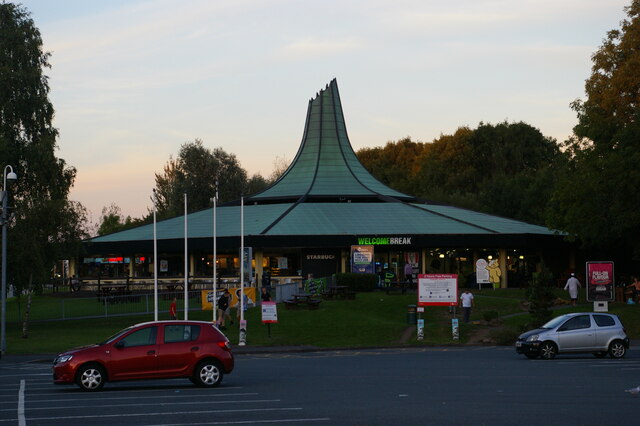
Restaurant building, Burtonwood service station
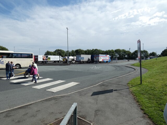
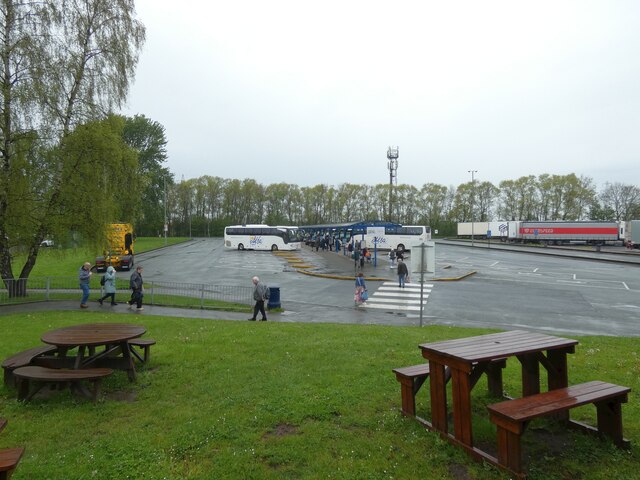
Alfa interchange at Burtonwood Alfa coaches depart from a dedicated parking lot at Burtonwood Services on the M62. Passengers on their outward journey  are picked up from points around the North West of England and North Wales on feeder coaches. There is then up to an hour's wait as luggage is transferred. The procedure is reversed for the return journey. It is efficient but can create frustrating long waits.
Alfa interchange at Burtonwood
Alfa coaches depart from a dedicated parking lot at Burtonwood Services on the M62. Passengers on their outward journey are picked up from points around the North West of England and North Wales on feeder coaches. There is then up to an hour's wait as luggage is transferred. The procedure is reversed for the return journey. It is efficient but can create frustrating long waits.
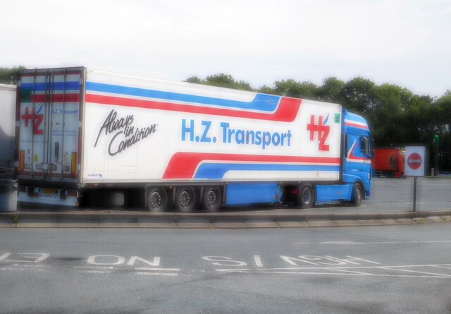
H.Z. Transport At Burtonwood services.
H.Z. Transport
At Burtonwood services.
Burtonwood Services Alfa coaches depart from a dedicated parking lot next to the lorry park at Burtonwood Services.
Burtonwood Services
Alfa coaches depart from a dedicated parking lot next to the lorry park at Burtonwood Services.
Chapelford Farm, farmhouse inn, Warrington It is on the area of the former USAF airfield. See <a href="https://www.geograph.org.uk/photo/3524456">SJ5789 : Chapelford Farm pub restaurant, Great Sankey</a> for another view, 9 years before.
Chapelford Farm, farmhouse inn, Warrington
It is on the area of the former USAF airfield. See SJ5789 : Chapelford Farm pub restaurant, Great Sankey for another view, 9 years before.
Dakota in the clouds Imaginative children's climbing frame in Dakota Park, Chapelford (on site of RAF Burtonwood)
Dakota in the clouds
Imaginative children's climbing frame in Dakota Park, Chapelford (on site of RAF Burtonwood)
Suburban Christmas lights and raindrops, Great Sankey Light from camera flash is reflected from drops of water in the light rain. Houses have strings of lights, some along facades, some hung on shrubs appear to be in mid air.
Suburban Christmas lights and raindrops, Great Sankey
Light from camera flash is reflected from drops of water in the light rain. Houses have strings of lights, some along facades, some hung on shrubs appear to be in mid air.
Dog walker in suburb, Midday Christmas day 2023 in Great Sankey In the quiet Whittle Hall housing estate there is just one dog walker, lots of parked cars. The road is Wensleydale Close.
Dog walker in suburb, Midday Christmas day 2023 in Great Sankey
In the quiet Whittle Hall housing estate there is just one dog walker, lots of parked cars. The road is Wensleydale Close.
Whittle Hall Park with Boxing Day walkers A dog walker on the footbridge, a family watching ducks on a pond, trees which have lost their leaves, in pleasant  sunshine on a winter morning.
Whittle Hall Park with Boxing Day walkers
A dog walker on the footbridge, a family watching ducks on a pond, trees which have lost their leaves, in pleasant sunshine on a winter morning.
Wensleydale Close, Whittle Hall Estate, Christmas Day 2023 With families and visitors inside for Christmas lunch there is a profusion of parked cars.
Wensleydale Close, Whittle Hall Estate, Christmas Day 2023
With families and visitors inside for Christmas lunch there is a profusion of parked cars.
Bus on Longshaw Street, Dallam One of Network Warrington's large fleet of DAF/VDL SB120/Wright Cadets lays over at the terminus just south of Harrison Square in Dallam, before working a 16A back to the town centre. Network Warrington currently faces competition from two other operators on this route, Fairbrother's and GHA Coaches.
Bus on Longshaw Street, Dallam
One of Network Warrington's large fleet of DAF/VDL SB120/Wright Cadets lays over at the terminus just south of Harrison Square in Dallam, before working a 16A back to the town centre. Network Warrington currently faces competition from two other operators on this route, Fairbrother's and GHA Coaches.
Harrison Square roundabout, Dallam Seen from Longshaw Street, which continues north beyond the roundabout. Buses serving Dallam turn at the roundabout, either to return to Warrington town centre or to continue via Hawleys Lane to Longford and Orford.
Harrison Square roundabout, Dallam
Seen from Longshaw Street, which continues north beyond the roundabout. Buses serving Dallam turn at the roundabout, either to return to Warrington town centre or to continue via Hawleys Lane to Longford and Orford.
West Coast Main Line from A574 Bridge, Warrington
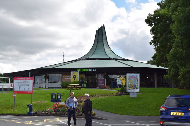
Burtonwood Services Welcome Break services on the M62.
Burtonwood Services
Welcome Break services on the M62.
Hulme Lock The site of a lock on an abandoned section of the Sankey Canal, alongside the Sankey Valley Trail.
Hulme Lock
The site of a lock on an abandoned section of the Sankey Canal, alongside the Sankey Valley Trail.
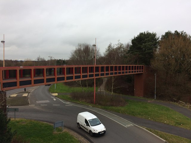
Westbrook Way/Cromwell Avenue Roundabout Footbridge One of 4 near identical footbridges at this roundabout.
Westbrook Way/Cromwell Avenue Roundabout Footbridge
One of 4 near identical footbridges at this roundabout.
Show me another place!

Mary Ann Pond is located at Grid Ref: SJ5890 (Lat: 53.406768, Lng: -2.6290419)

Unitary Authority: Warrington

Police Authority: Cheshire

What 3 Words

///next.grain.launch. Near Great Sankey, Cheshire

Related Wikis

Westbrook, Cheshire

Westbrook is a ward and suburb in north west Warrington, in the Warrington district, in the ceremonial county of Cheshire, England. Within the boundaries...

Gulliver's World

Gulliver's World is a theme park located in Warrington, England, loosely based on the world of Lilliput from Gulliver's Travels. It consists of the themed...

Bewsey Old Hall

Bewsey Old Hall is a brick built, three storey, mainly Jacobean building, incorporating or reusing elements of a former medieval hall situated on the edge...

Five Ponds Copse

Five Ponds Copse is a woodland in Cheshire, England, near Warrington. It covers a total area of 1.15 hectares (2.84 acres). It is owned and managed by...

Nearby Amenities

Located within 500m of 53.406768,-2.6290419
Crossing
Crossing: uncontrolled
Crossing Island: no
Crossing Markings: zebra
Tactile Paving: yes
Lat/Long: 53.4075967/-2.6332266
Crossing
Crossing: uncontrolled
Crossing Island: no
Crossing Markings: zebra
Tactile Paving: yes
Lat/Long: 53.4076532/-2.6309524
Crossing
Crossing: unmarked
Crossing Island: no
Tactile Paving: yes
Lat/Long: 53.4064676/-2.6282079
Crossing
Button Operated: yes
Crossing: traffic_signals
Crossing Island: no
Crossing Markings: dots
Crossing Ref: pelican
Kerb: lowered
Tactile Paving: yes
Lat/Long: 53.407405/-2.6281195
Crossing
Crossing: unmarked
Crossing Island: no
Tactile Paving: yes
Lat/Long: 53.4073618/-2.6266005
Turning Circle
Lat/Long: 53.4079751/-2.6271568
Turning Circle
Lat/Long: 53.4082407/-2.6243302
Turning Circle
Lat/Long: 53.4080151/-2.6241979
Turning Circle
Lat/Long: 53.4089408/-2.6245972
Turning Circle
Lat/Long: 53.4081781/-2.6255975
Turning Circle
Lat/Long: 53.4085594/-2.6258942
Turning Circle
Lat/Long: 53.4065532/-2.6270334
Turning Circle
Lat/Long: 53.4066025/-2.6271952
Crossing
Crossing: unmarked
Crossing Island: no
Tactile Paving: no
Lat/Long: 53.4049271/-2.6266873
Crossing
Crossing: unmarked
Crossing Island: yes
Kerb: lowered
Tactile Paving: no
Lat/Long: 53.4049135/-2.6273319
Crossing
Crossing: unmarked
Crossing Island: no
Kerb: normal
Tactile Paving: yes
Lat/Long: 53.4040654/-2.6287739
Turning Circle
Lat/Long: 53.405699/-2.6294325
Turning Circle
Lat/Long: 53.403707/-2.6318696
Turning Circle
Lat/Long: 53.4039245/-2.6312292
Turning Circle
Lat/Long: 53.4098919/-2.6244915
Barrier: cycle_barrier
Bicycle: yes
Cycle Barrier: double
Cyclestreets Id: 87410
Foot: yes
Motor Vehicle: no
Url: https://www.cyclestreets.net/location/87410/
Lat/Long: 53.4099012/-2.6247465
Barrier: cycle_barrier
Bicycle: yes
Cycle Barrier: double
Cyclestreets Id: 87411
Foot: yes
Motor Vehicle: no
Url: https://www.cyclestreets.net/location/87411/
Lat/Long: 53.4105451/-2.625066
Barrier: bollard
Lat/Long: 53.4034432/-2.630318
Turning Circle
Lat/Long: 53.4055046/-2.628477
Barrier: cycle_barrier
Bicycle: yes
Cycle Barrier: double
Cyclestreets Id: 87407
Foot: yes
Motor Vehicle: no
Url: https://www.cyclestreets.net/location/87407/
Lat/Long: 53.4078873/-2.6223197
Barrier: cycle_barrier
Bicycle: yes
Cycle Barrier: double
Cyclestreets Id: 87414
Foot: yes
Motor Vehicle: no
Url: https://www.cyclestreets.net/location/87414/
Lat/Long: 53.40936/-2.6277823
Barrier: cycle_barrier
Bicycle: yes
Cycle Barrier: double
Cyclestreets Id: 87408
Foot: yes
Url: https://www.cyclestreets.net/location/87408/
Lat/Long: 53.4093249/-2.6250172
Crossing
Crossing: uncontrolled
Crossing Island: no
Crossing Markings: zebra
Tactile Paving: yes
Lat/Long: 53.4083911/-2.63187
Post Box
Brand: Royal Mail
Brand Wikidata: Q638098
Brand Wikipedia: en:Royal Mail
Collection Times: Mo-Fr 17:30; Sa 11:00
Operator: Royal Mail
Operator Wikidata: Q638098
Post Box Design: type_k
Post Box Type: pillar
Ref: WA5 321
Royal Cypher: EIIR
Lat/Long: 53.4069793/-2.6295729
Post Box
Collection Times: Mo-Fr 17:15; Sa 12:00
Level: 0
Operator: Royal Mail
Operator Wikidata: Q638098
Post Box Type: indoor_pillar
Ref: WA5 120
Lat/Long: 53.4080759/-2.6294297
Post Box
Brand: Royal Mail
Brand Wikidata: Q638098
Brand Wikipedia: en:Royal Mail
Operator: Royal Mail
Operator Wikidata: Q638098
Post Box Design: type_k
Post Box Type: pillar
Ref: WA5 322
Royal Cypher: EIIR
Lat/Long: 53.4038339/-2.6297179
Turning Circle
Lat/Long: 53.4031041/-2.6280334
Turning Circle
Lat/Long: 53.4027046/-2.6295775
Turning Circle
Lat/Long: 53.4023002/-2.6293531
Bus Stop
Sevenwoods
Alt Name: Seven Woods
Bench: stand_up_bench
Bus: yes
Departures Board: timetable
Public Transport: platform
Shelter: yes
Lat/Long: 53.4078576/-2.6361888
Bus Stop
UCI Cinema
Bench: stand_up_bench
Bus: yes
Departures Board: timetable
Public Transport: platform
Shelter: yes
Lat/Long: 53.4064368/-2.6330789
Bus Stop
UCI Cinema
Bench: yes
Bus: yes
Departures Board: timetable
Public Transport: platform
Shelter: yes
Lat/Long: 53.4063896/-2.6333484
Bus Stop
Asda
Bench: yes
Bus: yes
Departures Board: realtime
Naptan AtcoCode: 069000014601
Naptan NaptanCode: wrgmgjm
Public Transport: platform
Shelter: yes
Lat/Long: 53.4067884/-2.630196
Bus Stop
Asda
Bench: yes
Bin: yes
Bus: yes
Departures Board: realtime
Public Transport: platform
Shelter: yes
Lat/Long: 53.4072227/-2.6292926
Bus Stop
Ladywood
Bus: yes
Departures Board: no
Public Transport: platform
Shelter: no
Lat/Long: 53.4064961/-2.6283353
Bus Stop
Ladywood
Bench: yes
Bus: yes
Departures Board: no
Public Transport: platform
Shelter: yes
Lat/Long: 53.4065059/-2.6281311
Bus Stop
Tasman Close
Bench: stand_up_bench
Bin: yes
Bus: yes
Departures Board: realtime
Public Transport: platform
Shelter: yes
Lat/Long: 53.4043023/-2.6284615
Bus Stop
Tasman Close
Bench: yes
Bin: yes
Bus: yes
Departures Board: realtime
Public Transport: platform
Shelter: yes
Lat/Long: 53.4043456/-2.6286143
Bus Stop
Morton Close
Bin: yes
Bus: yes
Departures Board: no
Public Transport: platform
Shelter: no
Lat/Long: 53.4030151/-2.6305049
Bus Stop
Morton Close
Bus: yes
Departures Board: no
Public Transport: platform
Shelter: no
Lat/Long: 53.4030109/-2.6303602
Crossing
Crossing: unmarked
Crossing Island: no
Crossing Markings: no
Cyclestreets Id: 87417
Tactile Paving: yes
Url: https://www.cyclestreets.net/location/87417/
Lat/Long: 53.4092007/-2.6284642
Crossing
Crossing: unmarked
Crossing Island: no
Crossing Markings: no
Tactile Paving: yes
Lat/Long: 53.4091995/-2.6285994
Crossing
Crossing: unmarked
Crossing Island: no
Crossing Markings: no
Tactile Paving: yes
Lat/Long: 53.4095564/-2.629038
Crossing
Crossing: unmarked
Crossing Island: no
Crossing Markings: no
Tactile Paving: yes
Lat/Long: 53.4094496/-2.6290652
Crossing
Button Operated: yes
Crossing: traffic_signals
Crossing Island: no
Crossing Markings: dots
Crossing Ref: pelican
Kerb: lowered
Tactile Paving: yes
Lat/Long: 53.4072448/-2.6286053
Crossing
Button Operated: yes
Crossing: traffic_signals
Crossing Island: no
Crossing Markings: dots
Crossing Ref: pelican
Kerb: lowered
Tactile Paving: yes
Lat/Long: 53.407455/-2.6282029
Crossing
Crossing: unmarked
Crossing Island: no
Crossing Markings: no
Tactile Paving: yes
Lat/Long: 53.4088196/-2.6286329
Crossing
Button Operated: yes
Crossing: traffic_signals
Crossing Island: no
Crossing Markings: dots
Crossing Ref: pelican
Kerb: lowered
Tactile Paving: yes
Lat/Long: 53.4073608/-2.6286099
Crossing
Crossing: unmarked
Crossing Island: yes
Kerb: lowered
Tactile Paving: yes
Lat/Long: 53.404655/-2.6275676
Crossing
Crossing: unmarked
Crossing Island: yes
Kerb: lowered
Tactile Paving: yes
Lat/Long: 53.4046124/-2.6275161
Crossing
Button Operated: yes
Crossing: traffic_signals
Crossing Island: no
Crossing Markings: dots
Crossing Ref: pelican
Kerb: lowered
Tactile Paving: yes
Lat/Long: 53.4075465/-2.6285394
Crossing
Button Operated: yes
Crossing: traffic_signals
Crossing Island: no
Crossing Markings: dots
Crossing Ref: pelican
Kerb: lowered
Tactile Paving: yes
Lat/Long: 53.4076032/-2.6284267
Traffic Signals
Traffic Signals: signal
Traffic Signals Direction: forward
Lat/Long: 53.407216/-2.6284429
Crossing
Button Operated: yes
Crossing: traffic_signals
Crossing Island: no
Crossing Markings: dots
Crossing Ref: puffin
Tactile Paving: yes
Wheelchair: yes
Lat/Long: 53.4073619/-2.6358785
Crossing
Crossing: unmarked
Crossing Island: no
Crossing Markings: no
Tactile Paving: no
Lat/Long: 53.4063392/-2.6328619
Crossing
Crossing: unmarked
Crossing Island: no
Crossing Markings: no
Tactile Paving: no
Wheelchair: yes
Lat/Long: 53.406851/-2.6349744
Crossing
Crossing: unmarked
Crossing Island: no
Crossing Markings: no
Tactile Paving: no
Lat/Long: 53.4063711/-2.6315944
Crossing
Crossing: unmarked
Crossing Island: yes
Tactile Paving: no
Lat/Long: 53.4048691/-2.6274543
Crossing
Crossing: unmarked
Crossing Island: yes
Crossing Markings: no
Tactile Paving: yes
Lat/Long: 53.4069098/-2.6300999
Crossing
Crossing: unmarked
Crossing Island: no
Crossing Markings: no
Tactile Paving: no
Lat/Long: 53.4073404/-2.6349956
Crossing
Crossing: unmarked
Crossing Island: no
Crossing Markings: no
Tactile Paving: no
Lat/Long: 53.4067111/-2.6322178
Traffic Signals
Traffic Signals: signal
Traffic Signals Direction: forward
Lat/Long: 53.4073245/-2.6287449
Crossing
Crossing: unmarked
Crossing Island: no
Tactile Paving: yes
Lat/Long: 53.4077976/-2.6223474
Crossing
Crossing: uncontrolled
Crossing Island: no
Crossing Markings: zebra
Tactile Paving: yes
Lat/Long: 53.4089738/-2.6294551
Generator Method: photovoltaic
Generator Output Electricity: yes
Generator Source: solar
Generator Type: solar_photovoltaic_panel
Location: roof
Power: generator
Lat/Long: 53.4098346/-2.6237439
Crossing
Crossing: uncontrolled
Crossing Island: no
Crossing Markings: zebra
Tactile Paving: yes
Lat/Long: 53.4076046/-2.6326463
Crossing
Crossing: unmarked
Crossing Island: no
Tactile Paving: yes
Lat/Long: 53.4078551/-2.632231
Crossing
Crossing: uncontrolled
Crossing Island: no
Crossing Markings: zebra
Tactile Paving: yes
Lat/Long: 53.4076155/-2.6317797
Pharmacy
Asda
Brand: Asda
Brand Wikidata: Q297410
Brand Wikipedia: en:Asda
Contact Phone: +44 1925 625810
Contact Website: https://storelocator.asda.com/north-west/warrington/westbrook-shopping-centre/pharmacy
Drive Through: no
Healthcare: pharmacy
Level: 0
Operator: Asda Stores Ltd
Lat/Long: 53.4083815/-2.6294933
Asda Opticians
Addr City: Warrington
Addr Housenumber: Unit 3
Addr Postcode: WA5 8UG
Addr Street: Westbrook Centre
Brand: Asda
Brand Wikidata: Q297410
Brand Wikipedia: en:Asda
Contact Phone: +44 1925 625820
Contact Website: https://storelocator.asda.com/north-west/warrington/westbrook-shopping-centre/opticians
Level: 0
Operator: Asda Stores Ltd
Shop: optician
Lat/Long: 53.4079083/-2.6299604
Cafe
Asda Café
Brand: Asda
Brand Wikidata: Q297410
Brand Wikipedia: en:Asda
Contact Phone: +44 1925 638633
Contact Website: https://storelocator.asda.com/north-west/warrington/westbrook-shopping-centre/cafe
Cuisine: coffee_shop
Drinking Water Refill: yes
Drinking Water Refill Network: Refill
Fhrs Id: 420112
Internet Access: wlan
Internet Access Fee: no
Level: 1
Opening Hours Covid19: Mo-Su off
Operator: Asda Stores Ltd
Takeaway: yes
Lat/Long: 53.4079997/-2.6298266
Crossing
Crossing: unmarked
Crossing Island: no
Tactile Paving: yes
Lat/Long: 53.4072187/-2.6305365
Crossing
Crossing: unmarked
Crossing Island: no
Crossing Markings: no
Tactile Paving: yes
Lat/Long: 53.4097754/-2.6284892
Crossing
Crossing: unmarked
Crossing Island: no
Crossing Markings: no
Tactile Paving: yes
Lat/Long: 53.4097684/-2.6286358
Crossing
Crossing: unmarked
Crossing Island: no
Tactile Paving: yes
Lat/Long: 53.4100679/-2.6335189
Crossing
Crossing: unmarked
Crossing Island: no
Crossing Markings: no
Tactile Paving: no
Lat/Long: 53.4063379/-2.6319257
Turning Circle
Turning Circle: circle
Lat/Long: 53.4085552/-2.6313193
Crossing
Crossing: uncontrolled
Crossing Island: no
Crossing Markings: zebra
Tactile Paving: yes
Lat/Long: 53.4076514/-2.6311049
Crossing
Crossing: marked
Crossing Island: no
Tactile Paving: yes
Lat/Long: 53.4072579/-2.6307282
Crossing
Crossing: uncontrolled
Crossing Island: no
Crossing Markings: zebra
Tactile Paving: yes
Traffic Calming: bump
Lat/Long: 53.4074634/-2.6301375
Crossing
Crossing: uncontrolled
Crossing Island: no
Crossing Markings: zebra
Tactile Paving: yes
Lat/Long: 53.4074675/-2.629386
Give Way
Direction: backward
Lat/Long: 53.4076783/-2.6310655
Crossing
Crossing: uncontrolled
Crossing Island: no
Crossing Markings: zebra
Tactile Paving: yes
Lat/Long: 53.4075322/-2.6295212
Crossing
Crossing: uncontrolled
Crossing Island: no
Crossing Markings: zebra
Tactile Paving: yes
Lat/Long: 53.407529/-2.6297605
Crossing
Crossing: uncontrolled
Crossing Island: no
Crossing Markings: zebra
Tactile Paving: yes
Lat/Long: 53.407529/-2.6299926
Crossing
Crossing: uncontrolled
Crossing Island: no
Crossing Markings: zebra
Tactile Paving: yes
Lat/Long: 53.4075243/-2.6302296
Crossing
Crossing: uncontrolled
Crossing Island: no
Crossing Markings: zebra
Tactile Paving: yes
Lat/Long: 53.4077914/-2.6307203
Crossing
Crossing: uncontrolled
Crossing Island: no
Crossing Markings: zebra
Tactile Paving: yes
Lat/Long: 53.4077875/-2.6293896
Crossing
Crossing: uncontrolled
Crossing Island: no
Crossing Markings: zebra
Tactile Paving: yes
Lat/Long: 53.4084636/-2.6287967
Crossing
Crossing: uncontrolled
Crossing Island: no
Crossing Markings: zebra
Tactile Paving: yes
Lat/Long: 53.4084579/-2.629284
Crossing
Crossing: uncontrolled
Crossing Island: no
Crossing Markings: zebra
Tactile Paving: yes
Lat/Long: 53.4079992/-2.6287818
Crossing
Crossing: uncontrolled
Crossing Island: no
Crossing Markings: zebra
Tactile Paving: yes
Lat/Long: 53.4079956/-2.6292668
Crossing
Crossing: marked
Crossing Island: no
Tactile Paving: yes
Lat/Long: 53.4071764/-2.6325433
Crossing
Crossing: marked
Crossing Island: no
Tactile Paving: yes
Lat/Long: 53.4074079/-2.6329202
Crossing
Crossing: unmarked
Crossing Island: no
Tactile Paving: no
Lat/Long: 53.4074825/-2.6332106
Crossing
Crossing: unmarked
Crossing Island: no
Tactile Paving: yes
Lat/Long: 53.4073649/-2.6322228
Crossing
Crossing: unmarked
Crossing Island: no
Tactile Paving: no
Lat/Long: 53.4080097/-2.6323457
Crossing
Crossing: unmarked
Crossing Island: no
Tactile Paving: no
Lat/Long: 53.4082547/-2.6322709
Crossing
Crossing: unmarked
Crossing Island: no
Tactile Paving: no
Lat/Long: 53.4085285/-2.6317594
Crossing
Crossing: unmarked
Crossing Island: yes
Crossing Markings: no
Tactile Paving: yes
Lat/Long: 53.407069/-2.6299985
Crossing
Crossing: unmarked
Crossing Island: no
Tactile Paving: no
Lat/Long: 53.4074069/-2.6313529
Crossing
Crossing: unmarked
Crossing Island: no
Tactile Paving: yes
Lat/Long: 53.4071887/-2.6300174
Traffic Signals
Traffic Signals: signal
Traffic Signals Direction: forward
Lat/Long: 53.4076744/-2.6284373
Traffic Signals
Traffic Signals: signal
Traffic Signals Direction: forward
Lat/Long: 53.4072139/-2.6285437
Traffic Signals
Traffic Signals: signal
Traffic Signals Direction: forward
Lat/Long: 53.4074262/-2.6279978
Crossing
Crossing: pavement
Crossing Island: no
Tactile Paving: no
Lat/Long: 53.4101285/-2.6340376
Crossing
Crossing: pavement
Crossing Island: no
Tactile Paving: no
Lat/Long: 53.4101369/-2.6335199
Crossing
Crossing: pavement
Crossing Island: no
Tactile Paving: no
Lat/Long: 53.4101734/-2.632776
Crossing
Crossing: unmarked
Crossing Island: no
Tactile Paving: yes
Lat/Long: 53.4102834/-2.6326624
Crossing
Crossing: pavement
Crossing Island: no
Tactile Paving: no
Lat/Long: 53.4103671/-2.6320338
Crossing
Crossing: pavement
Crossing Island: no
Tactile Paving: no
Lat/Long: 53.4105808/-2.6318684
Crossing
Crossing: unmarked
Crossing Island: no
Crossing Markings: no
Tactile Paving: no
Lat/Long: 53.4069633/-2.6351879
Give Way
Direction: forward
Lat/Long: 53.4077325/-2.6310198
Give Way
Direction: backward
Lat/Long: 53.4070225/-2.6299349
Traffic Signals
Traffic Signals: crossing
Traffic Signals Direction: backward
Lat/Long: 53.4073878/-2.6359036
Traffic Signals
Traffic Signals: crossing
Traffic Signals Direction: forward
Lat/Long: 53.4073321/-2.6358493
Crossing
Crossing: unmarked
Crossing Island: no
Tactile Paving: yes
Lat/Long: 53.407887/-2.6362846
Ladywood
Place: neighbourhood
Lat/Long: 53.4072918/-2.6243944
Turning Circle
Lat/Long: 53.4088667/-2.6247441
Turning Circle
Lat/Long: 53.409066/-2.6255844
Turning Circle
Lat/Long: 53.4089537/-2.6255777
Turning Circle
Lat/Long: 53.4087443/-2.6272538
Turning Circle
Lat/Long: 53.4086225/-2.6272631
Addr City: Warrington
Addr Housenumber: 1
Addr Postcode: WA5 9QP
Addr Street: Willoughby Close
Lat/Long: 53.4079617/-2.6267062
Addr City: Warrington
Addr Housenumber: 3
Addr Postcode: WA5 9QP
Addr Street: Willoughby Close
Lat/Long: 53.4079971/-2.6267347
Addr City: Warrington
Addr Housenumber: 25
Addr Postcode: WA5 9QP
Addr Street: Willoughby Close
Lat/Long: 53.4082371/-2.62699
Addr City: Warrington
Addr Housenumber: 27
Addr Postcode: WA5 9QP
Addr Street: Willoughby Close
Lat/Long: 53.4083063/-2.6269048
Addr City: Warrington
Addr Housenumber: 29
Addr Postcode: WA5 9QP
Addr Street: Willoughby Close
Lat/Long: 53.4084267/-2.6269456
Addr City: Warrington
Addr Housenumber: 31
Addr Postcode: WA5 9QP
Addr Street: Willoughby Close
Lat/Long: 53.4084699/-2.6269509
Addr City: Warrington
Addr Housenumber: 55
Addr Postcode: WA5 9QP
Addr Street: Willoughby Close
Lat/Long: 53.4091357/-2.6262039
Addr City: Warrington
Addr Housenumber: 57
Addr Postcode: WA5 9QP
Addr Street: Willoughby Close
Lat/Long: 53.4091249/-2.6261173
Addr City: Warrington
Addr Housenumber: 59
Addr Postcode: WA5 9QP
Addr Street: Willoughby Close
Lat/Long: 53.4090956/-2.6257997
Addr City: Warrington
Addr Housenumber: 61
Addr Postcode: WA5 9QP
Addr Street: Willoughby Close
Lat/Long: 53.4091547/-2.6257787
Addr City: Warrington
Addr Housenumber: 50
Addr Postcode: WA5 9QP
Addr Street: Willoughby Close
Lat/Long: 53.4089856/-2.6253607
Addr City: Warrington
Addr Housenumber: 48
Addr Postcode: WA5 9QP
Addr Street: Willoughby Close
Lat/Long: 53.4089404/-2.6253774
Addr City: Warrington
Addr Housenumber: 46
Addr Postcode: WA5 9QP
Addr Street: Willoughby Close
Lat/Long: 53.4088462/-2.6253718
Addr City: Warrington
Addr Housenumber: 44
Addr Postcode: WA5 9QP
Addr Street: Willoughby Close
Lat/Long: 53.4088008/-2.6253896
Addr City: Warrington
Addr Housenumber: 42
Addr Postcode: WA5 9QP
Addr Street: Willoughby Close
Lat/Long: 53.4088723/-2.6256889
Addr City: Warrington
Addr Housenumber: 40
Addr Postcode: WA5 9QP
Addr Street: Willoughby Close
Lat/Long: 53.4088726/-2.6257703
Addr City: Warrington
Addr Housenumber: 38
Addr Postcode: WA5 9QP
Addr Street: Willoughby Close
Lat/Long: 53.4088726/-2.625908
Addr City: Warrington
Addr Housenumber: 36
Addr Postcode: WA5 9QP
Addr Street: Willoughby Close
Lat/Long: 53.4088738/-2.6259989
Addr City: Warrington
Addr Housenumber: 34
Addr Postcode: WA5 9QP
Addr Street: Willoughby Close
Lat/Long: 53.4088614/-2.6261397
Addr City: Warrington
Addr Housenumber: 32
Addr Postcode: WA5 9QP
Addr Street: Willoughby Close
Lat/Long: 53.4088614/-2.6262302
Addr City: Warrington
Addr Housenumber: 22
Addr Postcode: WA5 9QP
Addr Street: Willoughby Close
Lat/Long: 53.4086547/-2.6265971
Addr City: Warrington
Addr Housenumber: 20
Addr Postcode: WA5 9QP
Addr Street: Willoughby Close
Lat/Long: 53.4086168/-2.6265749
Addr City: Warrington
Addr Housenumber: 18
Addr Postcode: WA5 9QP
Addr Street: Willoughby Close
Lat/Long: 53.4085312/-2.6265416
Addr City: Warrington
Addr Housenumber: 16
Addr Postcode: WA5 9QP
Addr Street: Willoughby Close
Lat/Long: 53.4084925/-2.62652
Addr City: Warrington
Addr Housenumber: 14
Addr Postcode: WA5 9QP
Addr Street: Willoughby Close
Lat/Long: 53.4084129/-2.626429
Addr City: Warrington
Addr Housenumber: 12
Addr Postcode: WA5 9QP
Addr Street: Willoughby Close
Lat/Long: 53.4083687/-2.6264103
Addr City: Warrington
Addr Housenumber: 10
Addr Postcode: WA5 9QP
Addr Street: Willoughby Close
Lat/Long: 53.4082712/-2.6264441
Addr City: Warrington
Addr Housenumber: 8
Addr Postcode: WA5 9QP
Addr Street: Willoughby Close
Lat/Long: 53.4082316/-2.6263992
Addr City: Warrington
Addr Housenumber: 4
Addr Postcode: WA5 9QP
Addr Street: Willoughby Close
Lat/Long: 53.408091/-2.6262772
Addr City: Warrington
Addr Housenumber: 2
Addr Postcode: WA5 9QP
Addr Street: Willoughby Close
Lat/Long: 53.4080259/-2.6262462
Generator Method: photovoltaic
Generator Output Electricity: yes
Generator Source: solar
Generator Type: solar_photovoltaic_panel
Power: generator
Lat/Long: 53.406785/-2.6243871
Generator Method: photovoltaic
Generator Output Electricity: yes
Generator Source: solar
Generator Type: solar_photovoltaic_panel
Power: generator
Lat/Long: 53.4074456/-2.6218954
Generator Method: photovoltaic
Generator Output Electricity: yes
Generator Source: solar
Generator Type: solar_photovoltaic_panel
Power: generator
Lat/Long: 53.4086234/-2.6265504
Generator Method: photovoltaic
Generator Output Electricity: yes
Generator Source: solar
Generator Type: solar_photovoltaic_panel
Power: generator
Lat/Long: 53.4061063/-2.6263163
Generator Method: photovoltaic
Generator Output Electricity: yes
Generator Source: solar
Generator Type: solar_photovoltaic_panel
Power: generator
Lat/Long: 53.4060787/-2.6262607
Generator Method: photovoltaic
Generator Output Electricity: yes
Generator Source: solar
Generator Type: solar_photovoltaic_panel
Power: generator
Lat/Long: 53.4061759/-2.6247683
Generator Method: photovoltaic
Generator Output Electricity: yes
Generator Source: solar
Generator Type: solar_photovoltaic_panel
Power: generator
Lat/Long: 53.4061786/-2.6248186
Generator Method: photovoltaic
Generator Output Electricity: yes
Generator Source: solar
Generator Type: solar_photovoltaic_panel
Power: generator
Lat/Long: 53.4061474/-2.6248277
Generator Method: photovoltaic
Generator Output Electricity: yes
Generator Source: solar
Generator Type: solar_photovoltaic_panel
Power: generator
Lat/Long: 53.4064502/-2.6248241
Generator Method: photovoltaic
Generator Output Electricity: yes
Generator Source: solar
Generator Type: solar_photovoltaic_panel
Power: generator
Lat/Long: 53.4064756/-2.6247266
Generator Method: photovoltaic
Generator Output Electricity: yes
Generator Source: solar
Generator Type: solar_photovoltaic_panel
Power: generator
Lat/Long: 53.4064614/-2.6251084
Generator Method: photovoltaic
Generator Output Electricity: yes
Generator Source: solar
Generator Type: solar_photovoltaic_panel
Power: generator
Lat/Long: 53.4063163/-2.6241549
Generator Method: photovoltaic
Generator Output Electricity: yes
Generator Source: solar
Generator Type: solar_photovoltaic_panel
Power: generator
Lat/Long: 53.4066201/-2.6238079
Generator Method: photovoltaic
Generator Output Electricity: yes
Generator Source: solar
Generator Type: solar_photovoltaic_panel
Power: generator
Lat/Long: 53.4066125/-2.6238614
Generator Method: photovoltaic
Generator Output Electricity: yes
Generator Source: solar
Generator Type: solar_photovoltaic_panel
Power: generator
Lat/Long: 53.4066432/-2.6226796
Generator Method: photovoltaic
Generator Output Electricity: yes
Generator Source: solar
Generator Type: solar_photovoltaic_panel
Power: generator
Lat/Long: 53.4070622/-2.6265772
Generator Method: photovoltaic
Generator Output Electricity: yes
Generator Source: solar
Generator Type: solar_photovoltaic_panel
Power: generator
Lat/Long: 53.407019/-2.6264042
Give Way
Lat/Long: 53.4052466/-2.6263817
Access: yes
Entrance: yes
Level: 0
Lat/Long: 53.4080807/-2.6294108
Access: yes
Entrance: main
Level: 0
Lat/Long: 53.4080235/-2.629489
Give Way
Direction: backward
Lat/Long: 53.4076081/-2.6322843
Give Way
Direction: forward
Lat/Long: 53.4076095/-2.6321743
Fast Food
Greggs
Addr City: Warrington
Addr Housenumber: Unit 1
Addr Postcode: WA5 8UG
Addr Street: Westbrook Centre
Brand: Greggs
Brand Wikidata: Q3403981
Brand Wikipedia: en:Greggs
Contact Website: https://www.greggs.co.uk/shop-finder?shop-code=5481
Cuisine: sandwich;bakery
Drive Through: no
Fhrs Id: 1295953
Level: 0
Opening Hours: Mo-Sa 06:30-21:00; Su 07:30-21:00
Takeaway: yes
Lat/Long: 53.4079066/-2.6297502
Fast Food
Subway
Addr City: Warrington
Addr Housenumber: Unit 2
Addr Postcode: WA5 8UG
Addr Street: Westbrook Centre
Brand: Subway
Brand Wikidata: Q244457
Brand Wikipedia: en:Subway (restaurant)
Contact Phone: +44 1925 259340
Contact Website: https://restaurants.subway.com/united-kingdom/en/warrington/unit-2-westbrook-cresentwarrington
Cuisine: sandwich
Drive Through: no
Fhrs Id: 1172509
Level: 0
Opening Hours: Mo-Sa 08:00-20:00; Su 09:00-19:00
Takeaway: yes
Lat/Long: 53.4079074/-2.6298538
Card Factory
Addr City: Warrington
Addr Housenumber: Unit 5
Addr Postcode: WA5 8UG
Addr Street: Westbrook Centre
Brand: Card Factory
Brand Wikidata: Q5038192
Brand Wikipedia: en:Card Factory
Contact Phone: +44 1925 242045
Contact Website: https://www.cardfactory.co.uk
Level: 0
Shop: gift
Lat/Long: 53.407906/-2.6301711
Dave Pluck Bookmakers
Addr City: Warrington
Addr Housenumber: Unit 4
Addr Postcode: WA5 8UG
Addr Street: Westbrook Centre
Contact Phone: +44 151 647 0530
Contact Website: https://www.davepluck.co.uk/stores/unit-4-westbrook-centre-warrington-wa5-8ug/
Level: 0
Shop: bookmaker
Lat/Long: 53.4079083/-2.6300595
British Heart Foundation
Addr City: Warrington
Addr Housenumber: Unit 7
Addr Postcode: WA5 8UG
Addr Street: Westbrook Centre
Brand: British Heart Foundation
Brand Wikidata: Q4970039
Brand Wikipedia: en:British Heart Foundation
Level: 0
Shop: charity
Website: https://www.bhf.org.uk/what-we-do/find-bhf-near-you/warrington-furniture-electrical-store
Lat/Long: 53.4079043/-2.630461
Pharmacy
Cohens Chemist
Addr City: Warrington
Addr Housenumber: Unit 6
Addr Postcode: WA5 8UG
Addr Street: Westbrook Centre
Brand: Cohens Chemist
Brand Wikidata: Q107998495
Contact Phone: +44 1925 444758
Contact Website: https://www.cohenschemist.co.uk/mycohens/locate/
Dispensing: yes
Drive Through: no
Healthcare: pharmacy
Level: 0
Lat/Long: 53.407906/-2.6303288
Westbrook Carpets & Laminates
Addr City: Warrington
Addr Housenumber: Unit 8
Addr Postcode: WA5 8UG
Addr Street: Westbrook Centre
Contact Phone: +44 1925 244784
Contact Website: https://www.westbrookcarpetsandlaminates.co.uk
Level: 0
Shop: flooring
Lat/Long: 53.407903/-2.63058
Brewsters Hairdressing & Barbers Shop
Addr City: Warrington
Addr Housenumber: Unit 10
Addr Postcode: WA5 8UG
Addr Street: Westbrook Centre
Contact Phone: +44 1925 417717
Contact Website: http://www.brewsters-hair.co.uk/brewsters-westbrook
Shop: hairdresser
Lat/Long: 53.4080781/-2.6310029
Halton Kelly
Addr City: Warrington
Addr Postcode: WA5 8UH
Addr Street: Westbrook Centre
Contact Email: simonkelly@haltonkelly.co.uk
Contact Facebook: https://www.facebook.com/HKELLYESTATES/
Contact Phone: +44 1925 575750
Contact Website: https://haltonkelly.co.uk
Office: estate_agent
Lat/Long: 53.4080968/-2.6312758
Edwards Grounds
Addr City: Warrington
Addr Housenumber: 411
Addr Postcode: WA5 8UG
Addr Street: Westbrook Centre
Contact Phone: +44 1925 232333
Contact Website: https://edwardsgrounds.co.uk/
Email: westbrook@edwardsgrounds.co.uk
Office: estate_agent
Lat/Long: 53.4081147/-2.6310687
American Golf
Addr City: Warrington
Addr Housename: Westbrook House
Addr Housenumber: 611
Addr Postcode: WA5 8UH
Addr Street: Westbrook Centre
Brand: American Golf
Brand Wikidata: Q62657494
Contact Phone: +44 1925 488400
Contact Website: https://www.americangolf.co.uk
Office: yes
Sport: golf
Lat/Long: 53.4080567/-2.6314288
Cafe
Costa
Addr City: Warrington
Addr Housenumber: 100
Addr Postcode: WA5 8UD
Addr Street: Westbrook Centre
Brand: Costa
Brand Wikidata: Q608845
Brand Wikipedia: en:Costa Coffee
Contact Phone: +44 1925 416698
Contact Website: https://www.costa.co.uk/locations/store-locator/map?latitude=53.40720000000002&longitude=-2.6329000000000065
Cuisine: coffee_shop
Internet Access: wlan
Internet Access Fee: no
Opening Hours: Mo-Fr 08:00-18:00; Sa-Su 09:00-18:00
Outdoor Seating: yes
Takeaway: yes
Wheelchair: yes
Lat/Long: 53.4073499/-2.6331499
Give Way
Lat/Long: 53.408831/-2.628603
Crossing
Crossing: unmarked
Crossing Island: no
Tactile Paving: no
Lat/Long: 53.4076419/-2.6329572
Cycleway: asl
Direction: forward
Lat/Long: 53.4073452/-2.6286679
Cycleway: asl
Direction: forward
Lat/Long: 53.4072587/-2.6284628
Cycleway: asl
Direction: forward
Lat/Long: 53.4074125/-2.6280721
Cycleway: asl
Direction: forward
Lat/Long: 53.4076294/-2.6284308
Crossing
Crossing: unmarked
Crossing Island: no
Crossing Markings: no
Tactile Paving: no
Lat/Long: 53.4065977/-2.6305571
Crossing
Crossing: pavement
Lat/Long: 53.4058113/-2.6321244
Crossing
Crossing: unmarked
Crossing Island: no
Crossing Markings: no
Tactile Paving: no
Lat/Long: 53.4062522/-2.6325606
Crossing
Crossing: unmarked
Crossing Island: no
Crossing Markings: no
Tactile Paving: no
Lat/Long: 53.4063267/-2.6325436
Crossing
Crossing: unmarked
Crossing Island: no
Crossing Markings: no
Tactile Paving: no
Lat/Long: 53.4061035/-2.632152
Crossing
Crossing: unmarked
Crossing Island: no
Crossing Markings: no
Tactile Paving: no
Lat/Long: 53.4061/-2.632293
Crossing
Crossing: unmarked
Crossing Island: no
Crossing Markings: no
Tactile Paving: no
Lat/Long: 53.4072446/-2.6353172
Crossing
Crossing: unmarked
Crossing Island: no
Crossing Markings: no
Tactile Paving: no
Lat/Long: 53.4071822/-2.6352289
Crossing
Crossing: unmarked
Crossing Island: no
Crossing Markings: no
Tactile Paving: no
Lat/Long: 53.4069028/-2.6352674
Crossing
Crossing: unmarked
Crossing Island: no
Crossing Markings: no
Tactile Paving: no
Lat/Long: 53.4068902/-2.6356869
Crossing
Crossing: unmarked
Crossing Island: no
Crossing Markings: no
Tactile Paving: no
Lat/Long: 53.406949/-2.6357897
Crossing
Crossing: unmarked
Crossing Island: no
Crossing Markings: no
Tactile Paving: no
Lat/Long: 53.4063999/-2.6337273
Crossing
Crossing: unmarked
Lat/Long: 53.4030707/-2.6304104
Crossing
Crossing: unmarked
Lat/Long: 53.4033843/-2.6301326
Crossing
Crossing: unmarked
Crossing Island: no
Crossing Markings: no
Tactile Paving: no
Lat/Long: 53.4062497/-2.6319171
Crossing
Crossing: unmarked
Crossing Island: yes
Tactile Paving: no
Lat/Long: 53.4045373/-2.6271859
Crossing
Crossing: unmarked
Crossing Island: no
Tactile Paving: yes
Lat/Long: 53.4042776/-2.6286633
Barrier: block
Lat/Long: 53.4072368/-2.6307642
Barrier: bollard
Lat/Long: 53.4069507/-2.632154
Crossing
Crossing: unmarked
Crossing Island: no
Tactile Paving: no
Lat/Long: 53.4069983/-2.6320029
Entrance: yes
Lat/Long: 53.4080422/-2.6328503
Crossing
Crossing: pavement
Crossing Island: no
Tactile Paving: no
Lat/Long: 53.4096487/-2.63356
Crossing
Crossing: pavement
Lat/Long: 53.4096737/-2.6337117
Crossing
Crossing: unmarked
Crossing Island: no
Tactile Paving: yes
Lat/Long: 53.4096068/-2.6346476
Crossing
Crossing: pavement
Lat/Long: 53.4108025/-2.6322825
Addr City: Warrington
Addr Housenumber: 13
Addr Postcode: WA5 8QJ
Addr Street: Ellesworth Close
Addr Suburb: Old Hall
Lat/Long: 53.4023261/-2.6295742
Addr City: Warrington
Addr Housenumber: 14
Addr Postcode: WA5 8QJ
Addr Street: Ellesworth Close
Addr Suburb: Old Hall
Lat/Long: 53.4023465/-2.6295156
Addr City: Warrington
Addr Housenumber: 15
Addr Postcode: WA5 8QJ
Addr Street: Ellesworth Close
Addr Suburb: Old Hall
Lat/Long: 53.4024314/-2.6292874
Addr City: Warrington
Addr Housenumber: 16
Addr Postcode: WA5 8QJ
Addr Street: Ellesworth Close
Addr Suburb: Old Hall
Lat/Long: 53.4024254/-2.6292206
Waste Basket
Colour: #000000
Material: plastic
Lat/Long: 53.4069699/-2.629587
Barrier: kissing_gate
Lat/Long: 53.4091313/-2.6305435
Turning Circle
Lat/Long: 53.4099218/-2.6246102
Waste Basket
Colour: #000000
Material: plastic
Lat/Long: 53.4075087/-2.6281204
Crossing
Crossing: unmarked
Crossing Island: no
Tactile Paving: yes
Lat/Long: 53.4077646/-2.6263558
Addr City: Warrington
Addr Housenumber: 2
Addr Postcode: WA5 8QH
Addr Street: Morton Close
Addr Suburb: Old Hall
Lat/Long: 53.4034218/-2.6296958
Addr City: Warrington
Addr Housenumber: 3
Addr Postcode: WA5 8QH
Addr Street: Morton Close
Addr Suburb: Old Hall
Lat/Long: 53.4033982/-2.6296471
Turning Circle
Lat/Long: 53.4028464/-2.62979
Turning Circle
Lat/Long: 53.4033822/-2.6270759
Addr City: Warrington
Addr Housenumber: 10
Addr Postcode: WA5 8QH
Addr Street: Morton Close
Addr Suburb: Old Hall
Lat/Long: 53.4028316/-2.6294178
Addr City: Warrington
Addr Housenumber: 11
Addr Postcode: WA5 8QH
Addr Street: Morton Close
Addr Suburb: Old Hall
Lat/Long: 53.4027699/-2.6293855
Barrier: bollard
Lat/Long: 53.4025285/-2.6294152
Addr City: Warrington
Addr Housenumber: 22
Addr Postcode: WA5 8QH
Addr Street: Morton Close
Addr Suburb: Old Hall
Lat/Long: 53.4031422/-2.6299498
Addr City: Warrington
Addr Housenumber: 21
Addr Postcode: WA5 8QH
Addr Street: Morton Close
Addr Suburb: Old Hall
Lat/Long: 53.4031415/-2.6298816
Addr City: Warrington
Addr Housenumber: 18
Addr Postcode: WA5 8AU
Addr Street: Carina Park
Addr Suburb: Westbrook
Lat/Long: 53.4100422/-2.6324886
Addr City: Warrington
Addr Housenumber: 20
Addr Postcode: WA5 8AU
Addr Street: Carina Park
Addr Suburb: Westbrook
Lat/Long: 53.4100784/-2.632516
Addr City: Warrington
Addr Housenumber: 26
Addr Postcode: WA5 8AU
Addr Street: Carina Park
Addr Suburb: Westbrook
Lat/Long: 53.4101188/-2.6320619
Addr City: Warrington
Addr Housenumber: 28
Addr Postcode: WA5 8AU
Addr Street: Carina Park
Addr Suburb: Westbrook
Lat/Long: 53.4101005/-2.6321262
Addr City: Warrington
Addr Housenumber: 30
Addr Postcode: WA5 8AU
Addr Street: Carina Park
Addr Suburb: Westbrook
Lat/Long: 53.4100802/-2.6321972
Addr City: Warrington
Addr Housenumber: 9
Addr Postcode: WA5 8AU
Addr Street: Carina Park
Addr Suburb: Westbrook
Lat/Long: 53.4103751/-2.6334478
Addr City: Warrington
Addr Housenumber: 15
Addr Postcode: WA5 8AU
Addr Street: Carina Park
Addr Suburb: Westbrook
Lat/Long: 53.4102271/-2.6332513
Addr City: Warrington
Addr Housenumber: 17
Addr Postcode: WA5 8AU
Addr Street: Carina Park
Addr Suburb: Westbrook
Lat/Long: 53.4102365/-2.6331744
Addr City: Warrington
Addr Housenumber: 27
Addr Postcode: WA5 8AU
Addr Street: Carina Park
Addr Suburb: Westbrook
Lat/Long: 53.41047/-2.6322791
Addr City: Warrington
Addr Housenumber: 29
Addr Postcode: WA5 8AU
Addr Street: Carina Park
Addr Suburb: Westbrook
Lat/Long: 53.4104894/-2.6322108
Addr City: Warrington
Addr Housenumber: 19
Addr Postcode: WA5 8AT
Addr Street: Hydra Close
Addr Suburb: Westbrook
Lat/Long: 53.4107431/-2.6323889
Addr City: Warrington
Addr Housenumber: 20
Addr Postcode: WA5 8AT
Addr Street: Hydra Close
Addr Suburb: Westbrook
Lat/Long: 53.4107226/-2.6324549
Turning Circle
Lat/Long: 53.4059964/-2.6349445
Turning Circle
Lat/Long: 53.4058996/-2.6350193
Turning Circle
Lat/Long: 53.4057648/-2.634336
Turning Circle
Lat/Long: 53.405688/-2.634263
Turning Circle
Lat/Long: 53.4053899/-2.6345928
Turning Circle
Lat/Long: 53.4053074/-2.6346916
Turning Circle
Lat/Long: 53.4054426/-2.6353818
Turning Circle
Lat/Long: 53.4053763/-2.6354042
Turning Circle
Lat/Long: 53.4060427/-2.6297036
Turning Circle
Lat/Long: 53.406118/-2.6298192
Turning Circle
Lat/Long: 53.4049033/-2.635791
Turning Circle
Lat/Long: 53.4049725/-2.6358495
Turning Circle
Lat/Long: 53.4040453/-2.6338032
Turning Circle
Lat/Long: 53.404017/-2.6340128
Turning Circle
Lat/Long: 53.4035076/-2.6337486
Turning Circle
Lat/Long: 53.4034183/-2.6337326
Turning Circle
Lat/Long: 53.4039392/-2.6319892
Turning Circle
Lat/Long: 53.403855/-2.6319445
Turning Circle
Lat/Long: 53.4044842/-2.6292665
Turning Circle
Lat/Long: 53.4048807/-2.6282439
Turning Circle
Lat/Long: 53.4049084/-2.6283392
Turning Circle
Lat/Long: 53.4044068/-2.6294258
Crossing
Crossing: unmarked
Crossing Island: no
Tactile Paving: no
Lat/Long: 53.4038753/-2.629984
Give Way
Lat/Long: 53.4072558/-2.630065
Give Way
Lat/Long: 53.4071733/-2.6300334
Waste Basket
Colour: #000000
Material: plastic
Lat/Long: 53.4064257/-2.6330167
Information: guidepost
Tourism: information
Lat/Long: 53.4092097/-2.6287333
Information: guidepost
Tourism: information
Lat/Long: 53.4094157/-2.6280624
Barrier: bollard
Lat/Long: 53.4065369/-2.6298113
Barrier: bollard
Lat/Long: 53.4061831/-2.6298305
Car Wash
Automated: no
Self Service: yes
Lat/Long: 53.4073668/-2.6293558
Grit Bin
Material: plastic
Lat/Long: 53.4071753/-2.6299182
Man Made: street_cabinet
Lat/Long: 53.4073086/-2.6292148
Man Made: street_cabinet
Street Cabinet: traffic_control
Lat/Long: 53.4074048/-2.6287715
Man Made: street_cabinet
Lat/Long: 53.4071515/-2.6282334
Man Made: street_cabinet
Lat/Long: 53.4083213/-2.628397
Man Made: street_cabinet
Lat/Long: 53.4085016/-2.6284114
Man Made: street_cabinet
Lat/Long: 53.4086791/-2.628447
Man Made: street_cabinet
Lat/Long: 53.4087015/-2.6284476
Communication Mobile Phone: yes
Man Made: mast
Tower Type: communication
Lat/Long: 53.4087156/-2.6284487
Man Made: street_cabinet
Lat/Long: 53.4096028/-2.6294204
Man Made: street_cabinet
Lat/Long: 53.4096028/-2.6294415
Man Made: street_cabinet
Lat/Long: 53.4096016/-2.6294862
Man Made: street_cabinet
Lat/Long: 53.4096009/-2.6295231
Communication Mobile Phone: yes
Man Made: mast
Tower Type: communication
Lat/Long: 53.4095775/-2.6294718
Waste Basket
Material: metal
Lat/Long: 53.4050346/-2.6320352
Communication Mobile Phone: yes
Man Made: mast
Tower Type: communication
Lat/Long: 53.4044252/-2.6269353
Man Made: street_cabinet
Lat/Long: 53.40444/-2.6269396
Man Made: street_cabinet
Lat/Long: 53.4044053/-2.6269284
Man Made: street_cabinet
Lat/Long: 53.4043796/-2.6269126
Man Made: street_cabinet
Lat/Long: 53.4045231/-2.6274126
Man Made: street_cabinet
Lat/Long: 53.4049335/-2.6272228
Barrier: kissing_gate
Lat/Long: 53.4045667/-2.6252694
Street Lamp
Lamp Mount: straight_mast
Lamp Type: led
Lat/Long: 53.4076762/-2.6283467
Street Lamp
Lamp Mount: straight_mast
Lamp Type: led
Lat/Long: 53.4080371/-2.6286359
Street Lamp
Lamp Mount: straight_mast
Lamp Type: led
Lat/Long: 53.4083578/-2.6284256
Street Lamp
Lamp Mount: straight_mast
Lamp Type: led
Lat/Long: 53.4087108/-2.6286532
Street Lamp
Lamp Mount: straight_mast
Lamp Type: led
Lat/Long: 53.4090622/-2.6286576
Street Lamp
Lamp Mount: straight_mast
Lamp Type: led
Lat/Long: 53.4092904/-2.6287917
Street Lamp
Lamp Mount: straight_mast
Lamp Type: led
Lat/Long: 53.4092724/-2.6285221
Street Lamp
Lamp Mount: straight_mast
Lamp Type: led
Lat/Long: 53.4092995/-2.6282984
Street Lamp
Lamp Mount: straight_mast
Lamp Type: led
Lat/Long: 53.4095001/-2.6281892
Street Lamp
Lamp Mount: straight_mast
Lamp Type: led
Lat/Long: 53.4091539/-2.6282036
Street Lamp
Lamp Mount: straight_mast
Lamp Type: led
Lat/Long: 53.4097142/-2.6280742
Street Lamp
Lamp Mount: straight_mast
Lamp Type: led
Lat/Long: 53.4096709/-2.6283184
Street Lamp
Lamp Mount: straight_mast
Lamp Type: led
Lat/Long: 53.409701/-2.6285643
Street Lamp
Lamp Mount: straight_mast
Lamp Type: led
Lat/Long: 53.409635/-2.6288887
Street Lamp
Lamp Mount: straight_mast
Lamp Type: led
Lat/Long: 53.4095894/-2.629228
Street Lamp
Lamp Mount: straight_mast
Lamp Type: led
Lat/Long: 53.4100485/-2.6286186
Communication Mobile Phone: yes
Man Made: mast
Tower Type: communication
Lat/Long: 53.4051609/-2.6274349
Man Made: street_cabinet
Lat/Long: 53.4051767/-2.6274446
Waste Basket
Colour: #000000
Material: plastic
Lat/Long: 53.4053124/-2.6277772
Street Lamp
Lamp Mount: straight_mast
Lamp Type: led
Lat/Long: 53.4029307/-2.6261484
Street Lamp
Lamp Mount: straight_mast
Lamp Type: led
Lat/Long: 53.4032514/-2.6261915
Street Lamp
Lamp Mount: straight_mast
Lamp Type: led
Lat/Long: 53.403509/-2.6265488
Street Lamp
Lamp Mount: straight_mast
Lamp Type: led
Lat/Long: 53.4038664/-2.6266156
Street Lamp
Lamp Mount: straight_mast
Lamp Type: led
Lat/Long: 53.4041133/-2.6269602
Street Lamp
Lamp Mount: straight_mast
Lamp Type: led
Lat/Long: 53.4043948/-2.6271719
Street Lamp
Lamp Mount: straight_mast
Lamp Type: led
Lat/Long: 53.4045412/-2.6273462
Street Lamp
Lamp Mount: straight_mast
Lamp Type: led
Lat/Long: 53.4045748/-2.6271487
Street Lamp
Lamp Mount: straight_mast
Lamp Type: led
Lat/Long: 53.4047963/-2.6276113
Street Lamp
Lamp Mount: straight_mast
Lamp Type: led
Lat/Long: 53.4048668/-2.6273673
Street Lamp
Lamp Mount: straight_mast
Lamp Type: led
Lat/Long: 53.4050129/-2.6273222
Street Lamp
Lamp Mount: straight_mast
Lamp Type: led
Lat/Long: 53.4048902/-2.6271443
Street Lamp
Lamp Mount: straight_mast
Lamp Type: led
Lat/Long: 53.404886/-2.6269612
Street Lamp
Lamp Mount: straight_mast
Lamp Type: led
Lat/Long: 53.4046518/-2.6269714
Street Lamp
Lamp Mount: straight_mast
Lamp Type: led
Lat/Long: 53.4052568/-2.6276883
Street Lamp
Lamp Mount: straight_mast
Lamp Type: led
Lat/Long: 53.4055777/-2.6276898
Street Lamp
Lamp Mount: straight_mast
Lamp Type: led
Lat/Long: 53.4058547/-2.6280093
Street Lamp
Lamp Mount: straight_mast
Lamp Type: led
Lat/Long: 53.4061919/-2.628012
Street Lamp
Lamp Mount: straight_mast
Lamp Type: led
Lat/Long: 53.4064844/-2.6283055
Street Lamp
Lamp Mount: straight_mast
Lamp Type: led
Lat/Long: 53.4068097/-2.6282114
Street Lamp
Lamp Mount: straight_mast
Lamp Type: led
Lat/Long: 53.4070914/-2.6285202
Street Lamp
Lamp Mount: straight_mast
Lamp Type: led
Lat/Long: 53.4072894/-2.6282544
Street Lamp
Lamp Mount: straight_mast
Lamp Type: led
Lat/Long: 53.407401/-2.6279509
Street Lamp
Lamp Mount: straight_mast
Lamp Type: led
Lat/Long: 53.407511/-2.628258
Street Lamp
Lamp Mount: straight_mast
Lamp Type: led
Lat/Long: 53.4074639/-2.628621
Street Lamp
Lamp Mount: straight_mast
Lamp Type: led
Lat/Long: 53.4072236/-2.6286818
Street Lamp
Lamp Mount: straight_mast
Lamp Type: led
Lat/Long: 53.4073406/-2.6288884
Street Lamp
Lamp Mount: straight_mast
Lamp Type: led
Lat/Long: 53.4071445/-2.6296605
Street Lamp
Lamp Mount: straight_mast
Lamp Type: led
Lat/Long: 53.4069574/-2.629785
Street Lamp
Lamp Mount: straight_mast
Lamp Type: led
Lat/Long: 53.4070492/-2.6301678
Street Lamp
Lamp Mount: straight_mast
Lamp Type: led
Lat/Long: 53.4073174/-2.6302413
Street Lamp
Lamp Mount: straight_mast
Lamp Type: led
Lat/Long: 53.4098395/-2.6284435
Street Lamp
Lamp Mount: straight_mast
Lamp Type: led
Lat/Long: 53.4103918/-2.628422
Street Lamp
Lamp Mount: straight_mast
Lamp Type: led
Lat/Long: 53.4107613/-2.6285635
Street Lamp
Lamp Mount: straight_mast
Lamp Type: led
Lat/Long: 53.4110756/-2.6283501
Street Lamp
Lamp Mount: straight_mast
Lamp Type: led
Lat/Long: 53.4094942/-2.6289089
Street Lamp
Lamp Mount: straight_mast
Lamp Type: led
Lat/Long: 53.4095713/-2.6304159
Street Lamp
Lamp Mount: straight_mast
Lamp Type: led
Lat/Long: 53.4095787/-2.6298092
Street Lamp
Lamp Mount: straight_mast
Lamp Type: led
Lat/Long: 53.4095612/-2.631013
Street Lamp
Lamp Mount: straight_mast
Lamp Type: led
Lat/Long: 53.409547/-2.6316136
Street Lamp
Lamp Mount: straight_mast
Lamp Type: led
Lat/Long: 53.4095242/-2.6322204
Street Lamp
Lamp Mount: straight_mast
Lamp Type: led
Lat/Long: 53.4095015/-2.6328194
Street Lamp
Lamp Mount: straight_mast
Lamp Type: led
Lat/Long: 53.4094333/-2.6340325
Street Lamp
Lamp Mount: straight_mast
Lamp Type: led
Lat/Long: 53.4094653/-2.6334128
Street Lamp
Lamp Mount: straight_mast
Lamp Type: led
Lat/Long: 53.4093896/-2.6346324
Street Lamp
Lamp Mount: straight_mast
Lamp Type: led
Lat/Long: 53.4025582/-2.6305486
Street Lamp
Lamp Mount: straight_mast
Lamp Type: led
Lat/Long: 53.4028366/-2.6305369
Street Lamp
Lamp Mount: straight_mast
Lamp Type: led
Lat/Long: 53.4030672/-2.6305005
Waste Basket
Material: metal
Lat/Long: 53.4035013/-2.6303638
Street Lamp
Lamp Mount: straight_mast
Lamp Type: led
Lat/Long: 53.4033145/-2.6304077
Street Lamp
Lamp Mount: straight_mast
Lamp Type: led
Lat/Long: 53.4035315/-2.6301829
Street Lamp
Lamp Mount: straight_mast
Lamp Type: led
Lat/Long: 53.4036855/-2.629953
Street Lamp
Lamp Mount: straight_mast
Lamp Type: led
Lat/Long: 53.4038384/-2.62969
Street Lamp
Lamp Mount: straight_mast
Lamp Type: led
Lat/Long: 53.4040331/-2.629321
Street Lamp
Lamp Mount: straight_mast
Lamp Type: led
Lat/Long: 53.4042068/-2.62896
Street Lamp
Lamp Mount: straight_mast
Lamp Type: led
Lat/Long: 53.4043684/-2.6285588
Street Lamp
Lamp Mount: straight_mast
Lamp Type: led
Lat/Long: 53.4045093/-2.6281233
Street Lamp
Lamp Mount: straight_mast
Lamp Type: led
Lat/Long: 53.4046589/-2.6277078
Street Lamp
Lamp Mount: straight_mast
Lamp Type: led
Lat/Long: 53.4071082/-2.6292009
Street Lamp
Lamp Mount: straight_mast
Lamp Type: led
Lat/Long: 53.4068295/-2.6300843
Street Lamp
Lamp Mount: straight_mast
Lamp Type: led
Lat/Long: 53.4067807/-2.6306053
Street Lamp
Lamp Mount: straight_mast
Lamp Type: led
Lat/Long: 53.4065608/-2.6309193
Street Lamp
Lamp Mount: straight_mast
Lamp Type: led
Lat/Long: 53.4064898/-2.6314295
Street Lamp
Lamp Mount: straight_mast
Lamp Type: led
Lat/Long: 53.4062633/-2.6317479
Street Lamp
Lamp Mount: straight_mast
Lamp Type: led
Lat/Long: 53.4064142/-2.6320362
Street Lamp
Lamp Mount: straight_mast
Lamp Type: led
Lat/Long: 53.4066014/-2.632119
Street Lamp
Lamp Mount: straight_mast
Lamp Type: led
Lat/Long: 53.4063908/-2.63246
Street Lamp
Lamp Mount: straight_mast
Lamp Type: led
Lat/Long: 53.4063884/-2.6327603
Street Lamp
Lamp Mount: straight_mast
Lamp Type: led
Lat/Long: 53.4061621/-2.6324468
Street Lamp
Lamp Mount: straight_mast
Lamp Type: led
Lat/Long: 53.4061115/-2.6320763
Man Made: street_cabinet
Lat/Long: 53.4060537/-2.6320763
Street Lamp
Lamp Mount: straight_mast
Lamp Type: led
Lat/Long: 53.4059773/-2.6320916
Street Lamp
Lamp Mount: straight_mast
Lamp Type: led
Lat/Long: 53.4063708/-2.6332779
Street Lamp
Lamp Mount: straight_mast
Lamp Type: led
Lat/Long: 53.4065806/-2.6337104
Street Lamp
Lamp Mount: straight_mast
Lamp Type: led
Lat/Long: 53.4066106/-2.6342549
Street Lamp
Lamp Mount: straight_mast
Lamp Type: led
Lat/Long: 53.4068144/-2.6346706
Street Lamp
Lamp Mount: straight_mast
Lamp Type: led
Lat/Long: 53.4068455/-2.6351952
Street Lamp
Lamp Mount: straight_mast
Lamp Type: led
Lat/Long: 53.4070419/-2.6351978
Street Lamp
Lamp Mount: straight_mast
Lamp Type: led
Lat/Long: 53.4072438/-2.6350656
Street Lamp
Lamp Mount: straight_mast
Lamp Type: led
Lat/Long: 53.4072448/-2.6354847
Street Lamp
Lamp Mount: straight_mast
Lamp Type: led
Lat/Long: 53.4073264/-2.6357259
Man Made: street_cabinet
Lat/Long: 53.4073503/-2.6360292
Street Lamp
Lamp Mount: straight_mast
Lamp Type: led
Lat/Long: 53.407562/-2.6361323
Street Lamp
Lamp Mount: straight_mast
Lamp Type: led
Lat/Long: 53.4070505/-2.6358369
Street Lamp
Lamp Mount: straight_mast
Lamp Type: led
Lat/Long: 53.406864/-2.6354697
Street Lamp
Lamp Mount: straight_mast
Lamp Type: led
Lat/Long: 53.4067815/-2.6357861
Street Lamp
Lamp Mount: straight_mast
Lamp Type: led
Lat/Long: 53.4078924/-2.6362062
Addr City: Warrington
Addr Housenumber: 2
Addr Postcode: WA5 8QW
Addr Street: Tasman Close
Lat/Long: 53.4038765/-2.6290412
Addr City: Warrington
Addr Housenumber: 4
Addr Postcode: WA5 8QW
Addr Street: Tasman Close
Lat/Long: 53.4038664/-2.6289511
Addr City: Warrington
Addr Housenumber: 26
Addr Postcode: WA5 8QW
Addr Street: Tasman Close
Lat/Long: 53.4034176/-2.6288106
Addr City: Warrington
Addr Housenumber: 28
Addr Postcode: WA5 8QW
Addr Street: Tasman Close
Lat/Long: 53.4034302/-2.6287359
Addr City: Warrington
Addr Housenumber: 30
Addr Postcode: WA5 8QW
Addr Street: Tasman Close
Lat/Long: 53.4034502/-2.6286286
Addr City: Warrington
Addr Housenumber: 32
Addr Postcode: WA5 8QW
Addr Street: Tasman Close
Lat/Long: 53.4034625/-2.62856
Addr City: Warrington
Addr Housenumber: 36
Addr Postcode: WA5 8QW
Addr Street: Tasman Close
Lat/Long: 53.4034567/-2.628287
Addr City: Warrington
Addr Housenumber: 38
Addr Postcode: WA5 8QW
Addr Street: Tasman Close
Lat/Long: 53.4034007/-2.6282568
Waste Basket
Lat/Long: 53.4071396/-2.6251213
Access: no
Barrier: block
Bicycle: yes
Foot: yes
Material: concrete
Motor Vehicle: no
Lat/Long: 53.4068334/-2.6321106
Access: no
Barrier: block
Bicycle: yes
Foot: yes
Material: concrete
Motor Vehicle: no
Lat/Long: 53.4075644/-2.6313914
Bench
Backrest: yes
Material: metal
Lat/Long: 53.4102533/-2.6337541
Give Way
Direction: backward
Lat/Long: 53.405122/-2.6262609
Crossing
Crossing: unmarked
Crossing Island: no
Tactile Paving: no
Lat/Long: 53.4071258/-2.6323308
Barrier: kerb
Lat/Long: 53.4074617/-2.6332101
Barrier: kerb
Lat/Long: 53.4075041/-2.6332112
Bicycle Parking
Bicycle Parking: stands
Capacity: 14
Covered: yes
Fee: no
Level: 0
Lat/Long: 53.4086703/-2.6294842
Surface: plastic
Traffic Calming: bump
Lat/Long: 53.4077883/-2.6293288
Surface: plastic
Traffic Calming: bump
Lat/Long: 53.4077867/-2.6294488
Direction: backward
Surface: plastic
Traffic Calming: bump
Lat/Long: 53.4074672/-2.6293147
Direction: forward
Surface: plastic
Traffic Calming: bump
Lat/Long: 53.4074679/-2.6294457
Surface: plastic
Traffic Calming: bump
Lat/Long: 53.4074727/-2.6288429
Surface: plastic
Traffic Calming: bump
Lat/Long: 53.4075446/-2.6287667
Surface: plastic
Traffic Calming: bump
Lat/Long: 53.4079595/-2.6287797
Surface: plastic
Traffic Calming: bump
Lat/Long: 53.408031/-2.6287835
Surface: plastic
Traffic Calming: bump
Lat/Long: 53.4084238/-2.6287952
Surface: plastic
Traffic Calming: bump
Lat/Long: 53.4085015/-2.6287981
Traffic Calming: bump
Lat/Long: 53.4077746/-2.6305841
Direction: backward
Surface: plastic
Traffic Calming: bump
Lat/Long: 53.4074644/-2.6301099
Direction: forward
Surface: plastic
Traffic Calming: bump
Lat/Long: 53.4074623/-2.6301661
Door: garage
Entrance: service
Lat/Long: 53.4085243/-2.6311446
Door: garage
Entrance: service
Lat/Long: 53.4085907/-2.6310172
Door: garage
Entrance: service
Lat/Long: 53.4086764/-2.6308375
Power: substation
Lat/Long: 53.4081287/-2.6306341
Power: substation
Lat/Long: 53.408433/-2.6313058
Tactile Paving: yes
Lat/Long: 53.4096643/-2.6295731
Fire Hydrant
Emergency: fire_hydrant
Fire Hydrant Type: underground
Lat/Long: 53.4059187/-2.6350769
Street Lamp
Lamp Type: led
Lat/Long: 53.4066549/-2.6360715
Street Lamp
Lamp Type: led
Lat/Long: 53.4065267/-2.6364139
Street Lamp
Lamp Type: led
Lat/Long: 53.4063526/-2.6363811
Street Lamp
Lamp Type: led
Lat/Long: 53.4057096/-2.6355388
Street Lamp
Lamp Type: led
Lat/Long: 53.4060765/-2.6352207
Street Lamp
Lamp Type: led
Lat/Long: 53.4060017/-2.6356921
Street Lamp
Lamp Type: led
Lat/Long: 53.405862/-2.6350542
Street Lamp
Lamp Type: led
Lat/Long: 53.4053978/-2.6353559
Street Lamp
Lamp Type: led
Lat/Long: 53.4055822/-2.6357825
Street Lamp
Lamp Type: led
Lat/Long: 53.4053443/-2.6361117
Street Lamp
Lamp Type: led
Lat/Long: 53.4049448/-2.6357893
Street Lamp
Lamp Type: led
Lat/Long: 53.4039063/-2.6348585
Street Lamp
Lamp Type: led
Lat/Long: 53.4043108/-2.6352831
Street Lamp
Lamp Type: led
Lat/Long: 53.4069115/-2.6362155
Street Lamp
Lamp Type: led
Lat/Long: 53.4071542/-2.6362457
Waste Basket
Material: metal
Waste: trash
Lat/Long: 53.4093156/-2.6253511
Waste Basket
Material: metal
Waste: trash
Lat/Long: 53.4093254/-2.6277964
The data included in this document is from www.openstreetmap.org. The data is made available under ODbL.

Have you been to Mary Ann Pond?

Leave your review of Mary Ann Pond below (or comments, questions and feedback).