Ball's Copse

Wood, Forest in Dorset

England

Ball's Copse

Ford, Melbury Osmond Bridleway W33 9 crosses a stream by ford and footbridge.
Ford, Melbury Osmond Credit: Derek Harper

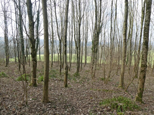
Ball's Copse is a picturesque woodland located in the county of Dorset, England. This tranquil forest covers an area of approximately 20 acres and is situated near the village of Piddlehinton, just a few miles northwest of the historic town of Dorchester.

The copse is predominantly made up of a mixture of broadleaf trees, including oak, beech, and ash, which create a dense canopy overhead, providing shade and shelter for a variety of wildlife. The forest floor is covered in a rich carpet of wildflowers and ferns, adding to the area's natural beauty.

As visitors explore Ball's Copse, they can follow a network of well-maintained footpaths that wind their way through the woods. These paths offer a peaceful and secluded environment, allowing visitors to immerse themselves in nature and enjoy the tranquil surroundings. The copse is particularly popular among hikers, nature enthusiasts, and families looking to escape the hustle and bustle of daily life.

The woodland is also home to a diverse range of wildlife, including deer, rabbits, squirrels, and numerous bird species. Birdwatchers can often spot woodpeckers, tits, and finches among the trees, while lucky visitors may even catch a glimpse of a rare and elusive British dormouse.

Ball's Copse is a cherished natural treasure in Dorset, providing a haven for both wildlife and humans alike. Whether it's a leisurely stroll, a picnic among the trees, or simply a moment of tranquility, this enchanting woodland offers a slice of natural beauty that is sure to leave a lasting impression on all who visit.

If you have any feedback on the listing, please let us know in the comments section below.
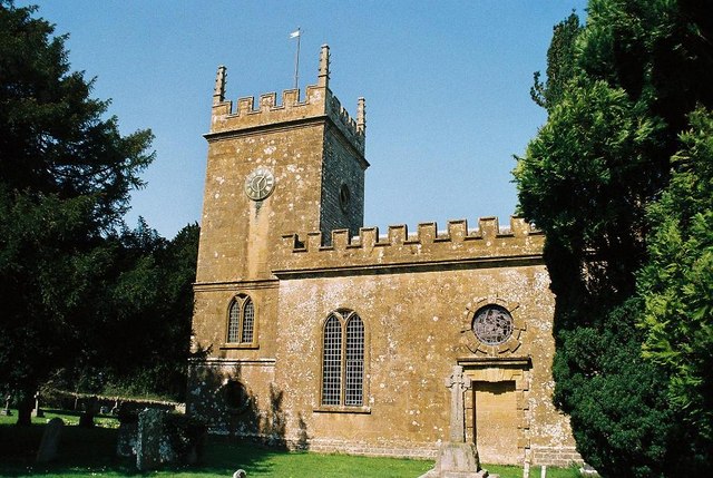
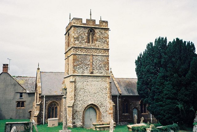
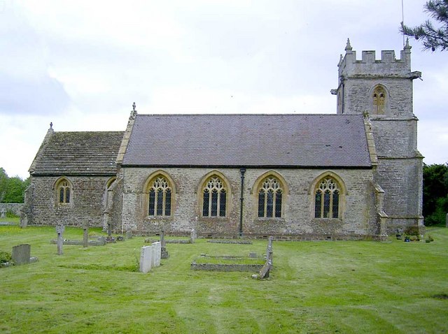
Ball's Copse Images

Images are sourced within 2km of 50.868161/-2.5907962 or Grid Reference ST5807. Thanks to Geograph Open Source API. All images are credited.

Ford, Melbury Osmond Bridleway W33 9 crosses a stream by ford and footbridge.
Ford, Melbury Osmond
Bridleway W33 9 crosses a stream by ford and footbridge.
Footpath to Evershot
Melbury House and Chapel
Cattle grid in Melbury Park
Ford at Melbury Osmond This ford is found at Town’s End near Melbury Osmond.
Ford at Melbury Osmond
This ford is found at Town’s End near Melbury Osmond.
Melbury House The grade I listed building is a "Country House in parkland. c.1530 quadrangular house with Prospect Tower built for Giles Strangways, by Ham Hill school of masons". Later changes are described at <span class="nowrap"><a title="https://historicengland.org.uk/listing/the-list/list-entry/1119248?section=official-list-entry" rel="nofollow ugc noopener" href="https://historicengland.org.uk/listing/the-list/list-entry/1119248?section=official-list-entry">Link</a><img style="margin-left:2px;" alt="External link" title="External link - shift click to open in new window" src="https://s1.geograph.org.uk/img/external.png" width="10" height="10"/></span> . To the left is St Mary's church, also grade I listed <span class="nowrap"><a title="https://historicengland.org.uk/listing/the-list/list-entry/1323935?section=official-list-entry" rel="nofollow ugc noopener" href="https://historicengland.org.uk/listing/the-list/list-entry/1323935?section=official-list-entry">Link</a><img style="margin-left:2px;" alt="External link" title="External link - shift click to open in new window" src="https://s1.geograph.org.uk/img/external.png" width="10" height="10"/></span> .
Melbury House
The grade I listed building is a "Country House in parkland. c.1530 quadrangular house with Prospect Tower built for Giles Strangways, by Ham Hill school of masons". Later changes are described at LinkExternal link . To the left is St Mary's church, also grade I listed LinkExternal link .
Melbury Sampford: church and house A slightly more revealing view than <a href="https://www.geograph.org.uk/photo/7576045">ST5706 : Melbury House</a>, with the Prospect Tower prominent on the right: "square foundation, becoming hexagonal in top stage via stone squinches, octagonal buttressing and finials, castellated parapet and higher hexagonal stair-turret castellated on north-west". More at <span class="nowrap"><a title="https://historicengland.org.uk/listing/the-list/list-entry/1119248?section=official-list-entry" rel="nofollow ugc noopener" href="https://historicengland.org.uk/listing/the-list/list-entry/1119248?section=official-list-entry">Link</a><img style="margin-left:2px;" alt="External link" title="External link - shift click to open in new window" src="https://s1.geograph.org.uk/img/external.png" width="10" height="10"/></span> . The church is described at <span class="nowrap"><a title="https://historicengland.org.uk/listing/the-list/list-entry/1323935?section=official-list-entry" rel="nofollow ugc noopener" href="https://historicengland.org.uk/listing/the-list/list-entry/1323935?section=official-list-entry">Link</a><img style="margin-left:2px;" alt="External link" title="External link - shift click to open in new window" src="https://s1.geograph.org.uk/img/external.png" width="10" height="10"/></span> .
Melbury Sampford: church and house
A slightly more revealing view than ST5706 : Melbury House, with the Prospect Tower prominent on the right: "square foundation, becoming hexagonal in top stage via stone squinches, octagonal buttressing and finials, castellated parapet and higher hexagonal stair-turret castellated on north-west". More at LinkExternal link . The church is described at LinkExternal link .
Melbury Park Looking in the opposite direction from <a href="https://www.geograph.org.uk/photo/7576046">ST5706 : Melbury Sampford: church and house</a>, with the road carrying the Hardy and Macmillan Ways following footpath W34 1.
Melbury Park
Looking in the opposite direction from ST5706 : Melbury Sampford: church and house, with the road carrying the Hardy and Macmillan Ways following footpath W34 1.
Path junction, Melbury Park Footpath W34 1 keeps straight on, carrying the Hardy and Macmillan Ways, while footpath W34 2 turns right. Melbury Park is grade II* listed <span class="nowrap"><a title="https://historicengland.org.uk/listing/the-list/list-entry/1000531?section=official-list-entry" rel="nofollow ugc noopener" href="https://historicengland.org.uk/listing/the-list/list-entry/1000531?section=official-list-entry">Link</a><img style="margin-left:2px;" alt="External link" title="External link - shift click to open in new window" src="https://s1.geograph.org.uk/img/external.png" width="10" height="10"/></span> .
Path junction, Melbury Park
Footpath W34 1 keeps straight on, carrying the Hardy and Macmillan Ways, while footpath W34 2 turns right. Melbury Park is grade II* listed LinkExternal link .
Cattle grid, Melbury Park The Hardy and Macmillan Ways follow footpath W34 1 as far as the cattle grid, when it magically becomes footpath W33 12 as it crosses the parish boundary between Melbury Sampford and Melbury Osmond. Melbury Park is grade II* listed <span class="nowrap"><a title="https://historicengland.org.uk/listing/the-list/list-entry/1000531?section=official-list-entry" rel="nofollow ugc noopener" href="https://historicengland.org.uk/listing/the-list/list-entry/1000531?section=official-list-entry">Link</a><img style="margin-left:2px;" alt="External link" title="External link - shift click to open in new window" src="https://s1.geograph.org.uk/img/external.png" width="10" height="10"/></span> .
Cattle grid, Melbury Park
The Hardy and Macmillan Ways follow footpath W34 1 as far as the cattle grid, when it magically becomes footpath W33 12 as it crosses the parish boundary between Melbury Sampford and Melbury Osmond. Melbury Park is grade II* listed LinkExternal link .
Sheep, Melbury Park Looking right from the stretch of footpath shown in <a href="https://www.geograph.org.uk/photo/7576049">ST5706 : Cattle grid, Melbury Park</a>. Melbury Park is grade II* listed <span class="nowrap"><a title="https://historicengland.org.uk/listing/the-list/list-entry/1000531?section=official-list-entry" rel="nofollow ugc noopener" href="https://historicengland.org.uk/listing/the-list/list-entry/1000531?section=official-list-entry">Link</a><img style="margin-left:2px;" alt="External link" title="External link - shift click to open in new window" src="https://s1.geograph.org.uk/img/external.png" width="10" height="10"/></span> .
Sheep, Melbury Park
Looking right from the stretch of footpath shown in ST5706 : Cattle grid, Melbury Park. Melbury Park is grade II* listed LinkExternal link .
Cattle grid, Melbury Park The Hardy and Macmillan Ways follow footpath W33 12 past this gated cattle grid. Melbury Park is grade II* listed <span class="nowrap"><a title="https://historicengland.org.uk/listing/the-list/list-entry/1000531?section=official-list-entry" rel="nofollow ugc noopener" href="https://historicengland.org.uk/listing/the-list/list-entry/1000531?section=official-list-entry">Link</a><img style="margin-left:2px;" alt="External link" title="External link - shift click to open in new window" src="https://s1.geograph.org.uk/img/external.png" width="10" height="10"/></span> .
Cattle grid, Melbury Park
The Hardy and Macmillan Ways follow footpath W33 12 past this gated cattle grid. Melbury Park is grade II* listed LinkExternal link .
Entering Melbury Osmond From the south along footpath W33 12, used by the Hardy and Macmillan Ways. On the right is the early C18 Town's End Farmhouse <span class="nowrap"><a title="https://historicengland.org.uk/listing/the-list/list-entry/1154861?section=official-list-entry" rel="nofollow ugc noopener" href="https://historicengland.org.uk/listing/the-list/list-entry/1154861?section=official-list-entry">Link</a><img style="margin-left:2px;" alt="External link" title="External link - shift click to open in new window" src="https://s1.geograph.org.uk/img/external.png" width="10" height="10"/></span> , and beyond the adjoining barns is the early C17 Walnut Tree Cottage <span class="nowrap"><a title="https://historicengland.org.uk/listing/the-list/list-entry/1119247?section=official-list-entry" rel="nofollow ugc noopener" href="https://historicengland.org.uk/listing/the-list/list-entry/1119247?section=official-list-entry">Link</a><img style="margin-left:2px;" alt="External link" title="External link - shift click to open in new window" src="https://s1.geograph.org.uk/img/external.png" width="10" height="10"/></span> , in the centre. The thatched building left of centre is the late C17 Town's End and Monmouth House <span class="nowrap"><a title="https://historicengland.org.uk/listing/the-list/list-entry/1119246?section=official-list-entry" rel="nofollow ugc noopener" href="https://historicengland.org.uk/listing/the-list/list-entry/1119246?section=official-list-entry">Link</a><img style="margin-left:2px;" alt="External link" title="External link - shift click to open in new window" src="https://s1.geograph.org.uk/img/external.png" width="10" height="10"/></span> , better shown in <a href="https://www.geograph.org.uk/photo/7577047">ST5707 : Town's End and Monmouth House, Melbury Osmond</a>.
Entering Melbury Osmond
From the south along footpath W33 12, used by the Hardy and Macmillan Ways. On the right is the early C18 Town's End Farmhouse LinkExternal link , and beyond the adjoining barns is the early C17 Walnut Tree Cottage LinkExternal link , in the centre. The thatched building left of centre is the late C17 Town's End and Monmouth House LinkExternal link , better shown in ST5707 : Town's End and Monmouth House, Melbury Osmond.
Town's End and Monmouth House, Melbury Osmond The thatched "former farmhouse, divided into two cottages. Late C17" is described at <span class="nowrap"><a title="https://historicengland.org.uk/listing/the-list/list-entry/1119246?section=official-list-entry" rel="nofollow ugc noopener" href="https://historicengland.org.uk/listing/the-list/list-entry/1119246?section=official-list-entry">Link</a><img style="margin-left:2px;" alt="External link" title="External link - shift click to open in new window" src="https://s1.geograph.org.uk/img/external.png" width="10" height="10"/></span> . In the foreground is Walnut Tree Cottage <span class="nowrap"><a title="https://historicengland.org.uk/listing/the-list/list-entry/1119247?section=official-list-entry" rel="nofollow ugc noopener" href="https://historicengland.org.uk/listing/the-list/list-entry/1119247?section=official-list-entry">Link</a><img style="margin-left:2px;" alt="External link" title="External link - shift click to open in new window" src="https://s1.geograph.org.uk/img/external.png" width="10" height="10"/></span> . See also <a href="https://www.geograph.org.uk/photo/7577041">ST5707 : Entering Melbury Osmond</a>.
Town's End and Monmouth House, Melbury Osmond
The thatched "former farmhouse, divided into two cottages. Late C17" is described at LinkExternal link . In the foreground is Walnut Tree Cottage LinkExternal link . See also ST5707 : Entering Melbury Osmond.
Bridleway, Town's End Bridleway W33 9 heads east through woodland.
Bridleway, Town's End
Bridleway W33 9 heads east through woodland.
Trees and bridleway junction near Melbury Osmond Bridleways W33 10 and W33 9 part company here, the former through the gate on the right and the latter through the gate left of centre. Melbury Park is grade II* listed <span class="nowrap"><a title="https://historicengland.org.uk/listing/the-list/list-entry/1000531?section=official-list-entry" rel="nofollow ugc noopener" href="https://historicengland.org.uk/listing/the-list/list-entry/1000531?section=official-list-entry">Link</a><img style="margin-left:2px;" alt="External link" title="External link - shift click to open in new window" src="https://s1.geograph.org.uk/img/external.png" width="10" height="10"/></span> .
Trees and bridleway junction near Melbury Osmond
Bridleways W33 10 and W33 9 part company here, the former through the gate on the right and the latter through the gate left of centre. Melbury Park is grade II* listed LinkExternal link .
Trees and fence near Beer Lane A belt of trees in Melbury Park, which is grade II* listed <span class="nowrap"><a title="https://historicengland.org.uk/listing/the-list/list-entry/1000531?section=official-list-entry" rel="nofollow ugc noopener" href="https://historicengland.org.uk/listing/the-list/list-entry/1000531?section=official-list-entry">Link</a><img style="margin-left:2px;" alt="External link" title="External link - shift click to open in new window" src="https://s1.geograph.org.uk/img/external.png" width="10" height="10"/></span> .
Trees and fence near Beer Lane
A belt of trees in Melbury Park, which is grade II* listed LinkExternal link .
Trees and fence near Beer Lane A reverse view of <a href="https://www.geograph.org.uk/photo/7577795">ST5807 : Trees and fence near Beer Lane</a>.
Trees and fence near Beer Lane
Show me another place!

Ball's Copse is located at Grid Ref: ST5807 (Lat: 50.868161, Lng: -2.5907962)

Unitary Authority: Dorset

Police Authority: Dorset

What 3 Words

///unwanted.capillary.fatigued. Near Yetminster, Dorset

Related Wikis

Stockwood, Dorset

for Stockwood in Bristol, see StockwoodStockwood is a village in west Dorset, England, around eight miles south-west of Sherborne and less than a mile...

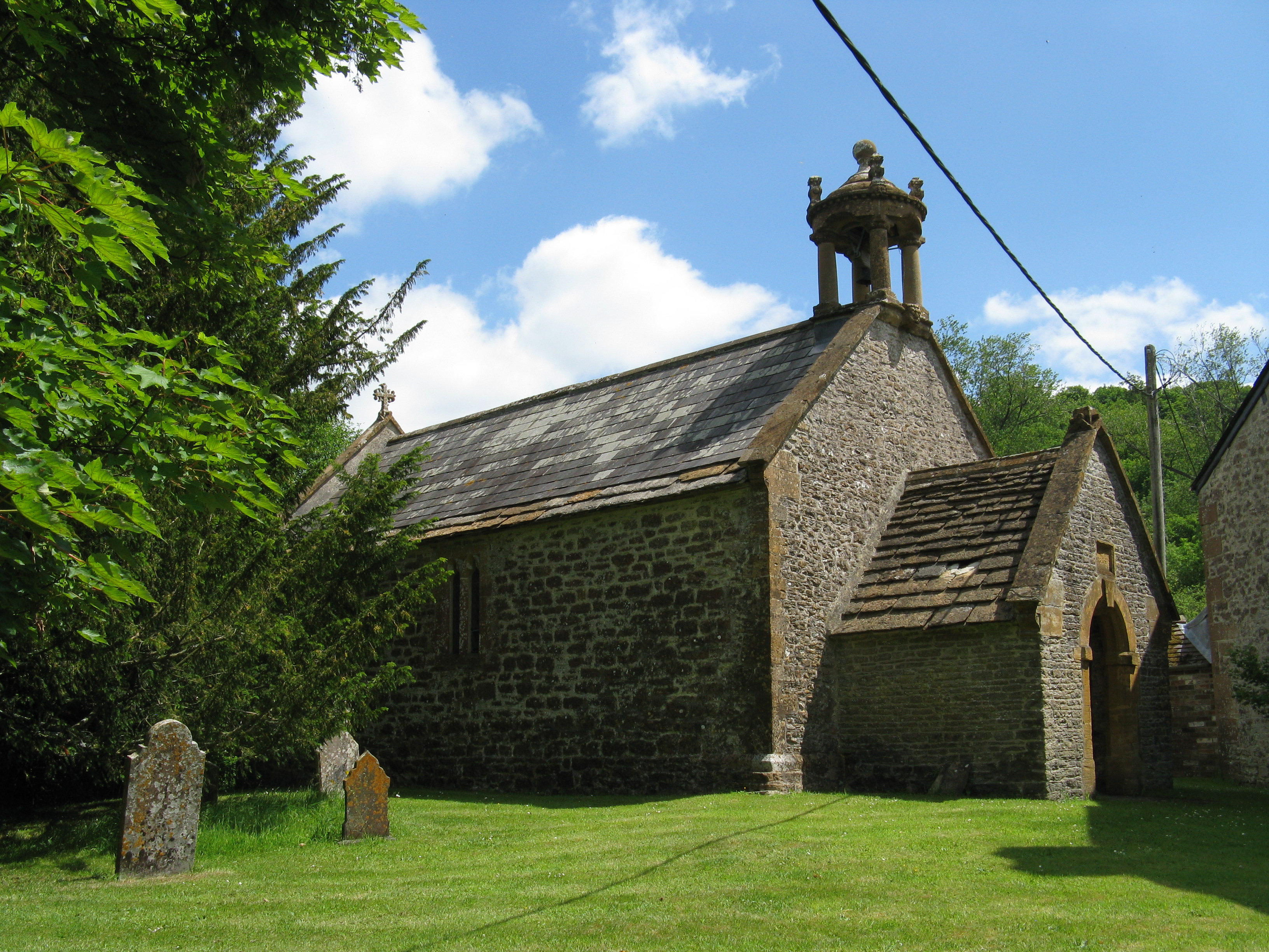
St Edwold's Church, Stockwood

St Edwold's Church in Stockwood, Dorset, England was rebuilt in the 15th century. It is recorded in the National Heritage List for England as a designated...

Melbury Osmond

Melbury Osmond is a village and civil parish in the county of Dorset in southern England. It lies approximately 7 miles (11 km) south of the Somerset town...

Chetnole railway station

Chetnole railway station is a small rural station serving the village of Chetnole, Dorset, England. The station is on the Heart of Wessex Line 21¼ miles...

Melbury Bubb

Melbury Bubb is a small village and civil parish in the county of Dorset in South West England, situated approximately 7 miles (11 km) south of the town...

Chetnole

Chetnole is a village and civil parish in the county of Dorset in southern England. It lies approximately 6 miles (9.7 km) south-southwest of Sherborne...

Melbury Sampford

Melbury Sampford is a village and civil parish 12 miles (19 km) northwest of Dorchester, in the Dorset district, in the ceremonial county of Dorset, England...
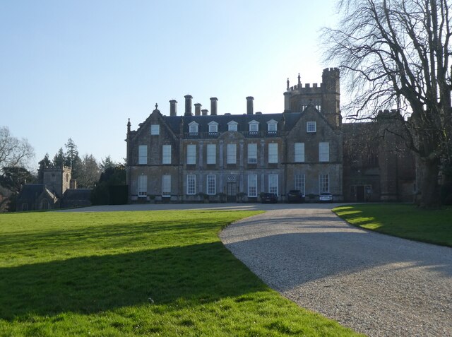
Melbury House

Melbury House is an English country house in the parish of Melbury Sampford near Evershot, Dorset, This Grade I listed mansion is the home of the Honorable...

Nearby Amenities

Located within 500m of 50.868161,-2.5907962
Post Box
Collection Times: Mo-Sa 09:00
Post Box Type: lamp
Ref: DT2 30
Ref GB Uprn: 10015438701
Lat/Long: 50.8701029/-2.5967834
Pub
The Sheaf of Arrows
Outdoor Seating: yes
Smoking: outside
Lat/Long: 50.8685153/-2.5956543
The data included in this document is from www.openstreetmap.org. The data is made available under ODbL.

Have you been to Ball's Copse?

Leave your review of Ball's Copse below (or comments, questions and feedback).