Saunders' Wood

Wood, Forest in Lancashire Chorley

England

Saunders' Wood

Yew Tree House Farm
Yew Tree House Farm Credit: Peter McDermott

Saunders' Wood, located in Lancashire, England, is a picturesque and verdant forest that spans over a vast area. Known for its rich biodiversity and natural beauty, this woodland attracts nature enthusiasts and hikers from all over the region. The wood is named after the Saunders family, who were the original landowners and custodians of this stunning natural gem.

Covering an area of approximately 500 acres, Saunders' Wood boasts towering ancient trees, including oak, beech, and ash, which provide a dense canopy and create a tranquil and serene atmosphere. The forest floor is adorned with a tapestry of colorful wildflowers, creating a vibrant and enchanting landscape.

The wood is home to a diverse range of wildlife, making it a haven for nature lovers and wildlife enthusiasts. Visitors may spot deer, foxes, badgers, and an array of bird species, including woodpeckers and owls. The presence of such a varied ecosystem provides a unique opportunity for nature observation and photography.

The wood offers several walking trails, providing visitors with the chance to explore its hidden treasures and immerse themselves in the beauty of nature. These trails are well-maintained and marked, ensuring a safe and enjoyable experience for all ages and fitness levels.

Saunders' Wood is also an important conservation area, with efforts in place to protect its natural habitats and promote sustainable practices. The woodland is managed by a dedicated team of conservationists and volunteers who work tirelessly to maintain its ecological balance and preserve its natural heritage.

In conclusion, Saunders' Wood in Lancashire is a breathtaking forest that offers a peaceful retreat in the heart of nature. With its remarkable biodiversity, well-maintained trails, and commitment to conservation, it is a must-visit destination for anyone seeking solace and a deeper connection with the natural world.

If you have any feedback on the listing, please let us know in the comments section below.

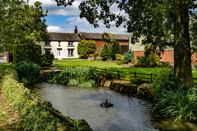
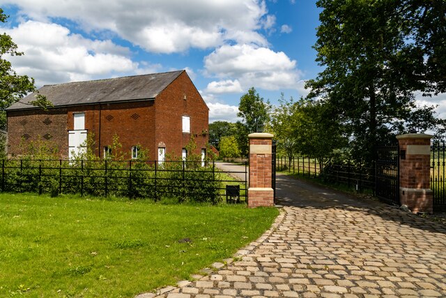
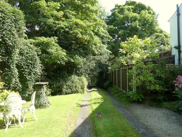
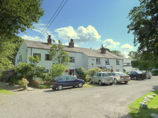
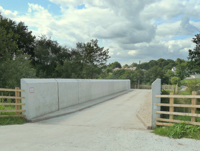
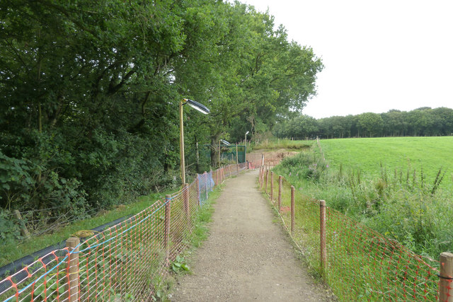
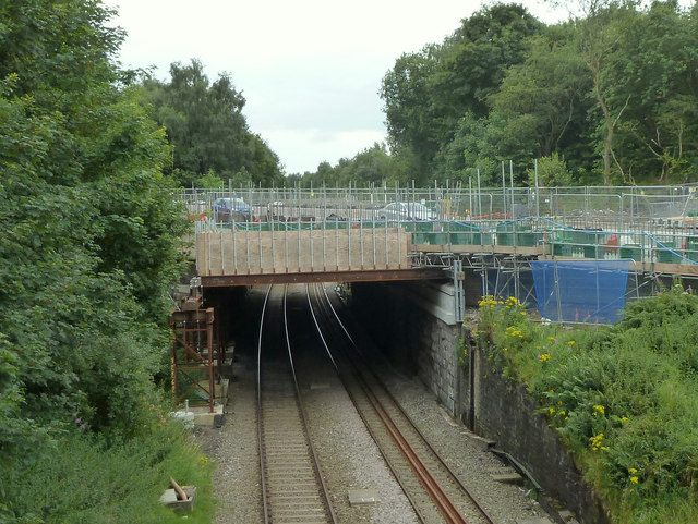
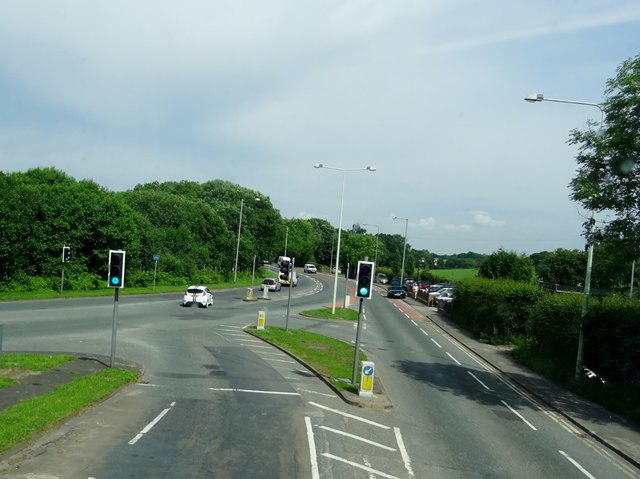
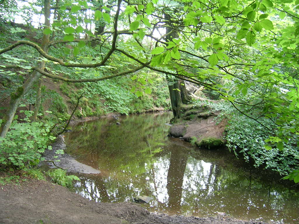
Saunders' Wood Images

Images are sourced within 2km of 53.63263/-2.6311427 or Grid Reference SD5815. Thanks to Geograph Open Source API. All images are credited.

Yew Tree House Farm
Yew Tree House Farm
Coppull Hall Lane
Coppull Hall Lane
Coppull Hall Barn at entrance to Coppull Hall.
Coppull Hall
Barn at entrance to Coppull Hall.
Wheatsheaf Hotel The Wheatsheaf Hotel public house.
Wheatsheaf Hotel
The Wheatsheaf Hotel public house.
Village Hall New house on the site of the old Village Hall.
Village Hall
New house on the site of the old Village Hall.
Butterworth Brow
Butterworth Brow
B5252 New roundabout on the B5252, Yarrow Valley Way.
B5252
New roundabout on the B5252, Yarrow Valley Way.
Martin's Lane, Heath Charnock
Houses on Martin's Lane, Heath Charnock
Frederick's Ice Cream Shop, Bolton Road, Heath Charnock
Bridge over railway at Bretter's Farm
Temporary Footpath alongside the A673 at Heath Charnock Due to work on the bridge over the railway
Temporary Footpath alongside the A673 at Heath Charnock
Due to work on the bridge over the railway
Work on A673 bridge over railway at Heath Charnock
Junction of Coppull Hall Lane and Green Lane
A673 meets the A6 at Skew Bridge
The Yarrow Bridge Public House outside Chorley standing by the River Yarrow.
The Yarrow Bridge
Public House outside Chorley standing by the River Yarrow.
Roundabout in Chorley One of several roundabouts in the town with wicker figures depicting various activities. This one has a sporting theme.
Roundabout in Chorley
One of several roundabouts in the town with wicker figures depicting various activities. This one has a sporting theme.
Myles Standish Way outside Chorley At its junction with the A6.
Myles Standish Way outside Chorley
At its junction with the A6.
Show me another place!

Saunders' Wood is located at Grid Ref: SD5815 (Lat: 53.63263, Lng: -2.6311427)

Administrative County: Lancashire

District: Chorley

Police Authority: Lancashire

What 3 Words

///brush.toxic.tops. Near Coppull, Lancashire

Related Wikis

Yarrow Valley Country Park

Yarrow Valley Country Park is a country park managed by Chorley Borough Council in Lancashire, England. It follows the River Yarrow for about 6 miles...

Holy Cross Catholic High School, Chorley

Holy Cross Catholic High School is a Roman Catholic Voluntary aided comprehensive school in Chorley, Lancashire, England. The school provides co-educational...

Duxbury Woods

Duxbury Woods is an area of woodland and parkland situated in Chorley, Lancashire, at the foot of the West Pennine Moors. The area originally existed as...

Duxbury Hall

Duxbury Hall was a 19th-century country house in Duxbury Park estate in Duxbury Woods, Duxbury, Lancashire that has been demolished. The hall was a plain...

Nearby Amenities

Located within 500m of 53.63263,-2.6311427
Source: Yahoo imagery
Lat/Long: 53.6330154/-2.6364725
Turning Circle
Source: Yahoo imagery
Lat/Long: 53.6363916/-2.6352779
Source: Yahoo imagery
Lat/Long: 53.636242/-2.6341951
Source: Yahoo imagery
Lat/Long: 53.6332136/-2.6364183
Source: Yahoo imagery
Lat/Long: 53.633293/-2.6369235
Source: Yahoo imagery
Lat/Long: 53.6332736/-2.6365952
Source: Yahoo imagery
Lat/Long: 53.6334246/-2.6363726
Source: Yahoo imagery
Lat/Long: 53.6334071/-2.6363181
Source: Yahoo imagery
Lat/Long: 53.6333751/-2.6362719
Source: Yahoo imagery
Lat/Long: 53.6334304/-2.636434
Source: Yahoo imagery
Lat/Long: 53.6332917/-2.6370737
Source: Yahoo imagery
Lat/Long: 53.6334042/-2.6378398
Source: Yahoo imagery
Lat/Long: 53.6334697/-2.6379649
Source: Yahoo imagery
Lat/Long: 53.6336911/-2.6381848
Source: Yahoo imagery
Lat/Long: 53.6338045/-2.6383061
Source: Yahoo imagery
Lat/Long: 53.6333409/-2.6358062
Source: Yahoo imagery
Lat/Long: 53.6333199/-2.635582
Source: Yahoo imagery
Lat/Long: 53.633249/-2.6353328
Source: Yahoo imagery
Lat/Long: 53.6332106/-2.6351402
Source: Yahoo imagery
Lat/Long: 53.6330474/-2.6349006
Source: Yahoo imagery
Lat/Long: 53.632854/-2.6348225
Source: Yahoo imagery
Lat/Long: 53.6332067/-2.6345186
Source: Yahoo imagery
Lat/Long: 53.6326685/-2.6339561
Source: Yahoo imagery
Lat/Long: 53.6328232/-2.6345655
Source: Yahoo imagery
Lat/Long: 53.6327643/-2.6350297
Source: Yahoo imagery
Lat/Long: 53.6324417/-2.6352194
Source: Yahoo imagery
Lat/Long: 53.6317904/-2.6364455
Source: Yahoo imagery
Lat/Long: 53.6317445/-2.6362435
Source: Yahoo imagery
Lat/Long: 53.6316875/-2.6359227
Source: Yahoo imagery
Lat/Long: 53.6316844/-2.6355268
Source: Yahoo imagery
Lat/Long: 53.6316902/-2.6353618
Source: Yahoo imagery
Lat/Long: 53.631743/-2.6351305
Source: Yahoo imagery
Lat/Long: 53.6318472/-2.6348905
Source: Yahoo imagery
Lat/Long: 53.6314654/-2.6373235
Source: Yahoo imagery
Lat/Long: 53.6311583/-2.6365621
Source: Yahoo imagery
Lat/Long: 53.6326743/-2.6359729
Source: Yahoo imagery
Lat/Long: 53.6328218/-2.6355991
Source: Yahoo imagery
Lat/Long: 53.633499/-2.6349574
Source: Yahoo imagery
Lat/Long: 53.6335229/-2.634859
Source: Yahoo imagery
Lat/Long: 53.6337449/-2.6343889
Source: Yahoo imagery
Lat/Long: 53.6338221/-2.6340407
Source: Yahoo imagery
Lat/Long: 53.6338733/-2.6335583
Source: Yahoo imagery
Lat/Long: 53.6335723/-2.635167
Source: Yahoo imagery
Lat/Long: 53.6337396/-2.6354363
Source: Yahoo imagery
Lat/Long: 53.6339393/-2.6355856
Source: Yahoo imagery
Lat/Long: 53.6341042/-2.6355193
Source: Yahoo imagery
Lat/Long: 53.6340896/-2.6352889
Source: Yahoo imagery
Lat/Long: 53.6341915/-2.6347924
Source: Yahoo imagery
Lat/Long: 53.6348996/-2.6361917
Source: Yahoo imagery
Lat/Long: 53.6350046/-2.6345988
Crossing
Bicycle: yes
Button Operated: yes
Crossing: traffic_signals
Crossing Ref: toucan
Kerb: lowered
Tactile Paving: yes
Lat/Long: 53.6352519/-2.6332525
Turning Circle
Lat/Long: 53.6345412/-2.6326514
Turning Circle
Lat/Long: 53.6324045/-2.6361209
Turning Circle
Lat/Long: 53.6346278/-2.6332267
Parking
Lat/Long: 53.631748/-2.6259151
Turning Circle
The Cedars
Lat/Long: 53.6351699/-2.6371852
Turning Circle
Lat/Long: 53.6316424/-2.6365308
Turning Circle
The Cedars
Lat/Long: 53.6353114/-2.6367802
Turning Circle
Lat/Long: 53.6319072/-2.6363873
Turning Circle
Lat/Long: 53.6317155/-2.6377137
Turning Circle
Lat/Long: 53.6337125/-2.6369843
Turning Circle
Lat/Long: 53.6339407/-2.6380907
Turning Circle
Lat/Long: 53.6346099/-2.6369004
Crossing
Crossing: uncontrolled
Kerb: lowered
Tactile Paving: no
Lat/Long: 53.6351698/-2.6335571
Turning Circle
Dale View
Lat/Long: 53.6352637/-2.6354139
Source: Yahoo imagery
Lat/Long: 53.6334051/-2.6365487
Source: Yahoo imagery
Lat/Long: 53.6332519/-2.6362914
Source: Yahoo imagery
Lat/Long: 53.6332398/-2.6363116
Crossing
Crossing: uncontrolled
Kerb: lowered
Tactile Paving: yes
Lat/Long: 53.6359987/-2.6361559
Crossing
Crossing: uncontrolled
Kerb: lowered
Tactile Paving: no
Lat/Long: 53.6356125/-2.6360892
Crossing
Crossing: uncontrolled
Kerb: lowered
Tactile Paving: no
Lat/Long: 53.6355726/-2.6359675
Crossing
Crossing: uncontrolled
Kerb: lowered
Tactile Paving: no
Lat/Long: 53.6357249/-2.635512
Crossing
Crossing: uncontrolled
Kerb: lowered
Tactile Paving: no
Lat/Long: 53.6358078/-2.6354941
Crossing
Crossing: uncontrolled
Kerb: lowered
Tactile Paving: no
Lat/Long: 53.6359401/-2.636245
Barrier: bollard
Bicycle: yes
Foot: yes
Motor Vehicle: no
Lat/Long: 53.6356258/-2.6334149
Crossing
Crossing: uncontrolled
Kerb: lowered
Tactile Paving: no
Lat/Long: 53.6366862/-2.627943
Barrier: cycle_barrier
Bicycle: yes
Foot: yes
Maxwidth: 1.5
Motor Vehicle: no
Lat/Long: 53.6338917/-2.6344812
Turning Circle
Lat/Long: 53.6347453/-2.6344872
Turning Circle
Lat/Long: 53.6337118/-2.6333557
Shelter
Shelter Type: picnic_shelter
Lat/Long: 53.6311168/-2.6372083
Gilling Dodd
Addr City: Chorley
Addr Housename: The Cruck Barn
Addr Place: Duxbury
Addr Postcode: PR7 4AT
Addr Street: Duxbury Hall Road
Office: architect
Lat/Long: 53.6310635/-2.6258008
Glendale Head Office
Addr City: Chorley
Addr Housename: Duxbury Park Coach House
Addr Place: Duxbury
Addr Postcode: PR7 4AT
Addr Street: Duxbury Hall Road
Office: company
Lat/Long: 53.6312909/-2.6251638
Restaurant
Nineteen
Addr City: Chorley
Addr Place: Duxbury
Addr Postcode: PR7 4AT
Addr Street: Duxbury Hall Road
Fhrs Id: 377056
Outdoor Seating: yes
Wheelchair: yes
Lat/Long: 53.6309617/-2.6248366
Material: wood
Power: pole
Lat/Long: 53.6353004/-2.628648
Material: wood
Power: pole
Lat/Long: 53.6305482/-2.6351738
Access: permissive
Barrier: swing_gate
Bicycle: yes
Foot: yes
Swing Gate Type: single
Lat/Long: 53.631231/-2.6364472
Access: permissive
Barrier: swing_gate
Bicycle: yes
Foot: yes
Lat/Long: 53.6336146/-2.6345016
Eaves Green
Place: suburb
Postal Code: PR7 3
Lat/Long: 53.6312098/-2.6379097
Bus Stop
Burgh Lane End
Bus: yes
Naptan AtcoCode: 2500LAA16443
Naptan CommonName: Burgh Lane End
Naptan Indicator: opp
Naptan NaptanCode: lanpajpt
Naptan Verified: no
Public Transport: platform
Lat/Long: 53.6355627/-2.634302
Bus Stop
Lower Burgh Way
Bus: yes
Naptan AtcoCode: 2500LAA15844
Naptan CommonName: Lower Burgh Way
Naptan Indicator: by
Naptan NaptanCode: lanjtjgm
Naptan Verified: no
Public Transport: platform
Lat/Long: 53.6343389/-2.6362648
Barrier: stile
Bicycle: yes
Foot: yes
Material: wood
Stile: squeezer
Lat/Long: 53.6348735/-2.6364632
Direction: S
Generator Method: photovoltaic
Generator Output Electricity: yes
Generator Solar Modules: 18
Generator Source: solar
Generator Type: solar_photovoltaic_panel
Location: roof
Power: generator
Lat/Long: 53.6340396/-2.6372592
Direction: E
Generator Method: photovoltaic
Generator Output Electricity: yes
Generator Solar Modules: 16
Generator Source: solar
Generator Type: solar_photovoltaic_panel
Location: roof
Power: generator
Lat/Long: 53.6340988/-2.6366289
Direction: E
Generator Method: photovoltaic
Generator Output Electricity: yes
Generator Solar Modules: 7
Generator Source: solar
Generator Type: solar_photovoltaic_panel
Location: roof
Power: generator
Lat/Long: 53.6343283/-2.6369601
Direction: SE
Generator Method: photovoltaic
Generator Output Electricity: yes
Generator Solar Modules: 8
Generator Source: solar
Generator Type: solar_photovoltaic_panel
Location: roof
Power: generator
Lat/Long: 53.6365873/-2.6334049
Direction: S
Generator Method: photovoltaic
Generator Output Electricity: yes
Generator Solar Modules: 11
Generator Source: solar
Generator Type: solar_photovoltaic_panel
Location: roof
Power: generator
Lat/Long: 53.6358792/-2.6330468
Turning Circle
Lat/Long: 53.6357024/-2.6333969
Direction: SE
Generator Method: photovoltaic
Generator Output Electricity: yes
Generator Solar Modules: 12
Generator Source: solar
Generator Type: solar_photovoltaic_panel
Location: roof
Power: generator
Lat/Long: 53.6361552/-2.6353589
Barrier: bollard
Bicycle: yes
Foot: yes
Material: concrete
Lat/Long: 53.6350397/-2.6337143
Barrier: bollard
Bicycle: yes
Foot: yes
Horse: yes
Lat/Long: 53.6340801/-2.6342999
Direction: SW
Generator Method: photovoltaic
Generator Output Electricity: yes
Generator Solar Modules: 9
Generator Source: solar
Generator Type: solar_photovoltaic_panel
Location: roof
Power: generator
Lat/Long: 53.6341855/-2.6352972
Direction: E
Generator Method: photovoltaic
Generator Output Electricity: yes
Generator Solar Modules: 5
Generator Source: solar
Generator Type: solar_photovoltaic_panel
Location: roof
Power: generator
Lat/Long: 53.6347851/-2.6353857
Direction: S
Generator Method: photovoltaic
Generator Output Electricity: yes
Generator Solar Modules: 8
Generator Source: solar
Generator Type: solar_photovoltaic_panel
Location: roof
Power: generator
Lat/Long: 53.634762/-2.6354541
Direction: W
Generator Method: photovoltaic
Generator Output Electricity: yes
Generator Solar Modules: 9
Generator Source: solar
Generator Type: solar_photovoltaic_panel
Location: roof
Power: generator
Lat/Long: 53.6348885/-2.6342766
Direction: W
Generator Method: photovoltaic
Generator Output Electricity: yes
Generator Solar Modules: 16
Generator Source: solar
Generator Type: solar_photovoltaic_panel
Location: roof
Power: generator
Lat/Long: 53.6351525/-2.6347527
Direction: W
Generator Method: photovoltaic
Generator Output Electricity: yes
Generator Solar Modules: 9
Generator Source: solar
Generator Type: solar_photovoltaic_panel
Location: roof
Power: generator
Lat/Long: 53.635333/-2.6357357
Direction: S
Generator Method: photovoltaic
Generator Output Electricity: yes
Generator Solar Modules: 6
Generator Source: solar
Generator Type: solar_photovoltaic_panel
Location: roof
Power: generator
Lat/Long: 53.6352853/-2.6356915
Lower Burgh Way
Bus: yes
Public Transport: stop_position
Lat/Long: 53.6343386/-2.6362233
Turning Circle
Lat/Long: 53.6328941/-2.633767
Turning Circle
Lat/Long: 53.6323947/-2.6341921
Source: Yahoo imagery
Lat/Long: 53.633247/-2.6365638
Source: Yahoo imagery
Lat/Long: 53.6332216/-2.6363614
Source: Yahoo imagery
Lat/Long: 53.6333407/-2.6359534
Source: Yahoo imagery
Lat/Long: 53.63502/-2.6344677
Turning Circle
Lat/Long: 53.6345389/-2.6332957
Turning Circle
Lat/Long: 53.634471/-2.632535
Turning Circle
Lat/Long: 53.6336394/-2.6334605
Turning Circle
Lat/Long: 53.6337618/-2.637105
The data included in this document is from www.openstreetmap.org. The data is made available under ODbL.

Have you been to Saunders' Wood?

Leave your review of Saunders' Wood below (or comments, questions and feedback).