Prior's Court Wood

Wood, Forest in Herefordshire

England

Prior's Court Wood

Converted Oast Houses, Perton Farm Originally four square kilns,which were converted into two dwellings, then converted into one large house. Outer two cowls are fixed louvres, inner two have fixed Herefordshire cowls, of wooden slats and metal bands.
Converted Oast Houses, Perton Farm Credit: Julian P Guffogg

Prior's Court Wood is a beautiful woodland area located in the county of Herefordshire, England. Covering an expansive area, the wood is known for its rich biodiversity and stunning natural landscapes. The wood is situated near the village of Priors Court, which is where it derives its name from.

The woodland is predominantly made up of native broadleaf trees such as oak, beech, and birch, creating a diverse and vibrant ecosystem. The trees form a dense canopy that provides shelter and habitat for a wide range of wildlife, including numerous bird species, small mammals, and insects.

Visitors to Prior's Court Wood are treated to a peaceful and tranquil environment, perfect for nature lovers and outdoor enthusiasts. The forest boasts a network of well-maintained trails, allowing visitors to explore and appreciate the wood's natural beauty. These paths wind through a variety of different habitats, including open glades, dense thickets, and meandering streams.

The wood is also home to a number of rare and protected species, making it an important conservation area. Conservation efforts are ongoing to ensure the preservation and enhancement of the wood's ecology.

Prior's Court Wood is a popular destination for walking, birdwatching, and photography. It offers a serene escape from the hustle and bustle of everyday life, allowing visitors to connect with nature and enjoy its peaceful ambiance. Whether it's a leisurely stroll or a more adventurous hike, Prior's Court Wood provides a stunning backdrop for outdoor exploration.

If you have any feedback on the listing, please let us know in the comments section below.

Prior's Court Wood Images

Images are sourced within 2km of 52.049858/-2.608666 or Grid Reference SO5839. Thanks to Geograph Open Source API. All images are credited.

Converted Oast Houses, Perton Farm Originally four square kilns,which were converted into two dwellings, then converted into one large house. Outer two cowls are fixed louvres, inner two have fixed Herefordshire cowls, of wooden slats and metal bands.
Converted Oast Houses, Perton Farm
Originally four square kilns,which were converted into two dwellings, then converted into one large house. Outer two cowls are fixed louvres, inner two have fixed Herefordshire cowls, of wooden slats and metal bands.
Fly-tipping in a plantation, Five Bridge Another example of those with no respect or responsibility.  A sofa dumped in a plantation off the A438 to the west of Dormington.
Fly-tipping in a plantation, Five Bridge
Another example of those with no respect or responsibility. A sofa dumped in a plantation off the A438 to the west of Dormington.
The A438 between Dormington and Bartestree
Dormington church St Peter's church, Dormington dates from the 13th century and was heavily restored in the 19th century.
Dormington church
St Peter's church, Dormington dates from the 13th century and was heavily restored in the 19th century.
Oast House, Claston Farm, Dormington
Oast House at Perton Farm, Perton
Hereford and Ledbury road signs
Hop fields by A438
Hop fields by A438
Gatehouse to Stoke Edith Park The house in Stoke Edith Park used to be the home of the Foley family but was demolished.
Gatehouse to Stoke Edith Park
The house in Stoke Edith Park used to be the home of the Foley family but was demolished.
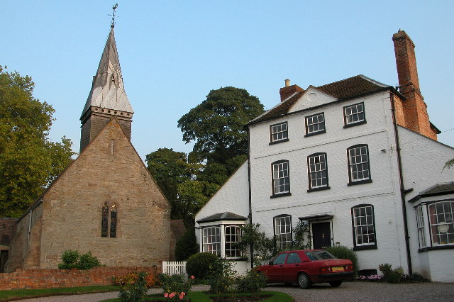
Dormington Church St Peter's church and an impressive Georgian house adjacent to it.
Dormington Church
St Peter's church and an impressive Georgian house adjacent to it.
Plantation, Five Bridges Marshy area with the road to Hereford requiring five bridges to cope with the waters of the River Frome.
Plantation, Five Bridges
Marshy area with the road to Hereford requiring five bridges to cope with the waters of the River Frome.
St Peter, Dormington
Interior, St Peter, Dormington
Footpath to Upper Dormington From the graveyard of St. Peter's Church
Footpath to Upper Dormington
From the graveyard of St. Peter's Church
St. Peter's Church, Dormington With a carpet of snowdrops on the churchyard floor in the late January sunshine.
St. Peter's Church, Dormington
With a carpet of snowdrops on the churchyard floor in the late January sunshine.
Spire detail, St. Peter's Church, Dormington A shingled bell turret with leaded spire.
Spire detail, St. Peter's Church, Dormington
A shingled bell turret with leaded spire.
Show me another place!

Prior's Court Wood is located at Grid Ref: SO5839 (Lat: 52.049858, Lng: -2.608666)

Unitary Authority: County of Herefordshire

Police Authority: West Mercia

What 3 Words

///dispenser.trudges.clincher. Near Lugwardine, Herefordshire

Related Wikis

Dormington

Dormington is a village and civil parish in Herefordshire, in the West Midlands of England. Dormington village is at the north of its parish, 5 miles...

Perton, Herefordshire

Perton is a hamlet in the English county of Herefordshire. It is in the civil parish of Stoke Edith being west of the village of that name. == External... ==

Weston Beggard

Weston Beggard is a small civil parish and hamlet in Herefordshire, England. It is located between the villages of Shucknall and Bartestree and lies approximately...

Longworth Roman Catholic Chapel

Longworth Roman Catholic Chapel is a redundant chapel in the village of Bartestree, Herefordshire, England, standing adjacent to the former Convent of...

Nearby Amenities

Located within 500m of 52.049858,-2.608666
Barrier: stile
Lat/Long: 52.0463021/-2.6107358
Man Made: survey_point
Note: No longer uses as no view.
Ref: S6409
Lat/Long: 52.0455212/-2.6086682
The data included in this document is from www.openstreetmap.org. The data is made available under ODbL.

Have you been to Prior's Court Wood?

Leave your review of Prior's Court Wood below (or comments, questions and feedback).