Coolham

Settlement in Sussex Horsham

England

Coolham

Barns at Falconers This part of the former farm has an air of disuse, but the rest of the large complex is well kept and used for habitation or business.
Barns at Falconers Credit: Robin Webster

Coolham is a small village located in the Horsham District of West Sussex, England. Situated approximately 12 miles northwest of the town of Horsham, it has a population of around 900 residents. The village is surrounded by beautiful countryside and farmland, offering a peaceful and idyllic setting.

Coolham is historically known for its farming heritage, and agriculture continues to play a significant role in the local economy. The village is characterized by its charming traditional cottages and a close-knit community spirit. It boasts a well-preserved village green, where locals gather for community events and festivities.

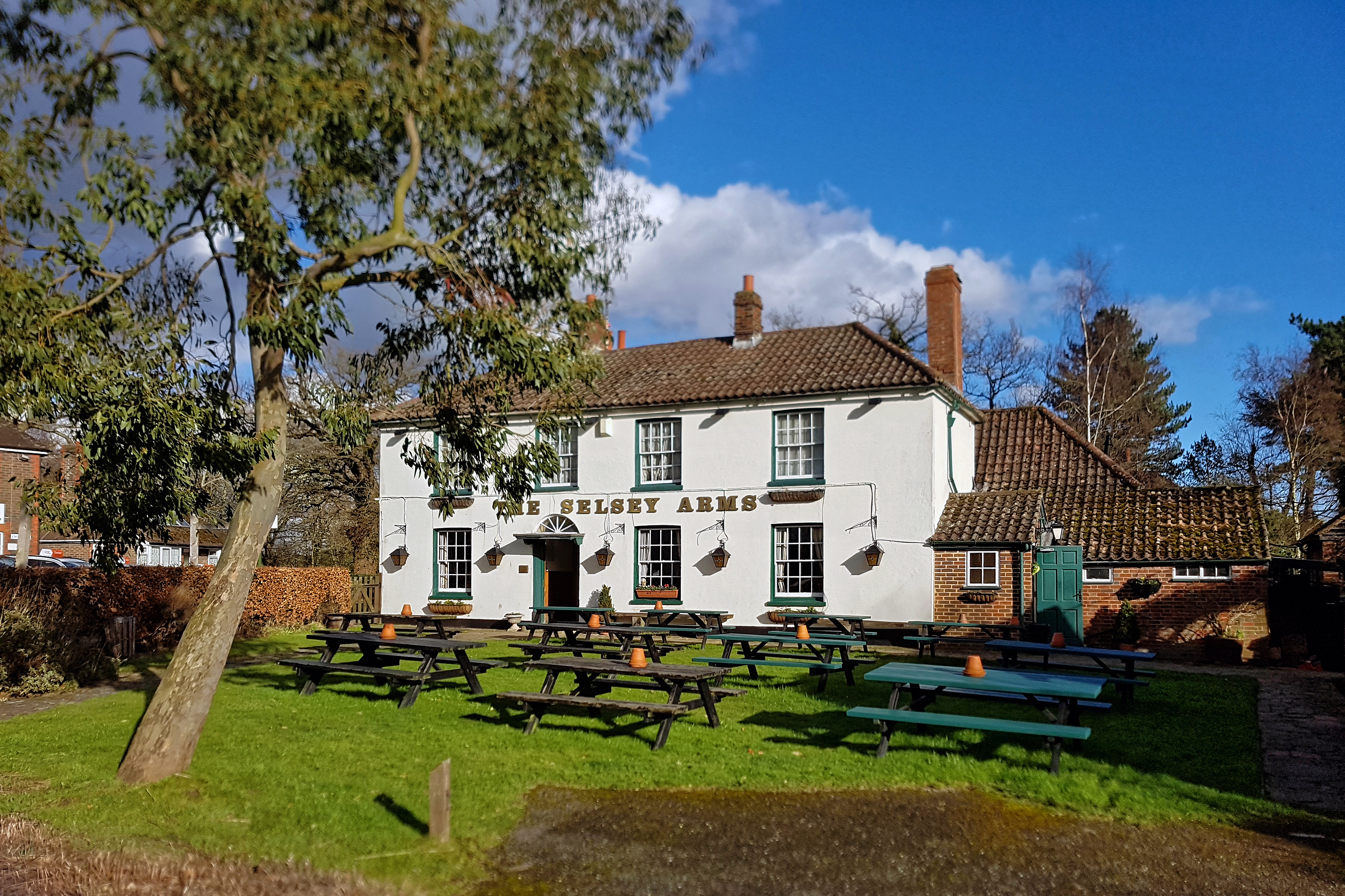
The village is home to a few amenities, including a local pub that serves as a popular gathering spot for residents and visitors alike. There is also a small village shop that caters to the day-to-day needs of the community. For more extensive shopping and entertainment options, the nearby towns of Horsham and Billingshurst offer a wider range of facilities.

Coolham is surrounded by picturesque countryside, offering ample opportunities for outdoor activities such as walking, cycling, and horse riding. The village is also located near the South Downs National Park, providing access to stunning landscapes and scenic trails.

The village benefits from excellent transport links, with easy access to major roadways like the A24 and A272. The nearest railway station is located in Billingshurst, providing frequent services to London and other major cities.

Overall, Coolham is a charming village that offers a peaceful and rural lifestyle, with easy access to amenities and beautiful natural surroundings.

If you have any feedback on the listing, please let us know in the comments section below.
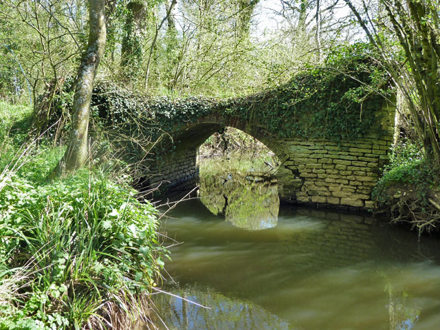
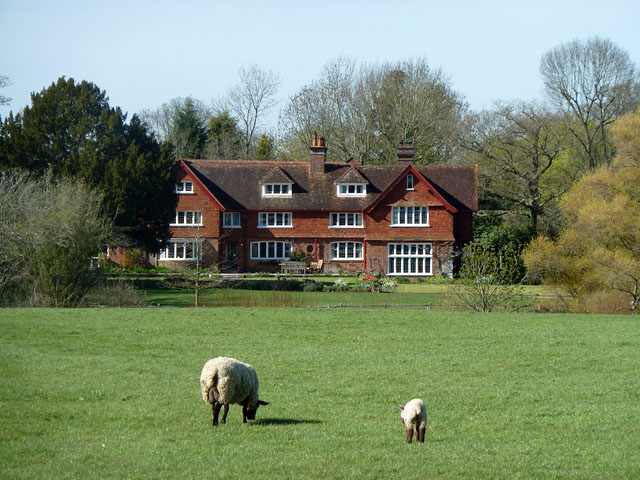
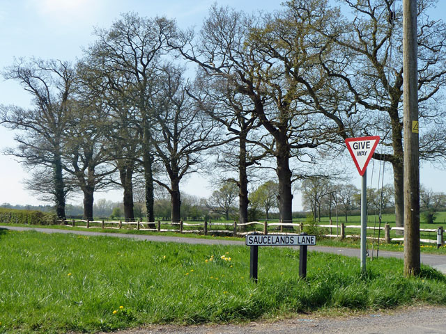
Coolham Images

Images are sourced within 2km of 50.992619/-0.402778 or Grid Reference TQ1222. Thanks to Geograph Open Source API. All images are credited.

Barns at Falconers This part of the former farm has an air of disuse, but the rest of the large complex is well kept and used for habitation or business.
Barns at Falconers
This part of the former farm has an air of disuse, but the rest of the large complex is well kept and used for habitation or business.
Footpath 2790 leaves Oldhouse Lane The sign warns passers to keep to the footpath as shooting may be in progress.
Footpath 2790 leaves Oldhouse Lane
The sign warns passers to keep to the footpath as shooting may be in progress.
Pond by Oldhouse Lane The lane is a bridleway running between widely spaced boundaries. The southern part is very muddy and poached from horse use, but here, and further north, the going is better. The pond may have been created to improve the drainage of the lane.
Pond by Oldhouse Lane
The lane is a bridleway running between widely spaced boundaries. The southern part is very muddy and poached from horse use, but here, and further north, the going is better. The pond may have been created to improve the drainage of the lane.
Coolham House and Coolham Cottage The cottage is on the left. The A272 runs behind the near hedge.
Coolham House and Coolham Cottage
The cottage is on the left. The A272 runs behind the near hedge.
Crumbling bridge This bridge carrying a farm track and Bridleway 1911 over a young River Adur could be in better repair.
Crumbling bridge
This bridge carrying a farm track and Bridleway 1911 over a young River Adur could be in better repair.
Earthworking, Coolham According to aerial photographs, a few years ago this field housed a dirt track for some sort of vehicle racing. Now what appears to be chalk marl or possibly gypsum waste is being spread and covered with a thin layer of native soil. Is this to improve the poor Weald Clay drainage for a project such as a golf course? The field seems too small for this.
Earthworking, Coolham
According to aerial photographs, a few years ago this field housed a dirt track for some sort of vehicle racing. Now what appears to be chalk marl or possibly gypsum waste is being spread and covered with a thin layer of native soil. Is this to improve the poor Weald Clay drainage for a project such as a golf course? The field seems too small for this.
Patman's Farm The dead tree was standing in roughly that position a few years ago.
Patman's Farm
The dead tree was standing in roughly that position a few years ago.
St Cuthman's and the lamb of God The establishment is a "retreat" run by the Roman Catholic Church, but advertised as open to all denominations or none.
St Cuthman's and the lamb of God
The establishment is a "retreat" run by the Roman Catholic Church, but advertised as open to all denominations or none.
Memorial trees by former Coolham airfield Most of the trees along the path and several more behind the viewpoint are memorials to those who died working out of Coolham A.L.G. Airfield in spring 1944. The end of the airfield is on the right, although there is no sign of it now, apart from the arrangement of fence lines and rights-of-way around a large level area. This was a temporary airfield for D-day purposes, A.L.G. standing for Advanced Landing Ground. The dead were eight from the Polish Air Force and seven from the RAF.
Memorial trees by former Coolham airfield
Most of the trees along the path and several more behind the viewpoint are memorials to those who died working out of Coolham A.L.G. Airfield in spring 1944. The end of the airfield is on the right, although there is no sign of it now, apart from the arrangement of fence lines and rights-of-way around a large level area. This was a temporary airfield for D-day purposes, A.L.G. standing for Advanced Landing Ground. The dead were eight from the Polish Air Force and seven from the RAF.
Trees at the crossroads Saucelands Lane meets Coolham Road, and its line is continued across the junction by the dead-end Sproutes Lane, out of sight to the right.
Trees at the crossroads
Saucelands Lane meets Coolham Road, and its line is continued across the junction by the dead-end Sproutes Lane, out of sight to the right.
Blue Idol meeting house, Coneyhurst, West Sussex The meeting house is used by the 'Quakers' or Society of Friends.
Blue Idol meeting house, Coneyhurst, West Sussex
The meeting house is used by the 'Quakers' or Society of Friends.
Sproutes Lane off the B2139 A dead end road that leads to Sproutes House, Sproutes Farm and Goringlee.
Sproutes Lane off the B2139
A dead end road that leads to Sproutes House, Sproutes Farm and Goringlee.
Bridleway 2352 approaching Upperbarn Copse
Bridleway junction in Upperbarn Copse The bridleway left to right is Oldhouse Lane.
Bridleway junction in Upperbarn Copse
The bridleway left to right is Oldhouse Lane.
View south on Oldhouse Lane (track)
Upperbarn Copse beside Oldhouse Lane
Ice on a tributary of the River Adur Having past under bridge on Oldhouse Lane.
Ice on a tributary of the River Adur
Having past under bridge on Oldhouse Lane.
Frozen pond by Oldhouse Lane
Show me another place!

Coolham is located at Grid Ref: TQ1222 (Lat: 50.992619, Lng: -0.402778)

Administrative County: West Sussex

District: Horsham

Police Authority: Sussex

What 3 Words

///aimlessly.hypocrite.stocked. Near Billingshurst, West Sussex

Nearby Locations

Coolham

Related Wikis

Coolham

Coolham is a small village in the civil parish of Shipley and the Horsham District of West Sussex, England. It is located at the crossroads of the A272...

RAF Coolham

Royal Air Force Coolham or more simply RAF Coolham is a former Royal Air Force Advanced Landing Ground located in West Sussex, England. The following units...

Parson's Brook

Parson's Brook is a minor river (brook) located in the Horsham District of West Sussex, England. It is a tributary to the River Adur. == Course == The...

Coneyhurst

Coneyhurst is a hamlet in the Horsham District of West Sussex, England. It lies on the A272 road 1.6 miles (2.5 km) southeast of Billingshurst (where the...

Dragon's Green

Dragon's Green is a hamlet in the civil parish of Shipley, and the Horsham district of West Sussex, England. The hamlet is 5 miles (8 km) south from the...

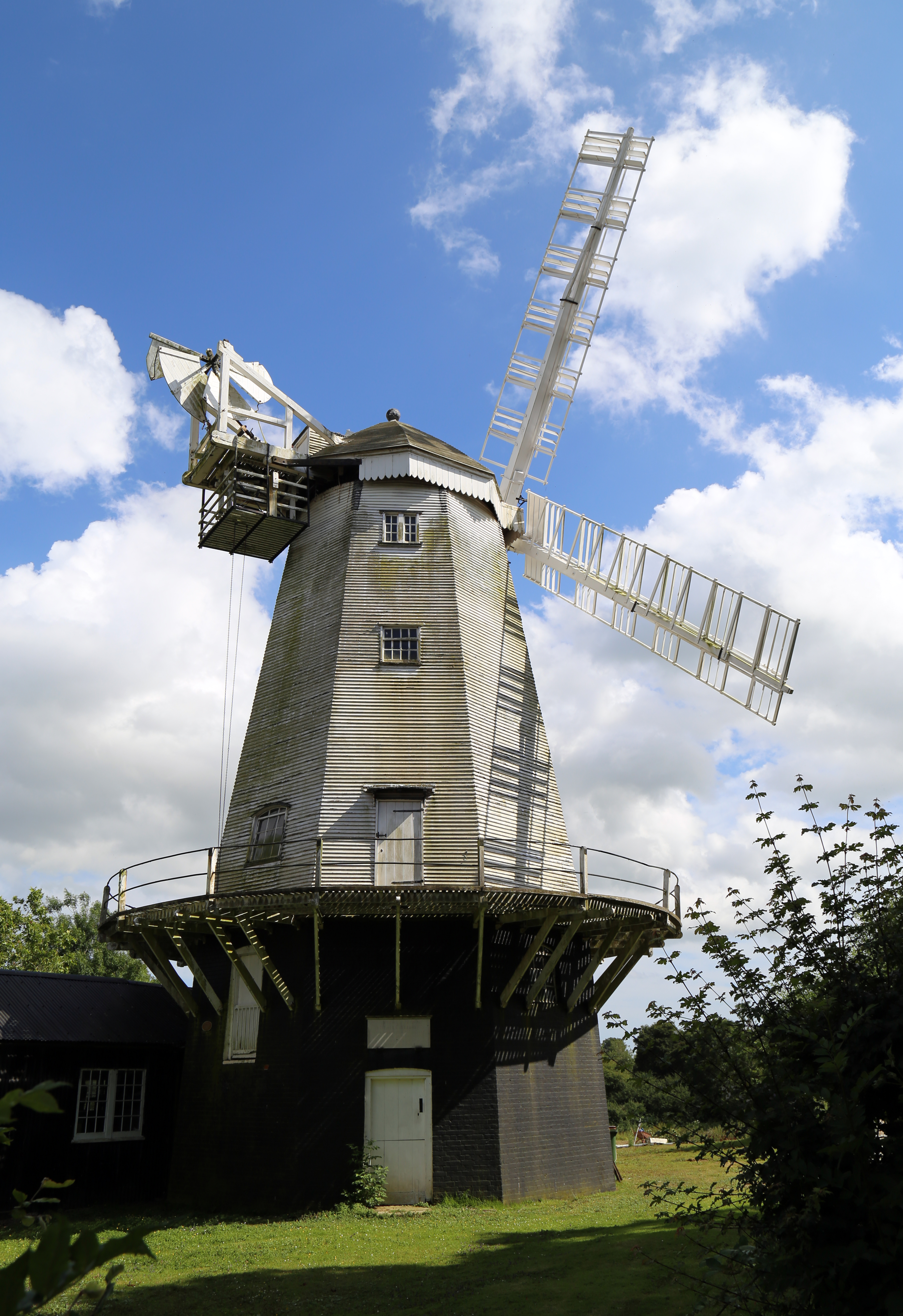
King's Mill, Shipley

King's Mill or Vincent's Mill, Shipley, West Sussex, England, is a smock mill built in 1879. == History == King's Mill was built in 1879 for Friend Martin...

Brooks Green

Brooks Green is a hamlet in the Shipley civil parish of the Horsham District of West Sussex, England. It is in the north-west of the parish, approximately...

Shipley, West Sussex

Shipley is a village and civil parish in the Horsham District of West Sussex, England. It lies just off the A272 road 6 miles (10 kilometres) north-east...

Nearby Amenities

Located within 500m of 50.992619,-0.402778
Coolham
Created By: POI Editor
Place: village
Source: npe
Wikidata: Q5167453
Lat/Long: 50.9939183/-0.4053407
Bus Stop
Coolham Cross Roads
Naptan AtcoCode: 4400HR0299
Naptan Bearing: N
Naptan CommonName: Coolham Cross Roads
Naptan Indicator: o/s Dorset House
Naptan Landmark: A272 junction
Naptan NaptanCode: wsxawapg
Naptan Street: Coolham Road
Naptan Verified: no
Source: naptan_import
Lat/Long: 50.9934965/-0.4049759
Coolham Cross Roads
Naptan AtcoCode: 4400HR0300
Naptan Bearing: S
Naptan BusStopType: CUS
Naptan CommonName: Coolham Cross Roads
Naptan Indicator: opp Southdown House
Naptan Landmark: A272 junction
Naptan NaptanCode: wsxawapj
Naptan Street: Coolham Road
Naptan Verified: no
Source: naptan_import
Lat/Long: 50.9930239/-0.4052064
Coolham Advance Landing Ground
Description: This memorial commemorates and honours the airmen of many nations who fought valiantly in defence of Britain whilst serving at Coolham Advance Landing Ground Airfield during Operation Overlord in 1944
Historic: memorial
Website: http://www.roll-of-honour.com/Sussex/CoolhamAdvancedLanding.html
Lat/Long: 50.992971/-0.4052522
Bench
Lat/Long: 50.9927592/-0.406546
Bench
Lat/Long: 50.9927692/-0.4065382
Post Box
Post Box Type: lamp
Ref: RH13 130
Royal Cypher: EIIR
Royal Cypher Wikidata: Q33102113
Lat/Long: 50.9933435/-0.4051034
Kindergarten
Coolham Montessori Nursery School
Addr City: Horsham
Addr Housename: Coolham Village Hall
Addr Postcode: RH13 8QN
Addr Street: Billingshurst Road
Addr Suburb: Coolham
Fhrs Id: 185894
Lat/Long: 50.9939995/-0.4084669
RAF Coolham
Description: Temporary airfield (Advanced Landing Ground) built in 1944 to support the D-Day Landings.
Historic: airfield
Website: http://wikimapia.org/16759600/Former-RAF-Coolham
Lat/Long: 50.9896784/-0.3990054
Give Way
Direction: backward
Lat/Long: 50.9932266/-0.4049844
Stop
Direction: forward
Stop: minor
Lat/Long: 50.9931874/-0.4052831
Barrier: yes
Lat/Long: 50.9899956/-0.407399
Addr City: Horsham
Addr Housename: Dane Realstar
Addr Parentstreet: Brooks Green Road
Addr Postcode: RH13 8GR
Addr Street: Baileys Farm
Addr Suburb: Coolham
Lat/Long: 50.9967014/-0.4057327
Kenny's Spitfire
Tourism: attraction
Lat/Long: 50.9930059/-0.4051163
Old House
Place: isolated_dwelling
Lat/Long: 50.9928906/-0.3998726
St Cuthman's Farm
Place: farm
Lat/Long: 50.9931053/-0.4013473
Home Farm
Place: isolated_dwelling
Lat/Long: 50.9940522/-0.4016637
Bridge Hill Farm
Place: farm
Lat/Long: 50.9895941/-0.4077925
The data included in this document is from www.openstreetmap.org. The data is made available under ODbL.

Have you been to Coolham?

Leave your review of Coolham below (or comments, questions and feedback).