Henshaw Wood

Wood, Forest in Cumberland Carlisle

England

Henshaw Wood

New Water Bridge
New Water Bridge Credit: David Liddle

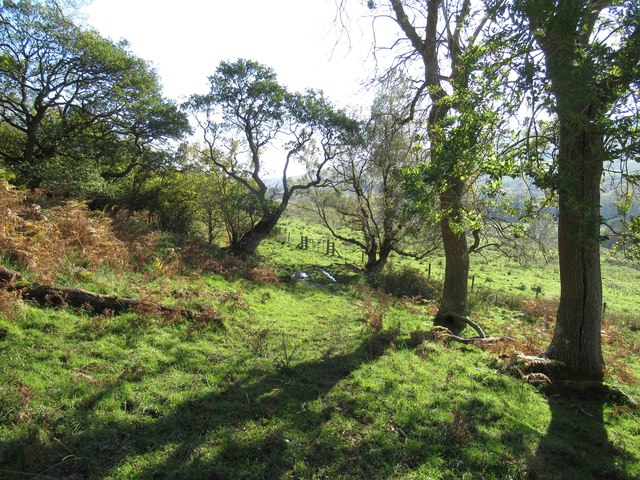
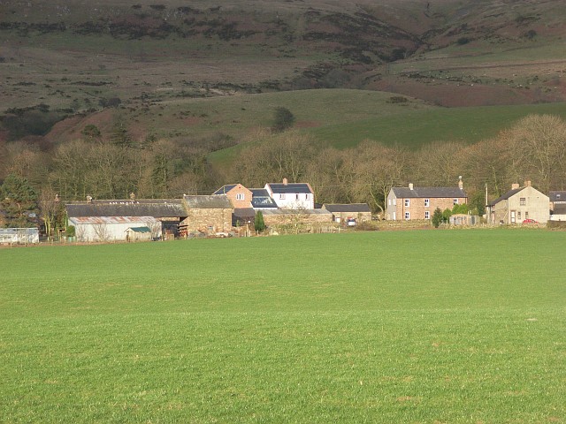
Henshaw Wood is a picturesque forest located in Cumberland, England. Covering an area of approximately 100 acres, this woodland is renowned for its natural beauty and diverse wildlife.

The wood is predominantly composed of ancient broadleaf trees, including oak, beech, and ash, which create a dense canopy overhead. These towering trees provide a habitat for a wide range of bird species, such as woodpeckers, owls, and various songbirds. Additionally, the forest floor is adorned with an array of wildflowers, including bluebells, primroses, and foxgloves, enhancing the enchanting atmosphere of the wood.

Henshaw Wood is intersected by a network of footpaths, allowing visitors to explore its tranquil surroundings. Nature enthusiasts can enjoy leisurely walks through the forest, admiring the tall trees and listening to the melodic sounds of the birds. The wood also features several designated picnic areas, inviting visitors to relax and enjoy a meal amidst the serene natural surroundings.

The forest is home to an abundance of wildlife, including deer, foxes, and squirrels. Nature lovers can spot these creatures in their natural habitat, adding an element of excitement to any visit. Additionally, the wood is known for its rare butterfly species, providing a haven for butterfly enthusiasts and researchers alike.

Henshaw Wood offers a peaceful retreat for those seeking solace in nature. Its lush greenery, diverse flora and fauna, and tranquil ambiance make it a popular destination for both locals and tourists alike.

If you have any feedback on the listing, please let us know in the comments section below.

Henshaw Wood Images

Images are sourced within 2km of 54.868104/-2.6604434 or Grid Reference NY5752. Thanks to Geograph Open Source API. All images are credited.

New Water Bridge
New Water Bridge
Footpath through Knotts Wood
Old Water Bridge Old Water flows into the River Gelt about a mile further on. The structure in the foreground is not an old sheep fold but a dry stone wall built to keep sheep away from a water intake point.
Old Water Bridge
Old Water flows into the River Gelt about a mile further on. The structure in the foreground is not an old sheep fold but a dry stone wall built to keep sheep away from a water intake point.
Road leading to Geltsdale House
Geltsdale House Date stone on front looks like 1661 but more likely 1861.  A very large and impressive farmhouse.
Geltsdale House
Date stone on front looks like 1661 but more likely 1861. A very large and impressive farmhouse.
Bridleway leading to Middle Top and Lord's Seat Track leading from Water Works below Geltsdale House meets a bridleway to the left is Old Water Bridge.
Bridleway leading to Middle Top and Lord's Seat
Track leading from Water Works below Geltsdale House meets a bridleway to the left is Old Water Bridge.
Bridleway below Tarnmonath Fell This bridleway leads from Old Water Bridge to Gairs.
Bridleway below Tarnmonath Fell
This bridleway leads from Old Water Bridge to Gairs.
The New Water Crossing Point New Water joins Old Water to become The River Gelt. This crossing is impassable when the river is in spate... as I found out during last winter!
The New Water Crossing Point
New Water joins Old Water to become The River Gelt. This crossing is impassable when the river is in spate... as I found out during last winter!
The Trig Point on Cumrew Fell It is quite unusual to find a trig point so close to a wall. 
The whole of the top of Cumrew Fell is banned to dogs because the grouse shooters don't want their "fun" spoiled.
The Trig Point on Cumrew Fell
It is quite unusual to find a trig point so close to a wall. The whole of the top of Cumrew Fell is banned to dogs because the grouse shooters don't want their "fun" spoiled.
Sheepfold overlooking New Water valley Stone sheepfold with one side open to wire-fenced grass paddock. New Water separates it from the grouse moor on Newbiggin Fell in the background - see <a href="https://www.geograph.org.uk/gridref/NY5950">NY5950</a>.
Sheepfold overlooking New Water valley
Stone sheepfold with one side open to wire-fenced grass paddock. New Water separates it from the grouse moor on Newbiggin Fell in the background - see NY5950.
Sheepfold viewed from across New Water valley
Little Bleaberry Gill With shoulder of Newbiggin Fell in background.
Little Bleaberry Gill
With shoulder of Newbiggin Fell in background.
Ruined house above New Water The presence of trees and walls means it was once inhabited.
Ruined house above New Water
The presence of trees and walls means it was once inhabited.
Pumping Station at Geltsdale View up to the Water Pumping Station at Geltsdale.
Pumping Station at Geltsdale
View up to the Water Pumping Station at Geltsdale.
Bridge over River Gelt near Binney Bank Bridge over the River Gelt near Binney Bank
Bridge over River Gelt near Binney Bank
Bridge over the River Gelt near Binney Bank
Ford across Old Water at Geltsdale Pumping Station Ford across Old Water at Geltsdale Pumping Station.
Ford across Old Water at Geltsdale Pumping Station
Ford across Old Water at Geltsdale Pumping Station.
Cattlegrid on the Geltsdale Road View along road to Geltsdale House.
Cattlegrid on the Geltsdale Road
View along road to Geltsdale House.
O.S. Trig point on Cardunneth Pike
Show me another place!

Henshaw Wood is located at Grid Ref: NY5752 (Lat: 54.868104, Lng: -2.6604434)

Administrative County: Cumbria

District: Carlisle

Police Authority: Cumbria

What 3 Words

///chose.monks.townhouse. Near Brampton, Cumbria

Nearby Locations

Henshaw Wood

Related Wikis

Geltsdale

Geltsdale is a hamlet and former civil parish, now in the parish of Castle Carrock, in the Cumberland district, in the ceremonial county of Cumbria, England...

Albyfield

Albyfield is a hamlet in Cumbria, England.

Carlatton and Cumrew

Carlatton and Cumrew are civil parishes in Cumbria, England with a common parish council.The Eastern boundary of this rural parish is Cardunneth Pike in...

Cumrew

Cumrew is a small village and civil parish in north-east Cumbria, England. About 7 miles (11 km) south of Brampton and 13 miles (21 km) east of Carlisle...

Nearby Amenities

Located within 500m of 54.868104,-2.6604434
Middle Foot
Place: locality
Lat/Long: 54.8718212/-2.6593038
The data included in this document is from www.openstreetmap.org. The data is made available under ODbL.

Have you been to Henshaw Wood?

Leave your review of Henshaw Wood below (or comments, questions and feedback).