Badger Wood

Wood, Forest in Westmorland Eden

England

Badger Wood

Leisure Centre, Center Parcs, Whinfell Village The main centre at Center Parcs near Penrith.
Leisure Centre, Center Parcs, Whinfell Village Credit: G McK

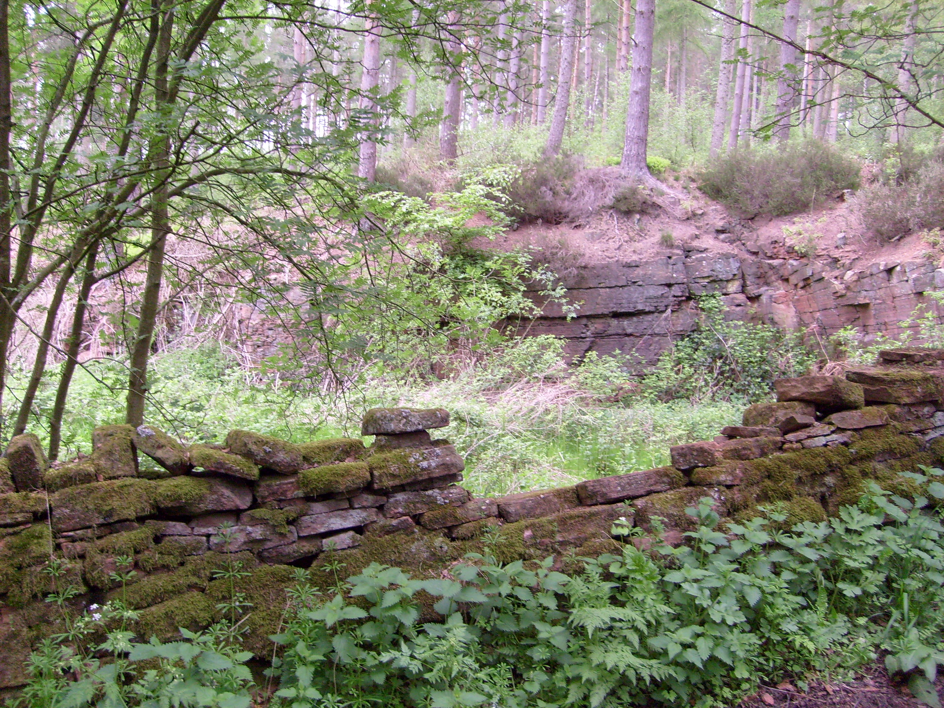
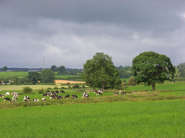
Badger Wood is a small woodland located in the county of Westmorland, England. Situated in the heart of the Lake District National Park, it is a popular destination for nature enthusiasts and outdoor adventurers alike. The wood covers an area of approximately 100 acres and is known for its diverse range of flora and fauna.

The woodland is primarily composed of broadleaf trees such as oak, beech, and birch, creating a dense and picturesque canopy. This habitat provides a suitable environment for a variety of wildlife species, including badgers, which the wood is named after. These elusive creatures can occasionally be spotted foraging for food or constructing their intricate underground burrows.

Badger Wood offers a network of well-maintained walking trails, allowing visitors to explore its natural beauty at their own pace. The paths wind through the woodland, passing tranquil ponds, babbling brooks, and vibrant wildflower meadows. The wood also boasts breathtaking viewpoints that offer panoramic vistas of the surrounding countryside, including the towering peaks of the Lake District.

In addition to its natural attractions, Badger Wood provides opportunities for recreational activities such as birdwatching, photography, and picnicking. The peaceful atmosphere and serene surroundings make it an ideal spot for a relaxing day out in nature.

Overall, Badger Wood in Westmorland is a captivating woodland that showcases the beauty of the Lake District. With its diverse ecosystem, picturesque trails, and abundant wildlife, it offers visitors a chance to immerse themselves in the tranquility and natural splendor of this idyllic region.

If you have any feedback on the listing, please let us know in the comments section below.
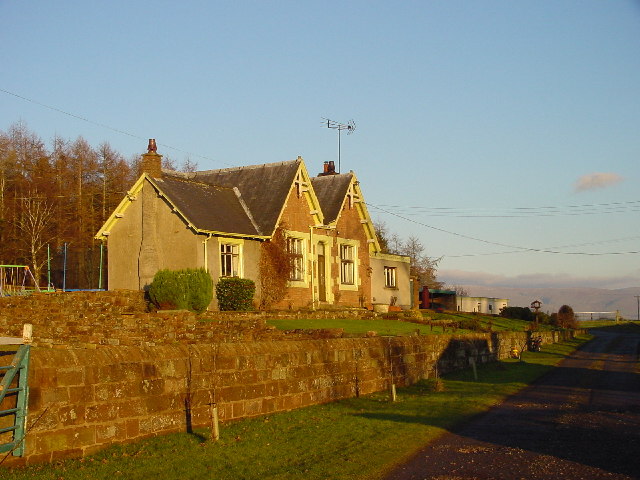
Badger Wood Images

Images are sourced within 2km of 54.636885/-2.6604076 or Grid Reference NY5727. Thanks to Geograph Open Source API. All images are credited.

Leisure Centre, Center Parcs, Whinfell Village The main centre at Center Parcs near Penrith.
Leisure Centre, Center Parcs, Whinfell Village
The main centre at Center Parcs near Penrith.
Footbridge Over Sandwith Sike This small stream drains from Whinfell Forest to the north.
Footbridge Over Sandwith Sike
This small stream drains from Whinfell Forest to the north.
The Old Rectory Cliburn Now a private house
The Old Rectory Cliburn
Now a private house
Signal Box Disused but preserved, next to the converted railway station of Cliburn.
Signal Box
Disused but preserved, next to the converted railway station of Cliburn.
Railway Station Cliburn Now converted to a house, which operates a "Certified Location" for the Caravan Club.
Railway Station Cliburn
Now converted to a house, which operates a "Certified Location" for the Caravan Club.
Forest Entrance Most of this small forest has now been converted to a holiday complex. This entrance leads to Birks.
Forest Entrance
Most of this small forest has now been converted to a holiday complex. This entrance leads to Birks.
Farmland with Scarecrow A pair of white-overalled scarecrows wave orange discs to protect the crops her. In the far wood - called Prickley - pheasants are reared.
Farmland with Scarecrow
A pair of white-overalled scarecrows wave orange discs to protect the crops her. In the far wood - called Prickley - pheasants are reared.
Converted School A familiar sight on the A66 at Winfell.
Converted School
A familiar sight on the A66 at Winfell.
Briggle Sike Drains Cliburn Moss
Briggle Sike
Drains Cliburn Moss
Whinfell Forest This is the main access road for the Center Parcs site.
Whinfell Forest
This is the main access road for the Center Parcs site.
Woodland at Center Parcs Typical woodland in between chalets at Center Parcs, Whinfell Forest.
Woodland at Center Parcs
Typical woodland in between chalets at Center Parcs, Whinfell Forest.
Gate Situated on the S side of the A66. The wooded hill top on the left hand side of the photo, hides, Center Parcs the holiday and leisure centre from the outside world, as it was built in the centre of a large wooded area.
Gate
Situated on the S side of the A66. The wooded hill top on the left hand side of the photo, hides, Center Parcs the holiday and leisure centre from the outside world, as it was built in the centre of a large wooded area.
Whinfell Forest  Leisure Village It used to be called 'Oasis'. It is a real fun place in wonderful surroundings.
Whinfell Forest Leisure Village
It used to be called 'Oasis'. It is a real fun place in wonderful surroundings.
Whinfell Forest A Nature trail in the southeast corner of the Center Parcs Holiday Village.
If you have young children this place makes holidaying easy.
Whinfell Forest
A Nature trail in the southeast corner of the Center Parcs Holiday Village. If you have young children this place makes holidaying easy.
Whinfell Forest clearing Where the pixies, elves and fairies play.
Whinfell Forest clearing
Where the pixies, elves and fairies play.
Public footpath up Leacet Hill
Faint track on the edge of woodland in Whinfell Forest
Junction of two forestry roads on the edge of Whinfell Forest
Show me another place!

Badger Wood is located at Grid Ref: NY5727 (Lat: 54.636885, Lng: -2.6604076)

Administrative County: Cumbria

District: Eden

Police Authority: Cumbria

What 3 Words

///vibrating.when.pocketed. Near Penrith, Cumbria

Related Wikis

Whinfell Forest

Whinfell Forest is a small area of woodland in the parish of Brougham, Cumbria, south east of Penrith in Cumbria and just off the A66 road leading to Appleby...

Cliburn Moss

Cliburn Moss is a national nature reserve located northwest of the village of Cliburn, in the county of Cumbria, England. It contains wetland habitats...

Cliburn railway station

Cliburn railway station was a station situated on the Eden Valley Railway in Westmorland (now in Cumbria), England. It served the village of Cliburn to...

Wetheriggs Pottery

Wetheriggs Pottery is a former pottery on the C3047 road, east of the hamlet of Clifton Dykes, in Clifton, Cumbria, 5 miles (8.0 km) southeast of Penrith...

RAF Hornby Hall

RAF Hornby Hall was a Royal Air Force satellite landing ground located near Brougham, 4 miles (6.4 km) east of Penrith, Cumbria and 8.8 miles (14.2 km...

Cliburn, Cumbria

Cliburn is a village and civil parish in the Eden district of Cumbria, England. The civil parish includes the hamlet of Town Head. In 2001 the population...

Melkinthorpe

Melkinthorpe is a hamlet in the civil parish of Lowther, in the Eden district, in the county of Cumbria, England. It is near the villages of Hackthorpe...

Ninekirks

Ninekirks is the local name for St Ninian's church, Brougham, Cumbria. Dedicated to Saint Ninian, it was formerly the Anglican parish church for Brougham...

Nearby Amenities

Located within 500m of 54.636885,-2.6604076
Crossing
Crossing: uncontrolled
Crossing Markings: yes
Lat/Long: 54.6340076/-2.6566829
Access: no
Barrier: fence
Lat/Long: 54.6365245/-2.6539115
Bus Stop
Created By: Potlatch 0.10f
Lat/Long: 54.6404023/-2.6562405
Post Box
Collection Times: Mo-Fr 16:45, Sa 08:30
Ref: CA10 327
Royal Cypher: EIIR
Royal Cypher Wikidata: Q33102113
Lat/Long: 54.6355122/-2.6532259
Subtropical Swimming Paradise
Access: customers
Fee: no
Leisure: water_park
Opening Hours: Mo-Su,PH 10:00-21:00
Sport: swimming
Lat/Long: 54.6355048/-2.6541102
Restaurant
Sports Café
Delivery: no
Operator: Center Parcs
Takeaway: no
Lat/Long: 54.6342567/-2.6597321
Restaurant
Bella Italia
Brand: Bella Italia
Brand Wikidata: Q4883362
Brand Wikipedia: en:Bella Italia
Cuisine: italian
Delivery: no
Reservation: recommended
Takeaway: no
Lat/Long: 54.6351364/-2.6533492
Entrance: main
Lat/Long: 54.6358251/-2.6528934
Entrance: main
Lat/Long: 54.6349987/-2.6533723
Access: customers
Entrance: yes
Lat/Long: 54.6358095/-2.6544096
Leisure: miniature_golf
Lat/Long: 54.6348414/-2.6590976
Access: yes
Entrance: main
Wheelchair: yes
Lat/Long: 54.6356403/-2.6580048
Throw Bag
Emergency: throw_bag
Lat/Long: 54.6371146/-2.6651233
Pond Life at Whinfell
Board Type: nature
Information: board
Tourism: information
Lat/Long: 54.6371239/-2.6651005
Information: map
Tourism: information
Lat/Long: 54.6370618/-2.6629266
Information: map
Tourism: information
Lat/Long: 54.6370836/-2.6627255
Crossing
Crossing: uncontrolled
Crossing Markings: yes
Lat/Long: 54.6345289/-2.6581175
Entrance: yes
Lat/Long: 54.6338519/-2.6582269
Entrance: yes
Lat/Long: 54.6343967/-2.6597675
Entrance: yes
Lat/Long: 54.6340157/-2.6583664
The data included in this document is from www.openstreetmap.org. The data is made available under ODbL.

Have you been to Badger Wood?

Leave your review of Badger Wood below (or comments, questions and feedback).