Constantine

Settlement in Cornwall

England

Constantine

Farmland, Constantine Daffodil bulbs had been lifted and were drying in a field crossed by two footpaths to the east of High Cross.
Farmland, Constantine Credit: Andrew Smith

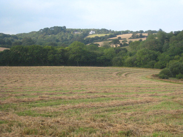
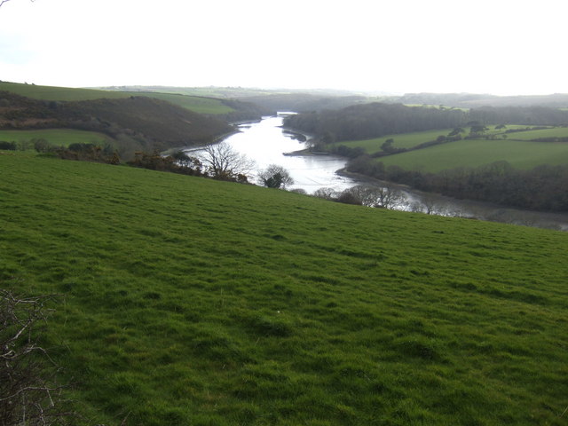
Constantine is a small village located in Cornwall, England. Situated in the southern part of the county, Constantine is nestled within the picturesque Helford River valley. This rural village is surrounded by lush green fields, rolling hills, and dense woodland, offering residents and visitors a tranquil and idyllic setting.

With a population of around 1,500 people, Constantine exudes a charming and close-knit community feel. The village is home to a range of amenities, including a primary school, a post office, a village shop, and a pub, providing essential services and a sense of convenience for its residents.

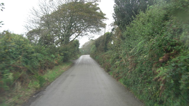
Constantine is renowned for its stunning natural beauty and is an ideal location for outdoor enthusiasts. The village is surrounded by countless walking trails and footpaths, offering breathtaking views of the surrounding countryside. Additionally, the nearby Helford River provides opportunities for boating, kayaking, and fishing, making it a popular destination for water sports enthusiasts.

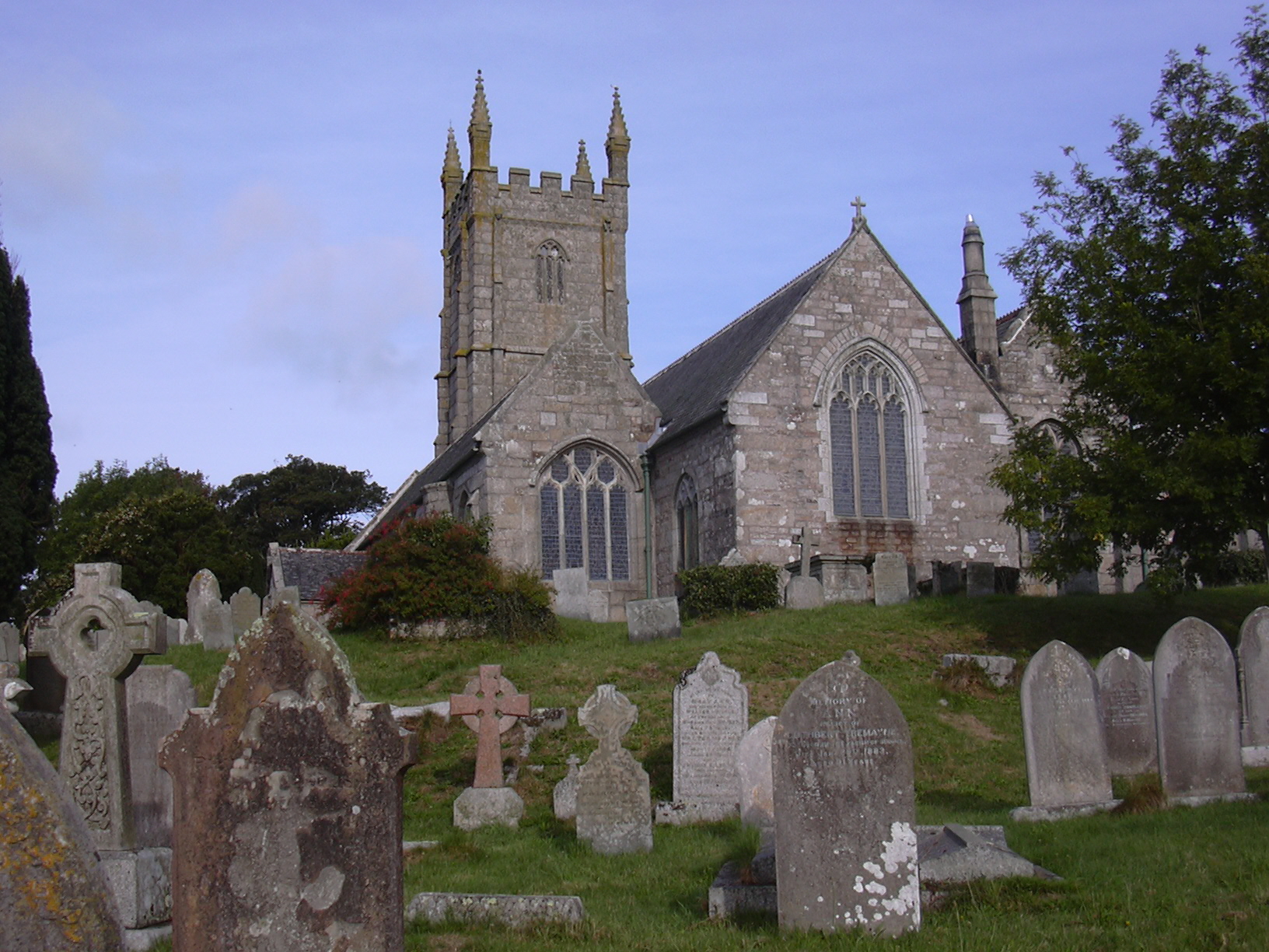
Historically, Constantine has a rich heritage dating back centuries, with evidence of settlement in the area since the Bronze Age. The village is dotted with historical landmarks, including the 15th-century Constantine Church, which boasts beautiful stained glass windows and a peaceful churchyard.

Overall, Constantine offers a quiet and picturesque escape from the hustle and bustle of city life. With its stunning natural surroundings, strong sense of community, and historical charm, this village in Cornwall attracts visitors and residents alike who appreciate the beauty of the English countryside.

If you have any feedback on the listing, please let us know in the comments section below.

Constantine Images

Images are sourced within 2km of 50.119511/-5.172594 or Grid Reference SW7329. Thanks to Geograph Open Source API. All images are credited.

Farmland, Constantine Daffodil bulbs had been lifted and were drying in a field crossed by two footpaths to the east of High Cross.
Farmland, Constantine
Daffodil bulbs had been lifted and were drying in a field crossed by two footpaths to the east of High Cross.
Farmland, Constantine A crop of spring barley just coming into flower to the south of Treviades.
Farmland, Constantine
A crop of spring barley just coming into flower to the south of Treviades.
Farmland, Constantine A cut silage field descends to Polwheveral Creek with Scott's Wood in the background.
Farmland, Constantine
A cut silage field descends to Polwheveral Creek with Scott's Wood in the background.
Pasture, Constantine Cattle beside the footpath passing to the north of Nanjarrow.
Pasture, Constantine
Cattle beside the footpath passing to the north of Nanjarrow.
Farmland, Constantine Officially the bridleway descending to Goongillings; stone stiles, in effect, limit it to being a footpath.
Farmland, Constantine
Officially the bridleway descending to Goongillings; stone stiles, in effect, limit it to being a footpath.
Grassland and wood, Constantine Scott's Wood is seen from the footpath descending to Scott's Quay.
Grassland and wood, Constantine
Scott's Wood is seen from the footpath descending to Scott's Quay.
St Constantine's Church
The Tolmen Centre
The Tolmen Centre
Old Guide Stone in Constantine Fingerstone by the UC road, in parish of Constantine (Kerrier District), opposite Old Vicarage and Church, junction of Bowling Green Road and Vicarage Terrace, by metal rails at junction.

Grade II listed.
List Entry Number: 1310987 <span class="nowrap"><a title="https://historicengland.org.uk/listing/the-list/list-entry/1310987" rel="nofollow ugc noopener" href="https://historicengland.org.uk/listing/the-list/list-entry/1310987">Link</a><img style="margin-left:2px;" alt="External link" title="External link - shift click to open in new window" src="https://s1.geograph.org.uk/img/external.png" width="10" height="10"/></span>

Surveyed

Milestone Society National ID: CW_GWLZ
Old Guide Stone in Constantine
Fingerstone by the UC road, in parish of Constantine (Kerrier District), opposite Old Vicarage and Church, junction of Bowling Green Road and Vicarage Terrace, by metal rails at junction. Grade II listed. List Entry Number: 1310987 LinkExternal link Surveyed Milestone Society National ID: CW_GWLZ
Pasture, Constantine A footpath passes to the west of Trengilly Farm.
Pasture, Constantine
A footpath passes to the west of Trengilly Farm.
Farmland, Constantine A footpath approaches the electricity substation near Brill.
Farmland, Constantine
A footpath approaches the electricity substation near Brill.
Farmland, Constantine Silage bales and a boulder in a field to the north-east of Trewardreva.
Farmland, Constantine
Silage bales and a boulder in a field to the north-east of Trewardreva.
Footpath through woodland, Constantine The path, slightly diverted off its official line passes to the west of Retallack and passes through areas of young woodland.
Footpath through woodland, Constantine
The path, slightly diverted off its official line passes to the west of Retallack and passes through areas of young woodland.
Grassland, Constantine Trevaney Farm is seen in the background from Tresahor Veor.
Grassland, Constantine
Trevaney Farm is seen in the background from Tresahor Veor.
Minor Road Near Chegwidden A minor road with hedges NNE of Brill Hill trig point looking towards Chegwidden.
Minor Road Near Chegwidden
A minor road with hedges NNE of Brill Hill trig point looking towards Chegwidden.
Recently harvested field at Trewince Looking towards houses at High Cross.
Recently harvested field at Trewince
Looking towards houses at High Cross.
Fore Street, Constantine
Unnamed lane west of Trewince
Show me another place!

Constantine is located at Grid Ref: SW7329 (Lat: 50.119511, Lng: -5.172594)

Unitary Authority: Cornwall

Police Authority: Devon and Cornwall

What 3 Words

///rises.mattress.converged. Near Wendron, Cornwall

Related Wikis

Constantine, Cornwall

Constantine () (Cornish: Lann Gostentin, meaning church enclosure of St Constantine) is a village and civil parish in Cornwall, England, United Kingdom...

Ponjeravah

Ponjeravah (Cornish: Pons a Revedh, meaning wonder bridge) is a hamlet near to and east of Constantine in Cornwall, England. == References ==

Polwheveral

Polwheveral (Cornish: Poll Hwevrer, meaning lively creek) is a hamlet near Constantine in Cornwall, England. Polwheveral is at the head of a creek of the...

Nancenoy

Nancenoy (Cornish: Nans Noy, meaning Noah's valley) is a hamlet near Constantine in west Cornwall, England, UK.The Trengilly Wartha Inn is a pub and restaurant...

Brill, Cornwall

Brill (Cornish: Bre Helgh, meaning hunt hill) is a village in south-west Cornwall, England, UK. It is located within the civil parish of Constantine, 1...

Polpenwith

Polpenwith (Cornish: Poll Pennrudh, meaning creek of the red headland) is a hamlet south of Constantine in west Cornwall, England. It is at the head of...

High Cross, Constantine

High Cross is a hamlet in south Cornwall, England, United Kingdom. It is situated one mile east of Constantine (where the 2011 population was included...

East Kerrier Rural District

East Kerrier Rural District was a local government division of Cornwall in England, UK, between 1894 and 1934. Established under the Local Government Act...

Nearby Amenities

Located within 500m of 50.119511,-5.172594
Constantine
Is In: Cornwall, England, UK
Is In Country: England
Is In Country Code: GB
Is In County: Cornwall
Name Kw: Lanngostentin
Place: village
Source: npe
Lat/Long: 50.1188811/-5.1749558
Barrier: stile
Foot: yes
Lat/Long: 50.1181396/-5.1758075
Toilets
Lat/Long: 50.1184726/-5.1766845
Pub
Queens Arms
Addr City: Falmouth
Addr Housenumber: 64
Addr Place: Constantine
Addr Postcode: TR11 5AB
Addr Street: Fore Street
Fhrs Id: 465903
Lat/Long: 50.1186684/-5.1745067
Bench
Lat/Long: 50.1151766/-5.1709424
Bus Stop
Spar
Naptan AtcoCode: 0800COC30353
Naptan Bearing: SE
Naptan CommonName: Spar
Naptan Crossing: Fore Street
Naptan Indicator: Opp
Naptan NaptanCode: corapdtg
Naptan Street: Vicarage Terrace
Naptan Verified: no
Source: naptan_import
Lat/Long: 50.1189549/-5.1755432
Post Office
Constantine Mobile Post Office Service
Addr Postcode: TR11 5UR
Brand: Post Office
Brand Wikidata: Q1783168
Opening Hours: Fr 09:00-11:00
Ref Pol Id: 150460
Source: OS OpenData StreetView;pol_branch_list_2022‑05‑27
Lat/Long: 50.1183266/-5.1764803
Turning Circle
Lat/Long: 50.1194977/-5.1739463
Recycling
Recycling Clothes: yes
Recycling Glass: yes
Recycling Paper: yes
Lat/Long: 50.1184622/-5.17655
Post Box
Brand: Royal Mail
Brand Wikidata: Q638098
Collection Times: Mo-Fr 16:00; Sa 11:00; Su off
Drive Through: no
Operator: Royal Mail
Operator Wikidata: Q638098
Post Box Mounting: building
Post Box Type: lamp
Ref: TR11 64
Royal Cypher: EIIR
Royal Cypher Wikidata: Q33102113
Source: survey;streetlevel imagery;aerial imagery
Lat/Long: 50.1178135/-5.1728052
Comfort
Name Kw: Kommfordh
Place: hamlet
Lat/Long: 50.1206166/-5.1745666
Ponjeravah
Place: hamlet
Wikidata: Q7227860
Lat/Long: 50.1184428/-5.1669949
Power: pole
Lat/Long: 50.1218989/-5.1773393
Power: pole
Lat/Long: 50.1159447/-5.1683448
Power: pole
Lat/Long: 50.1167686/-5.167923
Power: pole
Lat/Long: 50.1172338/-5.1677104
Power: pole
Lat/Long: 50.1175808/-5.1675428
Location Transition: yes
Power: pole
Lat/Long: 50.1181514/-5.1672839
Power: pole
Lat/Long: 50.1215386/-5.1753317
Power: pole
Lat/Long: 50.121232/-5.1739523
Power: pole
Lat/Long: 50.121214/-5.1737874
Power: pole
Lat/Long: 50.1209818/-5.1707927
Power: pole
Lat/Long: 50.1158178/-5.1693008
Power: pole
Transformer: distribution
Lat/Long: 50.1163905/-5.1701484
Power: pole
Lat/Long: 50.1206649/-5.1666326
Power: pole
Lat/Long: 50.1205987/-5.1658668
Location Transition: yes
Power: pole
Lat/Long: 50.1188246/-5.1665567
Power: pole
Lat/Long: 50.1191987/-5.1657486
Power: pole
Lat/Long: 50.1205607/-5.1658839
Power: pole
Lat/Long: 50.1155372/-5.1735386
Power: pole
Lat/Long: 50.1205059/-5.1659815
Post Box
Brand: Royal Mail
Brand Wikidata: Q638098
Collection Times: Mo-Fr 09:00; Sa 07:00; Su off
Drive Through: no
Operator: Royal Mail
Operator Wikidata: Q638098
Post Box Mounting: pier
Post Box Type: lamp
Ref: TR11 84D
Royal Cypher: EIIR
Royal Cypher Wikidata: Q33102113
Source: survey;streetlevel imagery;aerial imagery
Lat/Long: 50.1182694/-5.1784844
Post Box
Brand: Royal Mail
Brand Wikidata: Q638098
Collection Times: Mo-Fr 09:00; Sa 07:00; Su off
Drive Through: no
Operator: Royal Mail
Operator Wikidata: Q638098
Post Box Mounting: pier
Post Box Type: lamp
Ref: TR11 118D
Royal Cypher: EIIR
Royal Cypher Wikidata: Q33102113
Source: survey;streetlevel imagery;aerial imagery
Lat/Long: 50.1193589/-5.1762323
Post Box
Brand: Royal Mail
Brand Wikidata: Q638098
Collection Times: Mo-Fr 09:00; Sa 07:00; Su off
Drive Through: no
Operator: Royal Mail
Operator Wikidata: Q638098
Post Box Mounting: pier
Post Box Type: lamp
Ref: TR11 92D
Source: survey;streetlevel imagery;aerial imagery
Lat/Long: 50.1173094/-5.1706341
Post Box
Brand: Royal Mail
Brand Wikidata: Q638098
Collection Times: Mo-Fr 09:00; Sa 07:00; Su off
Drive Through: no
Operator: Royal Mail
Operator Wikidata: Q638098
Post Box Mounting: stone_wall
Post Box Type: wall
Ref: TR11 49D
Royal Cypher: EVIIR
Royal Cypher Wikidata: Q33102324
Source: survey;streetlevel imagery;aerial imagery
Lat/Long: 50.1184112/-5.1666622
The data included in this document is from www.openstreetmap.org. The data is made available under ODbL.

Have you been to Constantine?

Leave your review of Constantine below (or comments, questions and feedback).