Shaw's Wood

Wood, Forest in Lancashire Lancaster

England

Shaw's Wood

Aerial ropeway, Claughton Moor A loaded bucket is descending. The buckets have been painted pink to support Breast Cancer Now (Wear it Pink day).
The ropeway carries shale about 2km from the quarry to the brickworks <a href="https://www.geograph.org.uk/gridref/SD5666">SD5666</a>, and is gravity powered.
See <a href="https://www.geograph.org.uk/photo/2381025">SD5764 : Claughton Moor clay pit</a>, <a href="https://www.geograph.org.uk/photo/411530">SD5764 : Aerial ropeway, Claughton Brickworks.</a> & <a href="https://www.geograph.org.uk/photo/5923918">SD5666 : Aerial ropeway, Claughton Brickworks</a> for more information.
YouTube video - <span class="nowrap"><a title="https://www.youtube.com/watch?v=6RiYXI1Tfu4&t=326s" rel="nofollow ugc noopener" href="https://www.youtube.com/watch?v=6RiYXI1Tfu4&t=326s">Link</a><img style="margin-left:2px;" alt="External link" title="External link - shift click to open in new window" src="https://s1.geograph.org.uk/img/external.png" width="10" height="10"/></span>
Aerial ropeway, Claughton Moor Credit: Ian Taylor

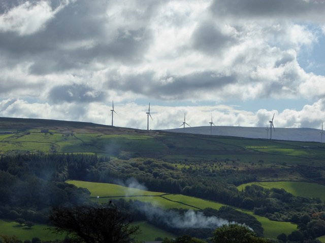
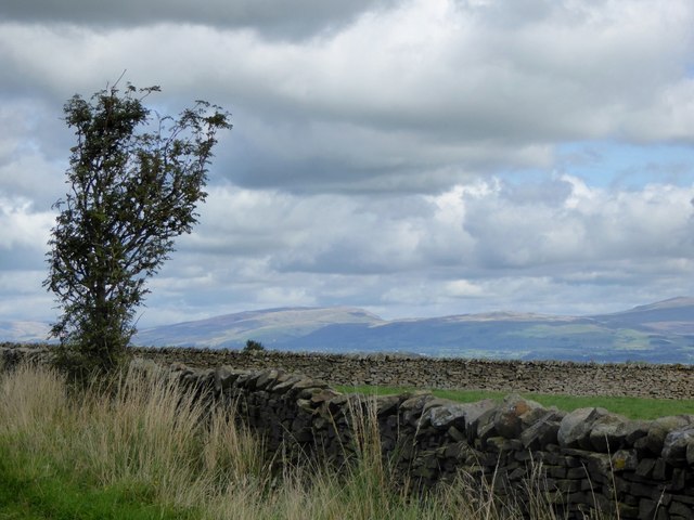
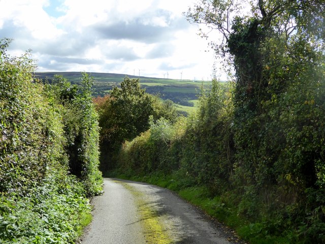
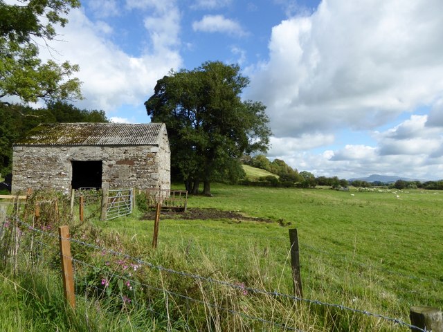
Shaw's Wood, located in the county of Lancashire, England, is a picturesque forest renowned for its natural beauty and rich history. Covering an area of approximately 100 acres, the wood is a sanctuary for diverse flora and fauna, making it a popular destination for nature enthusiasts and hikers.

The wood is predominantly composed of deciduous trees, including oak, beech, and birch, which create a stunning display of colors during the autumn season. The dense canopy provides a tranquil atmosphere, shielding visitors from the noise and hustle of the nearby urban areas.

Shaw's Wood holds great historical significance, dating back to the medieval period. It was traditionally part of a larger hunting estate and was later used for timber production during the industrial revolution. Remnants of old sawmills and charcoal kilns can still be found within the wood, serving as a reminder of its past.

The forest is home to a diverse range of wildlife, including deer, foxes, badgers, and a variety of bird species. Birdwatchers flock to Shaw's Wood to catch glimpses of rare species such as woodpeckers, kingfishers, and owls.

For visitors seeking a peaceful retreat, Shaw's Wood offers well-maintained walking trails that wind through the forest, allowing individuals to immerse themselves in nature. There are also designated picnic areas, perfect for enjoying a packed lunch amidst the tranquil surroundings.

Shaw's Wood in Lancashire is a true gem, offering a blend of natural beauty, historical significance, and a haven for wildlife, making it a must-visit destination for those seeking to reconnect with nature.

If you have any feedback on the listing, please let us know in the comments section below.

Shaw's Wood Images

Images are sourced within 2km of 54.094658/-2.66141 or Grid Reference SD5666. Thanks to Geograph Open Source API. All images are credited.
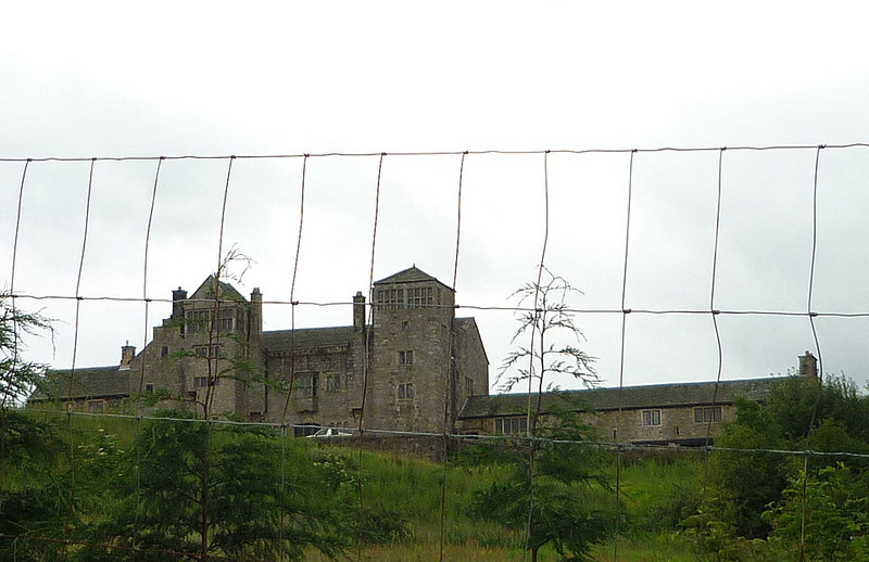
Aerial ropeway, Claughton Moor A loaded bucket is descending. The buckets have been painted pink to support Breast Cancer Now (Wear it Pink day).
The ropeway carries shale about 2km from the quarry to the brickworks <a href="https://www.geograph.org.uk/gridref/SD5666">SD5666</a>, and is gravity powered.
See <a href="https://www.geograph.org.uk/photo/2381025">SD5764 : Claughton Moor clay pit</a>, <a href="https://www.geograph.org.uk/photo/411530">SD5764 : Aerial ropeway, Claughton Brickworks.</a> & <a href="https://www.geograph.org.uk/photo/5923918">SD5666 : Aerial ropeway, Claughton Brickworks</a> for more information.
YouTube video - <span class="nowrap"><a title="https://www.youtube.com/watch?v=6RiYXI1Tfu4&t=326s" rel="nofollow ugc noopener" href="https://www.youtube.com/watch?v=6RiYXI1Tfu4&t=326s">Link</a><img style="margin-left:2px;" alt="External link" title="External link - shift click to open in new window" src="https://s1.geograph.org.uk/img/external.png" width="10" height="10"/></span>
Aerial ropeway, Claughton Moor
A loaded bucket is descending. The buckets have been painted pink to support Breast Cancer Now (Wear it Pink day). The ropeway carries shale about 2km from the quarry to the brickworks SD5666, and is gravity powered. See SD5764 : Claughton Moor clay pit, SD5764 : Aerial ropeway, Claughton Brickworks. & SD5666 : Aerial ropeway, Claughton Brickworks for more information. YouTube video - LinkExternal link
Aerial ropeway, Claughton Moor A pair of buckets (one loaded, one empty) pass a support tower. The buckets have been painted pink to support Breast Cancer Now (Wear it Pink day).
The ropeway carries shale about 2km from the quarry <a href="https://www.geograph.org.uk/gridref/SD5764">SD5764</a> to the brickworks <a href="https://www.geograph.org.uk/gridref/SD5666">SD5666</a>, and is gravity powered.
See <a href="https://www.geograph.org.uk/photo/2381025">SD5764 : Claughton Moor clay pit</a>, <a href="https://www.geograph.org.uk/photo/411530">SD5764 : Aerial ropeway, Claughton Brickworks.</a> & <a href="https://www.geograph.org.uk/photo/5923918">SD5666 : Aerial ropeway, Claughton Brickworks</a> for more information.
Aerial ropeway, Claughton Moor
A pair of buckets (one loaded, one empty) pass a support tower. The buckets have been painted pink to support Breast Cancer Now (Wear it Pink day). The ropeway carries shale about 2km from the quarry SD5764 to the brickworks SD5666, and is gravity powered. See SD5764 : Claughton Moor clay pit, SD5764 : Aerial ropeway, Claughton Brickworks. & SD5666 : Aerial ropeway, Claughton Brickworks for more information.
Aerial ropeway, Claughton Moor Looking downhill. The ropeway carries shale about 2km from the quarry <a href="https://www.geograph.org.uk/gridref/SD5764">SD5764</a> to the brickworks <a href="https://www.geograph.org.uk/gridref/SD5666">SD5666</a>, and is gravity powered. The line of the ropeway is easy to see, now that the buckets have been painted pink. The rusty support towers are well camouflaged. (There is a tower to the left of the bucket in the centre of the photo.) The Lakeland Fells are in the far distance.
Aerial ropeway, Claughton Moor
Looking downhill. The ropeway carries shale about 2km from the quarry SD5764 to the brickworks SD5666, and is gravity powered. The line of the ropeway is easy to see, now that the buckets have been painted pink. The rusty support towers are well camouflaged. (There is a tower to the left of the bucket in the centre of the photo.) The Lakeland Fells are in the far distance.
Aerial ropeway, Claughton Brickworks The bottom end and entry to the brickworks. The ropeway is not running today (jubilee holiday).
A loaded bucket has been left hanging on the rope (on the left, see <a href="https://www.geograph.org.uk/photo/7192023">SD5666 : Aerial ropeway, Claughton Brickworks</a>). Presumably this enables the ropeway to be restarted by gravity.
Aerial ropeway, Claughton Brickworks
The bottom end and entry to the brickworks. The ropeway is not running today (jubilee holiday). A loaded bucket has been left hanging on the rope (on the left, see SD5666 : Aerial ropeway, Claughton Brickworks). Presumably this enables the ropeway to be restarted by gravity.
Aerial ropeway, Claughton Brickworks A loaded bucket painted in Ukrainian colours.
Aerial ropeway, Claughton Brickworks
A loaded bucket painted in Ukrainian colours.
Lunesdale Court With jubilee bunting. Converted into separate housing units in the mid-1980s.
Built in 1874 as the Lunesdale Union Workhouse, later known as Hornby Institution. In WW2 the building became a children's hostel which continued until 1953. Lunesdale Rural District Council then used the site for their offices and workshops, until the local government reorganisation in 1974.   [David Kenyon]
Also see <span class="nowrap"><a title="https://www.workhouses.org.uk/Lunesdale/" rel="nofollow ugc noopener" href="https://www.workhouses.org.uk/Lunesdale/">Link</a><img style="margin-left:2px;" alt="External link" title="External link - shift click to open in new window" src="https://s1.geograph.org.uk/img/external.png" width="10" height="10"/></span>
Lunesdale Court
With jubilee bunting. Converted into separate housing units in the mid-1980s. Built in 1874 as the Lunesdale Union Workhouse, later known as Hornby Institution. In WW2 the building became a children's hostel which continued until 1953. Lunesdale Rural District Council then used the site for their offices and workshops, until the local government reorganisation in 1974. [David Kenyon] Also see LinkExternal link
Meeting of the Wenning and Lune rivers Lively confluence of these black peaty rivers. A sand martin colony is on the opposite bank from here, and the air is full of their constant activity and twittering.
Meeting of the Wenning and Lune rivers
Lively confluence of these black peaty rivers. A sand martin colony is on the opposite bank from here, and the air is full of their constant activity and twittering.
Claughton Manor Brick Works and aerial ropeway The cables crossing the road belong to the country's last gravity worked aerial ropeway that brings shale down from the quarry high above. Unfortunately it was not running on that day.
Claughton Manor Brick Works and aerial ropeway
The cables crossing the road belong to the country's last gravity worked aerial ropeway that brings shale down from the quarry high above. Unfortunately it was not running on that day.
Claughton aerial ropeway Seen from near the top where it crosses a public footpath. As it was not running I was quite safe passing under it. This is the last working gravity operated aerial ropeway in the UK. It extends from a quarry to a brick works at Claughton.
Claughton aerial ropeway
Seen from near the top where it crosses a public footpath. As it was not running I was quite safe passing under it. This is the last working gravity operated aerial ropeway in the UK. It extends from a quarry to a brick works at Claughton.
Silo by Claughton Beck Seen through a gate labelled Claughton Beck. On the rough and steep path to the upper end of the Claughton aerial ropeway
Silo by Claughton Beck
Seen through a gate labelled Claughton Beck. On the rough and steep path to the upper end of the Claughton aerial ropeway
Entrance to Claughton Hall Up a steep and rough track that continues to the quarry serving the aerial ropeway to Claughton Manor Brick works. According to the map this is the only entrance.
Entrance to Claughton Hall
Up a steep and rough track that continues to the quarry serving the aerial ropeway to Claughton Manor Brick works. According to the map this is the only entrance.
Farmland off Aughton Road Sheep pasture near Aughton.
Farmland off Aughton Road
Sheep pasture near Aughton.
Windfarm near Aughton
Aughton road verge The stone walls enclose sheep pasture.
Aughton road verge
The stone walls enclose sheep pasture.
Cul de Sac at Aughton The steep track leads down to Aughton Barns.
Cul de Sac at Aughton
The steep track leads down to Aughton Barns.
Barn at Aughton On the banks of the River Lune.
Barn at Aughton
On the banks of the River Lune.
Pasture at Aughton Cattle grazing by the River Lune.
Pasture at Aughton
Cattle grazing by the River Lune.
Aughton Barns This public footpath is somewhat watery after overnight rain.
Aughton Barns
This public footpath is somewhat watery after overnight rain.
Show me another place!

Shaw's Wood is located at Grid Ref: SD5666 (Lat: 54.094658, Lng: -2.66141)

Administrative County: Lancashire

District: Lancaster

Police Authority: Lancashire

What 3 Words

///dislodge.crusted.musician. Near Caton, Lancashire

Related Wikis

Claughton, Lancaster

Claughton ( KLAF-tən) is a small village and civil parish in the City of Lancaster in Lancashire, England. The village is on the A683 road east of Lancaster...

St Chad's Church, Claughton

St Chad's Church is in the village of Claughton, Lancashire, England. It is a redundant Anglican parish church, which is recorded in the National Heritage...

Claughton railway station

Claughton railway station served the village of Claughton in the City of Lancaster district of Lancashire, England. The station was located near Low Lane...

Claughton Hall

Claughton Hall (Claughton pronounced KLAF-tən) is a large country house in the English village of Claughton, Lancashire. A Grade I listed building, it...

River Wenning

The River Wenning is a tributary of the River Lune, flowing through North Yorkshire and Lancashire. The name derives from the Old English Wann, meaning...

St Saviour's Church, Aughton

St Saviour's Church is an Anglican parish church to the north of the hamlet of Aughton, Lancashire, England. == Ecclesiastical organisation == The church...

Hornby railway station

Hornby railway station served the village of Hornby in the City of Lancaster district of Lancashire, England. The station was located in a cutting off...

Hornby Village Institute

Hornby Village Institute is a public building in Main Street, Hornby, Lancashire, England. It is considered to be important architecturally, and is recorded...

Related Videos

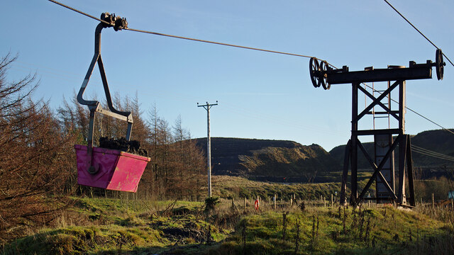
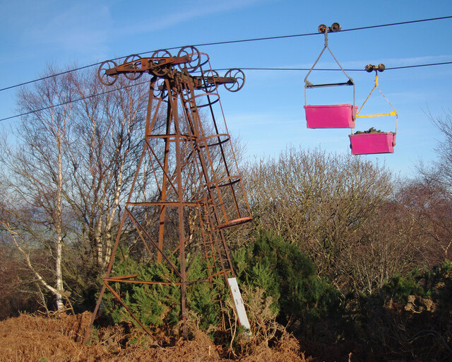
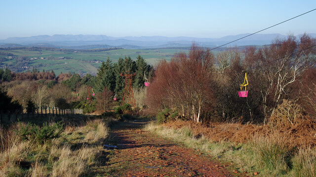
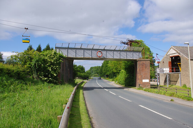
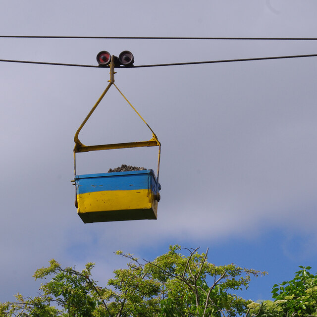
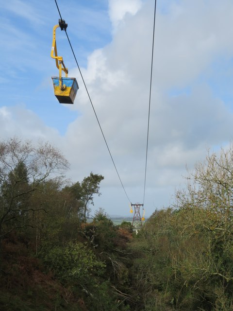
The UK's last aerial ropeway uses no power, moves 300 tonnes a day, and will be gone by 2036.

In Claughton, Lancashire, the Forterra brickworks produces 50 million bricks a year, from shale that's quarried a mile and a half ...

Inside a £3,500,000 Self-Made Couple's Renovated Home with Beautiful Interior Design

Do you have a luxury or unique home for us to feature? Apply to be on the show by sending us an email to ...

How to reset the code on a Somfy Wireless Keypad | SeceuroGlide Garage Doors

Watch this short and simple video to find out how to reset the entry code on the Somfy Wireless Keypad 2 RTS. Once you've reset ...

Nearby Amenities

Located within 500m of 54.094658,-2.66141
Claughton
Is In: Lancaster, Lancashire, England, UK
Place: hamlet
Source: survey, landsat
Lat/Long: 54.0943598/-2.6642906
Post Box
Post Box Type: lamp
Postal Code: LA2 9LB
Ref: LA2 149
Source: survey
Lat/Long: 54.0927947/-2.6663167
Narrow: yes
Lat/Long: 54.0939724/-2.6641602
Bus Stop
Meadowside
Bench: no
Bin: no
Bus: yes
Lit: yes
Naptan AtcoCode: 2500DCL3176
Naptan Bearing: NE
Naptan BusStopType: MKD
Naptan CommonName: Meadowside
Naptan Indicator: by
Naptan Landmark: Meadowside
Naptan LocalityCode: E0047430
Naptan NaptanCode: landgtdp
Naptan Street: Lancaster Road
Naptan Verified: no
Public Transport: platform
Ref: landgtdp
Shelter: yes
Tactile Paving: no
Lat/Long: 54.0927114/-2.6664619
Motor Vehicle: discouraged
Lat/Long: 54.0939667/-2.6568344
Meadowside
Bus: yes
Public Transport: stop_position
Lat/Long: 54.0926742/-2.6664186
Fenwick Arms
Bus: yes
Naptan AtcoCode: 250011157
Naptan Bearing: NE
Naptan BusStopType: MKD
Naptan CommonName: Fenwick Arms
Naptan Indicator: o/s
Naptan Landmark: Fenwick Arms
Naptan LocalityCode: E0047430
Naptan NaptanCode: lanadwpg
Naptan Street: Lancaster Road
Naptan Verified: no
Public Transport: stop_position
Ref: lanadwpg
Lat/Long: 54.0942608/-2.6639035
Bus Stop
Fenwick Arms
Bench: no
Bin: no
Bus: yes
Naptan AtcoCode: 250011157
Naptan Bearing: NE
Naptan BusStopType: MKD
Naptan CommonName: Fenwick Arms
Naptan Indicator: o/s
Naptan Landmark: Fenwick Arms
Naptan LocalityCode: E0047430
Naptan NaptanCode: lanadwpg
Naptan Street: Lancaster Road
Naptan Verified: no
Public Transport: platform
Ref: lanadwpg
Shelter: no
Tactile Paving: no
Lat/Long: 54.0942781/-2.6639726
Give Way
Direction: forward
Lat/Long: 54.0922768/-2.6675129
Generator Method: photovoltaic
Generator Orientation: south_east
Generator Output Electricity: yes
Generator Solar Modules: 10
Generator Source: solar
Generator Type: solar_photovoltaic_panel
Location: roof
Power: generator
Lat/Long: 54.0934557/-2.6654751
Generator Method: photovoltaic
Generator Orientation: east
Generator Output Electricity: yes
Generator Solar Modules: 16
Generator Source: solar
Generator Type: solar_photovoltaic_panel
Location: roof
Power: generator
Lat/Long: 54.0954833/-2.6546446
Generator Method: photovoltaic
Generator Orientation: south
Generator Output Electricity: yes
Generator Solar Modules: 9
Generator Source: solar
Generator Type: solar_photovoltaic_panel
Location: roof
Power: generator
Lat/Long: 54.0957139/-2.6542759
Power: pole
Lat/Long: 54.0944608/-2.6663313
Power: pole
Lat/Long: 54.0949858/-2.6665304
Power: pole
Lat/Long: 54.0956332/-2.6667921
Power: pole
Lat/Long: 54.096434/-2.6671165
Give Way
Direction: forward
Lat/Long: 54.0938308/-2.6643637
Give Way
Direction: backward
Lat/Long: 54.0938317/-2.6642339
Give Way
Direction: forward
Lat/Long: 54.093251/-2.6651211
Give Way
Direction: backward
Lat/Long: 54.0928014/-2.6662463
Advertising: board
Lat/Long: 54.0927869/-2.6663377
Waste Basket
Waste: dog_excrement
Lat/Long: 54.092676/-2.6666003
Give Way
Direction: forward
Lat/Long: 54.0932946/-2.6648636
Speed Camera
Lat/Long: 54.0950387/-2.6633437
Speed Camera
Lat/Long: 54.0953282/-2.6630679
The data included in this document is from www.openstreetmap.org. The data is made available under ODbL.

Have you been to Shaw's Wood?

Leave your review of Shaw's Wood below (or comments, questions and feedback).