Big Plantation
Wood, Forest in Somerset Mendip
England
Big Plantation

Big Plantation, Somerset, also known as Wood or Forest, is a sprawling and picturesque area located in the county of Somerset, England. Covering an extensive area of land, it is renowned for its abundant natural beauty and diverse wildlife.
The plantation is characterized by its dense and lush woodland, consisting of a variety of tree species such as oak, beech, and ash. These trees create a vibrant and enchanting atmosphere, attracting nature enthusiasts, hikers, and birdwatchers from far and wide.
The plantation is home to a diverse range of flora and fauna, making it a haven for wildlife. Numerous species of birds, including woodpeckers, owls, and songbirds, can be spotted here, delighting birdwatchers with their melodious tunes. The woodland also provides shelter and sustenance for mammals such as deer, foxes, and squirrels, adding to the rich biodiversity of the area.
Visitors to Big Plantation can enjoy a variety of activities, from leisurely walks and picnics to more adventurous pursuits such as mountain biking and horseback riding. The well-maintained trails winding through the woodland offer stunning views and opportunities for exploration.
With its tranquil ambiance and natural charm, Big Plantation, Somerset, provides a welcome escape from the hustle and bustle of everyday life. Whether one seeks solitude, an appreciation of nature, or an active outdoor experience, this expansive woodland offers something for everyone.
If you have any feedback on the listing, please let us know in the comments section below.
Big Plantation Images
Images are sourced within 2km of 51.233436/-2.6219042 or Grid Reference ST5648. Thanks to Geograph Open Source API. All images are credited.


Big Plantation is located at Grid Ref: ST5648 (Lat: 51.233436, Lng: -2.6219042)
Administrative County: Somerset
District: Mendip
Police Authority: Avon and Somerset
What 3 Words
///whizzing.alarm.repeat. Near Mendip, Somerset
Nearby Locations
Related Wikis

Pen Hill
Pen Hill forms part of the Mendip Hills plateau in Somerset, England. The hill is located in St Cuthbert Out civil parish in Mendip district. The name...
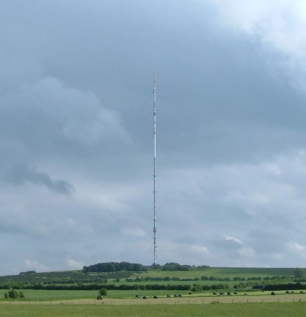
Mendip transmitting station
The Mendip transmitting station is a broadcasting and telecommunications facility on the summit of Pen Hill, part of the Mendip Hills range in Somerset...

Drove Cottage Henge
Drove Cottage Henge (sometimes called Hunter's Lodge Henge) is a scheduled monument in the Priddy parish of Somerset, England. It is located 370 metres...
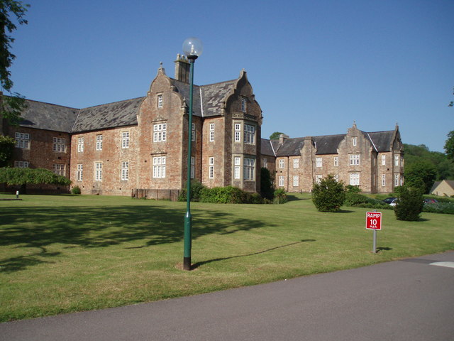
Mendip Hospital
Mendip Hospital opened in 1848 as the Somerset and Bath Pauper Lunatic Asylum at Horrington, near Wells, in the English county of Somerset. As a county...

Horrington
Horrington is a collection of three small villages (South Horrington, East Horrington and West Horrington) in the parish of St Cuthbert Out 1 mile (2 km...
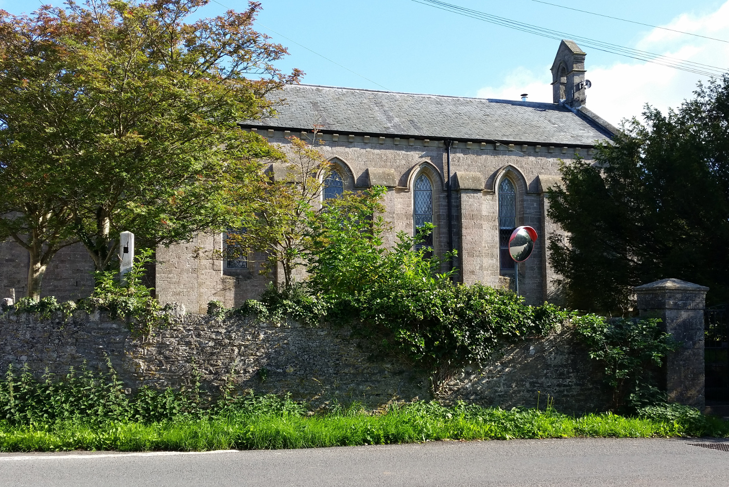
St John's Church, East Horrington
St John's Church is a former Church of England church in East Horrington, Somerset, England. It was built in 1838 to the designs of Richard Carver and...
Hunter's Hole
Hunter's Hole (or Hunters' Hole) is a cave in the Mendip Hills in Somerset, England. It is behind a pub, known as the Hunters Lodge Inn just outside Priddy...
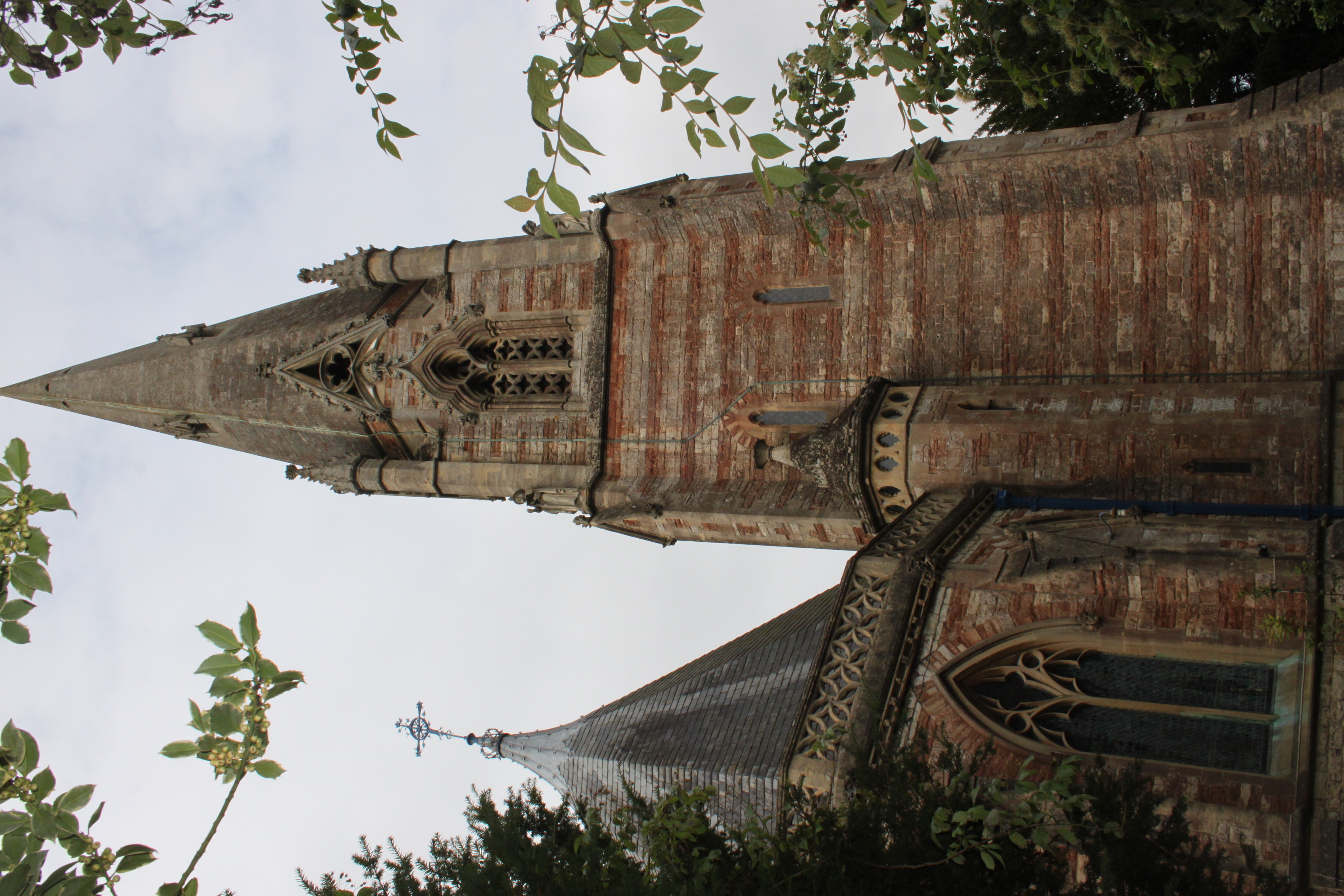
Church of St Thomas, Wells
The Church of St Thomas in Wells, Somerset, England, was built in the 1850s. It is a Grade II* listed building. == History == The church was built during...
Nearby Amenities
Located within 500m of 51.233436,-2.6219042Have you been to Big Plantation?
Leave your review of Big Plantation below (or comments, questions and feedback).