Biddle Combe
Valley in Somerset Mendip
England
Biddle Combe

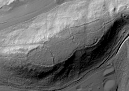
Biddle Combe, Somerset is a picturesque valley located in the southwest of England. Nestled within the Mendip Hills, this rural area is known for its stunning natural beauty and tranquil atmosphere. The valley is situated near the village of Cheddar and is surrounded by rolling green hills, lush meadows, and dense woodland.
Biddle Combe is renowned for its diverse wildlife and is home to a variety of flora and fauna. The valley boasts a rich biodiversity, with rare species of plants and animals thriving in its untouched habitats. Visitors can spot a range of bird species, including buzzards, owls, and woodpeckers, as well as elusive mammals such as badgers, foxes, and deer.
The valley is a popular destination for outdoor enthusiasts and nature lovers. It offers numerous walking and hiking trails, allowing visitors to explore the area's natural wonders at their own pace. The towering cliffs that surround the valley also attract rock climbers from far and wide, seeking the thrill of scaling the challenging limestone faces.
Aside from its natural attractions, Biddle Combe also has historical significance. The area is dotted with ancient archaeological sites, including burial mounds and stone circles, revealing the presence of human activity dating back thousands of years.
Overall, Biddle Combe, Somerset is a haven for those seeking tranquility, natural beauty, and outdoor adventures. With its breathtaking landscapes and rich biodiversity, this hidden gem in the heart of the Mendip Hills offers a unique and unforgettable experience for visitors.
If you have any feedback on the listing, please let us know in the comments section below.
Biddle Combe Images
Images are sourced within 2km of 51.229581/-2.6178995 or Grid Reference ST5648. Thanks to Geograph Open Source API. All images are credited.


Biddle Combe is located at Grid Ref: ST5648 (Lat: 51.229581, Lng: -2.6178995)
Administrative County: Somerset
District: Mendip
Police Authority: Avon and Somerset
What 3 Words
///sleepless.mavericks.scrubber. Near Mendip, Somerset
Nearby Locations
Related Wikis

Pen Hill
Pen Hill forms part of the Mendip Hills plateau in Somerset, England. The hill is located in St Cuthbert Out civil parish in Mendip district. The name...
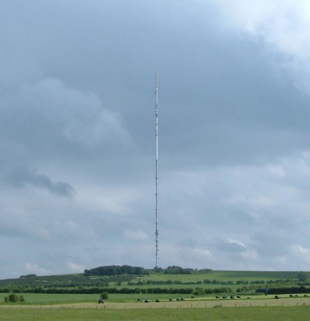
Mendip transmitting station
The Mendip transmitting station is a broadcasting and telecommunications facility on the summit of Pen Hill, part of the Mendip Hills range in Somerset...
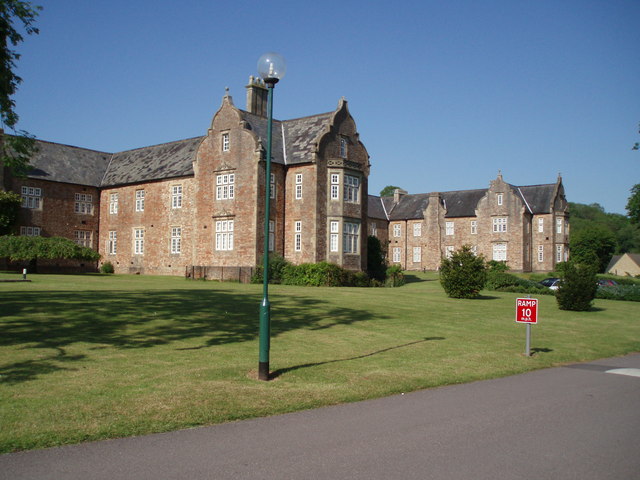
Mendip Hospital
Mendip Hospital opened in 1848 as the Somerset and Bath Pauper Lunatic Asylum at Horrington, near Wells, in the English county of Somerset. As a county...

Horrington
Horrington is a collection of three small villages (South Horrington, East Horrington and West Horrington) in the parish of St Cuthbert Out 1 mile (2 km...
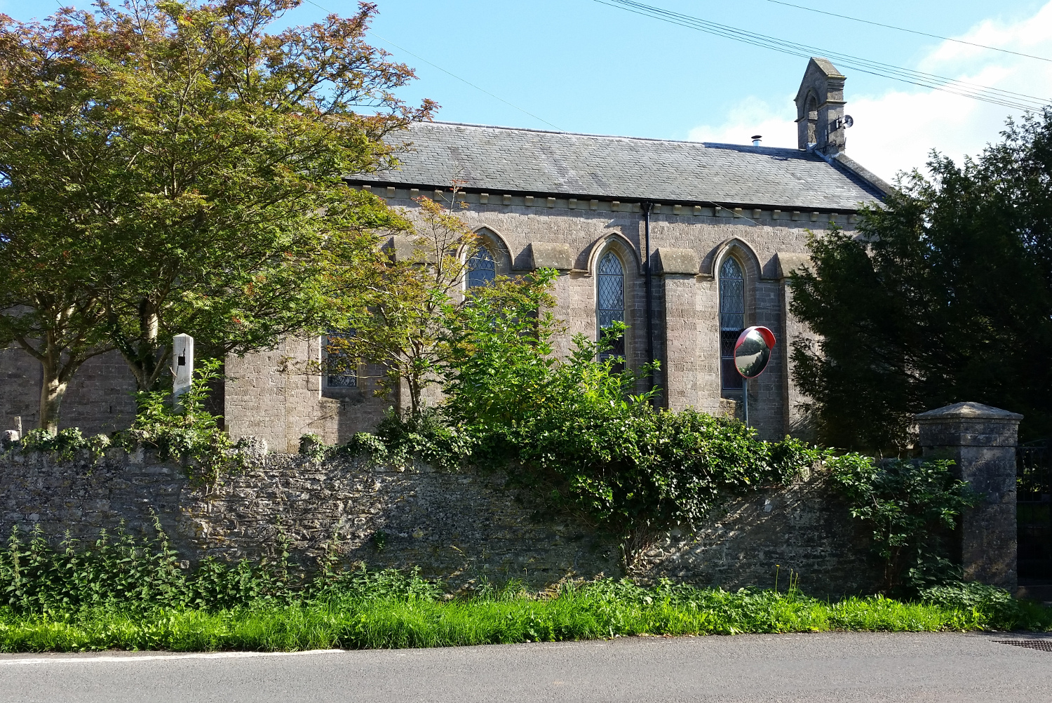
St John's Church, East Horrington
St John's Church is a former Church of England church in East Horrington, Somerset, England. It was built in 1838 to the designs of Richard Carver and...

Drove Cottage Henge
Drove Cottage Henge (sometimes called Hunter's Lodge Henge) is a scheduled monument in the Priddy parish of Somerset, England. It is located 370 metres...
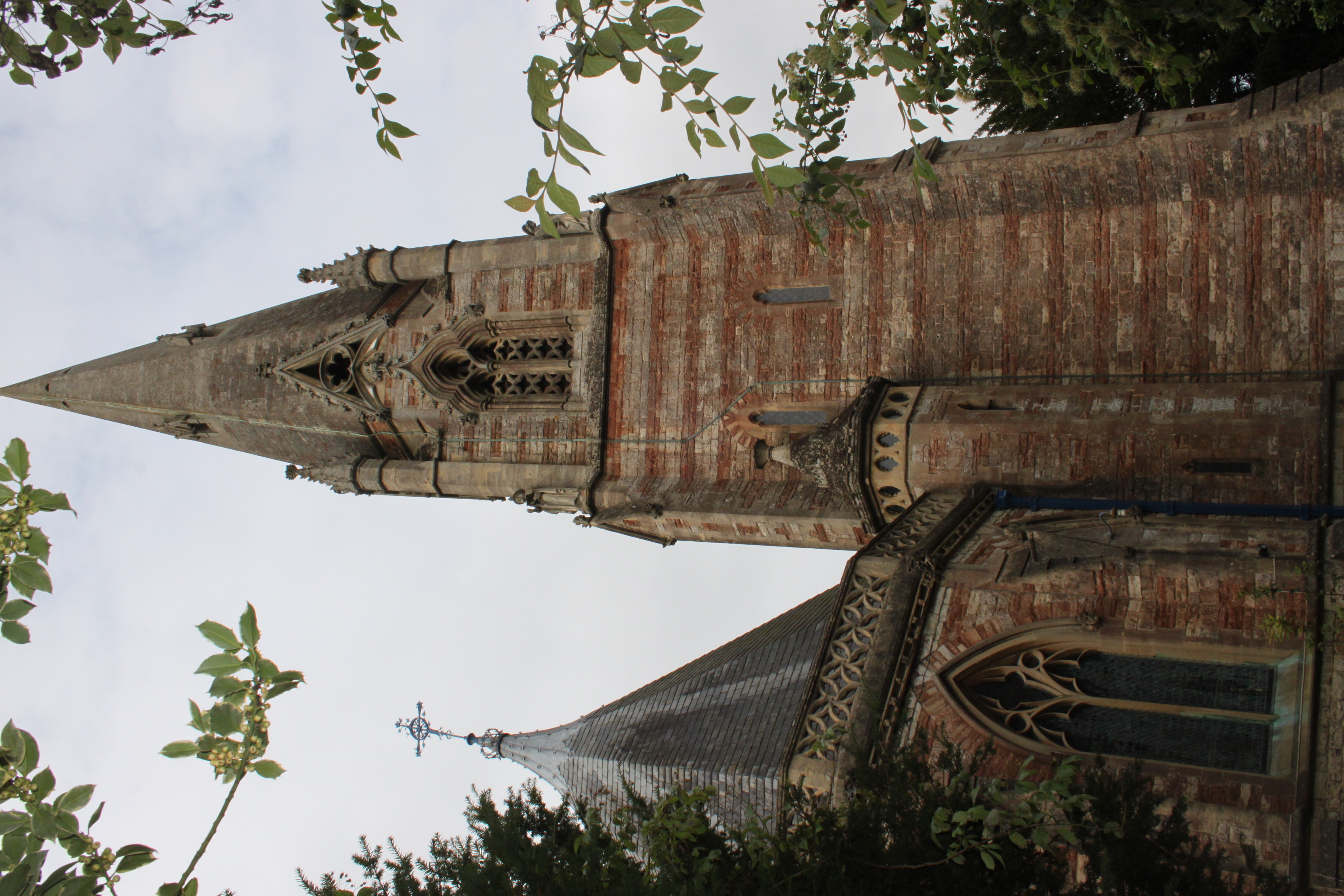
Church of St Thomas, Wells
The Church of St Thomas in Wells, Somerset, England, was built in the 1850s. It is a Grade II* listed building. == History == The church was built during...
King's Castle, Wells
King's Castle is an Iron Age enclosed hilltop settlement at the south-western edge of the Mendip Hills near Wells in Somerset, England. Though there are...
Have you been to Biddle Combe?
Leave your review of Biddle Combe below (or comments, questions and feedback).