Rabbit Lands Copse

Wood, Forest in Dorset

England

Rabbit Lands Copse

Ford, Melbury Osmond Bridleway W33 9 crosses a stream by ford and footbridge.
Ford, Melbury Osmond Credit: Derek Harper

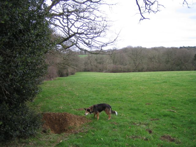
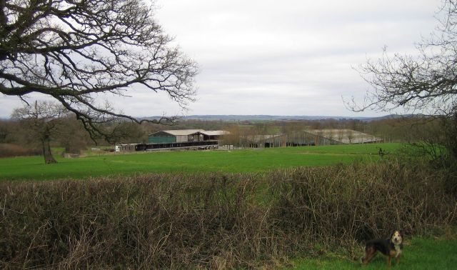
Rabbit Lands Copse is a picturesque woodland located in the county of Dorset, England. Covering an area of approximately 50 acres, this enchanting forest is nestled in the heart of the countryside, offering a tranquil and idyllic escape from the bustling city life.

The copse is known for its dense population of rabbits, hence its name, and is home to a diverse range of flora and fauna. It boasts a variety of tree species, including oak, beech, and birch, which create a vibrant and verdant canopy that provides shelter for numerous bird species.

Walking through Rabbit Lands Copse, one can experience the soothing sounds of nature, as the wind rustles through the leaves and birdsong fills the air. The forest floor is carpeted with a lush undergrowth of ferns, bluebells, and wildflowers, adding to the enchanting atmosphere.

The copse is intersected by meandering footpaths, allowing visitors to explore its beauty at their own pace. These pathways lead to a small clearing in the heart of the forest, where visitors can pause and appreciate the serene surroundings.

Rabbit Lands Copse is a popular destination for nature enthusiasts, birdwatchers, and families seeking a peaceful retreat. Its secluded location and natural beauty make it a haven for wildlife, providing a habitat for various woodland creatures.

Whether one is seeking a peaceful stroll amidst nature, or a place to reconnect with the natural world, Rabbit Lands Copse offers a serene and captivating experience for all who visit.

If you have any feedback on the listing, please let us know in the comments section below.

Rabbit Lands Copse Images

Images are sourced within 2km of 50.871393/-2.6195163 or Grid Reference ST5608. Thanks to Geograph Open Source API. All images are credited.

Ford, Melbury Osmond Bridleway W33 9 crosses a stream by ford and footbridge.
Ford, Melbury Osmond
Bridleway W33 9 crosses a stream by ford and footbridge.
Ford at Melbury Osmond This ford is found at Town’s End near Melbury Osmond.
Ford at Melbury Osmond
This ford is found at Town’s End near Melbury Osmond.
Cattle grid, Melbury Park The Hardy and Macmillan Ways follow footpath W34 1 as far as the cattle grid, when it magically becomes footpath W33 12 as it crosses the parish boundary between Melbury Sampford and Melbury Osmond. Melbury Park is grade II* listed <span class="nowrap"><a title="https://historicengland.org.uk/listing/the-list/list-entry/1000531?section=official-list-entry" rel="nofollow ugc noopener" href="https://historicengland.org.uk/listing/the-list/list-entry/1000531?section=official-list-entry">Link</a><img style="margin-left:2px;" alt="External link" title="External link - shift click to open in new window" src="https://s1.geograph.org.uk/img/external.png" width="10" height="10"/></span> .
Cattle grid, Melbury Park
The Hardy and Macmillan Ways follow footpath W34 1 as far as the cattle grid, when it magically becomes footpath W33 12 as it crosses the parish boundary between Melbury Sampford and Melbury Osmond. Melbury Park is grade II* listed LinkExternal link .
Sheep, Melbury Park Looking right from the stretch of footpath shown in <a href="https://www.geograph.org.uk/photo/7576049">ST5706 : Cattle grid, Melbury Park</a>. Melbury Park is grade II* listed <span class="nowrap"><a title="https://historicengland.org.uk/listing/the-list/list-entry/1000531?section=official-list-entry" rel="nofollow ugc noopener" href="https://historicengland.org.uk/listing/the-list/list-entry/1000531?section=official-list-entry">Link</a><img style="margin-left:2px;" alt="External link" title="External link - shift click to open in new window" src="https://s1.geograph.org.uk/img/external.png" width="10" height="10"/></span> .
Sheep, Melbury Park
Looking right from the stretch of footpath shown in ST5706 : Cattle grid, Melbury Park. Melbury Park is grade II* listed LinkExternal link .
Cattle grid, Melbury Park The Hardy and Macmillan Ways follow footpath W33 12 past this gated cattle grid. Melbury Park is grade II* listed <span class="nowrap"><a title="https://historicengland.org.uk/listing/the-list/list-entry/1000531?section=official-list-entry" rel="nofollow ugc noopener" href="https://historicengland.org.uk/listing/the-list/list-entry/1000531?section=official-list-entry">Link</a><img style="margin-left:2px;" alt="External link" title="External link - shift click to open in new window" src="https://s1.geograph.org.uk/img/external.png" width="10" height="10"/></span> .
Cattle grid, Melbury Park
The Hardy and Macmillan Ways follow footpath W33 12 past this gated cattle grid. Melbury Park is grade II* listed LinkExternal link .
Entering Melbury Osmond From the south along footpath W33 12, used by the Hardy and Macmillan Ways. On the right is the early C18 Town's End Farmhouse <span class="nowrap"><a title="https://historicengland.org.uk/listing/the-list/list-entry/1154861?section=official-list-entry" rel="nofollow ugc noopener" href="https://historicengland.org.uk/listing/the-list/list-entry/1154861?section=official-list-entry">Link</a><img style="margin-left:2px;" alt="External link" title="External link - shift click to open in new window" src="https://s1.geograph.org.uk/img/external.png" width="10" height="10"/></span> , and beyond the adjoining barns is the early C17 Walnut Tree Cottage <span class="nowrap"><a title="https://historicengland.org.uk/listing/the-list/list-entry/1119247?section=official-list-entry" rel="nofollow ugc noopener" href="https://historicengland.org.uk/listing/the-list/list-entry/1119247?section=official-list-entry">Link</a><img style="margin-left:2px;" alt="External link" title="External link - shift click to open in new window" src="https://s1.geograph.org.uk/img/external.png" width="10" height="10"/></span> , in the centre. The thatched building left of centre is the late C17 Town's End and Monmouth House <span class="nowrap"><a title="https://historicengland.org.uk/listing/the-list/list-entry/1119246?section=official-list-entry" rel="nofollow ugc noopener" href="https://historicengland.org.uk/listing/the-list/list-entry/1119246?section=official-list-entry">Link</a><img style="margin-left:2px;" alt="External link" title="External link - shift click to open in new window" src="https://s1.geograph.org.uk/img/external.png" width="10" height="10"/></span> , better shown in <a href="https://www.geograph.org.uk/photo/7577047">ST5707 : Town's End and Monmouth House, Melbury Osmond</a>.
Entering Melbury Osmond
From the south along footpath W33 12, used by the Hardy and Macmillan Ways. On the right is the early C18 Town's End Farmhouse LinkExternal link , and beyond the adjoining barns is the early C17 Walnut Tree Cottage LinkExternal link , in the centre. The thatched building left of centre is the late C17 Town's End and Monmouth House LinkExternal link , better shown in ST5707 : Town's End and Monmouth House, Melbury Osmond.
Town's End and Monmouth House, Melbury Osmond The thatched "former farmhouse, divided into two cottages. Late C17" is described at <span class="nowrap"><a title="https://historicengland.org.uk/listing/the-list/list-entry/1119246?section=official-list-entry" rel="nofollow ugc noopener" href="https://historicengland.org.uk/listing/the-list/list-entry/1119246?section=official-list-entry">Link</a><img style="margin-left:2px;" alt="External link" title="External link - shift click to open in new window" src="https://s1.geograph.org.uk/img/external.png" width="10" height="10"/></span> . In the foreground is Walnut Tree Cottage <span class="nowrap"><a title="https://historicengland.org.uk/listing/the-list/list-entry/1119247?section=official-list-entry" rel="nofollow ugc noopener" href="https://historicengland.org.uk/listing/the-list/list-entry/1119247?section=official-list-entry">Link</a><img style="margin-left:2px;" alt="External link" title="External link - shift click to open in new window" src="https://s1.geograph.org.uk/img/external.png" width="10" height="10"/></span> . See also <a href="https://www.geograph.org.uk/photo/7577041">ST5707 : Entering Melbury Osmond</a>.
Town's End and Monmouth House, Melbury Osmond
The thatched "former farmhouse, divided into two cottages. Late C17" is described at LinkExternal link . In the foreground is Walnut Tree Cottage LinkExternal link . See also ST5707 : Entering Melbury Osmond.
Bridleway, Town's End Bridleway W33 9 heads east through woodland.
Bridleway, Town's End
Bridleway W33 9 heads east through woodland.
Trees and bridleway junction near Melbury Osmond Bridleways W33 10 and W33 9 part company here, the former through the gate on the right and the latter through the gate left of centre. Melbury Park is grade II* listed <span class="nowrap"><a title="https://historicengland.org.uk/listing/the-list/list-entry/1000531?section=official-list-entry" rel="nofollow ugc noopener" href="https://historicengland.org.uk/listing/the-list/list-entry/1000531?section=official-list-entry">Link</a><img style="margin-left:2px;" alt="External link" title="External link - shift click to open in new window" src="https://s1.geograph.org.uk/img/external.png" width="10" height="10"/></span> .
Trees and bridleway junction near Melbury Osmond
Bridleways W33 10 and W33 9 part company here, the former through the gate on the right and the latter through the gate left of centre. Melbury Park is grade II* listed LinkExternal link .
Trees and fence near Beer Lane A belt of trees in Melbury Park, which is grade II* listed <span class="nowrap"><a title="https://historicengland.org.uk/listing/the-list/list-entry/1000531?section=official-list-entry" rel="nofollow ugc noopener" href="https://historicengland.org.uk/listing/the-list/list-entry/1000531?section=official-list-entry">Link</a><img style="margin-left:2px;" alt="External link" title="External link - shift click to open in new window" src="https://s1.geograph.org.uk/img/external.png" width="10" height="10"/></span> .
Trees and fence near Beer Lane
A belt of trees in Melbury Park, which is grade II* listed LinkExternal link .
Trees and fence near Beer Lane A reverse view of <a href="https://www.geograph.org.uk/photo/7577795">ST5807 : Trees and fence near Beer Lane</a>.
Trees and fence near Beer Lane
Melbury Park Trees on the northeast side of the park. Melbury Park is grade II* listed <span class="nowrap"><a title="https://historicengland.org.uk/listing/the-list/list-entry/1000531?section=official-list-entry" rel="nofollow ugc noopener" href="https://historicengland.org.uk/listing/the-list/list-entry/1000531?section=official-list-entry">Link</a><img style="margin-left:2px;" alt="External link" title="External link - shift click to open in new window" src="https://s1.geograph.org.uk/img/external.png" width="10" height="10"/></span> .
Melbury Park
Trees on the northeast side of the park. Melbury Park is grade II* listed LinkExternal link .
St Osmund's Church, Melbury Osmond The church is dedicated to St. Osmund, the Bishop of Salisbury from 1078 - 1099.

The present church dates from 1745 and is believed to be the third built on the site.

The author Thomas Hardy's parents, Jemima and Thomas, were married at St Osmund's in 1839.  A copy of their marriage certificate is displayed on the west wall of the nave.
St Osmund's Church, Melbury Osmond
The church is dedicated to St. Osmund, the Bishop of Salisbury from 1078 - 1099. The present church dates from 1745 and is believed to be the third built on the site. The author Thomas Hardy's parents, Jemima and Thomas, were married at St Osmund's in 1839. A copy of their marriage certificate is displayed on the west wall of the nave.
Fields Near Lewcombe Manor Fields and a freshly dug badger sett on the bridleway between Clarkham Cross and Lewcombe Manor.
Fields Near Lewcombe Manor
Fields and a freshly dug badger sett on the bridleway between Clarkham Cross and Lewcombe Manor.
Townsend Dairy Farm Near Melbury Osmond
Townsend Dairy Farm
Near Melbury Osmond
Monmouth Cottage, Melbury Osmond
Farmland near Melbury Osmund On the road south from Ryme Intrinseca, near to the A37 junction.
Farmland near Melbury Osmund
On the road south from Ryme Intrinseca, near to the A37 junction.
Field behind the Rest and Welcome Inn A footpath heads east from the A37 behind the Rest and Welcome Inn.  Unusually this field is ploughed ready from crops, unlike many of the large areas of  pasture around here.
Field behind the Rest and Welcome Inn
A footpath heads east from the A37 behind the Rest and Welcome Inn. Unusually this field is ploughed ready from crops, unlike many of the large areas of pasture around here.
Show me another place!

Rabbit Lands Copse is located at Grid Ref: ST5608 (Lat: 50.871393, Lng: -2.6195163)

Unitary Authority: Dorset

Police Authority: Dorset

What 3 Words

///typed.train.swells. Near Yetminster, Dorset

Related Wikis

Melbury Osmond

Melbury Osmond is a village and civil parish in the county of Dorset in southern England. It lies approximately 7 miles (11 km) south of the Somerset town...

Church of All Saints, Closworth

The Church of All Saints in Closworth, Somerset, England was built in the 13th century. It is a Grade II* listed building. == History == The church was...

Melbury Sampford

Melbury Sampford is a village and civil parish 12 miles (19 km) northwest of Dorchester, in the Dorset district, in the ceremonial county of Dorset, England...

Closworth

Closworth is a village and civil parish in Somerset, England, 5 miles (8.0 km) south of Yeovil in the South Somerset district, on the border with Dorset...

Nearby Amenities

Located within 500m of 50.871393,-2.6195163
Material: wood
Power: pole
Source: bing
Lat/Long: 50.8751756/-2.6162306
Material: wood
Power: pole
Source: bing
Lat/Long: 50.8747/-2.6177004
Material: wood
Power: pole
Source: bing
Lat/Long: 50.874221/-2.6192132
Material: wood
Power: pole
Source: bing
Lat/Long: 50.8737928/-2.620742
Material: wood
Power: pole
Source: bing
Lat/Long: 50.873329/-2.6221583
Material: wood
Power: pole
Source: bing
Lat/Long: 50.8728619/-2.6236603
Material: wood
Power: pole
Source: bing
Lat/Long: 50.8725301/-2.625055
Material: wood
Power: pole
Source: bing
Lat/Long: 50.8720883/-2.6262567
The data included in this document is from www.openstreetmap.org. The data is made available under ODbL.

Have you been to Rabbit Lands Copse?

Leave your review of Rabbit Lands Copse below (or comments, questions and feedback).