Strawberry Wood

Wood, Forest in Somerset Mendip

England

Strawberry Wood

Olympic long jump in Wells A section of pavement has been inlaid with the distance jumped by Mary Rand in 1964. The World Record was broken by this local girl in Tokyo and has been publicly celebrated near the Market Place, near the Bishop's Palace.

See <a href="https://www.geograph.org.uk/photo/2327840">ST5545 : Olympic record long jump</a> for the descriptive inscription.
Olympic long jump in Wells Credit: Neil Owen

Strawberry Wood is a charming woodland located in Somerset, England. This idyllic forest is renowned for its scenic beauty and vibrant ecosystem. Spanning over an area of approximately 50 acres, Strawberry Wood boasts a diverse range of native trees and plants, making it a haven for nature lovers and wildlife enthusiasts.

The woodland is primarily composed of broadleaf trees such as oak, beech, and ash, which create a dense canopy overhead, providing shade and shelter for the flora and fauna beneath. The forest floor is adorned with an array of wildflowers, including bluebells, primroses, and wood anemones, adding a burst of color to the landscape during springtime.

Strawberry Wood is home to a variety of wildlife species, making it an important ecological hub. Visitors may spot a range of bird species, including woodpeckers, owls, and thrushes, as well as small mammals like squirrels, foxes, and badgers. The forest is also inhabited by a diverse insect population, with butterflies, bees, and beetles frequenting the area.

The woodland offers a network of well-maintained walking trails, allowing visitors to explore its natural beauty at their own pace. These paths wind through the trees, offering glimpses of sunlight piercing through the foliage and creating a picturesque setting. The wood is a popular destination for hikers, photographers, and families seeking a peaceful retreat in nature.

Overall, Strawberry Wood in Somerset is a captivating forest that provides a tranquil escape from the hustle and bustle of everyday life. Its stunning scenery, abundant wildlife, and well-preserved trails make it a must-visit destination for nature enthusiasts and those seeking a connection with the natural world.

If you have any feedback on the listing, please let us know in the comments section below.

Strawberry Wood Images

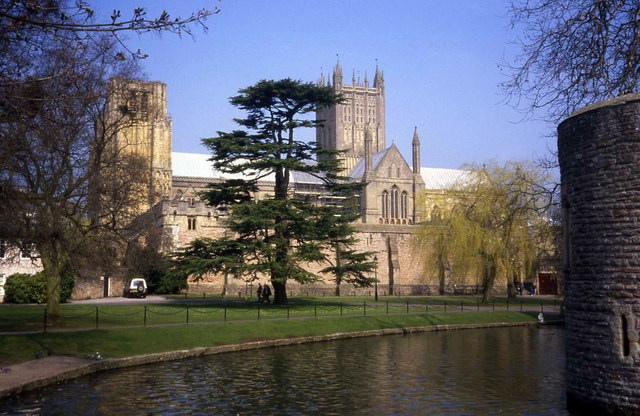
Images are sourced within 2km of 51.209349/-2.6331751 or Grid Reference ST5545. Thanks to Geograph Open Source API. All images are credited.

Olympic long jump in Wells A section of pavement has been inlaid with the distance jumped by Mary Rand in 1964. The World Record was broken by this local girl in Tokyo and has been publicly celebrated near the Market Place, near the Bishop's Palace.

See <a href="https://www.geograph.org.uk/photo/2327840">ST5545 : Olympic record long jump</a> for the descriptive inscription.
Olympic long jump in Wells
A section of pavement has been inlaid with the distance jumped by Mary Rand in 1964. The World Record was broken by this local girl in Tokyo and has been publicly celebrated near the Market Place, near the Bishop's Palace. See ST5545 : Olympic record long jump for the descriptive inscription.
Olympic record long jump Mary Rand broke the World ladies' long jump in Tokyo and the achievement is set in the pavement in the Market Place.

See <a href="https://www.geograph.org.uk/photo/2327830">ST5545 : Olympic long jump in Wells</a> for a longer view.
Olympic record long jump
Mary Rand broke the World ladies' long jump in Tokyo and the achievement is set in the pavement in the Market Place. See ST5545 : Olympic long jump in Wells for a longer view.
Penniless Porch The inscription reads "Built about 1450 by Bishop Bekynton, a benefactor to this city. Here beggars used to ask for alms."

An example of continued use of a building on the approach to Wells Cathedral, even after centuries. Seems times change but sometimes turn full circle.
Penniless Porch
The inscription reads "Built about 1450 by Bishop Bekynton, a benefactor to this city. Here beggars used to ask for alms." An example of continued use of a building on the approach to Wells Cathedral, even after centuries. Seems times change but sometimes turn full circle.
Wells Cathedral west front The much photographed west front of the building has around 300 figurines and has been on view since around 1250.
Wells Cathedral west front
The much photographed west front of the building has around 300 figurines and has been on view since around 1250.
Wells Cathedral South elevation seen from the Bishop's Palace moat.
Wells Cathedral
South elevation seen from the Bishop's Palace moat.
Cattle in The Park Large area of grassland to the south of the cathedral, occupied by a dairy herd. In front of the cathedral is the curtain wall and moat around the Bishop's Palace.
Cattle in The Park
Large area of grassland to the south of the cathedral, occupied by a dairy herd. In front of the cathedral is the curtain wall and moat around the Bishop's Palace.
The Fountain Inn, Wells Dating from the 16th Century when it housed workers building the Cathedral.
The Fountain Inn, Wells
Dating from the 16th Century when it housed workers building the Cathedral.
Wells Cathedral - a different view! Taken from the tranquillity of the cloisters.
Wells Cathedral - a different view!
Taken from the tranquillity of the cloisters.
Moat by the Bishop's Palace Seen at the eastern end of the Palace.
Moat by the Bishop's Palace
Seen at the eastern end of the Palace.
Cut benchmark on Wells Cathedral A survey benchmark (one of four listed on the Cathedral) on the west face, beside the larger entrance. See <a title="https://www.geograph.org.uk/photo/2525018" href="https://www.geograph.org.uk/photo/2525018">Link</a> for a wider view, and <span class="nowrap"><a title="http://www.bench-marks.org.uk/bm38869" rel="nofollow ugc noopener" href="http://www.bench-marks.org.uk/bm38869">Link</a><img style="margin-left:2px;" alt="External link" title="External link - shift click to open in new window" src="https://s1.geograph.org.uk/img/external.png" width="10" height="10"/></span> for the Benchmark Database.
Cut benchmark on Wells Cathedral
A survey benchmark (one of four listed on the Cathedral) on the west face, beside the larger entrance. See Link for a wider view, and LinkExternal link for the Benchmark Database.
West side of Wells Cathedral The impressive frontage of this historic place of worship also displays a benchmark - on the buttress to our right. See <a title="https://www.geograph.org.uk/photo/2525016" href="https://www.geograph.org.uk/photo/2525016">Link</a> for a closer look.
West side of Wells Cathedral
The impressive frontage of this historic place of worship also displays a benchmark - on the buttress to our right. See Link for a closer look.
Cut benchmark - the Bishop's Barn Located beside the door onto Silver Street. See <a href="https://www.geograph.org.uk/photo/2525020">ST5545 : Bishop's Barn</a> for a wider view, and <span class="nowrap"><a title="http://www.bench-marks.org.uk/bm38870" rel="nofollow ugc noopener" href="http://www.bench-marks.org.uk/bm38870">Link</a><img style="margin-left:2px;" alt="External link" title="External link - shift click to open in new window" src="https://s1.geograph.org.uk/img/external.png" width="10" height="10"/></span> for the Benchmark Database.
Cut benchmark - the Bishop's Barn
Located beside the door onto Silver Street. See ST5545 : Bishop's Barn for a wider view, and LinkExternal link for the Benchmark Database.
Bishop's Barn This barn, part of the Wells Cathedral area, is a listed fifteenth century tithe; it's a Grade 1. During the Bloody Assizes it apparently quartered Royalist troops.

A benchmark can be found on the nearer part of the arch, see <a href="https://www.geograph.org.uk/photo/2525019">ST5545 : Cut benchmark - the Bishop's Barn</a> for a look.
Bishop's Barn
This barn, part of the Wells Cathedral area, is a listed fifteenth century tithe; it's a Grade 1. During the Bloody Assizes it apparently quartered Royalist troops. A benchmark can be found on the nearer part of the arch, see ST5545 : Cut benchmark - the Bishop's Barn for a look.
The National Trust Gift Shop Wells
Wells Cathedral
Wells Cathedral
Vicar's Close, Wells
The External Clock Wells Cathedral
Show me another place!

Strawberry Wood is located at Grid Ref: ST5545 (Lat: 51.209349, Lng: -2.6331751)

Administrative County: Somerset

District: Mendip

Police Authority: Avon and Somerset

What 3 Words

///holdings.became.seabirds. Near Wells, Somerset

Related Wikis

The Old Deanery, Wells

The Old Deanery of Wells Cathedral in Wells, Somerset, England, dates from the 12th century. Along with the gatehouse and boundary walls has been designated...

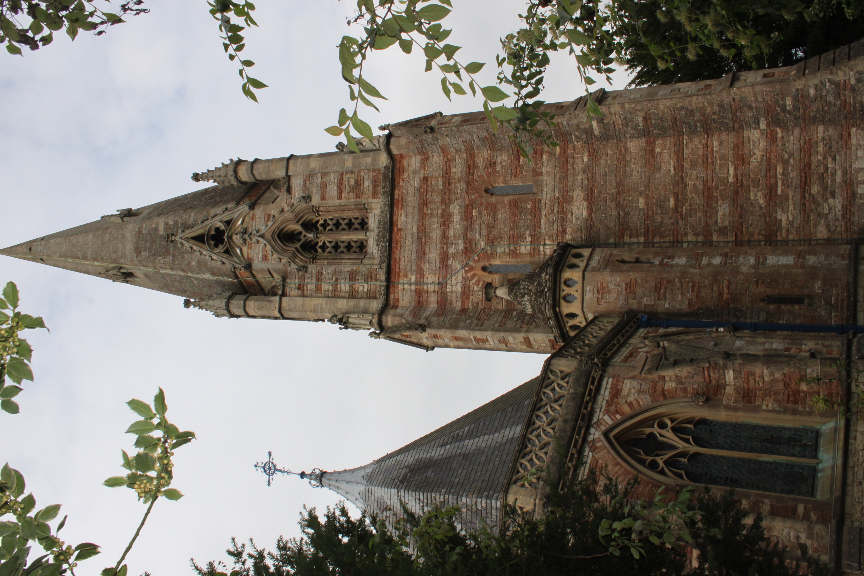
Church of St Thomas, Wells

The Church of St Thomas in Wells, Somerset, England, was built in the 1850s. It is a Grade II* listed building. == History == The church was built during...

Wells St Andrew

Wells St Andrew, or St Andrew Liberty, or derivations thereof, was a liberty, ecclesiastical parish, and later a civil parish, containing Wells Cathedral...

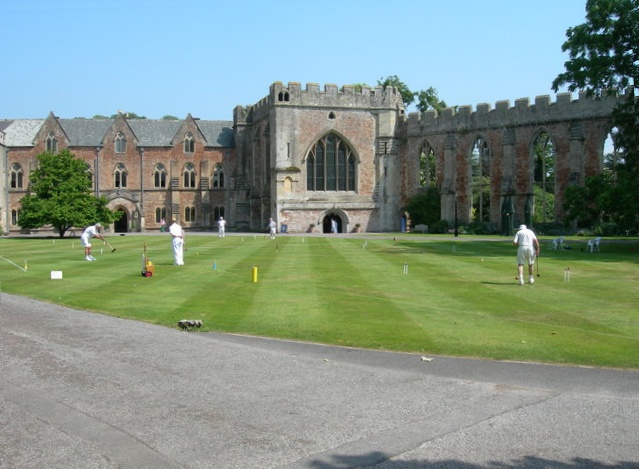
Bishop's Palace, Wells

The Bishop's Palace and accompanying Bishops House at Wells in the English county of Somerset, is adjacent to Wells Cathedral and has been the home of...

Diocese of Bath and Wells

The Diocese of Bath and Wells is a diocese in the Church of England Province of Canterbury in England. The diocese covers the county of Somerset and a...

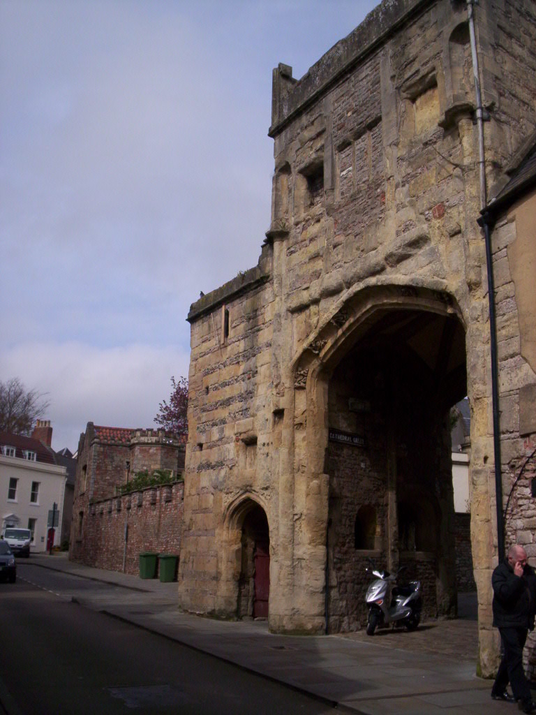
Brown's Gatehouse, Wells

Brown's Gatehouse (also known as the Dean's Eye) in Wells, Somerset, England, is an entrance gateway into a walled precinct, the Liberty of St Andrew,...
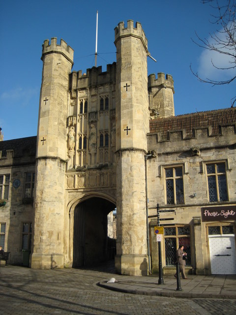
Chain Gate, Wells

The Chain Gate in Wells, Somerset, England, is an entrance gateway adjacent to the north side of Wells Cathedral, controlling access from St Andrew Street...
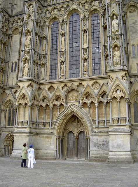
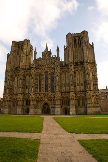
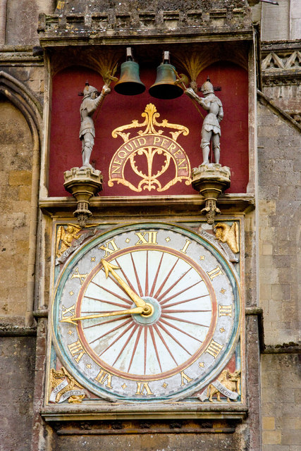
Wells Cathedral

Wells Cathedral is an Anglican cathedral in Wells, Somerset, England, dedicated to St Andrew the Apostle. It is the seat of the Bishop of Bath and Wells...

Nearby Amenities

Located within 500m of 51.209349,-2.6331751
Post Box
Brand: Royal Mail
Brand Wikidata: Q638098
Brand Wikipedia: en:Royal Mail
Operator: Royal Mail
Operator Wikidata: Q638098
Post Box Type: pillar
Ref: BA5 15
Royal Cypher: EIIR
Royal Cypher Wikidata: Q33102113
Lat/Long: 51.2130346/-2.6303879
Post Office
St Thomas Street Post Office
Addr City: Wells
Addr Housename: Budgens Of Wells
Addr Postcode: BA5 3LF
Addr Street: Bath Road
Opening Hours: Mo-Fr 07:30-20:00; Sa 09:00-19:30; Su 08:00-20:00
Ref Pol Id: 130532
Lat/Long: 51.2133496/-2.6348662
Removed Amenity: telephone
Lat/Long: 51.213316/-2.6312891
Bus Stop
Bus: yes
Naptan AtcoCode: 3600SOB21027
Naptan NaptanCode: sotdgajg
Public Transport: platform
Shelter: yes
Lat/Long: 51.2129596/-2.6305516
The data included in this document is from www.openstreetmap.org. The data is made available under ODbL.

Have you been to Strawberry Wood?

Leave your review of Strawberry Wood below (or comments, questions and feedback).