Frances Plantation

Wood, Forest in Somerset Mendip

England

Frances Plantation

Snowdrops on a wall Snowdrops growing on a drystone wall beside Smitham Hill, north of East Harptree.
Snowdrops on a wall Credit: Kevin Pearson

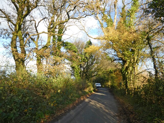
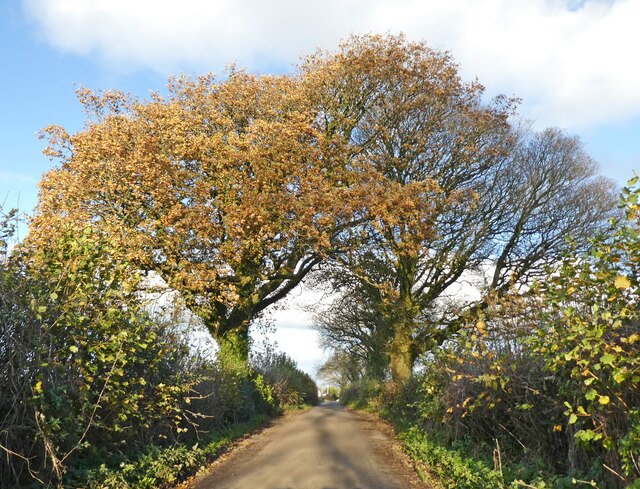
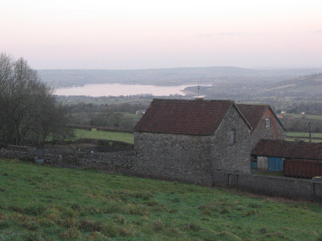
Frances Plantation, Somerset (Wood, Forest) is a historic and picturesque woodland area located in Somerset, England. Spanning approximately 200 acres, this plantation is renowned for its natural beauty and rich biodiversity. The woodland is predominantly composed of native deciduous trees, including oak, beech, and ash, creating a diverse and enchanting landscape.

Frances Plantation boasts a long and storied history, dating back several centuries. It is believed that the woodland was originally established as a hunting ground for the nobility during the medieval period. Over the years, it has changed ownership multiple times and has been carefully preserved and managed to maintain its natural charm.

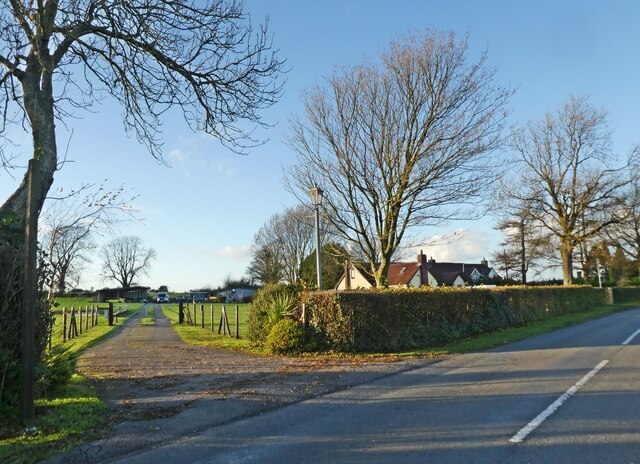
The plantation offers a range of recreational activities for nature enthusiasts and visitors alike. There are several well-maintained walking trails that wind through the woodland, providing an opportunity to explore and appreciate its diverse flora and fauna. Birdwatchers will delight in the variety of avian species that call Frances Plantation home, including woodpeckers, owls, and various songbirds.

In addition to its natural beauty, Frances Plantation also serves as an important habitat for wildlife. It provides a sanctuary for numerous mammal species, such as deer, foxes, and badgers. The woodland's tranquil atmosphere and secluded location make it a haven for wildlife, allowing visitors to catch a glimpse of these creatures in their natural habitat.

Frances Plantation, Somerset (Wood, Forest) continues to be a cherished destination for those seeking solace in nature. Its timeless beauty and historical significance make it a must-visit location for anyone interested in experiencing the natural wonders of Somerset.

If you have any feedback on the listing, please let us know in the comments section below.

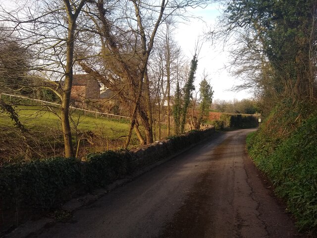
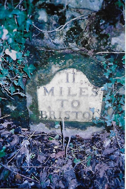
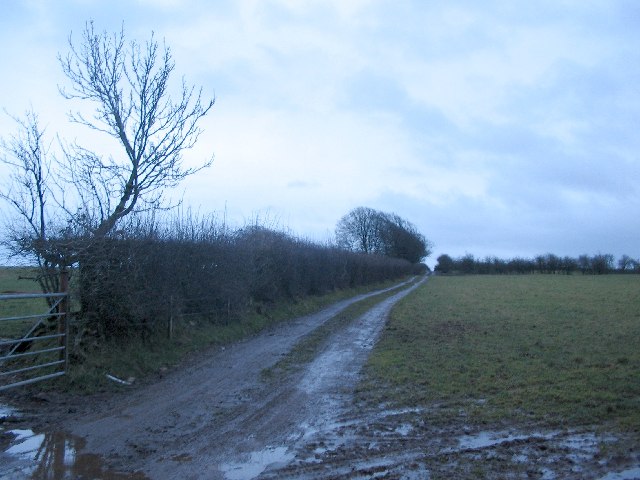
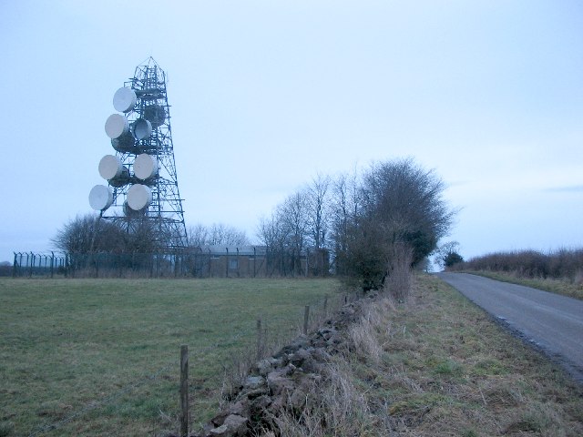
Frances Plantation Images

Images are sourced within 2km of 51.288107/-2.6435504 or Grid Reference ST5554. Thanks to Geograph Open Source API. All images are credited.

Snowdrops on a wall Snowdrops growing on a drystone wall beside Smitham Hill, north of East Harptree.
Snowdrops on a wall
Snowdrops growing on a drystone wall beside Smitham Hill, north of East Harptree.
Lane to Compton Martin
Ewe Lane
Ewe Lane
'Lambs Lair'
'Lambs Lair'
Entrance, Vale Hollow Farm
Field at East Harptree
Old stile and wall at East Harptree
Water Street looking Northeast
Old Milestone by B3134, Harptree Hill, near West Harptree The Milestone is located set in wall south of Tavistock Lodge on the North of the road.  Parish of West Harptree (North Somerset District). Metal plate attached to stone post, Bristol iron plate design, erected by the  Bristol turnpike trust in the 18th Century, plate going rusty. An earlier photograph can be found here: <a title="https://www.geograph.org.uk/photo/6056482" href="https://www.geograph.org.uk/photo/6056482">Link</a>

Inscription reads:-  11 / MILES / TO / BRISTOL  

Milestone Society National ID: SO_BRWL11
Old Milestone by B3134, Harptree Hill, near West Harptree
The Milestone is located set in wall south of Tavistock Lodge on the North of the road.  Parish of West Harptree (North Somerset District). Metal plate attached to stone post, Bristol iron plate design, erected by the Bristol turnpike trust in the 18th Century, plate going rusty. An earlier photograph can be found here: Link Inscription reads:- 11 / MILES / TO / BRISTOL Milestone Society National ID: SO_BRWL11
Rose Cottage  Water Street looking Northeast, with Rose Cottage on the right, which was built in 1863.
Rose Cottage
Water Street looking Northeast, with Rose Cottage on the right, which was built in 1863.
Smitham Chimney Smitham Chimney in East Harptree Woods
Smitham Chimney
Smitham Chimney in East Harptree Woods
Overhead Pipe in Harptree Combe Comes as a bit of a surprise in the tight strip of woodland in Harptree Combe.
The pipe is an aqueduct built in 1850 as part of the first modern water supply to Bristol. It taps a number of springs in the Chewton Mendip area and delivers the water to the Barrow Reservoirs <a href="https://www.geograph.org.uk/photo/85084">ST5367 : Barrow Reservoir</a> <a href="https://www.geograph.org.uk/photo/1004867">ST5467 : Barrow Tanks</a>. The tube is of wrought iron and still in original condition.
Overhead Pipe in Harptree Combe
Comes as a bit of a surprise in the tight strip of woodland in Harptree Combe. The pipe is an aqueduct built in 1850 as part of the first modern water supply to Bristol. It taps a number of springs in the Chewton Mendip area and delivers the water to the Barrow Reservoirs ST5367 : Barrow Reservoir ST5467 : Barrow Tanks. The tube is of wrought iron and still in original condition.
Public Footpath on Niver Hill A view looking southeast along the public footpath leading to the summit of Niver Hill,  behind the hedge at right.
Public Footpath on Niver Hill
A view looking southeast along the public footpath leading to the summit of Niver Hill, behind the hedge at right.
WT Station A view looking northeast along the minor road from the Castle of Comfort public house to East Harptree, showing the wireless telegraphy station and its impressive collection of microwave dishes.
WT Station
A view looking northeast along the minor road from the Castle of Comfort public house to East Harptree, showing the wireless telegraphy station and its impressive collection of microwave dishes.
Church at East Harptree A view looking west to the church of St. Lawrence at East Harptree.
Church at East Harptree
A view looking west to the church of St. Lawrence at East Harptree.
Pitt Farm A view looking north over Pitt Farm, with Chew Valley Lake in the distance.
Pitt Farm
A view looking north over Pitt Farm, with Chew Valley Lake in the distance.
Stone Stile A view looking west to the stile at the start of the footpath which runs adjacent to St Lawrence church at East Harptree.
Stone Stile
A view looking west to the stile at the start of the footpath which runs adjacent to St Lawrence church at East Harptree.
Show me another place!

Frances Plantation is located at Grid Ref: ST5554 (Lat: 51.288107, Lng: -2.6435504)

Administrative County: Somerset

District: Mendip

Police Authority: Avon and Somerset

What 3 Words

///decoded.wipe.presides. Near East Harptree, Somerset

Related Wikis

Smitham Chimney, East Harptree

Smitham Chimney is a chimney which was used for lead mining just outside the village of East Harptree, in the parish of Priddy, Somerset, England. It is...

Lamb Leer

Lamb Leer (grid reference ST544550) is a 14.59 hectare (36.04 acre) geological Site of Special Scientific Interest between East Harptree and Priddy in...

Wurt Pit and Devil's Punchbowl

Wurt Pit and Devil's Punchbowl (grid reference ST543537) is a 0.2 hectare (0.5 acre) geological Site of Special Scientific Interest between East Harptree...

Harptree Combe

Harptree Combe (grid reference ST561558) is a 13.63-hectare (33.68-acre) Site of Special Scientific Interest (SSSI) near East Harptree notified in 1954...

Richmont Castle

Richmont Castle was an 11th-century motte-and-bailey castle near the village of East Harptree, Somerset, England. Now totally ruined, it once included...

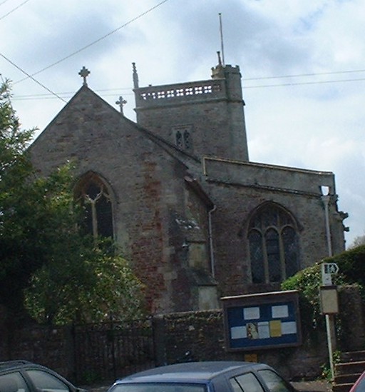
Church of St Laurence, East Harptree

The Church of St Laurence in East Harptree, Somerset, England, was built in the late 12th century. It is a Grade II* listed building.The original 12th...

East Harptree

East Harptree is a village and civil parish in Somerset, England. It is situated 5 miles (8.0 km) north of Wells and 15 miles (24.1 km) south of Bristol...
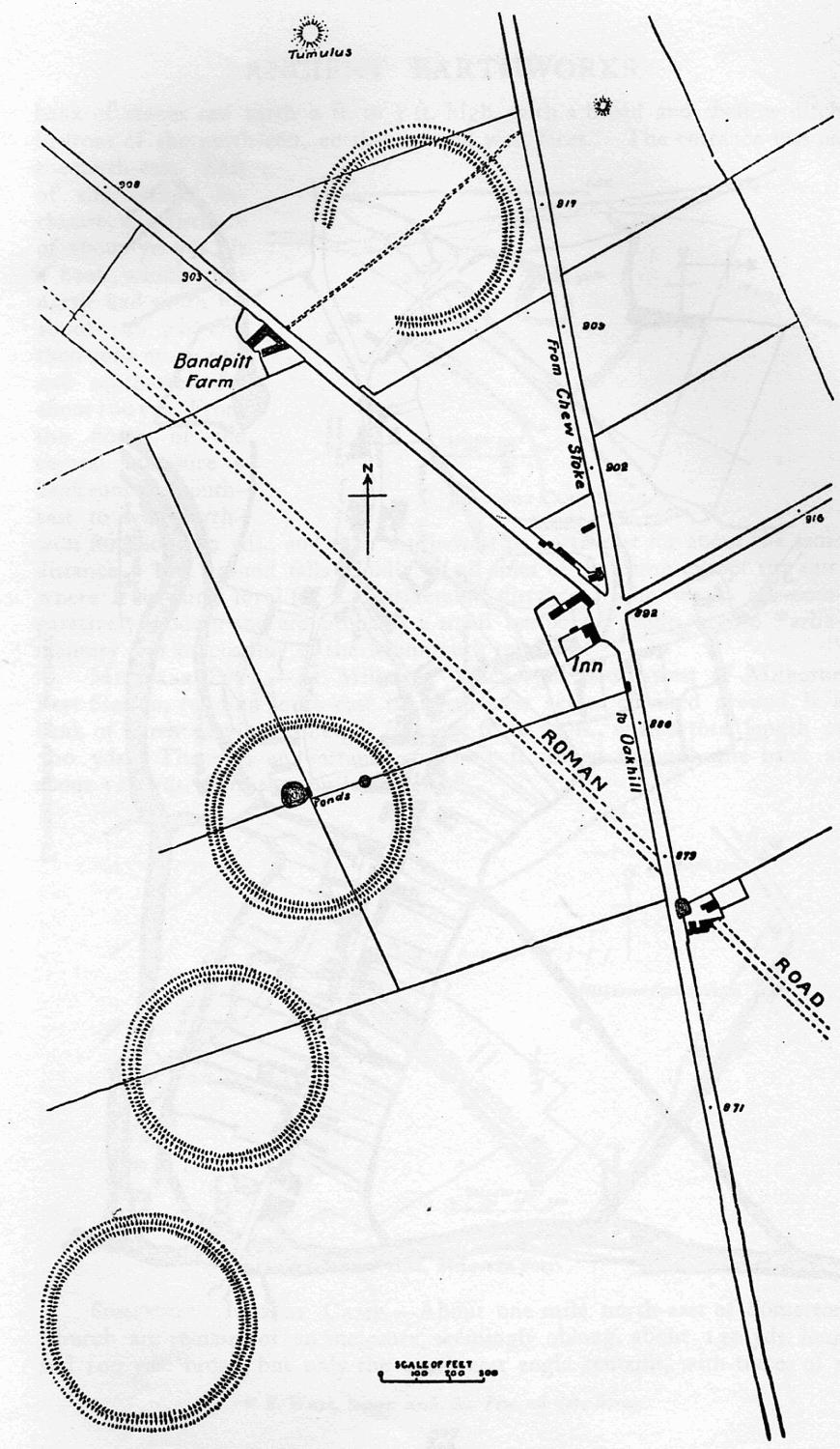
Priddy Circles

Priddy Circles are a linear arrangement of four circular earthwork enclosures near the village of Priddy on the Mendip Hills in Somerset, England. The...

Nearby Amenities

Located within 500m of 51.288107,-2.6435504
Man Made: chimney
Lat/Long: 51.2888997/-2.6406646
The data included in this document is from www.openstreetmap.org. The data is made available under ODbL.

Have you been to Frances Plantation?

Leave your review of Frances Plantation below (or comments, questions and feedback).