Bantyhill Wood
Wood, Forest in Cumberland Eden
England
Bantyhill Wood

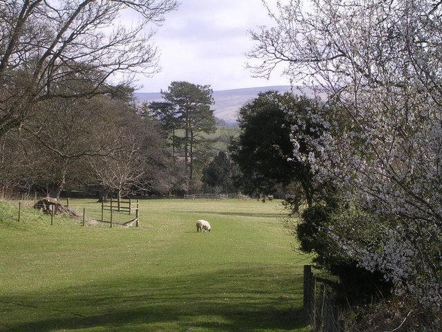
Bantyhill Wood is a picturesque forest located in Cumberland, England. Covering an area of approximately 100 acres, this woodland is a haven for nature enthusiasts and outdoor lovers alike.
The wood is characterized by its diverse range of tree species, including oak, beech, birch, and pine, creating a rich and vibrant landscape throughout the seasons. The canopy of the trees provides a sheltered environment, allowing a variety of flora and fauna to thrive within its boundaries.
Walking through Bantyhill Wood, visitors will find themselves immersed in a tranquil and peaceful atmosphere. The forest floor is blanketed with lush green moss and delicate wildflowers, creating a colorful carpet beneath the towering trees. The gentle sound of birdsong can be heard throughout, adding to the enchanting ambiance.
The wood is home to an array of wildlife, making it a prime spot for nature observation. Squirrels dart among the branches, while deer and foxes roam freely. Birdwatchers will delight in the chance to spot species such as woodpeckers, owls, and various songbirds.
Bantyhill Wood provides a range of recreational opportunities for visitors. There are well-maintained trails and pathways meandering through the forest, allowing for leisurely walks and hikes. Picnic areas are scattered throughout, providing a perfect spot to enjoy a meal surrounded by nature.
Overall, Bantyhill Wood offers a serene and idyllic setting for those seeking a peaceful retreat into nature. Its diverse ecosystem, stunning scenery, and abundant wildlife make it a truly captivating destination for outdoor enthusiasts and nature lovers alike.
If you have any feedback on the listing, please let us know in the comments section below.
Bantyhill Wood Images
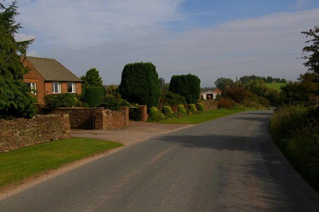
Images are sourced within 2km of 54.715741/-2.6995342 or Grid Reference NY5535. Thanks to Geograph Open Source API. All images are credited.


Bantyhill Wood is located at Grid Ref: NY5535 (Lat: 54.715741, Lng: -2.6995342)
Administrative County: Cumbria
District: Eden
Police Authority: Cumbria
What 3 Words
///salary.activates.safety. Near Penrith, Cumbria
Nearby Locations
Related Wikis

Great Salkeld
Great Salkeld is a small village and civil parish in the Eden District of Cumbria, England, a few miles to the north east of Penrith and bordering the...

Little Salkeld railway station
Little Salkeld was a railway station which served the village of Little Salkeld in Hunsonby parish and Great Salkeld, Cumbria, England. The Settle-Carlisle...
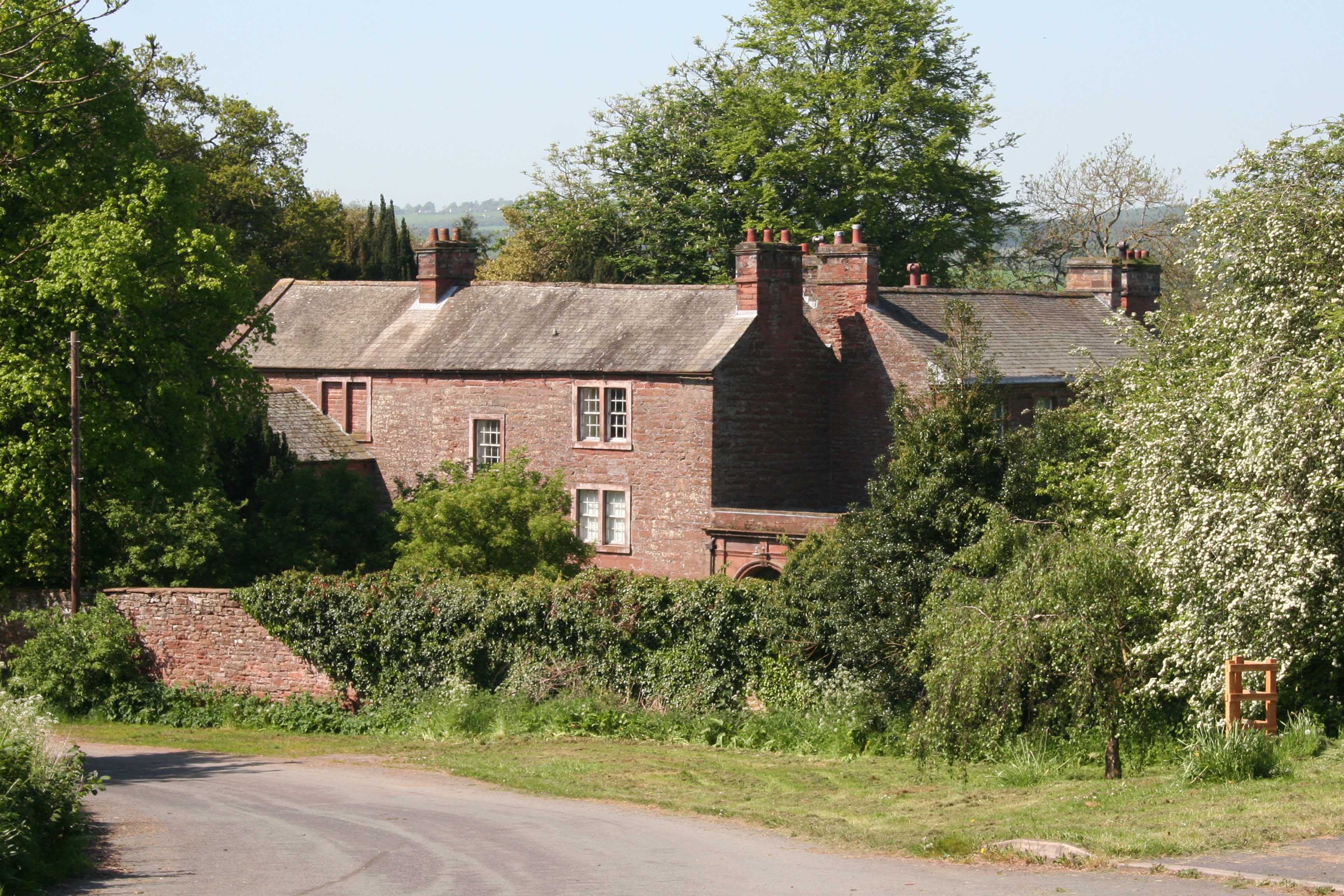
Salkeld Hall
Salkeld Hall is a red sandstone Grade II* listed country house in the village of Little Salkeld, Cumbria, England and is the original residence of the...

Little Salkeld rail accident
The Little Salkeld rail accident occurred on 19 January 1918 in Long Meg cutting, between Little Salkeld and Lazonby railway stations (about 15 miles south...

Little Salkeld
Little Salkeld is a small village and former civil parish, now in the parish of Hunsonby, in the Eden district of Cumbria, England, a few miles to the...

Penrith and The Border (UK Parliament constituency)
Penrith and The Border is a constituency in Cumbria represented in the House of Commons of the UK Parliament since 2019 by Neil Hudson, a Conservative...

Long Meg Mine
Long Meg Mine is a disused gypsum mine just north of Little Salkeld, Cumbria in the area known as Cave Wood Valley. It was operated between 1880 and 1976...
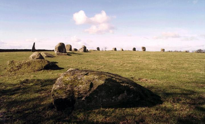
Long Meg and Her Daughters
Long Meg and Her Daughters is a Neolithic stone circle situated north-east of Penrith near Little Salkeld in Cumbria, North West England. One of around...
Nearby Amenities
Located within 500m of 54.715741,-2.6995342Have you been to Bantyhill Wood?
Leave your review of Bantyhill Wood below (or comments, questions and feedback).