Boatwood Plantation

Wood, Forest in Gloucestershire Forest of Dean

England

Boatwood Plantation

Path along course of Wye Valley Railway near Tintern
Path along course of Wye Valley Railway near Tintern Credit: Gareth James

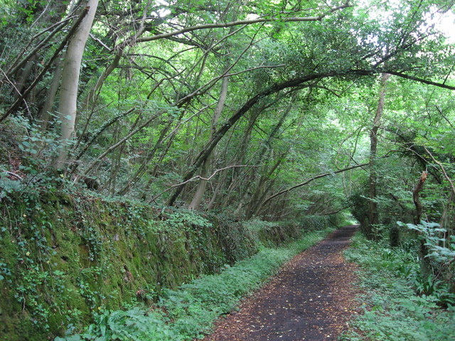
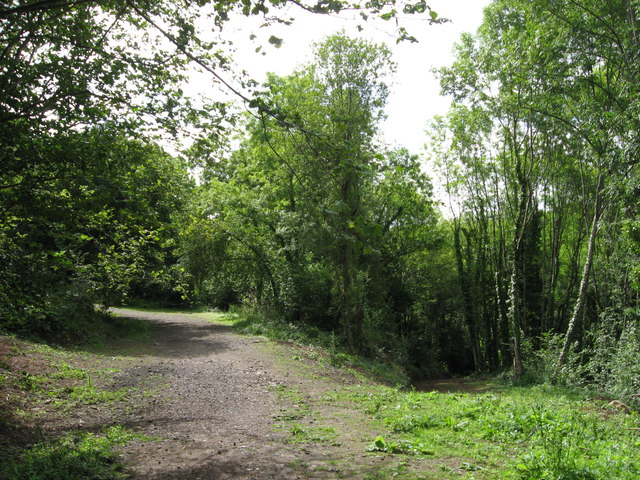
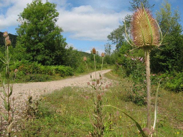
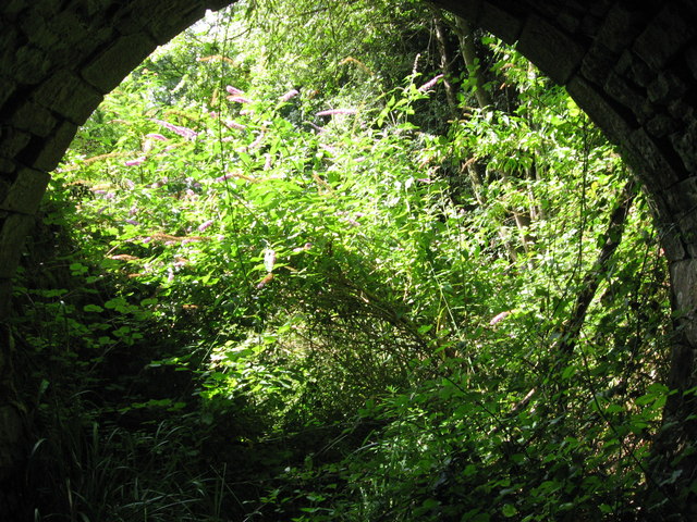
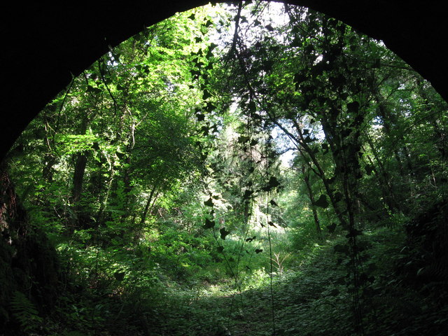
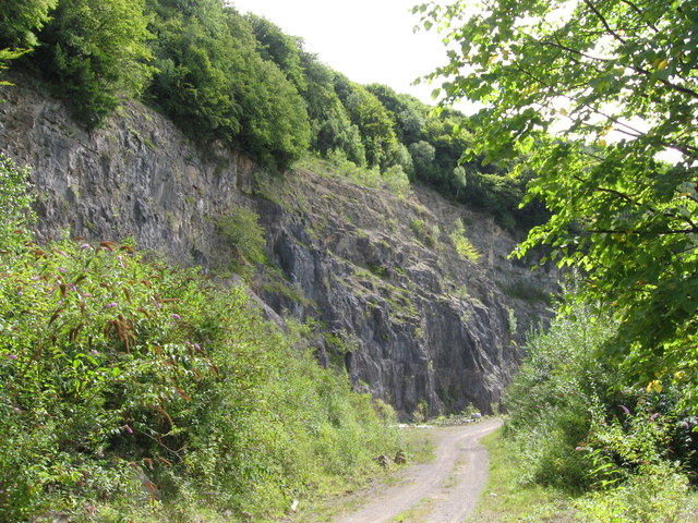
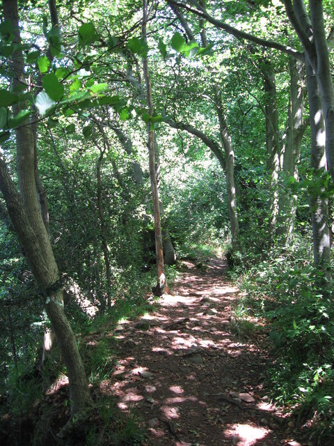
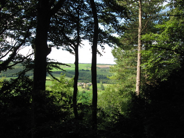
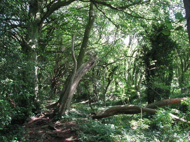
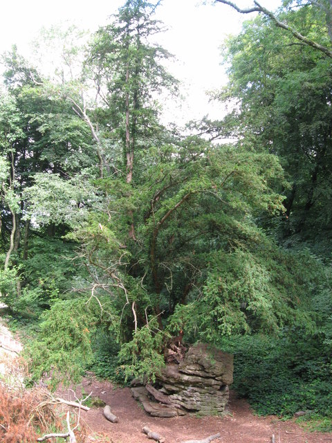
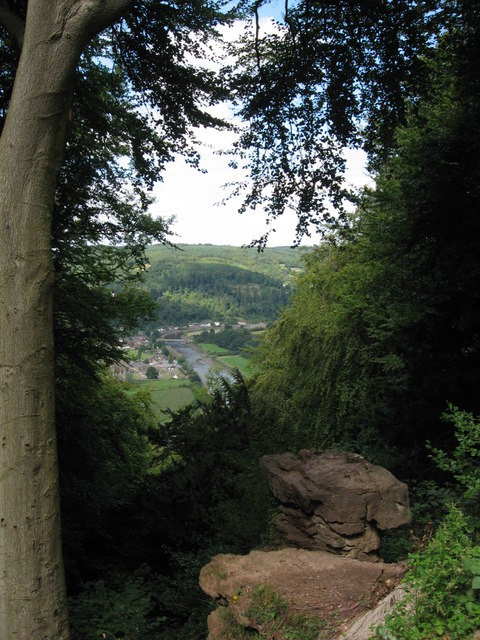
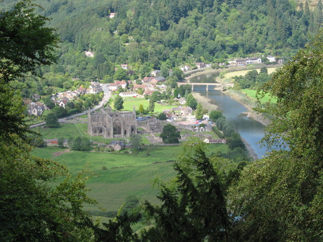
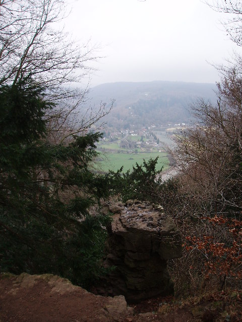
Boatwood Plantation is a picturesque woodland area located in Gloucestershire, England. Spread over a vast expanse, the plantation is renowned for its dense collection of ancient oak trees, which have stood tall for centuries. It is nestled in the heart of the enchanting Forest of Dean, making it a popular destination for nature enthusiasts and tourists.

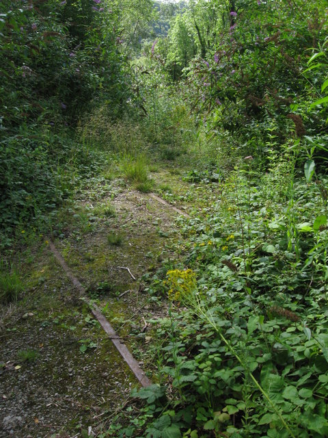
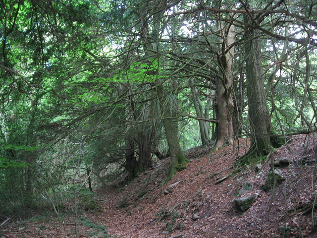
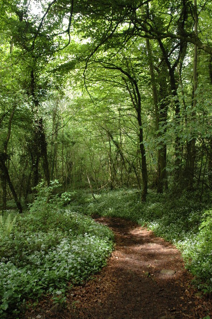
The woodland boasts an impressive biodiversity, with a diverse range of flora and fauna. The lush greenery provides a haven for numerous bird species, including woodpeckers and owls, making it a paradise for birdwatchers. Additionally, the forest floor is adorned with a carpet of vibrant wildflowers during the spring and summer months, adding to the plantation's natural charm.

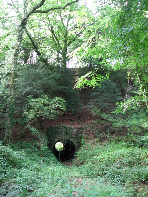
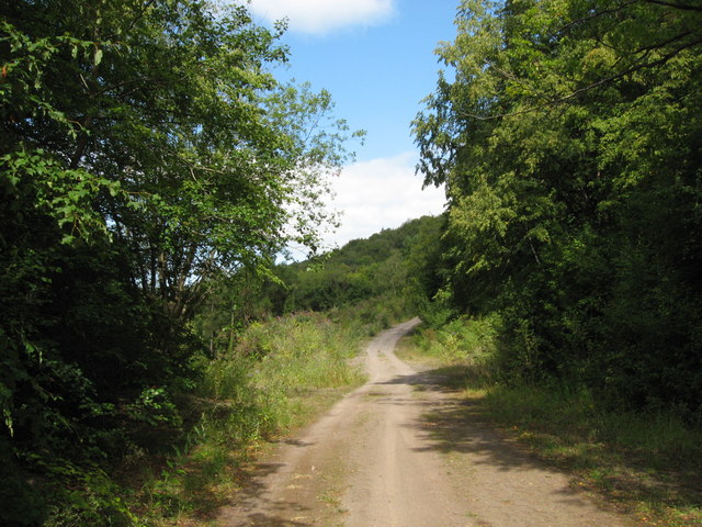
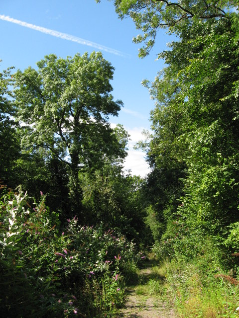
Visitors to Boatwood Plantation can explore its winding pathways and discover hidden gems along the way. The tranquil atmosphere is perfect for leisurely walks, picnics, and photography. The plantation also features designated areas for camping, allowing visitors to immerse themselves in the beauty of the surroundings for a longer period.

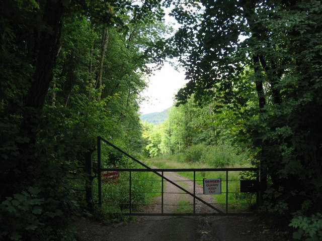
Boatwood Plantation is well-maintained, with clear signage and well-kept trails. It is easily accessible, with ample parking facilities available nearby. The plantation is open to the public throughout the year, with no admission fees, making it an affordable and family-friendly destination.

In summary, Boatwood Plantation in Gloucestershire is a captivating woodland retreat, offering visitors a chance to escape the hustle and bustle of everyday life and immerse themselves in the tranquility of nature.

If you have any feedback on the listing, please let us know in the comments section below.

Boatwood Plantation Images

Images are sourced within 2km of 51.683323/-2.6518452 or Grid Reference ST5598. Thanks to Geograph Open Source API. All images are credited.

Path along course of Wye Valley Railway near Tintern
Path along course of Wye Valley Railway near Tintern The railway line carried on straight ahead at this point, through the trees. Walkers now have a choice and can drop down right, or go up to the left.
Path along course of Wye Valley Railway near Tintern
The railway line carried on straight ahead at this point, through the trees. Walkers now have a choice and can drop down right, or go up to the left.
Path junction in woods near River Wye
Tunnel beneath disused railway line near Tintern Quarry
(No) light at the end of the tunnel The path at the western end of the tunnel (<a href="https://www.geograph.org.uk/photo/2544718">ST5498 : Tunnel beneath disused railway line near Tintern Quarry</a>) is very overgrown and currently impassable.
(No) light at the end of the tunnel
The path at the western end of the tunnel (ST5498 : Tunnel beneath disused railway line near Tintern Quarry) is very overgrown and currently impassable.
Path from tunnel under railway near Tintern Quarry The view from the eastern portal of <a href="https://www.geograph.org.uk/photo/2544718">ST5498 : Tunnel beneath disused railway line near Tintern Quarry</a> shows an overgrown, but still passable path.
Path from tunnel under railway near Tintern Quarry
The view from the eastern portal of ST5498 : Tunnel beneath disused railway line near Tintern Quarry shows an overgrown, but still passable path.
Path near Tintern Quarry
Disused railway near Tintern Quarry The rails are still in place, though obviously have not seen a train for many years!
Disused railway near Tintern Quarry
The rails are still in place, though obviously have not seen a train for many years!
Part of Tintern Quarry
Footpath near Tintern Quarry
Gateway to Tintern Quarry
Beside Offa's Dyke
Beside Offa's Dyke
On Offa's Dyke
On Offa's Dyke
View west from Offa's Dyke Reddings Farm can be seen between the trees.
View west from Offa's Dyke
Reddings Farm can be seen between the trees.
On Offa's Dyke
On Offa's Dyke
Yew tree growing from rocky outcrop Near the Devil's Pulpit on Offa's Dyke.
Yew tree growing from rocky outcrop
Near the Devil's Pulpit on Offa's Dyke.
The Devil's Pulpit
The Devil's Pulpit
View from the Devil's Pulpit As seen in <a href="https://www.geograph.org.uk/photo/2544763">ST5499 : The Devil's Pulpit</a>, the view is over Tintern, with its Abbey, the River Wye and the Wireworks Branch bridge prominent.
View from the Devil's Pulpit
As seen in ST5499 : The Devil's Pulpit, the view is over Tintern, with its Abbey, the River Wye and the Wireworks Branch bridge prominent.
Show me another place!

Boatwood Plantation is located at Grid Ref: ST5598 (Lat: 51.683323, Lng: -2.6518452)

Administrative County: Gloucestershire

District: Forest of Dean

Police Authority: Gloucestershire

What 3 Words

///jumps.flitting.dockers. Near Tintern, Monmouthshire

Related Wikis

Tintern Quarry

Tintern Quarry was a quarry in the Forest of Dean, Gloucestershire, England. It was served by the Wye Valley Railway from 1876 until it closed in 1981...

Miss Grace's Lane

Miss Grace's Lane (also known as Miss Grace's Lane Swallett), near Tidenham in the Forest of Dean, Gloucestershire, England, is a natural cave system,...

Poor's Allotment

Poor's Allotment (grid reference ST560990) is a 28.57-hectare (70.6-acre) biological Site of Special Scientific Interest in Gloucestershire, notified in...

Devil's Pulpit, Gloucestershire

The Devil's Pulpit is a rocky limestone outcrop and scenic viewpoint in the Forest of Dean District of Gloucestershire, England, within the Wye Valley...

Ridley Bottom, Tidenham

Ridley Bottom (grid reference ST563985) is a 1.1-hectare (2.7-acre) nature reserve in Gloucestershire. The site is listed in the 'Forest of Dean Local...

Boughspring

Boughspring is a hamlet in Gloucestershire, England. == History == Settlement at Boughspring dates back to Roman times when a villa was built nearby. Boughspring...

Lippets Grove

Lippets Grove (grid reference SO540000) is a 5-hectare (12-acre) nature reserve in Gloucestershire. The site was leased from the Forestry Commission in...

Caerwood and Ashberry Goose House

Caerwood And Ashberry Goose House (ST54719655 ST54649657) is a 0.01-hectare (0.025-acre) biological Site of Special Scientific Interest in Gloucestershire...

Nearby Amenities

Located within 500m of 51.683323,-2.6518452
Post Box
Post Box Type: lamp
Ref: NP16 425
Royal Cypher: EIIR
Royal Cypher Wikidata: Q33102113
Lat/Long: 51.6837425/-2.6463282
Bus Stop
Miss Grace's Ln
Naptan AtcoCode: 1600GLF753
Naptan Bearing: S
Naptan CommonName: Miss Grace's Ln
Naptan NaptanCode: gloadgwg
Naptan Street: B4228
Naptan Verified: no
Source: naptan_import
Lat/Long: 51.6832608/-2.6466307
Bus Stop
Miss Grace's Ln
Naptan AtcoCode: 1600GLF754
Naptan Bearing: NE
Naptan CommonName: Miss Grace's Ln
Naptan NaptanCode: gloadgwm
Naptan Street: B4228
Naptan Verified: no
Source: naptan_import
Lat/Long: 51.6837206/-2.6464058
Description: Tumuli
Historic: archaeological_site
Source: NPE
Lat/Long: 51.6833927/-2.6479517
Tidenham Chase
Place: village
Source: OS_OpenData_StreetView
Wikidata: Q115648427
Lat/Long: 51.6835191/-2.6470832
Give Way
Direction: forward
Lat/Long: 51.6835668/-2.6465204
Give Way
Direction: backward
Lat/Long: 51.6819249/-2.6471824
Power: pole
Transformer: distribution
Lat/Long: 51.6841375/-2.6466724
Power: pole
Lat/Long: 51.6840261/-2.6468521
Power: pole
Lat/Long: 51.6832445/-2.6473269
Power: pole
Lat/Long: 51.6824878/-2.6478714
Power: pole
Lat/Long: 51.6815565/-2.6474154
Power: pole
Transformer: distribution
Lat/Long: 51.6798568/-2.6483703
The data included in this document is from www.openstreetmap.org. The data is made available under ODbL.

Have you been to Boatwood Plantation?

Leave your review of Boatwood Plantation below (or comments, questions and feedback).