Church Grove

Wood, Forest in Gloucestershire Forest of Dean

England

Church Grove

Footpath north from Stowe Lane Complete with cock pheasant.
Footpath north from Stowe Lane Credit: Jonathan Billinger

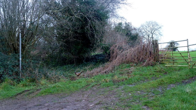
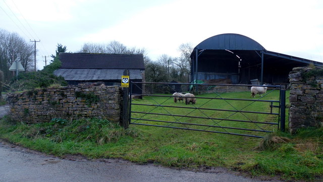
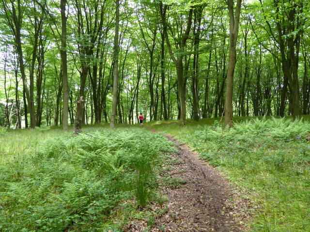
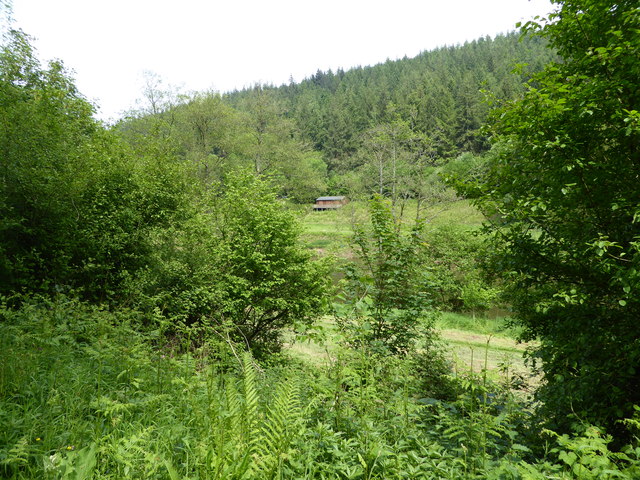
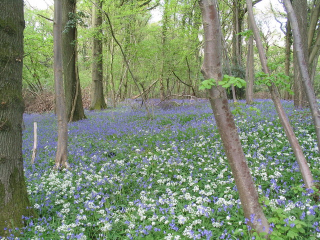
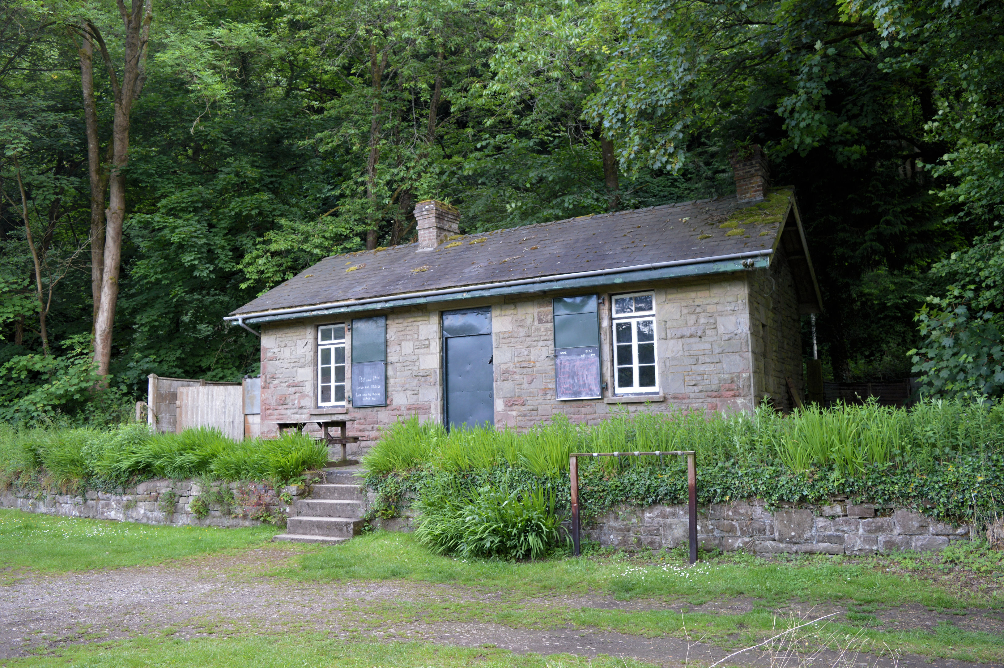
Church Grove is a picturesque woodland area located in Gloucestershire, England. Nestled in the heart of the county, this serene and tranquil forest is known for its natural beauty and rich history. Covering a vast area, Church Grove is a haven for nature lovers and outdoor enthusiasts alike.

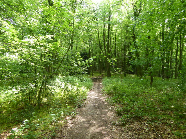
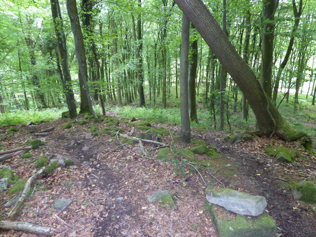
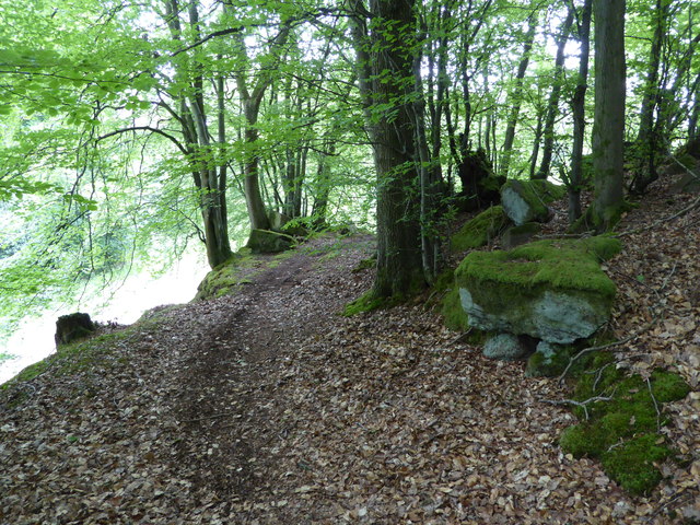
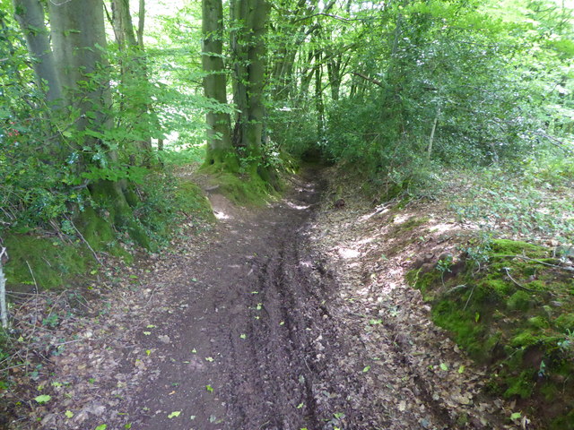
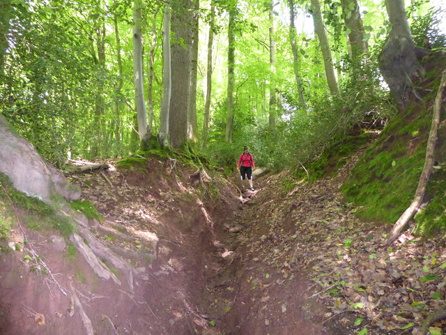
The woodland is characterized by its dense canopy of ancient trees, including oak, beech, and ash. These towering giants provide a home to a diverse range of flora and fauna, creating a thriving ecosystem within the forest. Visitors can expect to encounter various species of birds, mammals, and insects as they explore the grove.

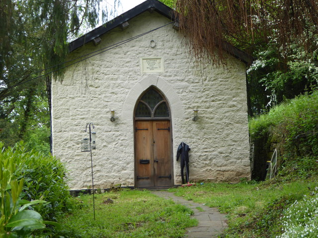
One of the main attractions of Church Grove is its namesake church, St. Mary's. This historic church dates back to the 12th century and boasts stunning architecture and intricate stained glass windows. It serves as a reminder of the area's deep-rooted religious heritage and provides a peaceful spot for reflection amidst the natural surroundings.

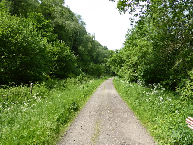
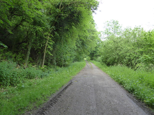
The grove offers a network of well-maintained walking trails, allowing visitors to immerse themselves in the beauty of the woodland. These trails lead to various points of interest, including a picturesque pond, which is home to a variety of aquatic life.

Church Grove is not only a sanctuary for nature enthusiasts but also a popular destination for photographers and artists, who are captivated by its ethereal beauty and serene atmosphere. Whether it's a leisurely stroll, a picnic among the trees, or simply enjoying the sights and sounds of nature, Church Grove offers a truly enchanting experience for all who visit.

If you have any feedback on the listing, please let us know in the comments section below.

Church Grove Images

Images are sourced within 2km of 51.758129/-2.6618326 or Grid Reference SO5406. Thanks to Geograph Open Source API. All images are credited.

Footpath north from Stowe Lane Complete with cock pheasant.
Footpath north from Stowe Lane
Complete with cock pheasant.
Stowegreen Farm Some ewes in the very safe pasture next to the barns.
Stowegreen Farm
Some ewes in the very safe pasture next to the barns.
Old Baptist Chapel at Whitebrook Churches and chapels no. 49. The old Baptist Chapel is on a very steep descent from Pen-y-Fan. Built in 1829 now converted to a dwelling.
Old Baptist Chapel at Whitebrook
Churches and chapels no. 49. The old Baptist Chapel is on a very steep descent from Pen-y-Fan. Built in 1829 now converted to a dwelling.
Footpath into the woods Nice May walking.
Footpath into the woods
Nice May walking.
A walk in the woods Nice walking.
A walk in the woods
Nice walking.
On a path in the woods Mountain bikers seem to like riding under this leaning tree.
On a path in the woods
Mountain bikers seem to like riding under this leaning tree.
Old path in the wood We discovered this old route.
Old path in the wood
We discovered this old route.
Old sunken way in the wood Now much used by mountain bikes and scramblers.
Old sunken way in the wood
Now much used by mountain bikes and scramblers.
Old sunken way in the wood Used and it seems abused by motorbike scramblers. The track has been eroded.
Old sunken way in the wood
Used and it seems abused by motorbike scramblers. The track has been eroded.
In the wood above Whitebrook, Mnmouthshire The village emerges beneath us.
In the wood above Whitebrook, Mnmouthshire
The village emerges beneath us.
Part of Whitebrook village The old Trinity church is now a holiday let I believe.
Part of Whitebrook village
The old Trinity church is now a holiday let I believe.
In Whitebrook village A house here, once a pub I believe.
In Whitebrook village
A house here, once a pub I believe.
Farm house at Whitebrook A handsome place.
Farm house at Whitebrook
A handsome place.
Beside the Wye at Whitebrook, Monmouthshire A dairy herd graze here beside the river.
Beside the Wye at Whitebrook, Monmouthshire
A dairy herd graze here beside the river.
On the Wye Valley Walk north of Whitebrook On the old railway line.
On the Wye Valley Walk north of Whitebrook
On the old railway line.
Part of the River Wye / Afon Gwy north of Whitebrook A family group has alighted from their Canadian canoes and is settling on the English river bank meadow for their lunch. Lucky peeps.
Part of the River Wye / Afon Gwy north of Whitebrook
A family group has alighted from their Canadian canoes and is settling on the English river bank meadow for their lunch. Lucky peeps.
On the Wye Valley Walk between Whitebrook and Redbrook On the Welsh bank heading north on the old railway line.
On the Wye Valley Walk between Whitebrook and Redbrook
On the Welsh bank heading north on the old railway line.
View across the River Wye near Whitebrook To a fishing bothy on the English bank.
View across the River Wye near Whitebrook
To a fishing bothy on the English bank.
Show me another place!

Church Grove is located at Grid Ref: SO5406 (Lat: 51.758129, Lng: -2.6618326)

Administrative County: Gloucestershire

District: Forest of Dean

Police Authority: Gloucestershire

What 3 Words

///recruiter.boosted.juggler. Near Coleford, Gloucestershire

Related Wikis

Whitebrook Halt railway station

Whitebrook Halt was a request stop on the former Wye Valley Railway. It was opened in 1927 to serve the village of Whitebrook. It was closed in 1959 when...

Bigsweir Woods

Bigsweir Woods (grid reference SO546060) is a 48.16-hectare (119.0-acre) biological Site of Special Scientific Interest in Gloucestershire, notified in...

Whitebrook

Whitebrook (Welsh: Gwenffrwd) is a small village in Monmouthshire, south-east Wales, United Kingdom. It is located four miles south east of Monmouth in...

Lower Hael Wood

Lower Hael Wood is a semi-ancient woodland and Site of Special Scientific Interest (SSSI), noted for its biological characteristics, in Monmouthshire,...

The Whitebrook

The Whitebrook, formerly known as The Crown at Whitebrook, is a restaurant with rooms in Whitebrook, 6 miles (9.7 km) south-south-east of Monmouth, Monmouthshire...

Bigsweir Bridge

Bigsweir Bridge is an 1827 road bridge crossing the River Wye, straddling the boundary between the parish of St. Briavels, Gloucestershire, England, and...

Highbury Wood

Highbury Wood (grid reference SO540086) is a 50.74-hectare (125.4-acre) biological Site of Special Scientific Interest in Gloucestershire, notified in...

St Briavels railway station

St Briavels Station was a station along the Wye Valley Railway. It was built in 1876 during the construction of the line on the Monmouthshire side of the...

Nearby Amenities

Located within 500m of 51.758129,-2.6618326
Bus Stop
The Florence Hotel
Bench: no
Naptan AtcoCode: 1600GLF433
Naptan Bearing: S
Naptan CommonName: The Florence Hotel
Naptan NaptanCode: gloadawj
Naptan Street: Lower Wye Valley Rd A466
Naptan Verified: no
Shelter: no
Source: naptan_import
Lat/Long: 51.7537136/-2.6620078
Bus Stop
Wyeseal Farm
Naptan AtcoCode: 1600GLF435
Naptan Bearing: SE
Naptan CommonName: Wyeseal Farm
Naptan Indicator: Opp
Naptan NaptanCode: gloadapg
Naptan Street: Lower Wye Valley Rd A466
Naptan Verified: no
Source: naptan_import
Lat/Long: 51.7585879/-2.6650348
Bus Stop
Wyeseal Farm
Naptan AtcoCode: 1600GLF436
Naptan Bearing: NW
Naptan CommonName: Wyeseal Farm
Naptan NaptanCode: gloadamw
Naptan Street: Lower Wye Valley Rd A466
Naptan Verified: no
Source: naptan_import
Lat/Long: 51.7585774/-2.6652955
The data included in this document is from www.openstreetmap.org. The data is made available under ODbL.

Have you been to Church Grove?

Leave your review of Church Grove below (or comments, questions and feedback).