Apse Heath

Settlement in Hampshire

England

Apse Heath

Western entrance to Borthwood Copse Off Alverstone Road, via Public Footpath NC40 to Queens Bower half a mile away.
Western entrance to Borthwood Copse Credit: Paul Coueslant

Apse Heath is a small village located on the Isle of Wight, in the county of Hampshire, England. Situated in the southeastern part of the island, it lies approximately 5 miles southeast of Newport, the island's main town.

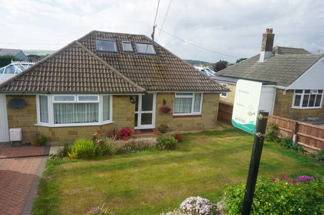
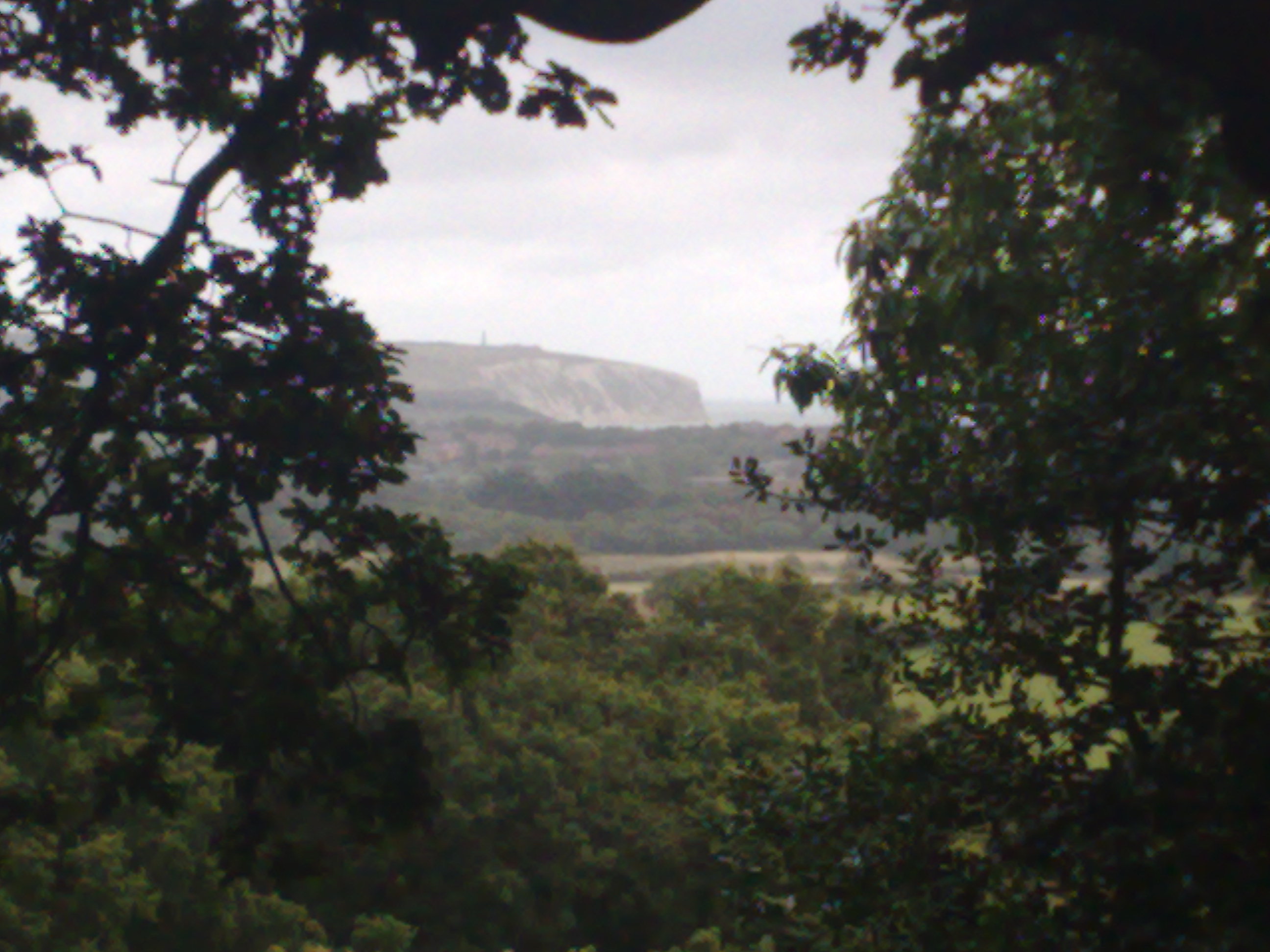
The village is known for its picturesque countryside, with rolling hills and open fields surrounding the area. It is primarily a residential area, with a mix of housing styles, ranging from traditional cottages to modern developments. The population of Apse Heath is relatively small, with around 500 residents.

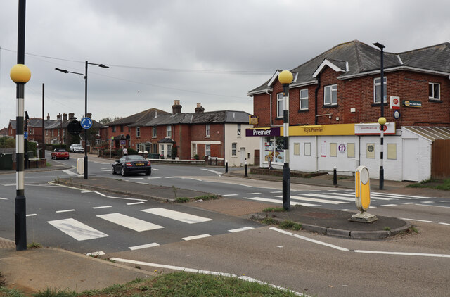
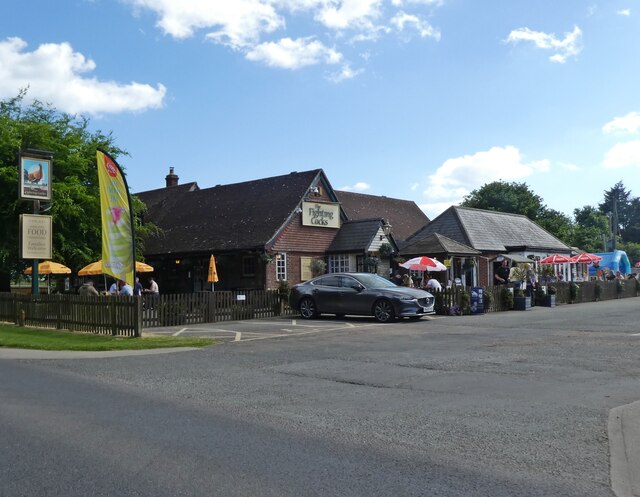
Despite its small size, Apse Heath offers a range of amenities to its residents. There is a local pub, The White Lion, which serves as a popular meeting place for locals and visitors alike. Additionally, there is a convenience store and a post office, providing essential services to the community.

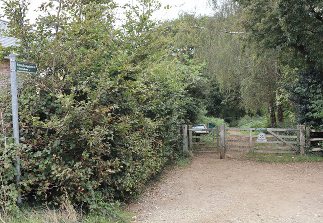
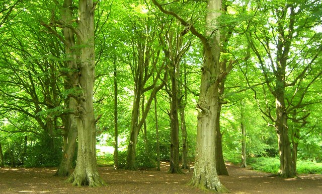
For outdoor enthusiasts, Apse Heath is a great location. The village is surrounded by beautiful countryside, perfect for walking, cycling, and exploring. Close by are several nature reserves, including Morton Marsh and Arreton Down, which offer opportunities for birdwatching and wildlife spotting.

Apse Heath is well-connected to other parts of the island, with regular bus services running through the village. It is also conveniently located near major transport links, such as the A3056 road, providing easy access to the rest of the Isle of Wight.

Overall, Apse Heath offers a peaceful and idyllic setting for those seeking a rural lifestyle, with its charming village atmosphere and access to stunning countryside.

If you have any feedback on the listing, please let us know in the comments section below.

Apse Heath Images

Images are sourced within 2km of 50.645861/-1.201554 or Grid Reference SZ5683. Thanks to Geograph Open Source API. All images are credited.

Western entrance to Borthwood Copse Off Alverstone Road, via Public Footpath NC40 to Queens Bower half a mile away.
Western entrance to Borthwood Copse
Off Alverstone Road, via Public Footpath NC40 to Queens Bower half a mile away.
Crossroads at Apse Heath Showing the single local store at the intersection of the A3056 Newport Road, with Alverstone Road to the north and Ventnor Road to the south.
Crossroads at Apse Heath
Showing the single local store at the intersection of the A3056 Newport Road, with Alverstone Road to the north and Ventnor Road to the south.
Mini roundabout on Newport Road
The Fighting Cocks
The Fighting Cocks
Thompson's on Watery Lane
Ager Farm Nursery on Harbors Lake Lane
Winford Road from Watery Lane
Bungalow on Forest Road, Winford
Morrisons supermarket near Sandown
Island Line class 483 train at Holliers Park Now-retired Island Line class 483 unit (and ex-London Transport 1938 stock) No. 483004 has found a new home at Holliers Park.
Island Line class 483 train at Holliers Park
Now-retired Island Line class 483 unit (and ex-London Transport 1938 stock) No. 483004 has found a new home at Holliers Park.
Bus Stop Cafe at Holliers Park
Sandown Airport On the map as Isle of Wight Airport but known locally as Sandown. This small Airport boasts a nice collection of old kites.
Link  <span class="nowrap"><a title="http://www.isleofwightairport.co.uk/" rel="nofollow ugc noopener" href="http://www.isleofwightairport.co.uk/">Link</a><img style="margin-left:2px;" alt="External link" title="External link - shift click to open in new window" src="https://s1.geograph.org.uk/img/external.png" width="10" height="10"/></span>
Sandown Airport
On the map as Isle of Wight Airport but known locally as Sandown. This small Airport boasts a nice collection of old kites. Link LinkExternal link
Entrance to Amazon World Entrance to Amazon World Wild Life Park. The large greenhouses in the background are for growing salad produce.
Entrance to Amazon World
Entrance to Amazon World Wild Life Park. The large greenhouses in the background are for growing salad produce.
NPS&CA Pavilion and Recreation Ground, Watery Lane
Borthwood Copse
Borthwood Copse
Garlic crop at Bathingbourne Farm
Sunshine Valley Trail Cycle and pedestrian route currently marked as a permissive footpath on the OS maps. The route follows the course of the old railway between Shanklin and Wroxall. The line was originally opened as an extension from Shanklin to Ventnor in 1866 but was closed in 1966. There has been talk of reopening the section but seems to have dissipated since the Island Line was privatised and taken over by Stagecoach in the 1990s.
Sunshine Valley Trail
Cycle and pedestrian route currently marked as a permissive footpath on the OS maps. The route follows the course of the old railway between Shanklin and Wroxall. The line was originally opened as an extension from Shanklin to Ventnor in 1866 but was closed in 1966. There has been talk of reopening the section but seems to have dissipated since the Island Line was privatised and taken over by Stagecoach in the 1990s.
Show me another place!

Apse Heath is located at Grid Ref: SZ5683 (Lat: 50.645861, Lng: -1.201554)

Unitary Authority: Isle of Wight

Police Authority: Hampshire

What 3 Words

///warthog.rely.wisely. Near Newchurch, Isle of Wight

Related Wikis

Apse Heath

Apse Heath is a hamlet on the Isle of Wight, UK. Apse Heath is centered on the intersection of Newport Road and Alverstone Road. At the 2011 Census the...

Princelett

Princelett, sometimes spelled "Princelet", is a hamlet on the Isle of Wight. Princelett is in Newchurch parish. Until the mid 20th Century it was known...

Ninham

Ninham is a hamlet on the Isle of Wight in the parish of Shanklin, and about 2 miles (3.3 km) away from Shanklin, the nearest tourist town. It is about...

Winford, Isle of Wight

Winford is a hamlet on the Isle of Wight which since the 1950s and particularly in the late 1970s has seen considerable housing development. The local...

Branstone, Isle of Wight

Branstone is a hamlet on the Isle of Wight, off the south coast of England. According to the Post Office the population of the hamlet at the 2011 Census...

Borthwood Copse

Borthwood Copse, near Sandown, Isle of Wight, England is a piece of woodland owned by the National Trust and is one of the numerous copses which make up...

America Wood

America Wood (grid reference SZ567820) is a 21.4 hectare biological Site of Special Scientific Interest on the Isle of Wight, notified in 1986. Legend...

Queen's Bower

Queen's Bower (or Queen Bower) is a hamlet on the Isle of Wight, England that has effectively merged with Winford and Apse Heath to create a village. It...

Nearby Amenities

Located within 500m of 50.645861,-1.201554
Mini Roundabout
Direction: clockwise
Lat/Long: 50.6470129/-1.2027976
Apse Heath
Place: hamlet
Wikidata: Q4782174
Wikipedia: en:Apse Heath
Lat/Long: 50.6473203/-1.2015868
Post Office
Apse Heath Post Office
Addr City: Sandown
Addr Country: GB
Addr Housenumber: 2
Addr Postcode: PO36 0JT
Addr Street: Ventnor Road
Addr Village: Apse Heath
Brand: Post Office
Brand Wikidata: Q1783168
Contact Website: https://www.postoffice.co.uk/branch-finder/0969354/apse-heath
Opening Hours: Mo-Su 08:00-18:30
Operator: Premier
Post Office Type: post_partner
Ref Pol Id: 1162
Lat/Long: 50.6469377/-1.2031007
Crossing
Crossing: uncontrolled
Crossing Ref: zebra
Kerb: lowered
Lat/Long: 50.6471035/-1.2030868
Source: Bing
Lat/Long: 50.6490235/-1.1971984
Source: Bing
Lat/Long: 50.6489905/-1.1974258
Bus Stop
Cheverton Shute
Bench: yes
Bus: yes
Contact Website: https://www.islandbuses.info/stops/230000003850
Naptan AtcoCode: 230000003850
Naptan Bearing: W
Naptan CommonName: Cheverton Shute
Naptan Indicator: towards Newport
Naptan NaptanCode: iowdgmg
Naptan Street: Newport Road
Public Transport: platform
Shelter: yes
Source: naptan_import
Lat/Long: 50.646446/-1.1967474
Bus Stop
Cheverton Shute
Bus: yes
Contact Website: https://www.islandbuses.info/stops/230000003860
Naptan AtcoCode: 230000003860
Naptan Bearing: E
Naptan CommonName: Cheverton Shute
Naptan Indicator: towards Shanklin
Naptan NaptanCode: iowdgmj
Naptan Street: Newport Road
Public Transport: platform
Shelter: yes
Source: naptan_import
Lat/Long: 50.646507/-1.1964571
Bus Stop
Smokey Hole
Bench: no
Bus: yes
Contact Website: https://www.islandbuses.info/stops/230000004020
Naptan AtcoCode: 230000004020
Naptan Bearing: N
Naptan CommonName: West of Winford
Naptan Indicator: towards Newport
Naptan NaptanCode: iowdgtp
Naptan Street: Alverstone Road
Public Transport: platform
Shelter: no
Source: naptan_import
Source Name: survey
Tactile Paving: no
Lat/Long: 50.6502253/-1.2016339
Bus Stop
Smokey Hole
Bench: no
Bus: yes
Contact Website: https://www.islandbuses.info/stops/230000004030
Naptan AtcoCode: 230000004030
Naptan Bearing: S
Naptan CommonName: West of Winford
Naptan Indicator: towards Shanklin
Naptan NaptanCode: iowdgtw
Naptan Street: Alverstone Road
Public Transport: platform
Shelter: no
Source: naptan_import
Source Name: survey
Tactile Paving: no
Lat/Long: 50.6499942/-1.2016822
Bus Stop
Apse Heath Crossroads
Bench: no
Bin: no
Bus: yes
Contact Website: https://www.islandbuses.info/stops/230000004060
Naptan AtcoCode: 230000004060
Naptan Bearing: W
Naptan CommonName: Apse Heath Cross Roads
Naptan Indicator: towards Newport
Naptan NaptanCode: iowdgwg
Naptan Street: Newport Road
Public Transport: platform
Shelter: no
Lat/Long: 50.646857/-1.2025662
Bus Stop
Apse Heath Crossroads
Bench: yes
Bin: yes
Bus: yes
Contact Website: https://www.islandbuses.info/stops/230000004070
Naptan AtcoCode: 230000004070
Naptan Bearing: E
Naptan CommonName: Apse Heath Cross Roads
Naptan Indicator: towards Shanklin
Naptan NaptanCode: iowdgwj
Naptan Street: Newport Road
Public Transport: platform
Ref GB Uprn: 10025500959
Shelter: yes
Source: naptan_import
Lat/Long: 50.6468748/-1.2020633
Post Box
Operator: Royal Mail
Operator Wikidata: Q638098
Post Box Type: pillar
Ref: PO36 52
Ref GB Uprn: 10015414168
Royal Cypher: GR
Royal Cypher Wikidata: Q33102273
Website: https://www.royalmail.com/services-near-you/postbox/apse-heath-post-office-po36-0lt/0000PO3652
Lat/Long: 50.6468889/-1.2029793
Power: pole
Lat/Long: 50.649182/-1.2052565
Power: pole
Lat/Long: 50.6489459/-1.2039471
Power: pole
Lat/Long: 50.6485055/-1.2012456
Material: wood
Power: pole
Source: Bing
Lat/Long: 50.6490111/-1.2026641
Power: pole
Source: Bing
Lat/Long: 50.6494065/-1.2046542
Power: pole
Lat/Long: 50.6483605/-1.2001155
Power: pole
Lat/Long: 50.648716/-1.2026587
Power: pole
Source: Bing
Lat/Long: 50.6484915/-1.2001613
Power: pole
Lat/Long: 50.6470315/-1.1984662
Power: pole
Lat/Long: 50.649105/-1.1990441
Power: pole
Lat/Long: 50.6447153/-1.1955813
Power: pole
Source: Bing
Lat/Long: 50.6491866/-1.1991272
Power: pole
Lat/Long: 50.6475807/-1.1991581
Raj's Premier
Addr City: Apse Heath, Sandown
Addr Country: GB
Addr Housenumber: 2
Addr Postcode: PO36 0JT
Addr Street: Ventnor Road
Brand: Premier
Brand Wikidata: Q7240340
Fhrs Id: 540532
Operator: Premier
Shop: convenience
Source Addr: FHRS Open Data
Website: https://www.premier-stores.co.uk/our-stores/rajs-premier-store
Lat/Long: 50.6469522/-1.203013
Barrier: stile
Foot: yes
Lat/Long: 50.6458084/-1.2061152
Barrier: stile
Lat/Long: 50.6464359/-1.1977418
Crossing
Crossing: uncontrolled
Crossing Ref: zebra
Kerb: lowered
Lat/Long: 50.6471661/-1.2030456
Turning Loop
Access: private
Lat/Long: 50.6427914/-1.2021577
Hiking: yes
Information: guidepost
Tourism: information
Lat/Long: 50.6455836/-1.2059252
Hiking: yes
Information: guidepost
Tourism: information
Lat/Long: 50.6448518/-1.2010208
Hiking: yes
Information: guidepost
Tourism: information
Lat/Long: 50.6465529/-1.2001887
Hiking: yes
Information: guidepost
Tourism: information
Lat/Long: 50.6464178/-1.1977642
Hiking: yes
Information: guidepost
Tourism: information
Lat/Long: 50.6501003/-1.2017587
Hiking: yes
Information: guidepost
Tourism: information
Lat/Long: 50.6491578/-1.2025895
Hiking: yes
Information: guidepost
Tourism: information
Lat/Long: 50.6453991/-1.2043977
Hiking: yes
Information: guidepost
Tourism: information
Lat/Long: 50.6454101/-1.2045083
Addr City: Apse Heath, Sandown
Addr Housenumber: 1
Addr Street: The Brambles
Lat/Long: 50.645507/-1.2054768
Addr City: Apse Heath, Sandown
Addr Housenumber: 11
Addr Street: The Brambles
Lat/Long: 50.6451004/-1.2054099
Barrier: stile
Lat/Long: 50.6465768/-1.2002393
Historic: boundary_stone
Note: Prob not a boundary stone, but need 'Stone'
Lat/Long: 50.6480659/-1.2025257
Historic Amenity: telephone
Ref GB Uprn: 10024894363
Lat/Long: 50.6470532/-1.2032039
Access: customers
Entrance: main
Lat/Long: 50.6469665/-1.2029183
Hiking: yes
Information: guidepost
Tourism: information
Lat/Long: 50.6430757/-1.2070262
Power: pole
Lat/Long: 50.6428681/-1.2065086
Power: pole
Lat/Long: 50.6420925/-1.2048027
Power: pole
Lat/Long: 50.6433393/-1.2069351
Power: pole
Lat/Long: 50.6428409/-1.2059185
Power: pole
Lat/Long: 50.6422881/-1.2047142
Recycling Type: container
Ref GB Uprn: 10024247098
Was Amenity: recycling
Lat/Long: 50.6473363/-1.2035032
Power: substation
Ref GB Uprn: 10024894364
Lat/Long: 50.6472374/-1.2036244
Charging Station
Capacity: 2
Lat/Long: 50.6472314/-1.2029123
Generator Solar Modules: 2
Generator Source: solar
Location: roof
Power: generator
Lat/Long: 50.6470293/-1.2058944
Generator Solar Modules: 12
Generator Source: solar
Location: roof
Power: generator
Lat/Long: 50.6470327/-1.2064657
Generator Solar Modules: 14
Generator Source: solar
Location: roof
Power: generator
Lat/Long: 50.6470369/-1.206003
Generator Solar Modules: 16
Generator Source: solar
Location: roof
Power: generator
Lat/Long: 50.6470259/-1.205598
Generator Solar Modules: 16
Generator Source: solar
Location: roof
Power: generator
Lat/Long: 50.6470106/-1.2050012
Generator Solar Modules: 16
Generator Source: solar
Location: roof
Power: generator
Lat/Long: 50.6466335/-1.198264
Bench
Backrest: yes
Material: wood
Lat/Long: 50.646987/-1.2024749
Generator Source: solar
Location: roof
Power: generator
Lat/Long: 50.6463473/-1.2011522
Generator Source: solar
Location: roof
Power: generator
Lat/Long: 50.6468941/-1.2017141
Addr Country: GB
Addr Housename: The Chapel
Addr Street: Newport Road
Lat/Long: 50.6467767/-1.2012018
Addr Country: GB
Addr Housename: The Old Church Hall
Addr Street: Newport Road
Lat/Long: 50.6467912/-1.2013078
Addr Country: GB
Addr Housename: The Vestry
Addr Street: Newport Road
Lat/Long: 50.6468558/-1.201293
Crossing
Crossing: unmarked
Kerb: lowered
Source: Bing;Mapillary
Tactile Paving: yes
Lat/Long: 50.6473772/-1.202771
Give Way
Lat/Long: 50.6471559/-1.202868
Barrier: kerb
Kerb: lowered
Tactile Paving: yes
Lat/Long: 50.6470692/-1.2031094
Barrier: kerb
Kerb: lowered
Tactile Paving: yes
Lat/Long: 50.6471836/-1.2030341
Barrier: kerb
Kerb: flush
Tactile Paving: yes
Lat/Long: 50.6471476/-1.2030578
Barrier: kerb
Kerb: flush
Tactile Paving: yes
Lat/Long: 50.6471297/-1.2030695
The data included in this document is from www.openstreetmap.org. The data is made available under ODbL.

Have you been to Apse Heath?

Leave your review of Apse Heath below (or comments, questions and feedback).