Appletreewick

Settlement in Yorkshire Craven

England

Appletreewick

Bend in wall near Folly Top
Bend in wall near Folly Top Credit: David Martin

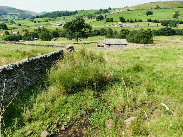
Appletreewick is a charming village located in the Craven district of North Yorkshire, England. Situated in the heart of the Yorkshire Dales National Park, this picturesque settlement is surrounded by breathtaking natural beauty and offers a peaceful retreat for visitors.

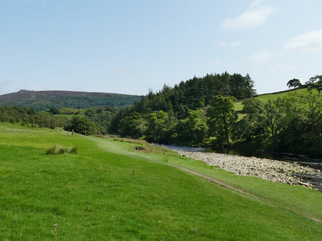
The village is named after the apple trees that once grew abundantly in the area, and its idyllic setting by the River Wharfe adds to its appeal. The historic St. Michael and All Angels Church, built in the 12th century, is a prominent landmark in the village and a testament to its rich heritage.

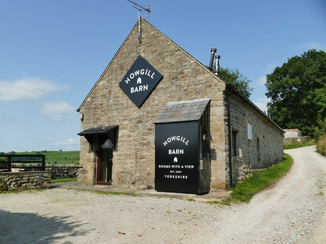
Appletreewick is renowned for its traditional stone-built cottages, which lend a quintessential English countryside feel to the area. The village is also home to two popular pubs, The Craven Arms and The New Inn, where visitors can enjoy a pint of locally brewed ale and sample delicious Yorkshire cuisine.

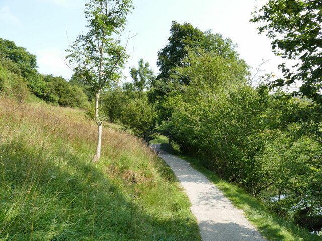
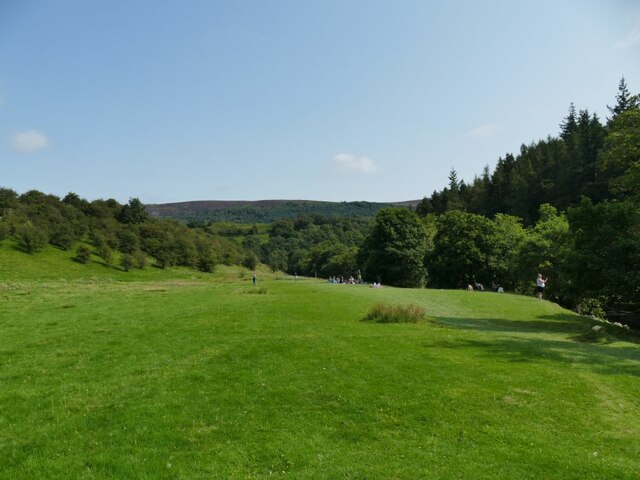
Outdoor enthusiasts are drawn to Appletreewick for its proximity to stunning walking trails and scenic landscapes. The village is a gateway to many popular hikes, including the picturesque walk to Bolton Abbey. Fishing and canoeing opportunities are also available on the River Wharfe, providing a chance to immerse oneself in the tranquil surroundings.

Throughout the year, Appletreewick hosts various events and festivals that celebrate its rural heritage, including the Appletreewick Scarecrow Festival and the Dales Beer Festival. These events attract both locals and tourists alike, creating a vibrant atmosphere within the village.

Appletreewick is a hidden gem within the Yorkshire Dales, offering a serene and authentic countryside experience to all who visit.

If you have any feedback on the listing, please let us know in the comments section below.

Appletreewick Images

Images are sourced within 2km of 54.036921/-1.921499 or Grid Reference SE0560. Thanks to Geograph Open Source API. All images are credited.

Bend in wall near Folly Top
Sheep dip below Howgill Lane The facility is variously referred to on maps as 'sheep dip' or 'sheep wash'; the water presumably comes from the stream causing the boggy surface in the foreground.
Sheep dip below Howgill Lane
The facility is variously referred to on maps as 'sheep dip' or 'sheep wash'; the water presumably comes from the stream causing the boggy surface in the foreground.
Howgill Barn Now holiday accommodation.
Howgill Barn
Now holiday accommodation.
Howgill Lodge Holiday accommodation with adjacent caravan and camp site.
Howgill Lodge
Holiday accommodation with adjacent caravan and camp site.
Bridge on Stangs Lane The bridge takes the lane over Fir Beck.
Bridge on Stangs Lane
The bridge takes the lane over Fir Beck.
New planting below Knowles Lodge Alongside the public footpath.
New planting below Knowles Lodge
Alongside the public footpath.
Rapids on the Wharfe below Haugh Wood There wasn't much water in the river at this time, it would be more impressive after heavy rain.
Rapids on the Wharfe below Haugh Wood
There wasn't much water in the river at this time, it would be more impressive after heavy rain.
Entering Haugh Wood from the west The path is part of the Dales Way.
Entering Haugh Wood from the west
The path is part of the Dales Way.
Picnic site by the Wharfe A fairly flat field, a short walk from Appletreewick village or the nearby caravan site, made a suitable picnic site for several families.
Picnic site by the Wharfe
A fairly flat field, a short walk from Appletreewick village or the nearby caravan site, made a suitable picnic site for several families.
Gravel bank in the Wharfe Fairly low flow in the river exposed this gravel bank. The path forms part of the Dales Way.
Gravel bank in the Wharfe
Fairly low flow in the river exposed this gravel bank. The path forms part of the Dales Way.
Barn at Haugh Mill Farm
Old tractor at Haugh Mill Farm
Former chapel near Howgill This former Primitive Methodist chapel was erected in 1836. It closed in the 1990s and was converted into a house: <span class="nowrap"><a title="https://www.myprimitivemethodists.org.uk/content/chapels/yorkshire/hi-hy/howgill_barden_pm_chapel_north_yorkshire" rel="nofollow ugc noopener" href="https://www.myprimitivemethodists.org.uk/content/chapels/yorkshire/hi-hy/howgill_barden_pm_chapel_north_yorkshire">Link</a><img style="margin-left:2px;" alt="External link" title="External link - shift click to open in new window" src="https://s1.geograph.org.uk/img/external.png" width="10" height="10"/></span>
Former chapel near Howgill
This former Primitive Methodist chapel was erected in 1836. It closed in the 1990s and was converted into a house: LinkExternal link
Meadow near Appletreewick
Rapids on the River Wharfe
View across the River Wharfe
View from the Dales Way towards Lower Fell Plantation
Old Milestone by Howgill Lane, Howgill By Howgill Lane track, in parish of Appletreewick (Craven District), Howgill North of Barden Bridge, Howgill Lane, set in wall opposite FP to Skyreholme.

Inscription reads:- : To / Pateley / Bridge / {pointing hand} / M 6 :

Surveyed

Milestone Society National ID: YN_XHOW.
Old Milestone by Howgill Lane, Howgill
By Howgill Lane track, in parish of Appletreewick (Craven District), Howgill North of Barden Bridge, Howgill Lane, set in wall opposite FP to Skyreholme. Inscription reads:- : To / Pateley / Bridge / {pointing hand} / M 6 : Surveyed Milestone Society National ID: YN_XHOW.
Show me another place!

Appletreewick is located at Grid Ref: SE0560 (Lat: 54.036921, Lng: -1.921499)

Division: West Riding

Administrative County: North Yorkshire

District: Craven

Police Authority: North Yorkshire

What 3 Words

///recorders.stretcher.muddy. Near Grassington, North Yorkshire

Nearby Locations

Appletreewick

Related Wikis

Appletreewick

Appletreewick is a village and civil parish in the Craven district of North Yorkshire, England, 6.5 miles (10.5 km) north-east of Skipton, 7 miles (11...

River Dibb

The River Dibb, also known as Barben Beck, is a small river located in North Yorkshire, England. It is a tributary of the River Wharfe. Grimwith Reservoir...

Skyreholme

Skyreholme is a hamlet in Wharfedale in the Yorkshire Dales, North Yorkshire, England. It lies 1-mile (1.6 km) east of Appletreewick, in the small side...

Hartlington

Hartlington is a small village and civil parish in the Craven district of North Yorkshire, England. At the 2011 Census, the population of the parish was...

Parcevall Hall

Parcevall Hall -- also known as Parceval Hall -- and its gardens are located at Skyreholme near Appletreewick village, Wharfedale, North Yorkshire, England...

Trollers Gill

Trollers Gill is a limestone gill or gorge in North Yorkshire, England, close to the village of Skyreholme and 4.7 miles (7.5 km) south-east of Grassington...

Burnsall

Burnsall is a village and civil parish in the Craven district of North Yorkshire, England. It is situated on the River Wharfe in Wharfedale, and is in...

Simon's Seat

Simon's Seat is a peak in the Yorkshire Dales in northern England. It is a prominent outcrop of millstone grit on the eastern side of Wharfedale. Although...

Nearby Amenities

Located within 500m of 54.036921,-1.921499
Appletreewick
Is In County: North Yorkshire
Place: village
Population: 218
Wikidata: Q2796599
Wikipedia: en:Appletreewick
Lat/Long: 54.0364783/-1.9201632
Pub
Craven Arms
Source: survey
Lat/Long: 54.0376141/-1.9244218
Pub
New Inn
Addr City: Skipton
Addr Country: GB
Addr Hamlet: Appletreewick
Addr Postcode: BD23 6DA
Fhrs Id: 292964
Source Addr: FHRS Open Data
Lat/Long: 54.0370301/-1.9217389
Shop: bicycle
Lat/Long: 54.0372857/-1.9216252
Natural: spring
Source: OS 1:25k
Lat/Long: 54.0328564/-1.9222439
Natural: spring
Source: OS 1:25k
Lat/Long: 54.0335621/-1.9252265
Historic: mine_shaft
Mineral: lead
Source: OS 1:25k:OS 1853
Lat/Long: 54.0390313/-1.9188755
lime kiln
Archaeological Site: industrial
Historic: archaeological_site
Mineral: limestone
Source: OS sheet 151,1853
Lat/Long: 54.0375277/-1.9213847
Fairy Hole
Historic: mine_shaft
Note: Not clear from OS 1853 whether this is a cave or mine
Source: OS 1853
Lat/Long: 54.0384438/-1.9220799
Telephone
Booth: K6
Covered: booth
Lat/Long: 54.0368914/-1.9214379
Bench
Lat/Long: 54.0374896/-1.9245216
Bench
Lat/Long: 54.0374951/-1.9245877
Bench
Lat/Long: 54.0375002/-1.924656
The data included in this document is from www.openstreetmap.org. The data is made available under ODbL.

Have you been to Appletreewick?

Leave your review of Appletreewick below (or comments, questions and feedback).