Broadlee Plantation

Wood, Forest in Somerset South Somerset

England

Broadlee Plantation

Kingsdon All Saints Church in the village of Kingsdon
Kingsdon Credit: Liz Martin

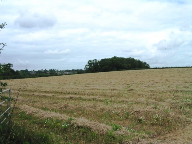
Broadlee Plantation is a picturesque woodland area located in Somerset, England. Covering a sprawling expanse, it is renowned for its diverse range of trees, flora, and fauna, making it an ideal destination for nature enthusiasts and outdoor lovers alike.

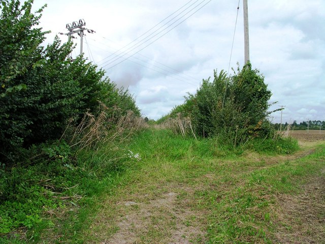
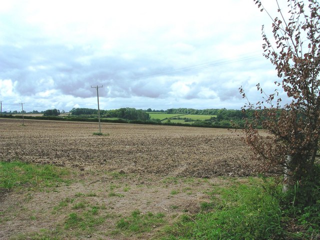
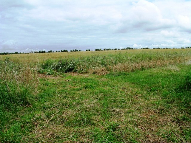
The plantation is predominantly composed of dense woodlands, characterized by towering oak, beech, and pine trees. These ancient trees provide a lush green canopy that stretches as far as the eye can see, creating a serene and peaceful atmosphere. The forest floor is carpeted with a rich layer of moss, ferns, and wildflowers, adding to the enchanting beauty of the area.

The plantation is home to a wide variety of wildlife, making it a haven for nature lovers and birdwatchers. Visitors might be lucky enough to spot deer, foxes, badgers, or even elusive red squirrels. The air is often filled with the melodious calls of songbirds, and the occasional sighting of a majestic bird of prey soaring above is not uncommon.

There are several well-marked trails and footpaths that wind through the plantation, providing visitors with the opportunity to explore its natural wonders. These paths offer a mix of easy strolls and more challenging hikes, catering to all levels of fitness and experience. Along the way, visitors can discover hidden glades, bubbling streams, and even a small waterfall, adding to the allure of the plantation.

Broadlee Plantation is a true gem of natural beauty in Somerset. Its combination of ancient woodland, diverse wildlife, and stunning scenery make it a must-visit destination for anyone seeking solace in nature's embrace.

If you have any feedback on the listing, please let us know in the comments section below.

Broadlee Plantation Images

Images are sourced within 2km of 51.040707/-2.6877268 or Grid Reference ST5127. Thanks to Geograph Open Source API. All images are credited.

Kingsdon All Saints Church in the village of Kingsdon
Kingsdon
All Saints Church in the village of Kingsdon
Lytes Cary Manor One of the National Trust's fine Somerset properties.
Lytes Cary Manor
One of the National Trust's fine Somerset properties.
Charlton Mackrell Church Charlton Mackrell Parish church
Charlton Mackrell Church
Charlton Mackrell Parish church
Pond of river walk at Lytes Cary
Garden at Lytes Cary
Lytes Cary The lodge and entranceway to Lytes Cary manor house, which is owned by The National Trust.
Lytes Cary
The lodge and entranceway to Lytes Cary manor house, which is owned by The National Trust.
River Cary near Lytes Cary Taken looking upstream from the road bridge south of Lytes Cary.
River Cary near Lytes Cary
Taken looking upstream from the road bridge south of Lytes Cary.
Kingsdon: The Kingsdon Inn Village pub with a nascent website here <span class="nowrap"><a title="http://www.kingsdoninn.co.uk/" rel="nofollow ugc noopener" href="http://www.kingsdoninn.co.uk/">Link</a><img style="margin-left:2px;" alt="External link" title="External link - shift click to open in new window" src="https://s1.geograph.org.uk/img/external.png" width="10" height="10"/></span>
Kingsdon: The Kingsdon Inn
Village pub with a nascent website here LinkExternal link
Lytes Cary This is the north-east façade of Lytes Cary manor house. The chapel, completed in 1348, is at the left end of the building with the main hall dating from the 15th and 16th centuries in the centre. The larger building to the right is a late 18th century addition. The sculpted yew trees, of which there are twelve, are in the Apostle Garden.
Lytes Cary
This is the north-east façade of Lytes Cary manor house. The chapel, completed in 1348, is at the left end of the building with the main hall dating from the 15th and 16th centuries in the centre. The larger building to the right is a late 18th century addition. The sculpted yew trees, of which there are twelve, are in the Apostle Garden.
Lytes Cary This is the south-east façade of Lytes Cary manor house. The chapel, completed in 1348, is at the right end of the building. The remainder of the façade was added by Sir Walter Jenner when he purchased the building in 1907. The manor house was in a very dilapidated state by this time, having been used as farm storage buildings for many years. Sir Walter bequeathed the estate to The National Trust on his death in 1948.
Lytes Cary
This is the south-east façade of Lytes Cary manor house. The chapel, completed in 1348, is at the right end of the building. The remainder of the façade was added by Sir Walter Jenner when he purchased the building in 1907. The manor house was in a very dilapidated state by this time, having been used as farm storage buildings for many years. Sir Walter bequeathed the estate to The National Trust on his death in 1948.
Catsgore House
Catsgore House
Farm Buildings Catsgore Farm
Red Post Cross - Kingsdon Busy junction on the A372 between Langport and Podimore, which crosses the B3151 between Somerton and Ilchester.
Red Post Cross - Kingsdon
Busy junction on the A372 between Langport and Podimore, which crosses the B3151 between Somerton and Ilchester.
Bridleway south of Charlton Mackrell View from public road north along public bridleway - church in distance
Bridleway south of Charlton Mackrell
View from public road north along public bridleway - church in distance
Fields south of Charlton Mackrell View from public road west towards Kingsdon Wood.
Fields south of Charlton Mackrell
View from public road west towards Kingsdon Wood.
Fields north of Lytes Cary View from Ilchester Road through field access SE towards Lytes Cary
Fields north of Lytes Cary
View from Ilchester Road through field access SE towards Lytes Cary
Fields south of Charlton Adam View of field from public road NE
Fields south of Charlton Adam
View of field from public road NE
Wheetle Plantation View of the plantation from field access on A372
Wheetle Plantation
View of the plantation from field access on A372
Show me another place!

Broadlee Plantation is located at Grid Ref: ST5127 (Lat: 51.040707, Lng: -2.6877268)

Administrative County: Somerset

District: South Somerset

Police Authority: Avon and Somerset

What 3 Words

///erupt.oath.life. Near Ilchester, Somerset

Related Wikis

Kingsdon, Somerset

Kingsdon is a village and parish in the South Somerset district of Somerset, England, situated 3 miles (4.8 km) south east of Somerton. The village has...

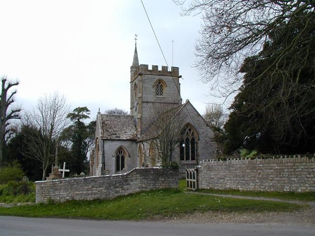
Church of All Saints, Kingsdon

The Church of All Saints in Kingsdon, Somerset, England was built in the 13th century. It is a Grade II* listed building. == History == Parts if the church...

Lytes Cary

Lytes Cary is a manor house with associated chapel and gardens near Charlton Mackrell and Somerton in Somerset, England. The property, owned by the National...

Charlton Mackrell

Charlton Mackrell is a village and former civil parish, now in the parish of The Charltons, in the Somerset district, in the ceremonial county of Somerset...

Church of St Mary, Charlton Mackrell

The Anglican Church of St Mary in Charlton Mackrell, Somerset, England was built in the 13th century. It is a Grade II* listed building. == History... ==

The Court, Charlton Mackrell

The Court is a Grade II* listed house, and former rectory, in Charlton Mackrell, Somerset. == History == The Court was built in 1792, for Richard Ford...

Charlton Mackrell railway station

Charlton Mackrell railway station was a minor railway station serving the village of Charlton Mackrell in Somerset, England, from 1905 until 1962. ��2...

Charlton House, Charlton Mackrell

Charlton House is a Grade II* listed house in Charlton Mackrell, Somerset. == History == Charlton House was built in 1726, with later extensions. The property...

Nearby Amenities

Located within 500m of 51.040707,-2.6877268
Source: survey
Lat/Long: 51.0363667/-2.6894395
Source: survey
Lat/Long: 51.0367858/-2.6867012
Power: pole
Lat/Long: 51.0417094/-2.6944201
Power: pole
Lat/Long: 51.0417078/-2.6933451
Power: pole
Lat/Long: 51.0417039/-2.6924173
Power: pole
Lat/Long: 51.0416886/-2.6911781
Power: pole
Lat/Long: 51.0416872/-2.6899741
Power: pole
Lat/Long: 51.0416774/-2.6888029
Power: pole
Lat/Long: 51.0416591/-2.6875439
Power: pole
Lat/Long: 51.0416562/-2.686341
Power: pole
Lat/Long: 51.0383997/-2.6907524
Power: pole
Lat/Long: 51.039028/-2.690831
Power: pole
Lat/Long: 51.0396852/-2.6909204
Power: pole
Lat/Long: 51.0403368/-2.6910106
Power: pole
Lat/Long: 51.0409767/-2.6910883
Power: pole
Lat/Long: 51.0379476/-2.6907002
Power: pole
Lat/Long: 51.0373074/-2.6906323
Power: pole
Lat/Long: 51.0416657/-2.6853527
Power: pole
Lat/Long: 51.0418151/-2.684111
Power: pole
Lat/Long: 51.0420873/-2.6816396
Power: pole
Lat/Long: 51.0419593/-2.6827944
The data included in this document is from www.openstreetmap.org. The data is made available under ODbL.

Have you been to Broadlee Plantation?

Leave your review of Broadlee Plantation below (or comments, questions and feedback).