Scroggs Wood

Wood, Forest in Westmorland South Lakeland

England

Scroggs Wood

Milestone Marker 02-55 (between bridges 183-182), Lancaster Canal - Site of missing Natland Hall Milestone Of the 56 milestones on the Lancaster Canal five are missing.
This is the site of one of them.  This section of the canal has been filled in.

If the milestone was there the inscription would be 25 :: 2
It would be located 55 miles from the Centre of Preston and 2 miles from Kendal.

Any information about this milestone would be appreciated, please.
Milestone Marker 02-55 (between bridges 183-182), Lancaster Canal - Site of missing Natland Hall Milestone Credit: Cactus Chris

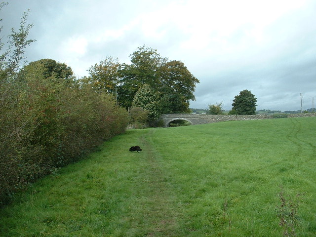
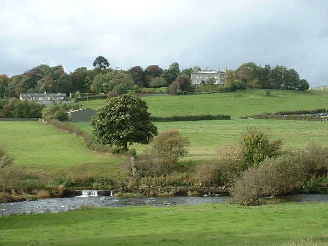
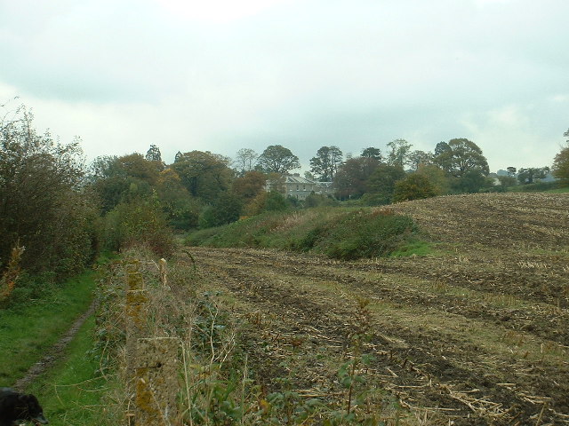
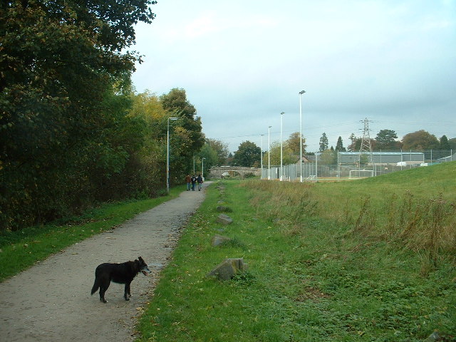
Scroggs Wood is a picturesque forest located in the county of Westmorland, England. Spanning over a vast area, the wood is known for its abundant biodiversity and stunning natural beauty. It is situated in the heart of the Lake District National Park, making it a popular destination for nature enthusiasts and hikers.

The woodland is predominantly made up of native tree species such as oak, birch, and beech, creating a diverse and vibrant ecosystem. The dense canopy provides a haven for numerous bird species, including woodpeckers, owls, and warblers, making it a haven for birdwatchers. Additionally, the forest floor is adorned with a rich variety of wildflowers, adding to its visual appeal.

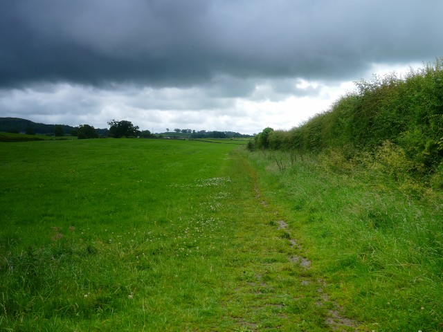
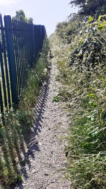
Scroggs Wood offers a network of well-maintained walking trails, allowing visitors to explore the forest and enjoy its tranquil ambiance. These trails cater to different skill levels, ranging from easy strolls to more challenging hikes for experienced trekkers. Along the way, walkers can catch glimpses of the surrounding countryside, including rolling hills and sparkling streams.

The wood is also home to various mammals, including roe deer, badgers, and foxes. Nature lovers may spot these elusive creatures if they are lucky. Moreover, the forest supports a diverse range of insect life, contributing to the overall ecological balance of the area.

With its stunning natural scenery, diverse wildlife, and well-marked trails, Scroggs Wood offers a captivating experience for visitors seeking solace in nature. Whether it's a leisurely walk or an immersive exploration, this woodland is a true gem within the Westmorland countryside.

If you have any feedback on the listing, please let us know in the comments section below.

Scroggs Wood Images

Images are sourced within 2km of 54.309102/-2.7532051 or Grid Reference SD5190. Thanks to Geograph Open Source API. All images are credited.
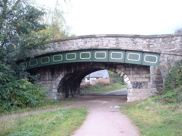
Milestone Marker 02-55 (between bridges 183-182), Lancaster Canal - Site of missing Natland Hall Milestone Of the 56 milestones on the Lancaster Canal five are missing.
This is the site of one of them.  This section of the canal has been filled in.

If the milestone was there the inscription would be 25 :: 2
It would be located 55 miles from the Centre of Preston and 2 miles from Kendal.

Any information about this milestone would be appreciated, please.
Milestone Marker 02-55 (between bridges 183-182), Lancaster Canal - Site of missing Natland Hall Milestone
Of the 56 milestones on the Lancaster Canal five are missing. This is the site of one of them. This section of the canal has been filled in. If the milestone was there the inscription would be 25 :: 2 It would be located 55 miles from the Centre of Preston and 2 miles from Kendal. Any information about this milestone would be appreciated, please.
Half Milestone between Milestones 02-55 and 03-54, Lancaster Canal There are at least ten stones on the upper reaches of the Lancaster Canal that are half way between two milestones. They appear to have been carved into a similar shape and size.  These have been confirmed as very likely to be half milestones by the Lancashire Canal Trust and the Milestone Society.


Approx distance to Milestone 02-55 is 0.492 miles up the canal and down the canal 0.527 miles to Milestone 03-54.

There are also winch points, but those have a different cross section and have been uploaded as winch points.

If you know of any other stones (please check my profile for those I have seen), or know more information about what they are I would be very grateful to hear from you.
Half Milestone between Milestones 02-55 and 03-54, Lancaster Canal
There are at least ten stones on the upper reaches of the Lancaster Canal that are half way between two milestones. They appear to have been carved into a similar shape and size. These have been confirmed as very likely to be half milestones by the Lancashire Canal Trust and the Milestone Society. Approx distance to Milestone 02-55 is 0.492 miles up the canal and down the canal 0.527 miles to Milestone 03-54. There are also winch points, but those have a different cross section and have been uploaded as winch points. If you know of any other stones (please check my profile for those I have seen), or know more information about what they are I would be very grateful to hear from you.
Winch point between Milestones 02-55 and 13-44, Lancaster Canal Winch point by the side of the Lancaster Canal.

If you know of any others (see my profile for those I have seen) I would be very grateful to hear from you.
Winch point between Milestones 02-55 and 13-44, Lancaster Canal
Winch point by the side of the Lancaster Canal. If you know of any others (see my profile for those I have seen) I would be very grateful to hear from you.
Footpath to Natland from Burton Road (A65) The path runs beside the West Coast Main Line railway
Footpath to Natland from Burton Road (A65)
The path runs beside the West Coast Main Line railway
Entrance to Brow Head from NE side of Burton Road Ordnance Survey documents indicate that a benchmark levelled at 86.607m above Newlyn Datum was verified in 1970 on the wall  1m left of the entrance which appears to have been remodelled in 2012
Entrance to Brow Head from NE side of Burton Road
Ordnance Survey documents indicate that a benchmark levelled at 86.607m above Newlyn Datum was verified in 1970 on the wall 1m left of the entrance which appears to have been remodelled in 2012
Low House Farm, Helsington
Barn conversion In progress at Briggs House Farm, Helsington.
Barn conversion
In progress at Briggs House Farm, Helsington.
Kendal Old Brewery Art Centre providing much culture to this historic town
Kendal
Old Brewery Art Centre providing much culture to this historic town
Former Kendal Youth Hostel - now a Nursing Home
Prizet It's a great name.....not Prizet House, or Lodge or Grange or whatever... Just straightforward, in your face, Prizet.  Great situation on a hilltop near Sedgwick.
Prizet
It's a great name.....not Prizet House, or Lodge or Grange or whatever... Just straightforward, in your face, Prizet. Great situation on a hilltop near Sedgwick.
Crowpark Bridge On the disused Lancaster Canal near Kendal. It's difficult to imagine that this 'normal' part of a farm field was once a major waterway. There is no water in the canal between Hincaster tunnel and Kendal with many sections, such as this one, completely filled in.
Crowpark Bridge
On the disused Lancaster Canal near Kendal. It's difficult to imagine that this 'normal' part of a farm field was once a major waterway. There is no water in the canal between Hincaster tunnel and Kendal with many sections, such as this one, completely filled in.
River Kent Near Kendal, with Prizet Farm and Prizet in the background
River Kent
Near Kendal, with Prizet Farm and Prizet in the background
Line of Lancaster Canal near Kendal Looking north, the line of the canal through this harvested maize field is obvious. The big house in the trees is Helme Lodge.
Line of Lancaster Canal near Kendal
Looking north, the line of the canal through this harvested maize field is obvious. The big house in the trees is Helme Lodge.
Line of Lancaster Canal in Kendal Looking north. The tall lamps illuminate an all-weather sports pitch, with shared use by local school and public.
Line of Lancaster Canal in Kendal
Looking north. The tall lamps illuminate an all-weather sports pitch, with shared use by local school and public.
The Change Bridge, Kendal Situated on the long disused section of the Lancaster Canal, this bridge allowed the Tow Horses to change from one side of the canal to the other [as the tow path changed sides] without unhitching from the barge they were towing. The horse track curving up to the bridge with no steps is clearly visible. This is the only bridge of its type in Cumbria, though there are others on the canal further south in Lancashire.
The Change Bridge, Kendal
Situated on the long disused section of the Lancaster Canal, this bridge allowed the Tow Horses to change from one side of the canal to the other [as the tow path changed sides] without unhitching from the barge they were towing. The horse track curving up to the bridge with no steps is clearly visible. This is the only bridge of its type in Cumbria, though there are others on the canal further south in Lancashire.
Canal Bridge, Kendal On the disused Lancaster Canal. The fancy metal section supports the widened road built upon the original bridge, which is now about twice as wide as originally built.
Canal Bridge, Kendal
On the disused Lancaster Canal. The fancy metal section supports the widened road built upon the original bridge, which is now about twice as wide as originally built.
River Kent, Kendal The River Kent, from which Kendal presumably takes its name, flows through the middle of the town and is a pretty, if inconvenient, landmark. The inconvenience is due to the complexities which the river adds to Kendal's traffic flow. The photo is taken looking upstream.
River Kent, Kendal
The River Kent, from which Kendal presumably takes its name, flows through the middle of the town and is a pretty, if inconvenient, landmark. The inconvenience is due to the complexities which the river adds to Kendal's traffic flow. The photo is taken looking upstream.
Nether Bridge on the River Kent, Kendal Looking south down the River Kent.
Nether Bridge on the River Kent, Kendal
Looking south down the River Kent.
Show me another place!

Scroggs Wood is located at Grid Ref: SD5190 (Lat: 54.309102, Lng: -2.7532051)

Administrative County: Cumbria

District: South Lakeland

Police Authority: Cumbria

What 3 Words

///crust.punchy.battle. Near Kendal, Cumbria

Nearby Locations

Scroggs Wood Alavna

Related Wikis

Alavana

Alavana was a name tentatively (and probably wrongly) applied to the ruins of a Roman fort at Watercrook about 2 mi (3.2 km) south of Kendal in Cumbria...

Westmorland County Football Association

The Westmorland County Football Association is the governing body of football in the county of Westmorland. The association was formed in 1897. ��2�...

Kendal College

Kendal College is a further education college situated in Kendal on the edge of the Lake District National Park. The college provides a range of training...

Kirkbie Kendal School

Kirkbie Kendal School is an academy school and known as a Business and Enterprise College in Kendal, Cumbria, Northern England, and serves the area around...

Nearby Amenities

Located within 500m of 54.309102,-2.7532051
Parking
Parking: street_side
Lat/Long: 54.3075916/-2.7588879
Bus Stop
Lumley Road
Bus: yes
Local Ref: AT
Naptan AtcoCode: 090079361356
Naptan Bearing: NE
Naptan BusStopType: MKD
Naptan CommonName: Lumley Road
Naptan Indicator: at
Naptan Landmark: junction for Lumley Road
Naptan LocalityCode: E0055517
Naptan NaptanCode: cumdjpdp
Naptan Street: Milnthorpe Road
Naptan Verified: no
Public Transport: platform
Ref: cumdjpdp
Shelter: no
Source: naptan_import
Lat/Long: 54.3121649/-2.7536855
Bus Stop
Lumley Road
Naptan AtcoCode: 090079362510
Naptan Bearing: S
Naptan CommonName: Lumley Road
Naptan Indicator: near
Naptan Landmark: Kent Park Avenue
Naptan NaptanCode: cumdjpjt
Naptan Street: Milnthorpe Road
Naptan Verified: no
Public Transport: platform
Source: naptan_import
Lat/Long: 54.3117945/-2.7540016
Bus Stop
Bellingham Road
Bench: yes
Naptan AtcoCode: 090079363386
Naptan Bearing: W
Naptan CommonName: Bellingham Road
Naptan Indicator: near
Naptan Landmark: number 74
Naptan NaptanCode: cumdjtat
Naptan Street: Bellingham Road
Naptan Verified: no
Shelter: no
Source: naptan_import
Lat/Long: 54.3117986/-2.751716
Whitewater: put_in
Lat/Long: 54.3084756/-2.7507419
Parking
Access: permissive
Capacity: 4
Description: Permissive parking for visitors to Scroggs Wood
Fee: no
Operator: Woodland Trust
Parking: surface
Surface: unpaved
Lat/Long: 54.308447/-2.7508666
Alauna roman fort
Alt Name: Watercrook, Alavana, Alavna
Historic: archaeological_site
Historic Civilization: roman
Historic Culture: roman
Source: English Heritage
Wikidata: Q18654686
Wikipedia: en:Alavana
Lat/Long: 54.30979/-2.7485995
Post Box
Drive Through: no
Post Box Type: pillar
Ref: LA9 16
Lat/Long: 54.3114846/-2.7529507
Bench
Backrest: yes
Source: survey
Lat/Long: 54.3121918/-2.7536564
Bench
Backrest: yes
Source: survey
Lat/Long: 54.311791/-2.7540186
Waste Basket
Source: survey
Lat/Long: 54.3118022/-2.7539942
Bench
Backrest: yes
Source: survey
Lat/Long: 54.3117152/-2.7545467
Ford: stepping_stones
Source: survey
Lat/Long: 54.3096882/-2.7567112
Bench
Backrest: yes
Source: survey
Lat/Long: 54.3086633/-2.7509263
Barrier: entrance
Source: survey
Lat/Long: 54.3087737/-2.7512035
Barrier: entrance
Source: survey
Lat/Long: 54.3116754/-2.7500446
Crossing
Crossing: unmarked
Crossing Island: no
Tactile Paving: no
Lat/Long: 54.3129352/-2.752667
Crossing
Crossing: unmarked
Crossing Island: no
Tactile Paving: no
Lat/Long: 54.3127208/-2.752911
Crossing
Crossing: unmarked
Crossing Island: no
Tactile Paving: no
Lat/Long: 54.3122365/-2.7536251
Give Way
Direction: backward
Lat/Long: 54.3112153/-2.7533706
Give Way
Direction: forward
Lat/Long: 54.311195/-2.7532578
Give Way
Direction: forward
Lat/Long: 54.3116463/-2.7543764
Give Way
Direction: forward
Lat/Long: 54.3117633/-2.7528015
Give Way
Direction: backward
Lat/Long: 54.3118864/-2.7517342
Give Way
Direction: backward
Lat/Long: 54.3109247/-2.7517157
Give Way
Direction: backward
Lat/Long: 54.311771/-2.7509952
Give Way
Direction: forward
Lat/Long: 54.3122329/-2.7497942
Give Way
Direction: forward
Lat/Long: 54.3121976/-2.7535439
Give Way
Direction: forward
Lat/Long: 54.3105977/-2.754188
Give Way
Direction: forward
Lat/Long: 54.3098372/-2.7533366
Noexit: yes
Lat/Long: 54.3102546/-2.7548671
Give Way
Direction: forward
Lat/Long: 54.3098698/-2.7570544
Give Way
Direction: backward
Lat/Long: 54.3102484/-2.7567032
Crossing
Crossing: unmarked
Crossing Island: yes
Kerb: flush
Tactile Paving: yes
Lat/Long: 54.3119758/-2.7538511
Lumley Road
Bus: yes
Public Transport: stop_position
Lat/Long: 54.3121161/-2.7536114
Lumley Road
Bus: yes
Public Transport: stop_position
Lat/Long: 54.3118416/-2.7540812
Watercrook
Place: locality
Lat/Long: 54.3091766/-2.7482155
Helsington
Place: suburb
Lat/Long: 54.3128684/-2.7508636
Crossing
Crossing: unmarked
Crossing Island: no
Tactile Paving: yes
Lat/Long: 54.311312/-2.7553827
Generator Method: photovoltaic
Generator Output Electricity: yes
Generator Source: solar
Generator Type: solar_photovoltaic_panel
Location: roof
Power: generator
Lat/Long: 54.3133552/-2.7539044
Generator Method: photovoltaic
Generator Output Electricity: yes
Generator Source: solar
Generator Type: solar_photovoltaic_panel
Location: roof
Power: generator
Lat/Long: 54.3132707/-2.7539849
Generator Method: photovoltaic
Generator Output Electricity: yes
Generator Source: solar
Generator Type: solar_photovoltaic_panel
Location: roof
Power: generator
Lat/Long: 54.3133098/-2.7539956
Generator Method: photovoltaic
Generator Output Electricity: yes
Generator Source: solar
Generator Type: solar_photovoltaic_panel
Location: roof
Power: generator
Lat/Long: 54.3133395/-2.7539741
Generator Method: photovoltaic
Generator Output Electricity: yes
Generator Source: solar
Generator Type: solar_photovoltaic_panel
Location: roof
Power: generator
Lat/Long: 54.3102758/-2.7557873
Generator Method: photovoltaic
Generator Output Electricity: yes
Generator Source: solar
Generator Type: solar_photovoltaic_panel
Location: roof
Power: generator
Lat/Long: 54.3095873/-2.7517613
Generator Method: photovoltaic
Generator Output Electricity: yes
Generator Source: solar
Generator Type: solar_photovoltaic_panel
Location: roof
Power: generator
Lat/Long: 54.3110003/-2.7513375
Generator Method: photovoltaic
Generator Output Electricity: yes
Generator Source: solar
Generator Type: solar_photovoltaic_panel
Location: roof
Power: generator
Lat/Long: 54.3112444/-2.7516353
Generator Method: photovoltaic
Generator Output Electricity: yes
Generator Source: solar
Generator Type: solar_photovoltaic_panel
Location: roof
Power: generator
Lat/Long: 54.3112537/-2.7526545
Generator Method: photovoltaic
Generator Output Electricity: yes
Generator Source: solar
Generator Type: solar_photovoltaic_panel
Location: roof
Power: generator
Lat/Long: 54.3120956/-2.7495378
Generator Method: photovoltaic
Generator Output Electricity: yes
Generator Source: solar
Generator Type: solar_photovoltaic_panel
Location: roof
Power: generator
Lat/Long: 54.312031/-2.7508717
Generator Method: photovoltaic
Generator Output Electricity: yes
Generator Source: solar
Generator Type: solar_photovoltaic_panel
Location: roof
Power: generator
Lat/Long: 54.3119997/-2.7513545
Direction: backward
Traffic Calming: table
Lat/Long: 54.312625/-2.7559473
Turning Circle
Lat/Long: 54.3126934/-2.7557422
Power: pole
Lat/Long: 54.3114355/-2.7587066
Power: pole
Lat/Long: 54.312504/-2.7579832
Direction: 200
Man Made: surveillance
Surveillance: public
Surveillance Type: ALPR
Surveillance Zone: traffic
Lat/Long: 54.3132649/-2.7522378
Noexit: yes
Lat/Long: 54.3125283/-2.7567249
Noexit: yes
Lat/Long: 54.312584/-2.7577617
Power: pole
Lat/Long: 54.3111617/-2.759642
Power: pole
Lat/Long: 54.3114405/-2.7586992
The data included in this document is from www.openstreetmap.org. The data is made available under ODbL.

Have you been to Scroggs Wood?

Leave your review of Scroggs Wood below (or comments, questions and feedback).