Hawes Wood

Wood, Forest in Westmorland South Lakeland

England

Hawes Wood

Low Sizergh Farmland Cultivated land at Low Sizergh farm.
Low Sizergh Farmland Credit: Colin Kinnear

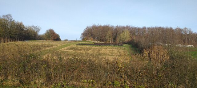
Hawes Wood, located in Westmorland, is a picturesque forest area known for its natural beauty and rich biodiversity. Spanning over a vast expanse of land, the wood is a haven for outdoor enthusiasts and nature lovers alike.

The forest is characterized by its dense woodland, comprising mainly of a mix of deciduous and coniferous trees. Towering oak, beech, and birch trees dominate the landscape, interspersed with spruces and pines. The lush vegetation provides a habitat for a wide variety of wildlife, including deer, foxes, badgers, and numerous species of birds.

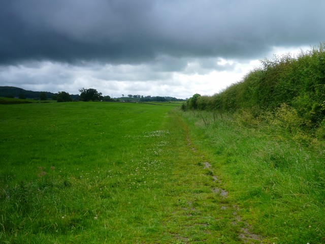
Hawes Wood offers an extensive network of walking trails, allowing visitors to explore its hidden treasures. The trails wind through the forest, leading visitors to stunning viewpoints, tranquil ponds, and babbling brooks. The landscape changes with the seasons, with vibrant wildflowers covering the forest floor in spring and vibrant hues of red, orange, and gold adorning the trees in autumn.

The wood also features several picnic areas and designated camping spots, making it an ideal destination for families and outdoor enthusiasts looking to immerse themselves in nature. Additionally, there are opportunities for birdwatching, photography, and wildlife spotting, making it a popular spot for nature enthusiasts and photographers.

Hawes Wood truly offers a peaceful and rejuvenating escape from the hustle and bustle of everyday life. Whether visitors are seeking solitude, adventure, or simply a connection with nature, this enchanting forest provides an ideal setting for all.

If you have any feedback on the listing, please let us know in the comments section below.
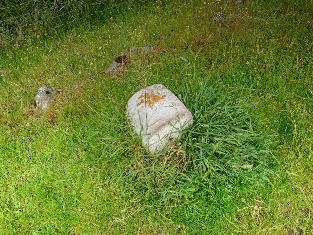
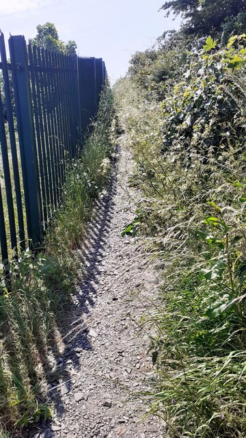
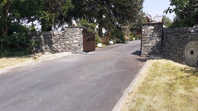
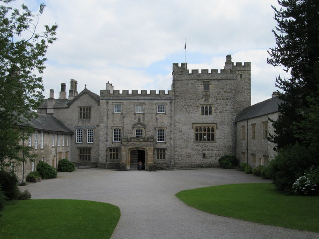
Hawes Wood Images

Images are sourced within 2km of 54.294183/-2.7530403 or Grid Reference SD5188. Thanks to Geograph Open Source API. All images are credited.

Low Sizergh Farmland Cultivated land at Low Sizergh farm.
Low Sizergh Farmland
Cultivated land at Low Sizergh farm.
Old Milestone Marker 03-54 F (between bridges 181-180), Lancaster Canal Old Milestone located by the side of the dry section of the Lancaster Canal.
This milestone is 54 miles from the centre of Preston and 3 miles from Kendal.

Inscription reads:-
24 :: 3
(Miles from Lancaster and Kendal respectively)

Milestone Society National ID: LAN-54
Old Milestone Marker 03-54 F (between bridges 181-180), Lancaster Canal
Old Milestone located by the side of the dry section of the Lancaster Canal. This milestone is 54 miles from the centre of Preston and 3 miles from Kendal. Inscription reads:- 24 :: 3 (Miles from Lancaster and Kendal respectively) Milestone Society National ID: LAN-54
Milestone Marker 02-55 (between bridges 183-182), Lancaster Canal - Site of missing Natland Hall Milestone Of the 56 milestones on the Lancaster Canal five are missing.
This is the site of one of them.  This section of the canal has been filled in.

If the milestone was there the inscription would be 25 :: 2
It would be located 55 miles from the Centre of Preston and 2 miles from Kendal.

Any information about this milestone would be appreciated, please.
Milestone Marker 02-55 (between bridges 183-182), Lancaster Canal - Site of missing Natland Hall Milestone
Of the 56 milestones on the Lancaster Canal five are missing. This is the site of one of them. This section of the canal has been filled in. If the milestone was there the inscription would be 25 :: 2 It would be located 55 miles from the Centre of Preston and 2 miles from Kendal. Any information about this milestone would be appreciated, please.
Half Milestone between Milestones 02-55 and 03-54, Lancaster Canal There are at least ten stones on the upper reaches of the Lancaster Canal that are half way between two milestones. They appear to have been carved into a similar shape and size.  These have been confirmed as very likely to be half milestones by the Lancashire Canal Trust and the Milestone Society.


Approx distance to Milestone 02-55 is 0.492 miles up the canal and down the canal 0.527 miles to Milestone 03-54.

There are also winch points, but those have a different cross section and have been uploaded as winch points.

If you know of any other stones (please check my profile for those I have seen), or know more information about what they are I would be very grateful to hear from you.
Half Milestone between Milestones 02-55 and 03-54, Lancaster Canal
There are at least ten stones on the upper reaches of the Lancaster Canal that are half way between two milestones. They appear to have been carved into a similar shape and size. These have been confirmed as very likely to be half milestones by the Lancashire Canal Trust and the Milestone Society. Approx distance to Milestone 02-55 is 0.492 miles up the canal and down the canal 0.527 miles to Milestone 03-54. There are also winch points, but those have a different cross section and have been uploaded as winch points. If you know of any other stones (please check my profile for those I have seen), or know more information about what they are I would be very grateful to hear from you.
Winch point between Milestones 02-55 and 13-44, Lancaster Canal Winch point by the side of the Lancaster Canal.

If you know of any others (see my profile for those I have seen) I would be very grateful to hear from you.
Winch point between Milestones 02-55 and 13-44, Lancaster Canal
Winch point by the side of the Lancaster Canal. If you know of any others (see my profile for those I have seen) I would be very grateful to hear from you.
Carex Farm Located on the edge of Sedgwick village.
Carex Farm
Located on the edge of Sedgwick village.
Arable fields near Sedgwick The land looked very dry on this early-June visit.
Arable fields near Sedgwick
The land looked very dry on this early-June visit.
Footpath to Natland from Burton Road (A65) The path runs beside the West Coast Main Line railway
Footpath to Natland from Burton Road (A65)
The path runs beside the West Coast Main Line railway
Entrance to Brow Head from NE side of Burton Road Ordnance Survey documents indicate that a benchmark levelled at 86.607m above Newlyn Datum was verified in 1970 on the wall  1m left of the entrance which appears to have been remodelled in 2012
Entrance to Brow Head from NE side of Burton Road
Ordnance Survey documents indicate that a benchmark levelled at 86.607m above Newlyn Datum was verified in 1970 on the wall 1m left of the entrance which appears to have been remodelled in 2012
Sizergh Lodge At the old north entrance to the Sizergh Castle estate
Sizergh Lodge
At the old north entrance to the Sizergh Castle estate
Picnic area, Sizergh Castle
Ashbank Lane Heading south west towards Sizergh Castle.
Ashbank Lane
Heading south west towards Sizergh Castle.
Ashbank Lane Gated road towards Sizergh Castle.
Ashbank Lane
Gated road towards Sizergh Castle.
Sizergh Castle
Sizergh Castle
Sizergh Castle across the mead
Entrance courtyard Sizergh Castle
Daffodil Bank Sizergh Castle
Sizergh Castle and garden
Show me another place!

Hawes Wood is located at Grid Ref: SD5188 (Lat: 54.294183, Lng: -2.7530403)

Administrative County: Cumbria

District: South Lakeland

Police Authority: Cumbria

What 3 Words

///coins.stress.dates. Near Kendal, Cumbria

Related Wikis

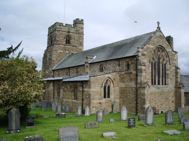
St Mark's Church, Natland

St Mark's Church is in the village of Natland, Cumbria, England. It is an active Anglican parish church in the deanery of Kendal, the archdeaconry of Westmorland...
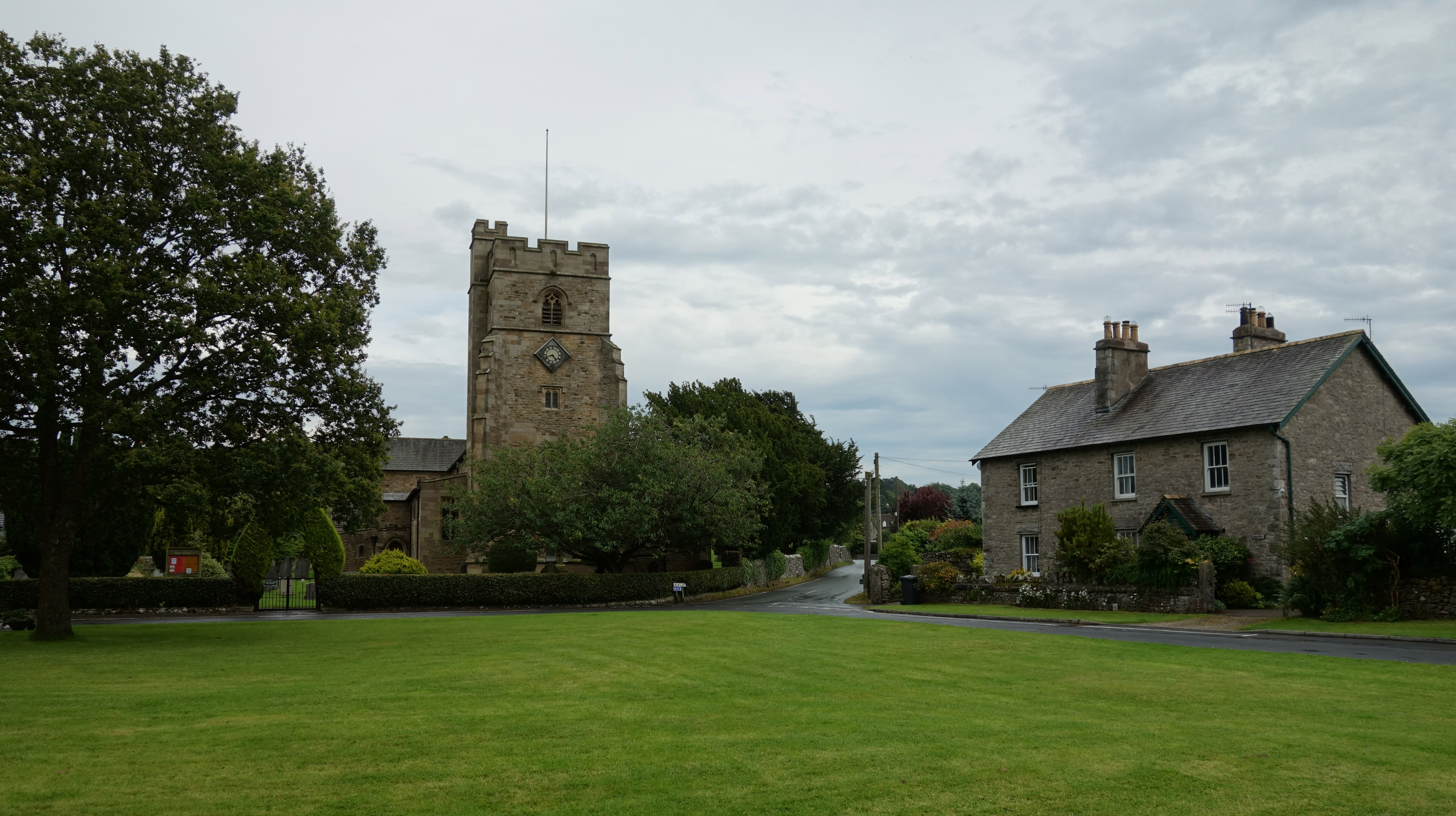
Natland

Natland is a village and civil parish about two miles (3 km) south of Kendal in the South Lakeland district of Cumbria, England, close to the village of...

Alavana

Alavana was a name tentatively (and probably wrongly) applied to the ruins of a Roman fort at Watercrook about 2 mi (3.2 km) south of Kendal in Cumbria...
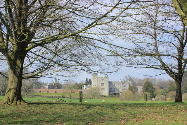
Sizergh

Sizergh Castle is a stately home with garden and estate at Helsington in Cumbria, England, about 4 miles (6 km) south of Kendal. Located in historic...
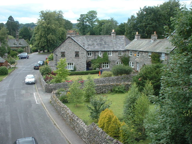
Sedgwick, Cumbria

Sedgwick is a village and civil parish in Cumbria, England, 4.5 miles (7.2 km) south of Kendal. In the 2001 census the parish had a population of 380,...

Westmorland General Hospital

Westmorland General Hospital (WGH) is a hospital near Oxenholme in Kendal, Cumbria, England. It is managed by the University Hospitals of Morecambe Bay...

Sedgwick House, Cumbria

Sedgwick House is located to the west of the village of Sedgwick, Cumbria, England. It was built as a country house, was later used as a school, and then...

Oxenholme

Oxenholme is a village in England just south of the town of Kendal, with which it has begun to merge. It is best known for Oxenholme Lake District railway...

Nearby Amenities

Located within 500m of 54.294183,-2.7530403
Barrier: stile
Lat/Long: 54.2917084/-2.7468718
Barrier: stile
Lat/Long: 54.2941165/-2.7472059
Barrier: stile
Layer: 0
Lat/Long: 54.2952871/-2.7486951
Whitewater: put_in;egress
Lat/Long: 54.294834/-2.7519804
S-Bends
Rapids: 4
Waterway: rapids
Lat/Long: 54.2907513/-2.7535361
Parking
Lat/Long: 54.2948465/-2.7516585
Hawes Bridge
Whitewater: put_in;egress
Lat/Long: 54.2948465/-2.752152
Fox Hall Vegan B&B
Tourism: guest_house
Lat/Long: 54.2963489/-2.7562588
Barrier: stile
Lat/Long: 54.2970615/-2.754431
Barrier: stile
Lat/Long: 54.2932456/-2.7465294
Power: tower
Lat/Long: 54.2919309/-2.7491609
Power: tower
Lat/Long: 54.2910448/-2.7576474
Power: tower
Lat/Long: 54.2914174/-2.7539459
Barrier: stile
Lat/Long: 54.2950371/-2.7516563
Barrier: stile
Lat/Long: 54.2974196/-2.7481175
Barrier: kissing_gate
Lat/Long: 54.2955595/-2.7491884
Barrier: entrance
Source: bing
Lat/Long: 54.2945197/-2.7458633
Barrier: entrance
Source: bing
Lat/Long: 54.2928572/-2.7476155
Barrier: entrance
Source: bing
Lat/Long: 54.2902391/-2.7505655
Barrier: cattle_grid
Source: bing
Lat/Long: 54.293334/-2.7595443
Barrier: stile
Lat/Long: 54.2961222/-2.750998
Barrier: stile
Source: survey
Lat/Long: 54.2953197/-2.7485482
Power: pole
Lat/Long: 54.2914969/-2.7507985
Power: pole
Lat/Long: 54.290938/-2.7507502
Power: pole
Lat/Long: 54.2903697/-2.7507126
Power: pole
Lat/Long: 54.2901208/-2.7514207
Power: pole
Lat/Long: 54.290913/-2.7512276
Power: pole
Lat/Long: 54.2915172/-2.7511016
Power: pole
Lat/Long: 54.2923986/-2.7508897
Power: pole
Lat/Long: 54.2932956/-2.7506912
Power: pole
Lat/Long: 54.2943225/-2.7504525
Power: pole
Lat/Long: 54.2953432/-2.7502432
Power: pole
Lat/Long: 54.2962792/-2.7498436
Power: pole
Lat/Long: 54.2971558/-2.7494842
Power: pole
Lat/Long: 54.2979463/-2.7491516
Power: pole
Lat/Long: 54.2979525/-2.7492508
Power: pole
Lat/Long: 54.2971965/-2.7496102
Power: pole
Lat/Long: 54.2962855/-2.749967
Power: pole
Lat/Long: 54.2953557/-2.7503425
Power: pole
Lat/Long: 54.2943366/-2.7505651
Power: pole
Lat/Long: 54.2933144/-2.7508011
Power: pole
Lat/Long: 54.292419/-2.7509943
Power: pole
Lat/Long: 54.2915345/-2.7512357
Power: pole
Lat/Long: 54.2909239/-2.7513349
Power: pole
Lat/Long: 54.2901537/-2.7515441
Barrier: stile
Lat/Long: 54.2954355/-2.7523032
The data included in this document is from www.openstreetmap.org. The data is made available under ODbL.

Have you been to Hawes Wood?

Leave your review of Hawes Wood below (or comments, questions and feedback).