Bamford's Wood

Wood, Forest in Lancashire South Ribble

England

Bamford's Wood

Liverpool Road at Hutton boundary
Liverpool Road at Hutton boundary Credit: Colin Pyle

Bamford's Wood is a picturesque forest located in the county of Lancashire, England. Covering an area of approximately 50 acres, this woodland is a haven of natural beauty and tranquility. Its dense canopy of tall trees creates a serene atmosphere, making it an ideal destination for nature enthusiasts and those seeking a peaceful retreat.

The wood is home to a diverse range of flora and fauna, offering a rich ecosystem for exploration. Visitors can expect to find a variety of native tree species such as oak, beech, and birch, which provide a stunning display of colors throughout the seasons. The forest floor is adorned with vibrant wildflowers, adding a splash of color to the landscape.

Tranquil streams and small ponds can be found meandering through the woodland, creating a soothing soundscape that enhances the overall serenity of the environment. These water features also attract a variety of wildlife, including deer, foxes, and a myriad of bird species, making it a popular destination for birdwatchers and wildlife photographers.

Bamford's Wood offers a network of well-maintained walking trails, allowing visitors to explore the forest at their own pace. With its gentle slopes and easy terrain, it is suitable for people of all ages and fitness levels. The paths lead visitors deeper into the forest, revealing hidden glades and viewpoints that offer stunning vistas of the surrounding countryside.

Overall, Bamford's Wood is a true gem in Lancashire, offering a peaceful haven for nature lovers and a chance to immerse oneself in the beauty of the natural world. Whether it is for a leisurely stroll, birdwatching, or simply finding solace in the tranquility of the forest, this woodland is a must-visit destination for anyone seeking a respite from the hustle and bustle of everyday life.

If you have any feedback on the listing, please let us know in the comments section below.

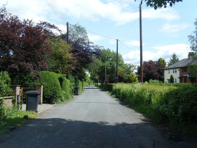
Bamford's Wood Images

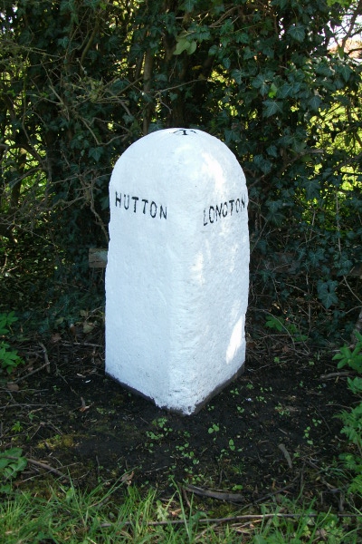
Images are sourced within 2km of 53.730173/-2.7507877 or Grid Reference SD5026. Thanks to Geograph Open Source API. All images are credited.

Liverpool Road at Hutton boundary
Liverpool Road, Hutton
Skip Lane/Ratten Lane junction
Ratten Lane near Sherdley Farm
A59 Longton by-pass
A59 Longton by-pass
The  footpath  is  the  other  side The footpath to Longton is the other side of the ditch, it comes in from the right then straight ahead through the gate up to Longton. The field drainage is being updated so a slight detour, taken from the grounds of Willow Cottage our B & B for the night. Longton is the start of the Ribble Way
The footpath is the other side
The footpath to Longton is the other side of the ditch, it comes in from the right then straight ahead through the gate up to Longton. The field drainage is being updated so a slight detour, taken from the grounds of Willow Cottage our B & B for the night. Longton is the start of the Ribble Way
Willow  Cottage  Longton Our very nice B & B for the night when we started to walk the Ribble Way
Willow Cottage Longton
Our very nice B & B for the night when we started to walk the Ribble Way
Houses on Chapel Lane, New Longton
Field entrance off Brownhill Lane, Longton
Brownhill Lane, Longton Looking south east on the flat.
Brownhill Lane, Longton
Looking south east on the flat.
Grazing off Drumacre Lane East
Drumacre Lane East Looking south west.
Drumacre Lane East
Looking south west.
Old Boundary Marker by Liverpool Road, Hutton Parish Boundary Marker by the UC road (was A59), in parish of Hutton (South Ribble District), Liverpool Road, after second sign for Hutton.

Inscription reads:-
: HUTTON : : LONGTON :
Carved bench mark on top. 

Surveyed

Milestone Society National ID: LA_HUTLON01pb
Old Boundary Marker by Liverpool Road, Hutton
Parish Boundary Marker by the UC road (was A59), in parish of Hutton (South Ribble District), Liverpool Road, after second sign for Hutton. Inscription reads:- : HUTTON : : LONGTON : Carved bench mark on top. Surveyed Milestone Society National ID: LA_HUTLON01pb
The Anchor Inn, Hutton Large public house on Liverpool Road.
The Anchor Inn, Hutton
Large public house on Liverpool Road.
Hutton, Liverpool Road
Liverpool Road, between Longton and Hutton
Bus Stop on Liverpool Road, outside Longton Library Longton is a large village with a population of 7,652 at the 2011 census. Situated in the South Ribble area, about 4miles West of Preston, the village dates back at least as far as the Middle Ages <span class="nowrap"><a title="https://en.wikipedia.org/wiki/Longton%2C_Lancashire" rel="nofollow ugc noopener" href="https://en.wikipedia.org/wiki/Longton%2C_Lancashire">Link</a><img style="margin-left:2px;" alt="External link" title="External link - shift click to open in new window" src="https://s1.geograph.org.uk/img/external.png" width="10" height="10"/></span>  .
Bus Stop on Liverpool Road, outside Longton Library
Longton is a large village with a population of 7,652 at the 2011 census. Situated in the South Ribble area, about 4miles West of Preston, the village dates back at least as far as the Middle Ages LinkExternal link .
Longton, Bus Stop on Liverpool Road Longton is a large village with a population of 7,652 at the 2011 census. Situated in the South Ribble area, about 4miles West of Preston, the village dates back at least as far as the Middle Ages <span class="nowrap"><a title="https://en.wikipedia.org/wiki/Longton%2C_Lancashire" rel="nofollow ugc noopener" href="https://en.wikipedia.org/wiki/Longton%2C_Lancashire">Link</a><img style="margin-left:2px;" alt="External link" title="External link - shift click to open in new window" src="https://s1.geograph.org.uk/img/external.png" width="10" height="10"/></span>  .
Longton, Bus Stop on Liverpool Road
Longton is a large village with a population of 7,652 at the 2011 census. Situated in the South Ribble area, about 4miles West of Preston, the village dates back at least as far as the Middle Ages LinkExternal link .
Show me another place!

Bamford's Wood is located at Grid Ref: SD5026 (Lat: 53.730173, Lng: -2.7507877)

Administrative County: Lancashire

District: South Ribble

Police Authority: Lancashire

What 3 Words

///weeks.that.dates. Near Preston, Lancashire

Related Wikis

New Longton and Hutton railway station

New Longton and Hutton station was a railway station on the West Lancashire Railway in England. It was over a mile from each of the villages of Hutton...

New Longton

New Longton is a village located 4 miles (6 km) south west of Preston, in the district of South Ribble, in the county of Lancashire, North West England...

Hutton, Lancashire

Hutton is a village and civil parish in Lancashire, England. It is located 3 miles (4.8 km) south west of Preston, in the South Ribble borough and parliamentary...

All Hallows Catholic High School

All Hallows Catholic High School is a coeducational secondary school located in Penwortham in the English county of Lancashire.Established in 1975, it...

Nearby Amenities

Located within 500m of 53.730173,-2.7507877
Note: FIXME
Lat/Long: 53.7328796/-2.7504097
New Longton and Hutton
Abandoned Railway: station
Railway: site
Lat/Long: 53.7263418/-2.7476213
Post Box
Ref: PR4 15
Lat/Long: 53.7333494/-2.7493877
Pub
Cricket Club
Lat/Long: 53.7271879/-2.7467494
Shop: newsagent
Lat/Long: 53.7266964/-2.7459657
Barrier: kissing_gate
Foot: designated
Lat/Long: 53.7316448/-2.7515971
Bus Stop
Bus: yes
Public Transport: platform
Lat/Long: 53.7267442/-2.7461132
The data included in this document is from www.openstreetmap.org. The data is made available under ODbL.

Have you been to Bamford's Wood?

Leave your review of Bamford's Wood below (or comments, questions and feedback).