Coppy Wood

Wood, Forest in Westmorland South Lakeland

England

Coppy Wood

The Strickland Arms At the entrance to Sizergh Castle, the Strickland Arms is named for the family who have owned the Castle for centuries.
The Strickland Arms Credit: Eirian Evans

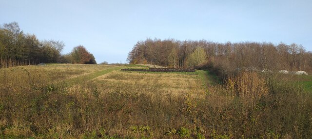
Coppy Wood is a picturesque forested area located in the county of Westmorland, England. Spanning over several acres, it is a significant natural landmark in the region. The wood is densely populated with a diverse range of tree species, including oak, beech, and ash, creating a rich and vibrant ecosystem.

The wood is known for its tranquil and serene atmosphere, making it a popular destination for nature enthusiasts and hikers. The well-maintained footpaths and trails winding through the forest provide visitors with the opportunity to explore its beauty and observe the local wildlife that thrives within its boundaries. Birdwatchers can spot various species of birds, such as woodpeckers, thrushes, and owls, while small mammals like squirrels and rabbits can be seen darting through the undergrowth.

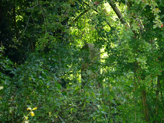
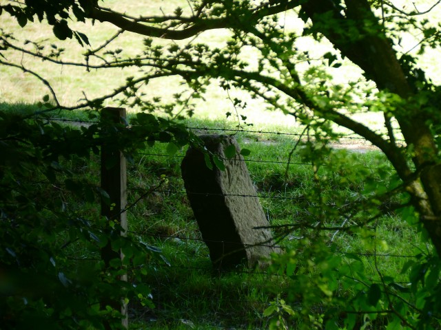
Additionally, Coppy Wood holds historical significance, with records dating back centuries. It has served as a source of timber for local communities and witnessed various land use changes over time. Today, it stands as a protected area, ensuring the preservation of its natural heritage.

The wood is easily accessible, located just a short distance from the nearby village. Visitors can find ample parking facilities and picnic areas for a leisurely day out. The local authorities have made efforts to maintain the wood's pristine condition, with regular conservation and management programs in place.

In summary, Coppy Wood in Westmorland offers a delightful escape into nature, providing a serene environment for exploration and relaxation. Its diverse flora and fauna, along with its historical significance, make it an ideal destination for those seeking a peaceful retreat amidst the beauty of the countryside.

If you have any feedback on the listing, please let us know in the comments section below.
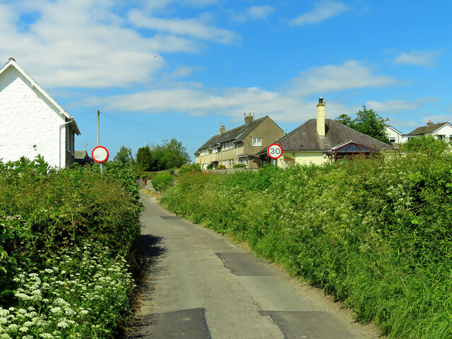
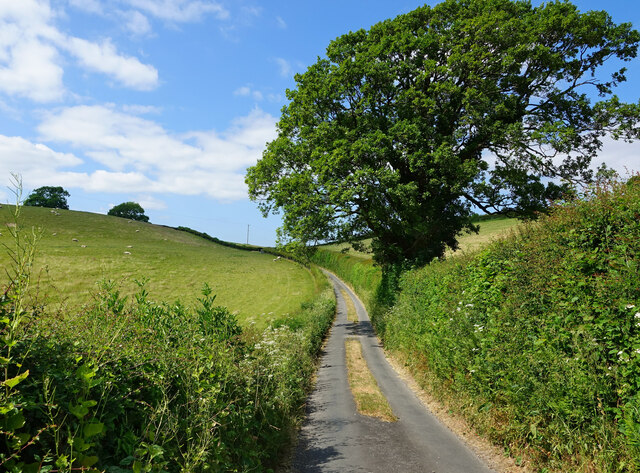
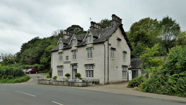
Coppy Wood Images

Images are sourced within 2km of 54.267884/-2.767654 or Grid Reference SD5086. Thanks to Geograph Open Source API. All images are credited.

The Strickland Arms At the entrance to Sizergh Castle, the Strickland Arms is named for the family who have owned the Castle for centuries.
The Strickland Arms
At the entrance to Sizergh Castle, the Strickland Arms is named for the family who have owned the Castle for centuries.
The west end of Hincaster Tunnel Opened on the 18th June 1819, the 378 yard tunnel was built to facilitate access to Kendal by the Lancaster Canal.
The tunnel had fallen into disuse by the mid 1940s and it was officially closed in 1955.
There is an Ordnance Survey 1GL bolt benchmark on the pilaster to the right of the tunnel entrance (detail photograph <a href="https://www.geograph.org.uk/photo/7364790">SD5085 : Benchmark, Hincaster Tunnel</a>).
The west end of Hincaster Tunnel
Opened on the 18th June 1819, the 378 yard tunnel was built to facilitate access to Kendal by the Lancaster Canal. The tunnel had fallen into disuse by the mid 1940s and it was officially closed in 1955. There is an Ordnance Survey 1GL bolt benchmark on the pilaster to the right of the tunnel entrance (detail photograph SD5085 : Benchmark, Hincaster Tunnel).
Sedgwick Hall Bridge Detail of the north face of Sedgwick Hall Bridge on the disused Lancaster Canal. The wicket gate caters for walkers using the former towpath which is a public footpath.
There is an Ordnance Survey benchmark visible on one of the voussoirs of the arch (photograph <a href="https://www.geograph.org.uk/photo/7097464">SD5186 : Benchmark, Sedgwick Hall Bridge</a>).
<a href="https://www.geograph.org.uk/photo/6578468">SD5186 : Sedgwick Hall Bridge</a> is a photograph of the bridge from the south.
Sedgwick Hall Bridge
Detail of the north face of Sedgwick Hall Bridge on the disused Lancaster Canal. The wicket gate caters for walkers using the former towpath which is a public footpath. There is an Ordnance Survey benchmark visible on one of the voussoirs of the arch (photograph SD5186 : Benchmark, Sedgwick Hall Bridge). SD5186 : Sedgwick Hall Bridge is a photograph of the bridge from the south.
Benchmark, Sedgwick Hall Bridge Detail of the Ordnance Survey 1GL Bolt benchmark on the north face of the arch of Sedgwick Hall Bridge. The benchmark marks a height of 46.0004 m above sea level (Ordnance Datum Newlyn) last verified in 1952 (location photograph <a href="https://www.geograph.org.uk/photo/7097453">SD5186 : Sedgwick Hall Bridge</a>).
Benchmark, Sedgwick Hall Bridge
Detail of the Ordnance Survey 1GL Bolt benchmark on the north face of the arch of Sedgwick Hall Bridge. The benchmark marks a height of 46.0004 m above sea level (Ordnance Datum Newlyn) last verified in 1952 (location photograph SD5186 : Sedgwick Hall Bridge).
Low Sizergh Farmland Cultivated land at Low Sizergh farm.
Low Sizergh Farmland
Cultivated land at Low Sizergh farm.
Old Milestone Marker 04-53 F (between bridges 178-177), Lancaster Canal Old Milestone located by the side of the dry section of the Lancaster Canal.
This milestone is 53 miles from the centre of Preston and 4 miles from Kendal.

Inscription reads:-
23 :: 4
(Miles from Lancaster and Kendal respectively)

Milestone Society National ID: LAN-53
Old Milestone Marker 04-53 F (between bridges 178-177), Lancaster Canal
Old Milestone located by the side of the dry section of the Lancaster Canal. This milestone is 53 miles from the centre of Preston and 4 miles from Kendal. Inscription reads:- 23 :: 4 (Miles from Lancaster and Kendal respectively) Milestone Society National ID: LAN-53
Old Milestone Marker 05-52 F (between bridges 176-175), Lancaster Canal Old Milestone located by the side of the dry section of the Lancaster Canal. This milestone is 52 miles from the centre of Preston and 5 miles from Kendal. 

Inscription reads:- 
22 :: 5 
(Miles from Lancaster and Kendal respectively)

Milestone Society National ID: LAN-52
Old Milestone Marker 05-52 F (between bridges 176-175), Lancaster Canal
Old Milestone located by the side of the dry section of the Lancaster Canal. This milestone is 52 miles from the centre of Preston and 5 miles from Kendal. Inscription reads:- 22 :: 5 (Miles from Lancaster and Kendal respectively) Milestone Society National ID: LAN-52
Benchmark, Hincaster Tunnel Detail of the Ordnance Survey 1GL Published Abstract Bolt benchmark on the west portal of Hincaster Tunnel. The benchmark marks a height of 45.9205m above mean sea level (Ordnance Datum Newlyn) last levelled and verified in 1971 (location photograph <a href="https://www.geograph.org.uk/photo/7364809">SD5085 : Transport Trust Red Wheel</a>).
Benchmark, Hincaster Tunnel
Detail of the Ordnance Survey 1GL Published Abstract Bolt benchmark on the west portal of Hincaster Tunnel. The benchmark marks a height of 45.9205m above mean sea level (Ordnance Datum Newlyn) last levelled and verified in 1971 (location photograph SD5085 : Transport Trust Red Wheel).
Transport Trust Red Wheel On the west portal of Hincaster Tunnel, the Transport Trust ‘Red Wheel’ sign highlights the importance of the tunnel as a transport heritage site.
The Transport Trust is Britain’s only charity dedicated to the preservation of all modes of transport and its infrastructure and the Red Wheel heritage plaque is the transport equivalent of an English Heritage Blue Plaque.
There is an Ordnance Survey bolt benchmark on the wall directly below the plaque (detail photograph <a href="https://www.geograph.org.uk/photo/7364790">SD5085 : Benchmark, Hincaster Tunnel</a>).
Transport Trust Red Wheel
On the west portal of Hincaster Tunnel, the Transport Trust ‘Red Wheel’ sign highlights the importance of the tunnel as a transport heritage site. The Transport Trust is Britain’s only charity dedicated to the preservation of all modes of transport and its infrastructure and the Red Wheel heritage plaque is the transport equivalent of an English Heritage Blue Plaque. There is an Ordnance Survey bolt benchmark on the wall directly below the plaque (detail photograph SD5085 : Benchmark, Hincaster Tunnel).
Railway buildings at Hincaster Typical red brick buildings associated with the railway.
Railway buildings at Hincaster
Typical red brick buildings associated with the railway.
Approaching the A590 Viewed near Viver on a bright early-June afternoon.
Approaching the A590
Viewed near Viver on a bright early-June afternoon.
Beware of floods A warning sign alerts road users to a flood risk ahead. The depth markers beside the railway bridge on the West Coast main line show how serious this can be.
Beware of floods
A warning sign alerts road users to a flood risk ahead. The depth markers beside the railway bridge on the West Coast main line show how serious this can be.
Approaching Sedgwick The first view of the village coming from Wellheads Lane.
Approaching Sedgwick
The first view of the village coming from Wellheads Lane.
On Wellheads Lane Heading for Sedgwick village on a lovely early-June afternoon.
On Wellheads Lane
Heading for Sedgwick village on a lovely early-June afternoon.
Carex Farm Located on the edge of Sedgwick village.
Carex Farm
Located on the edge of Sedgwick village.
Arable fields near Sedgwick The land looked very dry on this early-June visit.
Arable fields near Sedgwick
The land looked very dry on this early-June visit.
Strickland Arms South of Sizergh Castle
Strickland Arms
South of Sizergh Castle
Well Heads Skew Ford The depth gauges are definitely warranted today at this railway bridge on the West Coast Line. A photograph taken in normal conditions by Mary and Angus Hogg can be viewed at:
<a title="https://www.geograph.org.uk/photo/7513369" href="https://www.geograph.org.uk/photo/7513369">Link</a>
Well Heads Skew Ford
The depth gauges are definitely warranted today at this railway bridge on the West Coast Line. A photograph taken in normal conditions by Mary and Angus Hogg can be viewed at: Link
Show me another place!

Coppy Wood is located at Grid Ref: SD5086 (Lat: 54.267884, Lng: -2.767654)

Administrative County: Cumbria

District: South Lakeland

Police Authority: Cumbria

What 3 Words

///comic.sailors.streetcar. Near Milnthorpe, Cumbria

Related Wikis

Levens Hall

Levens Hall is a manor house in the Kent valley, near the village of Levens and 5 miles (9 km) south of Kendal in Cumbria, Northern England. == History... ==

Sedgwick House, Cumbria

Sedgwick House is located to the west of the village of Sedgwick, Cumbria, England. It was built as a country house, was later used as a school, and then...
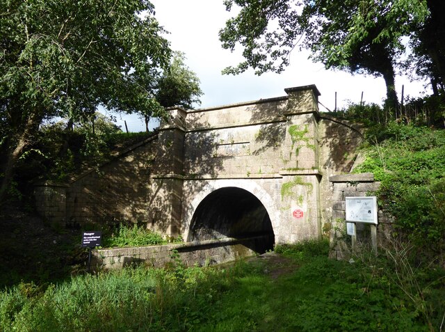
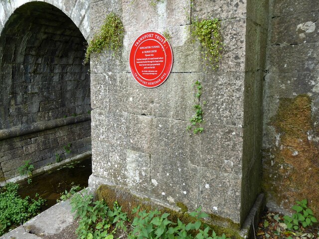
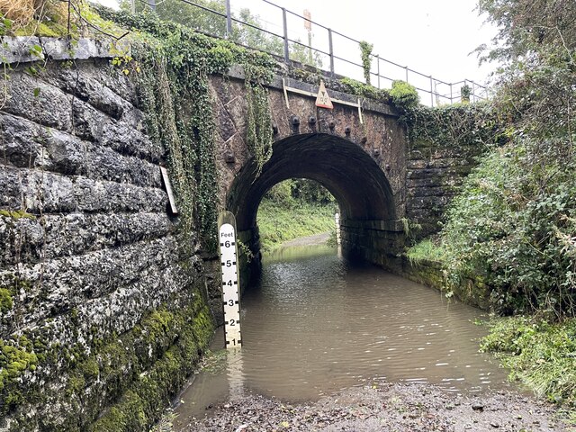
Hincaster Tunnel

The Hincaster Tunnel is a canal tunnel on the Lancaster Canal at Hincaster, a hamlet in Cumbria, England. == History == Work to extend the Lancaster Canal...

Levens, Cumbria

Levens is a village and civil parish in Westmorland and Furness, Cumbria. It lies within the historic county of Westmorland. In the 2001 census the parish...

Nearby Amenities

Located within 500m of 54.267884,-2.767654
Phone
Check Date: 2022-07-21
Emergency: phone
Lat/Long: 54.2693071/-2.7733409
Whitewater: egress
Lat/Long: 54.2694169/-2.7611879
Barrier: stile
Lat/Long: 54.2700804/-2.7637905
Waste Basket
Check Date: 2022-05-20
Lat/Long: 54.2692973/-2.7733564
Power: pole
Lat/Long: 54.2701418/-2.7719857
Power: pole
Lat/Long: 54.2701488/-2.7701318
Power: pole
Lat/Long: 54.2701506/-2.7683852
Power: pole
Lat/Long: 54.2701321/-2.7733395
Power: pole
Lat/Long: 54.2701874/-2.7653375
Power: pole
Lat/Long: 54.2703504/-2.7637359
Power: pole
Lat/Long: 54.2705379/-2.7621786
Power: pole
Lat/Long: 54.2645472/-2.7712806
Power: pole
Lat/Long: 54.2681032/-2.768722
Power: pole
Lat/Long: 54.2670643/-2.7694818
Power: pole
Lat/Long: 54.2662558/-2.7700865
Power: pole
Lat/Long: 54.265521/-2.7706138
Power: pole
Lat/Long: 54.2691277/-2.7679356
Power: pole
Lat/Long: 54.2701488/-2.7671778
Power: pole
Lat/Long: 54.2708726/-2.7678516
Power: pole
Lat/Long: 54.2716733/-2.7690389
Watering Place
Access: private
Lat/Long: 54.2711872/-2.7651388
Phone
Emergency: phone
Lat/Long: 54.2670445/-2.7738501
Waste Basket
Lat/Long: 54.2670314/-2.7738551
Give Way
Direction: forward
Lat/Long: 54.2663992/-2.774355
Note: Pavement just stops. No continuation and no crossing, apart from the private footpath to the house’s door.
Lat/Long: 54.2719067/-2.7710059
The data included in this document is from www.openstreetmap.org. The data is made available under ODbL.

Have you been to Coppy Wood?

Leave your review of Coppy Wood below (or comments, questions and feedback).