Coln Rogers

Settlement in Gloucestershire Cotswold

England

Coln Rogers

Coln St. Denis church, St. James the Great A Norman church with a c15 top stage to the Norman tower
Coln St. Denis church, St. James the Great Credit: Anonymous 4610

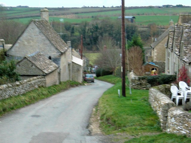
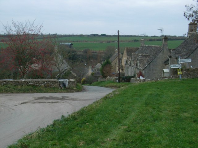
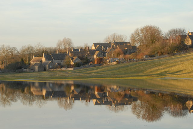
Coln Rogers is a picturesque village located in the county of Gloucestershire, England. Situated in the heart of the Cotswolds, it is known for its stunning natural beauty and charming rural atmosphere. The village is nestled along the banks of the River Coln, which adds to its idyllic setting.

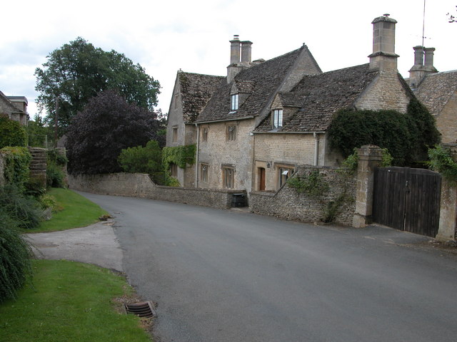
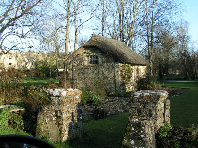
Coln Rogers is home to a small population of around 150 residents. The village retains its traditional character with a collection of honey-colored stone houses and cottages, many of which date back to the 17th and 18th centuries. This architectural style is typical of the Cotswolds region and adds to the village's timeless appeal.

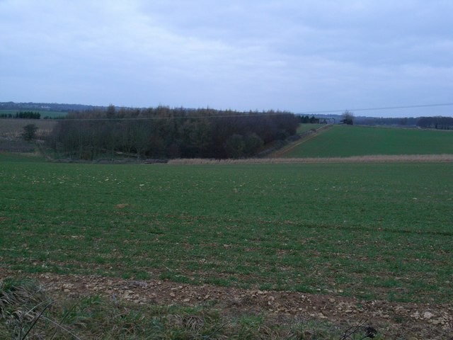
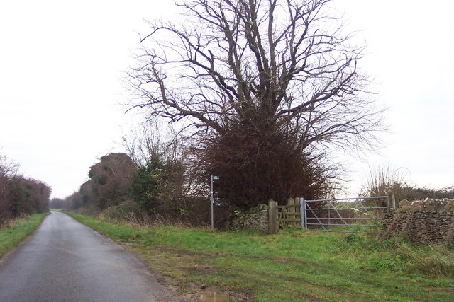
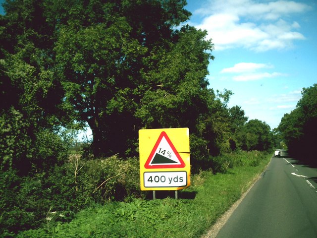
The surrounding countryside offers ample opportunities for outdoor activities and exploration. Coln Rogers is surrounded by rolling hills, lush green meadows, and ancient woodlands. The village is a popular destination for hikers, cyclists, and nature enthusiasts who come to enjoy the peaceful surroundings and breathtaking vistas.

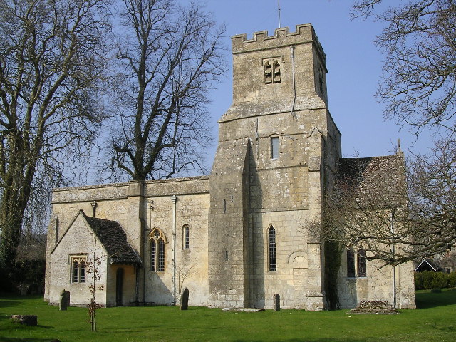
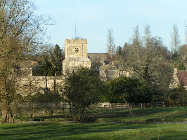
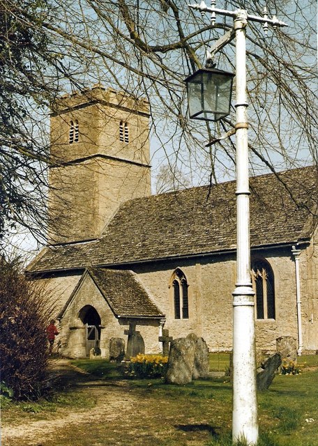
The village also boasts a few amenities for its residents and visitors. There is a charming village pub, known for its cozy atmosphere and delicious traditional cuisine. Additionally, a small church, St. Andrew's, stands at the heart of the village, providing a place of worship and a gathering point for the community.

Coln Rogers is conveniently located within a short distance of other popular Cotswold towns and villages, including Bibury and Bourton-on-the-Water. Its tranquil ambiance and stunning natural surroundings make it a sought-after destination for those seeking a peaceful retreat in the heart of the English countryside.

If you have any feedback on the listing, please let us know in the comments section below.

Coln Rogers Images

Images are sourced within 2km of 51.783961/-1.875151 or Grid Reference SP0809. Thanks to Geograph Open Source API. All images are credited.

Coln St. Denis church, St. James the Great A Norman church with a c15 top stage to the Norman tower
Coln St. Denis church, St. James the Great
A Norman church with a c15 top stage to the Norman tower
House in Coln St Dennis Cotswold stone house on the roadside in the village of Coln St Dennis.
House in Coln St Dennis
Cotswold stone house on the roadside in the village of Coln St Dennis.
Straw bales in stubble field, Fields Farm Field to the east of Fields Farm. Fields Farm can be seen in the background.
Straw bales in stubble field, Fields Farm
Field to the east of Fields Farm. Fields Farm can be seen in the background.
Calcot The village street.
Calcot
The village street.
Crossroads at Calcot
Tree plantation An isolated plantation, looking in the direction of Coln St Dennis.
Tree plantation
An isolated plantation, looking in the direction of Coln St Dennis.
Footpath starts here South-east towards Saltway Farm.
Footpath starts here
South-east towards Saltway Farm.
Farmland near Lower Chedworth The farmland is probably part of Fields Farm and rises gently from the viewpoint at the gateway of the field.
Farmland near Lower Chedworth
The farmland is probably part of Fields Farm and rises gently from the viewpoint at the gateway of the field.
Thatched Shed
Thatched Shed
Coln St Dennis church
A429 at Fossebridge A 14% climb out of Fossebridge towards Cirencester.
A429 at Fossebridge
A 14% climb out of Fossebridge towards Cirencester.
A429 at Fossebridge A 14% climb out of Fossebridge towards Northleach.
A429 at Fossebridge
A 14% climb out of Fossebridge towards Northleach.
Looking down into Coln St. Dennis.
Coln St. Dennis. Around the middle of the village.
Coln St. Dennis.
Around the middle of the village.
Coln St. Dennis Church.
Steep hill ahead Approaching Fossebridge on the A429, heading north east, the sign warns of the impending steep hill.
Steep hill ahead
Approaching Fossebridge on the A429, heading north east, the sign warns of the impending steep hill.
River Coln floods meadow at Calcot February 2008
River Coln floods meadow at Calcot
February 2008
Down the hill into Fossebridge
Show me another place!

Coln Rogers is located at Grid Ref: SP0809 (Lat: 51.783961, Lng: -1.875151)

Administrative County: Gloucestershire

District: Cotswold

Police Authority: Gloucestershire

What 3 Words

///managed.squaring.missions. Near Northleach, Gloucestershire

Nearby Locations

Coln Rogers The Grove

Related Wikis

Coln Rogers

Coln Rogers is a village and former civil parish, now in the parish of Coln St. Dennis, in the Cotswold district of the county of Gloucestershire, England...

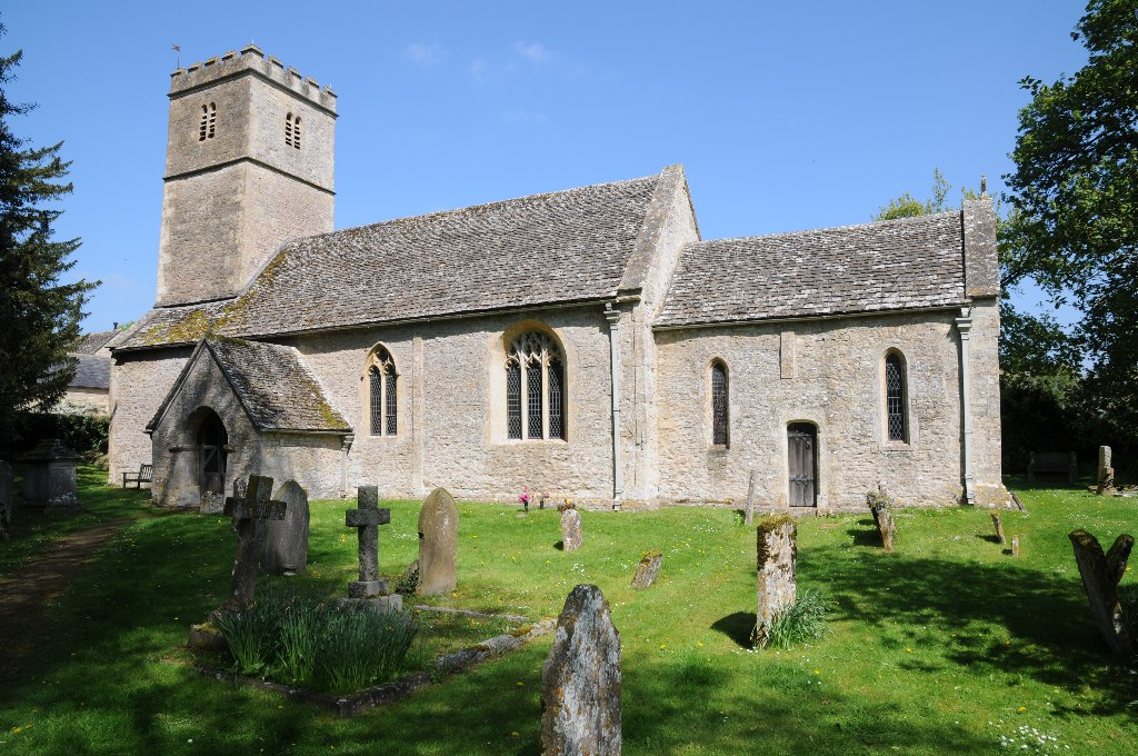
Church of St Andrew, Coln Rogers

The Anglican Church of St Andrew at Coln Rogers in the Cotswold District of Gloucestershire, England was built in the 11th century. It is a grade I listed...

Calcot, Gloucestershire

Calcot is a settlement in the English county of Gloucestershire. Calcot forms part of the civil parish of Coln St Dennis, within the Cotswold local government...

Winson, Gloucestershire

Winson is a village in the Cotswold district of the English county of Gloucestershire. == Location == Winson lies next to the River Coln, north west of...

Church of St James, Coln St. Dennis

The Anglican Church of St James at Coln St. Dennis in the Cotswold District of Gloucestershire, England was built in the 12th century. It is a grade I...

Winson Meadows

Winson Meadows (grid reference SP093081) is a 7.93-hectare (19.6-acre) biological Site of Special Scientific Interest in Gloucestershire, notified in 1974...

Coln St. Dennis

Coln St. Dennis is a village and civil parish on the River Coln in Gloucestershire about 3 miles (4.8 km) southwest of Northleach and about 7 miles (11...

Ablington Manor

Ablington Manor is a Grade I listed country house in Potlicker's Lane, Ablington within the parish of Bibury, Gloucestershire, England. The estate was...

Nearby Amenities

Located within 500m of 51.783961,-1.875151
Bus Stop
Upper Farm
Bus: yes
Naptan AtcoCode: 1600GL1419
Naptan Bearing: SW
Naptan CommonName: Upper Farm
Naptan NaptanCode: glogdapm
Naptan Street: Main Street
Naptan Verified: no
Public Transport: platform
Source: naptan_import
Lat/Long: 51.7848968/-1.8767889
Bus Stop
Upper Farm
Bus: yes
Naptan AtcoCode: 1600GL1420
Naptan Bearing: NE
Naptan CommonName: Upper Farm
Naptan Indicator: Opp
Naptan NaptanCode: glogdapg
Naptan Street: Main Street
Naptan Verified: no
Public Transport: platform
Source: naptan_import
Lat/Long: 51.7849239/-1.8768903
Bus Stop
Calcot Footpath
Bus: yes
Naptan AtcoCode: 1600GLC063
Naptan Bearing: S
Naptan CommonName: Calcot Footpath
Naptan NaptanCode: glogdata
Naptan Street: Coln St Dennis Road
Naptan Verified: no
Public Transport: platform
Source: naptan_import
Lat/Long: 51.7880693/-1.8754754
Bus Stop
Calcot Footpath
Bus: yes
Naptan AtcoCode: 1600GLC064
Naptan Bearing: N
Naptan CommonName: Calcot Footpath
Naptan Indicator: Opp
Naptan NaptanCode: glogdapt
Naptan Street: Coln St Dennis Road
Naptan Verified: no
Public Transport: platform
Source: naptan_import
Lat/Long: 51.7880155/-1.8755771
Bus Stop
Winson Mill Farm
Bus: yes
Naptan AtcoCode: 1600GLC369
Naptan Bearing: S
Naptan CommonName: Winson Mill Farm
Naptan NaptanCode: glogdawp
Naptan Street: Main Street
Naptan Verified: no
Public Transport: platform
Source: naptan_import
Lat/Long: 51.7802442/-1.8729022
Bus Stop
Winson Mill Farm
Bus: yes
Naptan AtcoCode: 1600GLC370
Naptan Bearing: N
Naptan CommonName: Winson Mill Farm
Naptan NaptanCode: glogdawj
Naptan Street: Main Street
Naptan Verified: no
Public Transport: platform
Source: naptan_import
Lat/Long: 51.7802443/-1.8730327
Post Box
Post Box Type: wall
Ref: GL54 26
Lat/Long: 51.7841195/-1.8772057
Telephone
Booth: K6
Covered: booth
Man Made: telephone_box
Phone: +44 01??? 720264
Lat/Long: 51.7849484/-1.8768509
Barrier: stile
Lat/Long: 51.7875319/-1.87126
Material: wood
Power: pole
Lat/Long: 51.787341/-1.8796197
Material: wood
Power: pole
Lat/Long: 51.785518/-1.8787389
Material: wood
Power: pole
Lat/Long: 51.7863227/-1.8812637
Material: wood
Power: pole
Lat/Long: 51.7863794/-1.8802133
Material: wood
Power: pole
Lat/Long: 51.7864319/-1.879191
The data included in this document is from www.openstreetmap.org. The data is made available under ODbL.

Have you been to Coln Rogers?

Leave your review of Coln Rogers below (or comments, questions and feedback).