Applethwaite

Settlement in Cumberland Allerdale

England

Applethwaite

Bend in the Greta Looking upstream along the River Greta.
Bend in the Greta Credit: DS Pugh

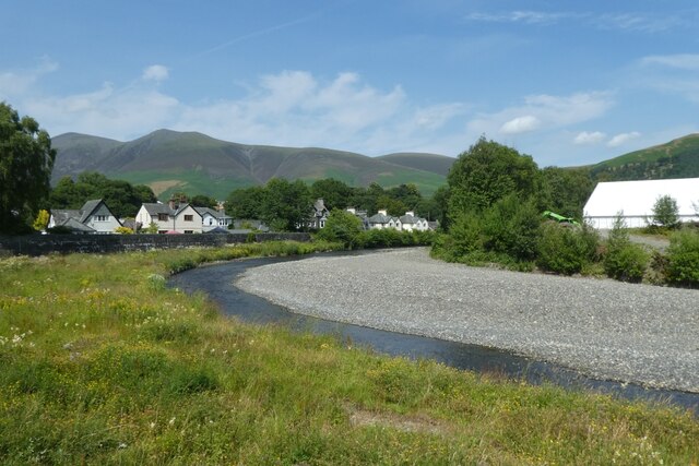
Applethwaite is a small village located in the county of Cumberland, England. It is situated in the northern part of the Lake District National Park, approximately 4 miles west of the town of Keswick. With a population of around 250 residents, Applethwaite is known for its picturesque scenery and tranquil atmosphere.

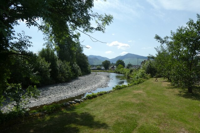
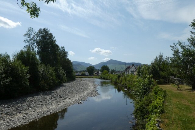
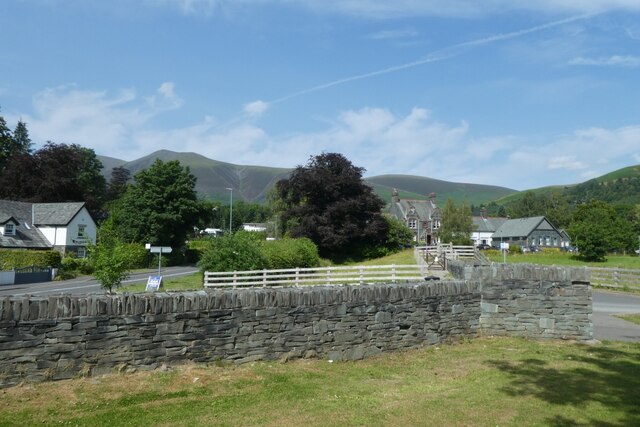
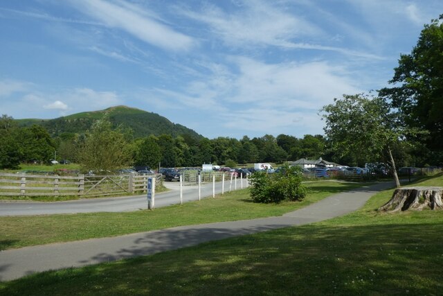
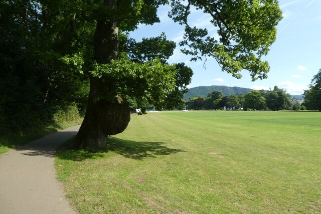
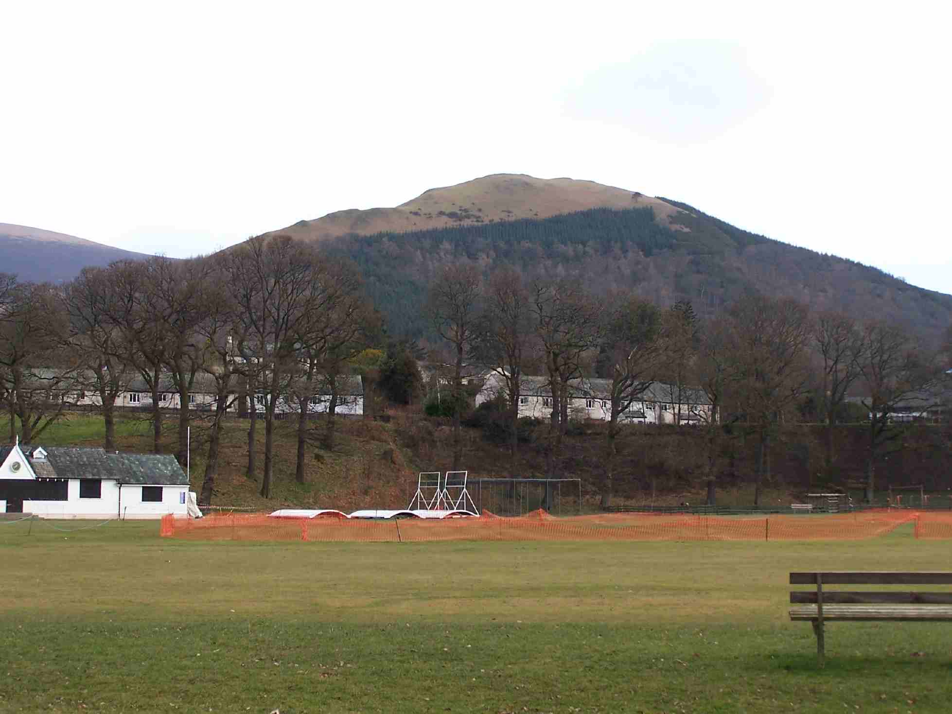
The village is surrounded by lush green fields, rolling hills, and dense forests, making it a popular destination for nature lovers and outdoor enthusiasts. The nearby Skiddaw Mountain offers stunning panoramic views of the surrounding area, attracting hikers and climbers from far and wide.

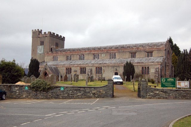
Applethwaite itself is characterized by its traditional stone houses, many of which date back several centuries, giving the village a charming and timeless feel. The village also boasts a quaint church, St. John's, which stands as a reminder of its long-standing history.

Despite its small size, Applethwaite benefits from its proximity to Keswick, where residents can find a range of amenities including shops, restaurants, and schools. The village also benefits from excellent transport links, with regular bus services connecting it to neighboring towns and villages.

Many visitors are drawn to Applethwaite for its peaceful and idyllic setting, making it a popular destination for those seeking a relaxing break in the heart of the Lake District. Whether it's exploring the surrounding countryside, visiting nearby attractions such as Derwentwater, or simply enjoying the tranquility of village life, Applethwaite offers a charming and picturesque retreat.

If you have any feedback on the listing, please let us know in the comments section below.

Applethwaite Images

Images are sourced within 2km of 54.620632/-3.140591 or Grid Reference NY2625. Thanks to Geograph Open Source API. All images are credited.

Bend in the Greta Looking upstream along the River Greta.
Bend in the Greta
Looking upstream along the River Greta.
Greta near Crossthwaite Road Looking downstream along the River Greta.
Greta near Crossthwaite Road
Looking downstream along the River Greta.
Downstream along the River Greta Looking along the river as it flows beside Crossthwaite Road.
Downstream along the River Greta
Looking along the river as it flows beside Crossthwaite Road.
Towards Crossthwaite Road Looking out of the car parks and Fitz Park onto Crossthwaite Road.
Towards Crossthwaite Road
Looking out of the car parks and Fitz Park onto Crossthwaite Road.
Path through Fitz Park Looking along a path from Crossthwaite Road through Fitz Park.
Path through Fitz Park
Looking along a path from Crossthwaite Road through Fitz Park.
A5271 Crossthwaite Road Looking along Crossthwaite Road near the hospital.
A5271 Crossthwaite Road
Looking along Crossthwaite Road near the hospital.
Path beside Brundholme Road Looking along a path with Brundholme Road on the other side of the hedge.
Path beside Brundholme Road
Looking along a path with Brundholme Road on the other side of the hedge.
Land behind the hospital Looking across fields beside Brundholme Road.
Land behind the hospital
Looking across fields beside Brundholme Road.
Grassland beside Brundholme Road Looking across grassland behind the hospital.
Grassland beside Brundholme Road
Looking across grassland behind the hospital.
Path in Fitz Park Looking along a path in Fitz Park with a large oak ahead.
Path in Fitz Park
Looking along a path in Fitz Park with a large oak ahead.
Cricket pitch in Fitz Park Looking along a path around Fitz Park.
Cricket pitch in Fitz Park
Looking along a path around Fitz Park.
Cricket ground in Fitz Park Looking across one of the cricket pitches.
Cricket ground in Fitz Park
Looking across one of the cricket pitches.
Cricket field in Fitz Park Looking across a cricket pitch in the early evening.
Cricket field in Fitz Park
Looking across a cricket pitch in the early evening.
Information Board on Round How This information board beside The Cumbria Way features the adjacent 17 hectare (41 acre) Gale Ghyll Woods, a part of the Mirehouse Estate.
The Ordnance Survey spell Gale Ghyll as the traditional Gale Gill.  Ghyll was introduced as a fashionable alternative spelling in Victorian times.
Information Board on Round How
This information board beside The Cumbria Way features the adjacent 17 hectare (41 acre) Gale Ghyll Woods, a part of the Mirehouse Estate. The Ordnance Survey spell Gale Ghyll as the traditional Gale Gill. Ghyll was introduced as a fashionable alternative spelling in Victorian times.
The Cumbria Way, Round How The public bridleway from Briar Rigg to Latrigg Car Park is the route of The Cumbria Way and crosses open ground above Round How (next photograph <a href="https://www.geograph.org.uk/photo/6933208">NY2725 : The Cumbria Way above Round How</a>).
The information board (photograph <a href="https://www.geograph.org.uk/photo/6933018">NY2725 : Information Board on Round How</a>) features the 17 hectare (41 acre) Gale Ghyll Woods that lie below the bridleway between Round How and Latrigg Car Park.
The path leading steeply up to the right leads on to Mallen Dodd and ultimately to the summit of Latrigg; a more easily graded path can be gained by following the bridleway for a further 425m (470 yards).
The Cumbria Way, Round How
The public bridleway from Briar Rigg to Latrigg Car Park is the route of The Cumbria Way and crosses open ground above Round How (next photograph NY2725 : The Cumbria Way above Round How). The information board (photograph NY2725 : Information Board on Round How) features the 17 hectare (41 acre) Gale Ghyll Woods that lie below the bridleway between Round How and Latrigg Car Park. The path leading steeply up to the right leads on to Mallen Dodd and ultimately to the summit of Latrigg; a more easily graded path can be gained by following the bridleway for a further 425m (470 yards).
The Cumbria Way by Gale Ghyll Woods The Cumbria Way, a 74 mile long distance trail from Ulverston to Carlisle follows the public bridleway from Briar Rigg to Latrigg Car Park beside Gale Ghyll Woods. This is also a popular walking route from Keswick to the summit of Skiddaw (next photograph <a href="https://www.geograph.org.uk/photo/6934004">NY2725 : The Cumbria Way near Gale Gill</a>).
The Cumbria Way by Gale Ghyll Woods
The Cumbria Way, a 74 mile long distance trail from Ulverston to Carlisle follows the public bridleway from Briar Rigg to Latrigg Car Park beside Gale Ghyll Woods. This is also a popular walking route from Keswick to the summit of Skiddaw (next photograph NY2725 : The Cumbria Way near Gale Gill).
Path Junction above Round How The path leading to the left through the gate is a permitted bridleway through Gale Ghyll Woods; the main right hand path is the public bridleway from Briar Rigg to Latrigg Car Park and the route of The Cumbria Way (next photograph <a href="https://www.geograph.org.uk/photo/6933055">NY2725 : The Cumbria Way by Gale Ghyll Woods</a>).
Path Junction above Round How
The path leading to the left through the gate is a permitted bridleway through Gale Ghyll Woods; the main right hand path is the public bridleway from Briar Rigg to Latrigg Car Park and the route of The Cumbria Way (next photograph NY2725 : The Cumbria Way by Gale Ghyll Woods).
The Cumbria Way above Round How The Cumbria Way, a 74 mile long distance trail from Ulverston to Carlisle follows the public bridleway from Briar Rigg to Latrigg Car Park beside Gale Ghyll Woods (next photograph <a href="https://www.geograph.org.uk/photo/6933060">NY2725 : Path Junction above Round How</a>).
This is also a popular walking route from Keswick to the summit of Skiddaw.
The Cumbria Way above Round How
The Cumbria Way, a 74 mile long distance trail from Ulverston to Carlisle follows the public bridleway from Briar Rigg to Latrigg Car Park beside Gale Ghyll Woods (next photograph NY2725 : Path Junction above Round How). This is also a popular walking route from Keswick to the summit of Skiddaw.
Show me another place!

Applethwaite is located at Grid Ref: NY2625 (Lat: 54.620632, Lng: -3.140591)

Administrative County: Cumbria

District: Allerdale

Police Authority: Cumbria

What 3 Words

///twinkled.severe.lectures. Near Keswick, Cumbria

Nearby Locations

Ormathwaite Applethwaite

Related Wikis

Underscar Manor

Underscar Manor is a country house at Underskiddaw in Cumbria. It is a Grade II listed building. == History == The house was designed by Charles Verelst...

Applethwaite

Applethwaite is a village in the foothills of Skiddaw near Keswick in the English Lake District. It is in the county of Cumbria, and forms part of the...

Underskiddaw

Underskiddaw is a civil parish in the Borough of Allerdale in the English county of Cumbria. The parish lies immediately to the north of the town of Keswick...

Great Crosthwaite

Great Crosthwaite is a suburb of the tourist town of Keswick in the Lake District, in the English county of Cumbria. == History == It was the original...

Keswick School

Keswick School is a coeducational 11–18 academy in Cumbria, UK with 1360 pupils on roll. There are 309 students in the sixth form and 40 boarders.The school...

St Kentigern's Church, Crosthwaite

Crosthwaite Parish Church is a church at Great Crosthwaite on the outskirts of Keswick in Cumbria, England. It is dedicated to St Kentigern and is the...

Latrigg

Latrigg is one of the lowest fells in the Lake District in North West England, but is a popular climb due to its convenient location overlooking the town...

Derwent Pencil Museum

The Derwent Pencil Museum is in Keswick, in the north-west of England. == History == The first pencil factory in Keswick opened in 1832. The second and...

Nearby Amenities

Located within 500m of 54.620632,-3.140591
Applethwaite
Place: village
Source: npe
Wikidata: Q4781376
Wikipedia: en:Applethwaite
Lat/Long: 54.6215183/-3.1389311
Information: guidepost
Note: Red Squirrels - Caution (road sign)
Tourism: information
Lat/Long: 54.6206419/-3.1371986
Village Crossroads
Local Ref: IN
Naptan AtcoCode: 090002521260
Naptan Bearing: S
Naptan BusStopType: CUS
Naptan CommonName: Village Crossroads
Naptan Indicator: in
Naptan Landmark: Applethwaite Village
Naptan NaptanCode: cumagtdg
Naptan Street: No name
Naptan Verified: no
Source: naptan_import
Lat/Long: 54.6210453/-3.139004
Croft House Cottages
Addr City: Applethwaite
Addr Housename: Croft House
Addr Postcode: CA12 4PN
Phone: +44 17687 73693
Smoking: outside
Tourism: guest_house
Website: https://crofthousecottages.co.uk/
Lat/Long: 54.6178826/-3.144261
Telephone
Defibrillator
Access: yes
Booth: KX100
Covered: booth
Defibrillator Location: inside old phone box, Raven Lane, Applethwaite
Emergency: defibrillator
Man Made: telephone_box
Source: survey
Lat/Long: 54.6202553/-3.1412636
Grit Bin
Lat/Long: 54.621028/-3.1390308
Hiking: yes
Information: guidepost
Source: GPS Survey
Tourism: information
Lat/Long: 54.6196315/-3.1408068
Barrier: stile
Lat/Long: 54.6185766/-3.1340081
Hiking: yes
Information: guidepost
Source: GPS Survey
Tourism: information
Lat/Long: 54.6186108/-3.1340107
Grit Bin
Lat/Long: 54.6206138/-3.1368246
Bench
Source: GPS Survey
Lat/Long: 54.6208417/-3.1377645
Hiking: yes
Information: guidepost
Source: GPS Survey
Tourism: information
Lat/Long: 54.6211227/-3.1383599
Bench
Source: GPS Survey
Lat/Long: 54.6221564/-3.1472109
WW1 & WW2
Historic: memorial
Source: GPS Survey
Lat/Long: 54.6221688/-3.1473061
Ormathwaite
Place: hamlet
Lat/Long: 54.6180766/-3.1360225
The Mill Race Cottage
Addr City: Applethwaite
Tourism: guest_house
Website: https://www.cumbrian-cottages.co.uk/northern-lakes/keswick-area/the-mill-race-cc112115
Lat/Long: 54.6209462/-3.1395161
Post Box
Operator: Royal Mail
Post Box Type: wall
Ref: CA12 149
Royal Cypher: EIIR
Royal Cypher Wikidata: Q33102113
Lat/Long: 54.6199632/-3.1414915
Bench
Lat/Long: 54.6202382/-3.1412319
Power: pole
Lat/Long: 54.6194414/-3.1340325
Power: pole
Lat/Long: 54.6193295/-3.1349443
Power: pole
Lat/Long: 54.6190982/-3.1370652
Power: pole
Lat/Long: 54.6192227/-3.1386347
Power: pole
Lat/Long: 54.619376/-3.1402129
Power: pole
Lat/Long: 54.6199253/-3.1419453
Power: pole
Lat/Long: 54.6200447/-3.1439424
Power: pole
Lat/Long: 54.6201603/-3.1456227
Power: pole
Lat/Long: 54.6202571/-3.1473441
The data included in this document is from www.openstreetmap.org. The data is made available under ODbL.

Have you been to Applethwaite?

Leave your review of Applethwaite below (or comments, questions and feedback).