Collam

Settlement in Inverness-shire

Scotland

Collam

View south over Leac a' Li Looking from a window of a house in Leac a' Li. 
A few sheep graze the poor vegetation between the exposed bedrock. 
The water is Loch Stocanais.
View south over Leac a' Li Credit: Richard Dorrell

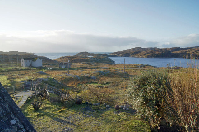
Collam is a small village located in the county of Inverness-shire, Scotland. Situated on the banks of the River Collam, it is surrounded by picturesque landscapes, including rolling hills and dense forests. The village is part of the historic parish of Kilmorack and is located approximately 10 miles west of the city of Inverness.

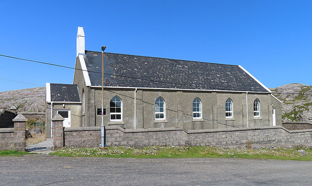
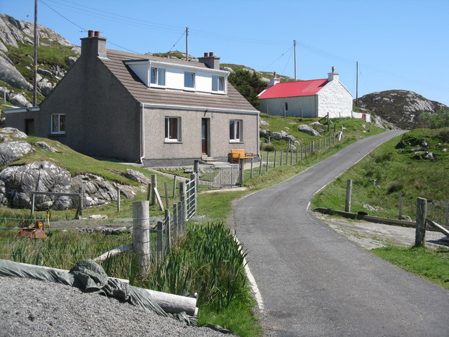
Collam has a population of around 300 residents, making it a close-knit community where neighbors often know each other. The village is primarily residential, with a few local businesses catering to the needs of its inhabitants. It has a small convenience store, a post office, and a local pub that serves as a hub for social gatherings.

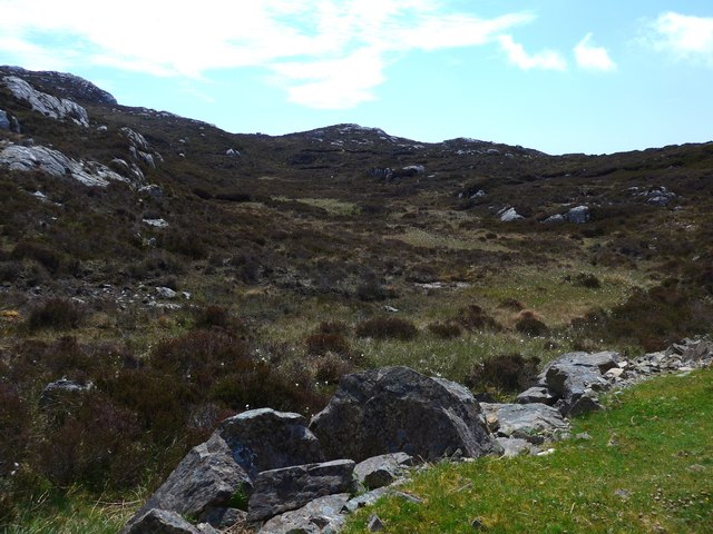
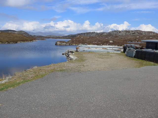
The surrounding area offers numerous recreational activities for residents and visitors alike. Nature enthusiasts can explore the nearby Glen Affric, known for its stunning landscapes and hiking trails. The River Collam is a popular spot for fishing, attracting anglers from far and wide. Additionally, the village is surrounded by several golf courses, providing opportunities for golf enthusiasts to enjoy their favorite sport.

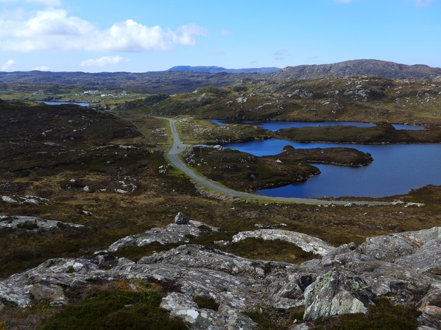
Transportation in Collam is mainly reliant on private vehicles, as public transportation options are limited. However, the village is well-connected to the rest of Inverness-shire by road, with the A862 passing through the nearby town of Beauly.

Overall, Collam offers a peaceful and idyllic setting for those seeking a tranquil retreat amidst the natural beauty of the Scottish Highlands.

If you have any feedback on the listing, please let us know in the comments section below.
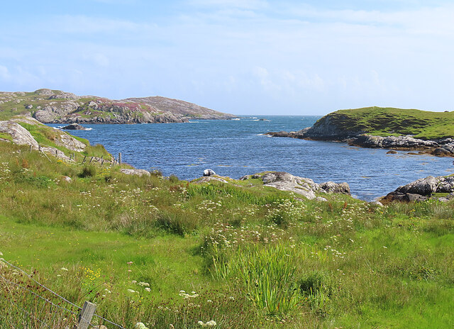
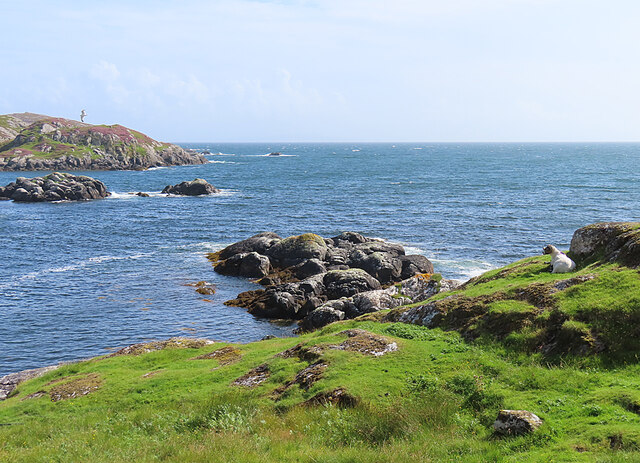
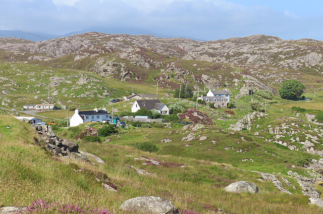
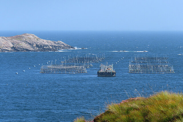
Collam Images

Images are sourced within 2km of 57.821137/-6.7997086 or Grid Reference NG1591. Thanks to Geograph Open Source API. All images are credited.
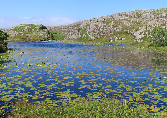
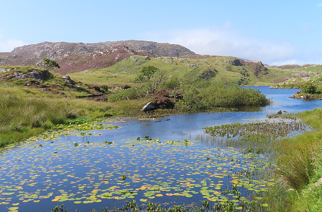
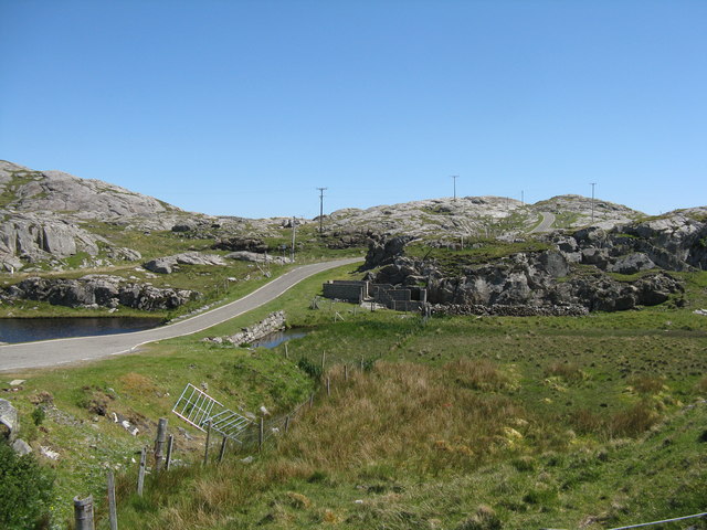
View south over Leac a' Li Looking from a window of a house in Leac a' Li. 
A few sheep graze the poor vegetation between the exposed bedrock. 
The water is Loch Stocanais.
View south over Leac a' Li
Looking from a window of a house in Leac a' Li. A few sheep graze the poor vegetation between the exposed bedrock. The water is Loch Stocanais.
Kirk at Stocanais The sign on the wall says that this is the Stockinish meeting house of the North Harris Free Presbyterian Church.
Kirk at Stocanais
The sign on the wall says that this is the Stockinish meeting house of the North Harris Free Presbyterian Church.
White Water-lily (Nymphaea alba) I always associate water-lilies with the lochans of eastern Harris, and was glad to find some still in flower in August, as I have only ever been to na h-Eileanan an Iar in spring and early summer before.
White Water-lily (Nymphaea alba)
I always associate water-lilies with the lochans of eastern Harris, and was glad to find some still in flower in August, as I have only ever been to na h-Eileanan an Iar in spring and early summer before.
Loch a' Chaolais This lochan is well covered with the floating leaves of the White Water-lily (Nymphaea alba).
Loch a' Chaolais
This lochan is well covered with the floating leaves of the White Water-lily (Nymphaea alba).
Loch Chliuthair This inlet opens in to Loch Cluer, another of the eastern Harris sea-lochs.
Loch Chliuthair
This inlet opens in to Loch Cluer, another of the eastern Harris sea-lochs.
Loch Cluer Loch Chliuthair in Gaelic takes its name from the village of Cliuthar, anglicised as Cluer.
Loch Cluer
Loch Chliuthair in Gaelic takes its name from the village of Cliuthar, anglicised as Cluer.
Collam A handful of houses beside Loch Ghreosabhaigh.
Collam
A handful of houses beside Loch Ghreosabhaigh.
Fish Farm In the outer part of Loch Ghreosabhagh. I take it that the poles and nets are to discourage birds form taking the fish.
Fish Farm
In the outer part of Loch Ghreosabhagh. I take it that the poles and nets are to discourage birds form taking the fish.
Lochan near Greosabhagh A lochan liberally sprinkled with water-lily leaves.
Lochan near Greosabhagh
A lochan liberally sprinkled with water-lily leaves.
Loch Harmasaig Most of this loch is hidden behind the knoll on the left.
Loch Harmasaig
Most of this loch is hidden behind the knoll on the left.
Lewisian Gneiss with the Shiant Isles behind Magnificent swirls of Lewisian Gneiss just south of Mol Ban in South Harris.
Lewisian Gneiss with the Shiant Isles behind
Magnificent swirls of Lewisian Gneiss just south of Mol Ban in South Harris.
Loch Harmasaig
Loch Harmasaig
Rough ground at Druim nan-Uidhean
Old pontoon equipment at Loch Harmasaig
The road to Greosabhagh A typical East Harris view - water and rock, rock and water.

Shots of parts of the island were used by Stanley Kubrick as the surface of Jupiter in the film 2001: A Space Odyssey.
The road to Greosabhagh
A typical East Harris view - water and rock, rock and water. Shots of parts of the island were used by Stanley Kubrick as the surface of Jupiter in the film 2001: A Space Odyssey.
Houses at Greosabhagh On The Golden Road.
Houses at Greosabhagh
On The Golden Road.
Road at Caolas Stocinis/Kyles Stockinish Looking over a short causeway across the end of Loch a' Chaolais.
Road at Caolas Stocinis/Kyles Stockinish
Looking over a short causeway across the end of Loch a' Chaolais.
Loch a' Chaolais A small loch in the rocky landscape, with pond weed [Potomageton sp.].
Loch a' Chaolais
A small loch in the rocky landscape, with pond weed [Potomageton sp.].
Show me another place!

Collam is located at Grid Ref: NG1591 (Lat: 57.821137, Lng: -6.7997086)

Unitary Authority: Na h-Eileanan an Iar

Police Authority: Highlands and Islands

What 3 Words

///vocab.group.curiosity. Near Tarbert, Na h-Eileanan Siar

Related Wikis

Stockinish Island

Stockinish Island (Scottish Gaelic: Eilean Stocainis) is an uninhabited island off Harris, in the Outer Hebrides. == Geography and geology == Stockinish...

East Loch Tarbert

East Loch Tarbert (Scottish Gaelic: Loch an Tairbeairt) is a sea loch that lies to the east of Harris in the Outer Hebrides of Scotland. The loch contains...

Sgeotasaigh

Scotasay (Scottish Gaelic: Sgeotasaigh) is small island in the Outer Hebrides of Scotland. It lies 1 kilometre (0.6 miles) off the east coast of Harris...

Harris distillery

Harris distillery is a Scotch whisky and Gin distillery in Tarbert on the Isle of Harris, Scotland. The distillery was the first legal distillery ever...

Nearby Amenities

Located within 500m of 57.821137,-6.7997086
Passing Place
Lat/Long: 57.8237135/-6.8007252
Passing Place
Lat/Long: 57.8231806/-6.799972
Passing Place
Lat/Long: 57.8202862/-6.8002172
Passing Place
Lat/Long: 57.8194795/-6.8012931
Passing Place
Lat/Long: 57.8190603/-6.8012316
Passing Place
Lat/Long: 57.8182934/-6.8013132
Passing Place
Lat/Long: 57.8174106/-6.802284
Material: wood
Power: pole
Lat/Long: 57.8205644/-6.7981052
Material: wood
Power: pole
Lat/Long: 57.8204201/-6.7977229
Material: wood
Power: pole
Lat/Long: 57.8210551/-6.798596
Barrier: cattle_grid
Lat/Long: 57.8218264/-6.7988267
Barrier: cattle_grid
Lat/Long: 57.8210243/-6.7951386
Material: wood
Power: pole
Lat/Long: 57.8209244/-6.794393
Material: wood
Power: pole
Lat/Long: 57.8210472/-6.7940014
Turning Circle
Lat/Long: 57.8211579/-6.7937049
Turning Circle
Lat/Long: 57.8195687/-6.7989544
Barrier: cattle_grid
Lat/Long: 57.8200152/-6.7996916
Material: wood
Power: pole
Lat/Long: 57.8176106/-6.8023367
Material: wood
Power: pole
Lat/Long: 57.8182274/-6.8014485
Material: wood
Power: pole
Lat/Long: 57.8191869/-6.8018799
Material: wood
Power: pole
Lat/Long: 57.8203208/-6.800698
Generator Method: wind_turbine
Generator Source: wind
Generator Type: horizontal_axis
Power: generator
Lat/Long: 57.8220736/-6.7943357
Material: wood
Power: pole
Lat/Long: 57.820696/-6.796723
Passing Place
Lat/Long: 57.8246772/-6.8013909
Passing Place
Lat/Long: 57.8216928/-6.7993034
Power: pole
Lat/Long: 57.8198079/-6.8012238
Power: pole
Lat/Long: 57.8208173/-6.8002282
Power: pole
Lat/Long: 57.8207421/-6.7986152
Power: pole
Lat/Long: 57.8202173/-6.797112
Power: pole
Lat/Long: 57.8213548/-6.7988696
Power: pole
Lat/Long: 57.8247772/-6.8021924
Power: pole
Lat/Long: 57.8244892/-6.8017891
Power: pole
Lat/Long: 57.8204157/-6.7995769
Power: pole
Lat/Long: 57.822741/-6.8010396
Power: pole
Lat/Long: 57.823592/-6.8014068
Power: pole
Lat/Long: 57.8218322/-6.8006697
Loch Chollaim
Natural: bay
Lat/Long: 57.8191317/-6.7928641
Power: pole
Lat/Long: 57.8172234/-6.7997181
Power: pole
Lat/Long: 57.8178063/-6.8007507
Generator Method: photovoltaic
Generator Output Electricity: small_installation
Generator Source: solar
Generator Type: solar_photovoltaic_panel
Power: generator
Lat/Long: 57.8206211/-6.794371
The data included in this document is from www.openstreetmap.org. The data is made available under ODbL.

Have you been to Collam?

Leave your review of Collam below (or comments, questions and feedback).